

Find out the latest on the conditions out on the trail.
Trail conditions and closures are monitored by the GDTA but much of this information is crowd-sourced and depends on trail user contributions. Please report trail conditions via email.
June 22, 2026
With the official start of summer, the first GDT hikers of the season have started! Valley bottom trails at lower elevations are mainly bare and muddy, while many trails at higher elevation remain completely or partially snow covered. With warmer weather, trail conditions can change quickly from icy in the morning to muddy and slippery in the afternoon. Plan for varying conditions – clothing layers, boots, cleats and/or poles are recommended. Please note that most trails are not maintained in the winter and downed trees won’t be removed until the trails are clear, usually in July.
Trail Closures and Notices
- SNOW MELT: Snow melt is proceeding rapidly but snow levels at higher elevations remain above average for this time of year and likely won’t be snow-free until early/mid July. Avalanche conditions may continue to exist so prepare accordingly. For up to date snow level data in BC, check out the Snow Survey Stations Interactive Map. In Alberta, check out the Alberta River Basins map (turn on the snow stations layer).
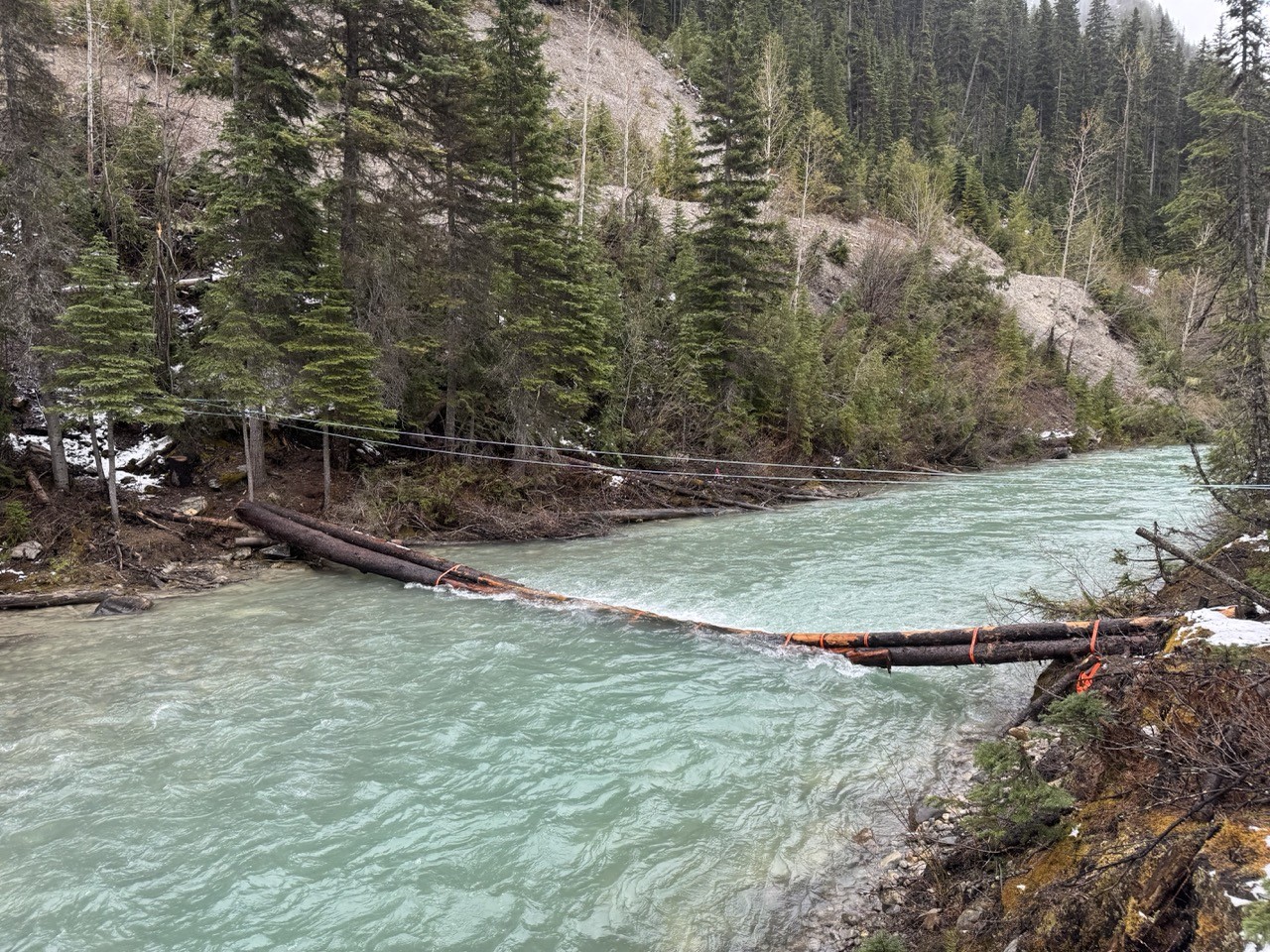
- CREEKS: Rainfall and rapid snow melt have resulted in very high water levels, some damaged or washed out bridges, and potentially dangerous creek crossings. Attempt to ford larger creeks early in the day when water levels are lowest.
- CLOSURE – The Blaeberry River bridge near Cairnes Creek Rec Site was damaged over the winter and washed away this spring. The Collie Creek Alternate Route is closed until the Blaeberry crossing is restored. A GDTA Trail Crew will be in there later this month, attempting to restore access.
- CAUTION – Cairnes Creek bridge was damaged over the winter and washed away this spring. Hikers should be prepared to ford the creek, ideally early in the morning when the water level is the lowest.
- CLOSURE – Kootenay National Park: Numa Creek Access Trail from Numa Creek campground to Numa Falls bridge is closed due to bridge washout and debris on trail.
- ELK CALVING SEASON: mid May to June 30. Protective mother elk will aggressively protect their newborns by kicking and charging at people. Stay at least 30 metres away from all elk during this time of year. Pay attention to trail closures in known elk calving areas.
- TICKS: Tick season has started. Be extra careful when in areas with a lot of underbrush and check yourself and your clothing after your hike.
- BEARS: Bears are out and about, actively searching for food. Be bear aware on the trails this summer, make noise and carry bear spray.
Access
- Highway 742 / Spray Lakes Road is closed between Grassi Lakes parking area and Goat Creek, southwest of Canmore due to a rockslide. No public access for any type of vehicle or on foot.
- A Kananaskis Conservation Pass is required for all vehicles visiting Kananaskis Country and provincial sites in the Bow Valley Corridor. The pass is not required for people arriving without a vehicle on foot, horseback or bicycle.
- The Yoho Valley Road is open.
- BC Parks lists Walker Creek FSR in good condition up to km 50. The road has received some maintenance in the past few years and should remain open and accessible for those with high clearance 4WD vehicles willing to drive the rough and overgrown road all the way to the Bastille Creek trailhead.
- For more information, check out Alberta 511 and Drive BC.
National and Provincial Park Trail Conditions:
Banff National Park
Jasper National Park – Submit a Jasper trail condition report
Kootenay National Park
Waterton Lakes National Park
Yoho National Park
Akamina‐Kishinena Provincial Park
Castle Wildland Provincial Park
Castle Provincial Park
Elk Lakes Provincial Park
Height of the Rockies Provincial Park
Kakwa Provincial Park
Mount Assiniboine Provincial Park
Mount Robson Provincial Park
Peter Lougheed Provincial Park