

1095 kilometres of trail, traversing the spine of the Rocky Mountains
The Great Divide Trail (GDT) is a wilderness hiking trail in the Canadian Rockies. The GDT closely follows the continental divide between Alberta and British Columbia, crossing the divide no fewer than 30 times. It begins in Waterton Lakes National Park at the Canada-US border (where it connects with the Continental Divide Trail) and ends 1,095 kilometres to the north in Kakwa Provincial Park.
The GDT is not always officially signed and the route is actually made up of several separate trail systems joined together by ATV tracks, roads, and wilderness routes. The GDT passes through five National Parks, eight Provincial Parks, three Wildland Provincial Parks, two wilderness areas and two special management areas, with 60 percent of the trail located in the Rocky Mountain National and Provincial Parks.
Outside of the Parks, the GDT varies from being a well developed, blazed trail to an unmarked, cross-country wilderness route where navigation skills are required and few or no backcountry facilities exist (e.g. campgrounds, outhouses). Most of the GDT is quite remote and cell phone reception is almost non-existent.
A journey on the GDT promises to be rewarding but not without a few challenges: hiking conditions are often strenuous and potentially hazardous, difficult mountain navigation, glacial stream crossings, deceptively short hiking season, harsh weather including potential summer snowstorms, grizzly bears, mosquitoes, and remote trail exit points for resupply or potential emergency access. It may sound daunting, but on the GDT you’ll discover a definitive wilderness experience in one of the most magnificent settings on Earth: diverse vegetation, towering snow-capped peaks, iridescent glacial waters, abundant wildlife and panoramic vistas at every turn!

Sections


History
- The first record of the Great Divide Trail appears in 1966, proposed by the Girl Guides of Canada.
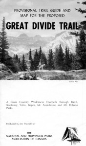
- In 1970, Jim Thorsell prepared the first ever GDT guide: the “Provisional Trail Guide and Map for the Proposed Great Divide Trail”.
- In 1974, six young people funded by the federal Opportunities for Youth program conducted a trail inventory and feasibility study for the Great Divide Trail between Waterton Lakes and Banff national parks. Their work led to the establishment of the Great Divide Trail Association in 1975/76. In 1976, the Alberta government provided a grant to the GDTA to do the detailed planning and flagging required to establish the GDT on Crown land. Provincially funded GDTA trail crews and volunteers established over 110 km of the GDT between Fording Pass and Tornado Pass between 1976 and 1987.
Great Divide Trail Facts and Stats:
- The GDT passes through:
- 5 National Parks: Waterton Lakes, Banff, Kootenay, Yoho and Jasper.
- 8 Provincial Parks: Akamina‐Kishinena, Castle, Elk Lakes, Peter Lougheed, Height of the Rockies, Mount Assiniboine, Mount Robson and Kakwa.
- 3 Wildland Provincial Parks: Castle, High Rock and Don Getty.
- 2 wilderness areas: Beehive Natural Area and White Goat Wilderness.
- 2 special management areas: Kananaskis Country and Willmore Wilderness Park.
- 5 forest districts: Castle, Bow/Crow, Cranbrook, Golden and Robson Valley.
- Length: 1,123 kilometres – 65% of the trail in Alberta and 35% in BC.
- Highest point: 2,590 m (8,497 ft) at an unnamed pass above Michele Lakes just south of the White Goat Wilderness Area
- Lowest point: 1,055 m (3,461 ft) at Old Fort Point trailhead near Jasper
- The GDT is designed for non-motorized use only – specifically for people on foot and horseback (although Parks Canada prohibits horseback travel on some sections of the trail in the National Parks).
- The GDT intersects with the Trans Canada Trail and the Great Divide Mountain Bike Route (a long distance bicycle touring route from Banff to New Mexico) in the Elk River Valley, overlapping both routes for approximately 30 kilometres.
- Portions of the GDT are hiked by thousands of people each year but far fewer attempt to thru‐hike the entire trail.
Planning a hike on the GDT?
These links will help you get started!


