

By Barb Lauer
Another summer, another section of the GDT completed. Woohoo! This summer it was Section D, Saskatchewan Crossing to Field (SOBO). Lynnie and I have now completed more than half of the GDT and feeling better and better that we will eventually complete it all!
Section D SOBO with the various alternates might just be my new favourite section… the variety of the terrain (floodplain, ridge walk, historical pass, spectacular pass, moraines, and glaciers – it had it all), the relatively easy start (it’s very flat if you start at Saskatchewan Crossing!), the new trail and bridges that have been built, the co-operating weather when we needed it most and the remoteness (we saw only two other hikers on the main part of section D – excluding the popular Iceline and Mistaya Canyon).
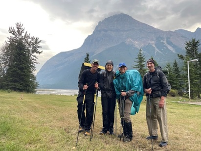
We completed Section D (~115km) in 6 days, 5 nights starting on August 21 and were joined by Dustin Lynx, author of Hiking Canada’s Great Divide Trail and River Taig, an uber experienced thru-hiker having hiked the GDT almost four times! In addition to the wonderful company, it is always nice to have along very strong hikers who can go first on the water crossings! Neither River nor Dustin had hiked the newly created route for Section D with the spectacular alternate routes. And we were all especially excited to celebrate River’s six-month post kidney donation anniversary on the hike! WOW! It was both humbling for us and exciting to celebrate with River!!!
Based on Dustin and River’s stories of the previous Section D, a HUGE shout out to Dan Durston, and Brad Vallancourt who created the new route including alternates, and to Dave Higgins and Doug Borthwick who have led trail building crews to Section D for the past few summers. Thank you!!
We started out in sunshine from Owen Creek (this is where Section E starts) and walked a lovely trail that was out of sight of the David Thompson highway and had great views of Mount Murchison. At the intersection with Hwy 93 we turned left and walked along this highway for about 5 km to Mistaya Canyon trailhead. It was on this highway that we met one of our thru-hiker icons for the trip, a solo hiker named Annie – a positive, strong looking 20 something year old who looked like she was on a day hike! She came into our minds a few times on the trip “wow, how did she do this on her own?” We met two other thru-hikers… more on them later.
We continued from Mistaya Canyon and joined the Howse Floodplain – they are both spectacular! With the sun still shining, we kept walking and eventually found a place to random camp.
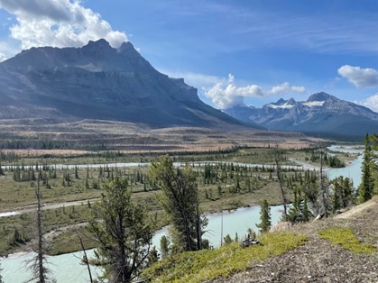
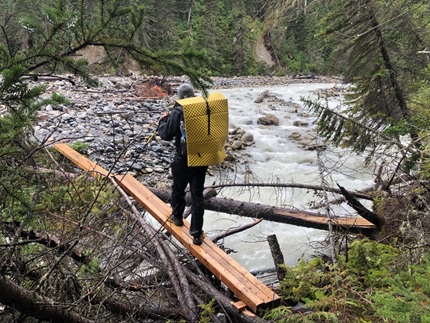
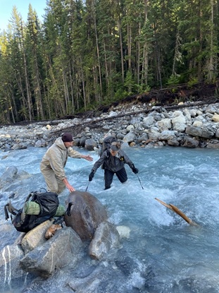
We were a bit surprised how often the main route along the floodplain did go into the forest. But the tradeoff of not having to continually cross water, appealed to most of us. River was the exception and was itching to get back out to the floodplain where there isn’t always a trail to follow, it can be faster, and the views are much better. Either way, there were also a few very steep, a bit sketchy up and down climbs to avoid dangerous crossings of the Howse River. The route also crosses Conway Creek, which would have been a lot scarier if Dustin and River weren’t there to lead the way. The other thing to watch for along the floodplain is crossing innocuous looking streams, slow moving water clouded with slit so you can’t see the bottom… they can get quite deep without much warning! So I’ve added to my water crossing learnings… pole ahead to test the depth of water!
We met our next iconic happy thru-hiker on the way to Howse Pass. He was walking barefoot and had lovely painted toenails!! Apparently, he started out with sandals but they were hurting his feet and so he reverted to no shoes as much as possible! How he did this with all the rocks, tree roots, pine needles, wood splinters, you get the picture, I have no idea.
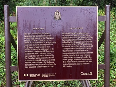
Walking through the historic Howse Pass with the plaques and historic signage felt really special.
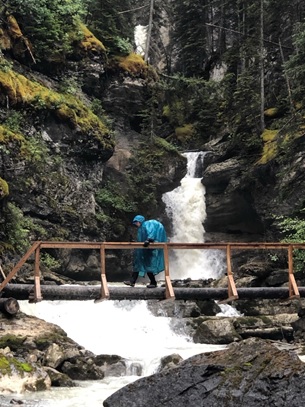
We camped at Lambe Creek after a day of on again off again rain – we were soaked. No rain gear seems to prevent wetting out after hours in the rain…. that is except my bright blue poncho (picture below which nobody else would be caught dead walking in!).
It was at Lambe Creek that we met our third iconic happy hiker – Justin Outdoors. After a day of rain, he walked into camp smiling! I had to ask him if he was dry, i.e. why are you so happy?? As it turns out he was soaked as well. And I can only think that he was relieved to be camping with four wet, tired, mildly grumpy old folks on the trail. Sometimes any company is good company! Word quickly spread through our camp that Justin is a You Tuber with many thousands of followers…. check out his videos of his GDT hike this summer.
Just by Lambe Creek campsite, there is bridge over Lambe Creek which was repaired this summer by the GDTA. Lynnie volunteered on this maintenance trip … she shared some harrowing stories of folks leaning off the bridge (while properly secured) to reinforce the railing. Much harder work than thru-hiking the trail. Thank you GDTA volunteers!!!
We had a very short day after Lambe Creek (~7 km) and camped at Cairnes Creek, as we chose to wait out the weather. We were aiming for no rain, snow, or heavy cloud cover when we tackled Amiskwi Ridge. A hard core thru-hiker could definitely do Section D in less time than we did.
The wait was worth it, the clouds cleared, and we headed up Collie Creek alternate and then onto Amiskwi Ridge alternate. Both alternate routes are fantastic – Collie Creek saves many kilometres of dirt road walking and Amiskwi Ridge has spectacular views if you are lucky enough to have the weather.
The trail out of Cairnes Creek is well flagged and even sign posted for Collie Creek alternate, there has been new trail work done there recently. It is lovely! Collie Creek was probably our toughest water crossing (fast flowing, white water looking) in Section D. But again we had Dustin and River there to lead, and so it was a-okay (definitely easier than the crossings in Section G). There was a very steep up from the creek crossing but the trail was awesome, like going up soft, cushy steps.
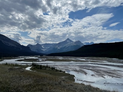
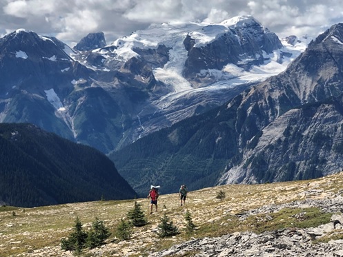
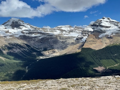
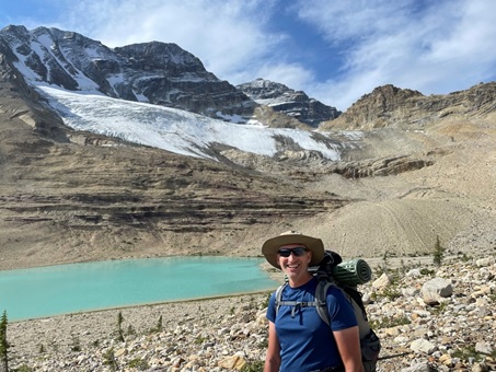
The trail up Amiskwi Ridge (SOBO) was another story… it starts out okay but when you come to the clear cut, it’s very tough going. This might have been because we waited too long to take a break and were hungry or it might have been because the clearcut flagging was pink and not dissimilar to the GDT flagging! It doesn’t matter… we gained the Amiskwi Ridge and it was AMAZING! This section might just be the most geologically diverse stretch of the GDT with various rock formations and fossils; we even stumbled onto a warm spring! Not to mention the spectacular views of the surrounding heavily crevassed glaciers. It is a must do on this section if the weather cooperates.
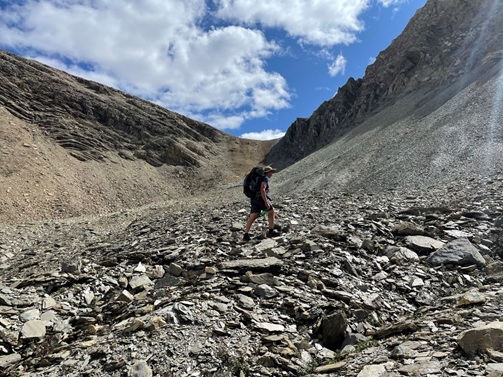
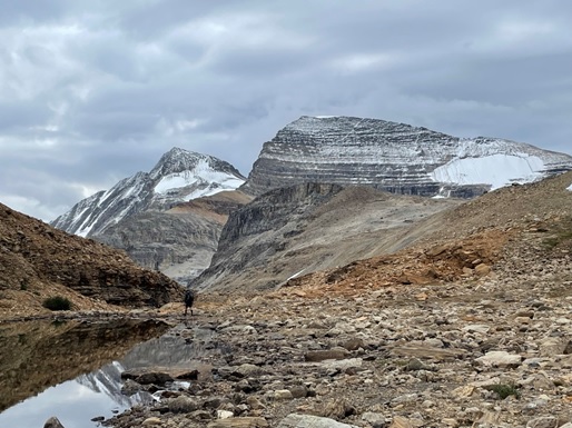
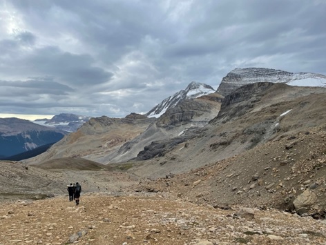
The other alternate route that we did was the Kiwetinok Alternate and I can’t rave enough about this… First the bad news… it’s a tough go with a lot of elevation gain, loss and gain again in a short distance. The toughest part of this alternate for me was the Kiwetinok Gap which really surprised me. It gets very steep near the top of the gap and then over the top there’s a nice walk down a dry river bed until you have to find the very steep, very faint trail (looked like a bear trail to us) through the trees to get down to the meadow. The immediate hike up to Kiwetinok Pass is more demoralizing than difficult! Going SOBO, there is good trail with flagging when you first start the alternate to above the trees on the approach to the Gap and again on the way down from Kiwetinok Pass (thank you Parks Canada!). In between these two areas, you’re a bit on your own (or with GPS). And if you happen to do the alternate northbound, make every attempt to walk backwards up towards Kiwetinok Pass or turnaround often – the views are spectacular!! [NB: Kiwetinok Pass alternate is not safe in early season due to a cornice that forms on the north side of Kiwetinok Gap.]
![Hiking up to Kiwetinok Pass [notice Kiwetinok Gap top right that we just came down!]](https://greatdividetrail.com/wp-content/uploads/2021/10/Section-D-11.jpg)
After the walk down from the pass, the trail joins the Iceline Trail and then onto Yoho Lake campground and then Field.
This last part of Section D is fantastic and so worth doing (with the small exception of the last 5 km into Field which had so many horizontal switchbacks that we thought we were going uphill!). We saw the unbelievable glaciers of the Iceline, Canada’s second highest waterfall – Takkakaw Falls, a herd of 30+ mountain goats grazing around the Burgess shale fossils and spectacular views of Emerald Lake and the backside of the President and Vice-President peaks. An outstanding final day! Quick sidebar… Yoho Lake campground is gorgeous, it’s actually on Yoho Lake and comes complete with two red Adirondack chairs to enjoy the view!
I hope you get a chance to do this section with the new alternate routes… it is so worth it!