Category: Trail Update

  • Spring 2020 Trail and Road Conditions

    Spring 2020 Trail and Road Conditions

    While Alberta and British Columbia cautiously move into the next phases of living with COVID-19, the Great Divide Trail Association is considering what is best for the health and safety of the trail community that we serve. With provincial and national parks re-opening, staying active in the outdoors is an excellent way to keep your body and mind healthy but we need to continue to do our part to limit the spread of COVID-19.

    At this time, the GDTA supports single-day hikes or horseback rides on the GDT and longer (weekend or multi-day), self-sufficient trips that don’t require resupply if they are in your local area, where trails and trailheads are open. 

    Please observe 2-metre physical distancing at all times on the GDT and avoid long-distance ‘thru’ hikes that involve resupplying and interaction with people in communities along the GDT. To limit the potential transmission of the virus between you and others, being completely self-supported on GDT outings is essential. Stay local, bring everything you need, avoid side trips from the trail to resupply, and always Leave No Trace.

    TRAIL CLOSURES AND NOTICES: 

    Due to the COVID-19 pandemic, hikers with plans on the GDT this summer should be prepared to change their plans, including considering the possibility of cancellation. 

    • Both Alberta and BC have declared public health emergencies.
    • Parks Canada – On June 1, limited access and services will be offered in the national parks along the GDT, where visitors will be permitted to access some trails, day use areas, and green spaces. All camping facilities remain closed until at least June 21, while Parks Canada assesses whether and how these services might resume. All existing national park reservations prior to June 21 will be automatically cancelled and refunded in full. If you have a national park campground reservation after June 21, you do not need to cancel your reservation at this time. You are encouraged to check back closer to your arrival date regarding cancellations.
    • Alberta Parks is taking an incremental approach to relaunching outdoor recreation by easing restrictions on access to provincial parks, camping and public land. Effective May 1, vehicle access restrictions are lifted and campground reservations opened on May 14 for Alberta residents only for camping dates starting June 1, temporarily limiting occupancy to 50 per cent capacity.
    • On May 14, BC Parks reopened the majority of provincial parks and on June 1, BC Parks will re-open most provincial campgrounds and backcountry camping. Backcountry campground online reservations opened on May 25. 
    • Snow levels in the Rockies are above average for this time of year and avalanche conditions continue to exist. For up to date snow level data in BC, check out the Snow Survey Bulletins and Commentaries which include links to the Snow Survey and Water Supply Bulletin and map. In Alberta, check out the Alberta River Basins map (turn on the snow pillow layer).

    ACCESS ROADS: 

    • Highways and roadways which pass through national parks remain open.
    • Akamina Parkway and Red Rock Parkway in Waterton Lakes National Park are closed.
    • Highway 40 from junction Highway 742 to junction Highway 541 is closed for the winter until June 15, 2020.
    • For more information, check out Alberta 511 and Drive BC.

    National and Provincial Park Trail Conditions:

    Banff National Park
    Jasper National Park
    Kootenay National Park
    Waterton Lakes National Park
    Yoho National Park

    Akamina‐Kishinena Provincial Park
    Castle Wildland Provincial Park
    Castle Provincial Park
    Elk Lakes Provincial Park
    Height of the Rockies Provincial Park
    Kakwa Provincial Park
    Mount Assiniboine Provincial Park
    Mount Robson Provincial Park
    Peter Lougheed Provincial Park

  • Winter 2019/20 Trail and Road Conditions

    Winter 2019/20 Trail and Road Conditions

    Trail Conditions Update – November 26, 2019

    Winter conditions are here. Snow has fallen on all of the GDT and is accumulating so expect wet, icy and slippery trail conditions. Boots, hiking poles, snow cleats or snowshoes are recommended. Temperatures are below freezing, so be prepared for winter conditions and short days when travelling into the backcountry this winter.

    Remember that the GDT is not designed for snow travel and is not maintained in the winter. When the trail is covered in snow, finding it may be impossible so excellent navigation skills are required. Hiking on the GDT when it’s snow covered means exposing yourself to potential avalanche risk. In many places, it’s unwise to travel the trail during these conditions. While planning your hike, research snow conditions and check out the Canadian Avalanche Centre for the latest avalanche bulletins

    TRAIL CLOSURES:

    • Most trails in Waterton Lakes National Park have now re-opened following the 2017 Kenow wildfire however the Akamina Parkway is now closed to all traffic including pedestrians meaning that hikers cannot access Rowe Lakes trailhead (a9) from Cameron Lake (a8). The GDTA is working with Waterton Lakes National Park staff to come up with a hiking detour prior to next summer. Stay tuned.
    • Numa Creek Trail (Rockwall access trail) remains closed due to wash out of the bridge over the Vermilion River. The pedestrian bridge is being replaced and access to the Rockwall from this location will be restored next year.
    • Jasper National Park seasonal closures – The GDT is closed from Four Point Campground (e15) to Signal Mountain Trailhead (e32) and from Moose Pass (f15) to Bess Pass (g3) from November 1, 2019 to February 28, 2020, to prevent trails from facilitating an unnatural level of predator access to threatened woodland caribou.

    TRAIL NOTICES:

    • In 2017, approximately 35 km of the GDT was burned by the Kenow Wildfire between Bertha Bay campground and Font Creek (a19). Some trails that have been damaged by wildfire may require environmental analysis or heavier engineering, and closures could be in place for many months as trails and roads are repaired. The GDTA will continue to monitor and assess the condition of these damaged trails and provide updates as they become available. 
    • From Scarpe Pass (a24), the trail disappears so hikers must route-find up to La Coulotte Ridge, where the hiking becomes significantly more difficult until you reach the ATV track (a27) heading down to the West Castle Road. 
    • The GDT is blocked by avalanche debris south of Tornado Pass (b16). Hikers can get around by traversing up slope.  
    • Leroy Creek has washed out approximately 100m of the trail obscuring the location of the creek ford at 50.677892, -115.317131. Look for cairns on either side of the creek marking the crossing.
    • The first half of the Amiskwi Trail was cleared in August 2018, but the rest of the trail is in poor shape much of the way to Amiskwi Pass. Expect brushy, overgrown conditions, and several fords of the Amiskwi River. 
    • The David Thompson Heritage Trail was cleared to Howse Pass in September 2019. A new log bridge is in place across Lambe Creek (d10). Cairnes Creek (d9) is a potentially dangerous ford, however currently there are two large trees down across the creek allowing hikers to cross. If these trees wash away, it is recommended to ford the creek early in the morning when glacial melt is lowest.
    • Descending the north side of Howse Pass (d11), the main route of the GDT now follows Conway Creek and Howse River floodplains wherever possible, without crossing the main channel of the Howse River. The floodplain is wide and scenic. There are several shallow fords of smaller channels on the floodplain so hikers must be prepared to have wet feet while enjoying a significantly better hiking experience than the old overgrown trail strewn with hundreds of fallen trees. In June and early July, the Howse River may be in flood making some sections of the floodplain difficult or impassable in which case hikers should consider using the old trail (now marked as an alternate route). Conversely, in late August and September when the river is low, hikers may be able to ford the main river channel and completely avoid any bushwhacking along the river’s edge. See here for a more detailed route description.
    • The first 6 km of the Owen Creek Trail are in fair condition. Beyond that point, the trail is in poor shape with several washed out sections. Expect challenging hiking for 3 km including skirting along steep creek-side cliffs and rock-hopping in the creek itself. At km 6, do not take the trail heading up away from the creek (it is a deadend). Look for orange blazes marking the correct route staying near the creek.
    • The Maligne Pass trail from Pobokton Creek (e20) to just south of Trapper Creek (e24) is no longer being maintained by Parks Canada so expect deteriorating and overgrown trail conditions; long pants are recommended. The Maligne River bridge has been removed. The river can usually be forded in normal summer conditions but can be a deep and challenging ford after periods of heavy rain. Most other bridges are still in place. The Six Passes Route is a cross-country alternative to the overgrown trail for hikers with route-finding experience – Read more here.
    • The Yates Torrent Bridge is out at the crossing of the Coleman Glacier outflow (near f16). Do not attempt to cross at the old bridge location. There are two options: (1) ford the Smoky River in the floodplain; or (2) ford Yates Torrent approximately 500m upstream (location was flagged in 2017). At both locations attempt to cross early in the morning when glacial melt is the lowest or be prepared for a fast and potentially dangerous creek ford.
    • The bridges across Gendarme and Carcajou Creeks are out on the Jasper North Boundary Trail. These two creeks are smaller than the Smoky River, but can still be treacherous. Cross Gendarme at the horse crossing just below the old bridge (marked), and Carcajou about 100m below the trail.
    • Hikers have reported that Wolverine campground and the surrounding trail are flooded. Detour around by following higher ground through the forest west of the trail and campground.
    • The bridge across Buchanan Creek on the trail to Kakwa Lake, has been removed. The crossing here can be hazardous early in the year or after heavy rains. 

    ACCESS ROADS: 

    Winter conditions exist on many mountain highways and roads. Roads can be snowy and icy so check for the latest conditions before you travel and carry chains and/or winter tires. For more information, check out Alberta 511 and Drive BC.

    • Akamina Parkway and Red Rock Parkway in Waterton Lakes National Park are closed due to ongoing construction but Red Rock Parkway is open to pedestrians.
    • Highway 40 is seasonally closed from Peter Lougheed Provincial Park to Highwood House beginning December 1.
    • Forestry Trunk Road 940 is seasonally closed south of Cataract Creek and northwest of Plateau Mountain Road beginning December 1.

    National and Provincial Park Trail Conditions:

    Banff National Park
    Jasper National Park
    Kootenay National Park
    Waterton Lakes National Park
    Yoho National Park

    Akamina‐Kishinena Provincial Park
    Castle Wildland Provincial Park
    Castle Provincial Park
    Elk Lakes Provincial Park
    Height of the Rockies Provincial Park
    Kakwa Provincial Park
    Mount Assiniboine Provincial Park
    Mount Robson Provincial Park
    Peter Lougheed Provincial Park

  • October 2019 Trail and Road Conditions

    October 2019 Trail and Road Conditions

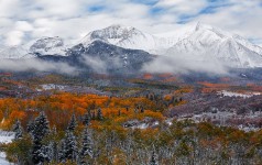
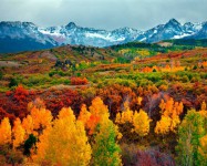
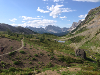
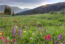
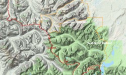
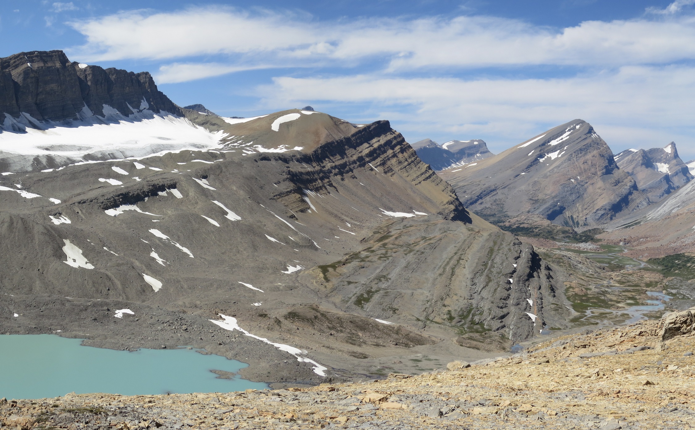
    Trail Conditions Update – October 25, 2019

    Fall colours are here, and so is the snow! Snow has fallen on much of the GDT and is starting to accumulate at higher elevations. Expect wet, slippery and muddy trail conditions. Heavy boots or cleats and poles are recommended. Nighttime and early morning temperatures are below freezing, so be prepared for cold temperatures and shorter days when travelling into the backcountry this fall. 

    ELK RUTTING SEASON WARNING: It is elk rutting season until mid-October. Warning signs that read “ATTENTION – Elk Mating” have been posted at areas where elk herds often gather. Be aware that bull elk become extremely aggressive during rutting season so keep at least 30 metres away from all elk and never get between a male and female elk.

    BEARS: It’s pre-hibernation feeding season for both black and grizzly bears which increases the chances of running into a bear on the trail. It is easy to surprise a bear that is focussed on feeding so make noise while hiking in bear territory. Be alert, make noise, carry bear spray and if you see a bear, back away slowly and leave the area. 

    TRAIL CLOSURES:

    • Most trails in Waterton Lakes National Park have now re-opened following the 2017 Kenow wildfire however the Akamina Parkway is now closed to all traffic including pedestrians meaning that hikers cannot access Rowe Lakes trailhead (a9) from Cameron Lake (a8). The GDTA is working with Waterton Lakes National Park staff to come up with a hiking detour prior to next summer. Stay tuned.
    • Numa Creek Trail (Rockwall access trail) remains closed due to wash out of the bridge over the Vermilion River. The pedestrian bridge is being replaced and access to the Rockwall from this location will be restored next year.

    TRAIL NOTICES:

    • In 2017, approximately 35 km of the GDT was burned by the Kenow Wildfire between Bertha Bay campground and Font Creek (a19). Some trails that have been damaged by wildfire may require environmental analysis or heavier engineering, and closures could be in place for many months as trails and roads are repaired. The GDTA will continue to monitor and assess the condition of these damaged trails and provide updates as they become available. 
    • From Scarpe Pass (a24), the trail disappears so hikers must route-find up to La Coulotte Ridge, where the hiking becomes significantly more difficult until you reach the ATV track (a27) heading down to the West Castle Road. 
    • The GDT is blocked by avalanche debris south of Tornado Pass (b16). Hikers can get around by traversing up slope.  
    • Leroy Creek has washed out approximately 100m of the trail obscuring the location of the creek ford at 50.677892, -115.317131. Look for cairns on either side of the creek marking the crossing.
    • The first half of the Amiskwi Trail was cleared in August 2018, but the rest of the trail is in poor shape much of the way to Amiskwi Pass. Expect brushy, overgrown conditions, and several fords of the Amiskwi River. 
    • The David Thompson Heritage Trail was cleared to Howse Pass in September 2019. A new log bridge is in place across Lambe Creek (d10). Cairnes Creek (d9) is a potentially dangerous ford, however currently there are two large trees down across the creek allowing hikers to cross. If these trees wash away, it is recommended to ford the creek early in the morning when glacial melt is lowest.
    • Descending the north side of Howse Pass (d11), the main route of the GDT now follows Conway Creek and Howse River floodplains wherever possible, without crossing the main channel of the Howse River. The floodplain is wide and scenic. There are several shallow fords of smaller channels on the floodplain so hikers must be prepared to have wet feet while enjoying a significantly better hiking experience than the old overgrown trail strewn with hundreds of fallen trees. In June and early July, the Howse River may be in flood making some sections of the floodplain difficult or impassable in which case hikers should consider using the old trail (now marked as an alternate route). Conversely, in late August and September when the river is low, hikers may be able to ford the main river channel and completely avoid any bushwhacking along the river’s edge. See here for a more detailed route description.
    • The first 6 km of the Owen Creek Trail are in fair condition. Beyond that point, the trail is in poor shape with several washed out sections. Expect challenging hiking for 3 km including skirting along steep creek-side cliffs and rock-hopping in the creek itself. At km 6, do not take the trail heading up away from the creek (it is a deadend). Look for orange blazes marking the correct route staying near the creek.
    • The Maligne Pass trail from Pobokton Creek (e20) to just south of Trapper Creek (e24) is no longer being maintained by Parks Canada so expect deteriorating and overgrown trail conditions; long pants are recommended. The Maligne River bridge has been removed. The river can usually be forded in normal summer conditions but can be a deep and challenging ford after periods of heavy rain. Most other bridges are still in place. The Six Passes Route is a cross-country alternative to the overgrown trail for hikers with route-finding experience – Read more here.
    • The Yates Torrent Bridge is out at the crossing of the Coleman Glacier outflow (near f16). Do not attempt to cross at the old bridge location. There are two options: (1) ford the Smoky River in the floodplain; or (2) ford Yates Torrent approximately 500m upstream (location was flagged in 2017). At both locations attempt to cross early in the morning when glacial melt is the lowest or be prepared for a fast and potentially dangerous creek ford.
    • The bridges across Gendarme and Carcajou Creeks are out on the Jasper North Boundary Trail. These two creeks are smaller than the Smoky River, but can still be treacherous. Cross Gendarme at the horse crossing just below the old bridge (marked), and Carcajou about 100m below the trail.
    • Hikers have reported that Wolverine campground and the surrounding trail are flooded. Detour around by following higher ground through the forest west of the trail and campground.
    • The bridge across Buchanan Creek on the trail to Kakwa Lake, has been removed. The crossing here can be hazardous early in the year or after heavy rains. 

    ACCESS ROADS: 

    • Akamina Parkway and Red Rock Parkway in Waterton Lakes National Park are closed due to ongoing construction but Red Rock Parkway is open to pedestrians.
    • For more information, check out Alberta 511 and Drive BC

    National and Provincial Park Trail Conditions:

    Banff National Park
    Jasper National Park
    Kootenay National Park
    Waterton Lakes National Park
    Yoho National Park

    Akamina‐Kishinena Provincial Park
    Castle Wildland Provincial Park
    Castle Provincial Park
    Elk Lakes Provincial Park
    Height of the Rockies Provincial Park
    Kakwa Provincial Park
    Mount Assiniboine Provincial Park
    Mount Robson Provincial Park
    Peter Lougheed Provincial Park

  • September 2019 Trail and Road Conditions

    September 2019 Trail and Road Conditions

    Trail Conditions Update – September 19, 2019

    Fall weather has arrived in the Rockies and that means autumn colours! Trail conditions are generally good but expect some wet and muddy sections during periods of rain. Be prepared for colder temperatures and shorter days when travelling on the trail this month.

    ELK RUTTING SEASON WARNING: It is elk rutting season until mid-October. Warning signs that read “ATTENTION – Elk Mating” have been posted at areas where elk herds often gather. Be aware that bull elk become extremely aggressive during rutting season so keep at least 30 metres away from all elk and never get between a male and female elk.

    BEARS: It’s pre-hibernation feeding season for both black and grizzly bears which increases the chances of running into a bear on the trail. It is easy to surprise a bear that is focussed on feeding so make noise while hiking in bear territory. Be alert, make noise, carry bear spray and if you see a bear, back away slowly and leave the area. 

    TRAIL CLOSURES:

    • WATERTON: The Tamarack Trail reopened on July 31. Most trails in Waterton Lakes National Park have now re-opened following the 2017 Kenow wildfire with the exception of the Alderson Lake Trail and campground which remain closed. The Mount Rowe-Sage Pass Alternate Route in Akamina-Kishinena Provincial Park is also closed. DETOUR: From Waterton Townsite, GDT hikers can follow the Akamina Parkway for 11 km to re-join the GDT at the Rowe Lakes trailhead (a9).
    • Numa Creek Trail (Rockwall access trail) remains closed due to wash out of the bridge over the Vermilion River. The pedestrian bridge is being replaced and access to the Rockwall from this location will be restored next year.
    • Trail 7 near Jasper is closed to hikers south of the junction with Trail 7e and north of the junction with Trail 7a due to grizzly and black bears frequenting the area. Detour by taking Trail 7e to Mildred Lake from where you can take several different trails to reach Old Fort Point trailhead. Equestrians can still use Trail 7 but are not to dismount.
    • Parks Canada has resumed work to replace the Meadow Creek Bridge, approximately 12 kilometres west of the Jasper townsite on Highway 16. Elysium Pass, Virl, Dorothy and Christine Lakes trailhead will be closed until construction is complete, expected in November 2019.

    TRAIL NOTICES:

    • In 2017, approximately 35 km of the GDT was burned by the Kenow Wildfire between Bertha Bay campground and Font Creek (a19). Some trails that have been damaged by wildfire may require environmental analysis or heavier engineering, and closures could be in place for many months, for the health of the trail and the surrounding landscapes as well as the safety of hikers, park staff and volunteers. The GDTA will continue to monitor and assess the condition of these damaged trails and provide updates as they become available. 
    • The 5 km of trail north of Sage Pass that was burned by the 2017 Kenow wildfire has not been cleared since the fire and is considered potentially hazardous due to dead-standing burnt trees. 
    • From Scarpe Pass (a24), the trail disappears so hikers must route-find up to La Coulotte Ridge, where the hiking becomes significantly more difficult until you reach the ATV track (a27) heading down to the West Castle Road. 
    • The GDT is blocked by avalanche debris south of Tornado Pass (b16). Hikers can get around by traversing up slope.  
    • Leroy Creek has washed out approximately 100m of the trail obscuring the location of the creek ford at 50.677892, -115.317131. Look for cairns on either side of the creek marking the crossing.
    • The first half of the Amiskwi Trail was cleared in August 2018, but the rest of the trail is in poor shape much of the way to Amiskwi Pass. Expect brushy, overgrown conditions, and several fords of the Amiskwi River. 
    • The David Thompson Heritage Trail was cleared to Howse Pass in September 2019. A new log bridge is in place across Lambe Creek (d10). Cairnes Creek (d9) is a potentially dangerous ford, however currently there are two large trees down across the creek allowing hikers to cross. If these trees wash away, it is recommended to ford the creek early in the morning when glacial melt is lowest.
    • Descending the north side of Howse Pass (d11), the main route of the GDT now follows Conway Creek and Howse River floodplains wherever possible, without crossing the main channel of the Howse River. The floodplain is wide and scenic. There are several shallow fords of smaller channels on the floodplain so hikers must be prepared to have wet feet while enjoying a significantly better hiking experience than the old overgrown trail strewn with hundreds of fallen trees. In June and early July, the Howse River may be in flood making some sections of the floodplain difficult or impassable in which case hikers should consider using the old trail (now marked as an alternate route). Conversely, in late August and September when the river is low, hikers may be able to ford the main river channel and completely avoid any bushwhacking along the river’s edge. See here for a more detailed route description.
    • The Owen Creek Trail was cleared in July 2015 up to km 6 but there has been some new deadfall since then. Beyond that point, the trail is in poor shape with several washed out sections. Expect challenging hiking for 3 km including skirting along steep creek-side cliffs and rock-hopping in the creek itself. At km 6, do not take the trail heading up away from the creek (it is a deadend). Look for orange blazes marking the correct route staying near the creek.
    • The bridge between Poboktan and Waterfalls campground (e19) has been replaced. 
    • The Maligne Pass trail from Pobokton Creek (e20) to Trapper Creek (e24) is no longer being maintained by Parks Canada so expect deteriorating and overgrown trail conditions; long pants are recommended. The Maligne River bridge has been removed but the river can be easily forded in normal summer conditions (less than knee deep in mid-summer). Most other bridges are still in place. The Six Passes Route is a cross-country alternative to the overgrown trail for hikers with route-finding experience – Read more here.
    • The Yates Torrent Bridge is out at the crossing of the Coleman Glacier outflow (near f16). Do not attempt to cross at the old bridge location. There are two options: (1) ford the Smoky River in the floodplain; or (2) ford Yates Torrent approximately 500m upstream (location was flagged in 2017). At both locations attempt to cross early in the morning when glacial melt is the lowest or be prepared for a fast and potentially dangerous creek ford.
    • The bridges across Gendarme and Carcajou Creeks are out on the Jasper North Boundary Trail. These two creeks are smaller than the Smoky River, but can still be treacherous. Cross Gendarme at the horse crossing just below the old bridge (marked), and Carcajou about 100m below the trail.
    • Hikers have reported that Wolverine campground and the surrounding trail are flooded. Detour around by following higher ground through the forest west of the trail and campground.
    • The bridge across Buchanan Creek on the trail to Kakwa Lake, has been removed. The crossing here can be hazardous early in the year or after heavy rains. 

    ACCESS ROADS: 

    • Akamina Parkway and Red Rock Parkway in Waterton Lakes National Park are closed to vehicles but open to pedestrians.
    • For more information, check out Alberta 511 and Drive BC.


    National and Provincial Park Trail Conditions:

    Banff National Park
    Jasper National Park
    Kootenay National Park
    Waterton Lakes National Park
    Yoho National Park

    Akamina‐Kishinena Provincial Park
    Castle Wildland Provincial Park
    Castle Provincial Park
    Elk Lakes Provincial Park
    Height of the Rockies Provincial Park
    Kakwa Provincial Park
    Mount Assiniboine Provincial Park
    Mount Robson Provincial Park
    Peter Lougheed Provincial Park

  • August 2019 Trail and Road Conditions

    August 2019 Trail and Road Conditions

    Trail Conditions Update – August 21, 2019

    Trail conditions are generally good but expect some wet and muddy sections during periods of rain. Warm weather means rapid melt during the day resulting in high water levels and potentially dangerous creek crossings, so attempt to ford larger creeks early in the day when water levels are lowest.

    GDTA Trail crews are out maintaining the GDT in August so make your presence known when hiking through a work area and say thanks for all their hard work!

    BEARS: It’s berry season! Berry bushes border trails, roads and campgrounds on the GDT, and black and grizzly bears are feeding on berries right now. Be bear aware on the trails this summer: be alert, make noise and carry bear spray.

    • Bear warning in Waterton Lakes National Park: A black bear is frequenting the Lakeshore Trail from the townsite to Boundary Bay. 

    FIRES: Fire advisories are in effect in Banff, Jasper and Waterton Lakes National Parks. If you must have a campfire in the backcountry, ensure you follow the rules.

    TRAIL CLOSURES:

    • WATERTON UPDATE: The Tamarack Trail reopened on July 31. Most trails in Waterton Lakes National Park have now re-opened following the 2017 Kenow wildfire with the exception of the Alderson Lake Trail and campground which remain closed. The Mount Rowe-Sage Pass Alternate Route in Akamina-Kishinena Provincial Park is also closed. DETOUR: From Waterton Townsite, GDT hikers can follow the Akamina Parkway for 11 km to re-join the GDT at the Rowe Lakes trailhead (a9).
    • Numa Creek Trail (Rockwall access trail) remains closed due to wash out of the bridge over the Vermilion River. The pedestrian bridge is being replaced and access to the Rockwall from this location will be restored next year.
    • Trail 7 near Jasper is closed to hikers south of the junction with Trail 7e and north of the junction with Trail 7a due to grizzly and black bears frequenting the area. Detour by taking Trail 7e to Mildred Lake from where you can take several different trails to reach Old Fort Point trailhead. Equestrians can still use Trail 7 but are not to dismount.
    • Parks Canada has resumed work to replace the Meadow Creek Bridge, approximately 12 kilometres west of the Jasper townsite on Highway 16. Elysium Pass, Virl, Dorothy and Christine Lakes trailhead will be closed until construction is complete, expected in November 2019.

    TRAIL NOTICES:

    • In 2017, approximately 35 km of the GDT was burned by the Kenow Wildfire between Bertha Bay campground and Font Creek (a19). Some trails that have been damaged by wildfire may require environmental analysis or heavier engineering, and closures could be in place for many months, for the health of the trail and the surrounding landscapes as well as the safety of hikers, park staff and volunteers. The GDTA will continue to monitor and assess the condition of these damaged trails and provide updates as they become available. 
    • The 5 km of trail north of Sage Pass that was burned by the 2017 Kenow wildfire has not been cleared since the fire and is considered potentially hazardous due to dead-standing burnt trees. 
    • From Scarpe Pass (a24), the trail disappears so hikers must route-find up to La Coulotte Ridge, where the hiking becomes significantly more difficult until you reach the ATV track (a27) heading down to the West Castle Road. 
    • The GDT is blocked by avalanche debris south of Tornado Pass (b16). Hikers can get around by traversing up slope.  
    • Leroy Creek has washed out approximately 100m of the trail obscuring the location of the creek ford at 50.677892, -115.317131. Look for cairns on either side of the creek marking the crossing.
    • The first half of the Amiskwi Trail was cleared in August 2018, but the rest of the trail is in poor shape much of the way to Amiskwi Pass. Expect brushy, overgrown conditions, and several fords of the Amiskwi River. 
    • Cairnes Creek (d9): The bridge is washed out making this a potentially dangerous ford. There are two large trees down across the creek allowing hikers to cross. If these trees wash away, it is recommended to ford the creek early in the morning when glacial melt is lowest.
    • The David Thompson Heritage Trail was cleared from Cairnes Creek to Lambe Creek (d10) in September 2018. A new log bridge is in place across Lambe Creek. 
    • Descending the north side of Howse Pass (d11), the main route of the GDT now follows Conway Creek and Howse River floodplains wherever possible, without crossing the main channel of the Howse River. The floodplain is wide and scenic. There are several shallow fords of smaller channels on the floodplain so hikers must be prepared to have wet feet while enjoying a significantly better hiking experience than the old overgrown trail strewn with hundreds of fallen trees. In June and early July, the Howse River may be in flood making some sections of the floodplain difficult or impassable in which case hikers should consider using the old trail (now marked as an alternate route). Conversely, in late August and September when the river is low, hikers may be able to ford the main river channel and completely avoid any bushwhacking along the river’s edge. See here for a more detailed route description.
    • The Owen Creek Trail was cleared in July 2015 up to km 6 but there has been some new deadfall since then. Beyond that point, the trail is in poor shape with several washed out sections. Expect challenging hiking for 3 km including skirting along steep creek-side cliffs and rock-hopping in the creek itself. At km 6, do not take the trail heading up away from the creek (it is a deadend). Look for orange blazes marking the correct route staying near the creek.
    • The bridge between Poboktan and Waterfalls campground (e19) has been replaced. 
    • The Maligne Pass trail from Pobokton Creek (e20) to Trapper Creek (e24) is no longer being maintained by Parks Canada so expect deteriorating and overgrown trail conditions; long pants are recommended. The Maligne River bridge has been removed but the river can be easily forded in normal summer conditions (less than knee deep in mid-summer). Most other bridges are still in place. The Six Passes Route is a cross-country alternative to the overgrown trail for hikers with route-finding experience – Read more here.
    • The Yates Torrent Bridge is out at the crossing of the Coleman Glacier outflow (near f16). Do not attempt to cross at the old bridge location. There are two options: (1) ford the Smoky River in the floodplain; or (2) ford Yates Torrent approximately 500m upstream (location was flagged in 2017). At both locations attempt to cross early in the morning when glacial melt is the lowest or be prepared for a fast and potentially dangerous creek ford.
    • The bridges across Gendarme and Carcajou Creeks are out on the Jasper North Boundary Trail. These two creeks are smaller than the Smoky River, but can still be treacherous. Cross Gendarme at the horse crossing just below the old bridge (marked), and Carcajou about 100m below the trail.
    • Hikers have reported that Wolverine campground and the surrounding trail are flooded. Detour around by following higher ground through the forest west of the trail and campground.
    • The bridge across Buchanan Creek on the trail to Kakwa Lake, has been removed. The crossing here can be hazardous early in the year or after heavy rains. 

    ACCESS ROADS: 

    • Akamina Parkway and Red Rock Parkway in Waterton Lakes National Park are closed to vehicles but open to pedestrians.
    • For more information, check out Alberta 511 and Drive BC.


    National and Provincial Park Trail Conditions:

    Banff National Park
    Jasper National Park
    Kootenay National Park
    Waterton Lakes National Park
    Yoho National Park

    Akamina‐Kishinena Provincial Park
    Castle Wildland Provincial Park
    Castle Provincial Park
    Elk Lakes Provincial Park
    Height of the Rockies Provincial Park
    Kakwa Provincial Park
    Mount Assiniboine Provincial Park
    Mount Robson Provincial Park
    Peter Lougheed Provincial Park


  • July 2019 Trail and Road Conditions

    July 2019 Trail and Road Conditions

    Trail Conditions Update – July 24, 2019

    Alpine wildflowers are blooming! Trail conditions are improving quickly but expect some wet and muddy sections and snow patches lingering at higher elevations. Warm weather means rapid snow melt during the day resulting in high water levels and potentially dangerous creek crossings, so attempt to ford larger creeks early in the day when water levels are lowest.

    GDTA Trail crews are out maintaining the GDT in July so make your presence known when hiking through a work area and say thanks for all their hard work!

    BEARS: Bears are out and about. Be bear aware on the trails this summer: be alert, make noise and carry bear spray.

    FIRES: Fire advisories are in effect in Banff and Jasper National Parks. If you must have a campfire in the backcountry, ensure you follow the rules.

    TRAIL CLOSURES:

    • WATERTON UPDATE: Red Rock Parkway reopened on Friday, July 5. Most trails in Waterton Lakes National Park have re-opened following the 2017 Kenow wildfire but some trails and backcountry campgrounds remain closed. The GDT is closed from the Carthew-Alderson trailhead (a3) to the Summit Lake-Boundary Creek trail junction (a7), and from Lineham Ridge summit (a11) to Lone Lake (a14). The Mount Rowe-Sage Pass Alternate Route in Akamina-Kishinena Provincial Park is also closed. Waterton Lakeshore Trail is open allowing access to the GDT Southern Terminus at the International Boundary (a1). From Waterton Townsite, a detour can be followed to reconnect with the GDT near Sage Pass (a17) via the Red Rock Parkway and Blakiston Valley or Snowshoe Trails. 
    • Partial closure of Three Isle Lake Trail in Peter Lougheed Provincial Park due to rockfall hazard. Detour around the closure using the Upper Lake Trail.
    • Numa Creek Trail (Rockwall access trail) remains closed due to wash out of the bridge over the Vermilion River. The pedestrian bridge is being replaced and access to the Rockwall from this location will be restored next year.
    • Trail 7 near Jasper is closed to hikers south of the junction with Trail 7e and north of the junction with Trail 7a due to grizzly and black bears frequenting the area. Detour by taking Trail 7e to Mildred Lake from where you can take several different trails to reach Old Fort Point trailhead. Equestrians can still use Trail 7 but are not to dismount.
    • Parks Canada has resumed work to replace the Meadow Creek Bridge, approximately 12 kilometres west of the Jasper townsite on Highway 16. Elysium Pass, Virl, Dorothy and Christine Lakes trailhead will be closed until construction is complete, expected in November 2019.

    TRAIL NOTICES:

    • In 2017, approximately 35 km of the GDT was burned by the Kenow Wildfire between Bertha Bay campground and Font Creek (a19). Some trails that have been damaged by wildfire may require environmental analysis or heavier engineering, and closures could be in place for many months, for the health of the trail and the surrounding landscapes as well as the safety of hikers, park staff and volunteers. The GDTA will continue to monitor and assess the condition of these damaged trails and provide updates as they become available. 
    • The 5 km of trail north of Sage Pass that was burned by the 2017 Kenow wildfire has not been cleared since the fire and is considered potentially hazardous due to dead-standing burnt trees. 
    • From Scarpe Pass (a24), the trail disappears so hikers must route-find up to La Coulotte Ridge, where the hiking becomes significantly more difficult until you reach the ATV track (a27) heading down to the West Castle Road. 
    • The GDT is blocked by avalanche debris south of Tornado Pass (b16). Hikers can get around by traversing up slope.  
    • Leroy Creek has washed out approximately 100m of the trail obscuring the location of the creek ford at 50.677892, -115.317131. Look for cairns on either side of the creek marking the crossing.
    • The first half of the Amiskwi Trail was cleared in August 2018, but the rest of the trail is in poor shape much of the way to Amiskwi Pass. Expect brushy, overgrown conditions, and several fords of the Amiskwi River. 
    • Cairnes Creek (d9): The bridge is washed out making this a potentially dangerous ford. There are two large trees down across the creek allowing hikers to cross. If these trees wash away, it is recommended to ford the creek early in the morning when glacial melt is lowest.
    • The David Thompson Heritage Trail was cleared from Cairnes Creek to Lambe Creek (d10) in September 2018. A new log bridge is in place across Lambe Creek. 
    • Descending the north side of Howse Pass (d11), the main route of the GDT now follows Conway Creek and Howse River floodplains wherever possible, without crossing the main channel of the Howse River. The floodplain is wide and scenic. There are several shallow fords of smaller channels on the floodplain so hikers must be prepared to have wet feet while enjoying a significantly better hiking experience than the old overgrown trail strewn with hundreds of fallen trees. In June and early July, the Howse River may be in flood making some sections of the floodplain difficult or impassable in which case hikers should consider using the old trail (now marked as an alternate route). Conversely, in late August and September when the river is low, hikers may be able to ford the main river channel and completely avoid any bushwhacking along the river’s edge. See here for a more detailed route description.
    • The Owen Creek Trail was cleared in July 2015 up to km 6 but there has been some new deadfall since then. Beyond that point, the trail is in poor shape with several washed out sections. Expect challenging hiking for 3 km including skirting along steep creek-side cliffs and rock-hopping in the creek itself. At km 6, do not take the trail heading up away from the creek (it is a deadend). Look for orange blazes marking the correct route staying near the creek.
    • The bridge between Poboktan and Waterfalls campground (e19) has been replaced. 
    • The Maligne Pass trail from Pobokton Creek (e20) to Trapper Creek (e24) is no longer being maintained by Parks Canada so expect deteriorating and overgrown trail conditions; long pants are recommended. The Maligne River bridge has been removed but the river can be easily forded in normal summer conditions (less than knee deep in mid-summer). Most other bridges are still in place. The Six Passes Route is a cross-country alternative to the overgrown trail for hikers with route-finding experience – Read more here.
    • The Yates Torrent Bridge is out at the crossing of the Coleman Glacier outflow (near f16). Do not attempt to cross at the old bridge location. There are two options: (1) ford the Smoky River in the floodplain; or (2) ford Yates Torrent approximately 500m upstream (location was flagged in 2017). At both locations attempt to cross early in the morning when glacial melt is the lowest or be prepared for a fast and potentially dangerous creek ford.
    • The bridges across Gendarme and Carcajou Creeks are out on the Jasper North Boundary Trail. These two creeks are smaller than the Smoky River, but can still be treacherous. Cross Gendarme at the horse crossing just below the old bridge (marked), and Carcajou about 100m below the trail.
    • Hikers have reported that Wolverine campground and the surrounding trail are flooded. Detour around by following higher ground through the forest west of the trail and campground.
    • The bridge across Buchanan Creek on the trail to Kakwa Lake, has been removed. The crossing here can be hazardous early in the year or after heavy rains. 

    ACCESS ROADS: 

    • Akamina Parkway and Red Rock Parkway in Waterton Lakes National Park are closed to vehicles but open to pedestrians.
    • For more information, check out Alberta 511 and Drive BC.


    National and Provincial Park Trail Conditions:

    Banff National Park
    Jasper National Park
    Kootenay National Park
    Waterton Lakes National Park
    Yoho National Park

    Akamina‐Kishinena Provincial Park
    Castle Wildland Provincial Park
    Castle Provincial Park
    Elk Lakes Provincial Park
    Height of the Rockies Provincial Park
    Kakwa Provincial Park
    Mount Assiniboine Provincial Park
    Mount Robson Provincial Park
    Peter Lougheed Provincial Park

  • June 2019 Trail and Road Conditions

    June 2019 Trail and Road Conditions

    Trail Conditions Update – June 29, 2019

    It’s transition time on the GDT. Valley bottom trails at lower elevations vary from bare and dry to wet and muddy, while most trails at higher elevation are still snow covered. With warmer weather, trail conditions can change quickly so plan for varying conditions – boots, cleats and/or poles are recommended. 

    SNOW: For up to date snow level data in BC, check out the Snow Survey and Water Supply Bulletins or the Automated Snow Weather Station Map. In Alberta, check out the Alberta River Basins map and turn on the snow pillow layer.

    CREEKS: Rapid snow melt during this time of year results in high water levels and potentially dangerous creek crossings, particularly later in the day. Attempt to ford larger creeks early in the day when water levels are lowest.

    ELK CALVING SEASON: May 15 to June 30. Protective mother elk will aggressively protect their newborns by kicking and charging at people. Stay at least 30 metres away from all elk during this time of year. Pay attention to trail closures in known elk calving areas.

    TICKS: It’s tick season. Long pants tucked into your socks are recommended. Be extra careful when in areas with a lot of underbrush and check yourself and your clothing after your hike.

    BEARS: With spring’s arrival, bears are leaving their dens in search of food. Be bear aware on the trails this spring, make noise and carry bear spray.

    FIRES: Fire advisories are in effect in Banff and Jasper National Parks. If you must have a campfire in the backcountry, ensure you follow the rules.

    TRAIL CLOSURES:

    • UPDATED: Due to the 2017 Kenow wildfire some trails and backcountry campgrounds in Waterton Lakes National Park and Akamina Kishinena Provincial Park remain closed. The GDT is closed from the Carthew-Alderson trailhead (a3) to the Summit Lake-Boundary Creek trail junction (a7), and from Lineham Ridge summit (a11) to Lone Lake (a14). Waterton Lakeshore Trail is open allowing access to the GDT Southern Terminus at the International Boundary (a1). From Waterton Townsite, a detour can be followed to reconnect with the GDT near Sage Pass (a17) via Blakiston Valley or Snowshoe Trails.
    • Numa Creek Trail (Rockwall access trail) remains closed due to wash out of the bridge over the Vermilion River. The pedestrian bridge is being replaced and access to the Rockwall from this location will be restored next year.
    • Trail 7 near Jasper is closed to hikers south of the junction with Trail 7e and north of the junction with Trail 7a due to grizzly and black bears frequenting the area. Detour by taking Trail 7e to Mildred Lake from where you can take several different trails to reach Old Fort Point trailhead. Equestrians can still use Trail 7 but are not to dismount.
    • Parks Canada has resumed work to replace the Meadow Creek Bridge, approximately 12 kilometres west of the Jasper townsite on Highway 16. Elysium Pass, Virl, Dorothy and Christine Lakes trailhead will be closed until construction is complete, expected in November 2019.

    TRAIL NOTICES:

    • In 2017, approximately 35 km of the GDT was burned by the Kenow Wildfire between Bertha Bay campground and Font Creek (a19). Some trails that have been damaged by wildfire may require environmental analysis or heavier engineering, and closures could be in place for many months, for the health of the trail and the surrounding landscapes as well as the safety of hikers, park staff and volunteers. The GDTA will continue to monitor and assess the condition of these damaged trails and provide updates as they become available. 
    • From Scarpe Pass (a24), the trail disappears so hikers must route-find up to La Coulotte Ridge, where the hiking becomes significantly more difficult until you reach the ATV track (a27) heading down to the West Castle Road. 
    • The GDT is blocked by avalanche debris south of Tornado Pass (b16). Hikers can get around by traversing down slope.  
    • Leroy Creek has washed out approximately 100m of the trail obscuring the location of the creek ford at 50.677892, -115.317131. Look for cairns on either side of the creek marking the crossing.
    • The first few kilometres of the Amiskwi Trail were cleared in August 2018, but the rest of the Amiskwi Trail is in poor shape much of the way to Amiskwi Pass. Expect brushy, overgrown conditions, poor or non-existent trail requiring some route-finding, and several fords of the Amiskwi River. 
    • Cairnes Creek (d9): The bridge is washed out making this a potentially dangerous ford. There are two large trees down across the creek allowing hikers to cross. If these trees wash away, it is recommended to ford the creek early in the morning when glacial melt is lowest.
    • The David Thompson Heritage Trail was cleared from Cairnes Creek to Lambe Creek (d10) in September 2018. A new log bridge is in place across Lambe Creek. 
    • Descending the north side of Howse Pass (d11), the main route of the GDT now follows Conway Creek and Howse River floodplains wherever possible, without crossing the main channel of the Howse River. The floodplain is wide and scenic. There are several shallow fords of smaller channels on the floodplain so hikers must be prepared to have wet feet while enjoying a significantly better hiking experience than the old overgrown trail strewn with hundreds of fallen trees. In June and early July, the Howse River may be in flood making some sections of the floodplain difficult or impassable in which case hikers should consider using the old trail (now marked as an alternate route). Conversely, in late August and September when the river is low, hikers may be able to ford the main river channel and completely avoid any bushwhacking along the river’s edge. See here for a more detailed route description.
    • The Owen Creek Trail was cleared in July 2015 up to km 6 but there has been some new deadfall since then. Beyond that point, the trail is in poor shape with several washed out sections. Expect challenging hiking for 3 km including skirting along steep creek-side cliffs and rock-hopping in the creek itself. At km 6, do not take the trail heading up away from the creek (it is a deadend). Look for orange blazes marking the correct route staying near the creek.
    • A bridge is out between Poboktan campground and Waterfalls campground (e19) and the creek is impassable during periods of high water. No detour is available.
    • The Maligne Pass trail from Pobokton Creek (e20) to Trapper Creek (e24) is no longer being maintained by Parks Canada so expect deteriorating and overgrown trail conditions; long pants are recommended. The Maligne River bridge has been removed but the river can be easily forded in normal summer conditions (less than knee deep in mid-summer). Most other bridges are still in place. The Six Passes Route is a cross-country alternative to the overgrown trail for hikers with route-finding experience – Read more here.
    • The Yates Torrent Bridge is out at the crossing of the Coleman Glacier outflow (near f16). Do not attempt to cross at the old bridge location. There are two options: (1) ford the Smoky River in the floodplain; or (2) ford Yates Torrent approximately 500m upstream (location was flagged in 2017). At both locations attempt to cross early in the morning when glacial melt is the lowest or be prepared for a fast and potentially dangerous creek ford.
    • The bridges across Gendarme and Carcajou Creeks are out on the Jasper North Boundary Trail. These two creeks are smaller than the Smoky River, but can still be treacherous. Cross Gendarme at the horse crossing just below the old bridge (marked), and Carcajou about 100m below the trail.
    • Hikers have reported that Wolverine campground and the surrounding trail are flooded. Detour around by following higher ground through the forest west of the trail and campground.
    • The bridge across Buchanan Creek on the trail to Kakwa Lake, has been removed. The crossing here can be hazardous early in the year or after heavy rains. 

    ACCESS ROADS: 

    • Akamina Parkway and Red Rock Parkway in Waterton Lakes National Park are closed to vehicles but open to pedestrians.
    • For more information, check out Alberta 511 and Drive BC.


    National and Provincial Park Trail Conditions:

    Banff National Park
    Jasper National Park
    Kootenay National Park
    Waterton Lakes National Park
    Yoho National Park

    Akamina‐Kishinena Provincial Park
    Castle Wildland Provincial Park
    Castle Provincial Park
    Elk Lakes Provincial Park
    Height of the Rockies Provincial Park
    Kakwa Provincial Park
    Mount Assiniboine Provincial Park
    Mount Robson Provincial Park
    Peter Lougheed Provincial Park

  • Spring 2019 Trail and Road Conditions

    Spring 2019 Trail and Road Conditions

    Spring is in the air and this is transition time on the GDT. Valley bottom trails at lower elevations vary from bare and muddy to slushy and icy, while trails at higher elevation remain snowbound. With warmer weather, trail conditions can change quickly from icy in the morning to slushy and slippery in the afternoon. Plan for varying conditions – warm layers, boots, snowshoes, cleats and/or poles are recommended.

    SNOW: Spring melt has started and snow levels in the Rockies are slightly below average for this time of year. Avalanche conditions continue to exist, especially at higher elevations so always check the latest avalanche bulletins before setting out. For up to date snow level data in BC, check out the Snow Survey Bulletins and Commentaries which include links to the Snow Survey and Water Supply Bulletin and map. In Alberta, check out the Alberta River Basins map (turn on the snow pillow layer).

    CLOSURES: Some trails in Waterton remain closed due to the 2017 wildfires: The GDT is closed from the Carthew-Alderson trailhead (a3) to the Summit Lake-Boundary Creek trail junction (a7), and from Lineham Ridge summit (a11) to Sage Pass (a17). A detour is available – see details here.

    TICKS: Tick season has started. Be extra careful when in areas with a lot of underbrush and check yourself and your clothing after your hike.

    BEARS: With spring’s arrival, bears are leaving their dens in search of food. Be bear aware on the trails this spring, make noise and carry bear spray.

    TRAIL NOTICES:

    • In 2017, approximately 35 km of the GDT was burned by the Kenow Wildfire between Bertha Bay campground and Font Creek (a19). Some trails that have been damaged by wildfire may require environmental analysis or heavier engineering, and closures could be in place for many months, for the health of the trail and the surrounding landscapes as well as the safety of hikers, park staff and volunteers. The GDTA will continue to monitor and assess the condition of these damaged trails and provide updates as they become available. 
    • From Scarpe Pass (a24), the trail disappears so hikers must route-find up to La Coulotte Ridge, where the hiking becomes significantly more difficult until you reach the ATV track (a27) heading down to the West Castle Road. 
    • The GDT is blocked by avalanche debris near Tornado Pass (b16). Hikers can get around by traversing down slope.  
    • Leroy Creek has washed out approximately 100m of the trail obscuring the location of the creek ford at 50.677892, -115.317131. Look for cairns on either side of the creek marking the crossing.
    • The first few kilometres of the Amiskwi Trail were cleared in August 2018, but the rest of the Amiskwi Trail is in poor shape much of the way to Amiskwi Pass. Expect brushy, overgrown conditions, poor or non-existent trail requiring some route-finding, and several fords of the Amiskwi River. 
    • Cairnes Creek (d9): The bridge is washed out making this a potentially dangerous ford. There are two large trees down across the creek allowing hikers to cross. If these trees wash away, it is recommended to ford the creek early in the morning when glacial melt is lowest.
    • The David Thompson Heritage Trail was cleared from Cairnes Creek to Lambe Creek (d10) in September 2018. A new log bridge is in place across Lambe Creek. 
    • Descending the north side of Howse Pass (d11), the main route of the GDT now follows the Conway Creek and Howse River floodplains wherever possible, without crossing the main channel of the Howse River. The floodplain is wide and exceptionally scenic, offering a route quite similar to that of the original travellers to Howse Pass centuries ago. There are several shallow fords of smaller channels on the floodplain so hikers must be prepared to have wet feet while enjoying a significantly better hiking experience than the old overgrown trail strewn with hundreds of fallen trees. In June and early July, the Howse River may be in flood making some sections of the floodplain difficult or impassable in which case hikers should consider using the old trail (now marked as an alternate route). Conversely, in late August and September when the river is low, hikers may be able to ford the main river channel and completely avoid any bushwhacking along the river’s edge. See here for a more detailed route description.
    • The Owen Creek Trail was cleared in July 2015 up to km 6 but there has been some new deadfall since then. Beyond that point, the trail is in poor shape with several washed out sections. Expect challenging hiking for 3 km including skirting along steep creek-side cliffs and rock-hopping in the creek itself. At km 6, do not take the trail heading up away from the creek (it is a deadend). Look for orange blazes marking the correct route staying near the creek.
    • The Maligne Pass trail from Pobokton Creek (e20) to Trapper Creek (e24) is no longer being maintained by Parks Canada so expect deteriorating and overgrown trail conditions; long pants are recommended. The Maligne River bridge has been removed but the river can be easily forded in normal summer conditions (knee deep in mid-summer). Most other bridges are still in place. The Six Passes Route is a cross-country alternative to the overgrown trail for hikers with route-finding experience – Read more here.
    • The Yates Torrent Bridge is out at the crossing of the Coleman Glacier outflow (near f16). Do not attempt to cross at the old bridge location. There are two options: (1) ford the Smoky River in the floodplain; or (2) ford Yates Torrent approximately 500m upstream (location was flagged in 2017). At both locations attempt to cross early in the morning when glacial melt is the lowest or be prepared for a fast and potentially dangerous creek ford.
    • The bridges across Gendarme and Carcajou Creeks are out on the Jasper North Boundary Trail. These two creeks are smaller than the Smoky River, but can still be treacherous. Cross Gendarme at the horse crossing just below the old bridge (marked), and Carcajou about 100m below the trail.
    • Hikers have reported that Wolverine campground and the surrounding trail are flooded. Detour around by following higher ground through the forest west of the trail and campground.
    • The bridge across Buchanan Creek on the trail to Kakwa Lake, has been removed. The crossing here can be hazardous early in the year or after heavy rains. 

    ACCESS ROADS: 

    • Akamina Parkway and Red Rock Parkway in Waterton Lakes National Park are closed.
    • For more information, check out Alberta 511 and Drive BC.

    National and Provincial Park Trail Conditions:

    Banff National Park
    Jasper National Park
    Kootenay National Park
    Waterton Lakes National Park
    Yoho National Park

    Akamina‐Kishinena Provincial Park
    Castle Wildland Provincial Park
    Castle Provincial Park
    Elk Lakes Provincial Park
    Height of the Rockies Provincial Park
    Kakwa Provincial Park
    Mount Assiniboine Provincial Park
    Mount Robson Provincial Park
    Peter Lougheed Provincial Park

  • GDT Route Updates for 2019

    GDT Route Updates for 2019

    Effective immediately, the GDTA is announcing one change to the main route of the GDT as well as an update on the detour around the trail closures in Waterton Lakes National Park.

    Waterton Detour – UPDATED July 5, 2019 (Section A) – Most trails in Waterton Lakes National Park have re-opened this year following the 2017 Kenow wildfire but portions of the GDT in the park remain closed. The GDT is closed from the Carthew-Alderson trailhead (a3) to the Summit Lake-Boundary Creek trail junction (a7), and from Lineham Ridge summit (a11) to Lone Lake (a14). The Mount Rowe-Sage Pass Alternate Route in Akamina-Kishinena Provincial Park is also closed.

    Waterton Lakeshore Trail is open allowing hikers to begin at the GDT Southern Terminus on the International Boundary. From Waterton Townsite, a detour can be followed to reconnect with the GDT near Sage Pass via the Red Rock Parkway and Blakiston Valley or Snowshoe Trails, a distance of 28 or 29.5 km depending on two route options.

    Waterton June 2019

    The detour begins at the Carthew-Alderson trailhead (a3) where hikers follow Evergreen Avenue through Waterton Townsite, about 3.5 km north to the Crandell Lake trailhead on the Red Rock Parkway not on the Akamina Parkway. The Crandell Lake Trail parallels the Red Rock Parkway for 7.5 km to Crandell Mountain campground (closed in 2019). Turn right (north) avoiding the bridge to the campground, leaving the trail to walk on the Red Rock Parkway (which is closed to vehicles but open to pedestrians) the remaining 7 km to reach the Red Rock Canyon trailhead.

    From the Red Rock Canyon trailhead, there are two options to reach the GDT:

    1. Blakiston Valley Trail – 10 km on good trail, reaching the GDT below South Kootenay Pass, 4.3 km south of Sage Pass. 
    2. Snowshoe Trail – 11.5 km on good trail, reaching the GDT at the Sage Pass trail junction (a16), 1.3 km from Sage Pass. Stay left at junctions with Goat Lake and Lost Lake trails at 4.6 km and 8.5 km respectively.

    Howse Floodplain Route (Section D) – Descending the north side of Howse Pass, the main route of the GDT now follows the Conway Creek and Howse River floodplains wherever possible, without crossing the main channel of the Howse River. The floodplain is wide and exceptionally scenic, offering a route quite similar to that of the original travellers to Howse Pass centuries ago. There are several shallow fords of smaller channels on the floodplain so hikers must be prepared to have wet feet while enjoying a significantly better hiking experience than the old overgrown trail strewn with hundreds of fallen trees. In June and early July, the Howse River may be in flood making some sections of the floodplain difficult or impassable in which case hikers should consider using the old trail (now marked as an alternate route). Conversely, in late August and September when the river is low, hikers may be able to ford the main river channel and completely avoid any bushwhacking along the river’s edge. See here for a more detailed route description.

  • Winter 2018/19 Trail and Road Conditions

    Winter 2018/19 Trail and Road Conditions

    Trail Conditions Update – November 23, 2018

    Winter conditions are here. Snow has fallen on all of the GDT and is accumulating so expect wet, icy and slippery trail conditions. Boots, hiking poles, snow cleats or snowshoes are recommended. Temperatures are below freezing, so be prepared for winter conditions and short days when travelling into the backcountry this winter.

    Remember that the GDT is not designed for snow travel and is not maintained in the winter. When the trail is covered in snow, finding it may be impossible so excellent navigation skills are required. Hiking on the GDT when it’s snow covered means exposing yourself to potential avalanche risk. In many places, it’s unwise to travel the trail during these conditions. While planning your hike, research snow conditions and check out the Canadian Avalanche Centre for the latest avalanche bulletins

    TRAIL CLOSURES:

    • Due to the Kenow wildfire and Boundary wildfire, some trails and backcountry campgrounds in Waterton Lakes National Park and Akamina Kishinena Provincial Park are closed. The GDT is closed from the Carthew-Alderson trailhead (a3) to the Summit Lake-Boundary Creek trail junction (a7), and from Lineham Ridge summit (a11) to Sage Pass (a17).  
    • Numa Creek Trail (Rockwall access trail) remains closed due to wash out of the bridge over the Vermilion River. The pedestrian bridge is being replaced and will be installed in fall 2018. Numa Creek Trail will be cleared in spring 2019 and access to the Rockwall from this location will be restored for mid-summer 2019.
    • Jasper National Park seasonal closure – The GDT is closed from Four Point Campground (e15) to Signal Mountain Trailhead (e32) from November 1, 2018 to February 28, 2019, to prevent trails from facilitating an unnatural level of predator access to threatened woodland caribou.

    TRAIL NOTICES:

    • In 2017, approximately 35 km of the GDT was burned by the Kenow Wildfire between Bertha Bay campground and Font Creek (a19). Some trails that have been damaged by wildfire may require environmental analysis or heavier engineering, and closures could be in place for many months, for the health of the trail and the surrounding landscapes as well as the safety of hikers, park staff and volunteers. The GDTA will continue to monitor and assess the condition of these damaged trails and provide updates as they become available. 
    • From Scarpe Pass (a24), the trail disappears so hikers must route-find up to La Coulotte Ridge, where the hiking becomes significantly more difficult until you reach the ATV track (a27) heading down to the West Castle Road. 
    • The GDT is blocked by avalanche debris near Tornado Pass (b16). Hikers can get around by traversing down slope.  
    • Leroy Creek has washed out approximately 100m of the trail obscuring the location of the creek ford at 50.677892, -115.317131. Look for cairns on either side of the creek marking the crossing.
    • The first few kilometres of the Amiskwi Trail were cleared in August 2018, but the rest of the Amiskwi Trail is in poor shape much of the way to Amiskwi Pass. Expect brushy, overgrown conditions, poor or non-existent trail requiring some route-finding, and several fords of the Amiskwi River. 
    • Cairnes Creek (d9): The bridge is washed out making this a potentially dangerous ford. There are two large trees down across the creek allowing hikers to cross. If these trees wash away, it is recommended to ford the creek early in the morning when glacial melt is lowest.
    • The David Thompson Heritage Trail was cleared from Cairnes Creek to Lambe Creek (d10) in September 2018. A new log bridge is in place across Lambe Creek. 
    • The Howse Pass Trail from Conway Creek (d12) to the Glacier Lake trail junction (d14) is in very poor condition. The trail is overgrown, with hundreds of wind-fallen trees across the trail. Hiking in the Howse River floodplain is highly recommended when the river channels are low enough to safely ford.
    • The Owen Creek Trail was cleared in July 2015 up to km 6 but there has been some new deadfall since then. Beyond that point, the trail is in poor shape with several washed out sections. Expect challenging hiking for 3 km including skirting along steep creek-side cliffs and rock-hopping in the creek itself. At km 6, do not take the trail heading up away from the creek (it is a deadend). Look for orange blazes marking the correct route staying near the creek.
    • The Maligne Pass trail from Pobokton Creek (e20) to Trapper Creek (e24) is no longer being maintained by Parks Canada so expect deteriorating and overgrown trail conditions; long pants are recommended. The Maligne River bridge has been removed but the river can be easily forded in normal summer conditions (knee deep in mid-summer). Most other bridges are still in place. The Six Passes Route is a cross-country alternative to the overgrown trail for hikers with route-finding experience – Read more here.
    • The Yates Torrent Bridge is out at the crossing of the Coleman Glacier outflow (near f16). Do not attempt to cross at the old bridge location. There are two options: (1) ford the Smoky River in the floodplain; or (2) ford Yates Torrent approximately 500m upstream (location was flagged in 2017). At both locations attempt to cross early in the morning when glacial melt is the lowest or be prepared for a fast and potentially dangerous creek ford.
    • The bridges across Gendarme and Carcajou Creeks are out on the Jasper North Boundary Trail. These two creeks are smaller than the Smoky River, but can still be treacherous. Cross Gendarme at the horse crossing just below the old bridge (marked), and Carcajou about 100m below the trail.
    • Hikers have reported that Wolverine campground and the surrounding trail are flooded. Detour around by following higher ground through the forest west of the trail and campground.
    • The bridge across Buchanan Creek on the trail to Kakwa Lake, has been removed. The crossing here can be hazardous early in the year or after heavy rains. 

    ACCESS ROADS: 

    Winter conditions exist on many mountain highways and roads. Roads can be snowy and icy so check for the latest conditions before you travel and carry chains and/or winter tires. For more information, check out Alberta 511 and Drive BC.

    • Akamina Parkway and Red Rock Parkway in Waterton Lakes National Park are closed.
    • Highway 40 is seasonally closed from Peter Lougheed Provincial Park to Highwood House beginning December 1.
    • Forestry Trunk Road 940 is seasonally closed south of Cataract Creek and northwest of Plateau Mountain Road beginning December 1.

    National and Provincial Park Trail Conditions:

    Banff National Park
    Jasper National Park
    Kootenay National Park
    Waterton Lakes National Park
    Yoho National Park

    Akamina‐Kishinena Provincial Park
    Castle Wildland Provincial Park
    Castle Provincial Park
    Elk Lakes Provincial Park
    Height of the Rockies Provincial Park
    Kakwa Provincial Park
    Mount Assiniboine Provincial Park
    Mount Robson Provincial Park
    Peter Lougheed Provincial Park