Category: Trail Update

  • July 2017 Trail and Road Conditions

    July 2017 Trail and Road Conditions

    Trail Conditions Update – July 29, 2017

    Summer is in full swing on the Great Divide which means alpine wildflowers are blooming and wildfires are burning in some areas.

    Trails are mostly bare and dry, with some snow patches at higher elevations. Warm weather means rapid snow and ice melt during the day resulting in high water levels and potentially dangerous creek crossings, so attempt to ford larger creeks early in the day when water levels are lowest.

    WILDFIRES: Fire danger ratings in the Rockies are very high and trail closures and campfire bans are in effect. Wildfire smoke is occurring along much of the GDT and is causing poor air quality and reduced visibility. Read wildfire updates regularly and be cautious out there.

    • TRAIL CLOSURE: Banff National Park, Kootenay National Park and Mount Assiniboine Provincial Park all have trail closures due to the due to the Verdant Creek Wildfire. The GDT is closed from Og Lake campground (c11) to Sunshine Meadows. Detour around the closure by leaving the GDT at Watridge Lake trail junction (c7) or Allenby Pass trail junction on the Assinibone Pass alternate route (noting that access is restricted to groups of 4 or more on the Allenby Pass Trail). Hikers can return to the GDT at Sunshine Village (c15). Sunshine Village is open.
    • A campfire ban is in effect in all of BC, which includes all sections of the GDT in BC from Akamina Pass to Kakwa Lake. These prohibitions do not apply to cooking stoves that use gas or propane.
    • Due to the high fire hazard, backcountry and front country campfire bans are in effect in Banff, Jasper, Kootenay, Waterton Lakes and Yoho National Parks.
    • A Fire Restriction and campfire ban has been issued for the Calgary Forest Area which includes all sections of the GDT in Alberta from Sage Pass to North Kananaskis Pass, due to high fire hazard. Gas or propane stoves are still allowed in campgrounds and random camping areas.
    • Given the extremely high fire hazard, campfires are not recommended anywhere on the GDT until further notice. 
    • For current information, check out Alberta Fire Bans or BC Wildfire Status websites.

    BEARS:  Berry bushes border trails, roads and campgrounds on the GDT, and black and grizzly bears are feeding on berries right now. Be bear aware on the trails this summer, make noise and carry bear spray.

    • Jasper National Park – Bears are frequenting the area around the Signal Fire Road on the north end of the Skyline Trail, so be extra cautious when travelling in that area, make noise and carry bear spray.

    TRAIL CLOSURES:

    • Banff National Park, Kootenay National Park and Mount Assiniboine Provincial Park all have trail closures due to the due to the Verdant Creek Wildfire. The GDT is closed from Og Lake campground (c11) to Sunshine Meadows. Detour around the closure by leaving the GDT at Watridge Lake trail junction (c7) or Allenby Pass trail junction on the Assinibone Pass alternate route (noting that access is restricted to groups of 4 or more on the Allenby Pass Trail). Hikers can return to the GDT at Sunshine Village (c15). Sunshine Village is open.
    • Trail 7 near Jasper is closed to hikers south of the junction with Trail 7e and north of the junction with Trail 7a due to grizzly and black bears frequenting the area next to the golf course. Detour by taking Trail 7e towards Trefoil Lakes and Trail 7b south to Old Fort Point trailhead. Equestrian uses can still use Trail 7 but are not to dismount.
    • Numa Creek Trail (Rockwall access trail) remains closed due to wash out of the bridge over the Vermilion River. 
    • Tumbling Creek Trail (Rockwall access trail) is closed from the Ochre Creek trail to the intersection of the Rockwall Trail before the Tumbling bridge due to a missing bridge at km 6.6.

    TRAIL NOTICES:

    • From Scarpe Pass (a24), the trail disappears up to La Coulotte Ridge and the hiking becomes significantly more difficult until you reach the ATV track (a27) heading down to the West Castle Road.
    • There is a new bridge over the Upper Elk Lake outflow (b38) and a new bypass trail to Fox Lake and West Elk Pass just before the bridge.
    • To protect sensitive habitat and improve habitat security for grizzly bears, hiking or travel anywhere except on official trails or designated roads in the Sunshine Meadows, Citadel Pass, and Healy Pass areas of Banff National Park is prohibited. 
    • The Rockwall Trail is still experiencing early season conditions and is recommended for experienced backpackers only who are prepared for hiking through a variety of hazards and obstacles including snow over steep slopes over Tumbling Pass (c30), avalanche debris across the trail in various locations and fording Helmet Creek by heading upstream from the bridge location (the creek is just above knee deep – bring a rope for a safer crossing).
    • Cairnes Creek (d9): The bridge is washed out making this a potentially dangerous ford. There are 2 large trees down across the creek allowing hikers to cross with dry feet. If these trees wash away, it is recommended to ford the creek early in the morning when glacial melt is lowest.
    • The damaged Lambe Creek bridge (d10) was removed in September 2015. It is recommended to ford the creek downstream.
    • The Howse Pass Trail from Conway Creek (d12) to the Glacier Lake trail junction (d14, 15 km) is in very poor condition. The trail is overgrown, with hundreds of wind-fallen trees across the trail. Hiking in the Howse River floodplain is a viable alternative if the Howse River is low enough to ford.
    • The Owen Creek Trail was cleared in July 2015 up to km 6. Beyond that point, the trail is in poor shape with several washed out sections. Expect challenging hiking for 3 km including skirting along steep creek-side cliffs and rock-hopping in the creek itself. At km 6, do not take the trail heading up away from the creek (it is a deadend). Look for orange blazes marking the correct route staying near the creek.
    • The Maligne Pass trail in Jasper National Park has been decommissioned and is in poor shape. The trail from Pobokton Creek (e20) to Maligne Lake (e25, approx 42 km) is no longer being maintained by Parks Canada so expect deteriorating and overgrown trail conditions; long pants are recommended. The Maligne River bridge has been removed but the river can be easily forded in normal summer conditions (knee deep in mid-summer). Most other bridges are still in place. Read Nathan Dahl’s August 30, 2015 Maligne Pass trail update here. The Six Passes Route is a good alternative to the overgrown trail.
    • The Yates Torrent Bridge is out at the crossing of the Coleman Glacier outflow (near f16). Do not attempt to cross at the old bridge location. Instead, ford the Smoky River farther down the valley. Attempt to cross early in the morning when glacial melt is the lowest or be prepared for a fast and potentially dangerous creek ford.
    • The bridges across Gendarme and Carcajou Creeks are out on the Jasper North Boundary Trail. These two creeks are smaller than the Smoky River, but can still be treacherous. Cross Gendarme at the horse crossing just below the old bridge (marked), and Carcajou about 100m below the trail.
    • The bridge across Buchanan Creek on the trail to Kakwa Lake, has been removed. The crossing here can be hazardous early in the year or after heavy rains. 

    ACCESS ROADS:

    • Akamina Parkway is open.
    • Access to the northern terminus of the GDT in Kakwa Provincial Park is via the Walker Creek Forest Service Road. The Walker Creek FSR has been repaired from Highway 16 to km 33.5. While travelling the remaining 40 kilometres on the Walker Creek FSR, attention is required to navigate the surface as it is uneven, rutted, slippery and very rough. 4WD/AWD high clearance vehicle is recommended. The last 10km from Bastille Creek to Buchanan Creek is closed due to washouts and is not driveable by vehicle so be prepared to walk this distance on foot.
  • November 2016 Trail and Road Conditions

    November 2016 Trail and Road Conditions

    Trail Conditions Update – November 1, 2016

    Winter is coming! Fresh snow has fallen on most of the GDT. Expect snow at higher elevations with wet, icy and slippery trail conditions, and wet and muddy sections at lower elevations with recent rainfall or snow melt. Nighttime and morning temperatures are below freezing, and significant snow is accumulating at higher elevations. Be prepared for early winter weather conditions when travelling into the backcountry this fall.

    SEASONAL CLOSURES:

    • Jasper National Park: The GDT is closed from Four Point Campground to Signal Mountain Trailhead from November 1, 2016 to February 28, 2017, to prevent trails from facilitating an unnatural level of predator access to threatened woodland caribou.
    • Peter Lougheed Visitor Information Centre is under a seasonal closure from October 11 until November 17, 2016.

    BEAR WARNINGS:

    • Jasper National Park – Two grizzly bears are frequenting the area between Nigel Pass and Maligne Pass. The bears have broken into cabins along the South Boundary trail to access horse feed. While they are no longer appearing at the cabins and have not shown aggression to people, they may return to the area. Pay extra attention when hiking in the area, make noise, and carry bear spray.

    TRAIL NOTICES:

    Early winter conditions exist so be prepared and pack accordingly. Snowshoes or cleats/spikes, and poles are recommended.

    • The trail from Sage Pass (a17) to Scarpe Pass (a24) was cleared and blazed in August 2014 and is in good shape. From Scarpe Pass, the trail disappears up to La Coulotte Ridge and the hiking becomes significantly more difficult until you reach the ATV track (a27) heading down to the West Castle Road.
    • The Aldridge Creek Trail between Fording River Pass (b31) and the Kananaskis Power Line Road (b32) was cleared and restored in July 2015.
    • Cairnes Creek (d9): The bridge is washed out making this a potentially dangerous ford. It is recommended to cross early in the morning when glacial melt is lowest.
    • The damaged Lambe Creek bridge (d10) was removed in September 2015. It is recommended to ford the creek farther downstream and cross early in the morning when glacial melt is lowest.
    • The Howse Pass Trail from Conway Creek (d12) to the Glacier Lake trail junction (d14, 15 km) is in very poor condition. The trail is overgrown, with hundreds of wind-fallen trees across the trail. Hiking in the Howse River floodplain is a viable alternative if the Howse River is low enough to ford.
    • The Owen Creek Trail was cleared in July 2015 up to km 6. Beyond that point, the trail is in poor shape with several washed out sections. Expect challenging hiking for 3 km including skirting along steep creek-side cliffs and rock-hopping in the creek itself. At km 6, do not take the trail heading up away from the creek (it is a deadend). Look for orange blazes marking the correct route staying near the creek.
    • The trail from Pinto Pass (e5) to Pinto Lake (e6) was cleared and blazed in August 2016. A new toilet and bear hang were installed at the Pinto Lake North (main) campground.
    • The Maligne Pass trail in Jasper National Park has been decommissioned and is in poor shape. The trail from Pobokton Creek (e20) to Maligne Lake (e25, approx 42 km) is no longer being maintained by Parks Canada so expect deteriorating and overgrown trail conditions; long pants are recommended. The Maligne River bridge has been removed but the river can be easily forded in normal summer conditions (knee deep in mid-summer). Most other bridges are still in place. Read Nathan Dahl’s August 30, 2015 Maligne Pass trail update here.
    • The trail from Colonel Pass (f9) to Upright Creek (f12) was cleared and blazed in August 2016. The trail has been moved back to the east side of the Moose River between Colonel Creek and Upright Creek and the ford of Upright Creek is marked. Colonel Creek campground (f11) has been restored.
    • The Yates Torrent Bridge is out at the crossing of the Coleman Glacier outflow (near f16). Do not attempt to cross at the old bridge location. Instead, ford the Smoky River farther down the valley. Attempt to cross early in the morning when glacial melt is the lowest or be prepared for a fast and potentially dangerous creek ford.
    • The bridges across Gendarme and Carcajou creeks are out on the Jasper North Boundary Trail. These two creeks are smaller than the Smoky River, but can still be treacherous. Cross Gendarme at the horse crossing just below the old bridge. Carcajou can be forded where the trail crosses the creek, unless the water level is high, then cross about 100m below the trail.
    • The trail north of Jackpine Pass (f21) all the way to Kakwa Pass (f42), is not marked and frequently disappears in meadows and boggy river valleys. Follow the GPS track to stay on route.
    • The bridge across Buchanan Creek, near the Kakwa Lake trailhead, has been removed. The crossing here can be hazardous early in the year or after heavy rains. In 2015, a gravel bar about 50 metres across the creek upstream provided the best crossing. The 10 km of road from Buchanan Creek to Bastille Creek is closed to vehicles as it is no longer driveable due to washouts so be prepared to walk this distance on foot.

    ACCESS TRAILS:

    ACCESS ROADS:

    Winter conditions exist on many mountain highways and roads. Roads can be snowy and icy so check for the latest conditions before you travel and carry chains and/or winter tires. For more information, check out Alberta 511 and Drive BC.

    • Highway 40 will be seasonally closed from Peter Lougheed Provincial Park to Highwood House beginning December 1.
    • Forestry Trunk Road 940 will be seasonally closed south of Cataract Creek and northwest of Plateau Mountain Road beginning December 1.
    • Access to the northern terminus of the GDT in Kakwa Provincial Park is via the Walker Creek Forest Service Road. The Walker Creek FSR has been repaired from Highway 16 to km 33.5. While travelling the remaining 40 kilometres on the Walker Creek FSR, attention is required to navigate the surface as it is uneven, rutted and slippery. The road is not recommended for anything other than a 4×4 high clearance vehicle. The last 10 km from Bastille Creek to Buchanan Creek is closed due to washouts and is not driveable by vehicle so be prepared to walk this distance on foot.
  • October 2016 Trail and Road Conditions

    October 2016 Trail and Road Conditions

    Trail Conditions Update – October 14, 2016

    Fall colours are here, and so is the snow! Fresh snow has fallen on most of the GDT. Expect snow above 1500 metres with wet, icy and slippery trail conditions, and wet and muddy sections at lower elevations with recent rainfall or snow melt. Nighttime and early morning temperatures are below freezing, and significant snow has accumulated at higher elevations. Be prepared for early winter weather conditions when travelling into the backcountry this fall.

    ELK RUTTING SEASON WARNING: It is elk rutting season until mid-October. Warning signs that read “ATTENTION – Elk Mating” have been posted at areas where elk herds often gather. Be aware that bull elk become extremely aggressive during rutting season so keep at least 30 metres away from all elk and never get between a male and female elk.

    BEAR WARNINGS: It’s pre-hibernation feeding season for both black and grizzly bears which increases the chances of running into a bear on the trail. It is easy to surprise a bear that is focussed on feeding so make noise while hiking in bear territory. Carry bear spray, watch for fresh bear signs, and if you see a bear, back away slowly and leave the area. Never run.

    • Jasper National Park – Two grizzly bears are frequenting the area between Nigel Pass and Maligne Pass. The bears have broken into cabins along the South Boundary trail to access horse feed. While they are no longer appearing at the cabins and have not shown aggression to people, they may return to the area. Pay extra attention when hiking in the area, make noise, and carry bear spray.

    TRAIL CLOSURES:

    • Waterton National Park – The Akamina Pass Trail is closed due to a black bear that has exhibited defensive behaviour towards people.

    WATERTON HIKER SHUTTLE SERVICE IS NOW CLOSED. Due to the construction at Cameron Lake Day-Use Area from April to November 2016, the Cameron Lake Day-Use Area and Akamina Parkway are closed to all traffic – including pedestrians and cyclists. The shuttle concluded service on September 18.

    WILDFIRE UPDATE: There are no campfire bans on the GDT. If you must have a campfire in the backcountry, ensure you follow the rules.

    TRAIL NOTICES:

    • The trail from Sage Pass (a17) to Scarpe Pass (a24) was cleared and blazed in August 2014 and is in good shape. From Scarpe Pass, the trail disappears up to La Coulotte Ridge and the hiking becomes significantly more difficult until you reach the ATV track (a27) heading down to the West Castle Road.
    • The Aldridge Creek Trail between Fording River Pass (b31) and the Kananaskis Power Line Road (b32) was cleared and restored in July 2015.
    • Cairnes Creek (d9): The bridge is washed out making this a potentially dangerous ford. It is recommended to cross early in the morning when glacial melt is lowest.
    • The damaged Lambe Creek bridge (d10) was removed in September 2015. It is recommended to ford the creek farther downstream and cross early in the morning when glacial melt is lowest.
    • The Howse Pass Trail from Conway Creek (d12) to the Glacier Lake trail junction (d14, 15 km) is in very poor condition. The trail is overgrown, with hundreds of wind-fallen trees across the trail. Hiking in the Howse River floodplain is a viable alternative if the Howse River is low enough to ford.
    • The Owen Creek Trail was cleared in July 2015 up to km 6. Beyond that point, the trail is in poor shape with several washed out sections. Expect challenging hiking for 3 km including skirting along steep creek-side cliffs and rock-hopping in the creek itself. At km 6, do not take the trail heading up away from the creek (it is a deadend). Look for orange blazes marking the correct route staying near the creek.
    • The trail from Pinto Pass (e5) to Pinto Lake (e6) was cleared and blazed in August 2016. A new toilet and bear hang were installed at the Pinto Lake North (main) campground.
    • The Maligne Pass trail in Jasper National Park has been decommissioned and is in poor shape. The trail from Pobokton Creek (e20) to Maligne Lake (e25, approx 42 km) is no longer being maintained by Parks Canada so expect deteriorating and overgrown trail conditions; long pants are recommended. The Maligne River bridge has been removed but the river can be easily forded in normal summer conditions (knee deep in mid-summer). Most other bridges are still in place. Read Nathan Dahl’s August 30, 2015 Maligne Pass trail update here.
    • The trail from Colonel Pass (f9) to Upright Creek (f12) was cleared and blazed in August 2016. The trail has been moved back to the east side of the Moose River between Colonel Creek and Upright Creek and the ford of Upright Creek is marked. Colonel Creek campground (f11) has been restored.
    • The Yates Torrent Bridge is out at the crossing of the Coleman Glacier outflow (near f16). Do not attempt to cross at the old bridge location. Instead, ford the Smoky River farther down the valley. Attempt to cross early in the morning when glacial melt is the lowest or be prepared for a fast and potentially dangerous creek ford.
    • The bridges across Gendarme and Carcajou creeks are out on the Jasper North Boundary Trail. These two creeks are smaller than the Smoky River, but can still be treacherous. Cross Gendarme at the horse crossing just below the old bridge. Carcajou can be forded where the trail crosses the creek, unless the water level is high, then cross about 100m below the trail.
    • The trail north of Jackpine Pass (f21) all the way to Kakwa Pass (f42), is not marked and frequently disappears in meadows and boggy river valleys. Follow the GPS track to stay on route.
    • The bridge across Buchanan Creek, near the Kakwa Lake trailhead, has been removed. The crossing here can be hazardous early in the year or after heavy rains. In 2015, a gravel bar about 50 metres across the creek upstream provided the best crossing. The 10 km of road from Buchanan Creek to Bastille Creek is closed to vehicles as it is no longer driveable due to washouts so be prepared to walk this distance on foot.

    ACCESS TRAILS:

    • Kootenay National Park – Numa Creek Trail remains closed due to a washed out bridge.

    ACCESS ROADS:

    • Due to the construction at Cameron Lake Day-Use Area from April to November 2016, the Cameron Lake Day-Use Area and Akamina Parkway are closed to all traffic – including pedestrians and cyclists. For more information and updates, check out Parks Canada’s website.
    • Access to the northern terminus of the GDT in Kakwa Provincial Park is via the Walker Creek Forest Service Road. The Walker Creek FSR has been repaired from Highway 16 to km 33.5. While travelling the remaining 40 kilometres on the Walker Creek FSR, attention is required to navigate the surface as it is uneven, rutted and slippery. The road is not recommended for anything other than a 4×4 high clearance vehicle. The last 10 km from Bastille Creek to Buchanan Creek is closed due to washouts and is not driveable by vehicle so be prepared to walk this distance on foot.
  • September 2016 Trail and Road Conditions

    September 2016 Trail and Road Conditions

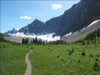
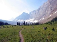
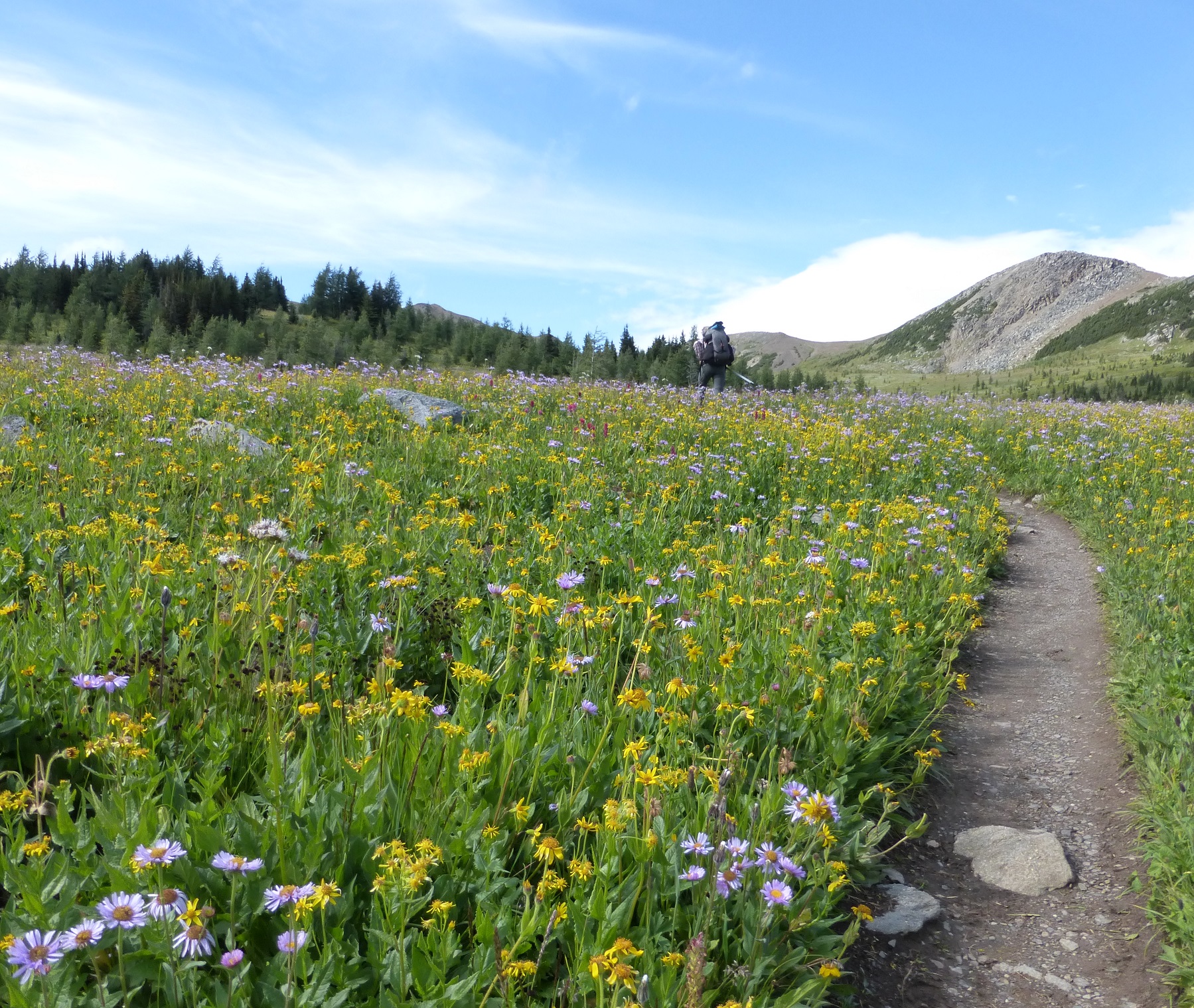
    Trail Conditions Update – September 22, 2016

    Fall is here and that means shorter days and quickly changing weather conditions in the mountains. Temperatures are dropping below freezing, and fresh snow has fallen and started to accumulate at higher elevations. Most trails have wet and muddy sections in areas with recent rainfall or snowfall. Creek crossings may be higher than normal during periods of significant rainfall.

    ELK RUTTING SEASON WARNING: It is elk rutting season until mid-October. Warning signs that read “ATTENTION – Elk Mating” have been posted at areas where elk herds often gather. Be aware that bull elk become extremely aggressive during rutting season so keep at least 30 metres away from all elk and never get between a male and female elk.

    BEAR WARNINGS: It’s pre-hibernation feeding season for both black and grizzly bears which increases the chances of running into a bear on the trail. It is easy to surprise a bear that is focussed on feeding so make noise while hiking in bear territory. Carry bear spray, watch for fresh bear signs, and if you see a bear, back away slowly and leave the area. Never run.

    • Banff National Park – To protect sensitive habitat and improve habitat security for grizzly bears, hiking is only permitted on designated trails and roads in the Sunshine Meadows, Citadel Pass, and Healy Pass areas of Banff National Park. Any off-trail use is prohibited without a restricted activity permit.
    • Jasper National Park – Two grizzly bears are frequenting the area between Nigel Pass and Maligne Pass. The bears have broken into cabins along the South Boundary trail to access horse feed. While they are no longer appearing at the cabins and have not shown aggression to people, they may return to the area. Pay extra attention when hiking in the area, make noise, and carry bear spray.

    TRAIL CLOSURES:

    • Waterton National Park – The Akamina Pass Trail is closed due to a black bear that has exhibited defensive behaviour towards people.
    • Jasper National Park – Trail #7 is closed to hikers at the junction with Trail #4g to Old Fort Point trailhead due to grizzly bears frequenting the area, and displaying aggressive behaviour. Detour is available by taking Trail #4g to Annette Lake where you can connect with Trails #4 or the Athabasca River trail to reach the Old Fort Point bridge (e34).
    • Banff National Park – To increase public safety and minimize displacement of grizzly bears from prime food sources at a critical time of the year, the Og Pass and Upper Assiniboine Pass trails are closed. Hikers are permitted to access Mount Assiniboine Provincial Park through Banff National Park via the lower Assiniboine Pass trail or the Wonder Pass trail.

    WATERTON HIKER SHUTTLE SERVICE IS NOW CLOSED. Due to the construction at Cameron Lake Day-Use Area from April to November 2016, the Cameron Lake Day-Use Area and Akamina Parkway are closed to all traffic – including pedestrians and cyclists. The shuttle concluded service on September 18.

    WILDFIRE UPDATE: There are no campfire bans on the GDT. If you must have a campfire in the backcountry, ensure you follow the rules.

    TRAIL NOTICES:

    • The trail from Sage Pass (a17) to Scarpe Pass (a24) was cleared and blazed in August 2014 and is in good shape. From Scarpe Pass, the trail disappears up to La Coulotte Ridge and the hiking becomes significantly more difficult until you reach the ATV track (a27) heading down to the West Castle Road.
    • The Aldridge Creek Trail between Fording River Pass (b31) and the Kananaskis Power Line Road (b32) was cleared and restored in July 2015.
    • Cairnes Creek (d9): The bridge is washed out making this a potentially dangerous ford. It is recommended to cross early in the morning when glacial melt is lowest.
    • The damaged Lambe Creek bridge (d10) was removed in September 2015. It is recommended to ford the creek farther downstream and cross early in the morning when glacial melt is lowest.
    • The Howse Pass Trail from Conway Creek (d12) to the Glacier Lake trail junction (d14, 15 km) is in very poor condition. The trail is overgrown, with hundreds of wind-fallen trees across the trail. Hiking in the Howse River floodplain is a viable alternative if the Howse River is low enough to ford.
    • The Owen Creek Trail was cleared in July 2015 up to km 6. Beyond that point, the trail is in poor shape with several washed out sections. Expect challenging hiking for 3 km including skirting along steep creek-side cliffs and rock-hopping in the creek itself. At km 6, do not take the trail heading up away from the creek (it is a deadend). Look for orange blazes marking the correct route staying near the creek.
    • The trail from Pinto Pass (e5) to Pinto Lake (e6) was cleared and blazed in August 2016. A new toilet and bear hang were installed at the Pinto Lake North (main) campground.
    • The Maligne Pass trail in Jasper National Park has been decommissioned and is in poor shape. The trail from Pobokton Creek (e20) to Maligne Lake (e25, approx 42 km) is no longer being maintained by Parks Canada so expect deteriorating and overgrown trail conditions; long pants are recommended. The Maligne River bridge has been removed but the river can be easily forded in normal summer conditions (knee deep in mid-summer). Most other bridges are still in place. Read Nathan Dahl’s August 30, 2015 Maligne Pass trail update here.
    • The trail from Colonel Pass (f9) to Upright Creek (f12) was cleared and blazed in August 2016. The trail has been moved back to the east side of the Moose River between Colonel Creek and Upright Creek and the ford of Upright Creek is marked. Colonel Creek campground (f11) has been restored.
    • The Yates Torrent Bridge is out at the crossing of the Coleman Glacier outflow (near f16). Do not attempt to cross at the old bridge location. Instead, ford the Smoky River farther down the valley. Attempt to cross early in the morning when glacial melt is the lowest or be prepared for a fast and potentially dangerous creek ford.
    • The bridges across Gendarme and Carcajou creeks are out on the Jasper North Boundary Trail. These two creeks are smaller than the Smoky River, but can still be treacherous. Cross Gendarme at the horse crossing just below the old bridge. Carcajou can be forded where the trail crosses the creek, unless the water level is high, then cross about 100m below the trail.
    • The trail north of Jackpine Pass (f21) all the way to Kakwa Pass (f42), is not marked and frequently disappears in meadows and boggy river valleys. Follow the GPS track to stay on route.
    • The bridge across Buchanan Creek, near the Kakwa Lake trailhead, has been removed. The crossing here can be hazardous early in the year or after heavy rains. In 2015, a gravel bar about 50 metres across the creek upstream provided the best crossing. The 10 km of road from Buchanan Creek to Bastille Creek is closed to vehicles as it is no longer driveable due to washouts so be prepared to walk this distance on foot.

    ACCESS TRAILS:

    • Kootenay National Park – Numa Creek Trail remains closed due to a washed out bridge.

    ACCESS ROADS:

    • Due to the construction at Cameron Lake Day-Use Area from April to November 2016, the Cameron Lake Day-Use Area and Akamina Parkway are closed to all traffic – including pedestrians and cyclists. For more information and updates, check out Parks Canada’s website.
    • Access to the northern terminus of the GDT in Kakwa Provincial Park is via the Walker Creek Forest Service Road. The Walker Creek FSR has been repaired from Highway 16 to km 33.5. While travelling the remaining 40 kilometres on the Walker Creek FSR, attention is required to navigate the surface as it is uneven, rutted and slippery. The road is not recommended for anything other than a 4×4 high clearance vehicle. The last 10 km from Bastille Creek to Buchanan Creek is closed due to washouts and is not driveable by vehicle so be prepared to walk this distance on foot.
  • August 2016 Trail and Road Conditions

    August 2016 Trail and Road Conditions

    Trail Conditions Update – August 29, 2016

    Trails are mostly in good condition, bare and dry with some muddy sections in areas with recent rainfall or snowfall (yes, snow has fallen at higher elevations in the north!).

    BEAR WARNINGS: It’s berry season on the GDT which increases the chances of running into a bear on the trail. Berry bushes are found throughout the Canadian Rockies, often bordering trails, roads and campgrounds. Both black and grizzly bears utilize this critical food source. It is easy to surprise a bear that is focussed on eating berries so make noise while hiking in berry territory. Carry bear spray, watch for fresh bear signs, and if you see a bear, back away slowly and leave the area. Never run.

    • Banff National Park – To protect sensitive habitat and improve habitat security for grizzly bears, hiking is only permitted on designated trails and roads in the Sunshine Meadows, Citadel Pass, and Healy Pass areas of Banff National Park. Any off-trail use is prohibited without a restricted activity permit.
    • Jasper National Park – Two grizzly bears are frequenting the area between Nigel Pass and Maligne Pass. The bears have broken into cabins along the South Boundary trail to access horse feed. While they are no longer appearing at the cabins and have not shown aggression to people, they may return to the area. Pay extra attention when hiking in the area, make noise, and carry bear spray.

    TRAIL CLOSURES:

    • Jasper National Park – Trail #7 is closed to hikers at the junction with Trail #4g to the junction with Trail #7a due to grizzly bears frequenting the area, and displaying aggressive behaviour. Detour is available by taking Trail #4g to Annette Lake where you can connect with Trails #4, #7b or the Athabasca River trail to reach the Old Fort Point bridge (e34).
    • Banff National Park – To increase public safety and minimize displacement of grizzly bears from prime food sources at a critical time of the year, the Og Pass and Upper Assiniboine Pass trails are closed. Hikers are permitted to access Mount Assiniboine Provincial Park through Banff National Park via the lower Assiniboine Pass trail or the Wonder Pass trail.

    WILDFIRE UPDATE: There are no campfire bans on the GDT. If you must have a campfire in the backcountry, ensure you follow the rules.

    WATERTON HIKER SHUTTLE SERVICE: Due to the construction at Cameron Lake Day-Use Area from April to November 2016, the Cameron Lake Day-Use Area and Akamina Parkway are closed to all traffic – including pedestrians and cyclists. GDT Hikers are not allowed to walk on the Akamina Parkway during construction, however Parks Canada is providing a complimentary shuttle service for hikers to safely access trailheads for the duration of the work.  The shuttle departs from Cameron Lake at the Summit Lake/Carthew-Alderson trailhead daily at 8:15am, 9:15am, 11:15am, 2:15pm, 4:00pm and 6:00pm. From Cameron Lake to Waterton townsite, shuttle stops include Akamina Pass, Rowe/Tamarack, Lineham, and Crandell Lake trailheads. Hikers are advised to be at the trailhead pickup locations 10 minutes prior to the scheduled departure time.

    TRAIL NOTICES:

    • The trail from Sage Pass (a17) to Scarpe Pass (a24) was cleared and blazed in August 2014 and is in good shape. From Scarpe Pass, the trail disappears up to La Coulotte Ridge and the hiking becomes significantly more difficult until you reach the ATV track (a27) heading down to the West Castle Road.
    • The Aldridge Creek Trail between Fording River Pass (b31) and the Kananaskis Power Line Road (b32) was cleared and restored in July 2015.
    • Cairnes Creek (d9): The bridge is washed out making this a potentially dangerous ford. It is recommended to cross early in the morning when glacial melt is lowest.
    • The damaged Lambe Creek bridge (d10) was removed in September 2015. It is recommended to ford the creek further downstream and cross early in the morning when glacial melt is lowest.
    • The Howse Pass Trail from Conway Creek (d12) to the Glacier Lake trail junction (d14, 15 km) is in very poor condition. The trail is overgrown, with hundreds of wind-fallen trees across the trail. Hiking in the Howse River floodplain is a viable alternative if the Howse River is low enough to ford.
    • The Owen Creek Trail was cleared in July 2015 up to km 6. Beyond that point, the trail is in poor shape with several washed out sections. Expect challenging hiking for 3 km including skirting along steep creek-side cliffs and rock-hopping in the creek itself. At km 6, do not take the trail heading up away from the creek (it is a deadend). Look for orange blazes marking the correct route staying near the creek.
    • NEW: The trail from Pinto Pass (e5) to Pinto Lake (e6) was cleared and blazed in August 2016. A new toilet and bear hang were installed at the Pinto Lake North (main) campground.
    • The Maligne Pass trail in Jasper National Park has been decommissioned and is in poor shape. The trail from Pobokton Creek (e20) to Maligne Lake (e25, approx 42 km) is no longer being maintained by Parks Canada so expect deteriorating and overgrown trail conditions; long pants are recommended. The Maligne River bridge has been removed but the river can be easily forded in normal summer conditions (knee deep in mid-summer). Most other bridges are still in place. Read Nathan Dahl’s August 30, 2015 Maligne Pass trail update here.
    • NEW: The trail from Colonel Pass (f9) to Upright Creek (f12) was cleared and blazed in August 2016. The trail has been moved back to the east side of the Moose River between Colonel Creek and Upright Creek and the ford of Upright Creek is well marked. Colonel Creek campground (f11) has been restored.
    • The Yates Torrent Bridge is out at the crossing of the Coleman Glacier outflow (near f16). Do not attempt to cross at the old bridge location. Instead, ford the Smoky River further down the valley. Attempt to cross early in the morning when glacial melt is the lowest or be prepared for a fast and potentially dangerous creek ford.
    • The bridges across Gendarme and Carcajou creeks are out on the Jasper North Boundary Trail. These two creeks are smaller than the Smoky River, but can still be treacherous. Cross Gendarme at the horse crossing just below the old bridge. Carcajou can be forded where the trail crosses the creek, unless the water level is high, then cross about 100m below the trail.
    • The trail north of Jackpine Pass (f21) all the way to Kakwa Pass (f42), is not marked and frequently disappears in meadows and boggy river valleys. Follow the GPS track to stay on route.
    • The bridge across Buchanan Creek, near the Kakwa Lake trailhead, has been removed. The crossing here can be hazardous early in the year or after heavy rains. In 2015, a gravel bar about 50 metres across the creek upstream provided the best crossing. The 10 km of road from Buchanan Creek to Bastille Creek is closed to vehicles as it is no longer driveable due to washouts so be prepared to walk this distance on foot.

    ACCESS TRAILS:

    • Kootenay National Park – Numa Creek Trail remains closed due to a washed out bridge.

    ACCESS ROADS:

    • Due to the construction at Cameron Lake Day-Use Area from April to November 2016, the Cameron Lake Day-Use Area and Akamina Parkway are closed to all traffic – including pedestrians and cyclists. Parks Canada is providing a complimentary shuttle service for hikers to safely access trailheads for the duration of the work. Shuttle stops include Cameron Lake/Carthew-Alderson, Akamina Pass, Rowe/Tamarack, Lineham, Crandell Lake trailheads. Note that some trailheads along the parkway may be temporarily closed for reconfiguration and then reopened sequentially as work is completed throughout the summer. For more information and updates, check out Parks Canada’s website.
    • Access to the northern terminus of the GDT in Kakwa Provincial Park is via the Walker Creek Forest Service Road. The Walker Creek FSR has been repaired from Highway 16 to km 33.5. While travelling the remaining 40 kilometres on the Walker Creek FSR, attention is required to navigate the surface as it is uneven, rutted and slippery. The road is not recommended for anything other than a 4×4 high clearance vehicle. The last 10 km from Bastille Creek to Buchanan Creek is closed due to washouts and is not driveable by vehicle so be prepared to walk this distance on foot.
  • July 2016 Trail and Road Conditions

    July 2016 Trail and Road Conditions

    Trail Conditions Update – July 29, 2016

    Wildflowers are blooming! Trails are mostly bare and dry with some muddy sections in areas with recent rainfall.

    WATERTON HIKER SHUTTLE SERVICE: Due to the construction at Cameron Lake Day-Use Area from April to November 2016, the Cameron Lake Day-Use Area and Akamina Parkway are closed to all traffic – including pedestrians and cyclists. GDT Hikers are not allowed to walk on the Akamina Parkway during construction, however Parks Canada is providing a complimentary shuttle service for hikers to safely access trailheads for the duration of the work.  The shuttle departs from Cameron Lake at the Summit Lake/Carthew-Alderson trailhead daily at 8:15am, 9:15am, 11:15am, 2:15pm, 4:00pm and 6:00pm. From Cameron Lake to Waterton townsite, shuttle stops include Akamina Pass, Rowe/Tamarack, Lineham, and Crandell Lake trailheads. Hikers are advised to be at the trailhead pickup locations 10 minutes prior to the scheduled departure time.

    WILDFIRE UPDATE: There are no campfire bans on the GDT. If you must have a campfire in the backcountry, ensure you follow the rules.

    BEAR WARNINGS: It’s berry season on the GDT which increases the chances of running into a bear on the trail. Berry bushes are found throughout the Canadian Rockies, often bordering trails, roads and campgrounds. Both black and grizzly bears utilize this critical food source. It is easy to surprise a bear that is focussed on eating berries so make noise while hiking in berry territory. Carry bear spray, watch for fresh bear signs, and if you see a bear, back away slowly and leave the area. Never run.

    Waterton Lakes National Park – A female black bear and her cubs are frequenting the area around the Rowe Lake Trail.  Pay extra attention when hiking in the area, make noise, and carry bear spray.

    Peter Lougheed Provincial Park – Bear warnings on the entire length of the Upper Kananaskis Lakes Trail and at Point, Forks and Interlakes campgrounds.

    Jasper National Park – Two grizzly bears are frequenting the area between Nigel Pass and Maligne Pass. The bears have broken into cabins along the South Boundary trail to access horse feed. While they are no longer appearing at the cabins and have not shown aggression to people, they may return to the area. Pay extra attention when hiking in the area, make noise, and carry bear spray.

    TRAIL CLOSURES:

    • Jasper National Park – Trail #7 is closed to hikers at the junction with Trail #7e to the junction with Trail #7a due to grizzly and black bears frequenting the area. Detour is available by taking Trail #7e to Mildred Lake where you can follow the east side of Beauvert Lake on Trail #7b or the Athabasca River trail to reach the Old Fort Point bridge (e34).
    • Peter Lougheed Provincial Park – Bear closures of the Shoreline Trail between Upper Lakes boat launch and North Interlakes day use areas, and the White Spruce day use area and the 1982 Canadian Mount Everest Expedition Trail.

    TRAIL NOTICES:

    • The trail from Sage Pass (a17) to Scarpe Pass (a24) was cleared and blazed in August 2014 and is in good shape. From Scarpe Pass, the trail disappears up to La Coulotte Ridge and the hiking becomes significantly more difficult until you reach the ATV track (a27) heading down to the West Castle Road.
    • The Aldridge Creek Trail between Fording River Pass (b31) and the Kananaskis Power Line Road (b32) was cleared and restored in July 2015.
    • Cairnes Creek (d9): The bridge is washed out making this a potentially dangerous ford. It is recommended to cross early in the morning when glacial melt is lowest.
    • The damaged Lambe Creek bridge (d10) was removed in September 2015. It is recommended to ford the creek further downstream and cross early in the morning when glacial melt is lowest.
    • The Howse Pass Trail from Conway Creek (d12) to the Glacier Lake trail junction (d14, 15 km) is in very poor condition. The trail is overgrown, with hundreds of wind-fallen trees across the trail. Hiking in the Howse River floodplain is a viable alternative if the Howse River is low enough to ford.
    • The Owen Creek Trail was cleared in July 2015 up to km 6. Beyond that point, the trail is in poor shape with several washed out sections. Expect challenging hiking for 3 km including skirting along steep creek-side cliffs and rock-hopping in the creek itself. At km 6, do not take the trail heading up away from the creek (it is a deadend). Look for orange blazes marking the correct route staying near the creek.
    • The Maligne Pass trail in Jasper National Park has been decommissioned and is in poor shape. The trail from Pobokton Creek (e20) to Maligne Lake (e25, approx 42 km) is no longer being maintained by Parks Canada so expect deteriorating and overgrown trail conditions; long pants are recommended. The Maligne River bridge has been removed but the river can be easily forded in normal summer conditions (knee deep in mid-summer). Most other bridges are still in place. Read Nathan Dahl’s August 30, 2015 Maligne Pass trail update here.
    • The Yates Torrent Bridge is out at the crossing of the Coleman Glacier outflow (near f16). Do not attempt to cross at the old bridge location. Instead, ford the Smoky River further down the valley. Attempt to cross early in the morning when glacial melt is the lowest or be prepared for a fast and potentially dangerous creek ford.The bridges across Gendarme and Carcajou Creeks are out on the Jasper North Boundary Trail. These two creeks are smaller than the Smoky River, but can still be treacherous. Cross Gendarme at the horse crossing just below the old bridge (marked), and Carcajou about 100m below the trail.
    • The bridge across Buchanan Creek, near the Kakwa Lake trailhead, has been removed. The crossing here can be hazardous early in the year or after heavy rains. In 2015, a gravel bar about 50 metres across the creek upstream provided the best crossing. The 10 km of road from Buchanan Creek to Bastille Creek is closed to vehicles as it is no longer driveable due to washouts so be prepared to walk this distance on foot.

    ACCESS TRAILS:

    • Kootenay National Park – Numa Creek Trail remains closed due to a washed out bridge.
    • Kootenay National Park – Be advised that the suspension bridge at the 12-km mark on the Helmet Creek trail has been removed until further notice. The creek can still be forded or crossed on a log upstream of the bridge location.

    ACCESS ROADS:

    • Due to the construction at Cameron Lake Day-Use Area from April to November 2016, the Cameron Lake Day-Use Area and Akamina Parkway are closed to all traffic – including pedestrians and cyclists. Parks Canada is providing a complimentary shuttle service for hikers to safely access trailheads for the duration of the work. Shuttle stops include Cameron Lake/Carthew-Alderson, Akamina Pass, Rowe/Tamarack, Lineham, Crandell Lake trailheads. Note that some trailheads along the parkway may be temporarily closed for reconfiguration and then reopened sequentially as work is completed throughout the summer. For more information and updates, check out Parks Canada’s website.
    • Access to the northern terminus of the GDT in Kakwa Provincial Park is via the Walker Creek Forest Service Road. The Walker Creek FSR has been repaired from Highway 16 to km 33.5. While travelling the remaining 40 kilometres on the Walker Creek FSR, attention is required to navigate the surface as it is uneven, rutted and slippery. The road is not recommended for anything other than a 4×4 high clearance vehicle. The last 10 km from Bastille Creek to Buchanan Creek is closed due to washouts and is not driveable by vehicle so be prepared to walk this distance on foot.
  • June 2016 Trail and Road Conditions

    June 2016 Trail and Road Conditions

    Trail Conditions Update – June 29, 2016

    Wildflowers are blooming! Most of the snow from the freak snowstorm last week has melted and trails are mostly bare and dry with patches of snow lingering at higher elevations. Warm daytime temperatures means the snow is melting quickly and creating muddy and slippery conditions.

    WATERTON HIKER SHUTTLE SERVICE: Due to the construction at Cameron Lake Day-Use Area from April to November 2016, the Cameron Lake Day-Use Area and Akamina Parkway are closed to all traffic – including pedestrians and cyclists. GDT Hikers are not allowed to walk on the Akamina Parkway during construction, however Parks Canada is providing a complimentary shuttle service for hikers to safely access trailheads for the duration of the work.  The shuttle departs from Cameron Lake at the Summit Lake/Carthew-Alderson trailhead daily at 8:15am, 9:15am, 11:15am, 2:15pm, 4:00pm and 6:00pm. From Cameron Lake to Waterton townsite, shuttle stops include Akamina Pass, Rowe/Tamarack, Lineham, and Crandell Lake trailheads. Hikers are advised to be at the trailhead pickup locations 10 minutes prior to the scheduled departure time.

    TICKS: It’s tick season so be extra careful when in areas with a lot of underbrush and check yourself and your clothing after your hike.

    BEAR WARNING: Jasper National Park – Two grizzly bears are frequenting the area between Nigel Pass and Maligne Pass. The bears have broken into cabins along the South Boundary trail to access horse feed. While they are no longer appearing at the cabins and have not shown aggression to people, they may return to the area. Pay extra attention when hiking in the area, make noise, and carry bear spray.

    WILDFIRE UPDATE: Currently there are no campfire bans on the GDT, but due to warm and dry conditions a fire advisory is in effect from Sage Pass to Peter Loughheed Provincial Park. Small campfires are allowed but if you must have a campfire in the backcountry, ensure you follow the rules.

    TRAIL CLOSURES:

    • Jasper National Park – Trail #7 is closed to hikers at the junction with Trail #7e to the junction with Trail #7a due to grizzly and black bears frequenting the area. Detour is available by taking Trail #7e to Mildred Lake where you can follow the east side of Beauvert Lake on Trail #7b or the Athabasca River trail to reach the Old Fort Point bridge (e34).
    • Elk Lakes Provincial Park – Elk Lakes Trail to Upper Elk Lake is closed beyond the Lower Elk Lake campground during construction of a new bridge over the Elk River. Detour to West Elk Pass by taking the Elkan Creek trail from the parking lot trailhead. Lower Elk Lake campground is still open and accessible but hikers are asked to exercise caution in this area during construction.

    TRAIL NOTICES:

    • The trail from Sage Pass (a17) to Scarpe Pass (a24) was cleared and blazed in August 2014 and is in good shape. From Scarpe Pass, the trail disappears up to La Coulotte Ridge and the hiking becomes significantly more difficult until you reach the ATV track (a27) heading down to the West Castle Road.
    • The Aldridge Creek Trail between Fording River Pass (b31) and the Kananaskis Power Line Road (b32) was cleared and restored in July 2015, but we have received reports of a small landslide covering the trail near the first ford of Aldridge Creek.
    • Cairnes Creek (d9): The bridge is washed out making this a potentially dangerous ford. It is recommended to cross early in the morning when glacial melt is lowest.
    • The damaged Lambe Creek bridge (d10) was removed in September 2015. It is recommended to ford the creek further downstream.
    • The Howse Pass Trail from Conway Creek (d12) to the Glacier Lake trail junction (d14, 15 km) is in very poor condition. The trail is overgrown, with hundreds of wind-fallen trees across the trail. Hiking in the Howse River floodplain is a viable alternative if the Howse River is low enough to ford.
    • The Owen Creek Trail was cleared in July 2015 up to km 6. Beyond that point, the trail is in poor shape with several washed out sections. Expect challenging hiking for 3 km including skirting along steep creek-side cliffs and rock-hopping in the creek itself. At km 6, do not take the trail heading up away from the creek (it is a deadend). Look for orange blazes marking the correct route staying near the creek.
    • The Maligne Pass trail in Jasper National Park has been decommissioned and is in poor shape. The trail from Pobokton Creek (e20) to Maligne Lake (e25, approx 42 km) is no longer being maintained by Parks Canada so expect deteriorating and overgrown trail conditions; long pants are recommended. The Maligne River bridge has been removed but the river can be easily forded in normal summer conditions (knee deep in mid-summer). Most other bridges are still in place. Read Nathan Dahl’s August 30, 2015 Maligne Pass trail update here.
    • The Yates Torrent Bridge is out at the crossing of the Coleman Glacier outflow (near f16). Do not attempt to cross at the old bridge location. Instead, ford the Smoky River further down the valley. Attempt to cross early in the morning when glacial melt is the lowest or be prepared for a fast and potentially dangerous creek ford.
    • The bridges across Gendarme and Carcajou Creeks are out on the Jasper North Boundary Trail. These two creeks are smaller than the Smoky River, but can still be treacherous. Cross Gendarme at the horse crossing just below the old bridge (marked), and Carcajou about 100m below the trail.
    • The bridge across Buchanan Creek, near the Kakwa Lake trailhead, has been removed. The crossing here can be hazardous early in the year or after heavy rains. In 2015, a gravel bar about 50 metres across the creek upstream provided the best crossing. The 10 km of road from Buchanan Creek to Bastille Creek is closed to vehicles as it is no longer driveable due to washouts so be prepared to walk this distance on foot.

    ACCESS TRAILS:

    • Kootenay National Park – Numa Creek Trail remains closed due to a washed out bridge.
    • Kootenay National Park – Be advised that the suspension bridge at the 12-km mark on the Helmet Creek trail has been removed until further notice. The creek can still be forded or crossed on a log upstream of the bridge location.

    ACCESS ROADS:

    • Due to the construction at Cameron Lake Day-Use Area from April to November 2016, the Cameron Lake Day-Use Area and Akamina Parkway are closed to all traffic – including pedestrians and cyclists. Parks Canada is providing a complimentary shuttle service for hikers to safely access trailheads for the duration of the work. Shuttle stops include Cameron Lake/Carthew-Alderson, Akamina Pass, Rowe/Tamarack, Lineham, Crandell Lake trailheads. Note that some trailheads along the parkway may be temporarily closed for reconfiguration and then reopened sequentially as work is completed throughout the summer. For more information and updates, check out Parks Canada’s website.
    • Access to the northern terminus of the GDT in Kakwa Provincial Park is via the Walker Creek Forest Service Road. The Walker Creek FSR has been repaired from Highway 16 to km 33.5. While travelling the remaining 40 kilometres on the Walker Creek FSR, attention is required to navigate the surface as it is uneven, rutted and slippery. The road is not recommended for anything other than a 4×4 high clearance vehicle. The last 10 km from Bastille Creek to Buchanan Creek is closed due to washouts and is not driveable by vehicle so be prepared to walk this distance on foot.
  • Spring 2016 Trail and Road Conditions Update

    Spring 2016 Trail and Road Conditions Update

    Trail Conditions Update – April 30, 2016

    Spring is in the air! This is transition time on the GDT. Hiking trails at lower elevations vary from bare and muddy to slushy and icy, while trails at higher elevation remain snowbound with potential avalanche risk. Trails can be icy in the morning but warmer daytime temperatures are creating slushy and slippery conditions. Plan for varying conditions – warm layers and snowshoes, cleats and/or poles are recommended.

    Spring avalanche conditions still exist, especially at higher elevations so always check the latest avalanche bulletins before setting out.

    Tick season has started. Be extra careful when in areas with a lot of underbrush and check yourself and your clothing after your hike.

    TRAIL CLOSURES:

    • Jasper National Park – Trail #7 is closed to hikers at the junction with Trail #7e to the junction with Trail #7a due to grizzly and black bears frequenting the area. Detour is available by taking Trail #7e to Mildred Lake where you can follow the Beauvert Lake Trail or Athabasca River Trail to reach the Old Fort Point bridge (e34).

    TRAIL NOTICES:

    • The trail from Sage Pass (a17) to Scarpe Pass (a24) was cleared and blazed in August 2014 and is in good shape. From Scarpe Pass, the trail disappears up to La Coulotte Ridge and the hiking becomes significantly more difficult until you reach the ATV track (a27) heading down to the West Castle Road.
    • The Aldridge Creek Trail between Fording River Pass (b31) and the Kananaskis Power Line Road (b32) was cleared and restored in July 2015.
    • Cairnes Creek (d9): The bridge is washed out making this a potentially dangerous ford. It is recommended to cross early in the morning when glacial melt is lowest.
    • The damaged Lambe Creek bridge (d10) was removed in September 2015. It is recommended to ford the creek further downstream.
    • The Howse Pass Trail from Conway Creek (d12) to the Glacier Lake trail junction (d14, 15 km) is in very poor condition. The trail is overgrown, with hundreds of wind-fallen trees across the trail. Hiking in the Howse River floodplain is a viable alternative if the Howse River is low enough to ford.
    • The Owen Creek Trail was cleared in July 2015 up to km 6. Beyond that point, the trail is in poor shape with several washed out sections. Expect challenging hiking for 3 km including skirting along steep creek-side cliffs and rock-hopping in the creek itself. At km 6, do not take the trail heading up away from the creek (it is a deadend). Look for orange blazes marking the correct route staying near the creek.
    • The Maligne Pass trail in Jasper National Park has been decommissioned and is in poor shape. The trail from Pobokton Creek (e20) to Maligne Lake (e25, approx 42 km) is no longer being maintained by Parks Canada so expect deteriorating and overgrown trail conditions; long pants are recommended. The Maligne River bridge has been removed but the river can be easily forded in normal summer conditions (knee deep in mid-summer). Most other bridges are still in place. Read Nathan Dahl’s August 30, 2015 Maligne Pass trail update here.
    • The Yates Torrent Bridge is out at the crossing of the Coleman Glacier outflow (near f16). Do not attempt to cross at the old bridge location. Instead, ford the Smoky River further down the valley. Attempt to cross early in the morning when glacial melt is the lowest or be prepared for a fast and potentially dangerous creek ford.
    • The bridges across Gendarme and Carcajou Creeks are out on the Jasper North Boundary Trail. These two creeks are smaller than the Smoky River, but can still be treacherous. Cross Gendarme at the horse crossing just below the old bridge (marked), and Carcajou about 100m below the trail.
    • The bridge across Buchanan Creek, near the Kakwa Lake trailhead, has been removed. The crossing here can be hazardous early in the year or after heavy rains. In 2015, a gravel bar about 50 metres across the creek upstream provided the best crossing.

    ACCESS ROADS:

    • Annual Winter Closure of Highway 40 from the Kananaskis Lakes Trail to the junction of Highway 541 between December 1 and June 15.
    • 8:00 pm to 8:00 am closure of the Bow Valley Parkway (Highway 1A) from March 1 to June 25 on the 17 kilometre section of the parkway from Johnston Canyon Campground to the Fireside Picnic Area, to reduce disturbance and increase habitat security for sensitive wildlife species during critical times.
    • The Red Rock Parkway in Waterton Lakes National Park is closed to allow for reconstruction of the parkway and the lower parking lot at Red Rock Canyon. Starting May 6 until June 17, 2016, the Red Rock Parkway will reopen for public use on weekends only, from 2:00pm Friday until 4:00pm Sunday. Full re-opening will occur on June 17, 2016.
    • Due to the construction at Cameron Lake Day-Use Area from April to November 2016, the Cameron Lake Day-Use Area and Akamina Parkway will be closed to all traffic – including pedestrians and cyclists. Parks Canada is pursuing a complimentary shuttle service for hikers to safely access trailheads for the duration of the work. Some trailheads along the parkway may be temporarily closed for reconfiguration and then reopened sequentially as work is completed throughout the summer. The Carthew-Alderson Trail will remain open. For more information and updates, check out Parks Canada’s website.
    • Access to the northern terminus of the GDT in Kakwa Provincial Park is via the Walker Creek Forest Service Road. The Walker Creek FSR has been repaired from Highway 16 to km 33.5. While travelling the remaining 40 kilometres on the Walker Creek FSR, attention is required to navigate the surface as it is uneven, rutted, slippery and very rough. The road is not recommended for anything other than a 4×4 high clearance vehicle. The last 10km from Bastille Creek to Buchanan Creek is closed due to washouts and is not driveable by vehicle so be prepared to walk this distance on foot.


  • November 2015 Trail and Road Conditions

    November 2015 Trail and Road Conditions

    Trail Conditions Update – November 1, 2015

    Winter is coming! The GDT has experienced an unusually long fall hiking season with some lower elevation trails still snowfree. At higher elevations expect fresh snow and wet or icy trail conditions, with temperatures falling below freezing. Conditions can change quickly so be prepared for all weather conditions when travelling into the backcountry this fall.

    SEASONAL CLOSURES:

    • Jasper National Park: The GDT is closed from Four Point Campground to Signal Mountain Trailhead from November 1, 2015 to February 28, 2016, to prevent trails from facilitating an unnatural level of predator access to threatened woodland caribou.
    • Peter Lougheed Visitor Information Centre is under a seasonal closure from October 13 until November 18, 2015.
    • The Lake Magog campground is currently closed due to safety concerns caused by a Grizzly bear in the area. Camping is only permitted at O’Brien Meadows within the Core Area of Mount Assiniboine Provincial Park at this time.

    TRAIL CLOSURES:

    • Elk Lakes Provincial Park: Extensive repairs and construction on the trail between Lower and Upper Elk Lakes to be carried out throughout 2015 hiking season. Detour to West Elk Pass by taking the Elkan Creek trail from the parking lot trailhead. Lower Elk Lake campground is still accessible but hikers are asked to exercise caution in this area during construction.

    TRAIL NOTICES:

    • The trail from Sage Pass (a17) to Scarpe Pass (a24) was cleared and blazed in August 2014 and is in good shape. From Scarpe Pass, the trail disappears up to La Coulotte Ridge and the hiking becomes significantly more difficult until you reach the ATV track (a27) heading down to the West Castle Road.
    • The Aldridge Creek Trail between Fording River Pass (b31) and the Kananaskis Power Line Road (b32) was cleared and restored in July 2015.
    • On October 7, 2015, a large landslide occurred on the relatively low angle western slopes of Mount Cautley, above the Lake Magog area in Mount Assiniboine Provincial Park. For public safety, BC Parks requests that visitors to the area stay well away from the site and stay clear of the slide’s run out downslope.
    • Cairnes Creek (d9): The bridge is washed out making this a potentially dangerous ford. It is recommended to cross early in the morning when glacial melt is lowest.
    • The damaged Lambe Creek bridge (d10) was removed in September 2015. It is recommended to ford the creek further downstream.
    • The Howse Pass Trail from Conway Creek (d12) to the Glacier Lake trail junction (d14, 15 km) is in very poor condition. The trail is overgrown, with hundreds of wind-fallen trees across the trail. Hiking in the Howse River floodplain is a viable alternative if the Howse River is low enough to ford.
    • The Owen Creek Trail was cleared in July 2015 up to km 6. Beyond that point, the trail is in poor shape with several washed out sections. Expect challenging hiking for 3 km including skirting along steep creek-side cliffs and rock-hopping in the creek itself. At km 6, do not take the trail heading up away from the creek (it is a deadend). Look for orange blazes marking the correct route staying near the creek.
    • The Maligne Pass trail in Jasper National Park has been decommissioned and is in poor shape. The trail from Pobokton Creek (e20) to Maligne Lake (e25, approx 42 km) is no longer being maintained by Parks Canada so expect deteriorating and overgrown trail conditions; long pants are recommended. The Maligne River bridge has been removed but the river can be easily forded in normal summer conditions (knee deep in mid-summer). Most other bridges are still in place. Read Nathan Dahl’s August 30, 2015 Maligne Pass trail update here.
    • The Yates Torrent Bridge is out at the crossing of the Coleman Glacier outflow (near f16). Attempt to cross early in the morning when glacial melt is the lowest or be prepared for a fast and potentially dangerous creek ford.

    ACCESS TRAIL CLOSURES:

    • Kootenay National Park – Due to washed out bridges, access to Numa Creek Falls and Trail remains closed.

    ACCESS ROADS UPDATE:

    Winter conditions exist on many mountain highways and roads. Roads can be snowy and icy so check for the latest conditions before you travel and carry chains and/or winter tires. For more information, check out Alberta 511 and Drive BC.

    • Highway 40 will be seasonally closed from Peter Lougheed Provincial Park to Highwood House beginning December 1.
    • Forestry Trunk Road 940 will be seasonally closed south of Cataract Creek and northwest of Plateau Mountain Road beginning December 1.
    • The Red Rock Parkway in Waterton Lakes National Park is closed for the season until approximately May 2016 to allow for reconstruction of the parkway and the lower parking lot at Red Rock Canyon.
    • Access to the northern terminus of the GDT in Kakwa Provincial Park is via the Walker Creek Forest Service Road. The Walker Creek FSR has been repaired from Highway 16 to km 33.5. While travelling the remaining 50 kilometres on the Walker Creek FSR, attention is required to navigate the surface as it is uneven, rutted, slippery and very rough. The road is not recommended for anything other than a 4×4 high clearance vehicle. The last 10km from Bastille Creek to Buchanan Creek are particularly rough and muddy and might not be driveable by vehicle so be prepared to walk this distance on foot.
  • August 2015 Trail and Road Conditions

    August 2015 Trail and Road Conditions

    Trail Conditions Update – August 24, 2015

    TRAILS: Conditions are good on most of the GDT. Trails are mainly dry and snowfree. It’s berry season! Your chances of running into a bear on the trail are higher at this time of year. Berry bushes are found throughout the GDT, often bordering the trail and near campgrounds, so be aware.

    WILDFIRE UPDATES: Campfires are permitted in designated fire pits on the GDT in all of Alberta and in Mount Robson and Kakwa Provincial Parks in BC. Campfires are still prohibited on all other sections of the GDT in south-eastern BC.

    • The Waterton wildfire on the east slopes of Campbell Mountain is now 100% contained and is considered under control. The Lakeshore Trail has re-opened but fire crews are still working in the area.  Please be careful when walking on the Lakeshore Trail between Boundary Bay and Goat Haunt, and do not disturb any of the fire fighting equipment in the area.
    • The Excelsior Creek wildfire in Jasper National Park is considered under control and all sections of the GDT have re-opened.
    • The Kakwa Park wildfire burning in the Jarvis Creek Valley is out. The Jarvis Creek Valley is once again open to the public.

    TRAIL CLOSURES:

    • Elk Lakes Provincial Park: Extensive repairs and construction on the trail between Lower and Upper Elk Lakes to be carried out throughout 2015 hiking season. Detour to West Elk Pass by taking the Elkan Creek trail from the parking lot trailhead. Lower Elk Lake campground is still accessible but hikers are asked to exercise caution in this area during construction.
    • Banff National Park: Og Pass trail and Upper Assiniboine Pass trail within Banff National Park are closed from August 1 to September 30, to increase public safety, and to minimize displacement of grizzly bears from prime food sources at a critical time of the year. Hikers are permitted to access Mount Assiniboine Provincial Park via the lower Assiniboine Pass trail or the Wonder Pass trail.

    BEAR WARNINGS:

    • Jasper National Park: Grizzly bears are frequenting the Bald Hills area near the Skyline trailhead and Maligne Lake. Extra caution and bear spray is recommended when hiking in this area. Please report all bear sightings to 780-852-6155. (17AUG2015)
    • Jasper National Park: The Brazeau Loop, Nigel Pass and Poboktan Creek trails are open but a bear warning is in effect. Two grizzly bears have broken into cabins along the South Boundary trail to access horse feed. While they are no longer appearing at cabins and have not shown aggression to people, they may return to the area. Recommendations to minimize the potential of a bear encounter:  Travel in tight groups of 4 or more; make noise to alert bears of your presence; carry bear spray; and keep a clean campsite, secure all food and garbage on designated bear cables or in bear storage lockers.  Please report all bear sightings to 780-852-6155. (30JUL2015)
    • Waterton Lakes National Park: Special caution is recommended while travelling or camping along the Lakeshore Trail from Boundary Bay to the Waterton townsite as a black bear is frequenting the area and has obtained unsecured human food. Be prepared to encounter a bear at anytime in and around this area. (10AUG2015)

    TRAIL NOTICES:

    • The trail from Sage Pass (a17) to Scarpe Pass (a24) was cleared and blazed last year and is in good shape. From Scarpe Pass, the trail disappears up to La Coulotte Ridge and the hiking becomes significantly more difficult until you reach the ATV track (a27) heading down to the West Castle Road.
    • The Aldridge Creek Trail between Fording River Pass (b31) and the Kananaskis Power Line Road (b32) was cleared and restored in July 2015.
    • Cairnes Creek (d9): The bridge is washed out making this a potentially dangerous ford. It is recommended to cross early in the morning when glacial melt is lowest.
    • The Lambe Creek bridge (d10) is badly damaged so it is recommended to ford the creek further downstream and avoid using the broken bridge.
    • The Howse Pass Trail from Conway Creek (d12) to the Glacier Lake trail junction (d14, 15 km) is in very poor condition. The trail is overgrown, with hundreds of wind-fallen trees across the trail. Hiking in the Howse River floodplain is a viable alternative if the Howse River is low enough to ford.
    • The Owen Creek Trail was cleared in July 2015 up to km 5. Beyond that point, the trail is in poor shape with several washed out sections. Expect challenging hiking for 3 or 4 km including skirting along steep creek-side cliffs and rock-hopping in the creek itself. At km 6, do not take the trail heading up away from the creek (it is a deadend). Look for orange blazes marking the correct route staying near the creek.
    • The Maligne Pass trail in Jasper National Park has been decommissioned and is in poor shape. The trail from Pobokton Creek (e20) to Maligne Lake (e25, approx 42 km) is no longer being maintained by Parks Canada so expect deteriorating and overgrown trail conditions; long pants are recommended. The Maligne River bridge has been removed but the river can be easily forded (knee deep in mid-summer). Most other bridges are still in place.
    • The Yates Torrent Bridge is gone at the crossing of the Coleman Glacier outflow (near f16) so attempt to cross early in the morning when glacial melt is the lowest or be prepared for a fast and dangerous creek ford. Thanks to Christine Friesen for the update!

    ACCESS TRAIL CLOSURES:

    • Kootenay National Park – Due to washed out bridges, access to Numa Creek Falls and Trail remains closed.

    Access Roads Update:

    • Construction work on Highway 40 continues from south of the winter gate to Junction Highway 541; expect delays.
    • Access to the northern terminus of the GDT in Kakwa Provincial Park is via the Walker Creek Forest Service Road. The Walker Creek FSR has been repaired from Highway 16 to km 33.5. While travelling the remaining 50 kilometres on the Walker Creek FSR, attention is required to navigate the surface as it is uneven, rutted, slippery and very rough. The road is not recommended for anything other than a 4×4 high clearance vehicle. The last 10km from Bastille Creek to Buchanan Creek are particularly rough and muddy and might not be driveable by vehicle so be prepared to walk this distance on foot. Thanks to Canadoug for the update!
    • The Elk River FSR will be closed periodically at 123km, 142km, and 145km for bridge replacements between September 1 to September 30.
    • The Red Rock Parkway in Waterton Lakes National Park will be closed for the season starting September 8 until approximately May 2016.