

Field to North Saskatchewan River Crossing
| Suggested start/finish | Field to The Crossing Resort |
| Recommended number of days for section | 5 (relaxed), 5 (average), 4 (fast) |
| Distance | 106 km |
| Elevation Gain/Loss | 5498m / -5341m |
| Traditional Territory of the | Blackfoot Confederacy, Tsuut’ina, Stoney Nakoda, Ktunaxa, Secwépemc, and Métis |
| National Parks | Yoho and Banff National Parks |
| Permits required | Parks Canada Discovery Pass and backcountry random camping permits in Yoho and Banff |
| Alternates | Kiwetinok Amiskwi Ridge Collie Creek |

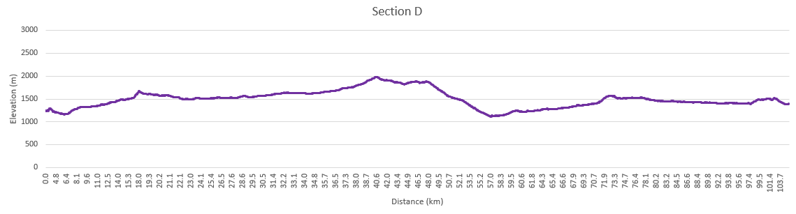
While Section D is the shortest, it has been called the most difficult part of the GDT. For the most part you’ll be on unofficial and unmaintained trails where blowdowns, overgrown trail and washouts can be common. Creek crossings are largely unbridged, so be prepared to ford rivers and streams. Some hikers have mentioned not encountering another person while hiking this part of the trail and this wilderness solitude is part of the charm of Section D. Starting at the hamlet of Field in Yoho National Park, Section D finishes up at a major highway junction and resort at Saskatchewan Crossing on the Icefields Parkway (Highway 93).
Leaving Field
Field started out as a major switching point for the Canadian Pacific Railway. Prior to the construction of the spiral tunnels in 1909, the descent from Kicking Horse Pass was the location of the “Big Hill”. This extremely steep section of track required large steam locomotives to be added to trains to help them up the grade. Field was the center of these operations, but today, with a population of less than 200, it’s mainly a place for tourists, hikers, and campers. There are several B&B options to stay at within Field as well as two nearby frontcountry campgrounds at Kicking Horse and Monarch.
From Field, the main GDT follows the Amiskwi Valley towards Amiskwi Pass. While the first part of this trail is maintained, if fairly quickly falls into disuse and blowdowns are frequent. You’ll have to ford the Amiskwi River three times as you make your way up the valley. Random camping is permitted once you’re 4 km away from the trailhead, however a random camping permit is still required from Parks Canada.
The Kiwetinok Alternate Route takes you steeply up to the Burgess Highline Trail, Yoho Lake campground, and onto the popular Iceline Trail. The views of Takakkaw Falls and Waputik Icefield across the valley are incredible. A campground and Alpine Club of Canada cabin are located in the Little Yoho Valley. From the campground, you’ll climb steeply up to Kiwetinok Pass where the trail ends and 8 km of cross-country route finding begins before reconnecting with the main GDT.
Campgrounds in this area:
- Kicking Horse (Frontcountry off trail) – Yoho National Park (permit and reservation required)
- Monarch (Frontcountry off trail) – Yoho National Park (permit and reservation required)
- Takakkaw Falls (Frontcountry off trail) – Yoho National Park (First come first served and permit required)
- Yoho Lake (Kiwetinok Alternate) – Yoho National Park (permit and reservation required)
- Little Yoho (Kiwetinok Alternate) – Yoho National Park (permit and reservation required)
- Stanley Mitchell Hut (Kiwetinok Alternate) – Alpine Club of Canada (reservation required)
- Amiskwi River – Yoho National Park random camping (permit required)
Entry / Exit Points
- South – Trans-Canada Highway 1
- North – Blaeberry Forestry Road
Resupply
- Field
Walking the Explorer’s Route
Over Amiskwi Pass you’ll enter the Blaeberry River valley. Leaving behind Yoho National Park, this will be the first time you’ll have been outside of a park since entering Elk Lakes Provincial Park in Section B. Much of the trail on this side of the pass is on forestry roads until you start on the David Thompson Heritage Trail. Named after the consummate explorer, David Thompson hiked or horsebacked over 90,000 km during the early 19th century, mapping over 4.9 million square km of North America. This historical route was used by the Secwépemc people as a travel and trade route, connecting Secwépemc ancestors to the northern Stoney and to the Rocky Mountain House during the fur trade.
Much work has been done to restore the historic Collie Creek Trail, with the goal of making it the main route in the future. Unfortunately, with the recent removal of the logging bridge over the Blaeberry River near Cairnes Creek Rec Site, this alternate route is closed. The GDT can also be exited here down the Blaeberry River Road to the Trans-Canada Highway near the town of Golden.
Campgrounds in this area:
- Ensign Creek – Random camping (no permit required)
- Cairnes Creek – Random camping (no permit required)
- Lambe Creek – Random camping (no permit required)
Entry / Exit Points
- Blaeberry Forestry Road
Resupply
- None
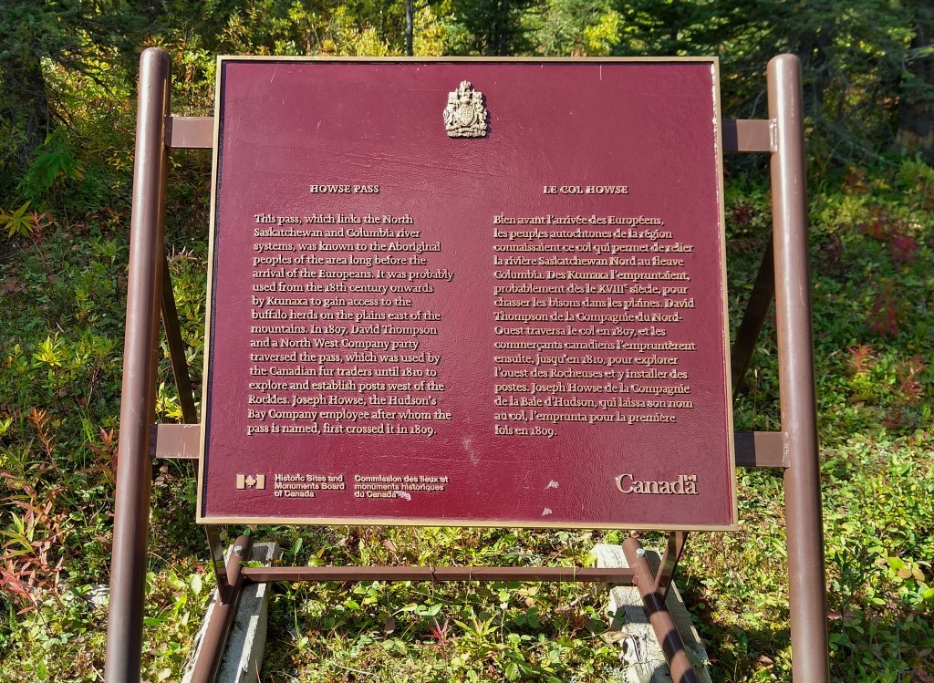
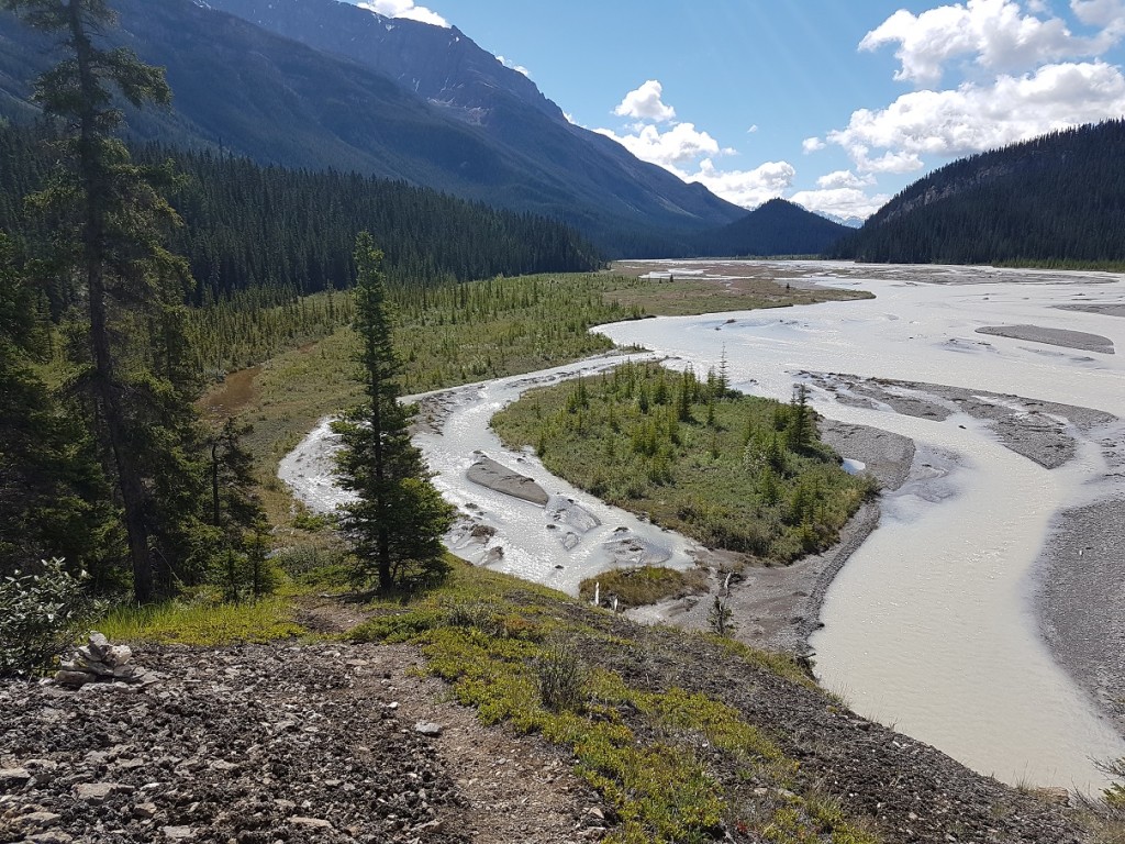
Howse Pass
Back to the Blaeberry, you’ll climb to the seldom used Howse Pass where the trail crosses the Great Divide below the treeline, back into Banff National Park in Alberta. Today the GDT mainly follows the Howse River floodplain as the former trail is choked with hundreds of blowdowns. Prepare for wet feet on this part of the trail as the route fords the many side channels of the floodplain. After the junction with the Glacier Lake Trail (recommended only for equestrians due to the deep ford of the Howse River), you’ll rejoin good trail and head towards Saskatchewan Crossing by following the trail to the spectacular Mistaya Canyon on the Icefields Parkway (Highway 93).
At Saskatchewan Crossing you’ll find a hotel, restaurant, gas station, and well equipped (if expensive) general store. If you plan to stay here, you’ll want to book ahead.
Campgrounds in this area:
- Conway Creek – Banff National Park (random camping permit required)
- Howse Floodplain – Banff National Park (random camping permit required)
- Howse River – Banff National Park (random camping permit required)
Entry / Exit Points
- South – Blaeberry Forestry Road
- North – Highway 93N (Icefields Parkway)
Resupply
- Saskatchewan Crossing Resort


