Category: Pathfinder

  • Message from GDTA President – Trail Crew Positions

    Message from GDTA President – Trail Crew Positions

    By Dave Hockey

    In this issue of our newsletter I would like to chat about all the people it takes to put on a safe and successful trail building or maintenance trip.

    The GDTA prides itself on the quality of our trail building & maintenance trips but few people know how much work and how many people it takes to pull it off. It all starts with our Trip Communication Manager, getting the list of trips together (this year 11!) and sending out the call for volunteers. Now it gets busy, with over 112 volunteers last year, each with a few questions and the usual forms to fill out, we are talking hundreds of emails.

    As the trips fill and the spreadsheets populate, some of the trip organization gets handed over to the Trip Leaders, responsible for planning the trip, getting everyone organized, trip transportation and making sure it all comes together. This is a busy position but comes with lots of rewards. Now we are developing Assistant Trip Leaders, to take the load off and learn how it’s done. This position is a learning role and lots of fun.  

    Safety has always been our number one priority and with the revision of the Occupational Health & Safety rules last year, our organization has an even greater responsibility to ensure the safety of our volunteers. With the Trip Leader having their hands full overseeing the crews, keeping the equipment working and day to day logistics on location, it’s hard to focus on all areas and that is why we are developing a new position, Trip Safety Officer. The Safety Officer will have the time to focus on fostering a safety culture, safety tailgate meetings and paperwork.

    Next up are the Equipment Manager and Assistant roles. If you have been on a GDTA trip you have seen one or both of our trailers full of tools and equipment. Well it all has to be readied for the new year, maintained throughout the season, check and fixed at the end of the year, then prepared for winter storage. Lots to do for our Equipment Manager and Assistant!

    Once out on the trip, our Crew Leaders assist the Trip Leader by supervising 5-6 volunteer crew members out on the trail when carrying out trail building and maintenance activities. They ensure our trail building is being performed to our standards and that the crews are working safely and having fun. Some lame jokes come in handy with this role.

    What about the Cook? This role is specific to our Signature Trips and some would say this is the most important role. The army figured this out decades ago, but luckily, we are just fighting back against mother nature and her weeds. Cooking for 20 hungry volunteers is a lot of work so we are also developing a Cook Assistant role to learn the ropes.

    I can’t wait to be the Camp Manager and or Camp Attendant. You camp in a beautiful part of Alberta, watch the crew leave camp for a good day of work and then what? You mosey around filling the solar showers, purifying the water, cut some wood and make tea and coffee for the crews return and bam you are a hero! Actually, there is a fair amount of work that goes on while the crews are away, but it is enjoyable and rewarding.

    Lastly, we have a City Contact to ensure any last-minute details are handled while crews are out in the field, coordinating with Trip Leaders and handling any emergency communication in town.  

    Now you are asking, how did we find all these people? Well, we haven’t yet. We have been tasking the same people for a few years now but as our volunteer base keeps growing, our trip numbers keep increasing and our commitment to running the best trips keeps building, we need to recruit more people to take on these roles. Some people look at our trips and think to themselves, well I can’t swing a Pulaski for 5 days and assume they can’t contribute to our trips. I think you can see with all the roles we are looking for that there is something for everyone who would like to contribute. So, what we are saying is “We Need You”!

    GDTA Trail Crew Positions:

    1. Trip Leader
    2. Assistant Trip Leader
    3. Trip Communication Manager
    4. Trip Safety Officer
    5. Equipment Manager
    6. Assistant Equipment Manager
    7. Crew Leader
    8. Cook
    9. Assistant Cook
    10. Camp Manager
    11. Camp Attendant
    12. City Contact

    Please consider these roles and joining one of our trips as one of the learning or assistant positions. If you have questions, you can email us for more information including a complete breakdown of each position including their duties and expectations. Help us put on the best trail trips in Canada. Thanks!

  • The Vanishing Trail – Part 2:  Mission Accomplished!

    The Vanishing Trail – Part 2:  Mission Accomplished!

    By David Higgins

    In “The Vanishing Trail – Part 1” in last fall’s edition of the Pathfinder, I shared some background on the historic route traversing the Blaeberry River valley in British Columbia and the Howse River valley in Alberta. Known today as the David Thompson Heritage Trail, the backcountry path constitutes an essential link in the Great Divide Trail between Yoho and Banff National Parks. Or at least it should – if it were possible to follow it! For many years the trail has been completely overgrown, blocked by innumerable fallen trees, and washed away in places by flooding.

    In early 2018, however, our organization signed a partnership agreement with Recreation Sites and Trails BC, under which the GDTA assumes stewardship of this important route. Although the agreement covers only 13 km on the western side of the Divide, this portion of the David Thompson Heritage Trail has been arguably the most challenging and frustrating for hikers. With the “wheels” thus set in motion, the proverbial i’s dotted and the t’s crossed, an official work trip was scheduled for late summer, the author’s arm having been firmly twisted to serve as crew leader.

    Vehicle access to the trailhead at Cairnes Creek, 65 road kilometres north of Golden, has been cut off for several years by washouts along the Blaeberry River, adding a tedious and often treacherous slog of 14 km for anyone hoping to reach the trail. In mid-summer, though, forest company Canfor began repairing the road, bypassing washed-out sections with new construction and installing bridges. This enabled me and my son Andrew, riding dual-sport motorcycles, to reach Cairnes Creek on the weekend of August 20-22nd to carry out reconnaissance ahead of the upcoming work trip – and answer the most important question: could we get four-wheeled vehicles all the way to the trailhead, over the partially-repaired road? The answer, we concluded, was yes – provided it didn’t rain and turn the construction zones into a quagmire! We also hiked – or more accurately thrashed our way – along the entire 13 km to Howse Pass and return, taking sober note of the sheer volume of work facing the incoming GDTA crew in just over a week’s time.

    Fast-forward to the early afternoon of August 30th; seven sturdy vehicles loaded with gear and 14 eager people from Alberta, BC and California were making their way up the Blaeberry valley in – you guessed it – a light but steady rain. Reaching the first of 3 washout bypasses, we were greeted by what can only be described of a sea of deep, gooey muck coating the entire unfinished right-of-way for the next 2 kilometers. After determining that only 4WD had any prospect of success, two vehicles were parked and five proceeded without incident. The next bypass featured a steep, slick down-and-up crossing of a temporary bridge, which by some miracle combined with superhuman driving skill, slowed but failed to halt our progress. But the final detour began with an abrupt, nasty uphill that in another setting might have sported a sign with a black diamond symbol and a name like “Widowmaker Gulch.” This, and the thick mud, proved too much for another of our mounts, so now we had the gear and passengers of 7 vehicles crammed into four, for the final 6 km to our objective.

    Blaeberry Road
    Blaeberry Road

    But the fun wasn’t over yet. Ahead, beyond the end of construction, the roadway was buried by two long-ish sections of rock-and-gravel alluvial wash, forcing us to invest a few hours of pick-and-shovel work to smooth the high and low spots and allow safe passage.

    The trail crew becomes a road crew
    The trail crew becomes a road crew

    All with no letup in the rain! Our soggy caravan finally splashed into the long-abandoned Cairnes Creek forest recreation site at 7 pm, with only an hour of poor light left to set up tents and our big, much-needed camp shelter. Everyone felt the next 3 days of trail work would be a piece of cake after dealing with the road! Later that evening another volunteer, John Courtney of Quesnel, magically appeared in camp, to be followed the next day by Doug Borthwick from the Okanagan, making for a nice even 16-strong crew.

    Cairnes Creek camp
    Cairnes Creek camp

    And what an amazing crew it proved to be! The lofty goal set out for us was complete rehabilitation of the first 8 km of the David Thompson Heritage Trail from Cairnes to Lambe Creek. To make this happen we had to reroute the trail in no less than 8 places where the river had washed it away, cut through literally hundreds of blowdowns, build new tread, and most significantly, remove the vast amount of undergrowth choking the trail throughout.

    Tools of the trade
    Tools of the trade

    It was extremely fortunate that we’d brought gas-powered brushers and especially people like Robert Armstrong, Julien Cossette and Doug Borthwick who knew how to use them, not to mention swamper extraordinaire Debbie Yanchula who must have dragged a ton of cuttings off into the bush to preserve the aesthetics of the trail.

    Rebuilding the trail next to the Blaeberry River
    Rebuilding the trail next to the Blaeberry River

    Jenny Feick, an original GDTA founder, and Ian Hatter, both of Victoria, were invaluable not only for their attention to detail but also their extensive knowledge of the flora and fauna. Jenny recognized the unique character of the Blaeberry valley: it contains many plants and trees not normally found in the Rockies, rather in the Columbia or coastal mountain ranges, such as Western Red Cedar, Western Yew, and the diabolical Devil’s Club. And speaking of expertise, new volunteer David Crowe’s photographic skills were highly prized – but perhaps not as immediately as his familiarity with wild berries, the downside being very few were left behind for the resident bear population!

    Huge thanks also to our new friend John Courtney, our one-and-only chainsaw operator without whose equipment, skills, energy and hard work we would never have come close to accomplishing our task.

    The trail crew heading out
    The trail crew heading out

    Prize for the longest commute to the work site goes hands-down to Joan Pendleton from the bay area in California (OK, so she was also doing some hiking in Jasper!). A great addition to the team nonetheless.

    Rounding out the balance of the crew (in alpha order), we had Bert Barlaan, Jeremy Bateson, Gail and Alistair Des Moulins and George Springer; all talented, positive, and highly motivated volunteers who were able to identify needs and very capably deal with them.

    The David Thompson Trail Crew
    The David Thompson Trail Crew

    Finally, a big appreciative salute to GDTA veteran Lani Smith, who not only expertly stick-handled latrine setup and camp management, but single-handedly filtered hundreds of litres of river water for everyone’s use. And his eternally cheerful disposition will always be a welcome addition to our camps.

    Happily as well, the weather mostly cooperated for our three work days, with only very light intermittent showers but cool (+10C) daytime temperatures. Preferable, everyone agreed, to the sweltering heat we’re often treated to on our July signature trips! And the only injury sustained, not counting Julien’s minor avocado-hand incident (if you don’t know what that is, just ask any millennial), was a wasp sting – to the trip leader of all people, who inadvertently disturbed a nest in a rotted log while dragging alder cuttings off the trail.

    At the end of the last day’s toil, after a short break to admire the scenic Lambe Creek canyon, the crew began making their way back along the newly-restored trail. It was immensely satisfying to experience the results of our efforts first-hand, not only from the perspective of hikers who would no longer have to laboriously route-find their way through the valley, but also in the knowledge that we accomplished the task set out for us in a first-rate manner, and a nationally significant historic resource was now well on the way to being fully restored. There was much discussion in favour of returning in 2019 to complete the restoration on the final 5 km to Howse Pass.

    A job well done!
    A job well done

    After dinner, a succinct text message went out from our Spot device to the GDTA leadership: “Mission Accomplished!” Then, as if unwilling to allow us any further consideration, the sky clouded over and a steady rain began to fall, continuing through the night and causing the trip leader to lose no small amount of sleep over the ability of our vehicles to make it through what would likely be an even worse sea of mud at the road construction sites. But the rain stopped during breakfast, allowing camp to be struck and packed up by 10 am, and we set off in convoy. As it turned out, travelling generally downhill made all the difference and no one got stuck. The remainder of our journey home was without incident, although minor repairs and major cleaning were in store for all the vehicles!

    I’m sure I speak for everyone involved when I say it was a great privilege and an honour to be invited to participate in the rehabilitation of this very special trail. We all look forward to not only completing the job on the BC side of Howse Pass but hopefully to be able to work with Parks Canada to re-open their portion of the extraordinary, no longer vanishing, David Thompson Heritage Trail.


  • Section D Facelift

    Section D Facelift

    Section DBy Brad Vaillancourt and Dan Durston

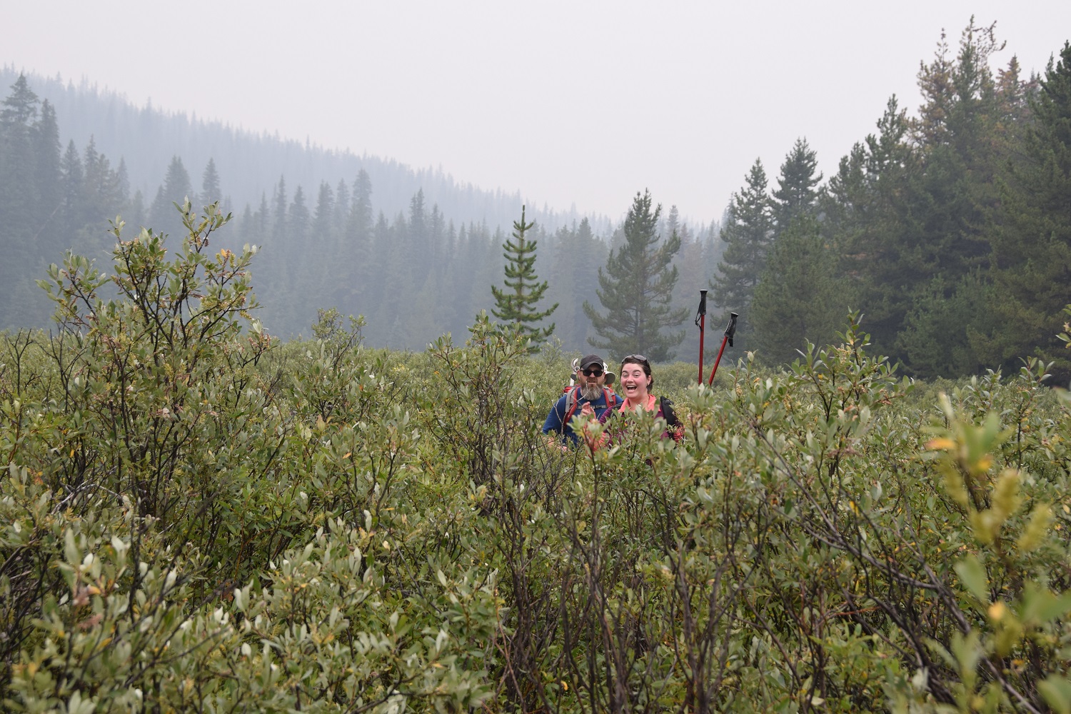
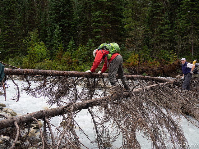
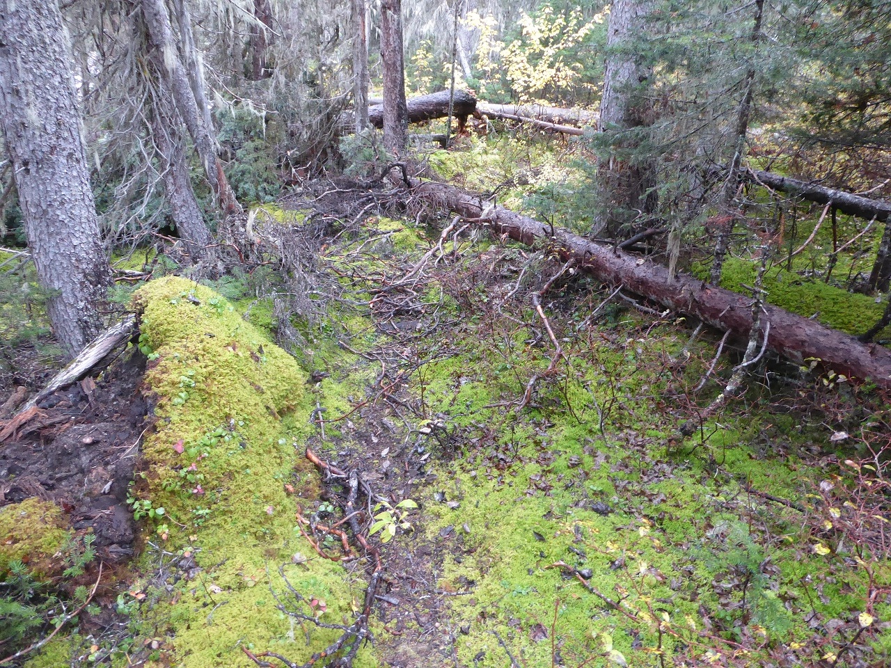
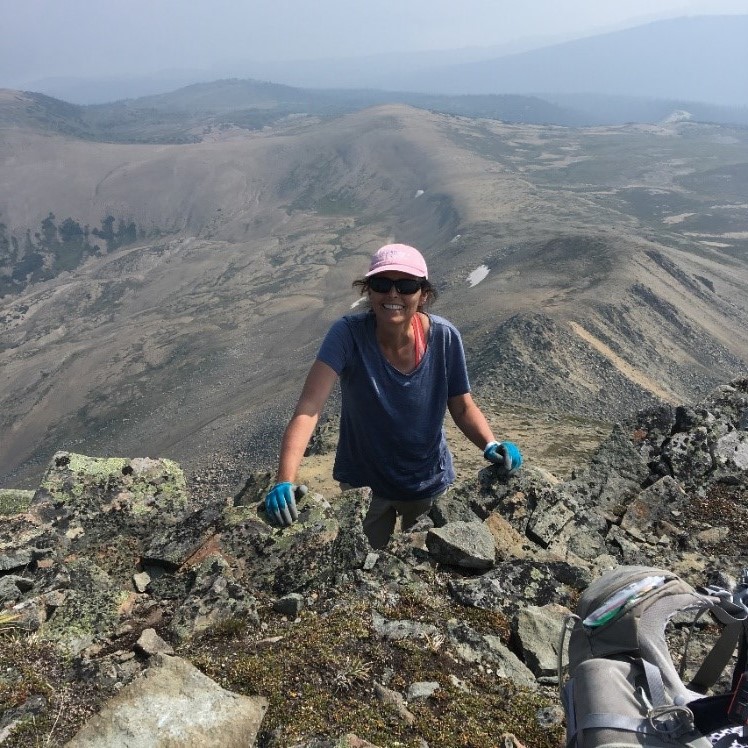
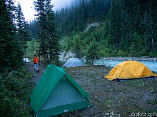
    Every family has its black sheep and the GDT is no different. Section D – Field to the Crossing – has an infamous and long-standing reputation of being the worst section of the GDT, demanding blood, sweat and tears from thru-hikers while providing very little reward in return. Section D offers the experience of overgrown trail that hasn’t been maintained in decades; hundreds of deadfall and blowdown trees creating a jungle gym of obstacles for hikers to navigate; and fast flowing glacial fed creeks that must be forded, so powerful they have washed away all attempts to build bridges across them. But that is all about to change.

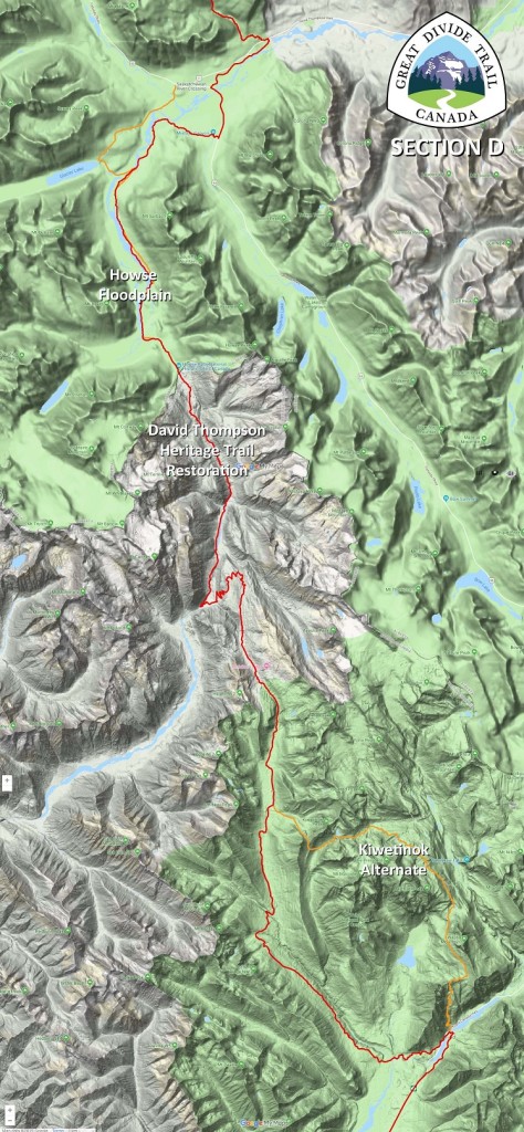
    This year, Section D has undergone a “facelift” with the re-routing of the main route onto the Howse Floodplain, the restoration of the David Thompson Heritage Trail and the introduction of the new Kiwetinok Alternate. While Section D will always be a remote and wild section of the GDT, requiring some route-finding, challenging creek fords, and increased physical and mental effort, GDT hikers can now look forward to more rewards for their efforts and a significantly improved hiking experience in 2019. 

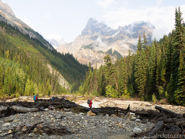
    The new Howse Floodplain route follows the Conway Creek and Howse River floodplains wherever possible, avoiding crossing the main channel of the Howse River. The floodplain is wide and exceptionally scenic, offering a route quite similar to that of the original explorers to Howse Pass centuries ago. There are several shallow fords of smaller channels on the floodplain so hikers must be prepared to have wet feet while enjoying a significantly better hiking experience than the old overgrown trail strewn with literally hundreds of fallen trees. In June and early July, the Howse River may be in flood making some sections of the floodplain difficult or impassable in which case hikers should consider using the old trail (now marked as an alternate route). Conversely, in late August and September when the river is low, hikers may be able to ford the main river channel and completely avoid any bushwhacking along the river’s edge. See below for a more detailed route description.

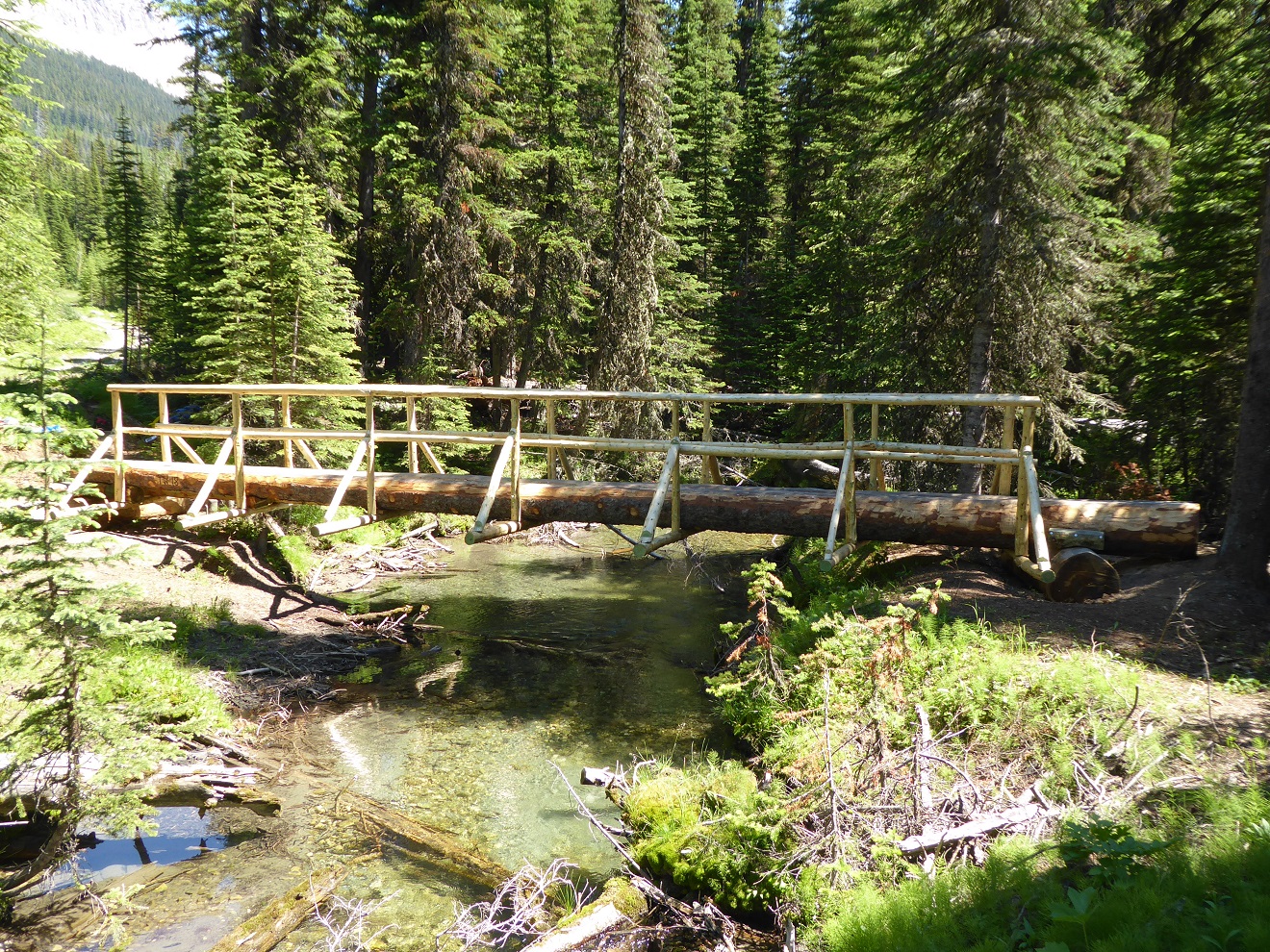
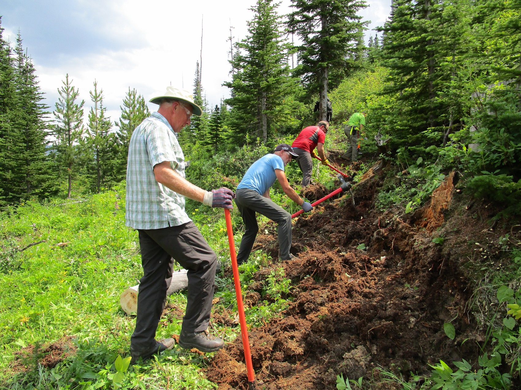
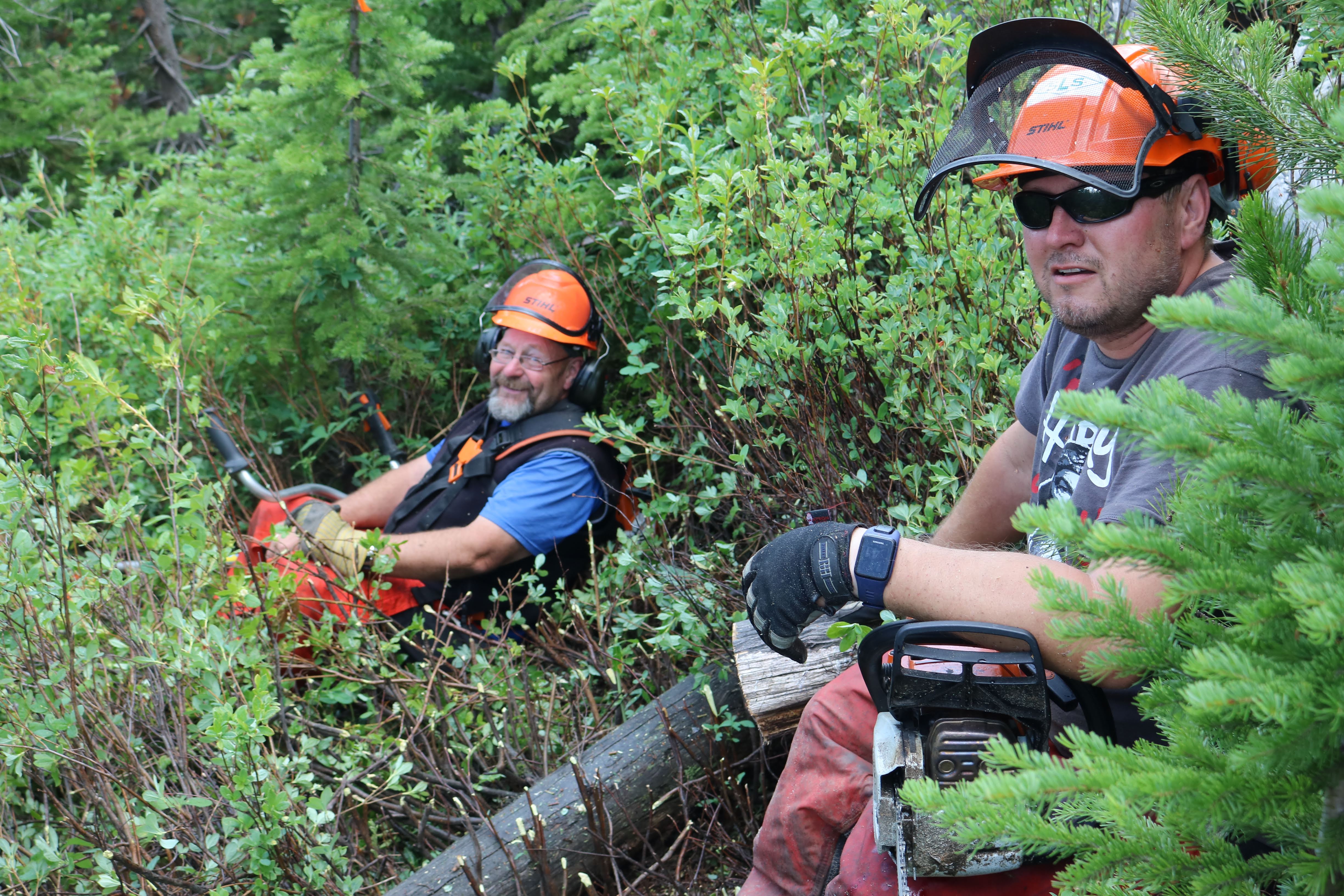
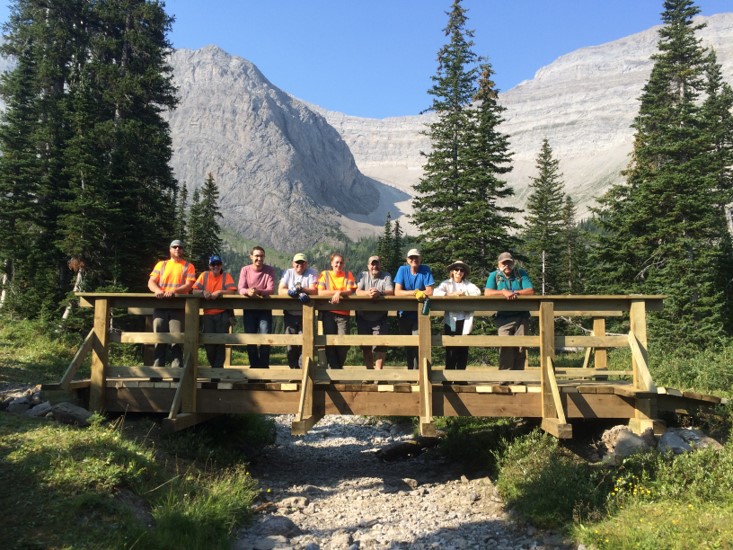
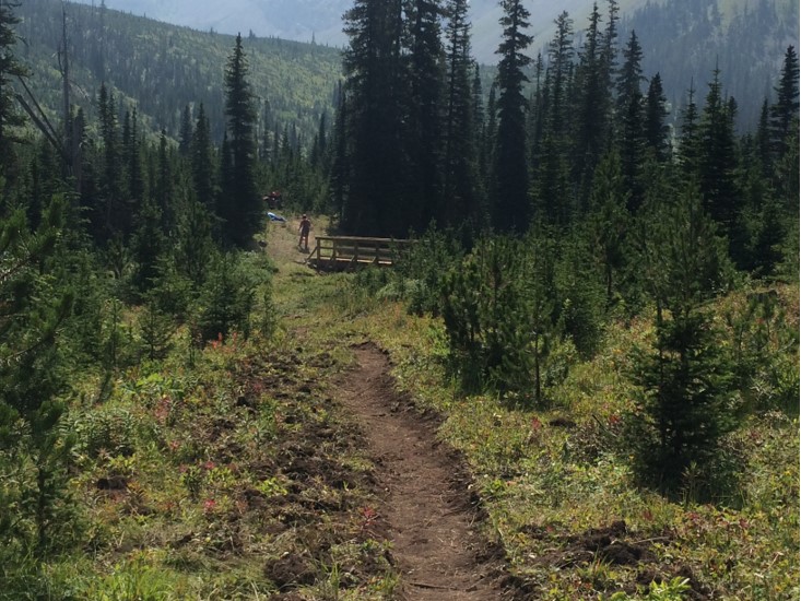
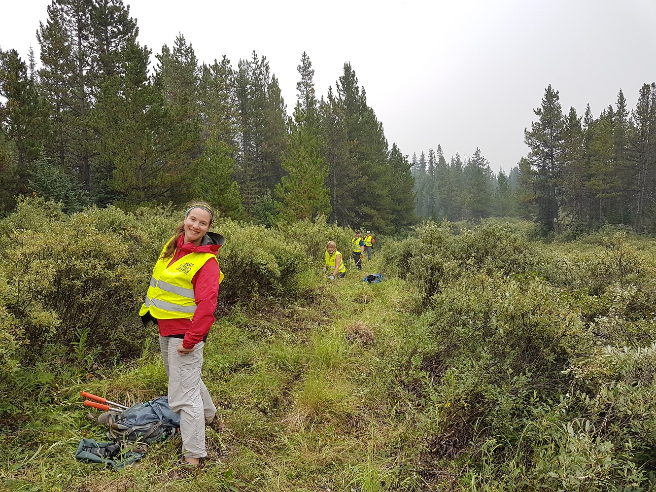
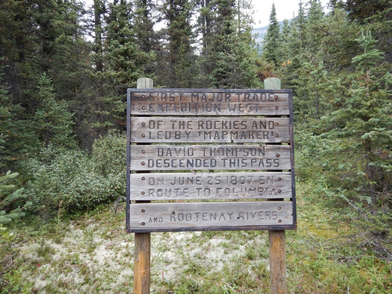
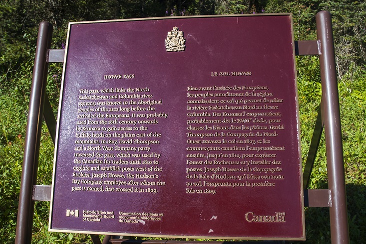
    Last summer work began to restore the David Thompson Heritage Trail, including clearing brush, removing deadfall, building tread around washed out sections, and constructing a new log bridge over Lambe Creek. Our goal was to keep any new trail constructed as close as practicable to the location of the original, and to maintain the character and “feel” of the original historic trail to the greatest extent possible. GDTA volunteers agreed that it was immensely satisfying to experience the results of their work first-hand, not only from the perspective of hikers who would no longer have to laboriously route-find their way through the valley, but also in the knowledge that this nationally significant trail was now restored (at least partially) to its historic glory. We will be returning to the David Thompson Heritage Trail this summer to complete the restoration of the final 5 km to Howse Pass. 

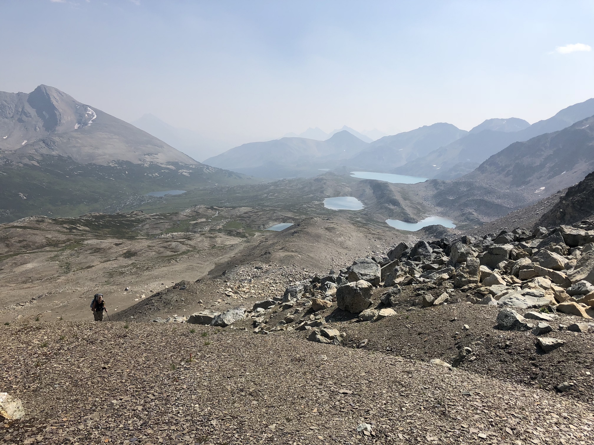
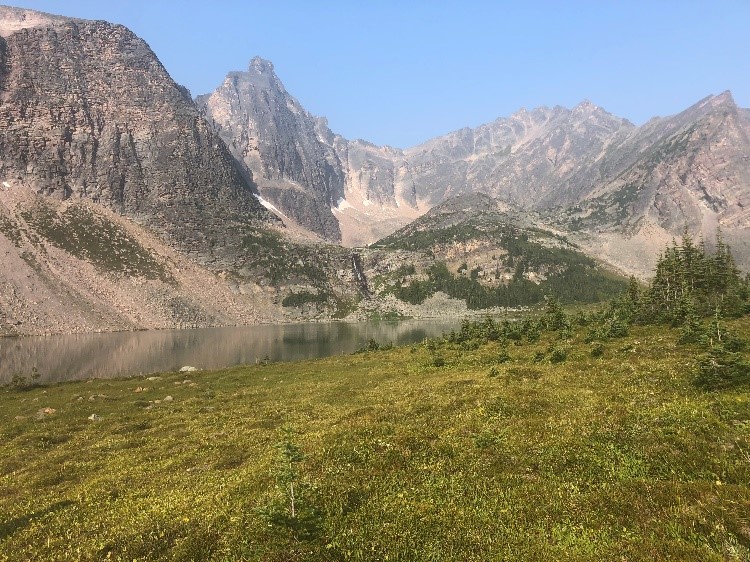
    The Kiwetinok Alternate allows hikers to skip most of the overgrown Amiswki Trail and avoid the most difficult ford of the Amiskwi River. Beginning in Field, the first 25 km of this alternate are on spectacular trail over 3 alpine passes in Yoho National Park: Burgess Pass, Yoho Pass and Kiwetinok Pass. Two national park campgrounds along the way provide convenient layover locations: Yoho Lake and Little Yoho campgrounds. From Kiwetinok Pass, the final 7 km are off trail and involve some scrambling on steep slopes but with saavy route-finding, hikers shouldn’t find the route too difficult. Note that due to the presence of a cornice on the north side of Kiwetinok Gap early in the season, this route is not recommended until after mid-July. See below for a more detailed route description.

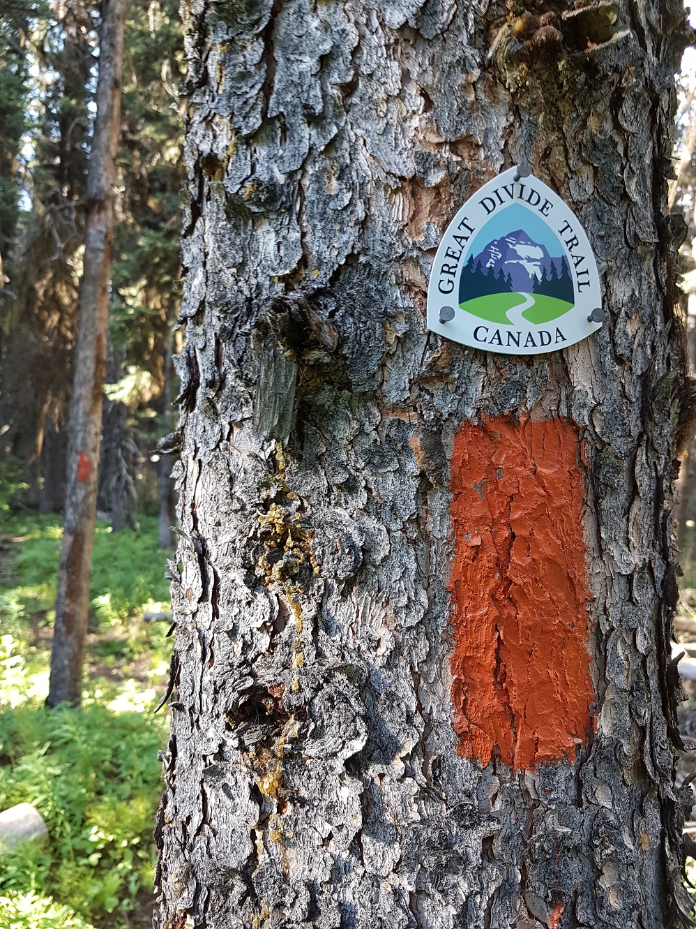
    These new routes are reflected in the GDTA map and the GDT App.

    Howse Floodplain Route Description:

    2.8 km north of Howse Pass, ford a tributary of Conway Creek to reach a trail junction (d12). At this junction ignore the old trail to the right and head left/west down the better trail as it follows the north bank of Conway Creek. The evident trail ends on the Conway Creek floodplain about 200 metres before hikers should look to ford to the south side of Conway Creek where the floodplain is open and easy walking. Ford Conway Creek and continue heading west on the floodplain on the south side of the creek toward its confluence with the Howse River. If Conway Creek is in flood and too difficult to cross here, you can stay on the north side of the creek and follow the non-ford alternate route through the forest that will involve a little bushwhacking and route-finding to reach the Howse floodplain.

    In 800 metres, reach the Howse River floodplain and ford Conway Creek (again) to the north side. The creek here is braided and shallow which should allow for an easy crossing. From here the Howse floodplain is wide open, easy walking and very scenic. Head north on the east side of the Howse floodplain for about 2 km until you reach a forested outcrop that from a distance appears to block your way but upon closer look is easy to walk through/around. Walk through the less dense trees to the east/right side of the outcrop to return to the open floodplain in 400 metres where you will find an old horse trail. Follow the horse trail north through grassy meadows on a section of the floodplain that hasn’t flooded in years. The horse trail ends in 1.5 km at an old horse camp located on the west side of the trail near the edge of the floodplain. A UFO-looking weather station can be seen a short distance to the east. At the floodplain’s edge, turn sharply right/northeast, sticking to the eastern bank of the Howse River.

    In 500 metres the main channel of the Howse River forces hikers into the forest but rather than bushwhacking east to the old trail, ford a small tributary (that offers better water than the silty Howse River) and follow a game trail next to the river, scrambling up a small cliff to avoid the river’s edge. The game trail is strewn with deadfall and brush but is a slightly better option than the overgrown trail. Equestrians should ford the Howse River here rather than taking the game trail. Late in the summer when the river is low, hikers may also be able to ford the river here. 

    Follow the game trail for 750 metres until the main river channel turns northwest allowing hikers to return to the floodplain. Head NNW staying on the east side of the floodplain. Early in the summer, the Howse River might be in flood making the floodplain difficult or impassable beyond this point; if so hikers should consider using the old trail which is 150 metres bushwhack east of the river’s edge.

    Enjoy 1.8 km of scenic walking on the floodplain which is mostly dry with a few shallow fords of minor channels until the main channel of the Howse River flows against a steep cliff on the eastern side of the floodplain forcing hikers into the forest again. Follow a well defined game trail that starts right next to the river at the south end of the cliff. Equestrians should ford the Howse River here rather than taking the game trail. The game trail becomes brushy and less distinct as it heads north on the edge of the cliff overlooking the river. In 300 metres just before the cliff edge veers northeast away from the river, descend a very steep trail down to the floodplain. Back on the floodplain, head north staying on the east side of the floodplain which is mostly dry and easy walking for the next 1.6 km. 

    When the main channel of the Howse River forces hikers off the floodplain for a third time, follow the old trail which lies just inside the forest at the edge of the river for 1 km. The old trail here is quite overgrown with sections of washed out tread and blowdown, allowing you to contemplate how nice walking on the floodplain is in comparison. The trail briefly heads out onto the open floodplain for about 1 km before darting back into the forest for another tedious 400 metres before the the main river channel moves west allowing hikers to return to the floodplain.

    Walking is relatively easy with some route-finding required to navigate around a forested outcrop and boggy terrain as hikers head north on the floodplain. In 2.6 km reach a signed junction with the Glacier Lake Trail (d14), marking the end of the floodplain route and the beginning of maintained trail. Leave the floodplain and return to the trail which improves significantly north of this point, 9.1 km from the Mistaya Canyon trailhead on Highway 93 (d16).

    Kiwetinok Alternate Route Description:

    The Kiwetinok alternate runs 32 km from the town of Field to where it rejoins the GDT deep in the Amiskwi Valley. This distance is similar to the bypassed portion of the GDT (31.3 km). Each option has its pros and cons, as the regular route runs along a low elevation valley bottom which is largely flat but often overgrown and lacking in alpine scenery, while the Kiwetinok Alternate heads into spectacular alpine on mostly good trail, but also includes much more elevation change and a necessary final 7 km of off-trail route finding involving some scrambling on steep slopes.

    Starting in the town of Field, follow a short connector trail to intercept the trail to Burgess Pass (which otherwise starts 500 metres down the highway). This connector trail leaves from the NE corner of the Yoho Trading Post parking lot and almost immediately crosses to the north side of the Trans-Canada Highway. Across the highway, good single-track winds through sparse trees before entering the forest and joining with the Burgess Pass trail after 300 metres.

    From the junction with the Burgess Pass trail, turn left to begin a stout 950m climb over 5.8 km to the pass. Once at Burgess Pass (2208m), you will reach a junction where the Burgess Pass Trail descends down the north side to Emerald Lake, but northbound hikers should turn right onto the Wapta Highline Trail which runs a spectacular 6.6 km through the alpine to Yoho Pass.

    This Wapta Highline Trail contours along at 2150m, forming a path above treeline and below Mount Field and then Wapta Mountain. Just above the trail on the flanks of Mount Field lies the famous Burgess Shale Walcott fossil quarry, which is emphatically closed to unaccompanied parties and this is enforced with cameras, serious fines for entry and even more serious fines for anyone caught with a stolen fossil. Continue onward as you gently descend 300m to Yoho Pass at 1850m.

    At Yoho Pass, another trail rising from Emerald Lake joins on the left so stay right to descend the east side of the pass. Only a few hundred metres after Yoho Pass, you will arrive at Yoho Lake Campground and trail junction. This campground is 12.7 km from the town of Field and makes for a good stop if you’re hiking a shorter day out of town. At this campground, a trail to the right descends to Yoho Valley Road but hikers bound for Kiwetinok should turn left. Over the next 9.5 km you will encounter three more similar junctions, where all of the right forks descend to the Yoho Valley, while all of the left forks lead you towards Kiwetinok Pass. 

    The first junction is 2.1 km after Yoho Lake (14.8 km from Field). Here, you intercept the Iceline Trail which has climbed steeply up from the Yoho Valley alongside Whisky-Jack Creek. At the junction go left and gently ascend to 2200m as you trek below the terminal moraines of retreating glaciers as the Iceline Trail contours through austere alpine below the high peaks of the Presidents Range. Takakkaw Falls can be seen across the valley to the east; at 384m, the falls are one of the highest in Canada.

    After another 3.3 km (18.1 km from Field) you arrive at the second junction. This time the Highline Trail descends to your right down to the Yoho Valley. Stay left and continue past the Emerald Glacier along the Iceline Trail for a further 4.1 km. Soon you begin a gentle descent to 2050m and reach the third junction in the Little Yoho Valley (22.2 km from Field). Here, weary travelers can turn right and walk 300 metres off-route to the Little Yoho Campground and adjacent Stanley Mitchell Hut (if possessing ACC reservations). To continue onward, stay left at this final junction and climb steadily (400m over 3 km) to Kiwetinok Pass at a lofty 2470m, 25 km from Field.

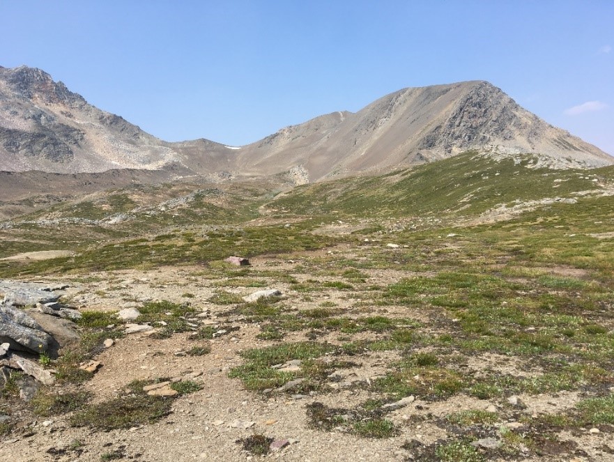
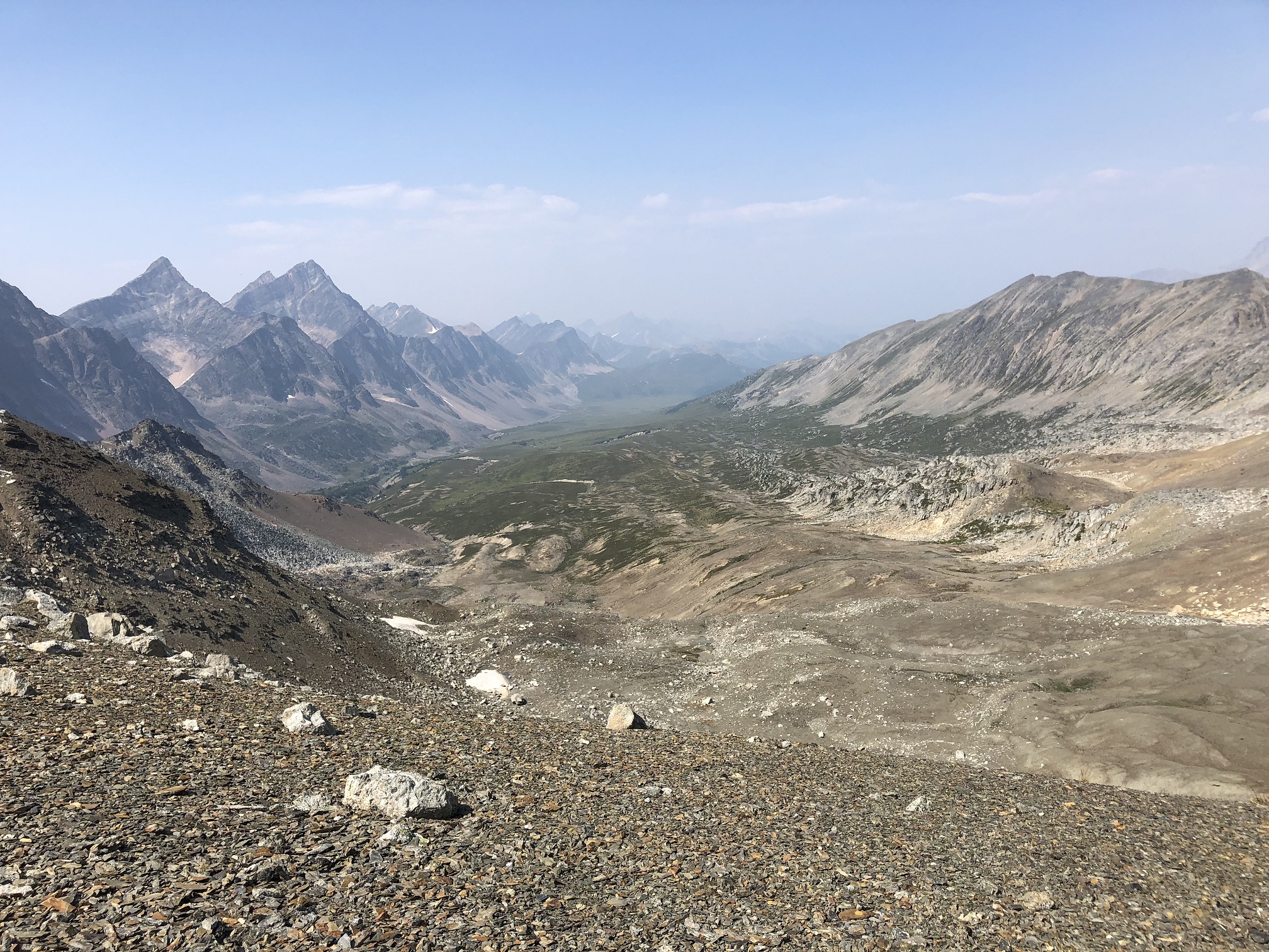
    From Kiwetinok Pass only 7 km remain until rejoining the GDT in the Amiskwi Valley. However, the remainder of the route is off trail involving challenging route-finding with significant elevation loss and gain, and thus substantially more rugged than the good trail you have enjoyed up to the pass. Allow several hours.

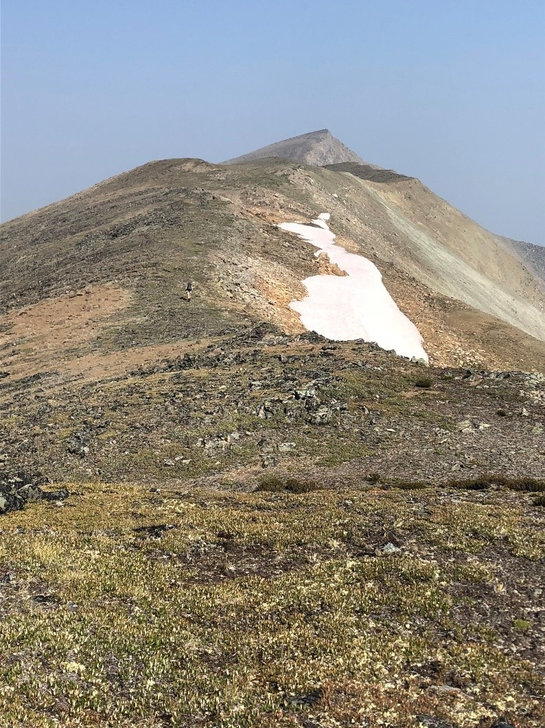
    Your next objective is “Kiwetinok Gap”, which is a modest break in the north wall of the Kiwetinok valley about 3 km away. Rather than contour along the north wall of the valley to the gap (which involves steep sidehilling on often slick vegetation and loose scree) the best route is to descend steeply to the valley bottom until you reach treed terrain at 2050m, 1.7 km from Kiwetinok Pass. At this elevation you can begin to ascend along a forested bench which provides more stable footing. Continue moving west as you climb the forested north wall, aiming to ascend as steeply as you were descending from the pass. After 0.7 km of walking through the trees, you will emerge from the forest at 2180m and intercept a small stream bed which runs down slope from Kiwetinok Gap. Ascend alongside the stream bed as you climb nearly due north for the final half kilometre to Kiwetinok Gap at 2355m.

    Once at Kiwetinok Gap you will crest to stunning views of the Amiskwi Valley and peaks beyond. Be aware that a cornice may be present on the north side of Kiwetinok Gap early in the season so this route is not recommended until after mid-July. Use caution as you approach the edge and look to descend around the cornice to one side or the other. If you are too early in the season and the cornice is large, you may have to retrace your steps.

    From Kiwetinok Gap the GDT lies about 4 km away including a substantial 730m descent. Previous parties have used a variety of descent routes including following the creek bed, but the best route is likely to stay to the left (west) of a forested mound that lies 500 metres away in the centre of the alpine bowl in front of you. As you descend to the west side of this hill, you will see a forested expanse below you with a narrow ribbon of meadows and loosely spaced trees running through it. Aim to follow this more open terrain as you continue to descend northwest below treeline.

    When you have descended 2.1 km in a northwest direction from Kiwetinok Gap to 1900m elevation, the slope becomes noticeably steeper as it descends to the creek a few hundred metres away. While you could continue descending to walk in or alongside the creek, the easiest footing is likely attained by angling more to the west here (to WNW from NNW) such that you move parallel to the creek but staying above the deeper creek valley. A few hundred metres further you will emerge from the forest into a burn zone, where you will be able to see the remaining kilometre of terrain between you and the GDT in the valley bottom. Below you, the GDT runs along the close (east) side of the Amiskwi River and veers even further east towards you after it crosses to the north side of the creek you are following. Thus, you should also cross to the north side of this creek at around 1650m as the creek valley mellows out. Once across the creek, continue NW for a final 600 metres to intercept the old road that the GDT follows. The terrain over the last 1.5 km is an old burn zone with many fallen trees, but it is relatively sparsely vegetated so good route-finding will make for tolerable travel until the GDT is reached about 2 km north of the first ford of the Amiskwi River (d3).

  • Pathfinder Newsletter – Summer/Autumn 2018

    Pathfinder Newsletter – Summer/Autumn 2018

    Pathfinder-Fall 2018
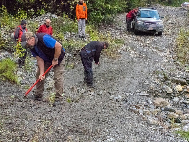
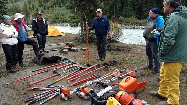
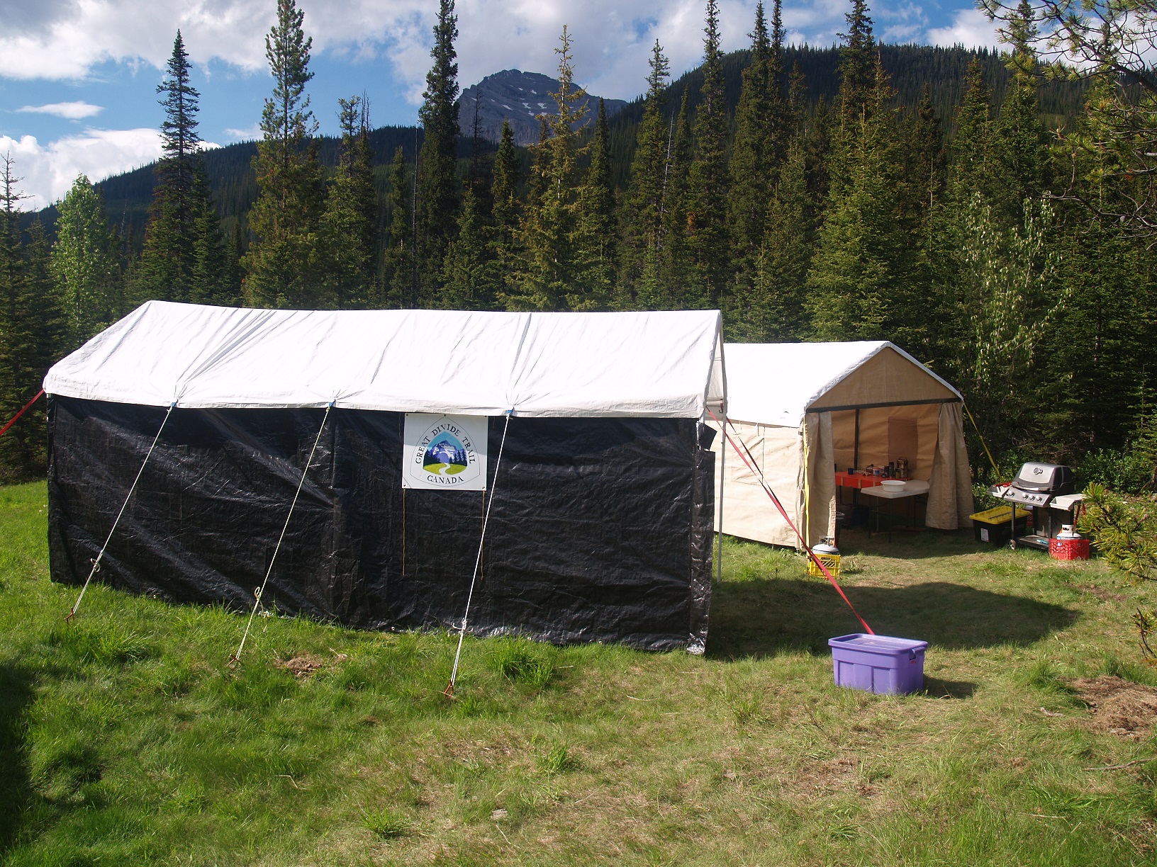
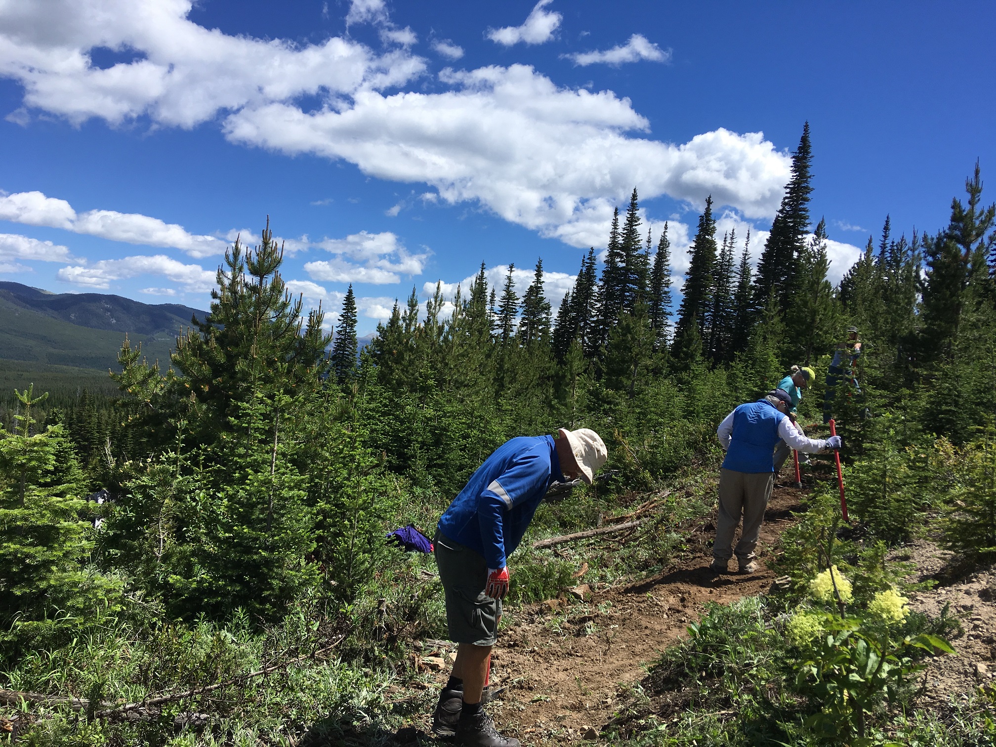
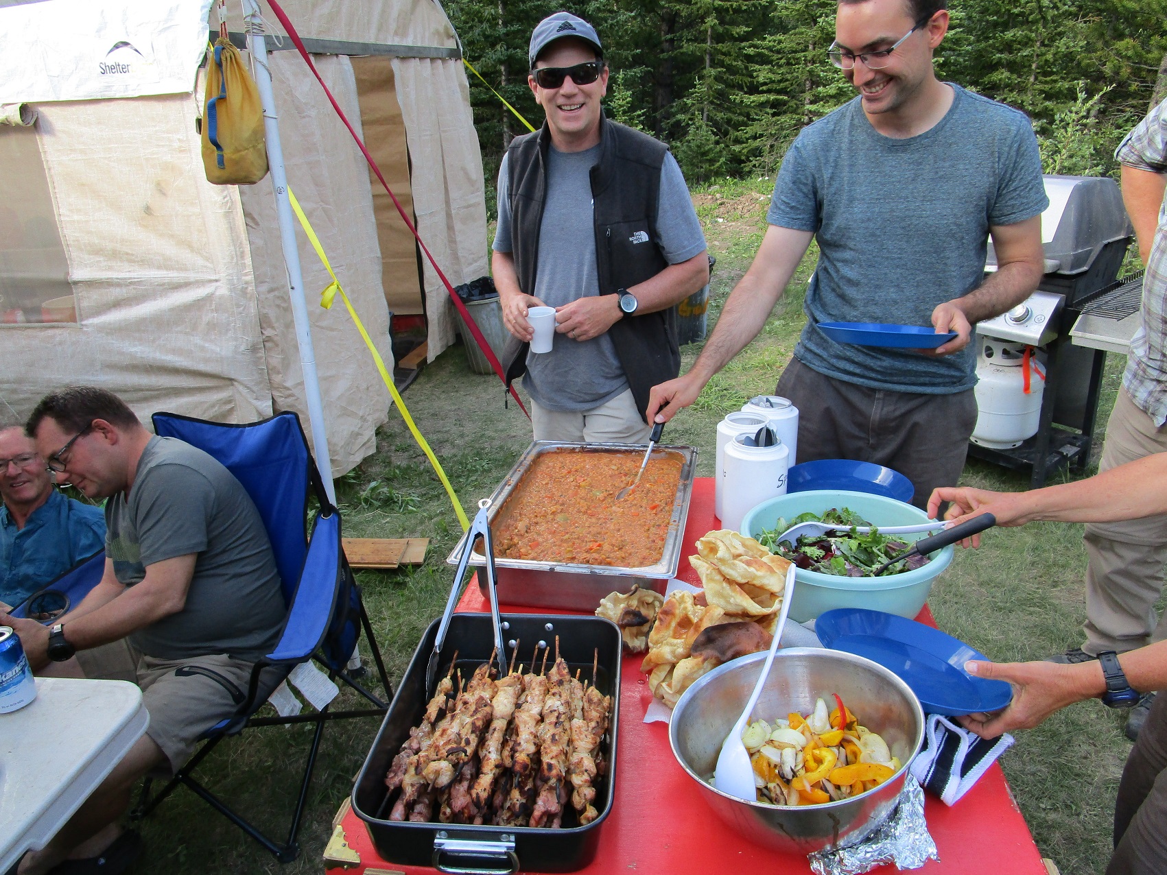
Summer of 2018 was very busy for the GDTA, with more trail building and maintenance trips than ever before! Despite another bad wildfire season, the GDT was as busy as ever with record numbers of thru-hikers on the trail.

    Read more about our recent events and activities in this edition of the Pathfinder Newsletter:

  • 2018 Trail Building & Maintenance Trips

    2018 Trail Building & Maintenance Trips

    2018 was a very busy year for the GDTA, with more Signature, Hybrid, Walking, Bridge-building, and Scouting trips than ever before! A huge amount was accomplished thanks to the large number of hard-working and dedicated volunteers. Key accomplishments in 2018:

        • 90 km of the Original Great Divide Trail cleared and maintained
        • 8 km of the historic David Thompson Heritage Trail restored
        • 6 km of the Maligne Pass Trail cleared in Jasper National Park
        • 5 km of new trail cleared and/or built on the High Rock Trail
        • 2 bridges built
        • 112 volunteers participated in 11 separate scouting, trail maintenance or trail building trips
        • 43 return volunteers from previous year’s trips
        • 35 first-time volunteers
        • An incredible sense of accomplishment achieved by all!

    High Rock Trail Trips: 7 trips on the High Rock Trail took place between June and September, including two bridge building trips and the first Crowsnest Chapter trip. This was Year 3 of construction on the High Rock Trail, the new section of trail being built between Crowsnest Pass and North Fork Pass to move the GDT off the road, away from the Line Creek Mine and onto new single track trail.

    Two separate crews participated in what we call “Hybrid Trips” between June 18 to 28, completing tread building on Section C. A Hybrid Trip offers a scaled down camp and kitchen set-up, with a more independent camp experience as volunteers bring and cook their own food. 

    Base camp
    Base camp

    This year the Alberta Occupational Health and Safety guidelines were updated for the first time in many years, causing a mild panic for volunteer organizations throughout Alberta. With a hard deadline of June 1st to comply to these new strenuous guidelines and operating procedures, our dedicated team worked countless hours to build on a safety plan that the Greater Bragg Creek Trails Association had implemented. Thanks to the hard work of several volunteers, we were able to meet the new safety requirements and our approval came as we drove out to the camp.

    The crew arrived at the Dutch Creek base camp on June 18 and set up tents, cooking and dining shelters, preparing for the next few days of trail building. After camp was set up, the crew gathered in the cooking tent to discuss the new safety plan and review tool use and safety procedures. Although the weather started off nice, the last few days of the trip were challenging in the pouring rain, but the crew worked hard to finish the tough stretch of tread work on Section C. 

    Building new trail
    Building new trail

    At the same time about 5 km north of the Dutch Creek base camp, a Bridge Building Crew was working on the longest natural log bridge on the GDT. They were also tasked to flag a route around a large avalanche debris field across the trail. This needed to be done before this year’s hikers were to pass through. On both crews last day, they ran into a few mechanical problems and poor weather which resulted in returning home later than planned but all were happy and proud of the work they had accomplished.

    Dutch Creek Bridge
    Dutch Creek Bridge

    July brought nice warm days and two back-to-back Signature Trips on the High Rock Trail. Signature Trips showcase how much fun it is to be involved with the GDTA, creating a safe learning opportunity for new volunteers. Signature Trip base camps offer an enhanced camp set-up that includes full backcountry kitchen facilities, a privy and a solar shower.

    Setting up the camp tent
    Setting up the camp tent

    On Signature Trips, all food is provided and meals are prepared by a head cook – quite the luxury in the backcountry! On the crossover day between the two Signature Trips, the Walking Trip crew also arrived at camp and a group BBQ lunch with all 3 crews took place. 42 hungry volunteers set a record for most people at a GDTA camp at the same time.

    Gourmet food in the backcountry
    Gourmet backcountry food

    Again, a renewed attention to safety was paramount and extra time was taken to review safety procedures and practices. The goal of the Signature Trips was to start building trail in Section E, south of North Racehorse Creek. The first Signature Crew endured a heat wave as they blazed a new trail up the steep slopes of Domke Ridge. 

    Tread construction
    Tread construction

    The second Signature Crew continued clearing the corridor and building new tread, and in addition to the heat they dealt with afternoon thunderstorms which made for some slippery slopes. These challenging conditions slowed trail construction slightly but the Signature Crews still built more than 1 km of new tread and cleared 2 km of trail corridor, almost to the top of the ridge.  

    The chainsaw/brush saw team
    The chainsaw/brush saw team
    Time for a water break
    Trail building is hard work, time for a water break

    August brought even hotter temperatures, and another Bridge Building Trip. First Creek Bridge was engineered and installed with the support from Alberta Environment & Parks (AEP) including additional crew members to help it get finished in a record 2 1/2 days. 

    First Creek Bridge
    First Creek Bridge

    Corridor clearing and tread work were also completed on Section G during this trip. We will continue working on the High Rock Trail in the First Creek valley in 2019.

    New tread
    New tread leading to the bridge

    The last trip on the High Rock Trail this year took place in late September and was another first. We have been working on building a Crowsnest Chapter and this was the first trip for the newly formed Chapter, squeezed in at the last moment. We managed to open corridor and pin flag 1.7 km of new trail south of Window Mountain Lake, that should keep the Chapter busy in 2019.

    Clearing the trail corridor
    Clearing and flagging the trail corridor

    Walking Trip on the Original GDT: A mark of a strong organization is its ability to focus on multiple projects at once. So even with all the trips happening on the High Rock Trail, we were able to also carry out several other trips on key sections of the GDT. In July, we held a 6-day Walking Trip on the original section of the GDT from Baril Creek to Tornado Pass, maintaining more than 90 kilometres of the centerpiece of the GDT, clearing 300 downed trees, re-building sections of washed out tread, installing new reassurance markers, and assessing future trail maintenance priorities.

    New GDT marker
    New GDT marker

    While the Walking Trip Crew was small (6 volunteers), the amount of work accomplished and the camaraderie built was huge!

    Walking Trip Crew
    Walking Trip Crew on Tornado Saddle

    Jasper National Park: Next up was the first ever trail maintenance trip held in a National Park, working with the Jasper Trails Alliance to clear the Maligne Pass Trail in Jasper National Park. This trip was very successful, and both trail associations enjoyed and benefited from working with each other. We hope this will be just the beginning of a great relationship with both the Jasper Trails Alliance and Jasper National Park. The Maligne Pass Trail is notorious for its overgrown willows that haven’t been cleared in years.

    The Maligne Pass Trail before...
    The Maligne Pass Trail before…

    So it was very rewarding to see the visual difference our efforts made to open this section of trail!

    And after!
    And after!

    David Thompson Heritage Trail: Across the Great Divide in BC, with the signing of our partnership agreement with Recreation Sites and Trails BC, we received approval for a maintenance trip on the David Thompson Heritage Trail. Our goal was to clear and restore 8 km of the trail to its former glory. Camp was set up near the confluence of Cairnes Creek with the Blaeberry River, but the trail is located on the north side of Cairnes Creek, a fast moving glacial flow. This obstacle was crossed twice each day (there and back) across two conveniently fallen tree.

    Cairnes Creek crossing
    Cairnes Creek crossing

    This trail hadn’t been maintained in more than 20 years and was in very bad condition, with sections of the trail being consumed by the nearby river. Literally hundreds of blowdowns and blockages had to be removed, as well as a ton of brush as much of the route lies in forest openings and exposed areas adjacent to the river where good sunlight and moisture have promoted a dense undergrowth of willow, rhododendron, alder and other understory shrubs. The trail was also re-routed around several washouts where new tread was built. 

    Restoring the David Thompson Heritage Trail
    Restoring the David Thompson Heritage Trail

    Our goal was to keep any new trail constructed as close as practicable to the location of the original, and to maintain the character and “feel” of the original historic trail to the greatest extent possible, and this was accomplished extremely well! Everyone agreed that it was immensely satisfying to experience the results of our three work days first-hand, not only from the perspective of hikers who would no longer have to laboriously route-find their way through the valley, but also in the knowledge that a nationally significant historic resource was now (at least partially) restored. There was much discussion about returning in 2019 to complete the restoration on the final 5 km to Howse Pass.

    Upper Blaeberry Valley
    Upper Blaeberry Valley

    Thank you! – Special thanks go out to all of our hard-working volunteers who built, maintained or mapped the trail this year, and everyone who spent countless hours over the winter months getting official authorizations, planning and making sure these trips went smoothly. Well done!

    And thanks to our sponsors and partners whose generous donations and support were a huge part of our successful trail work in 2018: MEC, Teck, The North Face, Stihl, Alberta Environment and Parks, Recreation Sites and Trails BC, and the Jasper Trails Alliance.

  • Volunteer Opportunities

    Volunteer Opportunities

    The Great Divide Trail Association is a 100% volunteer run organization.

    As presented at our 2018 Annual General Meeting, we currently organize our activities around five committees or volunteer teams. Most meet regularly in Calgary but it is possible to Skype or call into the meetings.  If you are interested in joining one of committees, please email: greatdividetrail@gmail.com

     Volunteer opportunities


    Organizational Excellence

    • Ensures that the GDTA has applicable policies, procedures and strategic plans in place to grow and protect the organization. 
    • Ensures the continuity and sustainability of the organization through the individuals involved, including the Board, members and volunteers. Ensures that the roles and responsibilities of the Board, members and volunteers are clearly understood and are consistent with the mission and vision of the organization.
    • Leads the Board nomination process, engaging potential candidates and ensuring that the Board includes an optimum mix of skills and characteristics that align with our values.
    • Champions the Volunteer Recognition Awards and other mechanisms used to honour members and volunteers.

    Ensuring Financial Capacity

    • Ensures the longevity of the organization through securing robust, diverse revenue streams to support and expand our capacity for operations.

    Outreach, Engagement and Education

    • Builds awareness of the Great Divide Trail and GDTA.
    • Ensures that the mission of the GDTA resonates with a broad audience of users, volunteers and funders through effective communication strategies and programs; robust and thriving outreach and education programs.
    • Engages the GDTA members in order to strengthen the community of volunteers that support the Great Divide Trail.

    Trail Building and Maintenance

    • Ensures an outstanding wilderness experience for current and future users that is consistent with the conservation and preservation of the scenic and wilderness value of the Rocky Mountains of Canada.
    • Fosters quality trail design, construction, management, protection, and maintenance, that ensures an excellent trail experience for current and future users.
    • This committee is currently full, but there will be opportunities to volunteer on a trail building or maintenance trip next summer. More information on these trips will be published in February/March.

    Protecting and Advocating for the Trail

    • Pursues formal recognition and protection of the Great Divide Trail.
    • Develops and maintains alliances with key governmental agencies and stakeholders, provincial or federal.
  • The Vanishing Trail

    The Vanishing Trail

    by Dave Higgins

    Amazing and improbable as it is, Howse Pass is one of the gentlest crossings of the Continental Divide in the southern Canadian Rockies, yet somehow it has managed to escape the fate of other passes in the region. No road or rail line disfigures it. This despite its favourable geography, at first, for a transcontinental railroad (it was CPR surveyor Walter Moberly’s chosen route, rather than Major A. B. Rogers’ successful recommendation of Kicking Horse Pass), and in more recent times, for a fourth major highway across the Divide between Alberta and British Columbia. Intense lobbying by central Alberta chambers of commerce for an extension of the David Thompson Highway between Saskatchewan Crossing and Golden (to save commercial traffic a couple hours of travel via Calgary) was, happily, unsuccessful.

    Cairnes Creek on the David Thompson Heritage Trail
    The approach to Howse Pass on the David Thompson Heritage Trail

    In the twenty-first century, however, Howse Pass could barely lay claim to a discernible footpath, let alone any sort of road. An ancient trail across the pass, linking the Columbia and Saskatchewan River basins, had been allowed to deteriorate to the point that bushwhacking was often the easier choice. Despite being a crucial link on the Great Divide Trail between Yoho and Banff National Parks, relatively few thru-hikers attempt the route, many preferring to bypass the area by way of the Icefields Parkway.

    It wasn’t this way historically, though. Archaeological evidence shows that the connecting river valleys on either side of the Divide, the Blaeberry in present-day British Columbia and the Howse in Alberta, hosted a substantial traffic of Ktunaxa (or Kootenay) people from west of the mountains, who established the trail and travelled the route for centuries, hunting bison on the Kootenay Plains and trading with other indigenous groups. The first European to cross the Divide here, “The Great Map-Maker” David Thompson, walked the trail in 1807 on his journey to the mouth of the Columbia River, hoping to establish it as the primary trade route between fur-trading posts on the prairies and forts along the Columbia and Pacific coast. In this he was thwarted by the plains-based Piikani (or Peigan) people, who were accustomed to having control over the Ktunaxa’s access to European trade goods, most importantly firearms (This would not be the last trans-Rockies commercial dispute!). The Piikani effectively blocked access to the pass and, ultimately, by 1811 it was abandoned by the fur traders in favour of the more northerly Athabasca Pass.

    Howse Pass-2

    A very good story! Good enough for the Canadian government to designate Howse Pass as a site of national historic significance, but, sadly, not good enough to provide for any possibility that Canadians (or others) might actually want to visit the site.

    Howse Pass plaque
    Historic plaque at Howse Pass

    So the intrepid hiker with an abiding passion for Canadian history has been faced with the choice of a 13-km slog through the almost impenetrable upper Blaeberry, with choking undergrowth throughout, many washed-out sections and two treacherous glacial creek crossings … OR an ordeal twice as long up the Howse River valley, with literally hundreds if not thousands of blow-downs to crawl under, over or around. But wait, it gets even better – a combination of both for the hapless GDT thru-hiker!

    Deteriorating trail
    Deteriorating trail

    Full marks to the BC government, however, for recognizing the value of their portion of the route and designating it the David Thompson Heritage Trail. This acknowledgement was accompanied by the last recent maintenance work, carried out in 1993. The trail was cleared of brush and deadfall, both creeks bridged, and signs erected. The access road from Golden was even in driveable condition all the way to the David Thompson trailhead at Cairnes Creek. 

    Old trailhead sign
    Old trailhead sign

    Alas, the Blaeberry valley is renowned for its vegetation producing capabilities and before long the trail was becoming overgrown and obstructed once again. A knockout punch was delivered in 2013 when severe flooding destroyed the bridges and the raging river carried away entire sections of trail. The access road suffered the same fate, rendering impassable the last 14 kilometres to the trailhead. At this point the David Thompson Heritage Trail began to literally disappear from the landscape.

    The story on the Alberta side, in Banff National Park, wasn’t much rosier. Flooding didn’t affect the trail so much as official indifference; Parks officials decided the Howse Pass trail was no longer deserving of attention, and that it would be left to revert to a natural state – i.e. to disappear. Strong winds, not unheard of on the eastern side of the Divide, seemed to be in agreement with this strategy and long stretches of the trail soon resembled a giant’s game of pick-up-stix.

    That pretty much sums up the situation GDT hikers faced by the summer of 2018 – at least those brave (or foolish) enough to attempt the Blaeberry/Howse Pass route. Enter the GDTA! Over the past several years our organization has been cultivating relationships with government departments, private companies and individuals, and other volunteer groups. The short-term objective is of course to get the Great Divide Trail completed to an acceptable standard throughout, but as experience has shown, trails need ongoing attention to keep them in usable condition, and partnerships are an essential element in the success of this effort. So bridges need to be built not only over creeks and rivers, but also between the GDTA and myriad other parties who have an interest in the places traversed by the Trail.

    GDTA Trail Crew
    GDTA Trail Crew

    This bridge-building effort has resulted in several successful trail restoration events recently, one of the most recent being on the David Thompson Heritage Trail. I’ll let you know how that trip worked out in the next edition of the Pathfinder. Stay tuned!

  • Volunteer Recognition Awards

    Volunteer Recognition Awards

    As you may already know the GDTA is a volunteer based organization that relies on the work and passion of people like you.

    Every year we recognize the efforts of volunteers who go above and beyond to help us achieve our objectives. This year has been an exceptional year for us with a total of 10 successful trail building trips. This couldn’t be done without the help of dedicated volunteers like you and as a result we want to recognize the efforts of nine individuals who have contributed across all areas.

    Pictured above are Lani Smith, Deb Yanchula, Dan Durston, Vikki McGuire
    Pictured above are Lani Smith, Deb Yanchula, Dan Durston, Vikki McGuire

    Peter Labastide: Peter was an all-star volunteer this year, participating on the first two back to back Hybrid trips and even staying over the weekend to solve some tricky trail reroute issues. He also helped out the bridge crew with some chainsaw work. During the trips he assisted in so many roles that he was defacto assistant trip leader. Back in Calgary, from loading the trailers to cleaning up and reloading, Peter was always there when needed. And finally, he capped the trail building season by leading the charge up the steepest section on our September scouting trip.

    Lani Smith: Lani was our camp attendant, the glue holding all the trips together and keeping them running smoothly. Camping out on location for 7 trips, fetching and filtering water (just like last year), as well as assisting cooks, communicating with trip leaders, and keeping a watchful eye on our camps. He was there to do anything needed to keep the work moving forward. He took on a huge role relaying the History and Soul of the GDTA to many of our new volunteers. He also helped coordinate an Original member meeting where they documented much of this history for the future builders and maintainers.

    Doug Borthwick: Doug started our trail building year off with a huge help, when he sold his tandem axle trailer to the GDTA at a significant discount, enabling us to solve both a storage and logistic issue. This was followed up by driving all the way to Coleman to assist with the inaugural Crowsnest Chapter meeting.  He continued the year participating on many of the trips all the way from Kelowna. He also took a leadership role on 3 of those trips ensuring they happened in a safe and successful manner. His patience and teaching ways were appreciated by many of the new volunteers and leaders too.

    Vikki McGuire and Shannon Budiselic: Vikki is new to the GDTA and this was her first trail building experience. Shannon is a veteran trail builder and was joining the signature trip after just completing the walking trip on the original GDT. When the signature trip kitchen and food coordinator had to cancel last minute due to illness, Vikki and Shannon were handed the menu and told they were in charge. Both Shannon and Vikki not only worked the trail every day but stepped up in managing the kitchen and cooking the meals. Their help was instrumental in keeping 20 workers happily fed and watered. Thank you.

    Kathy Plachta: Kathy is a very active volunteer with the GDTA. She manages the bookkeeping, accounts, membership renewals and is part of the Outreach Committee.  This is all in addition to taking care of Dahlia, who is just over a year old and is one of the youngest members of the GDTA!  We really appreciate Kathy’s dedication, attention to detail, creativity and her commitment to making the GDTA an even better organization.

    Carol-Lynn Darch: Carol-Lynn stepped up to chair the Outreach Committee this past year and with this took the lead on introducing our first ever pub night social events and organizing the Pathfinder Newsletter.  She’s an avid backcountry hiker and took to hiking parts of the Great Divide Trail this past summer and is now planning trips for her and her 2 young children to explore the trail.  We are grateful to Carol-Lynn for taking a leadership role this past year, generating new ideas and helping to get things done.

    Debbie Yanchula: We want to thank Deb Yanchula for her hard work and dedication to the GDTA on the Trail Building and Maintenance Committee, in particular for helping draft the Safety Manual and organizing food for the signature trip.  Deb was part of Food committee and she impressed us from the beginning with her incredible organizational skills and attention to detail – feeding 20 hungry volunteers for 5 days is no easy task, nor is preparing the menu and buying all that food! But Deb managed this without a hitch as though she’s been doing it for years – and it was her first time. She also spent countless hours drafting the GDTA Safety Manual needed for this year’s trail building trips. As if that wasn’t enough, she was a diligent member of the Trail Building and Maintenance Committee, and volunteered her time and manpower (and gas) on 2 trail maintenance trips.  For a volunteer who just started helping with the GDTA, Deb did an incredible amount of work in her first year – we look forward to seeing what’s to come.

    Dan Durston: Dan is being recognized for his important contributions to the Great Divide Trail Hikers Community. In 2017, Dan, along with his wife Tara, were the first hikers to Yo-Yo thru-hike the GDT. In 2018, Dan decided to give back to the trail that he grew to love the previous year and he became a huge contributor to the GDT Community. Dan provided trip planning advice to dozens of prospective GDT hikers via email, social media and in person. His friendly and knowledgeable advice was welcomed by all and contributed to the success of several GDT hikers in 2018. Additionally, Dan participated in the “Original GDT Walking Trip” where he single-handedly cleared more than 100 trees off the trail. Dan shared his knowledge and love for the GDT with the other volunteers on the Walking Trip and inspired a few of them to return next year to continue section hiking the GDT. The positive impact Dan had on the GDT Community in 2018 cannot be underestimated and deserves recognition!

  • Tales from the Trail: Hiking the Six Passes Alternate Route

    Tales from the Trail: Hiking the Six Passes Alternate Route

    by Barb Lauer

    Having volunteered with the GDTA for the past few years, it was definitely time to walk a section of the Great Divide Trail this summer. My hiking partner was the formidable Lynnie Wonfor who some of you may have met on a maintenance trip. So you get a sense of our abilities, we affectionately describe ourselves as two middle aged moms who love hiking and are up for an adventure! 

    Barb and Lynnie on the first pass
    Barb and Lynnie on the First Pass

    Inspired by the updated Guidebook by Dustin Lynx and feeling well supported by the GDT App by Atlas Guides or Guthook, we chose Section E – Saskatchewan River Crossing to Jasper northbound, which according to the guidebook “is a joy for anyone who likes trekking above timberline.” And that it was!! We had an absolutely amazing time! I won’t bore you with all of the details but do want to encourage anyone thinking of hiking Section E to consider hiking the Six Passes Alternate Route. It was a high point of our trip for us. It’s far more remote than other parts of section E; there is no trail, no route markings, no cairns. We saw no people and definitely followed more animal tracks than footprints. The remoteness and the feeling (rightly or wrong) that not many had hiked this area made it special for us. 

    Throughout the first few days of our trip, we did research on the alternate route – we asked everyone we met who was thru hiking whether they had done the decommissioned trail along Maligne Lake or were considering doing the Six Passes Alternate Route… not one person had done the Six Passes Alternate Route and the thru hikers going northbound were going to have a look but didn’t sound too convinced to me. And those that had hiked the Maligne Lake trail, didn’t really have any good things to say about it. Spurred on by this feedback and the GDT Guidebook, “This is one of my favourite hikes of the entire GDT, a real gem.”, we thought we had no choice, we had to give it a go.

    View towards First Pass
    View towards first pass

    So on our sixth day, we made our way up to Maligne Pass from Poboktan campsite and at the pass looked hard to line up the six passes, which according to the Guidebook is critical. Well for the life of us, we couldn’t see the six passes. We saw only one pass and were hoping that the trail went to the right towards a grassy slope. It didn’t.

    View from First Pass towards Maligne Pass
    View from First Pass towards Maligne Pass

    So we made our way up the scree-like pass, got good traction on the incline and got to the top of the pass without any problem. This first pass was a high point of the trip for us… we felt a great sense of excitement and adventure and the views from the top were spectacular. We were on our way onto the alternate route. 

    View from First Pass towards Second Pass
    View from First Pass towards Second Pass

    We spent the next two days walking the alternate route, going up and down the six passes. We’d point our phones with the GDT App to get the general direction, pick something to walk towards and then check again in a bit.  For some this is sacrosanct – we didn’t rely on a map and compass but used GPS. At the end of the day, wouldn’t have been able to hike the alternate route without the App. I have a poor sense of direction. So we are both very grateful to River Taig and everyone at the GDTA who worked on the App, it opened up a section of the wilderness to us and for that we say THANK YOU!

    Here are few more pictures from the hike up to the sixth pass and along the ridge to meet up with the Bald Hills trail. This section of the route is particularly spectacular! Some are a bit hazy due to smoke from forest fires.

    Enroute to the Sixth Pass
    Enroute to the Sixth Pass
    View south from Sixth Pass
    View south from Sixth Pass
    Ridge walk from Sixth Pass
    Ridge walk from Sixth Pass

    The down scramble from the peak after the sixth pass is not that bad. We went to the summit and then peeked over to find a reasonable place to go down. We headed down the spot that had a few ledges, which made it feel like there wasn’t any exposure. The place to be really careful is just after this scramble. The rocks are deceptively loose, it is really easy to innocently set off a few rocks towards your hiking partner. 

    The down scramble with Bald Hills trail in the background
    The down scramble with Bald Hills trail in the background

    For those going onto the Skyline, the shortcut mentioned in the Guidebook is still accessible. If going southbound, the trail is sign posted from the Skyline to Bald Hills and if going northbound, we’re not exactly sure where the trail starts from the Bald Hills trail, we went a bit early into the trees afraid that we might miss it. I don’t think you can miss it, it’s a double tracked huge trail at the south end. 

    I think that the most significant challenge with hiking the alternate route (that is in addition to going up and down more than 2,000m) is random camping. There are lots of flat places with access to water but limited places to hang a bear bag. The trees just aren’t tall enough. We camped just before going up the second pass and between the fifth and six passes. The first night we couldn’t find anything tall enough to tie our food to, which is a problem. The second night, there were big boulders that worked well for us.  However, our bear hang did get visited by small rodents in the night, as the string had been played with. Luckily, mighty Lynnie did a fantastic job tying the food up and the little guys were unable to get it down. You will need a random camping permit from Jasper National Park to camp in the area. Note that they won’t issue you one during times that are sensitive to caribou, i.e. during the calving and rutting seasons. 

    Overall, we would definitely recommend hiking the Six Passes Alternate Route over the decommissioned Maligne Pass Trail. 

     If you had a favourite hike on the GDT this summer, please consider sharing your story with us.  Please email us at greatdividetrail@gmail.com

  • 2018 AGM: President’s Report

    2018 AGM: President’s Report

    by Dave Hockey

    Well, I thought last year was busy, but this year was the busiest so far. We got off to a good start in November researching membership software and implementing it. This took countless hours and although we found out that the program did not meet our needs, many valuable lessons were learned and hopefully it will be our foundation for a future program to streamline our membership process. Our largest committee, the Trail Building and Maintenance Committee was in full swing looking ahead at potential new safety regulations we felt would be implemented by our government. We put money aside for chainsaw safety courses and approved all of our trips for the upcoming trail season. We also hired some interns to help with some grants and investigated charitable status but determined we just don’t have the organizational capacity to implement it, yet.

    Throughout the winter we spent time building relationships with Parks, exploring a relationship with the Army Cadets. We also signed a partnership agreement with Recreation Sites and Trail BC, to become the official trail operator of the David Thompson Heritage Trail in the upper Blaeberry valley.

    We also spent time talking with some of our corporate sponsors like the North Face who moved our organization up from the local level to National, including not only support with clothing for our Board Members and Volunteers, but hard dollars for trail work. We also applied and received the largest grant to date from Mountain Equipment Co-op, another long-term supporter. We also did some grant writing and many hours were spent by our Outreach Committee getting ready for our big spring fundraising event with Brian Keating, and our first ever pub night. We also took time to survey our board members and started working on long term strategies. Although our membership has leveled off, our email distribution list now reaches 825 people.

    The Brian Keating event was a huge success, hard not to be when you have the most exciting speaker in town, raising $8,000 for the GDTA. This was great timing as it was budget time and the trail work planning was in full swing.

    The late spring also came with good news at the Castle Parks Management Plan was finalized ensuring permanent protection for our trail within the new parks. During the summer months Alberta Parks even had trail crews working on the GDT in the park and installing our new reassurance markers. Big thank you to Julie MacDougall and the rest of the team at Alberta Parks! The good news kept rolling as the Livingstone and Porcupine Hills Public Land Use Zone (PLUZ) was also finalized, protecting our trail within it. The new recreation plans look great and work has already started to change this part of the province.

    Spring was also busy trying to get the Crowsnest Chapter off the ground with an information evening in Coleman drawing over 50 people. Then jumping right into the madness of complying with Alberta Occupational Health & Safety requirements and Parks approval of our safety plan at the last minute. This couldn’t have happened without some extreme work put in by our volunteers on the safety committee and the heavy lifting by the Greater Bragg Creek Trail Association.

    Summer – ready, set, here we go! 11 trips involving over 100 volunteers. Think about that for a moment, an organization with 250 members gets 100 volunteers out working for it, pretty impressive I have to say. We had 7 trips along the new section called the High Rock Trail, including building a 38-foot natural timber bridge as well as another engineered timber bridge, built with the support of Alberta Environment and Parks. Kudos to Brad Jones and the team down in Blairmore for your continued support. Then a walking trip on the original section of the GDT from Fording River Pass to Tornado Pass, maintaining the centerpiece of our trail, clearing 300 downed trees, installing new reassurance markers, and assessing future trail maintenance priorities.

    Next up was the first ever trail maintenance trip in a National Park, working with the Jasper Trails Alliance to clear a section of the Maligne Pass Trail in Jasper National Park.

    Then, we moved on to the David Thompson Heritage Trail near Golden BC, 8 kilometres of this historic trail were restored to its former glory. Following that, a 4-day scouting trip was completed to ensure we are ready for another busy year in 2019. And finally, the very first Crowsnest Chapter trail building trip near Window Mountain Lake.

    Our GDT Trail App was also updated with more accurate route data and new alternates. You can’t believe the number of hours this takes to make it look so simple and easy to use!

    We had another summer of periodic trail closures due to a bad wildfire season, but that did not stop record numbers of thru-hikers, estimated at more than 50 in 2018, along with hundreds of section hikers. As well the 3rd edition of Dustin Lynx’s ‘Hiking Canada’s Great Divide Trail’ guidebook was released in July.

    I can’t say enough thanks for the support of our board members, sponsors, parks partners and of the volunteers who made this all happen.

    Thank you!