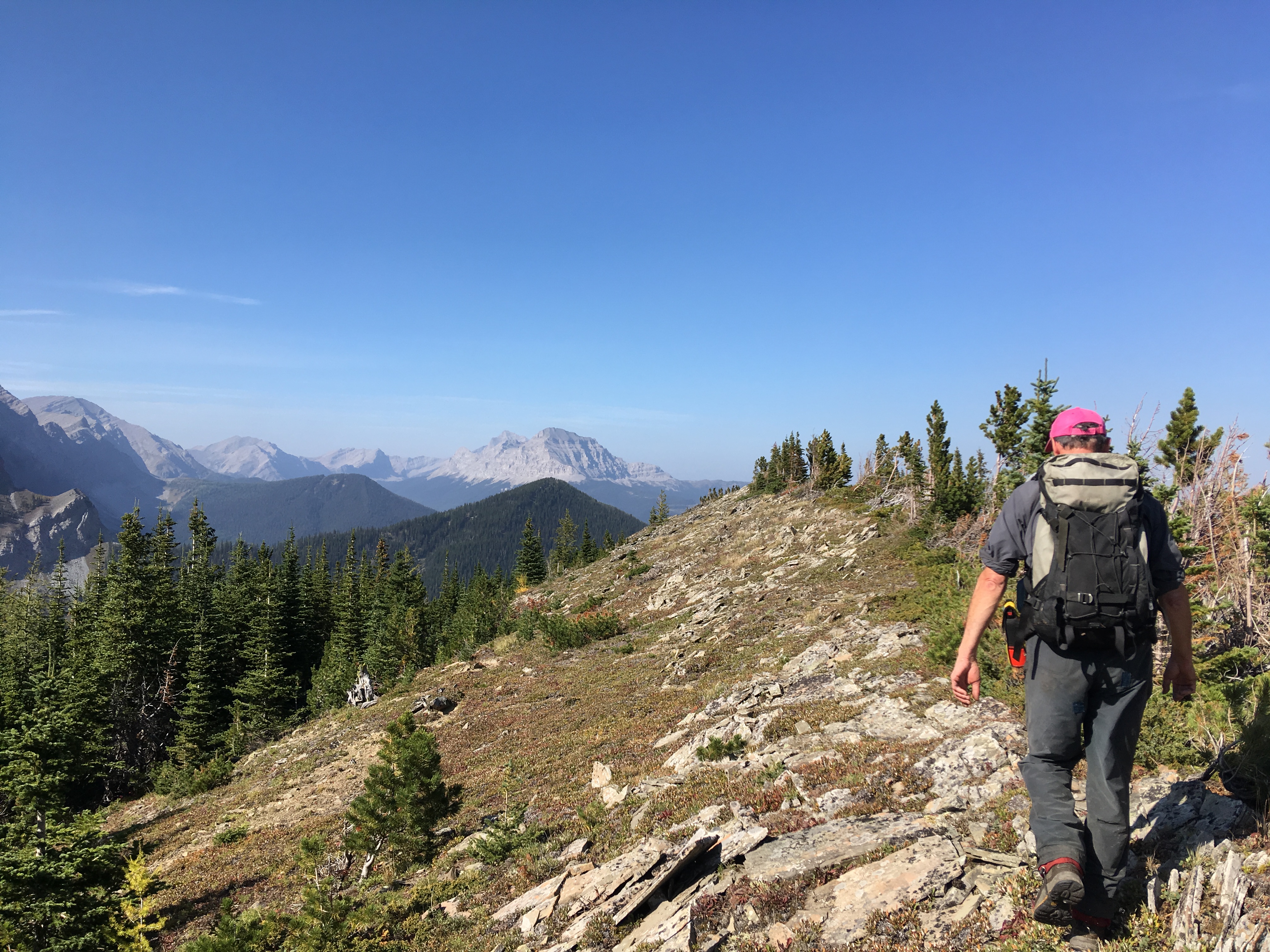
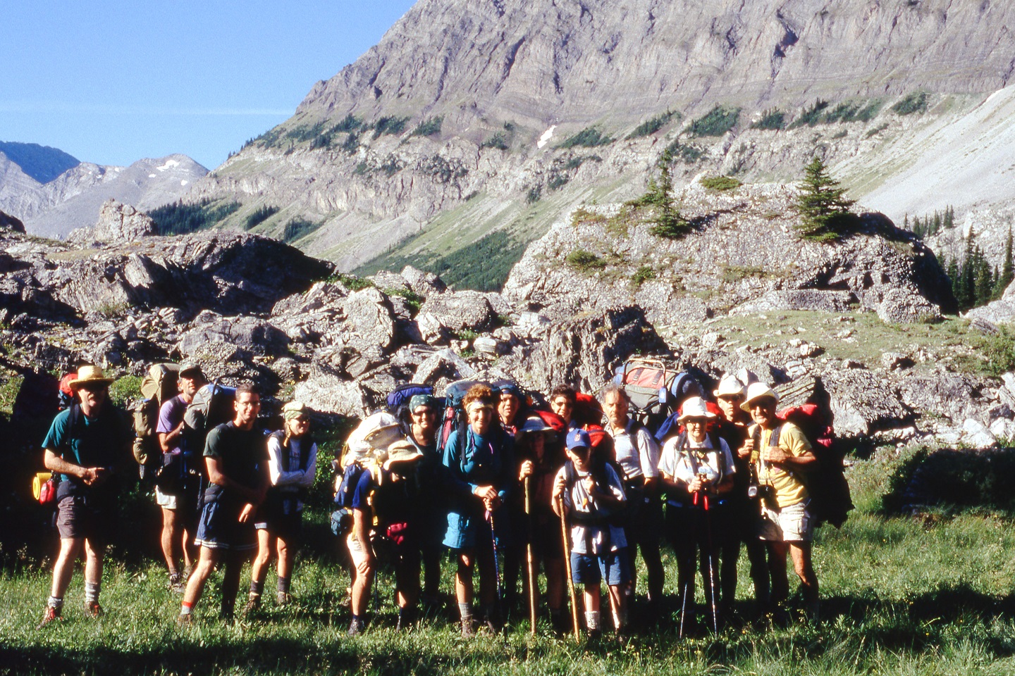
Ask Canadian Rockies hikers about the Livingstone PLUZ and you might draw blank stares. Often only known by locals, this swath of public land north of the municipality of Crowsnest Pass lies in the shadow of popular recreation destinations like Banff, Kananaskis Country, and Jasper.
Its abundance of treasures—the towering Crowsnest Mountain and Gould Dome, the majestic headwalls of the High Rock range, the poetic alpine lakes and meadows, the arresting views earned from ridgetops, the humbling sight of scrambling Rocky Mountain goats—are all left to enjoy by those who know where to go find them. What better locale to help with the construction of our High Rock Trail could there be?
Trail building with the Great Divide Trail Association is more than just volunteer work. It’s an opportunity to:
EXPLORE the geography of a breathtaking region. We promise you one of the most scenic daily commutes you could imagine. And why not cap a rewarding day of trail building with a stunning ridge walk (trips #1-5, waiting list only) or an optional dip into the glacial waters of Window Mountain Lake (trips #6-7)?
STEWARD the land, helping to create new sustainable recreation options for hikers and equestrians.
PRACTICE or TEACH new backcountry skills with fellow volunteers.
LEARN about flower and tree species identification, bird and mammal tracking, conservation issues in the Livingstone PLUZ, and sustainable trail building techniques.
MEET like-minded individuals with a wide array of life experiences and anecdotes. It’s the perfect ingredient for an enjoyable evening around the campfire.
SLEEP under the stars. Rejuvenating!
UNWIND and enjoy the great outdoors.
Will you join us this summer? Registration is well underway for our popular trail building trips. While some trips are already full, there are still plenty of availabilities for our members, including the following dates:
HIGH ROCK TRAIL (Livingstone PLUZ)
Trip #1 – Thursday, June 13 to Monday, June 17
Trip #2 – Monday, June 17 to Friday, June 21
Trip #3 – Saturday, June 22 to Thursday, June 27
Trip #4 – Thursday, June 27 to Tuesday, July 2
Trip #5 – Thursday, July 4 to Tuesday, July 9
Trip #6 – Tuesday, July 9 to Saturday, July 13 (drop ins available)
Trip #7 – Sunday, July 14 to Friday, July 19 (drop ins available)
ORIGINAL GDT, LOST CREEK (CATARACT CREEK PLUZ)
Trip #9 – Friday, August 2 to Tuesday, August 6
MALIGNE PASS TRAIL (PARTNERSHIP WITH JASPER TRAILS ALLIANCE)
Trip #10 – Saturday, August 10 and Sunday, August 11
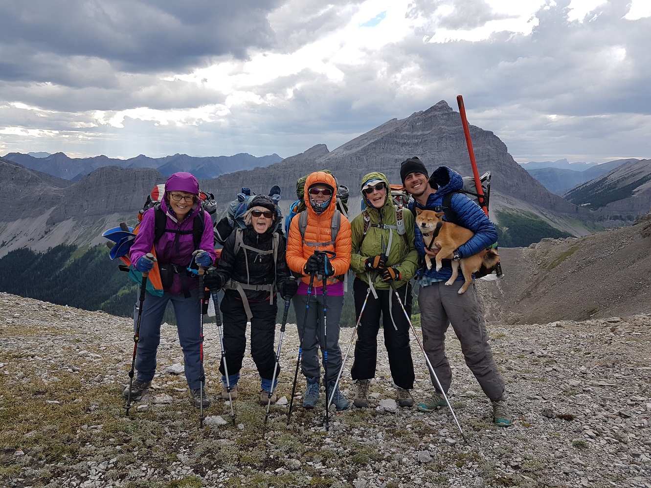
Hail Ridge, a short hike away from our backcountry basecamp for trips #1–5
Last April 7–13, organizations across the country celebrated National Volunteer Week. The thematic premise for recognizing Canada’s 12.7 million volunteers was simple: collectively, they lift communities.
We are no stranger to this phenomenon. Did you know that the GDTA is an organization run almost entirely by volunteers? It’s the joint work of 100+ individuals who give whatever time they have to help build, maintain, promote, and protect the trail and wilderness corridor we all cherish.
Happy volunteers on Tornado Saddle during our 2018 walking maintenance trip
Our work is driven by a shared belief in the social, economic, environmental, and health benefits of sustainable outdoor recreation. We don’t just build and maintain trail, we partner with other organizations, businesses, and municipal governments to enrich local communities and foster environmental stewardship.
We’d like to thank again all our supporters, partners, and volunteers. There are no words strong enough to express how appreciated and critical your support and commitment have been to the growth of the GDTA.
Let’s build on this momentum together in 2019. Here are some ways in which you can help:
If you are hiking the GDT, consider sharing with us your photographs, videos, writing, and/or other forms of art that put the trail and its experience in the spotlight. We’ll feature them on our website, social media, and/or official documents with proper credits.
Submit trail reports (accompanied by photographs of trail conditions) to us by email.
Become a trail crew leader, camp manager, safety officer, cook, and more on a trip.
Help our equipment manager in Calgary to repair and maintain our tools and trailers.
Join a committee to help organize outreach events and fundraisers, advocate for the trail and its protection, plan for trail building trips, apply for grants, recruit corporate partners, revise safety procedures, update hiking logistics information, and more.
Become a board member.
Share your legal, marketing, or accounting skills.
Help us develop a youth stewardship program.
Help produce and manage content for our website and social media.
Become a corporate business partner and/or encourage your employer to support our work.
“We hiked Section E last summer and found the Guthook Guides App to be invaluable! It allowed us to do the less travelled alternate routes with much more confidence.” Lynnie & Barb
The Great Divide Trail guide in the Guthook Guides app is a GPS map-based hiking guide for your mobile device. If you’re out hiking in the middle of nowhere, you don’t have to worry! The app works in airplane mode, so even if you don’t have cell service or internet, you can still see your location and navigate your way on the trail. The app uses your mobile device’s internal GPS and downloaded topographic maps to make sure you don’t get lost. Other features that you can use offline include the map, elevation profile, waypoint list, and more. You can also stay informed about trail conditions ahead by reading other hikers’ waypoint comments, and let other hikers know about your experience by leaving your own comments.
The apps have some new features for 2019, such as the ability to create custom waypoints. The Android app has some new features that were already available in the iPhone version, such as an improved custom route creation tool and the ability to add private notes to waypoints.
Atlas Guides (creator of Guthook Guides) released a completely new and redesigned Guthook Guides app for Android in November 2018. Like the iPhone version, it has all of Atlas Guides’ trail guides in one app. If you have the “Great Divide Trail” Android app, you can transfer your old purchase to the new Guthook Guides app by downloading the new app here and tapping the “Restore Purchases” button on the list of all the trail guides.
Atlas Guides also recently updated the Guthook Guides user interface app for iPhone. It has a new design for waypoint clusters on the map and on the elevation profile and a simpler way to navigate around the app. Find the new iPhone update in the App Store here.
If you need help using the app, you can watch Android and iPhone app tutorial videos on the Guthook Guides YouTube channel.
The Full Guide for the GDT costs CA$24.99 or you can purchase the section you are hiking for CA$5.49/section. Search for “Guthook Guides” in the App Store and Google Play Store to find our newly updated app for iPhone and Android. Find all 1100 km (680 mi) of the Great Divide Trail and adventure through the wilderness of the Canadian Rockies this year! Follow Guthook Guides on Instagram @guthookguides and tag Guthook Guides in your GDT hiking photos with the #withguthook hashtag for a chance to be featured on its page!
Through its partnership with Atlas Guides, the Great Divide Trail Association receives a portion of every Great Divide Trail guide sale in the Guthook Guides app.
For those without the time to do a thru-hike on the Great Divide Trail, you might want to consider a ~45k loop that travels on both sides of the GDT, crosses the divide over two passes, is not well known, is not well sign posted and is easily accessible from Calgary. Lynnie, Carol-Lynn and I did this loop last summer as preparation for our section hike in August. It offers all that the GDT has to offer but on a miniature scale – remote, route finding, stream crossing and beautiful scenery!
The trail starts and ends at North Interlakes Day Use Area in Peter Lougheed Provincial Park on the Upper Kananaskis Lake Circuit/Three Isle Lake Trail. We did the loop clockwise, heading past Three Isle Lake Campground over the South Kananaskis Pass into BC on the first day. We stayed at a fantastic, small campground that is just past the South Kananaskis Pass in B.C. – Beatty Lake Campground. The next day we looped around to the North Kananaskis Pass, back into Alberta, to Turbine Canyon for our second night. Our third day was an easy downhill walk back to North Interlakes Day Use area. A bit more information on the route is provided below.
The first day is very straightforward… there is a pretty clear trail all of the way. Picture of South Kananaskis Pass. We spend the night at Beatty Lake Campground in B.C., which is lovely! It’s on the lake, there are bear lockers and a few tent pads.
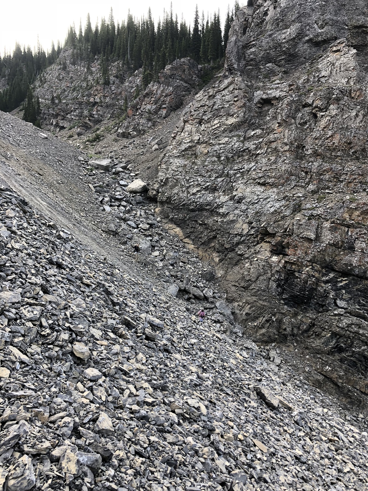
The second day was definitely more challenging. Our first challenge was to find the trail out of the campsite, down a rockslide and across a scree slope. You can just about make out Carol-Lynn and Lynnie in the picture here, as they work their way down the rock slope. It’s important to find the trail across from the scree slope, without it, I’m not sure how one would make it to LeRoy Creek. Once you’re on the unmaintained trail, it’s relatively easy to follow it; there was blue flagging last summer.
At one point there will be trail branching off from the main trail. Definitely take the time to explore this – it’s a beautiful rock water garden. We sat there for a little while until we heard a growl of sorts and then scurried off!
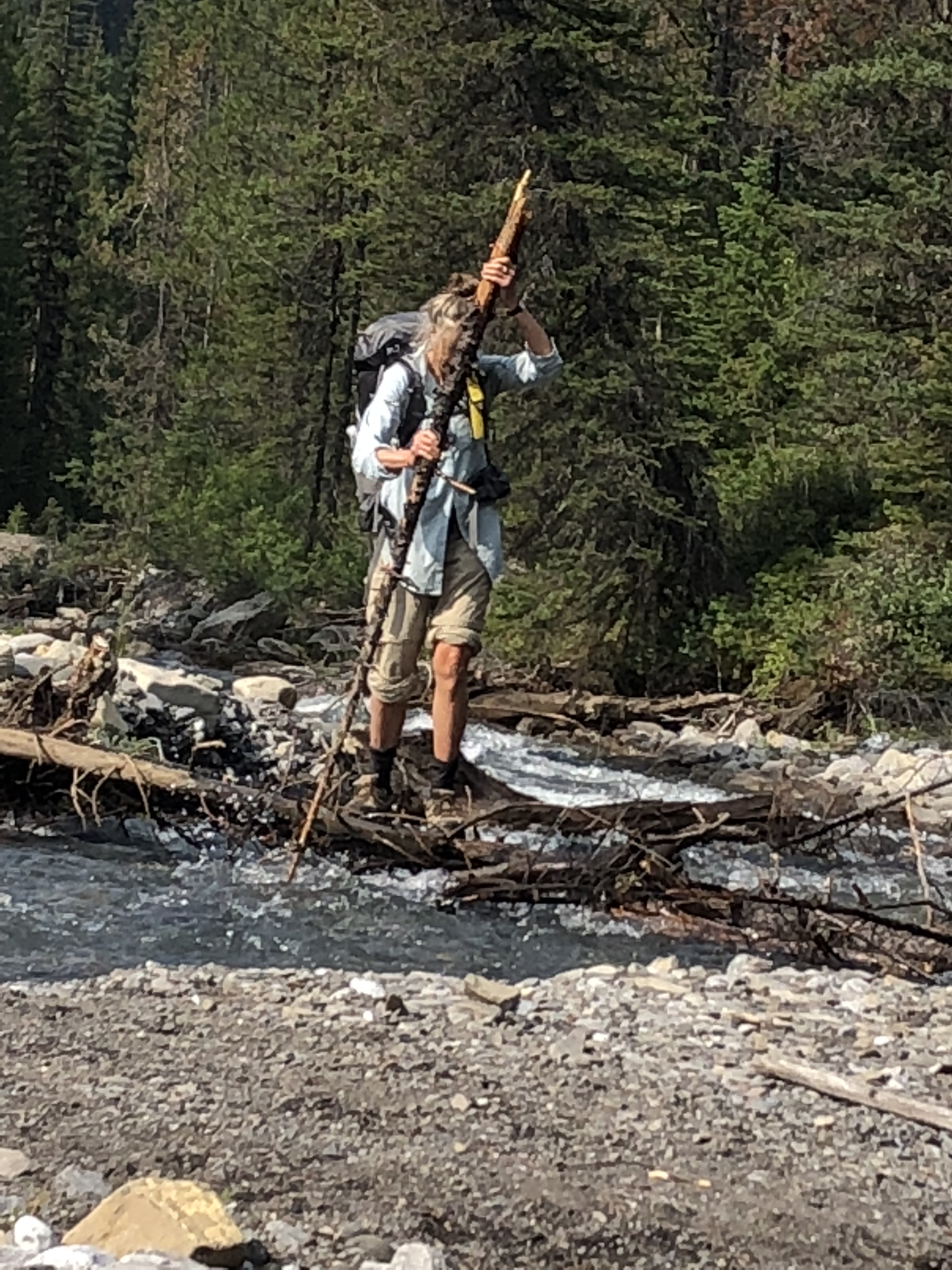
Many different techniques were used in crossing the Leroy Creek including the epic pioneer approach of Lynnie’s (pictured here) and the not so elegant, wet feet approach that I took (sorry no picture available!).
We got a bit messed up after crossing the creek, as my GPS route was washed out and no longer possible. Generally, if you cross the creek when you first come to it and then stay on that side until you go above the cliffs and then back down to the creek you will be fine; at this point keep looking for the trail on the other side of the river that goes up to the North Kananaskis Pass and onto Turbine Canyon campsite.
The third day is a very easy walk, almost entirely a gentle downhill from Turbine Canyon campsite. The three happy hikers are pictured here.
The short weekend trip was definitely a great introduction to the Great Divide Trail. If you enjoy feeling like you are the only ones out there, searching for the faintly marked trail while enjoying fantastic scenery, you will love this trip!
If you walk a section of the trail this summer, no matter how short or long, please consider writing about it and sharing it with other GDTA members. You can submit your articles to greatdividetrail@gmail.com
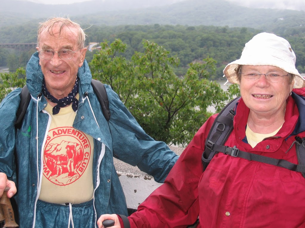
I’ll never forget the first time I encountered Willard Kinzie. In retrospect I had no inkling of how inspirational this man would be in my life, and for so many others as well.
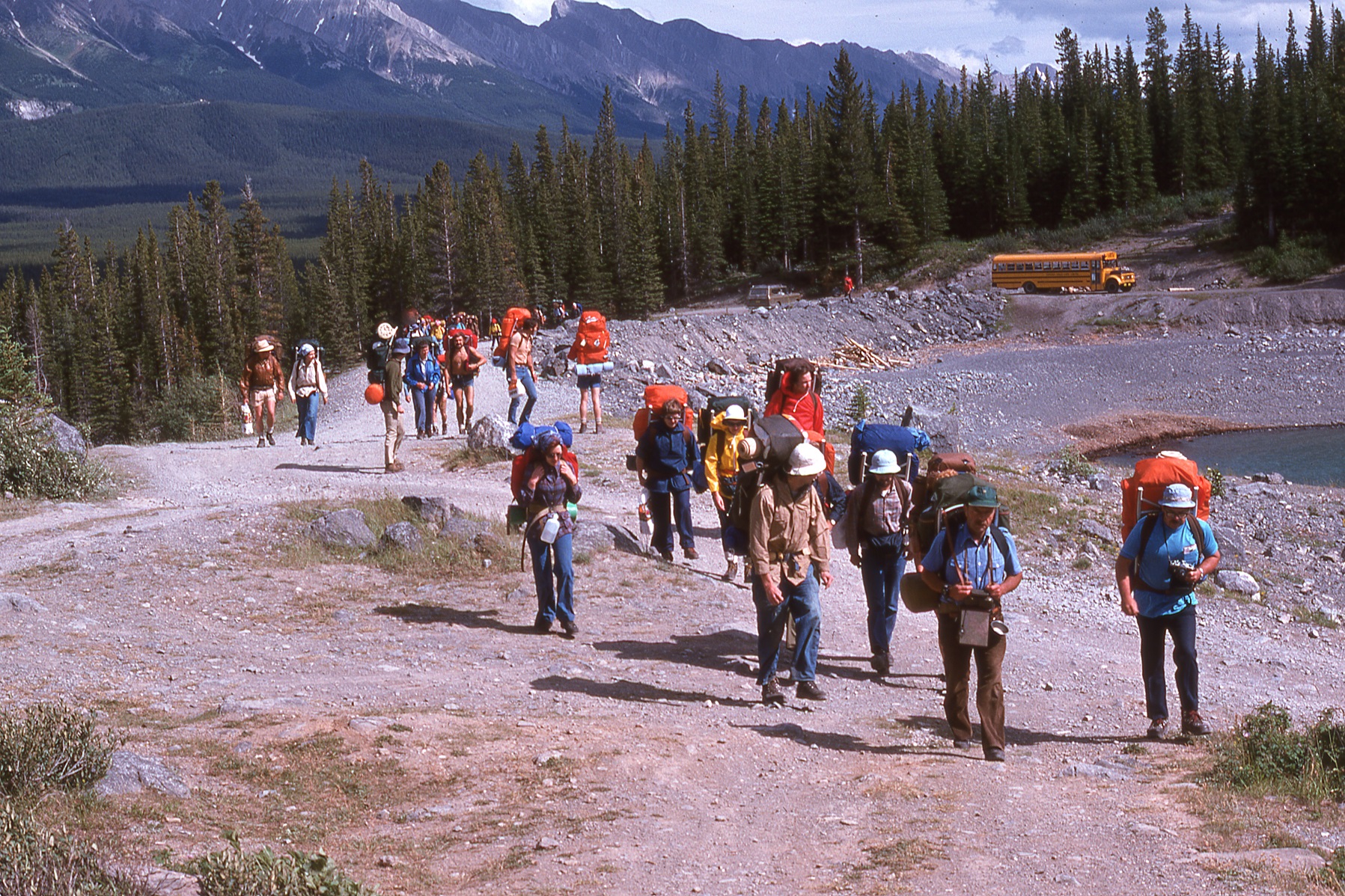
It wasn’t exactly a dark and stormy night – there have been a few of those in my life too – rather it was a warm and sunny morning – in July 1976 to be exact, and my good friend (and stalwart present-day GDTA work camp manager Lani Smith) had generously given me and my loaded backpack a ride to the Calgary airport. No, I wasn’t flying anywhere – rather I was meeting up with Willard and 35 other Ontarians who’d signed up for his first big backpacking expedition. And I was going to be the guide! You see, Willard had written to the newly-formed GDTA the previous winter requesting information and advice for leading a 10-day trip along the Great Divide Trail from Kananaskis Lakes to Mt. Eisenhower (known now as Castle Mountain). I was tasked with responding, and in the course of planning the itinerary and finding campsite locations capable of accommodating a large crowd, was asked by Willard if I’d mind coming along (at no charge) to show the way. Well that was an offer that was hard to refuse, since backpacking was my favourite activity and the price was right for a kid with no money. Never mind I hadn’t set foot on 99% of the route!
GDT 1976 expedition
My first impression meeting Willard was that he was old. Now of course when you’re only 22 anyone more than 30 seems over the hill, but this guy, as I found out, was pushing 60 and, being from the flatlands, in all probability would croak before we made the first night’s camp. And some of the others looked at least as old! So, with a growing sense of foreboding, I climbed with the group into a yellow school bus and we set off for Upper Kananaskis Lake. In those days the only trail to the backcountry began at the hydro dam and followed the north shore, eventually crossing the Kananaskis River at a ford just upstream of the lake. Except the river was still swollen from late snowmelt and we ended up picking our way gingerly over a logjam. I can’t begin to imagine doing that today! But Willard, who far from expiring seemed thoroughly energized by the terrain, the scenery, and especially the challenge of getting his group safely across the river, eagerly pitched in and made multiple trips carrying packs and lending a hand to hesitant hikers.
Crossing a logjam on the GDT in 1976
Eventually all 37 of us were safely on the south bank of the river, where our first camp was made on open flats with 360-degree views of the surrounding mountains. Most of the participants had never been to the Rockies, so this couldn’t have been a better introduction, and Willard made a big deal of thanking me in front of everyone for the mountain backdrop as though I’d had it designed and constructed specifically for them. (This would be repeated at each campsite!) Then we tucked into a satisfying dinner of beef stew with fresh-baked bread prepared by Willard’s wife Ruth back in Barrie, Ontario, packed in Tupperware containers for the flight to Calgary, and then transported via backpack to our campsite and reheated. Trail food indeed! Needless to say I was feeling a bit more positive about that trip with a full stomach, and even more so at the campfire that evening where we were all entertained by Willard’s expert storytelling.
On the GDT in 1981
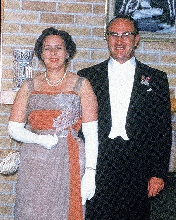
On subsequent days as the group made its way over North Kananaskis Pass, along the Palliser River, and into Banff National Park via Palliser Pass, I had lots of opportunities to speak with other hikers about our enigmatic leader. I’d sensed that Willard was highly respected and liked by everyone, and it soon became apparent why. First, as I found out, he had quite a few accomplishments under his belt. He’d served in the rank of Staff Sergeant with the Canadian Firefighters corps in the Second World War, then later as Mayor of Barrie, Ontario in the 1950s and 60s, and had steered the then-town toward city status to get a better deal for taxpayers.
Willard & Ruth meeting the Queen
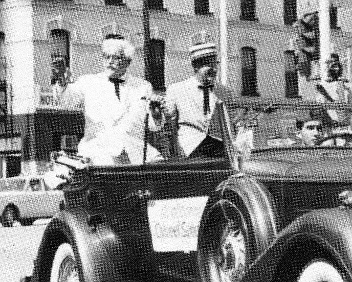
He’d talked Harland Sanders into signing him up for one of the first Kentucky Fried Chicken franchises in Canada and became a personal friend of the Colonel.
On Parade with the Colonel circa 1959
He’d started a dairy business in the 1940s and grew it into the largest independently-owned dairy in Canada, selling it to Beatrice Foods in the early 70s and retiring when he was only in his mid-fifties. Oh sorry, he didn’t exactly retire – he became busier than ever with directorships and executive roles in a large number of civic, commercial and service organizations. I was told that no one alive had more energy than Willard, and by our second day on the trail this was quickly becoming obvious. On the long, steep ascent from the Kananaskis River to Lawson Lake, he passed everyone at top speed and soon went by again (unloaded) in the opposite direction, passing on the uphill yet again carrying the backpack of a struggling hiker. All before the rest of us reached the top!
Second, Willard had a reputation as a “straight shooter” and a very honourable man whose word was good as gold. He treated everyone he worked with, including his employees, with the utmost respect and fairness, adopting profit-sharing long before it became widely accepted. He often employed developmentally-challenged people and taught them valuable skills, because he believed strongly in the importance of useful work to the human soul and no one deserved to have dignity more than those who were disadvantaged. If someone came to the door of his restaurant looking for a free meal or handout, the staff always referred these folks to Willard who had an open door policy. No one went away hungry or empty-handed but Willard would give them some work to do first, perhaps raking the yard, shoveling snow or pulling weeds along the railway tracks. Gives them self-respect, Willard would tell his staff.
One woman told me that no one was better than Willard at getting a great deal. Why, he’d badgered CP Air into carrying everyone on this trip for half-price, and the whole thing, transport, food and last night’s hotel, amounted to the sum of $375 per person. All this when the cheapest round trip air ticket between Calgary and Toronto cost over $400!
Well, that trip was just the start of a long association with what became Willard’s Adventure Club – for the next three decades, the Canadian Rockies and the Great Divide Trail were a favourite venue for his unique brand of tourism. (Thankfully, though, we never had to host such a large group again!) Other destinations were added over the ensuing years: the Grand Canyon, Appalachian Trail, the Chilkoot Trail, Pacific Crest Trail … and later Peru, Nepal, New Zealand and Tanzania, amongst other countries. And the list of adherents, or “regulars” on Willard’s trips grew ever longer. This despite some ironclad “rules,” such as two people in each tent and only a Sierra cup and spoon for meals.
On the GDT at Tornado Pass – 2000
At some point it dawned on me that a certain type of person was attracted to these trips. Sure, the category of “teacher” was inevitably over-represented, these folks often being single and having the summer off. And doctors and nurses seemed plentiful, which is never a bad thing. But there were definitely a few quirky types too. I had some firsthand experience thanks to Willard’s tent rule. On several trips my tent-mate was an otherwise very nice gentleman who, at bedtime, would talk nonstop about the minutiae of hiking/camping gear. I would often wake up after an hour or so and he’d still be at it. And then there was the tall middle-aged man with the German accent and military bearing who constantly challenged me on my backcountry navigation. For example, he would disagree with what I believed was our location on a topo map, stating with authority that a mountain in the distance was obviously (pointing at the map) that one, because it was obviously two kilometers distant, as opposed to the one I believed it was, more like six miles away. Two hours later as we neared the subject mountain, he wasn’t of a mind to concede he could have been wrong and distances in the Rockies can be deceiving, as I’d previously argued.
On another occasion the group descended a steep, narrow valley and came to a turbulent river that had to be forded. Having done my homework, I knew our trail was somewhere on the opposite side, parallel to the river. My German friend, however, having noticed a decent-looking path leading in the right direction but on our side of the river, declared that we would avoid the hazardous crossing and simply follow this trail instead. He wouldn’t take advice from me, as usual, and he managed by force of will to convince several others to go “his” way. The rest of us easily made the crossing on a downed tree trunk and quickly located the correct trail. An hour or so later we came to an avalanche clearing and saw the mutineer group laboriously clawing their way through a sea of avalanche debris across the river. Needless to say they re-joined the main group without the help of a log to make the crossing. But again, no acknowledgement or apology from the ringleader.
“Man, what’s WITH that guy?” I commented in exasperation to one of my “followers.”
“Oh, you mean Charles?” she laughed. “He’s still thinks he should be the one giving the orders … and he’s NEVER wrong.”
I was a little mystified. “Why’s THAT?”
“You don’t know about him? Oh, he used to be one of Hitler’s SS officers.”
From then on I tried to avoid getting into arguments with Charles.
On an only slightly less “chilling” but no less quirky subject, it was commonplace on Willard’s trips to see many participants stripping down to nothing after the day’s hike to wash up in the creek – so much the better if there was an alpine lake to jump into. But Willard had a no-photos prohibition for these instances, which with the other rules was explained at the start of every trip. On the 1979 Rockies Expedition, we were joined not only by Mary Jane Kreisel (1974 Project GDT member and present-day GDTA board member), who completed the whole 2-week itinerary (as I recall, she prudently declined to join the nude bathers), but also fellow 1974 Project GDT member and long-time volunteer Jenny Feick, who, in her job as a Banff park naturalist, accompanied the group for several days mid-trek to provide interpretation. But she’d missed the orientation, and when Willard good-naturedly reprimanded her for closing in on one of the bathers (a young, very good looking Swiss man) with camera in hand, she protested “I’m just trying to get a shot of Urs’s arse!” Well, that’s how I remember it anyway and apologies to Jenny if I have it wrong!
So how does a person with Willard’s background end up organizing and leading backpack trips that were the very definition of roughing it? I learned he wasn’t much of an outdoors or healthy-living type before embarking on this new “career.” He’d been quite overweight for much of his civic and business life, smoked cigars and never got much exercise. Then, in his fifties when he began to have health problems, his doctor instructed him to walk the mile or so between his house and his office rather than drive. He followed this advice, often hoofing it back to work in the evening after dinner to check that all was well. Uncharacteristically, he signed up for a walk-a-thon and during the 25-mile forced march befriended a man who told him, “If you like walking, you’ll love hiking!” Putting aside the possibility that may have been a warning, Willard soon became a member of the Bruce Trail Association, joining and eventually leading hikes along Canada’s first long-distance trail. He also took up running, and could be found most days at the local “Y” putting in his mandatory 8 miles on the track. Now, Willard might have seemed a bit old when I met him but no question, by then he looked very lean and muscular with not an ounce of extra fat.
On the Appalachian Trail
No doubt that level of fitness was a big factor in his two successful ascents of Mt. Kilimanjaro, the second of which was noteworthy for him as the oldest Canadian, and possibly the oldest person to have summited, on his 79th birthday.
Over his long “retirement,” Willard organized and led over 500 trips, visiting every continent including Antarctica, climbing hundreds of peaks, and hiking thousands of miles.
The Canadian Rockies was undoubtedly the most-visited destination, but a close second would be the 2200-mile (3500-km) Appalachian Trail, especially the rugged White Mountains section in New Hampshire. Over the years Willard returned to the “Whites” many times while methodically completing the rest of the Trail in sections. In 2006 I was privileged to join a select group for a final 40-mile hike near New York City to help him earn his end-to-end badge. By then his 87th birthday was only two weeks away, yet he didn’t seem much older than on that July day 30 years earlier. And in case you’re wondering, his Appalachian Trail name was “Titanium Man.” When I first heard that, I naturally assumed the moniker referred to how tough the man was. But no, it was an allusion to hi-tech knee and hip replacements (possibly the result of overdoing the running)!
Finishing the AT with Karen in 2006
This would be a great spot for a brief segue – those who know me also know I’m a great believer in the health benefits of walking, or more specifically hiking. I don’t intend to follow Willard’s example and do much running in my later years (artificial joints don’t interest me much, I guess!), but when it comes to hiking, I don’t think we can ignore the mountain of evidence. Sure, the fact that Willard was able to remain healthy in mind and body, stay active and never have to live in a care home can only be linked anecdotally to how much hiking he did, but I also know many alumni of Willard’s Adventure Club now in advanced years who give credit to Willard and following his example for their good health and independence. What’s more, there’s now good science to show that walking in a natural setting has significant mental and physical health advantages over doing the same on a treadmill, say, or city sidewalk. So as we continue to develop and promote the Great Divide Trail, we can know we’re all contributing toward a resource that’s very important to the long-term well-being of many of our fellow citizens.
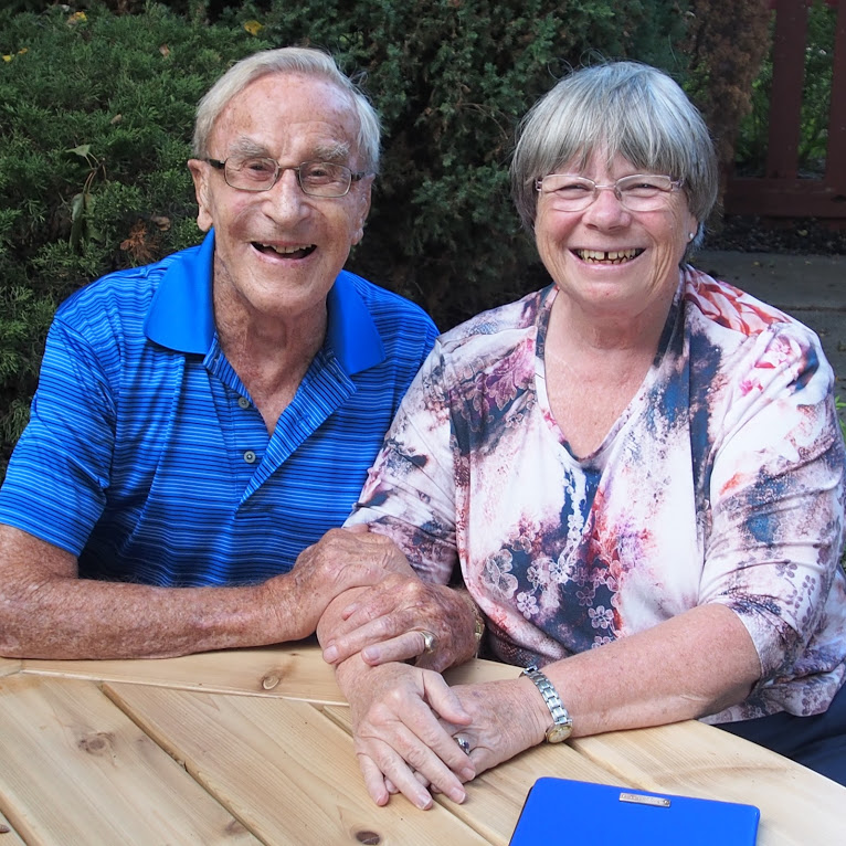
Now back to Willard – he remained active, walking and curling (his two favourite activities) well into his late 90s. Ruth, his wife of 69 years, passed away of Alzheimer’s disease in 2011, having been cared for at home for a great many years until the very end. In November 2016, at the age of 97, Willard was re-married, to his longtime companion and best friend Karen Hunter, an experienced hiker who had been a hardworking and reliable assistant on a large number of his expeditions.
Willard & Karen in 2015
My wife Mary Lou and I stopped in for a visit at Willard’s home in Barrie last September, just a week or so before his 99th birthday. He was in his usual great spirits, if a little miffed with his doctor who was reluctant to refer him for a replacement on his other, non-titanium hip, which would in Willard’s opinion free him from the use of a walker and let him get out on the trails again. But his mind, memory and sense of humour were sharp as ever and we had a great visit.
The following month, while reading to his great-granddaughter Serena, Willard suffered a stroke. After a couple of weeks it became clear that his condition was not going to improve. True to his nature of making big decisions quickly he asked the doctors to allow nature to take its course. He passed away on November 25, 2018.
It’s often said (though sadly not often enough), “They don’t make ‘em like that anymore.” Well Exhibit A proving this adage has got to be Willard Kinzie. He spent his long, productive time on this earth in service to others, according to his three pillars of a well-lived life: Family, God, and Community. He exemplified a “can-do” attitude and approach to challenges. He was a true visionary and mentor who could always see the best in people and encouraged them to better their lives and accomplish great things, much like he did himself by his own example. I can say with certainty that I’m one of the many people whose life has been immeasurably better for knowing the Titanium Man.
Dan Durston entertained a sellout crowd at Trolley 5 Brewpub in Calgary on the last day of winter, a fitting date as we start to get excited about hiking and camping this summer! Durston and his wife, T, hiked both directions of the Great Divide Trail, affectionately known as a “yoyo”, in 2017 because as Dan put it “1,100km did not seem to be a long enough hike!”
They started the adventure on June 1, leaving Waterton with most of the route ahead still covered in snow. Each was wearing a pair of children’s snowshoes (why children’s size you’re wondering?… well because of course, they weigh less than adult snowshoes). It wasn’t until they got to Coleman did they feel spring in the air, and even then winter would return for substantial portions of the high elevation route along the divide. After the snow ended, they continued to trek throughout the summer and into fall – finishing the GDT on November 1 after threats from forest fires had subsided.
I’m not going to recall all of the stories, because who knows, maybe Dan will give the presentation again in the future (we should be so lucky!). Dan did share a few of his videos with us at the event and if you were unable to attend the event or want to see more of their trip, click here.
The one piece of advice that stayed with me was their routine of stopping for a coffee at 3pm every day, regardless of where they were – in a meadow, by a creek, or being visited by a bear. Even brewing coffee in a ditch on the side of the road because on a thru-hike “unusual things like this become normal”.
Here are a few key facts of their trip:
WILDLIFE SPOTTED Sheep – 71 individuals, 6 groups Deer – Lots Porcupine – 9 individuals, 8 groups Goats – 7 individuals, 3 groups Grizzlies – 7 individuals, 4 groups Moose – 6 individuals, 5 groups Caribou – 5 individuals, 1 group Elk – 2 individuals, 1 group Black bear – 2 Wolverine – 1 Fisher – 1 Marten – 1 Wolf – 1 Coyote – 1
FAVOURITE PART: Section G (Mt. Robson to Kakwa)
CLOSEST GRIZZLY: 20 yards
LONGEST PERIOD WITHOUT SEEING ANYONE: 6 days
DISTANCE SNOWSHOED: 160 km
Finally a quick shout out to the volunteers who organized the evening – Vikki McGuire and Rob MacLaine and the MC of the evening, Dave Hockey. Dave not only introduced Dan Durston who he met while hiking the Pacific Crest Trail (it is a small world!) but also introduced others in attendance – Dustin Lynx, author of the GDT Guidebook (Hiking Canada’s Great Divide Trail) and River Taig, creator of the GPS App available through Guthook Guides.
Thank you again Dan for a great event! Everyone left with a spring in their step, just itching to get on the trail. And thank you everyone for your continued support!
Well it has been a busy winter for us at the GDTA, and I am sure everyone is happy that we made it through February. We hope you had a chance to take in one of our great outreach events. Our Outreach Committee certainty has been hard at work, the Dan Durston GDT Yo-Yo presentation at Trolley 5 Brewpub was sold out and standing room only. Then Chasing Sunsets, a panel discussion on transitioning from a hiker to backpacker was another great event, and upcoming in May another sold out event called Backcountry Emergencies. With the goal of reaching out to different demographics and giving back to our members, I have to say well done Outreach Committee!
The Trail Building & Maintenance committee has been hard at work too. Organizing 11 trail building and maintenance trips with more than 150 volunteers involved is a huge task, so much so we are going to hire our first paid temporary worker to handle some of the logistics. If you have not signed up for a trip yet you better get on it as they are filling up fast.
We have also started up a Fundraising Committee too, all of this trail building takes money and we want to make sure our revenue stream is both enhanced and more predictable. We are also applying for charitable status so keep your fingers crossed.
Of course, your Board of Directors is working on improvements as well. It always seems hard enough just to get through our regular business during our meetings, but we have dedicated one hour each meeting to work on the GDTA 3-year Strategic Plan. We hope this will give us an even clearer purpose and direction moving forward. On a more somber note, one of our board members had a serious accident and we are all thinking of him and hoping for a full recovery.
As this will be the last newsletter before our AGM, I wanted to let everyone know that I am stepping down as president. I have been on the board for 7 years and have enjoyed my time immensely. I’ve had the pleasure of working with many outstanding volunteers and have seen real progress in the building, maintenance and recognition of the Great Divide Trail. Above all else, it is the team of volunteers that has made the experience so fantastic. The GDTA is moving forward with lots of momentum and I wish the organization all the best in the future!
I hope everyone can take a little time this summer and get a few steps on the GDT and enjoy our trail and some well-deserved warmth.
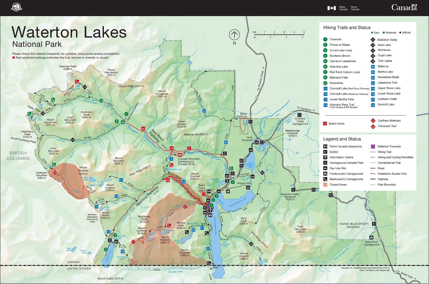
Effective immediately, the GDTA is announcing one change to the main route of the GDT as well as an update on the detour around the trail closures in Waterton Lakes National Park.
Waterton Detour – UPDATED July 5, 2019 (Section A) – Most trails in Waterton Lakes National Park have re-opened this year following the 2017 Kenow wildfire but portions of the GDT in the park remain closed. The GDT is closed from the Carthew-Alderson trailhead (a3) to the Summit Lake-Boundary Creek trail junction (a7), and from Lineham Ridge summit (a11) to Lone Lake (a14). The Mount Rowe-Sage Pass Alternate Route in Akamina-Kishinena Provincial Park is also closed.
Waterton Lakeshore Trail is open allowing hikers to begin at the GDT Southern Terminus on the International Boundary. From Waterton Townsite, a detour can be followed to reconnect with the GDT near Sage Pass via the Red Rock Parkway and Blakiston Valley or Snowshoe Trails, a distance of 28 or 29.5 km depending on two route options.
The detour begins at the Carthew-Alderson trailhead (a3) where hikers follow Evergreen Avenue through Waterton Townsite, about 3.5 km north to the Crandell Lake trailhead on the Red Rock Parkway not on the Akamina Parkway. The Crandell Lake Trail parallels the Red Rock Parkway for 7.5 km to Crandell Mountain campground (closed in 2019). Turn right (north) avoiding the bridge to the campground, leaving the trail to walk on the Red Rock Parkway (which is closed to vehicles but open to pedestrians) the remaining 7 km to reach the Red Rock Canyon trailhead.
From the Red Rock Canyon trailhead, there are two options to reach the GDT:
Blakiston Valley Trail – 10 km on good trail, reaching the GDT below South Kootenay Pass, 4.3 km south of Sage Pass.
Snowshoe Trail – 11.5 km on good trail, reaching the GDT at the Sage Pass trail junction (a16), 1.3 km from Sage Pass. Stay left at junctions with Goat Lake and Lost Lake trails at 4.6 km and 8.5 km respectively.
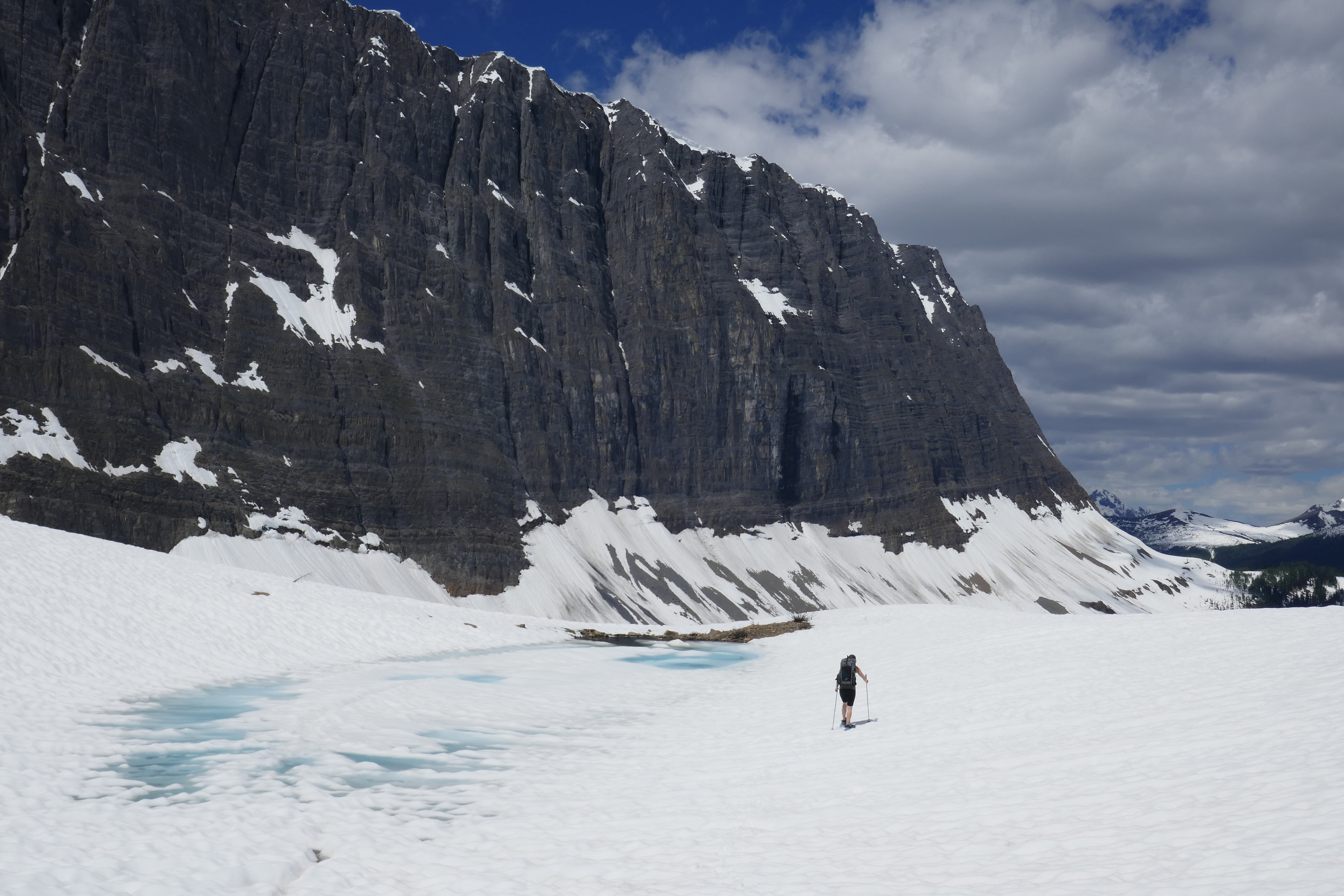
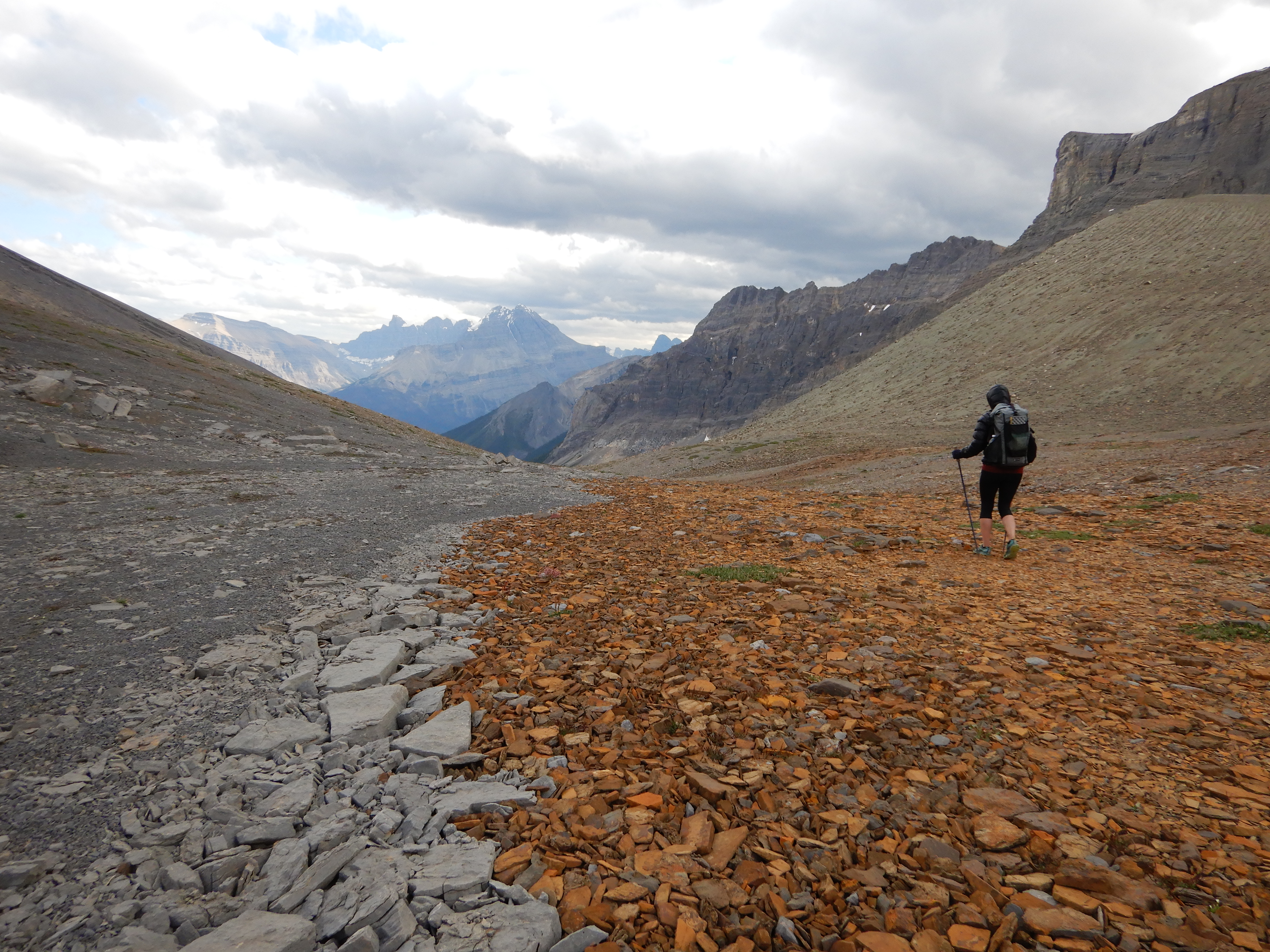
Howse Floodplain Route (Section D) – Descending the north side of Howse Pass, the main route of the GDT now follows the Conway Creek and Howse River floodplains wherever possible, without crossing the main channel of the Howse River. The floodplain is wide and exceptionally scenic, offering a route quite similar to that of the original travellers to Howse Pass centuries ago. There are several shallow fords of smaller channels on the floodplain so hikers must be prepared to have wet feet while enjoying a significantly better hiking experience than the old overgrown trail strewn with hundreds of fallen trees. In June and early July, the Howse River may be in flood making some sections of the floodplain difficult or impassable in which case hikers should consider using the old trail (now marked as an alternate route). Conversely, in late August and September when the river is low, hikers may be able to ford the main river channel and completely avoid any bushwhacking along the river’s edge. See here for a more detailed route description.
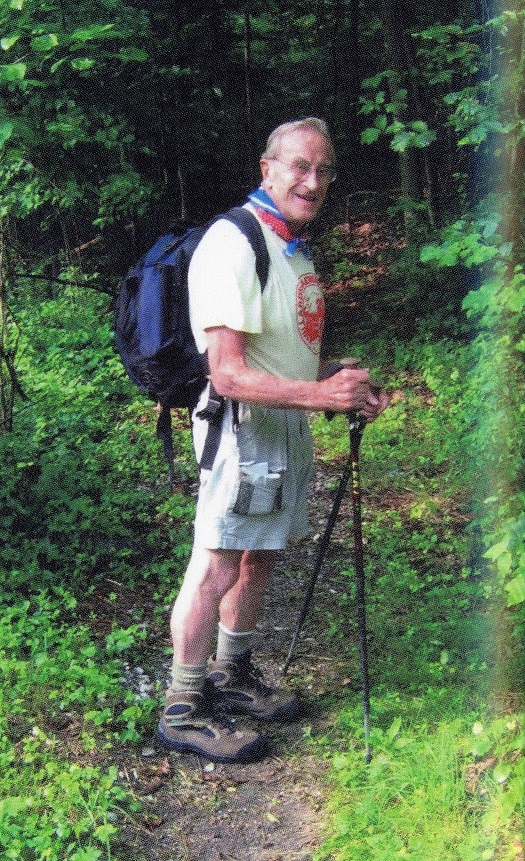
With less than four months until summer, it’s time to start making plans! This edition of the GDTA Pathfinder Newsletter has some important information for hiking and volunteering on the trail this year. Or if you are still undecided and are looking for inspiration, check out the articles written by David Higgins; the Feature Article about the trail work completed last summer on the David Thompson Heritage Trail or the Member Feature to commemorate an avid GDT enthusiast and section hiker, Bruce Parkin.
Message from GDTA President:Is it time for you to step into a leadership role on one of our maintenance trips? What does it take?
Member Feature: Bruce Parkin, In Memoriam – an article to commemorate an avid enthusiast and section hiker of the GDT
Feature Article: The Vanishing Trail – Part 2: Mission Accomplished
2019 Trail Building & Maintenance Trips – Call for Volunteers: Trip dates for 2019 are now available and we need you!
Hiking the Trail: Check out the significantly improved Section D, from Field to Saskatchewan River Crossing
The Great Divide Trail Association is an active organization with significant growth in 2018 and we are looking for an individual to take on the responsibilities of marketing and outreach. Some of our key accomplishments in 2018 include:
Membership grew by about +30%.
Significant work going into the planning, designing, constructing and maintaining the new 50 km High Rock Trail section of the GDT, located north of Crowsnest Pass.
Major trail projects on the David Thompson Heritage Trail and in Jasper National Park.
112 volunteers on 8 trips in 2018 (11 trips planned for 2019!)
Annual major fundraising event to raise awareness for the GDT held in Calgary with Brian Keating.
New chapter established in the Crowsnest Pass.
Formal recognition of the trail in the Castle Management Plan.
The GDT was featured in in Backpacker Magazine’s article awarding the GDT the title of ‘’wildest long distance trail”.
Marketing Position
The Marketing Position is a volunteer position and ideally, the individual will serve on the GDTA Board. The GDTA Board meets monthly and all members are expected to chair or participate in at least one committee.
Responsibilities:
Serve as Chair of the Outreach, Engagement & Education committee, striving to strengthen and expand opportunities that benefit the Trail with targeted messaging and attention to diverse and imaginative partnerships
Develop and implement a communication and PR plan to increase awareness of the Great Divide Trail and the Great Divide Trail Association
Increase the social media presence of the GDTA
Lead the events and outreach programming to ensure that we are engaging potential and current members
Public relations activities including writing articles for local and national press to increase awareness of the GDT or promote local events
Lead the development of the GDTA quarterly newsletter, website and other key communication channels to engage current members
Requirements:
Personal commitment to devote the time necessary to perform the responsibilities of the Marketing Position
Background and experience with marketing, PR or event planning
Leadership and management skills to attract and engage other volunteers to support the activities of the Outreach, Education and Engagement committee
An interest in promoting, protecting and maintaining the Great Divide Trail
If you are interested in this opportunity or have any questions, contact us.


 With less than four months until summer, it’s time to start making plans! This edition of the GDTA Pathfinder Newsletter has some important information for hiking and volunteering on the trail this year. Or if you are still undecided and are looking for inspiration, check out the articles written by David Higgins; the Feature Article about the trail work completed last summer on the David Thompson Heritage Trail or the Member Feature to commemorate an avid GDT enthusiast and section hiker, Bruce Parkin.