
by Jeff Gruttz
The Quiz:
For all our Southwest Alberta hikers / geography keeners….. which number is closest to the number of glaciers, or visible remnants thereof, contained in the most southerly drainage basin traversed by the GDT, the Oldman River drainage basin? Clue: this is a semi-trick question.
- 0
- 3
- 5
- 8
- 12
- 16
- 20
- 25
- 32
================================================
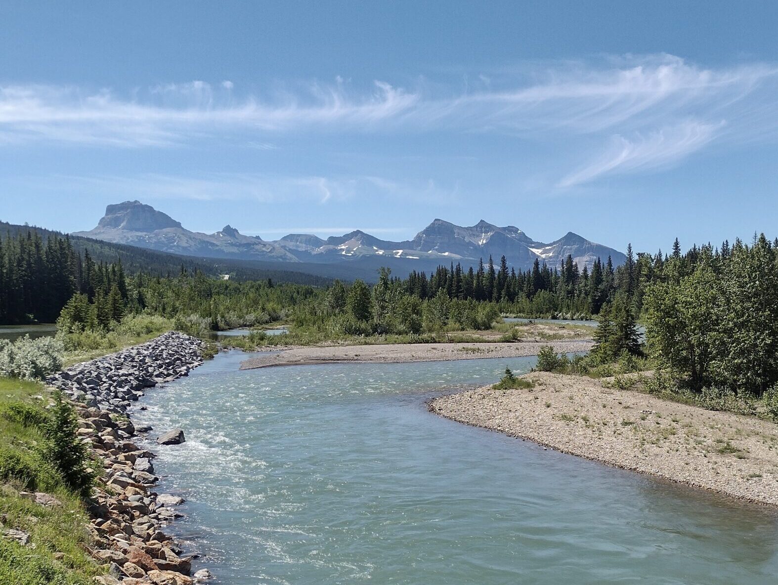
Closest answer – 25. While there are not any glaciers in the Oldman River’s ALBERTA section of its drainage basin, there are several in MONTANA’S Glacier National Park in the Oldman basin. Two Oldman tributaries flow northward from Montana into the Oldman River upstream of Lethbridge: the St. Mary River, at approximately 11 km upstream of Lethbridge, and the Belly River, an additional roughly 19 km upstream. A third river, Waterton River, empties into the Belly River south of Fort Macleod.
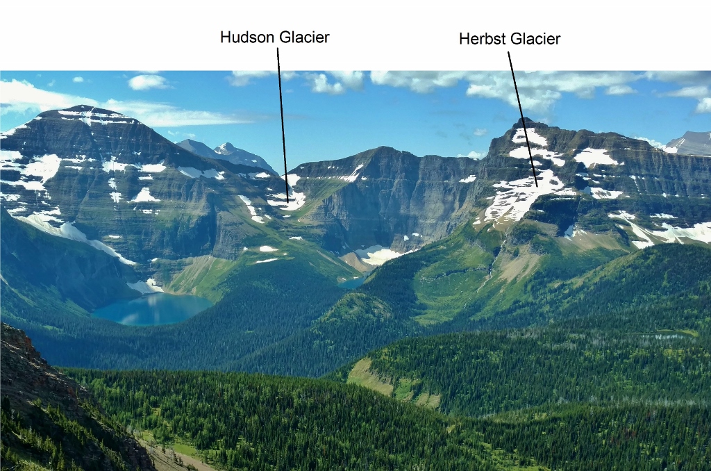
Glaciers (or remnants) in the Waterton River’s headwaters (perhaps others): Carter Glaciers (2+), Dixon, Thunderbird, Hudson, Herbst. Total – 6+
Glaciers (or remnants) in the Belly River’s headwaters (perhaps others): Ahern, Ipasha, Chaney, Shepard, Whitecrow, Miche Wabun, Old Sun. Total – 7
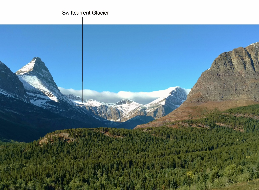
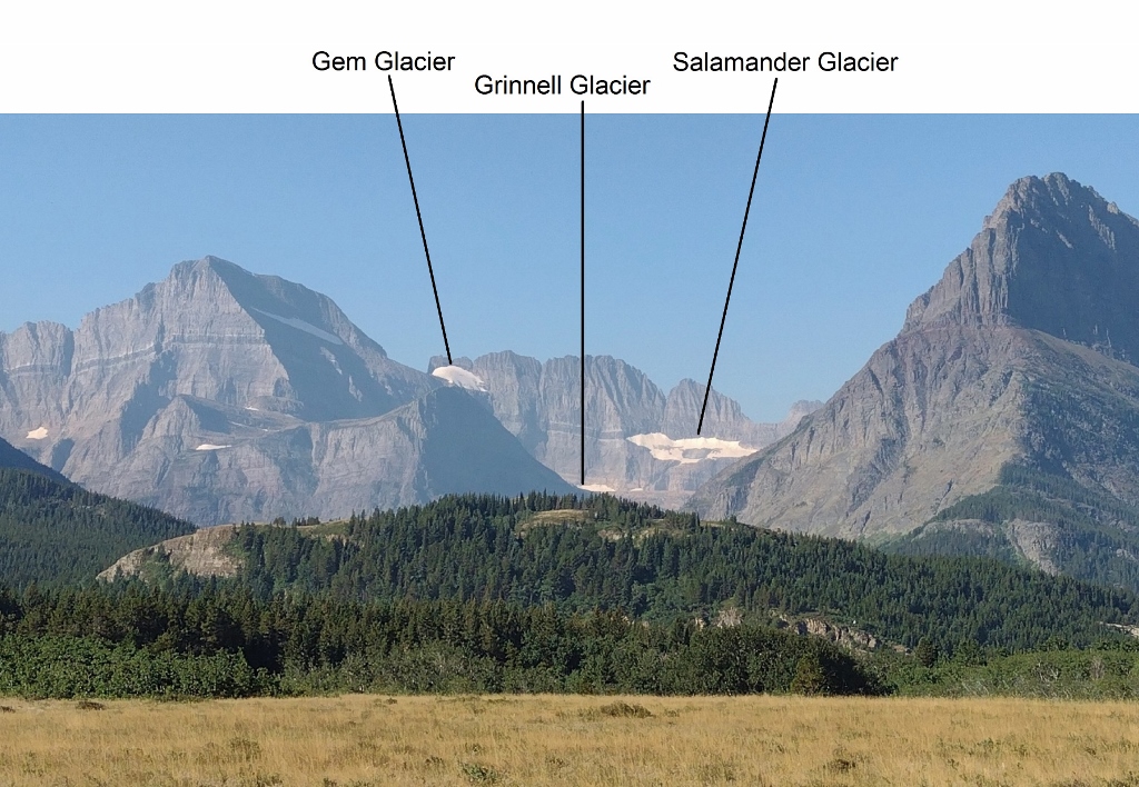
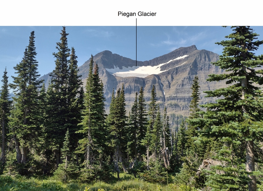
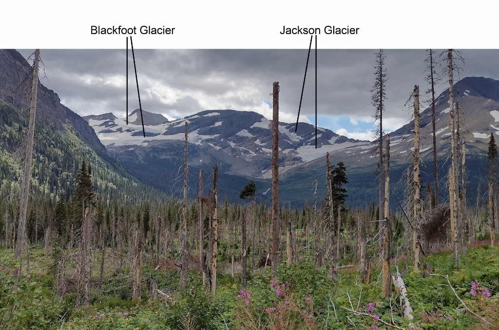
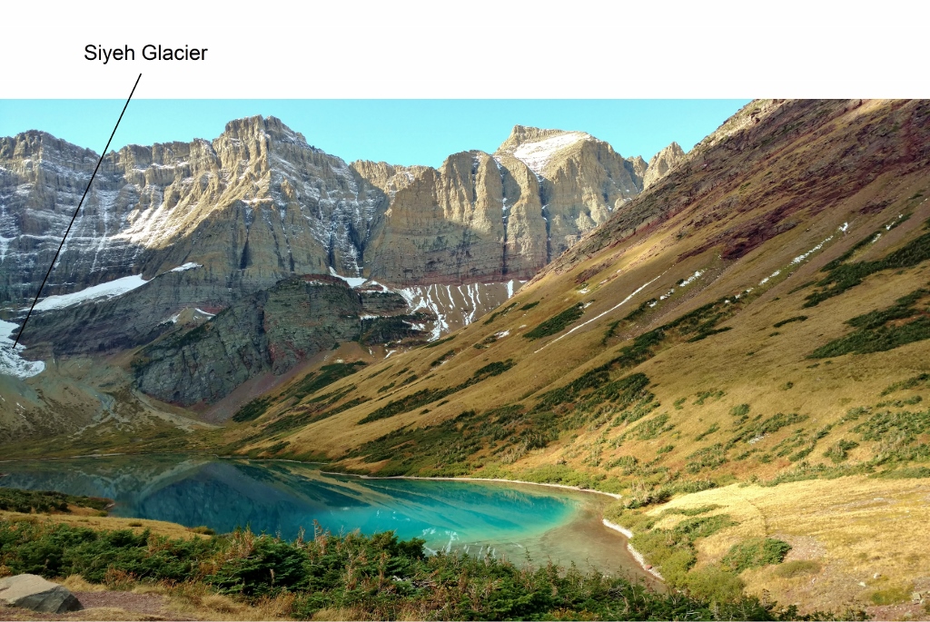
Glaciers (or remnants) in the St. Mary River’s headwaters (others as well?): North Swiftcurrent, Swiftcurrent, Salamander, Grinnell, Gem, Siyeh, Sexton, Piegan, Red Eagle, Logan, Blackfoot, Jackson. Total – 12.
Background:
My interest was aroused for further research when I read this about the Oldman River’s flow rates:
“Streamflows peak in early July, then recede steadily into late summer as the mountain snowpack disappears, and are sustained through the fall by run-off from glacier melt and whatever rain happens to fall”
… excerpted from this source (of unknown complete volume title or author), bottom of page 1: https://www.ubcpress.ca/asset/12421/1/9780774807128.pdf
Say what? Glacial meltwaters flow into the Oldman River? Not the Oldman River with which I’m familiar in Alberta! Ah yes …. but the Oldman River’s drainage basin extends into Montana. Why of course: Glacier National Park!