by Barb Lauer
Every summer for the past four, the mighty Lynnie Wonfor and myself have hiked a section of the GDT. It’s been awesome, something to look forward to every year, an opportunity to reconnect with the trail, hikers and volunteers. This summer we were planning to hike section A with Lynnie’s daughter, Sophie, and then Lynnie and I would go on to hike section B. A stretch goal, a mighty plan that didn’t quite work out. The day before we were meant to depart our driver, my husband, tested positive for Covid. So the plan was changed – Lynnie and Sophie would start section A and I would stay behind. Well, with my fear of missing out, the weather so nice, testing negative and feeling strong, I gave it four days and headed out. I was more than a bit conflicted though. I wanted Lynnie and Sophie to have the mother daughter experience and I didn’t want to give them Covid. My plan was to hike alone.
I went onto the GDT via Red Rock canyon in Waterton, bypassing the start of section A, as I’d hiked it before. My plan was to hike the Barnaby Ridge Alternate and then to finish section A at Coleman. I was excited about hiking on my own, as I wanted to give it a go. Sheesh, more on this below.
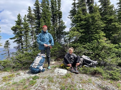
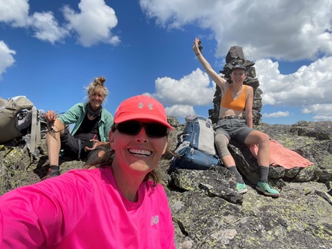
The first day, I rocked it. I took the Snowshoe Trail and was soon at Sage Pass. I ran into Lynnie and Sophie (photo below) some place before Font Creek campsite and kept going owing to the reasons above.

I stopped for dinner at Jutland Creek and went onto Scarpe Pass to spend the night. I’d seen no one since running into Lynnie and Sophie. I’m at Scarpe Pass at about 7pm and can’t find the water. I know there’s water there, from the guidebook and there are marmots around. I’m thinking I’m on my own, it’s getting late, my brains not working (a function of hiking alone) and so I opt to hike back to Jutland creek. It’s only 20 minutes, all good. Who should I meet there but Lynnie, Sophie and two thru hikers. After a day on my own (yup, that’s right after one day), it was great to see people!
The next day, it was off to La Coulotte Peak and Barnaby alternate.
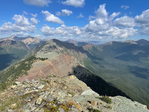
A bit about the Barnaby Ridge Alternate.. it’s probably the most challenging section of the GDT that I’ve hiked (and I’ve completed sections C, D, E and G with lots of alternates including the Northover Ridge, Six Passes, Kiwetinok). There is scrambling with a backpack, walking along cliff edges, steep ups, steep downs and walking on dubious scree. The crux is getting down La Coulotte Peak but it doesn’t stop there, it was challenging through to joining Barnaby Ridge.
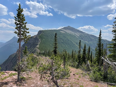
The trail thins out a bit after Scarpe Pass but there is a trail. The La Coulotte ridge can be narrow with steep up and downs. You have to watch your footing. Getting up La Coulotte peak, was absolutely fine. It’s a grind but nothing too tricky. There were lots of footsteps to follow.
Getting down La Coulotte peak was a different story. I checked the app and read about folks who walked towards the west and around the cliff band and did not scramble over it. I had a look and thought why not? The why not, is that the scree is very loose, if you lose your footing you’re going to slide for a bit and then head over a few cliff bands. As I did this route, at one point my front foot went loose. I steadied myself and then considered turning around but with a backpack, thought no way. So, I continued, walking like I was doing a river crossing, three points of contact and very slowly. It worked out but I wouldn’t recommend this route. The next challenge was to navigate two more cliff bands. I checked out going east around them but I didn’t like the loose rock underfoot. And as I’d seen a number of videos where people, scramble over, I thought I’d try it. The second rock band was fine and gave me confidence. I haven’t done a lot of scrambling with a backpack.
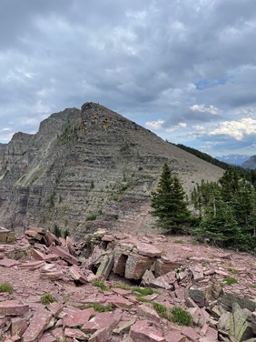
The final rock band looked okay too or so I thought. On my last step down, I had to stretch to get to the ground. As I was reaching down, the rock I was balancing on gave way. I was going down. Somehow I managed to grab a small tree enroute and so didn’t slide far. But it did shake me up. I had a rest, stopped the bleeding, bandaged up my legs and elbow, and gave some thought to what now. I wasn’t ready to go back up La Coulotte and so I continued on.
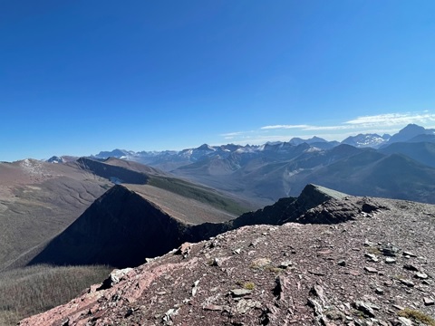
I kept going along the ridge for maybe one and a half kilometers (got up the peak in the photo above) and thought what am I doing… I don’t know if I’ll see anyone else on this route, there are still many tricky bits to navigate and I do not even have a full first aid kit! SHEESH! So I turned around. It was going to be a long day but a known day. About a kilometer later, I met up with Lynnie and Sophie! They said join them, they had Polysporin and iodine! What a relief!! I had a short cry and joined them, keeping a distance for reasons explained above. The rest of the hike into Grizzly Lake seemed long (probably because I’d already walked part of it). There was one tricky bit with loose rock and then loose rock on rock to get down but it was okay. And then you see the first lake and think you’re almost there…. but you’re not. It’s further along the ridge. Finally arrived at Grizzly lake, it’s an awesome campsite!
The next day, the plan was to go to Barnaby Lake and navigate the two GDTA flagged routes to avoid serious scrambling. About 13.5 km, how hard can that be? Well very hard! It took us an average of a km/ hr. We rolled into Southfork Lakes at about 9:30 pm and called it a day. The GDT flagged sections were great. Thank you GDTA (and Dan Durston). It was nice to have the route clearly marked with flagging. The rest of the time we relied on the Far Out app for the most part. Sometimes there was trail and sometimes there wasn’t.
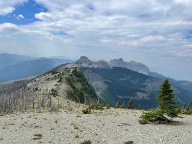
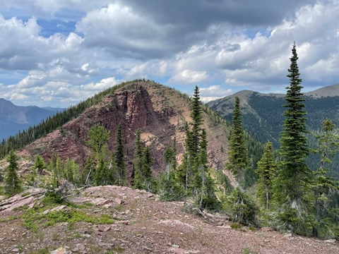
We had one tricky bit this day. Rather than going up the last unnamed peak, we followed a clear trail around it. The scree was loose at times but it felt okay. But then as we came around and looked to hike down to the pass, there were cliff bands everywhere with loads of loose rock. It was a bit overwhelming for those of us who already took a tumble on this trip! And it was 7:30pm. Have to say, that Lynnie was amazing at this point and successfully found the trail using the app. When we looked back, this section scramble didn’t look that bad, you can see the weakness in the rocks. It was a different picture from above, late in the day with tired bodies.

As we walked the Barnaby Ridge Alternate, I kept wondering where is the very wide ridge that was featured in the GDTA marketing literature? Well, we finally found it at about 8pm on day two of the Barnaby ridge alternate. It’s the true Barnaby ridge and it is lovely!!

If you are interested in only hiking the Barnaby Ridge and do not want to scramble in a backpack, I’d strongly recommend doing it as a short backcountry trip. The trailhead is where the GDT alternate route meets hwy 774 , AllTrails calls it the Syncline Barnaby staging area. Hike to either Barnaby Lake (awesome small campground by a lake with sheltered campsites) or Southfork Lakes (more random camping but closer to the ridge). With a base here, you can hike up to the ridge and Southfork Mt and go along the ridge for as long as you like.
After camping at Southfork Lakes, we separately decided to come off the trail. I woke up feeling run down and thought Covid might be hitting me (it wasn’t, it was just the result of lack of sleep in a wind blown tent). Sophie and Lynnie thought that they’d done the best of section A and it was time to get ready for Sophie’s next adventure. Lynnie and I planned to come back later in the summer to finish A.
I’m still wondering how I feel about the Barnaby Ridge Alternate route. I’m not someone who enjoys hiking with lots of exposure and I do think that there was a bit of exposure and you had to be careful with your foot placement on the steep ups and downs near the edge. It is a physically demanding section; I wouldn’t plan for your normal 25 km thru hike day on this section.
I have a great deal of respect for the folks who thru hike the trail alone. I can’t imagine a more difficult challenge! After this very small experience, I would give it another go. But only after an exhaustive search that turned up no one willing to go with me, and only if there was no scrambling. Been there, done that.
Postscript: Lynnie and I did go back to Waterton in September but as the weather was amazing, we opted to do the Rowe Alternate instead of the last part of section A. Zoe, Lynnie’s daughter, joined us for this short adventure. I loved it! With light backpacks, cooler weather (less need for water), bright blue skies, autumn colors, very little wind and strong bodies, I think it was my favorite hike all summer! I’ll write this up for the spring Pathfinder newsletter. Whoohoo!!!