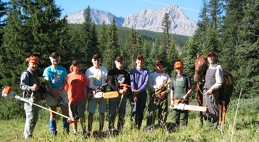
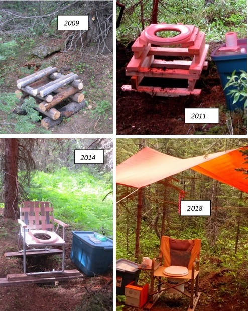
In the early spring of this year, the Outreach Committee presented four GDT trip preparation, planning, and helpful advice webinars:
Webinar 1: Women’s Hiking/Backpacking Webinar
Webinar 2: Risk Management Webinar
Webinar 3: Planning a Hike Along the Great Divide Trail Webinar
Webinar 4: Training for Your Hike Webinar
These webinars were well attended. For those not able to attend, videos and slideshows of these webinars are posted on the GDTA’s YouTube channel.
Links to these videos and slideshows are also included here for your reference.
The GDTA profusely thanks all the webinar panelists and contributors for all their time spent in preparing and presenting these webinars. And a special big Thank You to Austin Hager for organizing all these webinars, making them happen, and providing videos and slides of them.
Women’s Hiking/Backpacking Webinar
March 2, 2023
This was a webinar for women and by women.
The three panel speakers were Charlene Deck, Nicole Dubeta, and Eloise Robbins, all very accomplished thru-hikers, having all hiked the GDT. Additionally, they’ve hiked other long distance trails including the AT, CDT, PCT, and other trails.
During this webinar, the panelists addressed questions and issues that women typically have about topics such as hiking solo, taking up backpacking, gear, hygiene, safety, and other pertinent issues. Drawing from their vast experience, this was a very informative and relevant webinar.
Risk Management Webinar
March 9, 2023
This webinar discussed risks due to the “elements” – water crossings, snow hazards, and heat, when hiking the GDT. Facing these challenges and reducing their risk level to achieve a successful hike, was the theme of this webinar.
Austin Hager, a GDT thru-hiker and active GDTA member, brought his expertise to this webinar. Josh Wiebe, a GDT thru-hiker and water resources engineer drew upon his vast knowledge to unlock the mysteries of confronting tough water crossings.
The four main topics of this webinar were:
Safely managing river crossings on the GDT
Managing snowpack along the GDT
Managing the heat
Water carries
Places along the GDT where these risks are highest were presented and discussed.
Here is this webinar’s video with its slide presentation:
Planning a Hike Along the Great Divide Trail Webinar
March 16, 2023
This webinar began by introducing the Great Divide Trail Association and key facts of the Great Divide Trail (GDT). From there, each section, was discussed with an emphasis on planning information – access, campsites, permits, resupply options, and town facilities (accommodations, food, gear, stores, etc). Alternates were also discussed for each section.
Unfortunately, the audio was not captured for this webinar. However, the slide show with many of these details and gorgeous pictures is on the GDTA YouTube channel. Here is this webinar’s slideshow:
Training for Your Hike Webinar
April 6, 2023
This webinar featured Dr. Morgan Brosnihan, owner of Blaze Physio. She specializes in thru-hiker injury prevention and helping thru-hikers achieve their goals.
The main topics discussed were:
Common hiking injuries
Training and other preparation for hiking to reduce injury
On-trail injury mitigation and care
This was a very detailed and pragmatically useful video.
by Jenny L. Feick, PhD, Editor of Tales from the Great Divide, Vignettes on the Origins & Early History of Canada’s Great Divide Trail and the Great Divide Trail Association
The questions that I get asked most often when GDTA volunteers find out I was one of the “original six” are ones related to the food and gear we used when we did the early trail surveys and route planning for the GDT between Waterton Lakes and Banff national parks. The topic of food came up quite a bit when we did the interviews that form the basis of Chapters Two to Six in Tales from the Great Divide.
For this issue of the Pathfinder, I’m sharing excerpts related to the food we ate in the summer of 1974 while doing the field work for Project: Great Divide Trails. Since our crew ranged in age from 19 to 23 and were backpacking or hiking around 25 miles per day in rugged terrain, we needed a lot of calories to sustain us. So, food was a top of mind concern then and in our recollections. While lighter weight backpacking food had come on the market by 1974, the budget limitations of our federal Opportunities for Youth grant precluded us purchasing such expensive products.
In the dialogue below, JENNY refers to Jenny Feick, MARY JANE to Mary Jane Kreisel (née Cox), CLIFF to Cliff White (the project leader), DAVE to Dave Higgins. There are also excerpts from an email from Chris Hart and a phone interview with Dave Zevick. We are the so-called “original six” who worked on Project: Great Divide Trails in 1974.
Information on how to obtain your own printed or PDF copy of the 2nd edition of Tales from the Great Divide follows the excerpts.
Excerpt from Tales from the Great Divide, 2nd Edition from pp 22-26 in “Chapter Three: Project: Great Divide Trails”
JENNY: “…I do remember, Mary Jane, you were given a budget of $400.00[1] to feed six young people who were going to be working hard on the trail exploring for three months.”
MARY JANE: “And the downfall was mackerel.”
CLIFF: “It was my father’s Bridge Brand account because my father [Cliff White Senior] used to manage Sunshine Ski Hill Area, and we had a deal with Bridge Brand to deliver the groceries, so we really got a deal on our groceries [for Project: Great Divide Trails]”.
“Bridge Brand, a food distributing company, you had to go down to Bridge Brand and take what they would deliver, and basically we couldn’t afford any of the stuff they would deliver for Sunshine Lodge.”
MARY JANE: “Instead of being able to order tuna, which everybody would love, Bridge Brand had these large cans of mackerel. And nobody ate mackerel back then. None of us did, but wehad to.”
CLIFF: “I still don’t.”
MARY JANE: “So, you would be dumping out a can of mackerel and hiding it in whatever you could.”
JENNY: “Tuna Helper [a General Mills pasta and seasonings product].”
JENNY: “You couldn’t afford to throw anything out, because that was it. Then tomorrow was something worse.”
MARY JANE: “We did have Tuna Helper. That’s right.”
JENNY:“And we had Hamburger Helper [another General Mills processed food product].”
Figure. 26: Mary Jane Cox reviewing the food she selected for the crew of Project: Great Divide Trails in Calgary, Alta., May 1974. (Photo by Dave Higgins) PS. The wine was not part of the crew’s rations.
CLIFF: “Didn’t we get those freeze‑dried …”
JENNY: “Protein‑ettes.[3] Textured soya protein. Three different flavours: beef, chicken and ham. So, they were little kind of brown, beige and pink droppings.”
DAVE: “They looked like rabbit food.”
MARY JANE: “Anyways, you would eat that, and because it was filled with sulphur‑type preservatives, some of us, it just ran right through you!”
JENNY: “Or you would wake up in the middle of the night parched. You had to drink a gallon of water.”
MARY JANE: “Yes, you were parched. It was just awful.”
CLIFF: “Did we have any fresh food? I can’t recall any.”
JENNY: “We did the first night, with the Hamburger Helper.”
CLIFF: (Nodding) “We had a pound of hamburger [each week], and you are walking 500 miles [that summer]. You get only half a pound of hamburger [a week] and you’ve got to split it with your partner.”
JENNY: “But it was frozen when we left town and then it was thawed by the time we got to make it [that night when we camped].”
CLIFF: “What did you fix with that?”
JENNY: “Hamburger with Hamburger Helper.”
CLIFF: “That’s where the dehydration starts, right there.”
JENNY: “And Dave and I would sneak some fresh stuff in, right? For the first bit of the week.”
DAVE: (Nodding) “We’d buy a few of our own supplemental stuff.”
Figure27: Dave Higgins eating a nectarine at Upper Kananaskis Lakes, Alta., August 1974. (Photo by Jenny Feick) When possible, Dave Higgins and Jenny Feick supplemented their project food rations with fresh fruit and vegetables.
CLIFF:“What did we have for breakfast?”
MARY JANE:“We had oatmeal. I remember that.”
DAVE:“Every day.”
MARY JANE:“And sometimes you would mix cold, cold water from the streams with oatmeal and put in, was it brown sugar?”
JENNY:“Brown sugar.”
MARY JANE:“And you would eat it cold. I remember eating it cold sometimes. A lot of the time.”
CLIFF:“We didn’t have time to heat anything up in the morning anyways.”
Excerpt from Tales from the Great Divide, 2nd Edition from page 60-63 in “Chapter Three: Project: Great Divide Trails” – The Cliff White Special
MARY JANE:“Let’s go to the Cliff White Special. Back to 1974.”
“We would often pair off and switch it up. So, this time it was Cliff [White] and Jenny [Feick] and myself.”
JENNY:“And the two Daves [Higgins and Zevick] and Chris [Hart] were together in another area.”
MARY JANE:“My mom had bought me a jacket that was supposed to be really good in the rain. She said, ‘The woman said it was great in the rain.’ So, we took off that day, Jenny and I, in separate directions, and we were going to meet up and have our can of tuna. So, she gave me the can of tuna to [carry in my pack as I] walk along”.
“Anyways, it was pouring rain, and the windchill took it way, way, way down that day, didn’t it?”
JENNY:“It was cold.”
MARY JANE:“So, the rain jacket that my mom got me got soaked within the first two minutes, straight through. And I suppose we didn’t know a lot about clothing, (turning to Cliff, Dave and Jenny) or maybe you guys did, so I just trusted her. So, that’s the first time in my life that I got hypothermic, and I did, actually, walking along there.”
JENNY:“It was when you stopped, too. You’re stopping all the time to record the information.”
MARY JANE: (Nodding) “I’m pretty sure I got to North Kootenay Pass, I believe. I was on my way back and I knew something was wrong, because things were just getting weird. So, I thought the best thing I could do was open the can of tuna and eat it.”
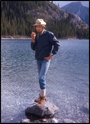
Figure78: Historic North Kootenay Pass from the B.C. side on that cold, damp day in June 1974. (Photo by Mary Jane Cox)
JENNY:“The whole can. Meanwhile, I’m thrashing around in another valley. And I think Ian [Hatter] and I were in that same valley this summer, actually. The instructions [in 1974] were to go to the end of this trail and then go over this notch and into the other valley and meet up with MJ.”
(Turning to Cliff) “Because you had just dropped us off. You dropped me off at one trailhead and Mary Jane at another trailhead, and we were just supposed to meet up.”
MARY JANE:“With the tuna. And you can imagine, at this point in time, we were so sick of mackerel.”
JENNY:“All of this is keeping me going through this rain. I had to go straight up this slope to get to this notch and down the other side with the thought of sharing this can of tuna. And I got there and Mary Jane said she had eaten the whole thing!”
MARY JANE:“I said, ‘I was about to die, Jenny!’ You said, ‘Oh, I don’t give a shit!’”[4]
JENNY:“But we walked out [together].”
MARY JANE:“We walked out. I was completely soaked and you were probably semi‑soaked, and we were cold. So, we get to the campsite.”
JENNY:“I was hungry.”
MARY JANE:“Yes, you were hungry. We get to the campsite and we have one tent. I don’t know why one, but we had one tent for the three of us (indicating Jenny, Cliff and herself) So, we (indicating her and Jenny) were tired. So, we wanted to go [to sleep].I said, ‘I’m done, I can’t do anything more.’ I’d at least had the tuna.”
JENNY:“I stayed awake.”
MARY JANE:“Cliff said, ‘No, no, we’ve got to cook!’ So, we get this pot over the fire. (Looking at Cliff and Jenny) You’re going to have to fill in some of the details, because you know my memory. The Protein‑ettes go in.”
CLIFF:“There was that stupid well.”
JENNY:“It was a sulphur spring. We didn’t know about it. Now they [Alberta Parks in Castle Provincial Park] mark it as a sulphur spring.”
CLIFF: “It looks like drinking water and has a pump on it, but don’t use it.”
JENNY:“There was this caldron.”
MARY JANE:“It was a caldron across the fire, on some kind of thing.”
JENNY:“With sulphur water.”
CLIFF:“Our last bag of Protein‑ettes, probably.”
JENNY:“That was the final touch, because you (looking at Cliff) put in onion soup mix [first], but there was so much water and there was just a few little onions floating around in this sulphur water.”
MARY JANE:“He added potatoes.”
CLIFF:“Sure, more salt.”
JENNY:“It was a [dry powdered] mashed potato mix. It kind of made it like a milky substance with onion flakes floating around. Then we added the Protein‑ettes to get it bolstered up. I think they were the ham [flavoured] Protein‑ettes, because we didn’t like [the] ham [flavour],and it was maybe the last day of the week. So, there were little pink things floating around in there. And we needed some seasoning, so you (indicating Cliff) went up with the pepper shaker. (Miming turning a pepper shaker upside down) And then, the top fell off of the pepper shaker! The whole thing of pepper went into this soup!”
CLIFF:“At the very last second.”
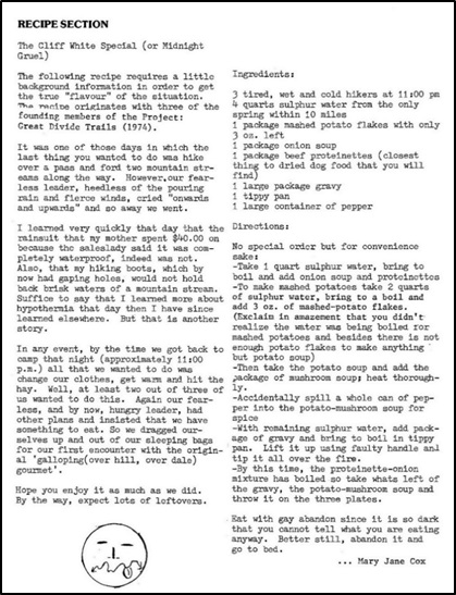
Figure 79: The recipe for the Cliff White Special. (image scanned by Dave Higgins)
JENNY: (Miming tasting the soup) “And then Cliff says, ‘Oh, yes, it’s really good! Come on, girls, eat up!’”
MARY JANE:“I thought at one point, too, somebody touched it and half the thing fell into the fire.”
CLIFF:“No great waste.”
MARY JANE:“So, I took one look at this and said, ‘I’m going to bed.’”
JENNY:“Cliff and I ate it. I was so hungry, I didn’t care.”
CLIFF: “I have no taste buds, so it doesn’t bother me.”
MARY JANE:“I just went to bed. At least I witnessed it. That’s in one of the [GDTA] newsletters. It’s called ‘The Cliff White Special’” [see Cox 1980b in Appendix C].
JENNY:(Looking at Cliff and Mary Jane) “But the next morning, do you remember this?”
CLIFF:“No.”
JENNY:“This is priceless.”
MARY JANE:“Cliff got up first, and saw this chain gang, you know, a prison chain gang.”
JENNY:“There was a chain gang working in that [provincial] park. It turns out that there was a camp for prisoners in the Castle [valley], and we happened to camp right next to it.”
MARY JANE:“So, he (indicating Cliff) was making breakfast, and then one of us got out [of the tent].”
JENNY:“All these men who haven’t seen women for ages [are watching]. I come out [after MJ]. There’s two women! What is this? And they started staring. And, all of a sudden, Cliff was in this big hurry to leave. (Mimicking Cliff’s voice) ‘We’ve got to get out of here; we’ve got to get out of here!’ It was because you said you were nervous. You told us afterwards when we were driving away, you said, [again, mimicking Cliff] ‘Did you see those guys? They had chains on; they looked really mean.’ ”
“We didn’t even notice the chains. (Looking at Mary Jane) You and I just thought they were guys working on the campsite, but (turning to Cliff) you saw they were chained together. They all had the same uniforms. I don’t know why we didn’t notice that.”
MARY JANE:“I said, ‘We’re not getting any breakfast now’.”
CLIFF:“It was right after the movie Cool Hand Luke came out.”
MARY JANE:“It’s funny how these things happen all within days, boom, boom, boom, like that.”
CLIFF:“I’m surprised we ate. I just remember, ‘This water is inedible! What else can you do to ruin this soup? How are we going to drink this stuff?’”
JENNY:“It was sulphur water, yes, but it was so spicy with that pepper.”
LANI: (Looking at Jenny and Cliff) “And you ate it anyway.”
JENNY:“I didn’t have any choice.”
CLIFF:“It’s not going to get any better tomorrow. Just stick with the plan.”
MARY JANE:“I’d hate to see the poor bear that came through and started eating the Protein‑ettes that was left on the fire.”
CLIFF:“You know it’s bad when the highlight of the week was the Hamburger Helper.”
Excerpt from page 64 of “Chapter Three: Project: Great Divide Trails” in the Section “Discussing Reflections from Chris Hart”
MARY JANE: …(Reading Chris Hart’s email)
“Getting lost near sunset in B.C. south of the Royal Group after following grizzly tracks all day. I get to the checkpoint to link up with Cliff and he isn’t there and neither is my pack. I’m out of my mind with worry because I’m sure I’m in the right place, but my pack is gone and I’m really in the middle of nowhere. Suddenly, Cliff comes whistling down the trail to warn the bears. He informs me that he hauled our packs to a cache up a tree out of sight. He’s very late and we’re both very worried about the bears. We’re about five or six miles west of Elk Lake. It’s almost dark. We’re both bone tired and have no food. I turn my Gerry tube inside out and lick the last remnants of peanut butter out of it. We have to follow a trail through a boulder field and, by the time we get to the car, it’s pitch black. I don’t get my clothes off… just lie down in the park campground and pass out. Two days later, I am so sick with a digestive tract bug that I can’t walk on my own.”
JENNY:“Yes, I remember he was really sick.”
MARY JANE:“Yes, we did have Gerry tubes.[5] Peanut butter kept us sustained.”
CLIFF:“That’s probably all that got us through, when you think about it.”
DAVE: (Looking at Wayne Marshall) “Did you ever see those Gerry tubes? You can still buy them. It’s a plastic tube, like a toothpaste tube, and you fill it yourself. You turn the end over and it has a little plastic clip on it.”
CLIFF:“We probably still have some.”
DAVE:“I, actually, once in a while, still use them for peanut butter and jam.”
Excerpts from page 85 and 87 of “Chapter Three: Project: Great Divide Trails” in the Section “Dave Zevick’s Tales from the Great Divide, Transcript of the telephone interview…”
“I remember the one time we were doing a longer trip and we ran out of food. I can’t remember if it was for a couple days or whatever. We came upon this patch of wild strawberries and we dropped to the patch on our hands and knees eating them.”
“Food was an interesting thing. I guess that was definitely a theme. There was the bologna, and it was actually pretty good. Because in the pack, the things would heat up, so you would sometimes get a little bit of green on the bologna, so you just kind of cut that off; you’re all right.”
“Then Cliff got into the mackerel. He started to buy cans of mackerel. Cliff says, ‘Well, it’s got to be good; it’s fish oil, it’s good.’ I remember we were on some mountain paths, and we opened up the first tin and it was half a mackerel in there and it was the tail and you could see oil.”
“We tried to eat that. We were pretty hungry, but we couldn’t eat it, it was so bad. We left most of that under a rock and that was the end of the mackerel.”
“And then, at the same time, there was Protein‑ettes, that was a vegetable form of protein. If you mixed that with Hamburger Helper, it was pretty good. So, that was good. The one night, actually, Cliffy and I had a chuck steak that we cooked over the fire, and then we realized why they call it chuck steak, because we both threw our steaks into the river. We chucked it and that was it.”
“Cheese and bread: we would have cheese and bread quite often. The cheese, what would happen is it would kind of melt on the hot days, so you would have that orange liquid and a messy blob, and then the bread is all broken up into crumbs and chunks. You just kind of poured the two together and made cheese balls.”
“I can’t remember what we had for breakfast. It must have been some kind of oatmeal or whatever. We’d eat big when we got out, that’s for sure. We were in B.C. somewhere; there isn’t a food store.”
…
“We had Tuna Helper. And I’m not sure what it was, there was something that, the next morning, things didn’t agree with me. I left a pair of underwear up in the mountains. I hoofed it out, made it to the road. I hitchhiked back to Banff and got showered up.”
What is Tales from the Great Divide and How Can I Get a Copy?
Tales from the Great Divide, Vignettes on the Origins and Early History of Canada’s Great Divide Trail and Great Divide Trail Association is a self-published compendium of stories from individuals involved firsthand in the start and development of the GDT and the GDTA. First published in September 2019, Tales from the Great Divide brings to life the memories of many of the ‘originals’ whose vision, idealism, dedication, and hard work over five decades made Canada’s Great Divide Trail a reality. Transcripts of interviews and storytelling sessions, combined with excerpts from letters and other documents and hundreds of photographs and illustrations, reveal the adventurous, heartbreaking, and hilarious moments that characterized the early history of the GDT. Devising and establishing a route for this wilderness long-distance trail along the crest of the Canadian Rocky Mountains demonstrated naive courage and optimism. These pathfinders faced personal hardships and their trail work took place at a time before lightweight gear existed and without technological aids such as GPS, inReach, cell phones, or satellite phones. In their quest to establish the GDT with a protected corridor, they confronted numerous threats and challenges. The first edition is out of print but a pdf can be ordered from the Nature Wise Consulting website for $11.00.
The Second Edition of Tales from the Great Divide (416 pages, 300+ images) includes more than 100 pages of new material, over 100 additional images, and other enhancements. The second edition was completed in 2021. It is the definitive reference book on the history of the GDT and the GDTA. There are now five ways people can obtain a copy of the 2nd edition:
Until June 30, 2023, order a print-on-demand version from Amazon for Cdn $85.00 (rate in US$ varies with the exchange rate) plus shipping (free for Amazon Prime members). The rate rises as of July 1st.
Arrange to purchase a printed copy directly in person from Jenny Feick, the editor, in the Invermere area or Dave Higgins in Calgary for Cdn $65.00 (shipping anywhere in Canada would cost $20.00). To set this up, please email jenny.feick@gmail.com . Rates will rise once the current inventory is sold since Amazon is charging more to print author’s copies as of June 30, 2023.
[1] Editor’s Note: In the proposal for Project: Great Divide Trails (see pages 345-346 in Appendix F), the figure requested was $640.00. However, the Winter 1980 edition of the Pathfinder contained an article that stated the project budget for food was only $200.00 (see Cox 1980b in Appendix C). Cliff White’s thesis notes (see White 1977 in Appendix C) that Project: Great Divide Trails also received funding from the Alberta Department of Youth, Culture and Recreation. Mary Jane figures that may account for the discrepancy as they might have supplemented the OFY budget for food.
[2] Editor’s Note: The Winter 1980 edition of the Pathfinder contained an article that described Cliff White’s ‘recipe’ of mixing a can of applesauce with a can of mackerel for a fast, nutritious meal. (see Cox 1980a in Appendix C)
[3] According to http://www.trademarkia.com records, the Creamette Company produced Protein-ettes from May 1973 until November 1995. General Mills’ Hamburger Helper and Tuna Helper were trademarked and introduced in 1971 and 1973, respectively, as part of its Betty Crocker product line. These boxed processed foods were still being sold in 2021.
[4] Editor’s Note: I have no recollection of saying this. However, Mary Jane Kreisel (née Cox) remarked in November, 2019 that I likely had bought this can of tuna out of my meagre salary so no wonder I was upset.
[5] Editor’s Note: Invented in 1955 by outdoor gear pioneer Gerry Cunningham in Colorado, U.S.A., these reusable plastic tubes helped backpackers store and use viscous foods such as peanut butter and jam. Gerry promoted the “Go Light, Leave No Trace”, philosophy through his writing, inventions and outdoor gear business (see http://www.oregonphotos.com/Gerry1.html or https://historyofgear.weebly.com/my-adventures.html accessed April 1, 2020 and Johnson 2008 in Appendix C).
All pictures are by the author unless otherwise credited.
Introduction
One of the most vivid images I get when I read Tales from the Great Divide is the story Dave Zevick tells about him and Cliff running out of food during a tough week of trail surveying for Project: Great Divide Trails in the summer of 1974[1]. When they entered a clearing and saw a field of wild strawberries, they fell on their hands and knees and devoured as many as they could. Recalling the delight of foraging on wild fruit in the vicinity of the Great Divide and many other areas, combined with questions I’ve received from newbie GDT hikers on the edibility of various berries, provided the inspiration for this article.
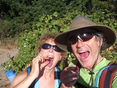
Author Jenny Feick and her husband Ian Hatter devouring Himalayan blackberries on Vancouver Island in August 2011. (Selfie Photo by Ian Hatter)
What is a Berry Anyway?
In everyday English, a “berry” is any small edible fruit. Although many small seeds may be present, berries lack the stone or pit found in other types of fruit. Most people tend to think of berries as being round, brightly coloured, juicy, a bit squishy, tasting sweet or sour, and able to be plucked off of a plant be it a forb[2], bush, or tree. People called certain fruits “berries” thousands of years before scientists developed a precise definition.
When reading botanical definitions, it helps to know the parts of a flower (modified from Geggle, Laura, Jan. 12, 2017, “Why are bananas berries but strawberries aren’t?”, LiveScience).
The science of botany defines a berry more precisely as a fleshy fruit without a stone (pit) produced from a single flower containing one ovary[3] that is superior[4]. The berry is the most common type of fleshy fruit in which the entire outer layer of the ovary wall ripens into a potentially edible pericarp[5]. Berries may be formed from one or more carpels[6] from the same flower (i.e. from a simple or a compound ovary). The seeds are usually embedded in the fleshy interior of the ovary. Berries all have three distinct fleshy layers: the exocarp (outer skin), the mesocarp (fleshy middle) and the endocarp (innermost part, which holds the seeds). The skin of the berry is its exocarp, its fleshy middle makes up its mesocarp and the jelly-like innards holding the seeds comprise its endocarp.
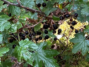
Among the wild berry-like fruits one might encounter along the GDT, crowberries, wild currants and Oregon grapes are examples of real berries[7] but many so-called berries are not true berries. This chaotic discrepancy in berry nomenclature reflects Nature’s complexity and the myriad ways plants evolved.
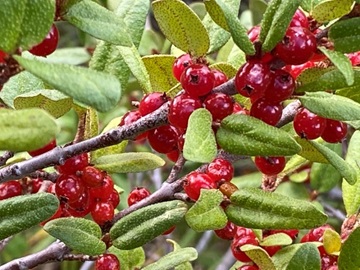
These succulent sweet-sour wild prickly currants are true berries.
When is a Berry not a Berry?
The botanical definition excludes certain fruits that meet the culinary definition of berries, including Saskatoons, raspberries, and strawberries. What people commonly think of as berries may actually be drupes, pomes, aggregate or accessory fruits, capsules, or even modified conifer seed cones. Some botanists do not even consider wild cranberries, blueberries and huckleberries to be true berries, calling them epigynous or false berries, but that’s getting really picky. Regardless, any fruit that resembles a berry in texture and form, whether it actually is a berry or not, is termed “baccate”.
To be a berry, fruits must develop from one flower that has one ovary. Certain plants have flowers with just a single ovary. Blueberries meet that criterion, as do cranberries and huckleberries. The botanists who do not consider these plants to bear true berries list another criterion related to the position of the ovary on the plant. These botanists classify true berries as the ones that develop from a single ovary that is superior, i.e., attached above the other floral parts, not below. Another characteristic of a true berry is that the fruit in question must contain two or more seeds.
Some botanists consider blueberries to be true berries and others call them epigynous or false berries.
Epigynous Berries or False Berries
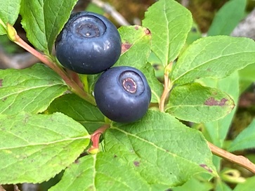
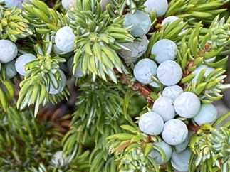
The term epigynous berries refer to berries that develop from an inferior ovary, i.e., one attached below the other floral parts. In these so-called false berries, they include tissue derived from parts of the flower besides just the ovary. The floral tube, formed from the basal part of the sepals, petals and stamens, can become fleshy at maturity and unite with the ovary to form the fruit. Wild examples include members of the genus Vaccinium (e.g., cranberries, blueberries, and huckleberries)[8].
Examples of some of the delicious edible Vaccinium species one can find along the GDT.
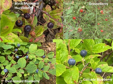
Drupes
A drupe or stone fruit is a fleshy fruit with thin skin and a hard pit inside that contains a single seed[9]. In the vicinity of the GDT, the obvious drupes you might see are chokecherries or pin cherries. However, bearberries are also drupes. The common bearberry’s (Arctostaphylos uva-ursi) drupes are dry and mealy, and each contains a stone consisting of several nutlets. Each of the juicier bright scarlet drupes of A. rubra, the red bearberry, found high in the alpine, has a single stone. The squashberry (Viburnum edule) also bears a bright red and juicy drupe that is ¼ to ½ inch (0.635 to 1.27 cm) in diameter.
Wild examples of berry-like fruit called drupes one can find along parts of the GDT: chokecherries, bearberry, red bearberry, and squashberry.
Pomes
Pome fruits are produced by certain plants in the Rose family that have a structure (the core) in which tough tissue clearly separates the seeds from the outer softer pericarp. Most common agricultural pomes (e.g., apples and pears) are obviously not berries. However, some of the smaller pomes look like and get called berries. For example, Saskatoons or serviceberries are a typical berry size and can become so soft at maturity that they resemble a berry. Nevertheless, structurally, they are pomes. When people complain of Saskatoons being mealy, it’s because of the tough core around the seeds.
These very juicy Saskatoon berries (Amelanchia alnifolia) along the GDT in the Blaeberry Valley in September 2018 each have a core like apples and pears.
Aggregate fruits
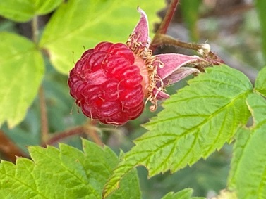
Some plants produce flowers with more than one ovary. Aggregate or compound fruits contain seeds from the different ovaries of a single flower, with the individual subunits, which are actually drupes, joined at maturity to form the complete complex fruit. Examples of aggregate fruits commonly called “berries” include members of the genus Rubus, the raspberries. Each drupe contains a seed; that’s why wild raspberries are so crunchy. Since these types of fruit consist of so many drupes, they’re called aggregate fruit. Botanically, these are not true berries.
This wild raspberry (Rubrus idaeus) is a classic example of an aggregate fruit and is not a true berry in the botanical sense.
Accessory fruits
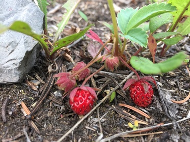
Accessory fruits are a type of aggregate fruit from a plant that bears flowers with multiple ovaries. In accessory fruits, the floral ovaries do not generate the edible part. Instead, it develops from the flower’s receptacle[10]. What is eaten is accessory tissue, hence the term accessory fruit. The wild strawberries so avidly devoured by Cliff and Davey in 1974 are perfect examples. Instead of being comprised of multiple drupes, the strawberry has a collection of little yellow ovals on its outer surface. Most people think these are the seeds on a strawberry, but they are actually modified fruits called achenes[11]. The non-fleshy aggregate of these seed-like achenes on a strawberry’s exterior is actually the “fruit”, derived from the sum total of its ovaries. The fleshy edible part of a strawberry is the accessory tissue.
What look like seeds on the outside of a wild blue-leaf strawberry (Fragaria virginiana) are actually the plant’s fruit that contain the seeds.
Surprisingly, buffaloberries also fit in this category. The fruit resembles a drupe, but in this case, the ovary matures as an achene (dry seed), and the fleshy fruit is really the swollen calyx (the sepals).
Capsules
Some types of plants produce dry capsules, which are notable by opening along three or more lines at the top of the fruit to release their seeds. Members of the Lily family produce capsules.
Berry-like Conifer Seed Cones
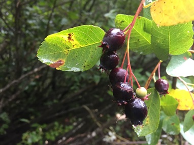
The female seed cones of some conifers have fleshy and merged scales, giving them a berry-like appearance. All three species of juniper found along the GDT[12] produce these so-called juniper “berries”, which are more correctly termed fleshy cones. Usually, one bite into one of these strong tasting and pitchy cones is enough to convince most people that it’s inedible[13].
What appear to be berries on a common juniper shrub (Juniperus communis) are actually fleshy cones.
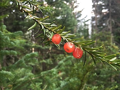
The seed cones of species in the Yew family have a bright colour when fully developed, increasing their resemblance to true berries. Instead of the woody female seed cone typical of coniferous trees, the reproductive structure of the Western (Pacific) yew (Taxus brevifolia) consists of a single seed that becomes surrounded by a fleshy, scarlet cup-like covering called an aril[14]. This bright red covering, derived from a highly modified cone scale, is edible. However, each of these mistakenly called “yew berries” encloses a very poisonous seed, which can induce vomiting, dizziness, difficulty breathing, tremors, and changes in heart rate. If untreated, it can cause death. The needles are also toxic. The bark of the Pacific yew tree provided the basis for an effective cancer treatment[15]. Pacific yew trees can only be found in a few locations along the GDT on the west side of the Great Divide.
Beware of the “berries” of Pacific yew trees. The seed inside the scarlet cone scale is lethal.
How Did Berries Evolve?
Over the millennia, flowering plants devised myriad ways to produce and broadcast their seed. Bearing fleshy edible fruit is Nature’s way to entice getting animals to consume and distribute their seeds, thus perpetuating that species.
Berries and other fleshy berry-like fruits have only been on planet Earth for the past 66 million years. The first fossil evidence of baccate fruits appeared by the end of the Cretaceous Period and the beginning of the Paleogene Period as most of the mammal species found today began to appear. Large fleshy fruits tend to be associated with moist habitats with closed tree canopies, where wind dispersal of dry fruits is far less effective. These habitat types became increasingly common during the 43 million years of the Paleogene. The associated change in fruit type may have led to the evolution of fruit eating in mammals and birds. The increasing importance of seed dispersal by fruit-eating vertebrates, including reptiles, birds, and mammals, may also have driven the evolution of fleshy fruits like berries.
Identifying the Good, the Bad and the Deadly
Many wild berries are edible and delicious (See Table 1). Others are edible but not desirable unless specially prepared (See Table 2). Others, such as baneberries and Devil’s club berries, are toxic to humans even though other mammals such as grizzly bears can eat them (See Table 3). Also, just because you have read that some First Nations made/make use of a baccate fruit does not mean it is safe for you to eat. Indigenous peoples have time-tested traditional ways to safely harvest and prepare the food. With all this in mind, here are some guidelines to follow to stay safe when foraging for wild berries.
Bring and use plant identification information when going to new environments. With the huge variety of wild berry-like fruits, identifying the species and its edibility can be challenging and even overwhelming. If you are going on a day hike or even a longer expedition on the GDT, carry a book[16] or use an app[17] with the names, pictures, and descriptions of bacciferous or baccate plants, i.e., plants that bear berries, to help you figure out which species you are observing and contemplating devouring.
Never eat a berry you can’t identify.When in doubt, don’t eat any unidentified wild berries. It is not worth the risk of getting sick for the small amount of calories in such berries. Diarrhea, vomiting, and nausea will strip you of vital fluids and sugars, placing you in greater danger than you would have been without the berries. Just because you see another creature eat a berry does not mean they are safe for humans to eat, even if that animal is a mammal. Other species have different digestive enzymes enabling them to ingest berries toxic for Homo sapiens.
Stay away from berries on plants with spines, bitter smells, or milky sap. Usually, these plants are not safe for humans to eat, including the berries. Check for: milky or odd-colored saps; berries or nuts in pods and bulbs; bitter or soapy taste; spines or small pointy hairs; pink, purple, or black spurs; or three-leaved growth pattern (like wild sarsaparilla or poison ivy).
Avoid eating white, yellow, and green berries. In most cases, these three colors indicate poisonous berries. While a knowledgeable hiker might be able to name or find some exceptions, the best approach is to avoid all white, yellow, and green berries unless you’re sure they are edible. This advice applies when a so-called edible berry is one of these colours as it indicates that it is not yet ripe. Many unripe fruits carry toxins, which dissipate once the berry ripens fully. For example, when the blue elderberries are green they contain very toxic chemicals that will cause stomach distress and even death if consumed. Even with red berries, there’s a 50:50 chance the berries are safe to eat. If you see red berries in clusters, they tend to be toxic or inedible. Solo red berries are usually okay but not always. In general, in the vicinity of the GDT, aggregated “berries” (i.e., raspberries) are safe to eat, and most blue or black berries are edible. There are, however, some exceptions such as Queen’s Cup or blue-bead lily.
Nature Quiz. Which of these berries should you avoid picking and eating while on the GDT?
Be Berry Careful!
Two Tests for Edibility
If you believe that you must eat something in a survival situation, there are two tests to check to see if a berry-like fruit is edible. Both require patience and restraint.
1. Crush the berries to test the juice on your forearm, lips, and tongue. See if the juices cause any irritation. First, crush the berry on your arm, waiting five minutes or so to see if you get irritated. Then repeat the process on your lips and gums. Finally, chew a berry for 10-15 minutes, but don’t swallow it. If none of this causes irritation, move on to the next step. Only test one berry at a time. Otherwise, these tests are useless since you won’t be able to tell which of the two berries is causing the problem.
2. Eat 1-2 berries and wait 20 minutes. Eat slowly, seeing how your body reacts. If you’re going to get sick, symptoms (see below) will appear within 20 minutes. Nevertheless, even if you feel fine after 20 minutes, keep eating slowly. Pace the berries out over a long time to prevent any toxins from gathering and give you time to adjust or note problems. If the berry tastes terrible, don’t eat it.
Symptoms of Berry Poisoning
If you insist on consuming unidentified berries, know the symptoms of berry poisoning. You could experience intense digestive disturbance and nervous symptoms. If you experience any of the following symptoms within a few hours of eating the berries, see a doctor immediately: nausea, vomiting, dizziness, diarrhea, convulsions, blurred vision, or abdominal cramps. When passing through private lands or some of the provincial Crown lands which have been sprayed with herbicide, pesticides, or other chemicals, avoid eating any berries coated with these toxins. Rinse off any berries in clean water to render them safer. Chemically poisoned berries can create the same symptoms as poisonous ones.
The Ethics of Berry Picking
Berry-like fruits have been a valuable food source for humans since before the start of agriculture, and remain among the primary food sources of other primates. No doubt about it, there is something primal about eating wild berries plumped up by the rain and warmed by the sun. Taking a berry break along the GDT can generate pure joy.
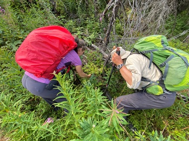
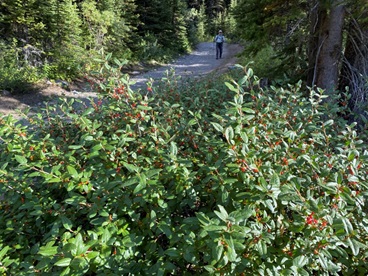
Two hungry hikers on the Numa Creek Trail near the GDT avidly picking wild black huckleberries (Vaccinium membranaceum) in August 2022.
While consuming wild berries has its benefits, please be sensitive to the whole bush or forb. These plants have just invested most of their life energy to produce these ripe and succulent fruits and they depend on the dispersal of the seeds in the berries to reproduce. Respect the plant and try to cause as little damage as possible. Indigenous peoples put in place rules and practices to respect, honour and sustain berry patches over thousands of years, a tradition we would be wise to continue.
When you gather, collect no more than ten percent or less of the berries you see in an area. Consider other hikers who may appreciate a few ripe huckleberries on their instant oatmeal the next morning, as well as all the birds and mammals that live there that depend on those berries for their survival. For example, the late summer berry season is vital for bears. This is the time they enter a state of nearly constant eating and drinking called hyperphagia to prepare for their winter dormant period. Berries offer a high-calorie and vitamin-dense food source for these foraging omnivores. Black bears need to eat up to 20,000 calories per day to bulk up before entering their dens. Grizzly bears require more, up to 58,000 calories daily. A large, male grizzly can eat as many as 200,000 berries in a single day.
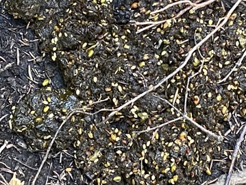
This bear scat provides evidence that plants have evolved a berry good seed dispersal strategy.
Parks Canada wildlife specialists warn that, due to the intensity of foraging in the late summer and early fall, bears are less likely to notice people nearby. This makes proven safety measures such as traveling in groups, carrying bear spray, and frequently making noise even more crucial to continued safe coexistence. When planning where to locate the GDT, try to situate the path away from dense patches of buffaloberry bushes. Trail crews will need to establish good sight lines in areas that pass through areas where buffaloberries grow. As a hiker, think twice before spending much time foraging in a bear’s favourite berry patch.
Creating good sight lines where bears frequent berry patches reduces potential bear-human conflicts.
The Future of Berries Along the GDT
Back in 1811, North West Company fur trader and explorer Alexander Henry the Younger named a river the “Blaeberry Torrent” after the abundant berry bushes seen lining its bank. These were likely huckleberries, which in Scotland, were called blaeberries. “Blae” means bluish in colour, of a dark colour between blue and grey. At that time, the Northern Hemisphere was still in the grip of the Little Ice Age, with average global temperatures dipping 1 degree C below pre-1450 levels. This resulted in exceptionally severe winters in western North America, advancing glaciers, and expansion of spruce forests and ericaceous shrubs, including the huckleberries and blueberries that the Scottish fur traders called blaeberries. Today, hikers travelling through the Blaeberry Valley to and from Howse Pass can still see the berry bushes honoured in the place name, but in recent years, one can see that many are stressed by drought and higher than normal temperatures.
Climate change affects the range of where different baccate species can live as well as wild berry production. A 2019 study by University of Calgary researchers forecasts that hotter temperatures in the Northern Rockies in Canada could lead to a troubling mismatch between bears’ peak foraging weeks and the height of buffaloberry season. Their analysis revealed that in as little as 60 years, buffaloberries could ripen as much as three weeks earlier, with these temporal shifts more extreme at higher elevations. In Banff National Park, wildlife specialists reported that the hot arid conditions in 2021 and 2022 led to an 80% reduction in the buffaloberry crop from its 2020 level. Those years also saw low production of Saskatoons, blueberries and huckleberries. This threatens the bears’ historical reliance on berries in Canada’s Rocky Mountains.
Canada buffaloberries (Shepherdia canadensis), a critical food source for bears, can be adversely affected by climate change.
As plants respond to changing temperatures by producing berries earlier, bears will have an increasingly shorter window in which to feed on one of their key food sources. They will seek out alternate calorie sources, some of which, like garbage or spilled grain on railway tracks, could bring them into life-threatening conflicts with people.
Backpacking early or late in the season further north along the GDT across the Blueberry Alpine route and by Blueberry Lake one can still capture what it may have felt like for people travelling through the Great Divide area before the period of global climate change we are currently experiencing. Appreciate the frosty nights and cold damp days, as those conditions maintain the blueberries for which the area is named as well as other berry-like fruits along the GDT.
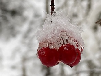
Many berry-like fruits, including these squashberries (Viburnum edule), need a frost to hasten the ripening process and make them palatable.
Species of Edible Berry-like Fruit You Might Encounter along the GDT
Family
Common Names
Scientific Name
Appearance
Taste/Texture
Fruit Type
Honeysuckle family
High-bush cranberry or squashberry
Viburnum edule or Viburnum opulus
Round shiny red to orange
Pungent, tart, soft; palatable only after a frost with one large flat seed/fruit
Drupe
Crowberry family
Crowberry
Empetrum nigrum
Globular purplish or black, growing singly along the stem or in clusters of 2-5
Thirst-quenching when ripe; can be somewhat acidic and acrid; taste better after a frost
True Berry
Heather family
Dwarf blueberry
Vaccinium caespitosum
Globular, light blue to blackish blue berries with a pale waxy coating, 6-8 mm in diameter
Sweetest, best-flavoured kind of blueberries
Epigynous Berry
Heather family
Mountain bilberry or black mountain huckleberry, black huckleberry or twin-leaved huckleberry
Vaccinium membranaceum
Large shiny, spherical, dark purple or black berries with no waxy coating
Sweet, thirst-quenching
Epigynous Berry
Heather family
Canada blueberry
Vaccinium myrtilloides
Medium sized blue berries with a waxy film that grow in clusters
Sweet
Epigynous Berry
Heather family
Low bilberry
Vaccinium myrtillus
Spherical, 5-8 mm in diameter, varying from dark red to blue-black, without a waxy coating
Juicy and sweetish
Epigynous Berry
Heather family
Oval-leaved blueberry or mountain blueberry
Vaccinium ovalifolium
Good-sized, dark blue but usually covered with a thick, waxy coating that gives them a greyish appearance
Good flavor but rot or go mouldy easily; also have coarser seeds than other blueberries
Epigynous Berry
Heather family
Bog cranberry, wild cranberry or moss cranberry
Vaccinium oxycoccus
Round to somewhat elongated, remain hard and green until after first frost when they turn red and soften
Tart with a hint of sweetness like commercial cranberries
Epigynous Berry
Heather family
Grouseberry
Vaccinium scoparium
Tiny (up to 5 mm across) bright red berries
Sweet
Epigynous Berry
Heather family
Low-bush cranberry, mountain cranberry, or rock cranberry
Vaccinium vitis-idaea ssp. Minus
Bright red berries up to 1 cm in diameter
Tart tasting and hard until exposed to frost; soft when ripe and acidic
Epigynous Berry
Gooseberry family
Northern black currant or wild black currant
Ribes hudsonianum
Oval, 7-12 mm long, black, berries covered with a whitish waxy coating and in upright clusters
Somewhat bitter and unpalatable
True Berry
Gooseberry family
Mountain gooseberry
Ribes irriguum
Round, smooth, reddish purple to deep bluish-purple or purplish-black berries in drooping clusters of 2-4
Very sour when green; good flavor when ripe but they don’t last
True Berry
Gooseberry family
Smooth gooseberry
Ribes oxyacanthoides
Round, smooth, reddish purple to deep bluish-purple or purplish-black berries
Good flavor when ripe; otherwise sour
True Berry
Gooseberry family
Swamp gooseberry or prickly currant
Ribes lacustre
Small, clustered, dark purple to blackish berries; spiny and covered with tiny stiff black bristles
succulent sweet-sour
True Berry
Rose family
Saskatoon berry or service berry
Amelanchier alnifolia
Small to large fruit; reddish-purple to dark blue when ripe
Vary from sweet and juicy to dry and quite seedy to tart
Pome
Rose family
Red hawthorn
Crataegus columbiana
Bright red fruit hangs in clusters
Mealy texture, large seeds, pleasant but bland flavour
Pome or Haw
Rose family
Black hawthorn
Crataegus douglasii
Shiny black fruit hangs in clusters
Mealy texture, large seeds, pleasant but bland flavour
Pome or Haw
Rose family
Tall strawberry
Fragaria vesca
Pink or red fruit when ripe with tiny light-coloured achenes
Soft, delicious, bursting with flavour
Accessory Fruit
Rose family
Blue-leaf strawberry
Fragaria virginiana
Globular, bright red fruit at ground level
Soft, juicy, flavourful
Accessory Fruit
Rose family
Pin cherry or bird cherry
(Prunus pensylvanica)
Slightly elongated, 8-12 mm in diameter, bright red to almost black fruits
Usually tart but not bitter; juicy, small stone
Drupe
Rose family
Dwarf raspberry
Rubus pubescens
Red
Sweet, juicy, soft, seedy
Aggregate fruit
Rose family
Creeping raspberry
Rubus acaulis
Reddish to dark purple
Sweet, juicy, soft, seedy
Aggregate fruit
Rose family
Trailing wild raspberry
Rubus pedatus
Bright red with only 2-5 druplets each
Sweet, juicy, soft, seedy
Aggregate fruit
Rose family
Wild raspberry
(Rubus idaeus)
Bright red or occasionally yellow
Tender texture, sweet delicate taste and a pleasant aroma
Aggregate fruit
Rose family
Thimbleberry
(Rubus parviflorus)
Fruit turns from green to whitish pink to bright red as it ripens; shallowly cup-shaped
Extraordinarily soft, juicy and fragile; usually sweet and tasty, sometimes dry with tiny seeds
Aggregate fruit
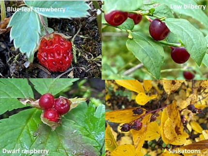
Examples of some of the edible berries you could encounter along the GDT.
Species of Berries Needing Cooking or Other Special Preparation Before You Can Eat Them Safely
Family
Common Names
Scientific Name
Appearance
Taste/Texture
Pages
Lily family
False Solomon’s seal
Smilacina racemose
Numerous mottled green and brown berries form, becoming red when ripe
Extremely sweet, like saccharin or syrup, very seedy
Capsule
Lily family
Star-flowered false Solomon’s seal
Smilacina stellate
Two to eight large berries that are green with red stripes when unripe, eventually ripening to red
Extremely sweet, like saccharin or syrup, very seedy
Clusters of tiny (1/8-1/4” in diameter), dark blue berries (or powder-blue due to whitish waxy coating)
Not overly sweet, tart, earthy, bright; over 50% of the berry is filled with its seed
Drupe
Dogwood family
Red-osier dogwood
(Cornus sericea or Cornus stolonifera)
Clustered berries are green when unripe, turning white with a blueish tinge as they ripen in August; each drupe has a small spot at the end
Soft when ripe and extremely bitter
Drupe
Oleaster family
Soapberry or Canada buffaloberry
(Shepherdia Canadensis)
Currant-sized scarlet-red or golden-yellow berries that turn bright red when ripe
Tart, somewhat bitter, an acquired taste
Accessory Fruit
Heather family
Creeping snowberry
Gaultheria hispidula
Small white, oval, slightly hairy berries
Juicy, sweet, mild wintergreen fragrance
Drupe
Heather family
Kinnikinnick or bearberry
Arctostaphylos uva-ursi
Dull orangey red to bright red, 7-10 mm broad
Insipid, dry, hard, mealy texture
Drupe
Heather family
Red bearberry
Arctostaphylos rubra
Bright scarlet and shiny when ripe
Succulent, tart
Drupe
Rose family
Sitka Mountain-ash
Sorbus sitchensis
Initially green, then orange, turning red when ripe, in flat clusters
Extremely bitter and unpleasant with a hard crunchy texture; astringent; best after a few hard frosts
Pome
Rose family
Choke cherry or wild cherry
Prunus virginiana
Red to purple or dark black, shiny, ovoid, 8-11 mm long, in long hanging clusters
Sweet but astringent until fully ripened by a frost; medium stone
Drupe
Some examples of berry-like fruit requiring cooking and other special preparation to render them edible.
Poisonous and Inedible Berries To Avoid Along the GDT
Family
Common Names
Scientific Name
Appearance
Taste/Effect
Fruit Type
Lily family
Queenscup or bluebead lily
(Clintonia uniflora)
One single egg-shaped berry (6-12 mm round), metallic dark blue in colour
Foul tasting; may cause vomiting, diarrhea, loss of appetite, lethargy, and dehydration
Capsule
Lily family
Claspleaf twisted stalk
Streptopus amplexifolius
Dark yellowish to red berries, many-seeded, oval-oblong, 10-12 mm long. Seeds about 3 mm long
Bland cucumber like taste; cathartic powerful purgative or laxative effect, causing severe evacuation
Capsule
Lily family
Small twisted stalk
Streptopus streptopoides
When ripe, each red, oval berry is up to 15 mm long
Bland cucumber like taste; cathartic powerful purgative or laxative effect, causing severe evacuation
Capsule
Aralia Family
Devil’s club
Oplopanax horridus
Conical cluster of small (about .25 inches in diameter and 4 mm long) bright, shiny, red flattened berries with pits, arranged in a large terminal pyramidal clusters. Each drupe has 2-3 seeds.
Acrid and toxic
Drupe
Honeysuckle family
Twinflower honeysuckle or black twinberry
Lonicera involucrate
Fruits are roundish or oval, shiny, black berries, paired on long axillary stalks and distinct; ripening August or September
The soft fruit tastes sweet at first but has a disgusting sour or bitter aftertaste; emetic and cathartic; the plant is notorious for absorbing toxins from the ground and nearby water
True Berry
Honeysuckle family
Waxberry or snowberry
Symphoricarpos albus and Symphoricarpos occidentalis
White, round, soft and opaque drupes, 1 cm across
Slight wintergreen flavor, spongy texture; the drupes contain two nutlets as well as alkaloids that cause mild symptoms of vomiting and dizziness
Drupe
Dogwood family
Bunchberry or dwarf dogwood
(Cornus canadensis)
The scarlet red, waxy-looking drupes are oblong in shape and displayed in clusters of 3-6 berries
The drupe is bitter, considered inedible, and will cause minor irritation if ingested
Drupe
Buttercup family
Red baneberry
(Actaea rubra)
In July and August, a red, opaque, shiny berry develops with a tiny black dot at the end. Each berry also has its own elongated thin stem.
The berries are acrid and poisonous causing dizziness, stomach cramps, headaches, vomiting, and diarrhea. As few as 5 or 6 of them can cause serious illness or death, causing respiratory distress and sending the heart into cardiac arrest.
Drupe
Buttercup family
White baneberry
(Actaea rubra f. neglecta)
In July and August, a white, opaque, shiny berry develops with a large conspicuous black dot at the end. Each berry also has its own elongated thick stem.
The berries are acrid and poisonous causing dizziness, stomach cramps, headaches, vomiting, and diarrhea. As few as 5 or 6 of them can cause serious illness or death, causing respiratory distress and sending the heart into cardiac arrest.
Drupe
Avoid eating any of these toxic berries if you see them along the GDT!
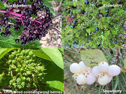
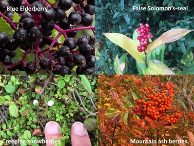
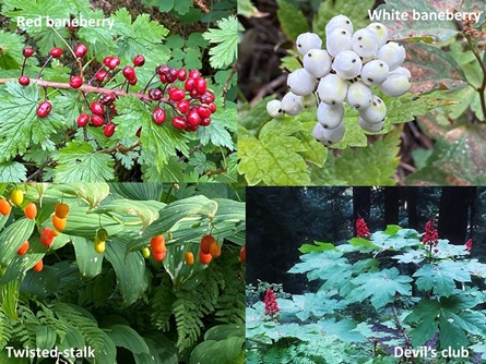
Nature Quiz Answer: Avoid eating blue elderberry drupes raw. They must be cooked first to render them safe to consume. Avoid eating any green unripe berries. While red osier dogwood berries are edible when ripe, they can cause some gastrointestinal distress if consumed in excess. Do not consume snowberries, which contain alkaloids that can induce vomiting and dizziness. The only berry safe to eat in this collage is the crowberry.
[1] See page 85 in the Second Edition of Tales from the Great Divide.
[2] A forb is a herbaceous flowering plant that is not a graminoid (grass, sedge, or rush). The term is used in biology and in vegetation ecology, especially in relation to grasslands and understory. Typically these are dicots without woody stems.
[3] In botany, an ovary is the enlarged basal portion of the pistil, the female organ of a flower. The ovary contains ovules, which develop into seeds upon fertilization. The ovary itself will mature into a fruit, either dry or fleshy, enclosing the seeds.
[4] An ovary attached above other floral parts is termed superior; when it lies below the attachment of other floral parts, it is called inferior. It has nothing to do with its quality or status.
[5] A pericarp is the part of a fruit formed from the wall of the ripened ovary. The suffix “carp” carp stems from the word “carpel,” which refers to the pistil, the female organ of the flower.
[6] Carpels are evolutionary modified leaves that bear seeds and comprise the innermost whorl of a flower. One or more carpels make up the pistil. Fertilization of an egg within a carpel by a pollen grain from another flower results in seed development within the carpel.
[7] In terms of agricultural fruits, besides currants, true berries include grapes, tomatoes, and eggplants (aubergines).
[8] Common agricultural fruits sometimes classified as epigynous berries include bananas, coffee, and members of the family Cucurbitaceae (gourds, cucumbers, melons and squash).
[9] Peaches, nectarines, plums, apricots, and cherries are examples of stone fruit or drupes.
[10] A flower’s receptacle is the thickened part of a stem (pedicel) from which the flower organs grow
[11] An achene is a type of simple dry fruit produced by many species of flowering plants. Achenes are monocarpellate (formed from one carpel) and indehiscent (they do not open at maturity). Achenes contain a single seed that nearly fills the pericarp, but does not adhere to it. In many species, what is called the “seed” is an achene, a fruit containing the seed. The seed-like form is due to the hardening of the fruit wall (pericarp), which encloses the solitary seed so closely as to seem like a seed coat.
[12] Common juniper (Juniperus communis) and creeping juniper (J. horizontalis) are shrubs and the Rocky Mountain juniper (J. scopulorum) is a tree.
[13] While juniper fruit is well known in Europe and North America as a flavouring for gin and beer and as a culinary spice, Indigenous use of juniper “berries” in Canada’s Rocky Mountains was very limited.
[14] An aril is a specialized outgrowth from a seed that partly or completely covers the seed.
[15] Taxol® (NSC 125973) Paclitaxel, the most well-known natural-source cancer drug in North America, was originally derived from the bark of the Pacific yew tree (Taxus brevifolia). Used in the treatment of breast, lung, and ovarian cancer, as well as Kaposi’s sarcoma, the estimated 5-year overall survival rates in a 2005 study published in the New England Journal of Medicine were 86.5% for the group receiving paclitaxel every three weeks and 89.7% for the group receiving weekly paclitaxel.
[16] Two useful books are Pojar, Jim and Any MacKinnon. 2013. Alpine Plants of British Columbia, Alberta & Northwest North America. Edmonton, Alta.: Lone Pine Publishers, 528 pages and Turner, Nancy J. 1997. Royal British Columbia Museum Handbook Food Plants of Interior First Peoples. Vancouver, B.C.: UBC Press, 215 pages.
[17] iNaturalist (https://inaturalist.ca/ ) and Seek (https://www.inaturalist.org/pages/seek_app)
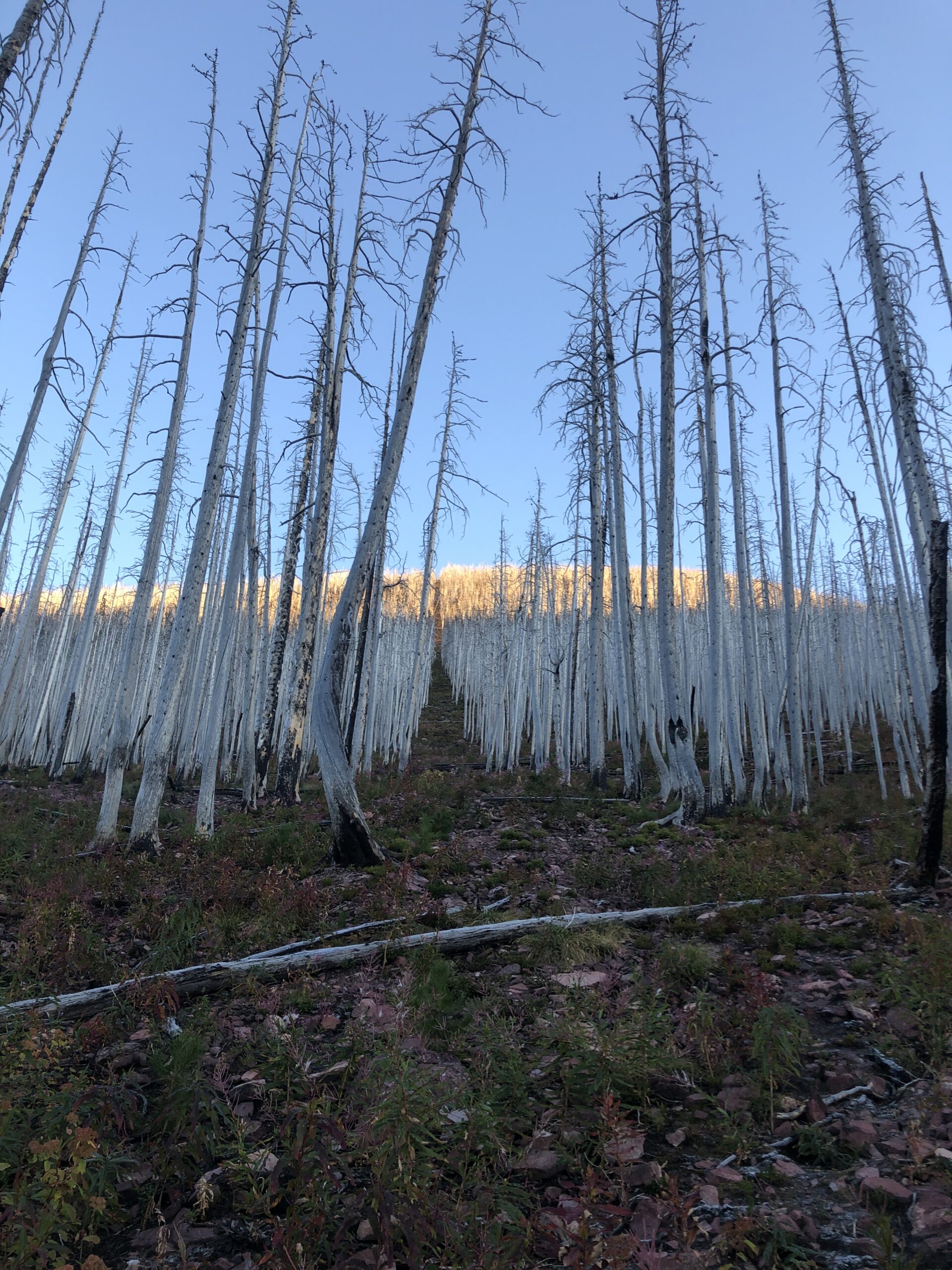
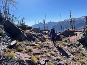
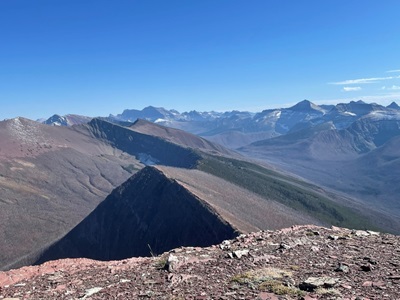
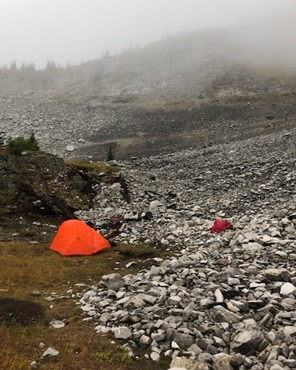
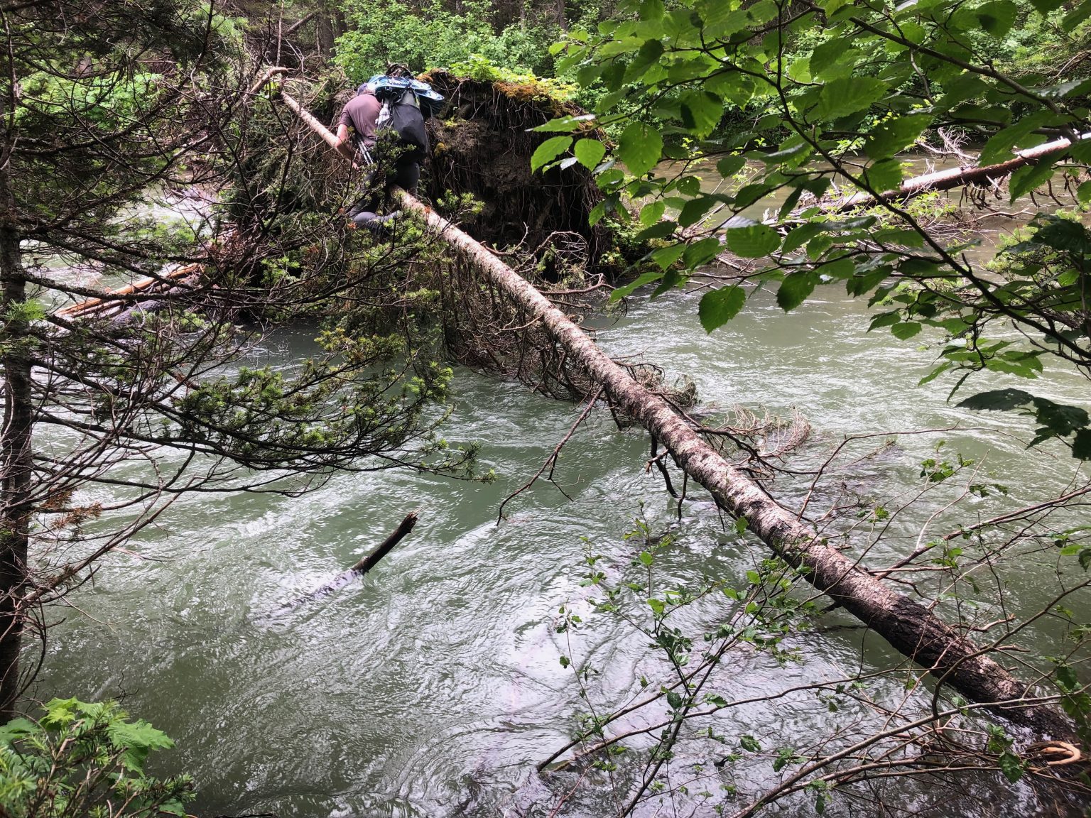
Last September (2022), mighty Lynnie Wonfor, her daughter, Zoe, and I hiked the Rowe Alternate as a weekend thru hike. We had planned to hike the last part of Section A (which we missed earlier that summer), but the weather was too good to pass up doing something a bit more interesting! And Rowe Alternate is indeed interesting! The total trip was about 30km, of which 12km was a ridge walk with spectacular views, varied trail, a few challenges, and interesting geology.
Heading out…
As an aside, if I was thru hiking Section A, I would steer clear of this alternate route if I could. As fantastic as it was, the thought of carrying an almost full backpack and sufficient water could make this day beyond challenging. We camped at Twin Lakes and so I can’t comment on the trail between South Kootenay Pass and Sage Pass. There are places to dry camp just before South Kootenay Pass but there is absolutely no water.
And it’s definitely not advisable to do this route if there is a strong wind or rain in the forecast. Most of the easy walking on the route is on the cliff edge, all good if the rock is not slippery and the wind is not trying to push you off it! Lynnie and Sophie, saw people scramble off the Mount Rowe ridge in bad weather when they hiked the normal GDT route via Lineham Ridge (which is an awesome hike in its own right).
But in September, with light backpacks, cooler weather and a blue sky, the Rowe Alternate route is the ultimate short thru hike. Our plan was to head onto the trail at Akamina Creek campsite, spend the first night there and the second night at Twin Lakes coming out at Red Rock Canyon the following morning. Total distance was about 30km, nothing too crazy for two days. Although the first day was about 19km with 1200m elevation gain, no water and more of a route than a trail. This was the perfect weekend challenge!
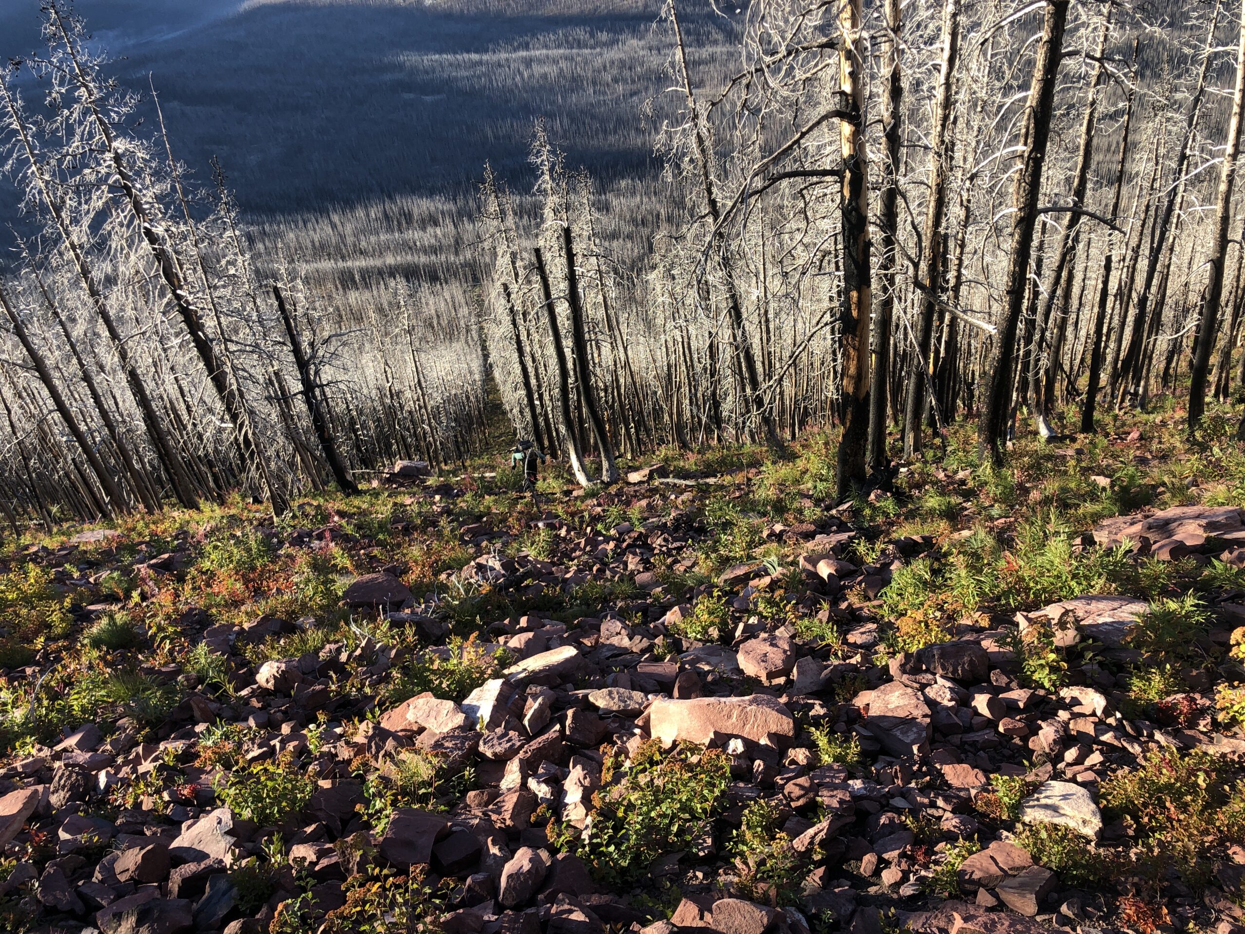
We arrived later in the day and hiked the ~2 km to Akamina Creek campsite. The campsite is fairly new; it was rebuilt after the forest fires in 2017.
The next morning, we were up in the dark so we could be off as close to 7:00 am as possible. We wanted to give ourselves at least 12 hours to get to Twin Lakes. The short walk out of the campsite to the turn off towards the ridge as the sun was rising and the air was cool, felt great. We turned toward Mount Rowe at the registration box, followed the faint trail and headed towards the thin vertical cutline, the border between BC and Alberta. You can’t miss it. This first 2 km up is hard work, but generally not scrambly. The grade is an average of 20% with some sections much higher. You need to watch where you put your feet to ensure you don’t trip over but otherwise, it’s a nice warm up!
Looking up the thin vertical cutline.
Looking down the thin vertical cutline.
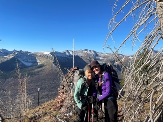
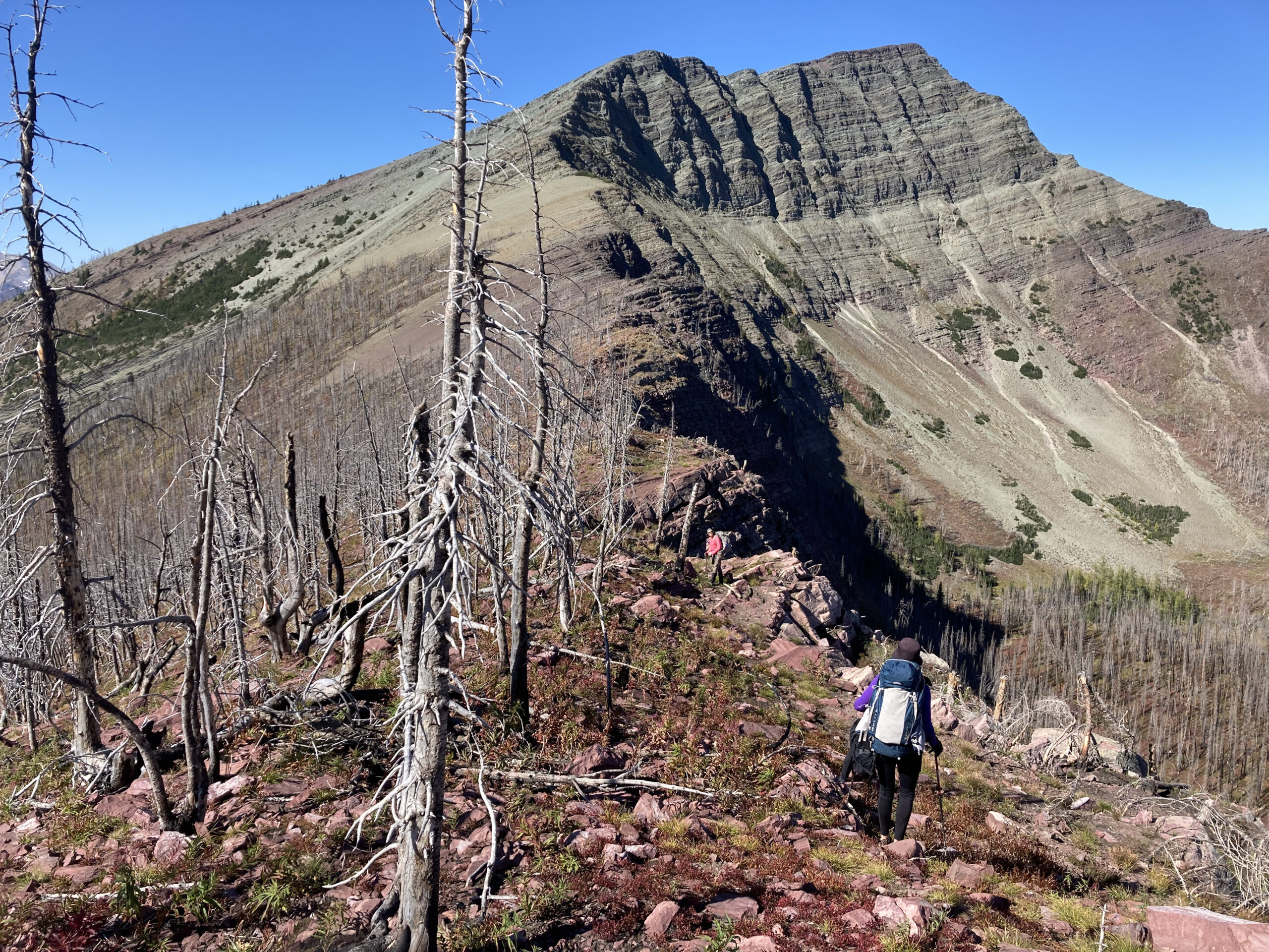
Once we reached the top, we had our first of many celebrations for the day! We were on the ridge! And now had about 12 km of ridge walking! Woohooo! And this is where the fun begins!
At the top, now on the ridge. Woohooo!
At this point, we were ready for a bit of easy walking so that we could make up some of the time it took us to hike up to the ridge. Not to be. After reaching the ridge, we were almost immediately into terrain with boulders, loose rock and thick trees to navigate. This was disappointing. But once we readjusted our mindset to slow moving, it was fantastic!
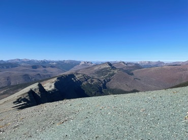
The ridge, looking north.
Photos of the ridge make it look smooth and easy walking. It’s not. The route is surprisingly varied, there were many small obstacles to navigate, which is really fun if you’re not pressed for time. At some point along the route a trail emerged. It was along the cliff edge and might be an animal trail, it sure felt like one. This is by far the easiest route to take along the ridge. The sooner you locate this, the less bushwhacking there will be. We still had small obstacles, but at least sections of the trail were relatively easy (as long as you’re okay with a cliff edge).
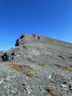
Here is a section that felt like we were walking within the crown of the ridge.
Walking on the crown of the ridge.
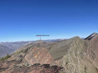
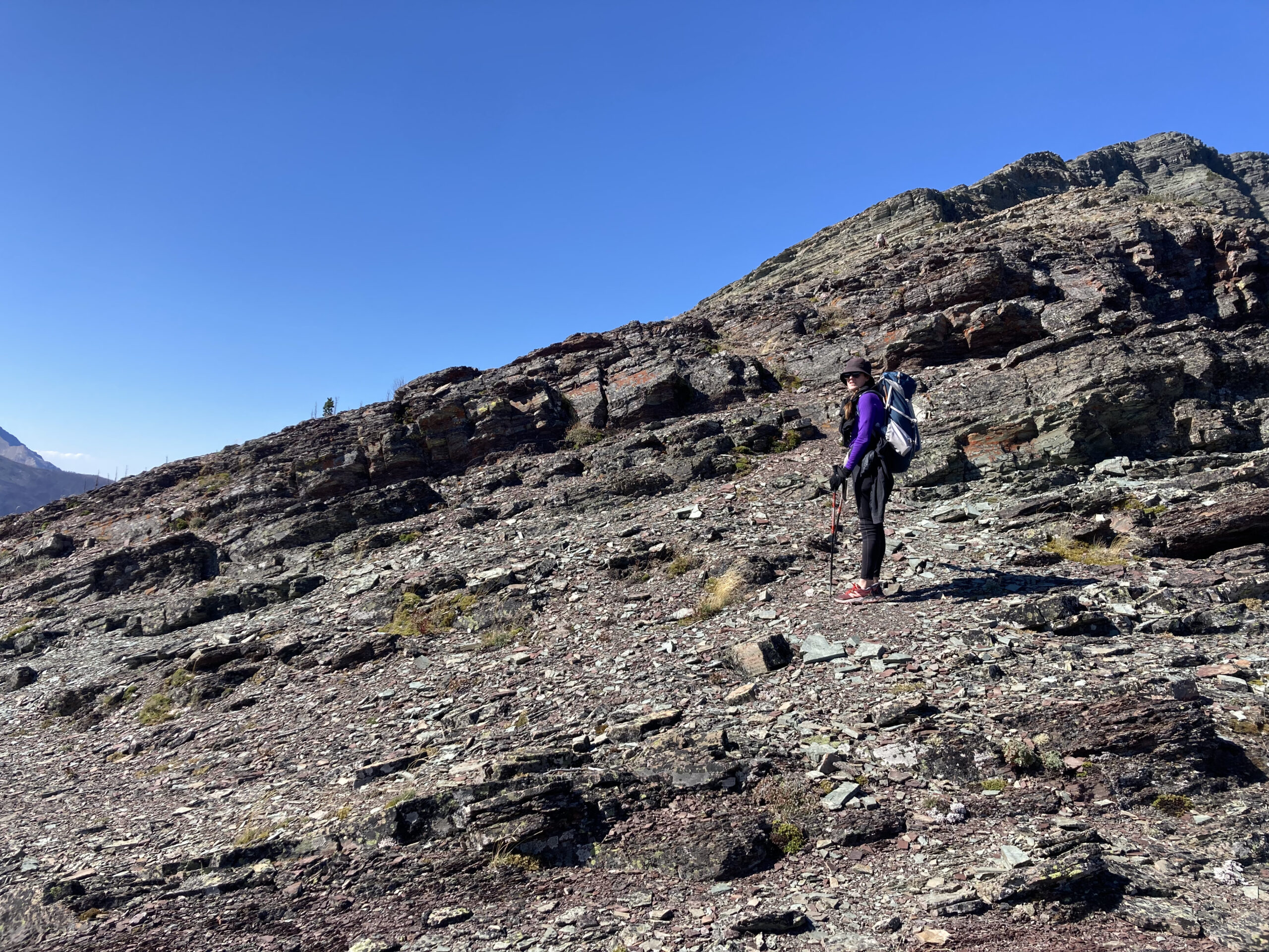
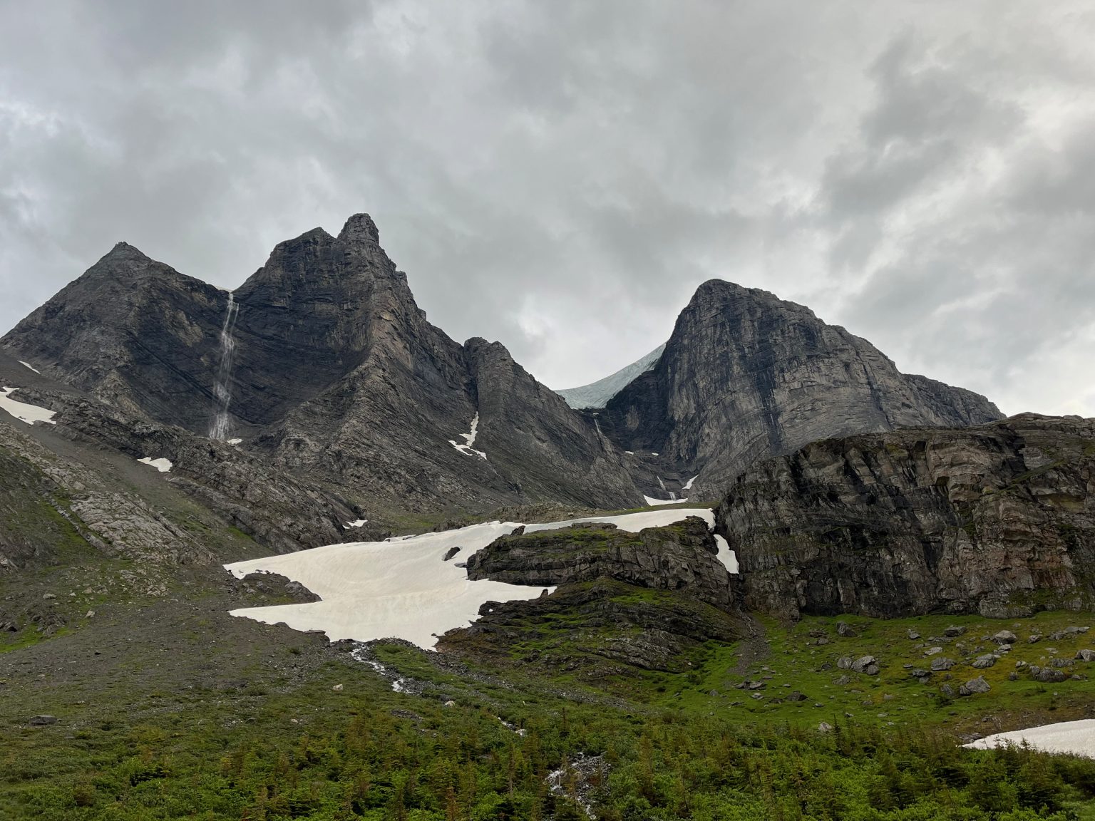
The crux of the route is Festubert Mountain, the green topped mountain in the distance. At 2,520m, it’s the highest point along the ridge and involves some dreaded scrambling in a backpack. In the end, the scrambling wasn’t that bad, it was more about the loose rock on rock which was slippery and a bit scary.
Approaching Festubert Mountain.
As we started up Festubert Mountain, we moved down the first rock band towards the left, looking for a shorter section of the rock wall that we could scramble up. If we were going to slip on loose rock on this first rock band, we didn’t want to fall far!
Zoe at the first rock band.
Once we were up this rock band and onto the slope of the mountain we felt more secure. A fall in this area would send you down on your face, not off the mountain. We worked our way up diagonally, looking for spots that looked a bit more solid than others. It becomes an easier hike as you get closer to the top.
Almost at the top.
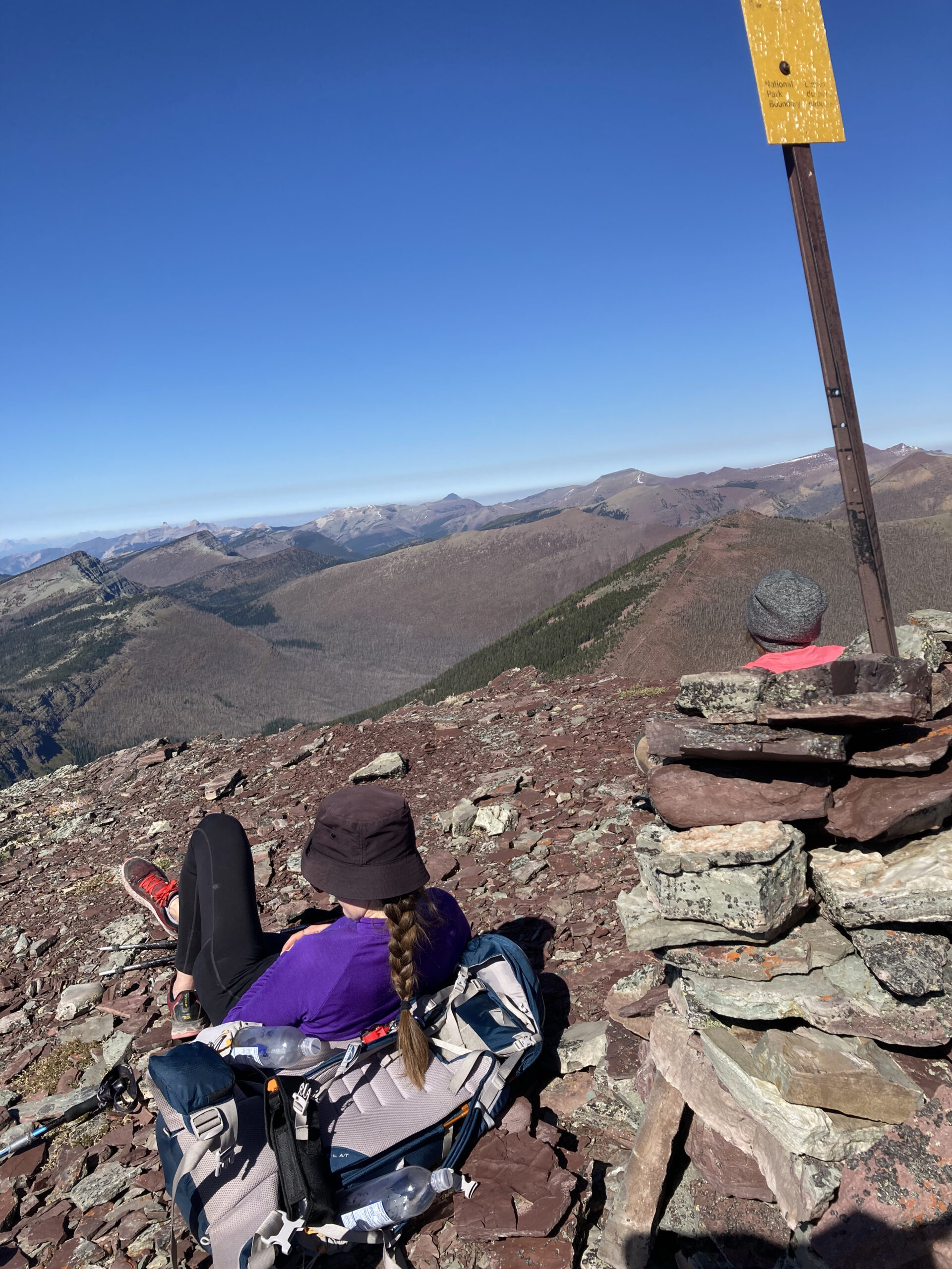
And then a rest at the top of Festubert Mountain! Here are a few shots from the top of Festubert Mountain, looking both ways on the ridge.
A much-needed rest at the top.
Looking back towards the south, where we came from.
And looking north, towards where we were going.
From the top of Festubert Mountain, there is just less than 9 km to go to Twin Lakes campground, mainly downhill. This doesn’t sound like a lot but…
I found the descent off Festubert Mountain lovely, nice soft shale that my feet could sink into.
Coming down from Festubert Mountain.
The route along the ridge continued to be slightly undulating with lots of interesting features (i.e. route finding, rocks, etc.).
More fantastic ridge walking.
Then as we got near South Kootenay Pass, the route got more treed and route finding was a lot more challenging. We got our phones out with the FarOut GDT app fired up and we used that to navigate the route down to the pass. There is a faint trail that you will want to find to get down to the pass. It’s pretty steep around here. Once in the vicinity of South Kootenay Pass, there was more bushwhacking, navigating blown down trees and stepping through undergrowth until we found the trail that took us off the ridge, down to the main GDT and Parks Canada trail. Be careful in here, the undergrowth is thick, there is no trail (or we couldn’t find it) and my inclination was to have my phone out the entire time which almost tripped me up. If you are continuing onto Sage Pass… I’m not sure how long the bushwhacking continues. Presumably there is some sort of a trail, as people do day hike to Kishinena Peak and Sage Pass.
Once we rejoined the main trail, it was very quick hiking and dare I say a bit boring after the ridge walk; the trail felt like a highway in comparison. We arrived at the campsite after sunset, had just enough time to find our headlamps! I think all told, it took us about 13½ hours.
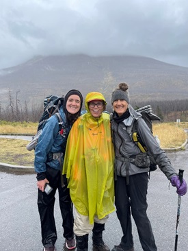
The next day, we hiked out in the rain. I had a chance to try out a lighter weight rain poncho that I just bought (3 oz lighter than my blue one). I liked wearing it (less material to get in the way), but I don’t think it takes as nice a photo as the blue poncho! Oh well… I’ve never been particularly fashion conscious and I’ll take the 3 oz savings!
Zoe, Barb, and Lynnie finishing at the trailhead in rain.
If you have tons of energy (and I mean tons of energy), you could extend this short trip by adding two epic ridge walks in Waterton to the start and finish. At the start, there’s the Akamina Ridge loop (18k, 900m elevation gain) accessible from Akamina Creek Campsite. At the end of the trip, you could add Avion Ridge to your walk out from Twin Lakes. This trail is accessible from Goat Lake campsite on the Snowshoe trail. This will add elevation and some distance, but I hear it’s fantastic!
Geartrade.ca was founded in 2012 in Okotoks, Alberta by an outdoor enthusiast and entrepreneur who saw a need for an outdoor gear marketplace. Jesse and Michelle took over the reins in 2018, and haven’t looked back!
Over the years, this local business has flourished with online sales throughout North America. However, it is still the little touches, customer service, and professional advice that matter most to the Geartrade team. They strive to take the time needed to make sure their customers walk away with the right product for their next adventure.
With a degree in EcoTourism and Outdoor Leadership, Co-Owner and operator Jesse Hebenton, has an extensive background in the outdoor field both in retail and as a guide and outdoor facilitator. But at the end of the day let’s face it, he’s a big time gear junkie. Jesse’s wife, Michelle, had been doing the bookkeeping while on maternity leave for their two kids, and joined the business full-time in the summer of 2022! She brings her background in business and love of adventure along with her – but she is a rookie when it comes to gear knowledge, so leave those hard questions to Jesse!
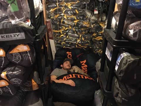
Jesse taking a little break with Rigs, who’s employee of the month, every month. Originally they ran the business from their house, and this was a little peak at the basement.
Together their mission has been and continues to be simple, they want to provide outdoor enthusiasts with the best marketplace to buy brand name, high quality gear. Recently they have been expanding their gear selection in the Ultralight category! Geartrade.ca now houses some of the top brands in the ultralight hiking market, some of which you can’t find anywhere else in Canada! They also love carrying some of the smaller cottage companies that are producing some incredible technical gear, on a smaller scale.
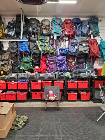
A little snap shot from 2019 of their second location which was operated from the garage. Soon after moving in they had another member join the team.
Geartrade.ca has recently moved into a full retail location, thriving in the heart of Okotoks. Despite this exciting growth and change, their unwavering commitment to providing exceptional customer service remains steadfast. Jesse and Michelle have a deep-rooted dedication to making every customer experience a memorable one. This approach is what sets their business apart.
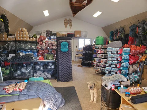
In 2020, they outgrew the garage and moved into a small shop space on an acreage.
The GDT is on the hiking wish-list for both Jesse and Michelle, but until then, they love to support the GDTA by donating a portion of their proceeds from their annual Geartrade.ca Advent Boxes! In addition to that, the geartrade.ca website hosts the GDT Store where you can purchase Official GDT merch. Those sales directly support the GDTA!
A message from Jesse and Michelle:
“To all of the customers we have already had the pleasure of meeting, thank you for the support and continuing to trust us with gear advice for your upcoming adventure. And to those who are new to our shop, we can’t wait to meet you or chat about your next trip. Happy trails!”
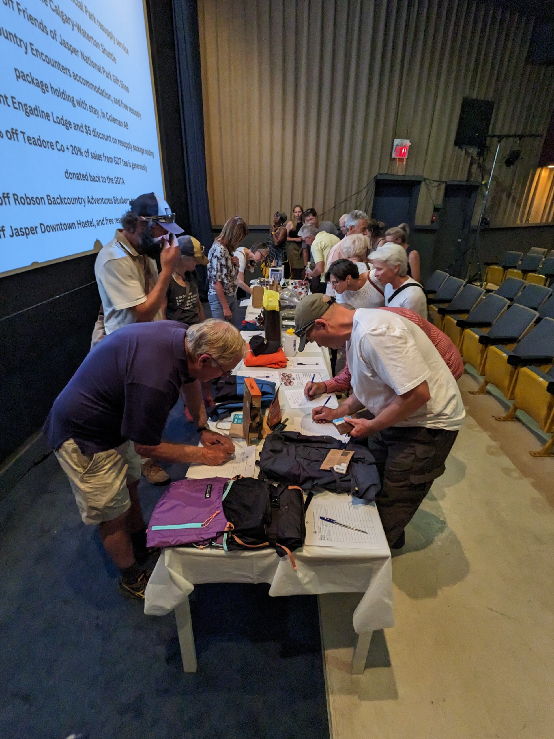
The Great Divide Trail Film Fundraiser, brought together outdoor enthusiasts, and supporters to raise funds for the preservation and promotion of the Great Divide Trail (GDT). With a total of 178 in-person attendees and an additional 128 online participants, the event proved to be a remarkable success, generating $9,000. The film titled OUT THERE: A Great Divide Trail Documentary by Wilderland Media, not only showcased a captivating film but also served as a platform to create awareness about the GDT and its significance.
The Globe Cinema, located in Calgary Alberta, served as the in-person venue for the Great Divide Trail Film Fundraiser. As doors opened, attendees eagerly gathered, excited to embark on a visual journey through the stunning landscapes of the Great Divide Trail. The cinema’s atmosphere buzzed with anticipation as guests mingled, visited the silent auction table, and shared stories about exploring the great outdoors.
Silent auction
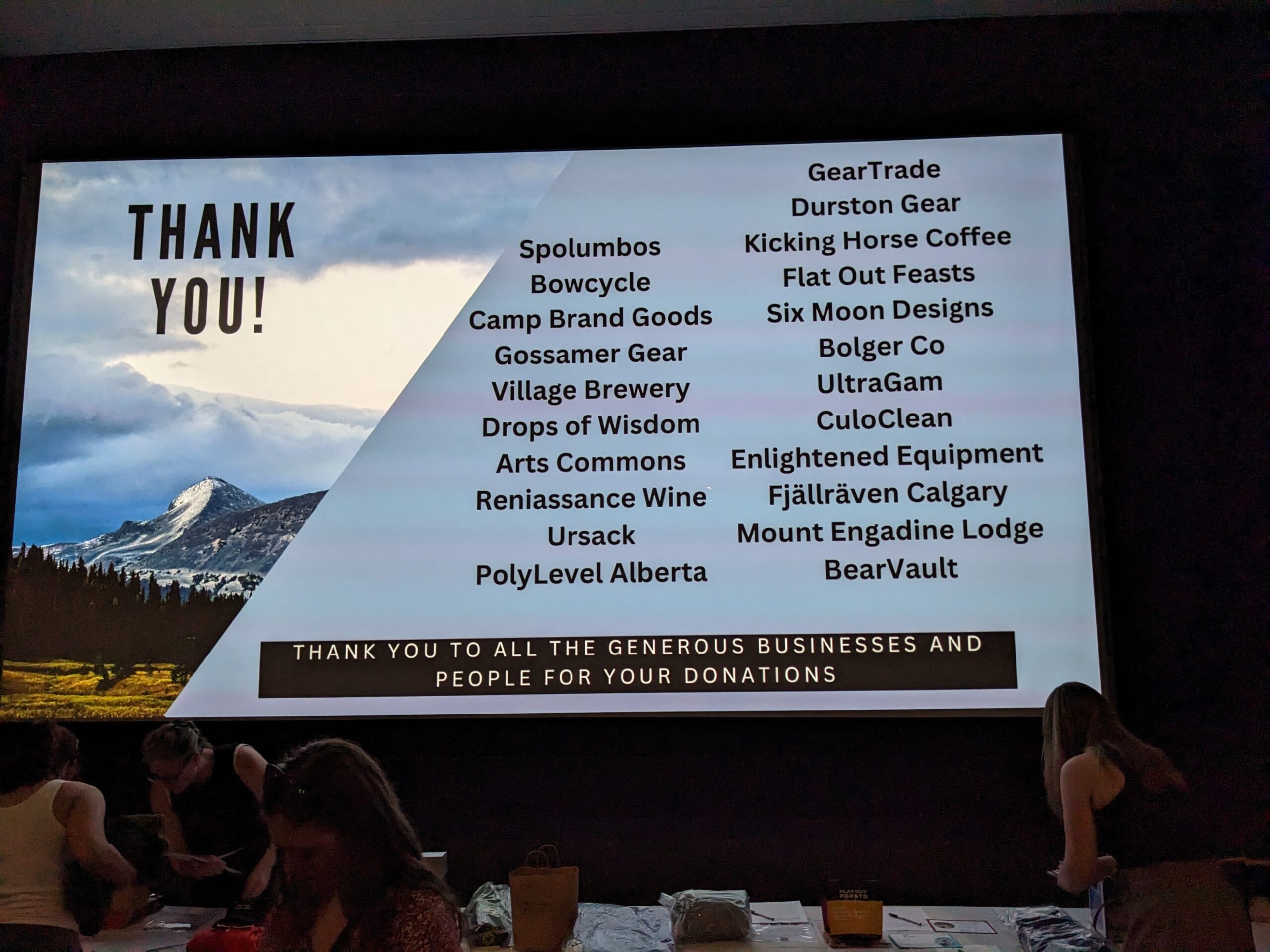
The event kicked off with a silent auction featuring items from many *generous businesses such as GearTrade, Flat Out Feasts, and Mount Engadine Lodge. The silent auction was responsible for raising $3,000, which was a significant portion of the total event income. A big thank you goes out to these amazing businesses!
Silent auction donators
Before the film, the GDTA organizers gave an introduction including a land acknowledgement, and expressing gratitude for the attendees’ support, and to the businesses for the silent auction donations, and to Wilderland Media. The film screening that followed showcased a selection of awe-inspiring scenic frames that captured the trail’s beauty, challenges, and the experiences of those who had traversed it. After the film there were door prizes, and time for any last bids on the auction.
Film introduction
Recognizing the need for inclusivity of the out-of-town GDTA supporters, the GDTA also hosted an online component of the event. Wilderland provided private YouTube links to the online viewers to be able to view the film for a 48-hour time period at home, allowing individuals from all around the world to participate in the fundraiser. The GDTA has members from all over the world, and Board and Committee members from across Canada and the US, so this hybrid event model was a perfect fit.
Wilderland Media, comprised of a husband and wife duo (Ryan Brown and Ilse Praet), hiked the Great Divide Trail in 2022, filming as they hiked. Many of the film viewers asked if they had anyone along with them to film, and the answer is no, they filmed it all themselves! Before embarking on their journey, Ryan and Ilse had contacted the GDTA to ask if there was anyone in the Association who was willing to be interviewed, or provide photos for the film. It was through these conversations that the Film Fundraiser idea was born.
The Great Divide Trail Film Fundraiser was a remarkable event that brought together outdoor enthusiasts, and supporters to celebrate and support the Great Divide Trail. The funds raised will contribute to the preservation and promotion of the trail, ensuring that its beauty and significance are appreciated by generations to come. This event serves as a testament to the power of community and collective efforts in safeguarding our natural treasures.
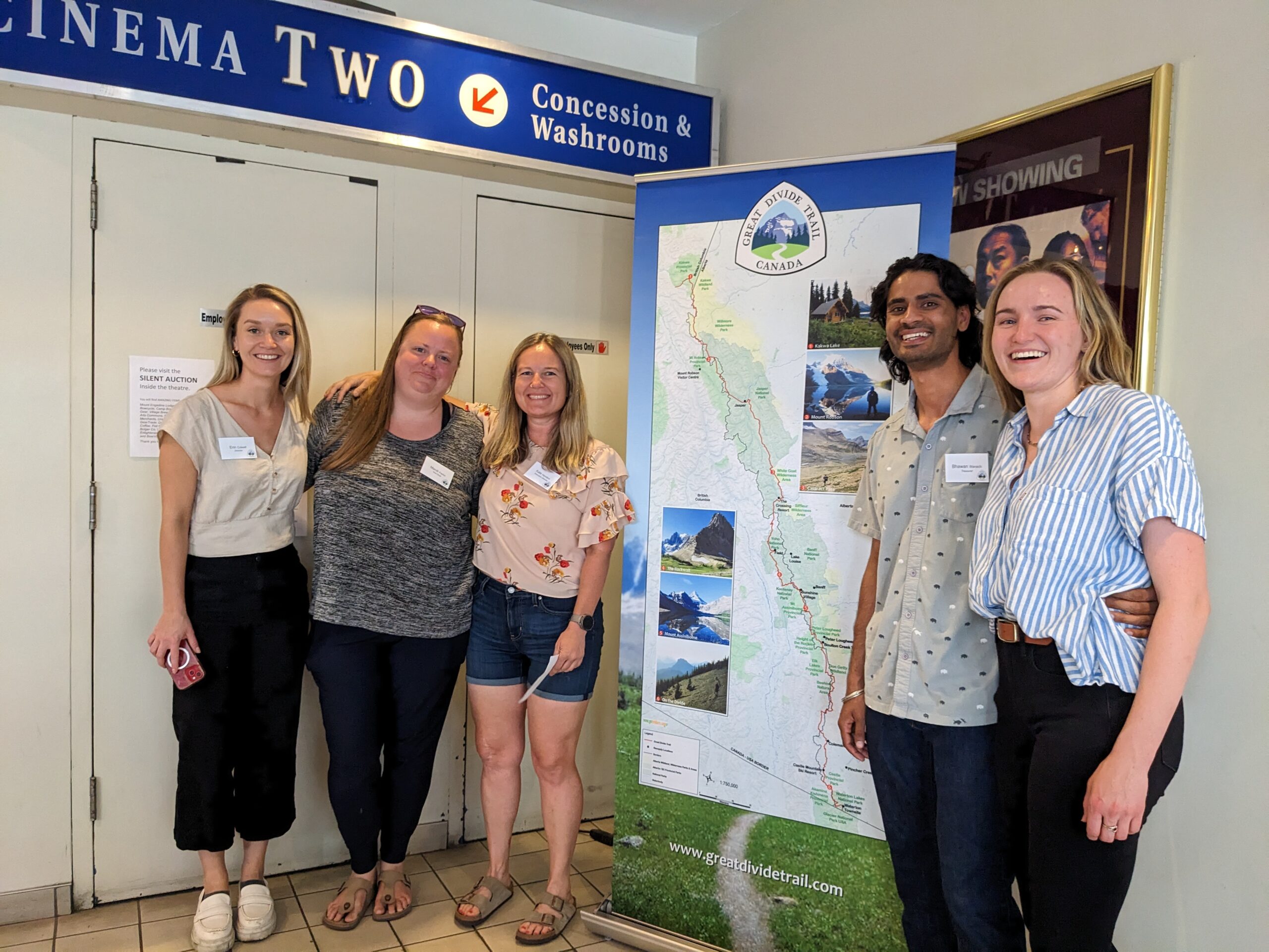
The event crew – Erin, Mandi, Kate, Bhawan, and Shannon
Wilderland Media will be offering the film to view (for purchase) on their website.
*Generous businesses who supported this event through silent auction donations: Mount Engadine Lodge, Spolumbos, Bowcycle, Camp Brand Goods, Gossamer Gear, Village Brewery, Drops of Wisdom, Arts Commons, Renaissance Wine Merchants, Ursack, PolyLevel Alberta, GearTrade, Durston Gear, Kicking Horse Coffee, Flat Out Feasts, Six Moon Designs, Bolger Co, UltraGam, CuloClean, Enlightened Equipment, Fjällräven Calgary, and BearVault
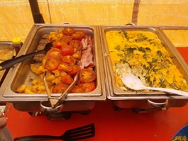
Oftentimes while summer hiking, I find myself craving something cold, something fresh, something crunchy – something “salad-y”. While I have been known to stuff my pack and lug around heavy tomatoes, cucumber and peppers to get my fix, with a bit of trial and error and my trusty dehydrator, I’ve found that a cold soaked couscous or quinoa salad can usually satisfy my craving, while also making for a quick and fuss free lunch. Typically, I’ll mix the dehydrated salad and cold water into a Hydroflask or Mylar bag before setting out for the day, allowing the salad to soak for a few hours while I hike.
This is one of my favourite dehydrated meals that allows for a lot of wiggle room in the recipe to add or omit different ingredients to keep things interesting while out on the trail. Feel free to follow this recipe as it is, or use it as a loose guideline to create your own unique dish that suits your own palate and adheres to any dietary restrictions or preferences that you may have.
When making these couscous bowls, you can dehydrate each individual ingredient separately and then divide all ingredients into four servings; alternatively, you can mix all ingredients together before dehydrating (I find this to be the easiest way to go). If you choose to dehydrate each ingredient on its own, it is best not to chop the spinach or basil. Instead, dehydrate whole spinach and basil leaves and once they’re dried, crumble them with your hands. For a bit of extra delicious fat, add some crumbled feta cheese and a drizzle of olive oil to your prepared meal once it’s time to eat. Enjoy!
Cold Soaked Couscous Salad
Yield: 4 servings
Ingredients:
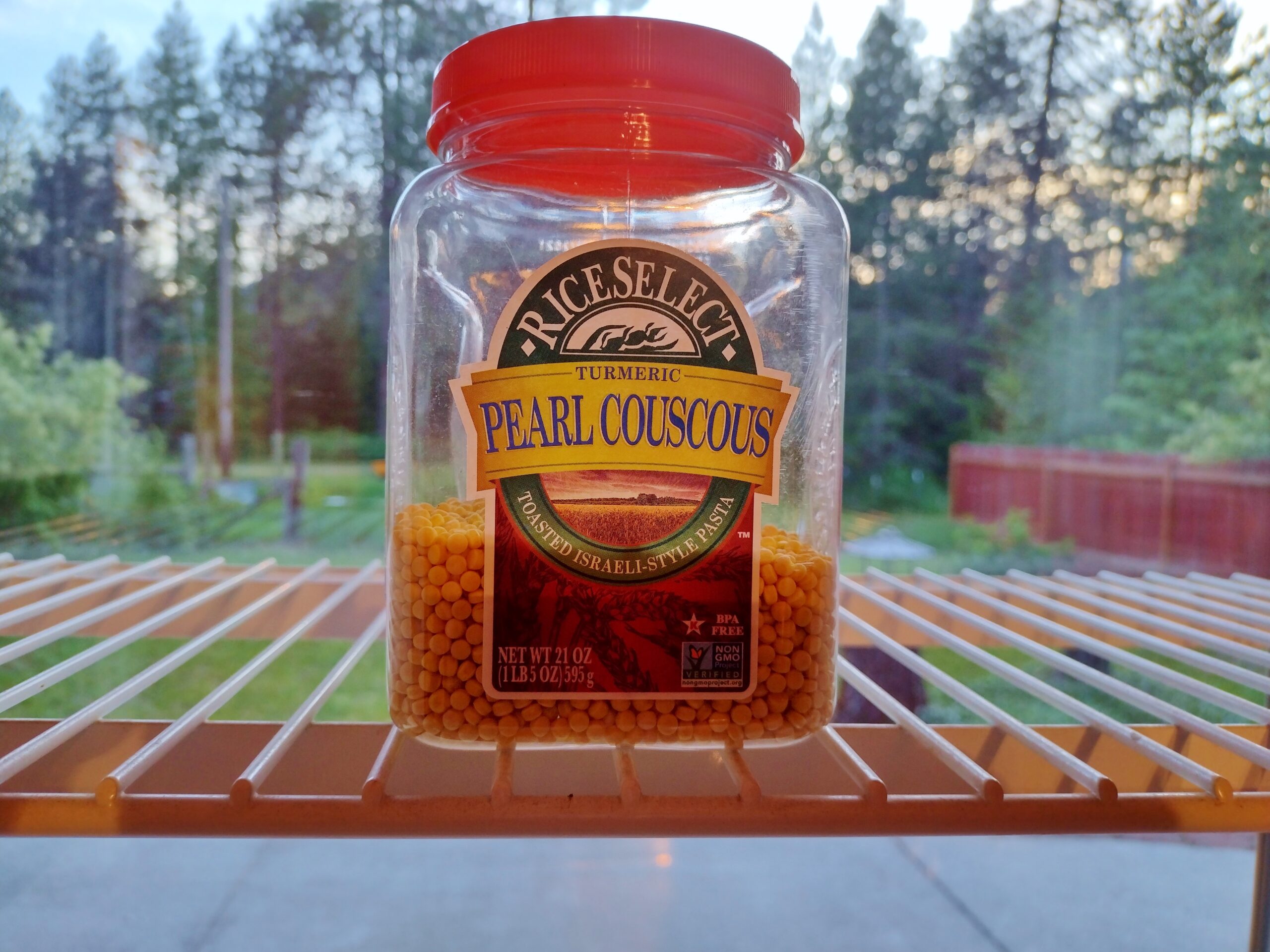
1 cup uncooked couscous, medium grain*
1 cup tomato, chopped**
1 cup cucumber, finely chopped
1 cup spinach, finely chopped
1 cup zucchini, finely chopped***
3/4 cup black pitted olives, thinly sliced
1/2 cup red bell pepper, finely chopped
1/2 cup orange bell pepper, finely chopped
1/2 cup yellow bell pepper, finely chopped
1/2 cup red onion, thinly sliced
5 or 6 large basil leaves, chopped
1 tsp Italian seasoning
1 tsp garlic powder
1/2 tsp sea salt
1/2 tsp fresh ground black pepper
*for an extra punch of flavour and nutrition, cook your couscous in chicken or vegetable stock instead of water **sun-dried tomatoes are also yummy, if you have them on hand ***zucchini can be raw or roasted
I just wanted to send a “thanks” to the GDTA for your work on the “High Rock” trail. This September I did the southern section of the GDT, starting at the U.S. border in Waterton and finishing at Spray Lakes / Shark Mountain in Kananaskis… around 380 km in all. I did it in one push (no food drops along the way). Took along enough food for 3+ weeks but made good time and finished in 16 days. A couple of rainy days and a bit of new snow on one higher section north of Castle Mountain, but other than that glorious fall weather with the larch trees in full golden colour.
Looking north toward Racehorse Shoulder
Camp north of Racehorse Shoulder
Doing the southern section of the GDT has been on the radar for a while now. Back in the mid-1970’s a friend and I did what was at the time the newly proposed Great Divide Trail, (I remember there being a short write-up at the back of the old Canadian Rockies Trail Guide), starting in southern Banff and hiking northwards to Jasper. As the trail does now, we mainly made use of established trails in national and provincial parks, but also had to do a bit of challenging cross country hiking leaving Yoho into the Blaeberry River valley and up to Howse Pass. We got as far as Jasper townsite but never did the final connection up to Mt. Robson… a good adventure for a couple of young guys still in their teens. Quite a bit different back then; no need to make advance reservations for campsites, no need to stick to a set itinerary, random camping in lots of places where it’s now forbidden.
With a good weather forecast this fall I decided that it was time to give the southern section a look, especially as there was now a shiny new trail from Coleman north, avoiding plodding along roads and ATV trails up the Elk Valley in BC where the trail used to go. The work you guys did on building the High Rock Trail was amazing! Expansive views, lots of challenging ups and downs, still a few places where a close eye on navigation was needed, a few challenging creek crossings, but all in all a great adventure on newly constructed trails. I was hoping to meet a few people along the way, but was quite surprised that I met only ONE other GDT hiker the whole time I was out (and that was in Peter Lougheed Park only a few kms from the road). Other than that, the only people I saw were day hikers the first couple of days in Waterton and in places with road access like around Coleman and near Kananaskis Lakes. Only one bear sighted but lots of signs; diggings in almost all high meadows, lots of scat and tracks. I did a lot of yelling and singing as I went along and kept the bear spray close at hand. I tried to camp up high as much as possible, sometimes carrying water from a lower creek to get to a nice spot above treeline up high.
Fording River Pass
Very re-assuring to see GDT markings after a faint section of trail
Looking at the GDT website it seems there are a fair number of people now doing the trail; interesting to read their accounts and see how fast they are doing it. On the other hand, if and when I do the final section from Jasper to either Mt. Robson or Kakwa, I think I will log in and claim the record for the longest time taken to complete the GDT. Back when I started backpacking with Mom, the second trip we ever did was to the Egypt Lake area via Sunshine Village and Simpson Pass in the summer of 1972 when I was 13 years old. That trip covered a section of what became the GDT and I’ve been back there many times since.
If I use the trip in 1972 as the first time I hiked on the GDT, this year marks my 50th anniversary on the trail; I’d be surprised if there are many other GDT hikers who can claim that level of longevity (and lack of speed). If I finally finish Section F north of Jasper, it will be at least 51 years; not sure if that’s a record to be proud of (or that others will be keen to try to match). However, you never know… still lots of greybeards out there and there may be a few others who have been at it just as long as I. Although nowadays I sometimes feel old as I watch the younger generation(s) blast by on the trail.
Then and now! Backpacking with Mom on the Egypt Lake hike in 1972 — external frame pack, open cell foamy, running shoes, blue jeans. Me 50 years later in the burned area of Waterton NP. (the hair style is remarkably similar)
Once again, thanks to the GDTA for all the work you have done trail building; I often thought of you guys toiling away as I cruised along on the new trail, admiring the skill and perseverance that went into opening up such a wonderful route.
The concept began in 2003 while two hikers (Dan Wallace and Wayne Marshall) were walking the Great Divide Trail (GDT) when it just disappeared. The pair had spent many of the previous summers hiking The Trail and decided losing The Trail was a sign – it was time to ‘give back’. The need was obvious – the existing Trail required maintenance. These Trail hikers pivoted to become Trail maintainers.
1996 Dan and Wayne – first GDT trip
With no experience, no money, no tools or equipment – only an idea, the pair spent the winter of 2003 researching and reaching out which culminated in the organizing and implementation of a Trail maintenance ‘trip’ in 2004. The intention was to interest like-minded people in volunteering to come on a few-day trip to camp on the Great Divide Trail and be willing to work. This would include using specialized tools and equipment to cut and remove deadfall, repair The Trail tread, clear the corridor, blaze The Trail and connectors, and replace or build log bridges.
2004 Trail maintenance
The 2004 Trip was unique:
It was the first of many annual trips reviving the Great Divide Trail that was built in the mid 1970’s.
It was scheduled to be ten days, two weekends and the week in-between.
It had ‘organization’ support (Alberta Wilderness Association), some financial assistance from a private donor and a sponsor (Stihl).
Trail maintenance tools and equipment were borrowed.
It had a ‘camp’ set up near Perky Perkinson’s cabin in the Cataract Creek Valley.
Since the campsite had no road access, an outfitter with pack horses was used to transport the required camp gear, tools, equipment, and supplies.
Ten volunteers and a horse were the crew. They backpacked their own personal gear to and from the camp.
A cook planned the breakfast, lunch, and dinner menus; purchased the food, prepared and cooked the meals over a campfire along with a two-burner camp stove.
Perky Perkinson’s Cabin 2004
Crew 2004
It is the Longest Running GDTA Trip
The success of the inaugural Trip led to subsequent annual Trail maintenance trips. These were usually held at different locations along The Trail with some being for specific purposes, for example bridge building.
These early trips introduced hiking enthusiasts not only to the beauty of the Great Divide Trail but also to its remoteness and ruggedness. It gave them an opportunity to not only hike but also work on The Trail therefore appreciating the efforts of those Trail maintainers and builders who came before them. These trips initialized a community of like-minded people. Many of these came back many times to become veterans acquiring skills and expertise which they willingly shared with new recruits. Some were so motivated by their experience they continued to give back by becoming Great Divide Trail Association (GDTA) Board and/or Committee members.
These trips continued, with the latest being held in 2022, however there were some interruptions along the way including a forest fire, a flood and a pandemic.
It Evolved
Over the years, with increasing membership, sponsorship (funding) and experience, the annual Trip developed, matured. and grew. The first Trip was born from a perceived need and has grown into a vital component of what the GDTA does. Every Trip was an opportunity to learn through experience and feedback from volunteers with the intention of making the event more efficient, enjoyable, comfortable, and memorable.
The pair of lost hikers – Dan and Wayne, morphed into a group – the Friends of the Great Divide Trail. It was highly recommended the group not be formally recognized for political reasons however, it would not last. One year, while attempting to get a Trip permit, a pointed comment from a government agent told the group “to grow up” which inspired the reactivation of the Great Divide Trail Association in 2013.
The appetite of thru-hikers and new members encouraged the creation of the GDTA website and more. Social media and the increased workload revealed the need for committees. With the formation of GDTA committees, the Trip became the responsibility of the Trail Building and Maintenance Committee (TBMC) always with a desire to improve/enhance Trip working and living conditions. Trip leadership roles and responsibilities were identified: Trip Coordinator, Trip Manager, Safety Officer, Camp Manager to name a few. Trip participants signed up for camp positions/tasks. Thus everyone contributed.
The ‘realignment’ of The Trail from the British Columbia side to the Alberta side, creating the High Rock Trail, resulted in big Trip changes one of which was converting from Trail maintenance to Trail building. The TBMC decided one Trip a year was not sufficient to construct the new Trail in a reasonable amount of time therefore more trips were added. As a result, in 2015, the original Trip became named – The Signature Trip; referring to “something that serves to be set apart or identify” (Merriam- Webster). It is important to note the Signature Trip birthed the many ‘specialized’ trips that are common today.
What started with ten adventurous people offering to maintain the Trail is now a Signature Trip with twenty energetic Trail builders and supporters.
In the beginning people sat on logs around the campfire. Now, with transport, volunteers can relax in their own comfortable lawn/camp chairs while sharing their stories.
2009 – Logs around the campfire
Transport
2019 – Campchairs around the campfire
If one felt a need to wash/bath, a clean mountain lake or a pool in a cold stream was usually available (it was also a fridge).
Clear mountain lake – brrrrrrr……..
Cold streams make good refridgerators
Now one can choose a warm shower (solar heated) in a private, tarp-walled, stall.
Solar heated shower bags
Shower
Since water is a necessity for drinking and food preparation, the camp was normally located near a stream enabling volunteers to haul water in barrels and pails. Now a solar panel charges a battery powered electric pump providing ‘running’ water almost to camp – still a work in progress.
A filtering system was also devised for drinking water.
Left – Bringing water to the campsite Right – 2022 – Water filtration system to go with the new water pump
Volunteers slept on foamies in personal tents that were initially backpacked in. Now with ATV support some choose to sleep in larger tents allowing a person to stand to put on work clothes or bring a folding cot.
Large tent courtesy of ATV support
And cot also hauled in on the ATV
When it rained, campers huddled under tarps tied to the trees, next it was a car shelter, then it was two. Now people meet and dine comfortably in walled, heated, canvas outfitters tents.
2010 – Commons shelter
2011 – Commons shelter
2018 – Commons shelter
2022 – Commons shelter
From day one, feeding the Signature Trip crew well, was a priority. The cook planned menus, purchased the food which was organized and packed for shipping to the campsite.
Shopping for food (top); Organizing and packing food (bottom)
Initially cooking equipment was primitive but effective and efficient. The cook and helpers prepared the food to be cooked on Coleman stoves and the campfire.
2009 – Burgers grilled over the campfire
2009 – Cooking on the Coleman stove
Meals on the campfire
Over time, the Colemans (the stoves, not the people) were replaced with a heavy-duty propane camp stove, and then two.
2010 – The heavy-duty propane stove
2014 – Two heavy-duty propane stoves
And then supplemented with a BBQ to keep the prepared food warm. One year, a beef roast was cooked in the BBQ.
Full blown propane barbeque
In two of the latter years, workers had the fortune of enjoying their meals created by a backcountry chef who used chaffing pans.
2021 – Meal prepared by the chef
And of course, steaks by Lianne and Dan.
2009 – Yummy steaks over the fire (top) 2022 – Personalized steaks on the barbeque (bottom)
In the early days, food was eaten on ‘paper’ plates with whatever utensils each of us brought with us. Today, camp drink and food are provided in/on re-useable cups and plates along with real utensils.
2022 – Real plates, cups, forks, knives, etc.
Some participants have more of a food ‘experience’.
Digging right in, Ah, to be young again…
An outdoor portable/folding kitchen pantry provided a workspace, a storage area for pots and pans, and even a sink.
2010 – Portable outdoor kitchen
Of course, what goes in must come out. As the book (now in its 4th edition) says, people had to learn “How to Shit in the Woods”. Over the years, the latrine also advanced. From a cat hole with a strategically placed log, to several logs to give elevation, to 2 x 4’s appropriately and securely stacked topped by a toilet seat, to a luxury commode complete with a roof, and all with an open-air view. The latrine is a defining structure for the Signature Trip.
Commode evolution
It is a Learning Opportunity
Since its inception, the Signature Trip was designed to be a learning opportunity. The Trip, with its experienced leadership, offered knowledge and safety for people who may never have backpacked and camped in the bush overnight. Participants, with the guidance of mentors, experienced the rigours of setting-up and taking-down the camp. At the end of a hard day’s work, volunteers tasted the nutritious meals that they did not have to plan, purchase, or cook even though they helped prepare or cleaned up.
The Trip supplied unfamiliar tools along with the training and opportunity to learn their safe use, some even being taught how to use trail building and maintenance power tools. A few seized the opportunity to ‘scout’ the new Trail route.
2014 – Trail maintenance tools
At the nightly campfire, after a traditional knot tying session, volunteers learned, from others, about their hiking adventures all over the world. As an experiment at the 2022 Signature Trip, participants also had the chance to discover where they were camping by interpreting a topographical map and competing against other teams to locate geocaches.
Knot tying session
It Builds Community
The Signature Trip typically attracts, due to the reasons above, participants that are ‘new’ to the Great Divide Trail. They may have heard of it, or even walked on parts of it. Most have little to no experience backpacking and camping in a remote location but are open to the possibilities.
Some volunteers return to the Signature Trip many times. Signature Trippers discover ‘community’; they find like-minded people with stories and experience to share, outdoor enthusiasts wanting to give back, adventurists who are looking for excitement and a challenge. Instructors and learners. Knowledge and skill. Practice and expertise.
Many first timers chose to re-live the exhilaration and come back on this or other types of GDTA trips thereby creating a community supporting each other to achieve a common vision.
It Has Tradition
Since 2004, what is now called the Signature Trip has been held almost every year, with some exceptions. The Signature Trip introduced many to the Great Divide Trail, its supporters and promotors, its community, its sponsors. The Signature Trip has become a tradition for the Great Divide Trail Association.
At the conclusion of the Signature Trip on the way back to Calgary it has become a ritual for the tired and dirty volunteers to convene at the Black Diamond Bar and Hotel pub to celebrate their Trip achievements.
2010 – Annual after party at Black Diamond Bar and Hotel pub
Is it a Brand?
If an organization’s ‘brand’ has these features: memorable, defining, unique, long lasting and mass recognition perhaps the Signature Trip has become the brand of the Great Divide Trail Association.
North America’s continental divide contains stunning peaks and wild protected spaces which give rise to some of the world’s most renowned hiking trails. Most notably, the Continental Divide Trail (CDT) runs 3100 miles up the spine of the Rocky Mountains from Mexico to Canada. North of the Canadian border, the Great Divide Trail (GDT) continues traversing the divide for a further 700 miles through even more prominent peaks, larger icefields, and wilder spaces. When the GDT finally ends in Kakwa Provincial Park it terminates not because the divide has ended or the peaks have faded from their lofty heights. Rather the trail ends because the landscape has become so wild and rugged that human use has become too scarce to maintain a continuous hiking trail any further. Thus the divide lays, beckoning, in a largely intact and wild state to the would-be adventurer to continue northwards.
In the past two centuries, fewer than 5 parties have attempted a journey north from Kakwa for a substantial portion of the Divide and only one of those groups – Walkin’ Jim – completed a route largely true to the divide (the other parties were pulled eastward into mellower terrain near the prairies). In 2001, the late Walkin’ Jim and his partner spent 17 days pioneering a high route along the divide from Kakwa Lake to the next practical resupply point at Monkman Provincial Park. More than just a resupply point, Monkman lays as a natural geographic endpoint for a hike on the continental divide because Monkman marks the end of both the continental divide in the Rockies (from here the divide cuts east into the lowlands of central BC) and the big peaks of the Rockies (From Monkman the Rockies fade out for several hundred kilometers such that Monkman’s Barton/Vreeland icefield is the last icefield for 350 km and one of the last peaks over 8000′).
Building off Walkin’ Jim’s accomplishments, in 2022 my hiking partner Ben and I spent 7 days undertaking a similar route (hereafter called the Great Divide Route or “GDR”) while taking it even higher, closer to the divide, and into new terrain during our 195 km / 117 mile trip. This is the story of our hike combined with some beta for those similarly inclined.
Map:
Here is a map that shows our trip which is mostly GPS data but sketched in a few spots where we didn’t record. Also present are access roads and some sketched lines indicating possible improvements to the route.
Late on July 10, 2022 our kind shuttle driver dropped Ben and I off at the desolate Lick Creek Trailhead. As he drove away, a nervous feeling settled in my stomach as we became solidly committed to a route that held a lot of difficulty and uncertainty: unknown passes, a big river crossing, substantial lingering snow, and potentially lengthy sections of bushwhacking. We continued on foot for another hour or two towards the 4WD trailhead (18 km) before camping for the night alongside the old road.
We awoke for our first full day of the hike with 30 km (18 mi) left on our approach to the Great Divide Route (“GDR”) plus another 10 km along the GDR to reach the cabin at Jarvis lakes – the last outpost of civilization until Monkman. We appreciated the easy 5 km/hr walking on the old road knowing miles hereafter would be harder fought. By mid-afternoon we were at the turn off onto the Jarvis Lakes trail and by 5 pm had covered the 40 km to the cabin. Tired but in good spirits, we spent the evening swimming, grazing on food left in the cabin, and reading the log book. Interestingly, there was a map of the area upon which someone has annotated a snowmobile route and camp in the Narraway valley where we were headed to tomorrow. I sketched the camp’s location on my map in case there was some form of shelter here.
Kakwa River
I was nervous as we headed to bed. To walk north from Jarvis Lakes is to become deeply committed to the route as the next bail point isn’t until Warner Pass (75 km of trackless wilderness away). I knew the route was possible since Walkin’ Jim had been through, but our food bags carried a lot fewer days of supplies than he had and we had new sections on our route. Hitting a major obstacle or just making too slow of progress could mean turning around and backtracking for days.
View of Mt. Ida from Jarvis Cabin
Day 2 – 24 km
Our second day held our first alpine stretch at Moonias Pass, followed by a descent into the Narraway Valley. The Narraway is largest valley we have to cross on the trip (the divide here is heavily glaciated) and thus holds both the longest bushwhack and the largest river crossing. Our timing of early July combined with a persistently cold spring had meant that the snow melt had only recently started in earnest and we expected the river crossing to be a substantial swim.
From the Jarvis Cabin we walked several kilometers along the increasingly faint trail until we reached a burn below Moonias Pass where the trail was finally snuffed out. From here we quickly ascended through the open burn to reach the pass itself where stunning views of Mt. Ida awaited. Mt. Ida has an iconic pyramid shape rimmed with glaciers and is so beautiful it used to be a cover image on BC Parks literature. At Moonias Pass we navigated around several shallow lakes and encountered a small herd of caribou. Caribou used to be common throughout the Canadian Rockies but a variety of human stresses have reduced their range severely and now only a few small herds are left – making this sighting quite special.
Mt. Ida
Across Moonias pass, we arrived at Moonias Lake with its stunning deep blue color. We huffed over the steep headwall behind Moonias Lake to cross into the Narraway valley. On the backside of the headwall lay Fay Lake, which occupies a remarkable position below a massive cliff wall. The scene is reminiscent of Floe Lake in Kootenay National Park but cloud cover and partial ice on the lake prevented us from capturing its full beauty.
Moonias Lake
From Fay Lake we descended a tributary valley of the Narraway River. Our goal for the day was to get across the presumably large Narraway River and camp at the snowmobile camp at the other side, which we jokingly began to refer to as a ‘lodge’ out of baseless fantasy. The river was 8 km away and we made good time for several kilometers until the forest grew thicker. The final 5 km to the river degraded into a cold march as the vegetation thickened while the rain started and turned to intermittent sleet. We arrived at the river at 7 pm, having been soaked and cold for hours. The scene at the river was unsurprisingly grim, as snowmelt plus heavy rain had risen the muddy waters over the banks of the wide channel. We had the option to remain on our original side and follow the river upstream (as Walkin’ Jim had done and reported to be ‘great’ travel), but crossing here would allow us to climb back above treeline quicker and would let us access a nameless lake encircled by cliffs on three sides that looked like a gem too awesome to miss (hereafter Watin Lake after the nearby peak).
I was initially excited for the adventure of the river swim – well perhaps not the swim itself but the perverse pleasure of watching Ben attempt his first big river swim. However after hours of being cold the twinkle in my eye faded and we faced the task with somber determination. Gear was stuffed into garbage bags and soon Ben was standing on the edge probing the depths (which gave no hint as to their limit). It was obvious the river was much too deep to probe, so Ben lunged into the waters and began swimming. I followed quickly to prevent hesitation from turning into paralysis. Of course the river was ice cold and deep, but thankfully it was relatively slow moving and we made it across after 30 seconds or so. With teeth chattering, we set off along the far bank in search of our snowmobile ‘lodge’ which we now joked probably had a sauna. Minutes later we found the ‘lodge’, which of course turned out to be nothing more than pile of trash left by an irresponsible snowmobile party. We hurried into our tents for the night to warm up.
Day 3 – 21 km
Ben and I awoke to improved weather and were glad we had completed the swim the night prior. After a leisurely start we broke camp at 9 am. We made fairly good time as I followed Ben through looser forests and rock outcrops as we ascended towards treeline. By 10am we were into the subalpine and starting the “heart of the trip” as the next 40 km were almost entirely above treeline and often right on the divide – seemingly perfect high route trekking.
We left the Narraway valley through a gorgeous unnamed pass to the east of Watin Mountain, and wrapped around its flanks through another beautiful alpine bowl en route to the hidden bowl holding my cliff-rimmed Watin Lake. I’d never heard of anyone visiting this spot before, so I was excited to take in the scene and it didn’t disappoint. Rugged cliffs on 3-sides, beautiful blue-green water, and a perfect meadow for camping at the outflow. It’s hard to imagine a nicer spot to camp, but for us it was much too early in the day (1 pm).
Watin Lake
From Watin Lake we cut through several meadows to quickly descend to the headwaters of Belcourt Creek. This creek would normally be an easy crossing but we arrived at peak spring conditions and had to select our spot more carefully; eventually finding a fordable spot at a beaver dam (2 pm). We walked past more beautiful meadows for camping and remarked at how good the quality of the meadows has been on this trip, as we expected them to be marshy bogs this far north rather than the friendly footing that they were. In Walkin’ Jims trip report, they noted ancient fire rings in this area.
From Belcourt Creek we began the gentle climb to Amisk Lake and Natanik Pass beyond. Soon the outflow of Amisk Lake steepened to become a serious torrent and unfortunately we missed our chance to cross to the better eastern side, which meant rough travel through slide paths covered in willow and alder while enviously looking at the friendly walking on the far bank. Soon we left treeline behind and entered the alpine where we met two adult Grizzlies enjoying the spring vegetation who didn’t give us much attention. We gave them a wide berth and continued onwards to Amisk Lake (4pm), which was yet another absolutely stunning gem of a lake. If there’s one thing about this section of the divide that really stands out, it is the immense quality of the alpine lakes.
Climbing to Natanik Pass from Amisk Lake
Behind Amisk Lake lies Natanik Pass. We ascended the 800′ to the pass quickly as the weather worsened with occasional gales that rimed our eyes with ice pellets. We took a short break in a sheltered spot and then crossed the pass, which was beautiful in the moody light and held a smaller alpine lake on the northern side with yet more lower elevation lakes in the distance. We dropped 1000′ feet where some poor route finding briefly got us into some tricky cliff bands. By 6 pm we halted for the day at Herrick Pass beside a subalpine pond and heartily immersed ourselves in dinner. So far the trip was going well, but the sheer remoteness of our position continued to be intimidating. The nearest access point was 3 days in any direction.
Day 4 – 20 km
Herrick Pass sits right at treeline which was ideal for providing a sheltered camp while also allowing us to quickly rejoin the alpine. We broke camp shortly after 8 am and quickly climbed 1000′ to cross the divide (4th time) at a pleasant pass to the NE of Paksumo mountain (9 am). The backside held a wide open alpine bowl filled with vistas and wildflowers. Just a short ways off route to either side lay hidden alpine lakes that I was remiss to walk past without a glimpse, but our schedule and energy did not allow for side trips. Thus far we were putting in a solid physical effort with no breaks during the day and sometimes not even a sit down lunch (did we ever stop for lunch?). My legs were beginning to feel the effects of it, with some fatigue setting in and a growing throb in my knee (the usual IT band issue) but nothing unfamiliar. Ben also was starting to tire but we were in good spirits.
Wildflowers and gorgeous vistas up in the alpine meadows near Paksumo Mountain
We made good time through 3 km of open alpine and continued to make good progress as we descended through the subalpine and then into thin woods rimming a lake near Paksumo Pass. We crossed the inflow of the lake at 11 am and took advantage of the handy modern convenience of satellite imagery to join a strip of meadow that provided easy passage back up to the alpine. Fields of glacier lilies carpeted the way as we crossed the divide again and wrapped around the steep alpine flanks of another unnamed mountain.
It was here that we faced the first real route decision of the trip. Thus far our route had been quite good — straightforward even – as the topography provides a natural and obvious high route line along the divide (aside from the Narraway Valley where glaciers on the divide had forced us lower). However north of Paksumo Pass the geography grows more complex and forces the explorer to choose between a greater number of less appealing options.
Likely the best choice from here was to turn east and cross the divide again at a very attractive looking pass (route sketched below) as Walkin’ Jim had done. Over this pass is another ~3 km of alpine/subalpine followed by 5 km through meadow strewn forests to reach Warner Pass where an ATV trail can be walked 28 km to vehicle access. In his journal, Walkin’ Jim appeared to make good time to Warner Pass and then resupplied out this ATV trail. For people interested in following our steps, a journey from Kakwa to Warner Pass via this route would be an excellent trip as the reward:difficulty ratio is quite favorable with no major hardships other than the long bushwhack and swim in the Narraway Valley (which might be a ford by August).
We, however, had other plans. I favored a more direct route to the north because immediately north of us lay an immensely attractive alpine ridgewalk. The ridge itself looked quite promising, but the grunt up to it looked substantial as did the descent at the far end. More problematically, beyond the ridge we had to cross lower terrain (3600 – 3800′) than we had been in up to this point (usually 5000 – 6500′ with treeline around 5400′) to get back to the divide, plus this was on the wetter west side of the divide (hint: thicker vegetation).
It was mid-afternoon (2pm) when we started the 1000′ climb to the ridgewalk. The slope reared steeper as we neared the top so we scrambled around the initial peak to join the ridge on the backside. The ridge was incredible of course and provided 5 km of good travel with stunning views.
Spectacular 5 km immense ridge walk
The climb to the ridge had taken a while (2 hours) and the ridgewalk another 1.5 hours, which meant it was 5:30 when we were perched on the far end facing a steep descent. After a tricky 1000′ descent, we found a soggy but workable meadow at treeline and set up camp for the night at 7 pm – our longest day yet.
Day 5 – 18 km
While the ridgeline on day 4 had been incredible, it left us in a challenging position. My initial plan had been to descend to cross a tributary of the Framstead and then climb 2500′ right back up the other side to a second smaller ridgewalk, but the next climb looked highly unattractive due to the thick vegetation, steep slopes (up to 35 degrees), and sheer size of it. Thus, we opted to stay low and follow the main channel of the Framstead for a long, low elevation walk up the valley.
Leaving camp we were immediately into steep terrain with slick rhododendron. Progress was slow for the 1500′ down to the valley bottom. We broke camp at 7:30 – a record for us – but it took until 9 am to cover the 1.5 km to the ford across the channel arriving from Warner Lake. From here progress was slow for another 2 hours until the thicker alder and devil’s club gave way to more open fern bottomed woodlands. We spent a further 3 hours wandering up the Framstead valley at an improved speed of 2-3 km/hr through mixed vegetation of tolerable passage. The Framstead valley is not protected in a park, but the logging stops far downstream (thankfully) which had us wondering when the last time someone was in this neck of the woods.
By 2:30 pm we had made our way 9 km from camp and past a sizeable tributary of the Framstead which I had hoped might allow us to ford the river and climb over the shoulder of Weaver peak to rejoin the alpine sooner. Unfortunately the river was hardly diminished above this point while also being rowdy enough that a swim was unattractive. Such circumstances are the crucible of adventure. If we couldn’t find a creative way across it would be a long walk upstream until it was fordable, so we proceeded along the bank while hoping fate would smile upon us.
Soon we did come across an interesting circumstance. A previous storm had ripped a large tree out of the bank and left it perched such that the rootball was in the middle of the river with its trunk laying on our bank. On the rootball lay the tip of a second slimmer tree which extended almost to the far bank. We assessed the double tree crossing opportunity and decided to give it a shot. We proceeded cautiously on the slippery wet log out to the root ball, and then climbed up and over the degrading rootball to reach the second tree. The smaller tree had just enough flex to keep things exciting. At the other side a small jump delivered me to the far bank. Ben followed and we completed the exciting crossing.
Crossing the Framstead
Unfortunately the route on the other side was not as friendly as I was hoping. The climb up to the shoulder of Weaver Peak was large (1800′) and steep with thick vegetation. We made slow progress to reach the top (3 hours; 5:30pm). On retrospect, we should have skipped the crossing and continued up the Framstead to walk 5 km around the shoulder which surely would have taken less than 4.5 hours, or better yet, not been here in the first place by sticking to Walkin’ Jim’s route past Warner and Tuck Lakes.
Once we had descended the far side of the shoulder we rejoined Walkin’ Jim’s route and made better progress up towards the pass behind Weaver Peak that would be our gateway into Monkman Park. It is here that spectacular views abounded of the north face of the unclimbed Weaver Peak including several waterfalls leaving its high glaciers and spraying down its 2500′ cliffs. Truly an impressive area. We compensated for our slow progress today by hiking later into the evening and finally stopped at dusk (9 pm) at the border of Monkman Park.
North face of Weaver Peak
Day 6 – 30 km
Entering Monkman Park are the Limestone Lakes – a series of 3 huge and gorgeous lakes. On the satellite imagery they look like alpine lakes but that appearance is deceiving because their elevation is relatively modest (4600′, with treeline typically at 5400′. The minimal forest is due partly to the numerous avalanche slide paths around the lake, leaving them surrounded by quite a bit of willow and sometimes alder. We worked our way around the north side of the first one encountering slow but tolerable progress.
We continued around the second lake and then at the third lake briefly started up the wrong side (the cliff strewn north side) but wisely backtracked to the friendlier slopes on the southern shore. This third lake is quite interesting because it is drained not by a creek but rather by a sink hole. This means the outflow doesn’t rise and fall with the lake level, but rather remains at a constant rate. This results in very low water in the lake by the late season (which I knew) which provides easy travel on the dry lake bed by late summer, but also means that during spring snowmelt the lake cannot drain fast enough like a normal lake does, and thus the water levels rise massively (which I didn’t realize). With our arrival near peak snowmelt, we found the third lake extremely full such that large trees that normally rim the lake were fully submerged. It was quite a marvel to see the lake perhaps 30-40′ above its normal waterline. Thus, instead of a leisurely walk around the dry lake bed it was a long push through the forest for us. The travel felt slow but we must have been doing alright because we still logged 30 km this day.
After the final Limestone Lake we climbed 1000′ up to a gorgeous alpine ridge where we looked back on the lakes. At this point we stopped for a break at the top (I think our first sit down break of the trip). Soon we were off again travelling right on the divide for a scenic 10 km to reach a high pass that was the last crux of the trip. We crested the pass at 6:30 pm while working very hard.
From here the intensity and commitment of the trip that had been a mainstay until now faded into a sense of relief and accomplishment. All we had left was a friendly walk across the gorgeous and relatively flat Monkman Tarns alpine area to reach the Monkman Memorial Trail, which would deliver us 28 km to the trailhead. It may have been a good idea to camp near here, but the travel ahead was easy and I wanted to catch a glimpse of the Mt. Barton/Vreeland icefield that is the final icefield before the Northern Rockies end and marks the end of the continental divide in the Rockies. Ben and I wandered forward in the still evening air and took advantage of the long daylight to walk a further 2.5 hrs across the tarns and then set up camp during the alpenglow.
Looking at the northern end of the Divide in the Northern Rockies
Last night, in Monkman Provincial Park
Day 7 – 33 km
With the uncertain portion of the route complete, we took a leisurely morning and let the sunlight dry our tents before breaking camp at 8:30 am. Half an hour later we arrived at the start of the trail, which was relatively faint and often buried by snow but still an amazing aid after 5 days without such assistance. The trail was faint to Monkman Lake but we made good time and stopped for a swim at 11am. Soon after we came across other hikers which was a bit of a shock after so many days in the wild. Around 5 pm we arrived at the busy trailhead and were greeted by Kevin Sharman who had assisted us in planning the trip and also provided a neat historical connection as he had also assisted Walkin’ Jim with resupply over 20 years earlier. Kevin treated us to homemade pizza and we spent the evening telling the stories of the trip.
To see more of the gorgeous photos, please enjoy this slideshow:
Advice to Future Travellers
The section of the divide from Kakwa to Monkman is a remarkable section of terrain. The quality of the terrain lacks nothing compared to the more populated areas in the Rockies to the south. Of particular note are the large alpine lakes which occupy stunning settings and are more abundant than elsewhere along the divide in the Canadian Rockies. We also were impressed by the quality of the meadows, which we expected to be boggy this far north but often provided sure footing and fast travel.
To the experienced adventurer, I can enthusiastically recommend the section of the divide from Kakwa to Warner Pass (via Walkin’ Jim’s exit). It is a stunning and incredible wild section of the Rockies where the rewards are plentiful and the hardships are relatively few, with only the Narraway Valley laying as a substantial impediment (even that wouldn’t have been too bad if we had nicer weather).
The final third of the GDR route from Warner Pass to Monkman has a less favorable ratio of reward to hardship, but is awesome in many areas and worth travelling for those seeking wild places. It would be ideal to travel this section via Walkin’ Jims route (see map; via Warner Lake to Tuck Lake) and do so later in the summer so that lower water levels at Limestone Lakes make for easier travel. Between Warner Lake and the Monkman Tarns the travel is rarely easy, but also is rarely that bad and there are regular attractions to offset the 2-3 days of effort (notably the north face of Weaver Peak, Limestone Lakes, and the Monkman Tarns).
Access
For a hiker arriving to this area via the Great Divide Trail, you can resupply at Blueberry (long haul), Kakwa Lake (long way out the Walker FSR), our our eastern approach (Two Lakes Road) but perhaps the best option is to detour over to Grande Cache from Big Shale Hill (see map) and then return via the Sheep Creek Trail which leaves a little over 200 km to Monkman.
For a hiker attempting only this high route section, there are access roads to the southern end from the west (Walker FSR) and east (Two Lakes Road) where the eastern access is both a shorter walk and leaves a much quicker car shuttle to the northern end. Cars can drive the Two Lakes road to the 2WD trailhead at Lick Creek, while some vehicles will make it further to Deadhorse Meadows 4WD trailhead, but it is difficult road and crosses unbridged creeks that are too high until late season. My map also sketches on a ‘horse trail’ from the Lick Creek trailhead to join the GDR near Jarvis Lakes. Only the first half of this trail is shown on maps but the full route was mentioned in the journal at the Jarvis Lakes cabin where one horse party spoke of using it on two occasions in the past 5 years and claimed to have maintained it, so it may provide a slightly shorter and more pleasant access from the east but the actual conditions are quite uncertain.