Category: News

Parent category of all content that could be considered as news (as opposed to blog)

  • July 2014 Trail and Road Conditions


    trail-conditions

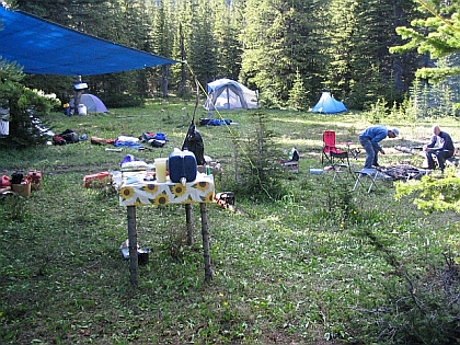
    Trail Conditions Update – JULY 22, 2014

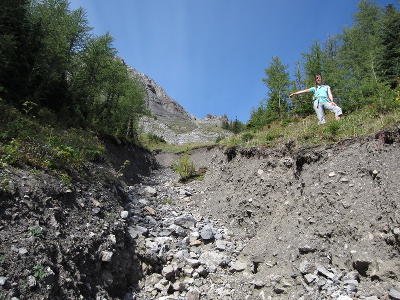
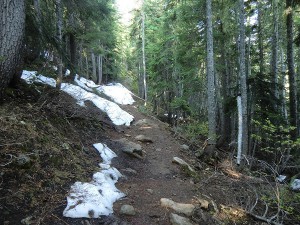
    High elevation sections of the GDT still have some snow patches but trail conditions are improving quickly. As a result of last summer’s flood damage to the trail and bridges, some trails remain closed in 2014 (see below). It is recommended that anyone planning to hike the GDT this year research the status of any trails you wish to use and exercise additional caution and allow adequate time to route-find and safely navigate unforeseen obstacles.

    Trail Closures and Notices:

    • TRAIL CLOSURE – As per Ministerial Order 43/2014, the GDT is closed at the Owen Creek trailhead to Pinto Lake due to the Spreading Creek Wildfire burning on the eastern boundary of Banff National Park about 10 kilometres east of the Saskatchewan River Crossing. The wildfire is being held but there is still significant smoke in the area. Highway 11 and Highway 93 are open but expect delays. Check the Alberta Wildfire Report for the latest information. DETOUR: Use Sunset Pass trail or Nigel Pass trail, 16 and 38 km north of the Saskatchewan River Crossing respectively.
    • TRAIL CLOSURE – Banff National Park: The Howse River/Pass Trail is closed due to the Spreading Creek Wildfire. No detour is available at this time due to the large size of backcountry area closed due to the wildfire.
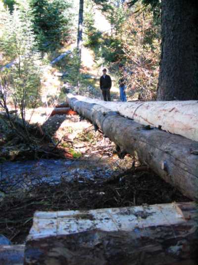
    • TRAIL CLOSURE – Elk Lakes Provincial Park: Lower Elk Lakes trail beyond the campground (between Lower and Upper Lakes) and the trail from Upper Elk Lakes to West Elk Pass are closed due to washed out bridges and sections of trail. DETOUR: Use Elkan Creek trail and Elk Pass (east).
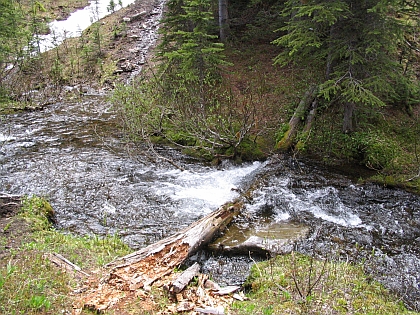
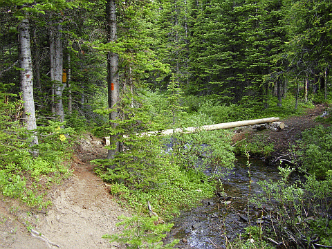
    • ACCESS TRAIL CLOSURES – Kootenay National Park: Numa Creek trail is temporarily closed due to a washed-out bridge. Tumbling Creek Trail remains closed for the summer.
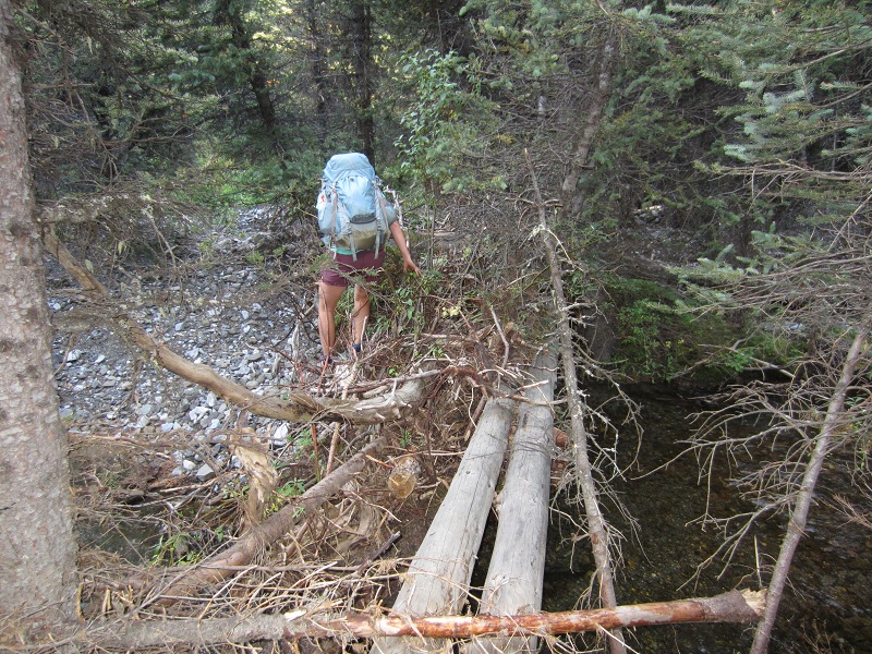
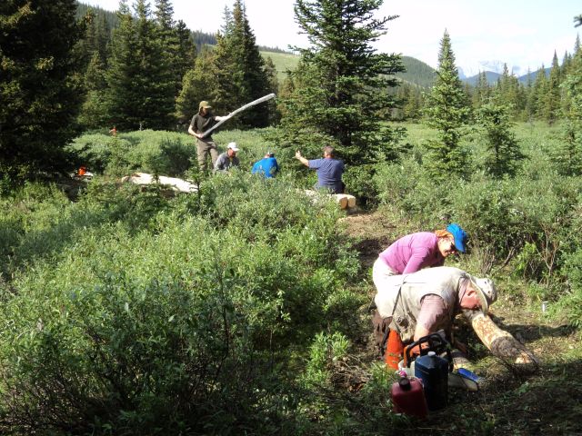
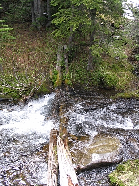
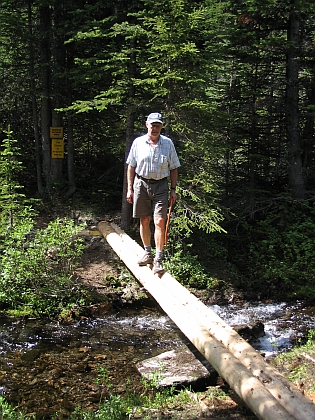
    • Cairnes Creek: The bridge is washed out making this a potentially dangerous ford. It is recommended to cross early in the morning when glacial melt is lowest.
    • Highwood House store and gas bar are currently closed.

    Access Roads Update

    Alberta:

    • Highway 11 and Highway 93 are open but expect delays due to the Spreading Creek Wildfire.
    • Highway 40 is open from Highway 1 to Highway 541 but traffic is detoured or limited to one-lane in some areas due to construction work south of Lost Lemon Lookout to the junction with Highway 541, in particular near Lineham Creek where a new bridge is being constructed. For more information, check out Alberta 511.
    • Forestry Trunk Road 940 is now open from Highwood House to Highway 532. The section south of Cataract Creek is under construction so expect delays and rough conditions; caution is advised.
    • Highway 532 from junction Forestry Trunk Road 940 to Johnson Creek Bridge remains closed.
    • The Oldman River Road is washed out approximately 10 kilometres from the junction with Forestry Trunk Road 940 with no timetable for repair/re-opening.

    BC:

    • The Elk River Road accessing Elk Lakes Provincial Park is now open.


  • The Flood of 2013

    Unfortunately due to road and trail damage from the severe flooding in south-western Alberta in June 2013, our 2013 GDT Trail Maintenance trip was cancelled.

    From August 30 to September 1, 2013, three members of the Great Divide Trail Association hiked from Hidden Creek to Baril Creek, assessing damage to the GDT caused by the extreme flooding. In general the GDT in this section is still in good shape and hikeable but most creeks show some signs of severe flooding and associated damage, e.g. rock and tree debris, mud deposits and in a few extreme cases complete re-routing of the water channel. Several bridges have washed away but all creek crossings can still be forded. There are a few short sections where the trail has washed away but detours exist where necessary.

    Flood debris on the Cataract Creek bridge
    Flood debris on the Cataract Creek bridge
    Flood damaged gully
    Flood damaged gully

    As a result of damage to the trail and bridges it is recommended that hikers on the GDT exercise additional caution and allow adequate time to route-find and safely navigate unforeseen obstacles.

    Former ‘high-level’ bridge over Baril Creek

    Highwood House and Baril Creek trailhead are accessible via Highway 541 but other road closures have made access to the GDT difficult or impossible.

  • Etherington Creek – 2012

    Fifteen volunteers spent four days camped on the north fork of Etherington Creek.  A bridge over the main fork of Etherington Creek was built and the trail was reconstructed through the difficult cut-block section leading toward Baril Creek.

    Tools of the Trail Trade
    Tools of the Trail Trade

    This work was originally planned for 2011, but logistic issues required it to be postponed. This year, everything went smoothly and despite the occasionally threatening – and downright soggy – weather, the planning goals were met.

    The ford of Etherington creek is only about three steps, but the channel is deep.  One of the first tasks was to reinstall a bridge, replacing one that was swept away in the floods of ’95.

    Construction of the new Etherington Creek bridge
    Construction of the new Etherington Creek bridge

    The bridge is located a bit further downstream from the original location, and is adjacent to the spot where the Trail exits the trees and enters the meadow bottom lands.  The trail has also been rerouted on the north side of the meadows, so it no longer goes between the two hunters camps as it did in the past.

    In the cut-block section, which has caused many people problems over the past years, a full day of chainsaw and Pulaski work has cleared the deadfall off the old trail in the upper block, and laid down a new path tread in the lower one.  With this work, plus clearing all the way up to Lunch Stop Meadow, we hope some outfitters will start using this section of trail again, and help really establish it.

    On Rye Ridge, looking southwest to the Divide
    On Rye Ridge, looking southwest to the Divide

    In the other direction, a team went up Rye Ridge and picked up the re-blazing from where work stopped several years ago.  The ridge is now blazed north to where the Trail re-enters the trees.  A navigation issue (or two) were also addressed by brush clearing.

    And perhaps most importantly, we installed our first GDTA sign post.  It’s only taken about 35 years, and we hope this is a big step toward formal recognition of the GDT through the Forest Reserve.

    Thank you to Mountain Equipment Co-op and Stihl for providing funding and support for the work.

  • Lost Creek – 2010

    This year’s planned trail maintenance in the Lost Creek area has been successfully completed.  Sixteen people took part in a four-day weekend of brush clearing, branch pruning, trail re-alignment and re-blazing.  The goal of completing trail maintenance south to where last year’s work ended was accomplished.

    The Friends of the GDT plan the next day's work at Thursday's Planning Session
    The Friends of the GDT plan the next day’s work at Thursday’s Planning Session
  • Upper Oldman – 2009

    Upper Oldman – 2009

    Major trail work took place during July 2009.  A newly formed volunteer group dedicated to the ongoing maintenance of the GDT, the Friends of the Great Divide Trail, spearheaded the effort by recruiting new volunteers, obtaining permits from the Alberta Government, and arranging for donations of food and the loan of power tools and equipment.

    The GDT route through the upper Oldman area had seen little or no maintenance since the mid-1980s and many trail users reported losing the Trail entirely near the old Galena Mine.  During a 4-day outing, ten volunteers from Alberta and BC constructed a new log bridge over the Oldman River, and carried out tread work and brush clearing for several kilometres in each direction. New paint blazes were also applied throughout. The weather was ideal, the scenery was fantastic, the bugs few, and the camaraderie was great! Everyone went home feeling a huge sense of accomplishment.

    The Trail Crew
    The Trail Crew
    The Old Bridge
    The Old Bridge
    The Old Bridge across the Oldman River
    The Old Bridge across the Oldman River
    Setting the Footing
    Setting the Footing
    The new bridge
    The new bridge
    The test
    The test
    The Builders
    The Builders
    Camp
    Camp
    Company
    Company
    Lunch
    Lunch
    Cutting new trail bed
    Cutting new trail bed

    This slope below the Galena Miracle mine is a spot where hikers have often had trouble staying on the Trail.

    Reblazing
    Reblazing
    Pruning
    Pruning
  • Baril Creek – 2006

    Baril Creek – 2006

    In September 2006, members of the Great Divide Trail Association and the Alberta Wilderness Association, with help from several Pathway Connectivity employees, did bridge construction across Baril Creek and trail clearing up to Fording River Pass.  The entire Baril access trail was also re-blazed.

    Cornwell-cirque
    On the Divide: Baril Peak (l) and Mt Cornwell from Fording Pass summit
    New bridge across Baril Creek
    New bridge across Baril Creek
    Old trapper's shelter below the pass
    Old trapper’s shelter below the pass
  • Cataract Creek – 2004

    In 2004, major trail clearing, bridge building and some trail realignment was done between Cataract and Lost Creeks, across the spectacular Cataract Plateau. The new line was surveyed in June, with construction work occurring in August. The entire section from Rye Ridge to Cataract Plateau was re-blazed as well.

    cabin
    Perkinson’s Cabin – still with us after many years!
    Lunch stop on the ridge during the survey with Mt Farquhar (left) and an unnamed peak (right)
    Lunch stop on the ridge during the survey with Mt Farquhar (left) and an unnamed peak (right)


    The Divide from the Cataract Plateau
    The Divide from the Cataract Plateau


    trail marker becomes part of trail
    Reusing a fallen blazed tree for a new bridge stringer


    Putting in a switchback
    Putting in a switchback


    Headwaters of Cataract Creek with the Divide behind
    Headwaters of Cataract Creek with the Divide behind