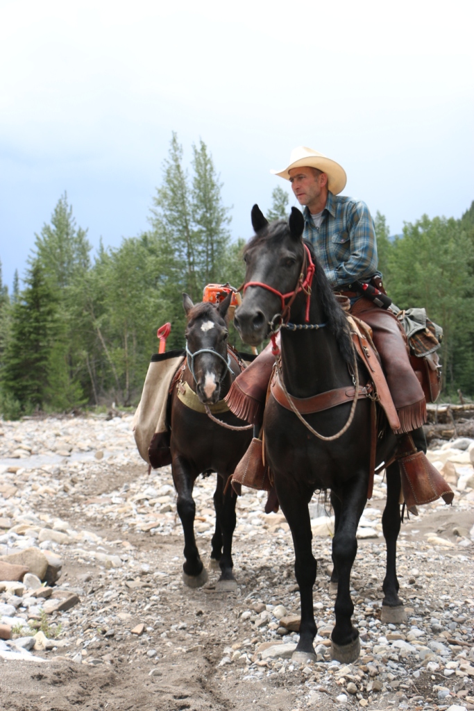
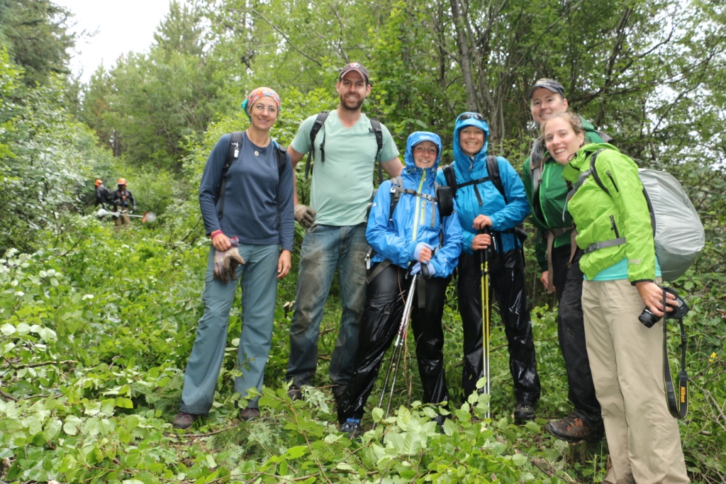
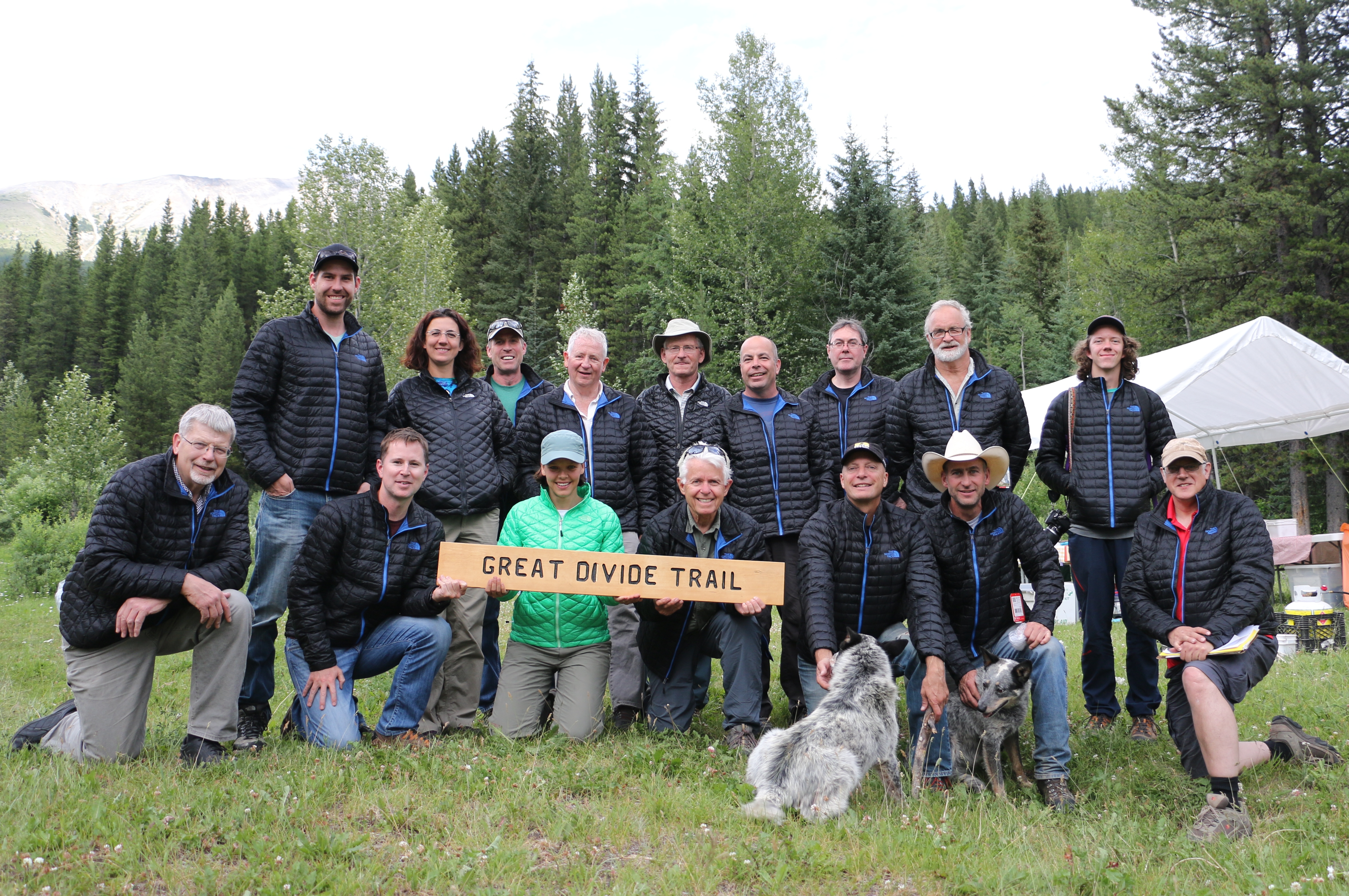
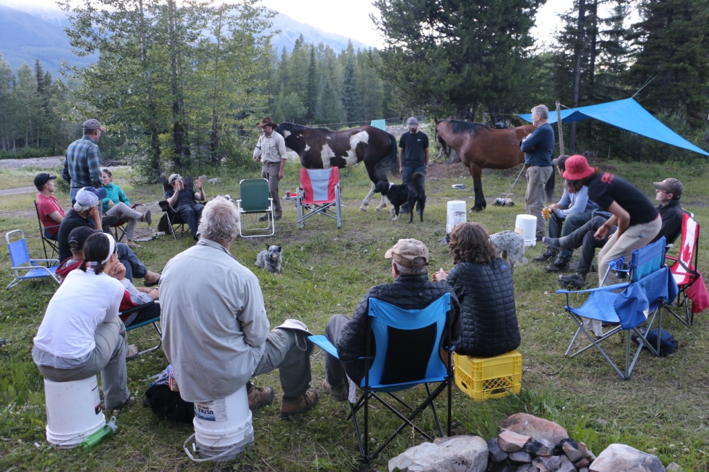
From July 15-19, the Great Divide Trail Association partnered with the Hornaday Wilderness Society, the trail operator for the Aldridge Creek Trail. 18 volunteers worked to re-establish the trail from the Aldridge Creek trailhead to Fording River Pass, repairing and building trail tread, and removing brush and fallen trees. [Photos by Jean-Francois, Evan, Bill and Brad]
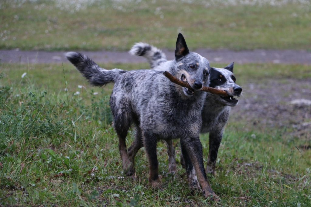
Bill from the Hornaday Wilderness SocietySmokey and Bandit (Bill’s dogs)
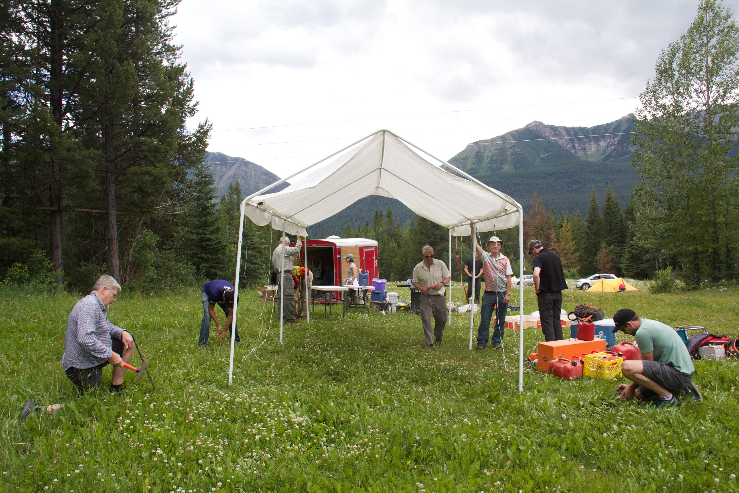
A washout on the Kananaskis Powerline Road necessitated a last minute relocation of our basecamp but the new site proved to be even better.
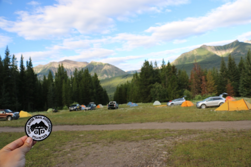
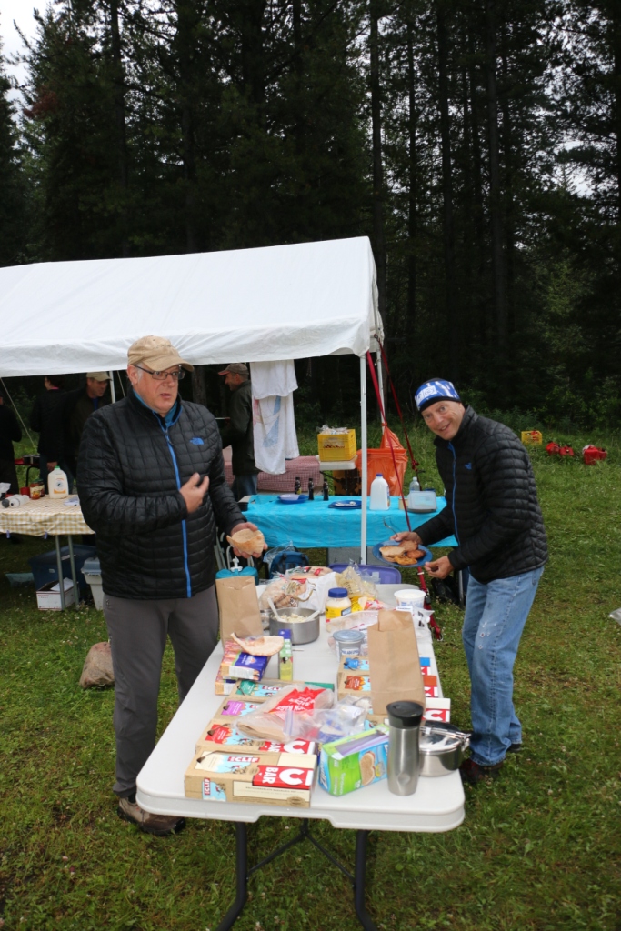
Setting up campOur basecamp (and the vintage GDTA badge)Transporting water to camp
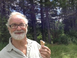
Dan, our kitchen coordinator and camp chef, thought that ice cream would be a good idea on this year’s trip. But when all of the ice cream started melting on Day 1, everyone chipped in to make sure none went to waste.
Dan’s ice cream
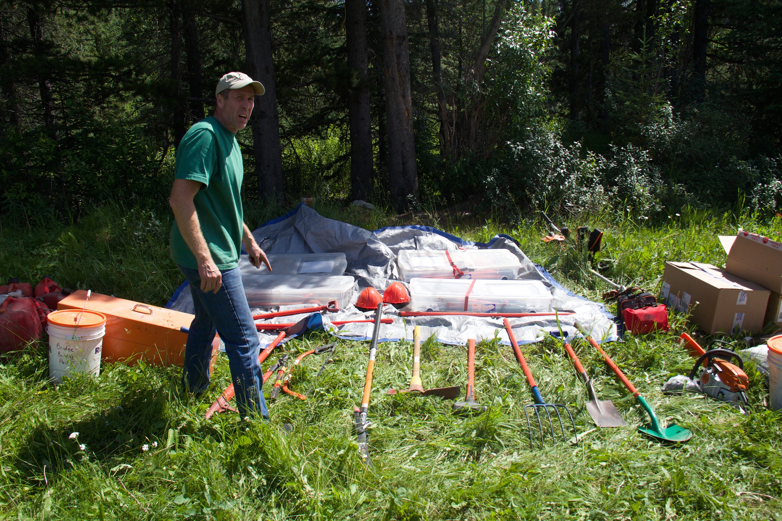
Tools of the tradeMaking lunches for the work dayThe stare down
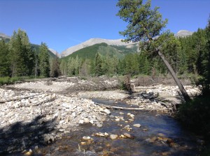
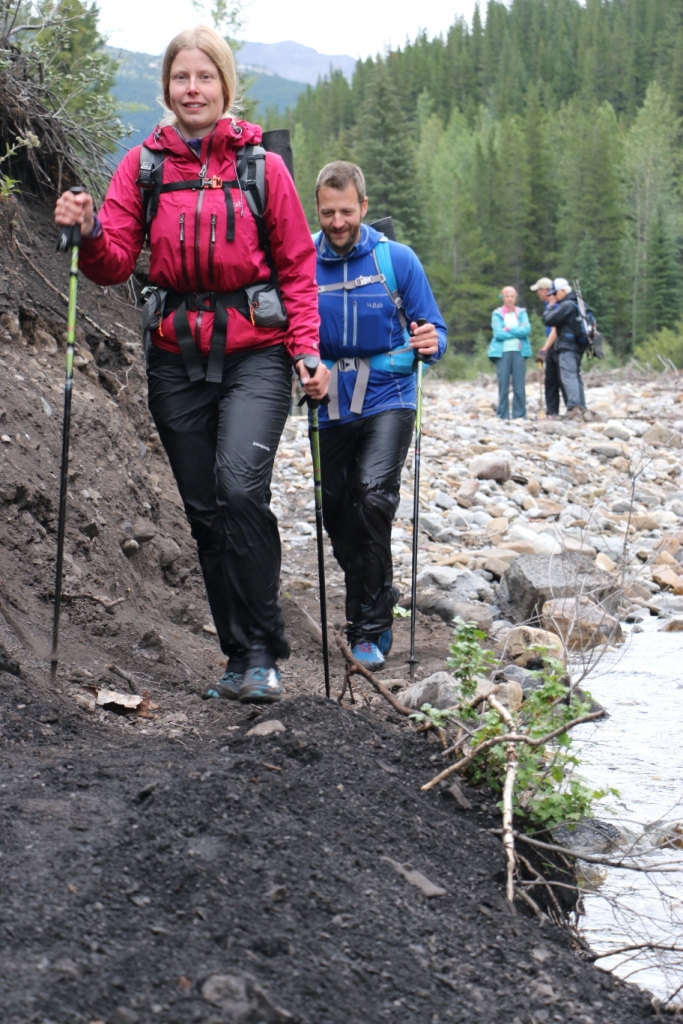
The lower section of the Aldridge Creek Trail was washed out in 2013 when a massive flood increased the flow of the creek exponentially. After the flood, only remnants of the original trail remained on the huge gravel floodplain.
Aldridge Creek floodplain
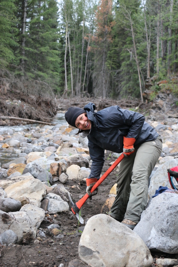
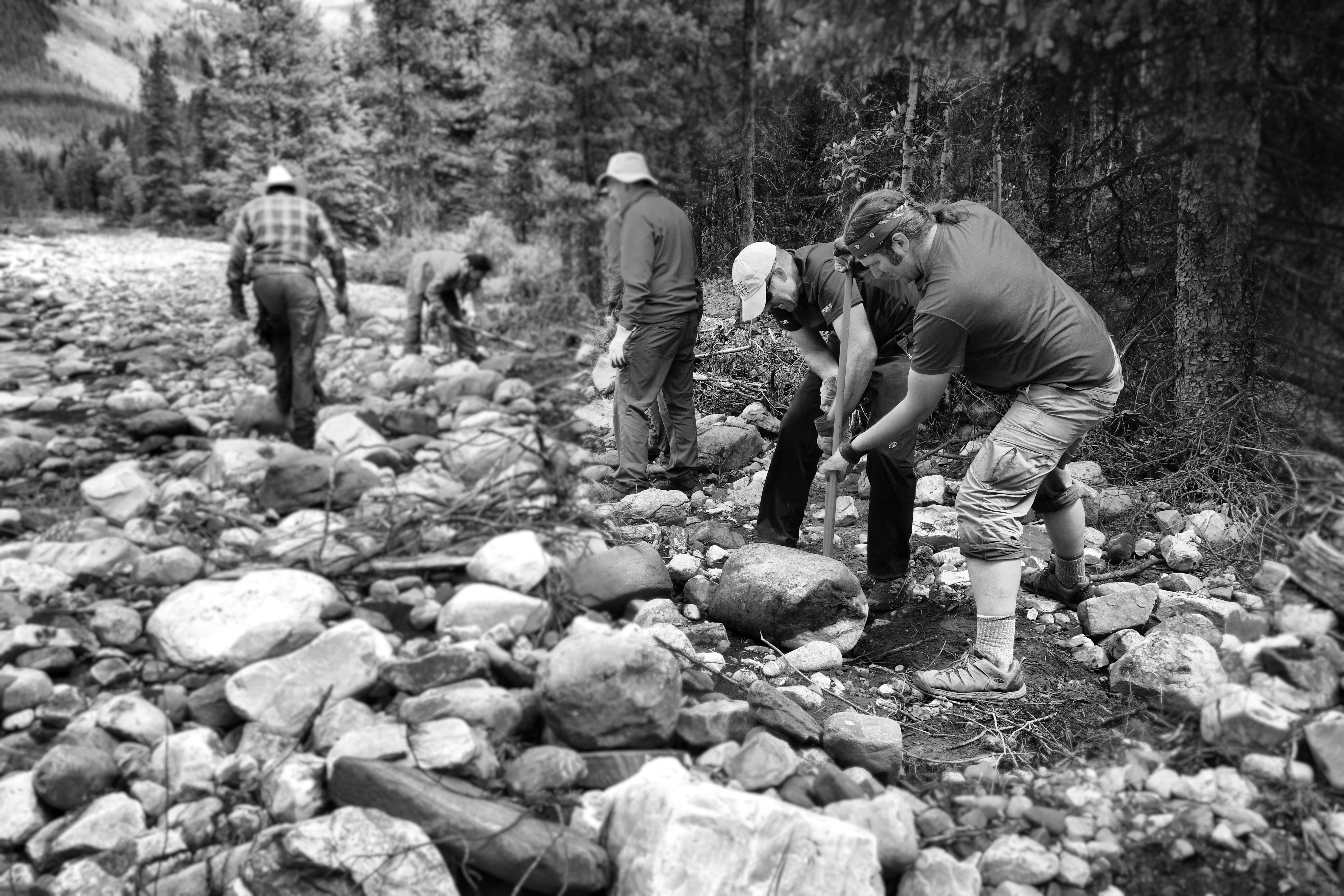
Our crew cleared boulders and debris and re-established the trail in the lower valley. This work involved the use of shovels, mattocks, saws and loppers.
Trail building on the floodplainBoulder rolling
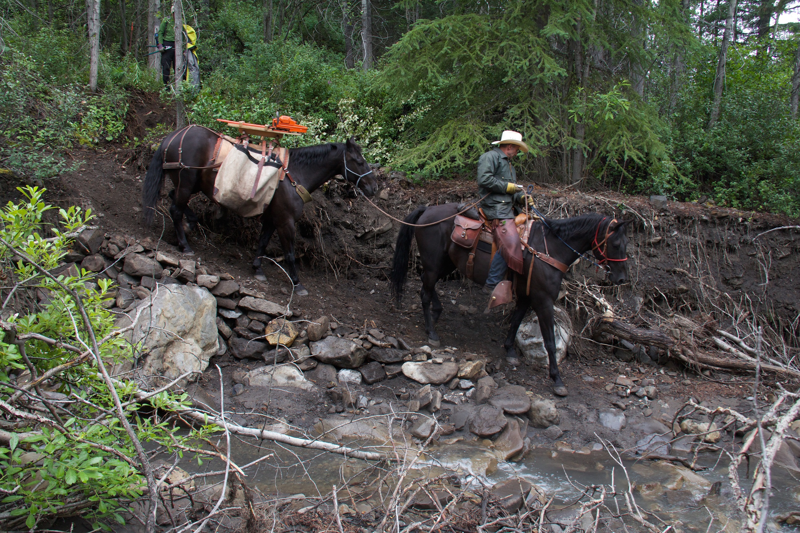
A new crossing of Mud Creek was built, good for hikers and horses.
Building new trailBuilding new trail at Mud CreekNew trail at Mud Creek
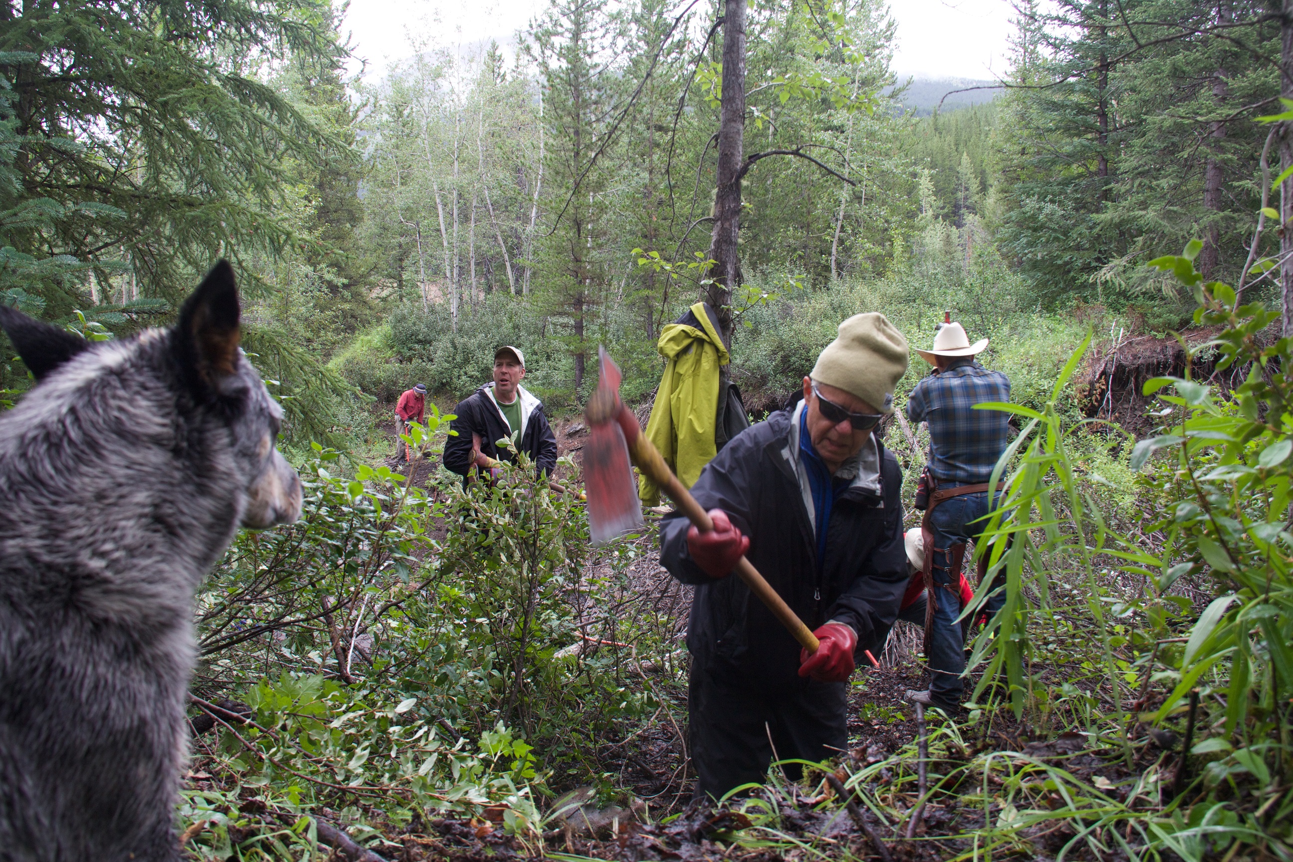
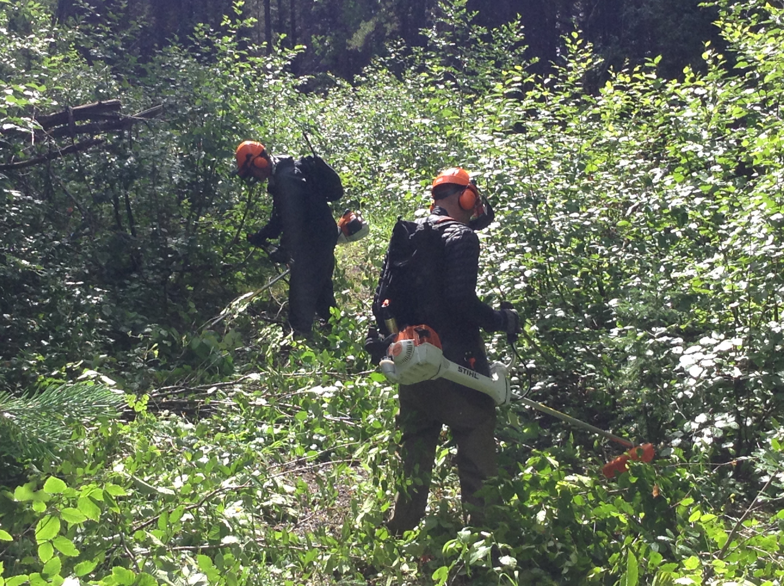
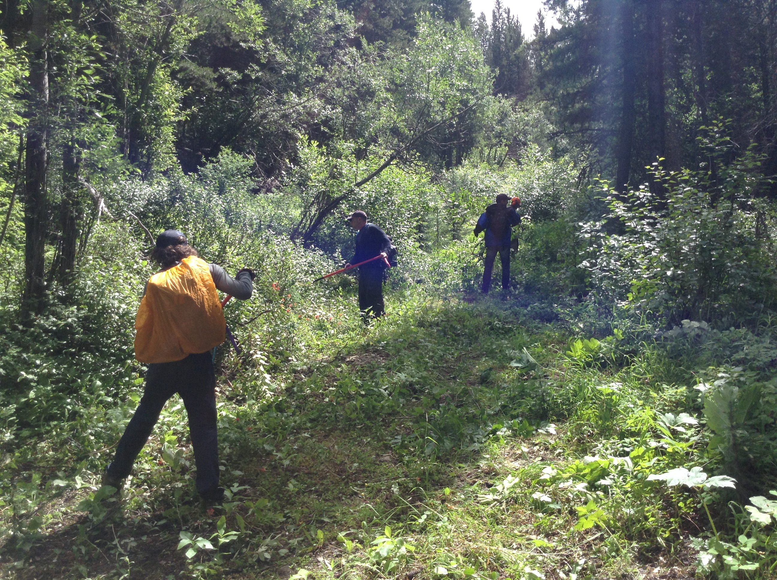
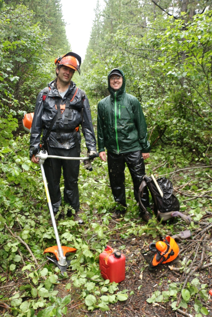
The upper section of the Aldridge Creek Trail was overgrown with alder, often completely disappearing beneath the encroaching brush. Two Stihl brush saws and hours of sweat and hard work were needed to clear more than 3 kilometres of trail corridor.
Ready to tackle the alderAlder clearing with the brush sawsRe-establishing the trail corridorThe soaking wet trail clearing crew
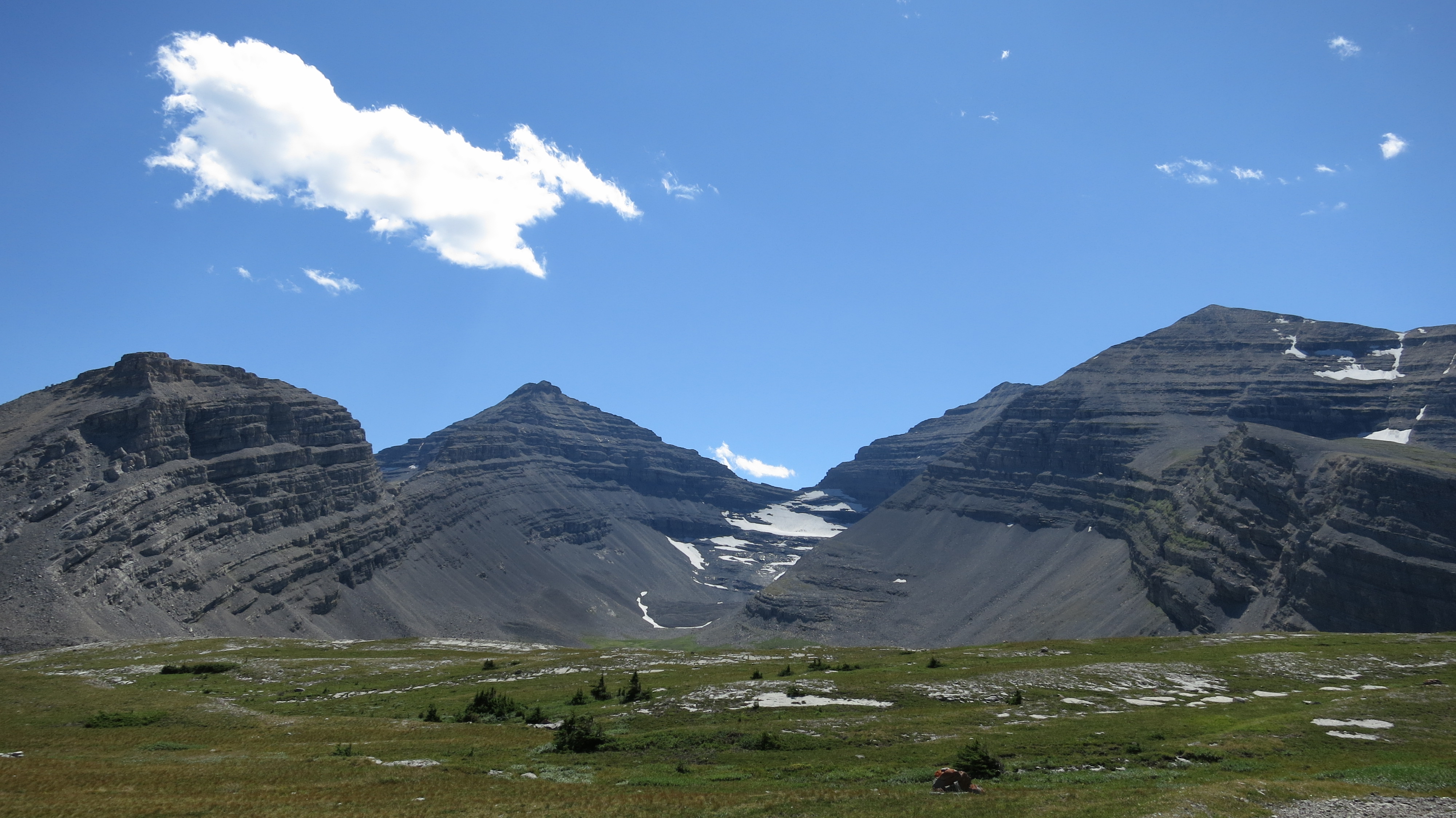
We had expected it to take 2 days to clear the overgrown trail but it ended up taking 3 full days to re-establish the trail up to Fording River Pass.
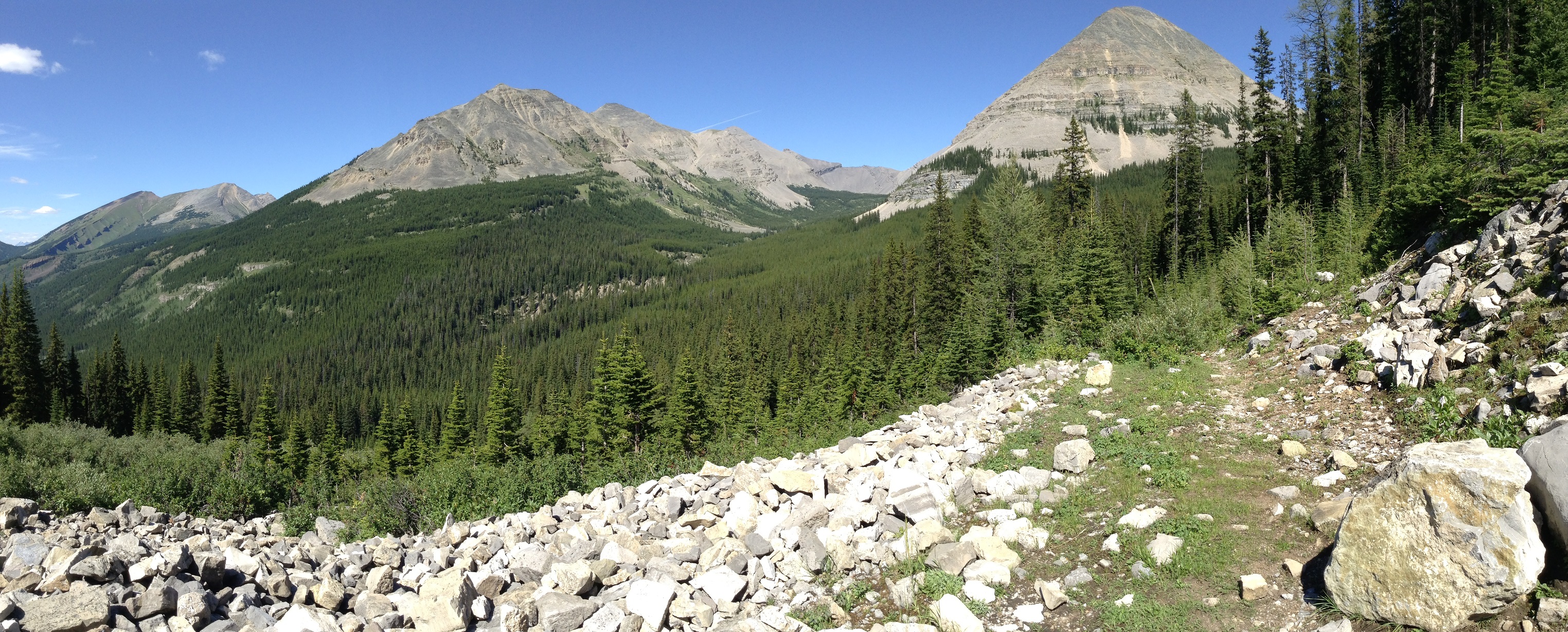
Nearing Fording River PassLarch trees near Fording River Pass
On Days 2 and 3 of our trip, we were greeted by 4 happy thru-hikers, all excited to see us clearing and repairing what had been a notoriously bad section of the GDT. We met Gian and Laura on Thursday and Erin and Elizabeth on Friday. Check out Erin’s blog where she writes about her experience meeting our GDTA Trail Crew.
GDT thru-hikers, Laura and Gian (from Switzerland)GDT thru-hikers Erin and Elizabeth with the GDTA crew
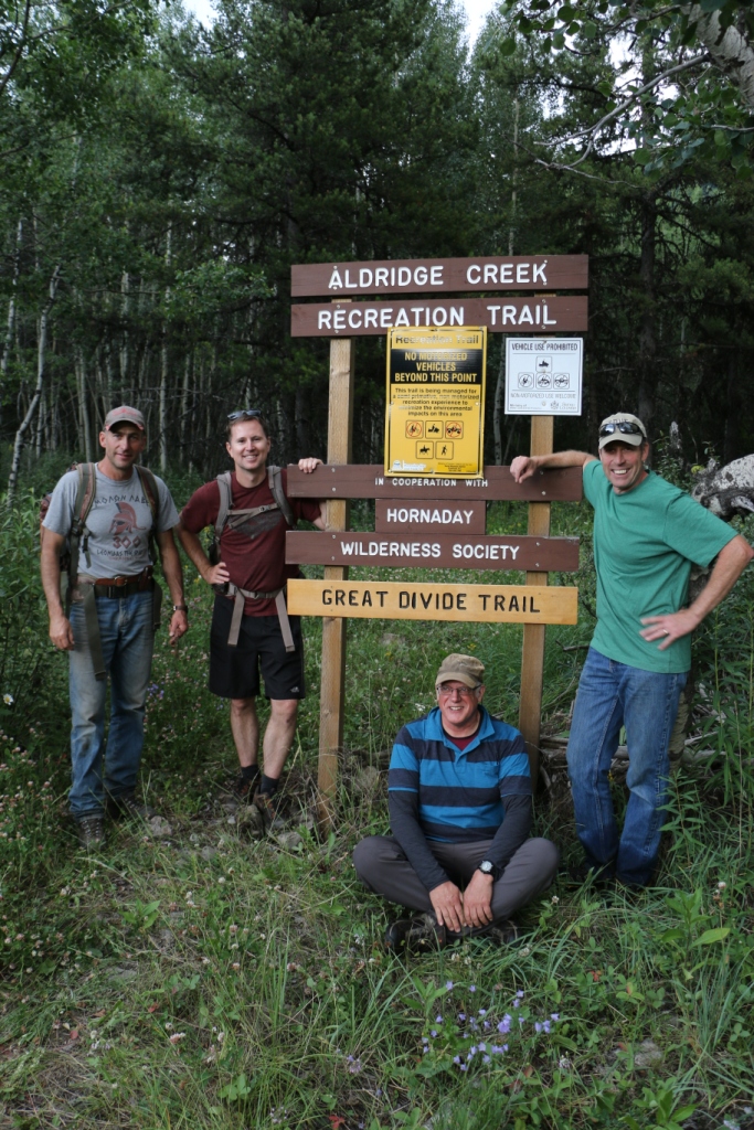
And at the trailhead we installed our first ever routered GDT sign!
The trailhead sign
Thanks to all of our dedicated volunteers who participated in this year’s GDT Trail Maintenance Trip. Your hard work and enthusiasm made for a hugely successful trip!
The GDTA Volunteer Trail Crew
Special thanks to our sponsors for making our trip possible: The North Face, MEC, the Yellowstone to Yukon Conservation Initiative, Stihl, Spray Lake Sawmills and Superstore – Thank you!
TRAILS: Conditions are good on most of the GDT. Trails are mainly dry and snowfree. It’s berry season! Your chances of running into a bear on the trail are higher at this time of year. Berry bushes are found throughout the GDT, often bordering the trail and near campgrounds, so be aware.
WILDFIRE UPDATES: Campfires are permitted in designated fire pits on the GDT in all of Alberta and in Mount Robson and Kakwa Provincial Parks in BC. Campfires are still prohibited on all other sections of the GDT in south-eastern BC.
The Waterton wildfire on the east slopes of Campbell Mountain is now 100% contained and is considered under control. The Lakeshore Trail has re-opened but fire crews are still working in the area. Please be careful when walking on the Lakeshore Trail between Boundary Bay and Goat Haunt, and do not disturb any of the fire fighting equipment in the area.
The Excelsior Creek wildfire in Jasper National Park is considered under control and all sections of the GDT have re-opened.
The Kakwa Park wildfire burning in the Jarvis Creek Valley is out. The Jarvis Creek Valley is once again open to the public.
TRAIL CLOSURES:
Elk Lakes Provincial Park: Extensive repairs and construction on the trail between Lower and Upper Elk Lakes to be carried out throughout 2015 hiking season. Detour to West Elk Pass by taking the Elkan Creek trail from the parking lot trailhead. Lower Elk Lake campground is still accessible but hikers are asked to exercise caution in this area during construction.
Banff National Park: Og Pass trail and Upper Assiniboine Pass trail within Banff National Park are closed from August 1 to September 30, to increase public safety, and to minimize displacement of grizzly bears from prime food sources at a critical time of the year. Hikers are permitted to access Mount Assiniboine Provincial Park via the lower Assiniboine Pass trail or the Wonder Pass trail.
BEAR WARNINGS:
Jasper National Park: Grizzly bears are frequenting the Bald Hills area near the Skyline trailhead and Maligne Lake. Extra caution and bear spray is recommended when hiking in this area. Please report all bear sightings to 780-852-6155. (17AUG2015)
Jasper National Park: The Brazeau Loop, Nigel Pass and Poboktan Creek trails are open but a bear warning is in effect. Two grizzly bears have broken into cabins along the South Boundary trail to access horse feed. While they are no longer appearing at cabins and have not shown aggression to people, they may return to the area. Recommendations to minimize the potential of a bear encounter: Travel in tight groups of 4 or more; make noise to alert bears of your presence; carry bear spray; and keep a clean campsite, secure all food and garbage on designated bear cables or in bear storage lockers. Please report all bear sightings to 780-852-6155. (30JUL2015)
Waterton Lakes National Park: Special caution is recommended while travelling or camping along the Lakeshore Trail from Boundary Bay to the Waterton townsite as a black bear is frequenting the area and has obtained unsecured human food. Be prepared to encounter a bear at anytime in and around this area. (10AUG2015)
TRAIL NOTICES:
The trail from Sage Pass (a17) to Scarpe Pass (a24) was cleared and blazed last year and is in good shape. From Scarpe Pass, the trail disappears up to La Coulotte Ridge and the hiking becomes significantly more difficult until you reach the ATV track (a27) heading down to the West Castle Road.
The Aldridge Creek Trail between Fording River Pass (b31) and the Kananaskis Power Line Road (b32) was cleared and restored in July 2015.
Cairnes Creek (d9): The bridge is washed out making this a potentially dangerous ford. It is recommended to cross early in the morning when glacial melt is lowest.
The Lambe Creek bridge (d10) is badly damaged so it is recommended to ford the creek further downstream and avoid using the broken bridge.
The Howse Pass Trail from Conway Creek (d12) to the Glacier Lake trail junction (d14, 15 km) is in very poor condition. The trail is overgrown, with hundreds of wind-fallen trees across the trail. Hiking in the Howse River floodplain is a viable alternative if the Howse River is low enough to ford.
The Owen Creek Trail was cleared in July 2015 up to km 5. Beyond that point, the trail is in poor shape with several washed out sections. Expect challenging hiking for 3 or 4 km including skirting along steep creek-side cliffs and rock-hopping in the creek itself. At km 6, do not take the trail heading up away from the creek (it is a deadend). Look for orange blazes marking the correct route staying near the creek.
The Maligne Pass trail in Jasper National Park has been decommissioned and is in poor shape. The trail from Pobokton Creek (e20) to Maligne Lake (e25, approx 42 km) is no longer being maintained by Parks Canada so expect deteriorating and overgrown trail conditions; long pants are recommended. The Maligne River bridge has been removed but the river can be easily forded (knee deep in mid-summer). Most other bridges are still in place.
The Yates Torrent Bridge is gone at the crossing of the Coleman Glacier outflow (near f16) so attempt to cross early in the morning when glacial melt is the lowest or be prepared for a fast and dangerous creek ford. Thanks to Christine Friesen for the update!
ACCESS TRAIL CLOSURES:
Kootenay National Park – Due to washed out bridges, access to Numa Creek Falls and Trail remains closed.
Access Roads Update:
Construction work on Highway 40 continues from south of the winter gate to Junction Highway 541; expect delays.
Access to the northern terminus of the GDT in Kakwa Provincial Park is via the Walker Creek Forest Service Road. The Walker Creek FSR has been repaired from Highway 16 to km 33.5. While travelling the remaining 50 kilometres on the Walker Creek FSR, attention is required to navigate the surface as it is uneven, rutted, slippery and very rough. The road is not recommended for anything other than a 4×4 high clearance vehicle. The last 10km from Bastille Creek to Buchanan Creek are particularly rough and muddy and might not be driveable by vehicle so be prepared to walk this distance on foot. Thanks to Canadoug for the update!
The Elk River FSR will be closed periodically at 123km, 142km, and 145km for bridge replacements between September 1 to September 30.
The Red Rock Parkway in Waterton Lakes National Park will be closed for the season starting September 8 until approximately May 2016.
TRAILS: Conditions are good on most of the GDT. Trails are mainly dry with some wet and muddy sections and possible snow patches at higher elevations. The wildflower bloom is early this year!
WILDFIRE UPDATE: Rain and cooler temperatures have decreased fire danger in much of the Canadian Rockies so the fire ban has been lifted in Banff and Jasper National Parks as well as in Mount Robson and Kakwa Provincial Parks. Campfires are permitted in designated fire pits on the GDT in Alberta and in Mount Robson and Kakwa Provincial Parks in BC. Campfires are still prohibited on all other sections of the GDT in south-eastern BC.
The Excelsior Creek Wildfire burning in Jasper National Park is now considered under control and all sections of the GDT have re-opened.
The Kakwa Park wildfire burning in the Jarvis Creek Valley has not resulted in the closure of the GDT in the area.
TRAIL CLOSURE:
Elk Lakes Provincial Park: Extensive repairs and construction on the trail between Lower and Upper Elk Lakes to be carried out throughout 2015 hiking season. Detour to West Elk Pass by taking the Elkan Creek trail from the parking lot trailhead. Lower Elk Lake campground is still accessible but hikers are asked to exercise caution in this area during construction.
BEAR WARNING:
Jasper National Park: The Brazeau Loop, Nigel Pass and Poboktan Creek trails have re-opened but a bear warning is in effect. Two grizzly bears have broken into cabins along the South Boundary trail to access horse feed. While they are no longer appearing at cabins and have not shown aggression to people, they may return to the area. Recommendations to minimize the potential of a bear encounter: Travel in tight groups of 4 or more; make noise to alert bears of your presence; carry bear spray; and keep a clean campsite, secure all food and garbage on designated bear cables or in bear storage lockers. Please report all bear sightings, incidents and animal carcasses to 780-852-6155.
TRAIL NOTICES:
The trail from Sage Pass (a17) to Scarpe Pass (a24) was cleared and blazed last year and is in good shape. From Scarpe Pass, the trail disappears up to La Coulotte Ridge and the hiking becomes significantly more difficult until you reach the ATV track (a27) heading down to the West Castle Road.
The Aldridge Creek Trail between Fording River Pass (b31) and the Kananaskis Power Line Road (b32) was cleared and restored in July 2015.
The Wonder Pass trail (alternate route) has several large mudslides on the Marvel Lake section. It is recommended to go in and out via Assiniboine Pass to access Mount Assiniboine Provincial Park.
Cairnes Creek (d9): The bridge is washed out making this a potentially dangerous ford. It is recommended to cross early in the morning when glacial melt is lowest.
The Lambe Creek bridge (d10) is badly damaged so it is recommended to ford the creek further downstream and avoid using the broken bridge.
The Howse Pass Trail from Conway Creek (d12) to the Glacier Lake trail junction (d14, 15 km) is in very poor condition. The trail is overgrown, with hundreds of wind-fallen trees across the trail. Hiking in the Howse River floodplain is a viable alternative if the Howse River is low enough to ford.
The Owen Creek Trail was cleared in July 2015 up to km 5. Beyond that point, the trail is in poor shape with several washed out sections. Expect challenging hiking for 3 or 4 km including skirting along steep creek-side cliffs and rock-hopping in the creek itself. At km 6, do not take the trail heading up away from the creek (it is a deadend). Look for orange blazes marking the correct route.
The Maligne Pass trail in Jasper National Park has been decommissioned and is in poor shape. The trail from Pobokton Creek (e20) to Maligne Lake (e25, approx 42 km) is no longer being maintained by Parks Canada so expect deteriorating and overgrown trail conditions; long pants are recommended. The Maligne River bridge has been removed but the river can be easily forded (knee deep in mid-summer). Most other bridges are still in place.
ACCESS TRAIL CLOSURES:
Kootenay National Park – UPDATE: Tumbling Creek Trail is now open. Due to washed out bridges, access to Numa Creek Falls and Trail remains closed.
Access Roads Update:
Construction work on Highway 40 continues from south of the winter gate to Junction Highway 541; expect delays.
Access to the northern terminus of the GDT in Kakwa Provincial Park is via the Walker Creek Forest Service Road which has been repaired from Highway 16 to 33.5km on the Walker Creek FSR. The remaining 50 kilometres vary in condition from OK to very rough. The last 10km from Bastille Creek to Buchanan Creek are particularly rough and can be muddy so a 4×4 is recommended.
WILDFIRE UPDATE: Currently there are no fire bans for the GDT but there is a wildfire burning near the southern boundary of the Willmore Wilderness Area about 15 km northeast of the GDT.
TRAILS: Conditions are continuing to improve. Hiking trails at lower elevations vary from bare and dry to wet and muddy, but many trails are still snowbound above 2,000 metres. Trails can be icy in the morning but warm daytime temperatures means the snow is melting quickly and creating muddy and slippery conditions. Traction cleats or poles are recommended for hikers at higher elevations.
TRAIL CLOSURE:
Jasper National Park: The GDT is closed from Cataract Pass to Poboktan Creek trailhead due to a grizzly bear becoming food conditioned and causing property damage at several sites throughout the closure area. Currently the only available detour is Highway 93.
TRAIL CONSTRUCTION:
Elk Lakes Provincial Park: Extensive repairs and construction on the trail between Lower and Upper Elk Lakes to be carried out throughout 2015 hiking season. Please exercise caution in this area during construction.
Restoration of the Aldridge Creek Trail between Fording River Pass and the Kananaskis Power Line Road will take place July 15-18. Please exercise caution in this area during construction.
TRAIL NOTICES:
Cairnes Creek: The bridge is washed out making this a potentially dangerous ford. It is recommended to cross early in the morning when glacial melt is lowest.
The Lambe Creek bridge is badly damaged so it is recommended to ford the creek further downstream and avoid using the broken bridge.
The Maligne Pass trail in Jasper National Park has been decommissioned and is in poor shape. The trail from Pobokton Creek to Maligne Lake (approx 42 km) is no longer being maintained by Parks Canada so expect deteriorating and overgrown trail conditions; long pants are recommended. The Maligne River bridge has been removed but the river can be easily forded (knee deep in mid-summer). Most other bridges are still in place.
The Howse Pass Trail from Conway Creek to the Glacier Lake trail junction (15km) is in very poor condition. The trail is overgrown, with hundreds of wind-fallen trees across the trail. Hiking in the Howse River floodplain is a viable alternative if the Howse River is low enough to ford.
ACCESS TRAIL CLOSURES:
Kootenay National Park: Due to washed out bridges, Tumbling Creek Trail is closed and access to Numa Creek Trail is closed.
Jasper National Park: Nigel Pass Trail and Poboktan Creek Trail are both closed due to a grizzly bear becoming food conditioned and causing property damage at several sites throughout the closure area.
BEAR WARNING – Bears are frequenting valleys at lower elevations in search of food so caution is recommended when travelling on trails in those areas. Pay attention, make noise and carry bear spray.
ELK: Calving season is May 15 to June 30. Protective mother elk can be aggressive during this time so exercise caution. Keep at least 30 metres away and avoid lone female elk or calves.
TICKS: It’s tick season so be extra careful when in areas with a lot of underbrush and check yourself and your clothing after your hike.
Access Roads Update:
Construction work on Highway 40 continues from south of the winter gate to Junction Highway 541; expect delays.
Access to the northern terminus of the GDT in Kakwa Provincial Park is via the Walker Creek Forest Service Road which has been repaired from Highway 16 to 33.5km on the Walker Creek FSR. The remaining 50 kilometres vary in condition from OK to very rough. The last 10km from Bastille Creek to Buchanan Creek are particularly rough and can be muddy so a 4×4 is recommended.
The Great Divide Trail Association has received a MEC Community Contributions Grant to help fund this summer’s trail maintenance trip at Aldridge Creek!
Thank you to MEC for continuing to support our efforts to establish our trail along Canada’s Great Divide!
After one of the mildest winters in a long time, the snow levels in the mountains are unusually low and melting fast. With this warm spring weather, we are all looking forward to getting back up in the mountains and on the Great Divide soon!
Trail Maintenance 2015
Where: Aldridge Creek Trail
When: July 15 to 19, 2015
This year we are partnering with the Hornaday Wilderness Society to repair damage to the trail caused by the floods of 2013 and re‐establish the GDT from Aldridge Creek trailhead to Fording River Pass.
Fording River Pass
We will be repairing and building trail tread, removing brush and fallen trees, marking the trail, and performing riparian restoration as required. For those of you new to trail building and maintenance, this year’s trip will include a tool use and safety orientation so previous experience is not required.
Let me know if you are interested in participating in the 2015 GDTA Trail Maintenance Trip or if you’re not able to participate on the actual trip dates but would like to help with some of the pre-trip planning activities. We can use your help!
Upcoming GDTA Presentations
Interested in learning more about the Great Divide Trail and the work of the GDTA?
On EARTH DAY, Wednesday, April 22nd at 7:30pm, check out the GDT presentation at the University of Calgary Outdoor Centre in Room KNA160 (Kinesiology Department) at the University of Calgary, 2500 University Drive NW, Calgary.
On Tuesday, April 28th at 7:00pm, learn about volunteering with the GDTA at the Alberta Wilderness Association office, 455 ‐ 12 Street NW, Calgary.
On Friday, May 15th from 1:00-3:00pm at the Calgary Winter Club, 4611 14 St NW, Calgary.
Partnership Grants
We are happy to announce that the Great Divide Trail Association has been awarded the following grants:
Thank you to the Yellowstone to Yukon Conservation Initiative for supporting our 2015 Aldridge Creek Trail Maintenance Trip with a $1,000 grant! We are honoured and appreciate the help connecting our wilderness trail in the Y2Y corridor.
Thanks to Suncor Energy Inc. and Jean-Francois Cianci for the generous contribution of $750 through the SunCares Community Service Volunteering Grant!
And thanks to the North Face for their continued support of our annual trail maintenance trips!
The GDTA Blog
“Oh The Peaks You Will See!” by Jen Peddlesden
When I first got involved with the GDTA I did not realize that I had already hiked many of the kilometers of this trail! Possibly you have too? The other surprising fact was that there were many, many more spectacular hikes and mountain views that await us who are game to attempt the other lesser known parts of the Great Divide Trail.
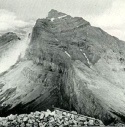
The first mountain in this short feature is Tornado Mountain, as it is front and centre in the logo of the GDT. Tornado Mountain is located on the Great Divide at the headwaters of Dutch Creek, Hidden Creek and Tornado Creek. Though you get much closer to this beautiful peak on the GDT, you can also see it from where Highway #22 now crosses on the Oldman River Bridge. If you are hiking the GDT, you will encounter this peak in the Coleman to Kananaskis section of the trail as described by Dustin Lynx in his book ‘Hiking the Great Divide Trail.’ At 3,099 metres, it is part of the High Rock Range (also known as the Tornado Group), which lies parallel and to the west of the Livingstone Range.
Originally named in 1858 by Thomas Blakiston as Gould’s Dome (John Gould was a British ornithologist much admired by Blakiston), it was renamed in 1915 by Morrison Bridgland of the Interprovincial Boundary Surveyors. The experiences of Bridgland and his associate Arthur O. Wheeler on the mountain resulted in their attaching the appellation ‘Tornado Mountain’. To quote their report “Tornado Mountain is a storm centre of the locality and, on the occasion of two ascents, the party had narrow escapes; first, through a cloud-burst accompanied by sheets of hail, which caused the mountain to run wild, torrents of water cascading down its slopes in every direction, and rockfalls, loosened by the water, crashing on all sides; on the second occasion, a fierce electrical storm encircled the summit and severe shocks were felt by members of the party”.
In 2014, without any of the furor of Tornado Mountain affecting them, the GDTA trail crew repaired the trail which crosses the saddle of Tornado Mountain, one of the highest points on the GDT at 2,445 metres, a delightful alpine pass below the giant rock buttresses and chimneys which make Tornado Mountain so beautiful. Read more about this mountain on Peakfinder.
“Getting Saucy” by Jocelyn Wood
To continue on the dehydration trail food tips, we’re getting saucy in this issue of Pathfinder! Sauces are simple and can make great use of leftover sauces or can translate a single jar of sauce into many delicious do-it-yourself wilderness feasts.
Step 1: Buy a jar of sauce (tomato based is good, nothing too oily or dairy based but chunky is okay) or make your own.
Step 2: Fire up your dehydrator to a medium-high setting.
Step 3: Lay out a sheet of parchment paper or Paraflexx paper on your dehydrator tray.
Step 4: Pour sauce slowly over parchment paper and using a spatula or large spoon begin spreading sauce along paper so that it is even and smooth until it is the thickness of a toonie.
Step 5: Put tray in your dehydrator and let it work its magic until the sauce is no longer sticky to the touch and pliable (6-10 hours).
Step 6: Peel sauce away and store until needed. You will need about a 1/4 cup of packed sauce strips to fulfill your saucy needs in a pasta dish for 2.
To Rehydrate: Add sauce flakes to 1 cup of warm to boiling water (I like to put it into my leftover pasta water) and mix until rehydrated.
BONUS TIP: Blend your choice of fruits (include an apple) and use the same methods to make your own fruit leather!
Trail and Road Conditions Update
Spring is transition time on the GDT. Hiking trails at lower elevations vary from bare and muddy to slushy and icy, while trails at higher elevation remain snowbound with potential avalanche risk. Trails can be icy in the morning but warm daytime temperatures are creating slushy and slippery conditions. Snowshoes, cleats and/or poles are recommended for hikers.
There has been some recent late season snowfall in April and avalanche conditions still exist, especially at higher elevations so always check the latest avalanche bulletins before setting out.
Tick season has started. Be extra careful when in areas with a lot of underbrush and check yourself and your clothing after your hike.
Access Roads:
Annual Winter Closure of Forestry Trunk Road 940 from December 1 to April 30, from Cataract Creek Campground to the junction with the Plateau Mountain access road.
Annual Winter Closure of Highway 40 from the Kananaskis Lakes Trail to the junction of Highway 541 between December 1 and June 15. Construction work continues from South of the winter gate to Junction Highway 541.
Annual Winter Closure of Highway 532 from December 1 to April 30, west of the staging area of the Indian Graves Campground to the intersection of the Forestry Trunk Road 940.
GDTA Membership – We need you!
The Great Divide Trail Association is a membership organization built by the support of people like you. Together, we share a common vision: the completion and long‐term preservation of the Great Divide Trail. By becoming a member of the GDTA, you are supporting the trail experience that you love and contributing to the legacy of the Great Divide Trail.
A $30 Annual GDTA Membership gives you up to date information and trip‐planning resources for the Great Divide Trail; voting status at meetings of members of the GDTA; eligibility to serve on the GDTA Board of Directors; invitations to participate in trail classes and volunteer trail projects; and the knowledge that you are helping to protect and preserve the Great Divide Trail. Check out our website for more information on how to become a member today.
GDT Trip-Planning
Anyone planning to hike on the GDT this year, please let us know if we can be of assistance with your trip-planning. Check out the Trip-Planning Resources on our website for maps, trail conditions, resupply information and much more. We’re happy to help!
Sincerely,
Brad Vaillancourt
President, Great Divide Trail Association
Spring is transition time on the GDT. Hiking trails at lower elevations vary from bare and muddy to slushy and icy, while trails at higher elevation remain snowbound with potential avalanche risk. Trails can be icy in the morning but warm daytime temperatures are creating slushy and slippery conditions. Snowshoes, cleats and/or poles are recommended for hikers.
There has been some recent snowfall in April and avalanche conditions still exist, especially at higher elevations so always check the latest avalanche bulletins before setting out.
Tick season has started. Be extra careful when in areas with a lot of underbrush and check yourself and your clothing after your hike.
Access Roads Update:
Annual Winter Closure of Forestry Trunk Road 940 from December 1 to April 30, from Cataract Creek Campground to the junction with the Plateau Mountain access road.
Annual Winter Closure of Highway 40 from the Kananaskis Lakes Trail to the junction of Highway 541 between December 1 and June 15. Construction work continues from South of the winter gate to Junction Highway 541.
Annual Winter Closure of Highway 532 from December 1 to April 30, west of the staging area of the Indian Graves Campground to the intersection of the Forestry Trunk Road 940.
Thank you to the Yellowstone to Yukon Conservation Initiative for supporting our 2015 Aldridge Creek Trail Maintenance Trip with a grant! We are honoured and appreciate the help connecting our wilderness trail in the Y2Y corridor.
Check out the GDT presentation at the Alpine Club of Canada, Calgary Section at 7:30pm on April 8th in the Hearth Room at the Hillhurst Sunnyside Community Centre, 1320 5 Avenue NW, Calgary.


 Spring is transition time on the GDT. Hiking trails at lower elevations vary from bare and muddy to slushy and icy, while trails at higher elevation remain snowbound with potential avalanche risk. Trails can be icy in the morning but warm daytime temperatures are creating slushy and slippery conditions. Snowshoes, cleats and/or poles are recommended for hikers.