This edition of the Pathfinder Newsletter includes articles showcasing GDT and other wilderness adventures, information to help (re)plan your 2020 summer on the Great Divide – hiking and/or volunteering, announcements, conditions, GDT literature news, and general interest articles. Enjoy!
GDTA COVID-19 Update: An important message from the GDTA regarding the COVID-19 situation.
On May 5, the Charities Directorate let us know we are now a registered charity. This means that The Great Divide Trail Association can issue official tax receipts for charitable donations. This is a big step for us and we hope that individuals and corporate donors will take this opportunity to contribute to our organization.
There are many reasons to donate to the GDTA – most of which support the organization’s mandate to maintain, promote and protect the Great Divide Trail.
Trail building
One of the GDTA’s main purposes is to provide a public amenity by planning, designing, constructing and maintaining the Great Divide Trail. We have many worthwhile programs and projects to fulfill this. Here are some priorities:
Build 45 km of new trail in the High Rock Section of the GDT north of the Crowsnest Pass in Alberta. We have built 15 km to date, are maintaining 17 km of existing pathways, and have 13 km left to build.
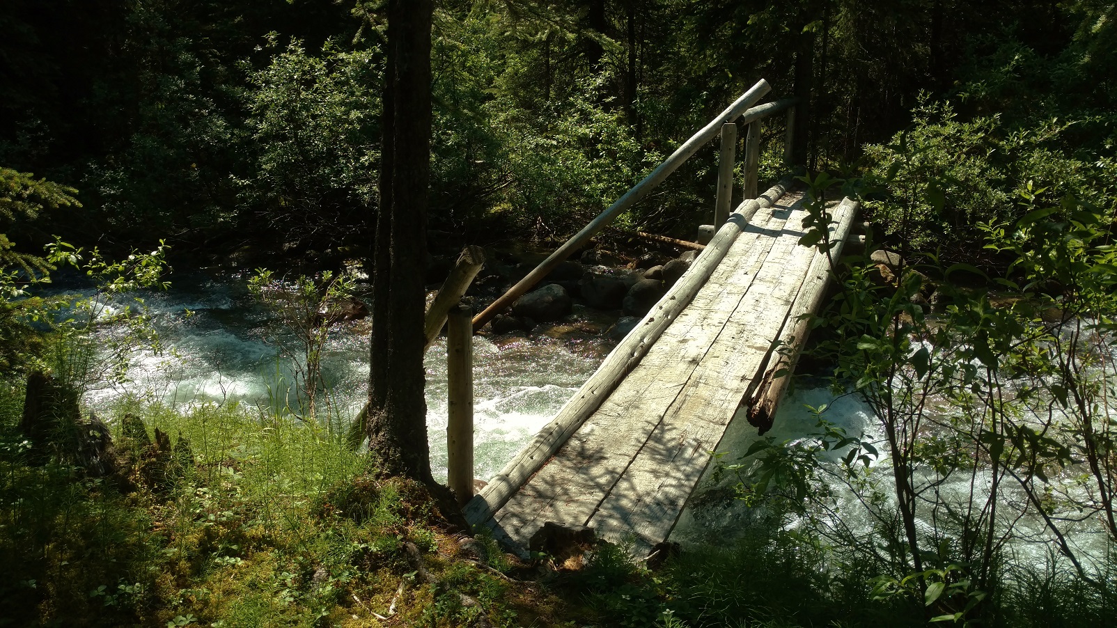
Construct a large new bridge spanning a treacherous portion of Cairnes Creek along the historic David Thompson Heritage Trail section of the GDT in BC.
Clear overgrowth along the Maligne Pass Trail section of the GDT in Jasper National Park in collaboration with the Jasper Trails Alliance.
Provide ongoing trail maintenance of 100 km of the Original Great Divide Trail between Fording River Pass and North Fork Pass in Alberta.
To do this, we need funds for tools and equipment, contractors, camp supplies, insurance, signage, training, and transportation. As trail building and maintenance activity grows and extends to far reaching sections of the GDT, the budget also grows. Last year, we spent over $22,000 on these activities.
GDTA outreach
Another GDTA purpose is to educate the public about the Great Divide Trail and encourage its use consistent with the scenic and wilderness values of the Canadian Rockies. This is no small task. Here are some of the things we do on an ongoing basis to inform trail users and promote the trail to the general public:
Provide regular updates on the GDTA website and social media to provide trail users with current trip planning resources.
Present outreach and education programs including workshops on hiking and safety as well as guest presentations featuring long-distance hikers and wilderness enthusiasts.
Prepare seasonal newsletters to inform and update about trail topics, events, and volunteer opportunities.
These activities require funds for website costs, marketing, venue rental, merchandise, and presenters. Last year, we spent almost $5,000 on these activities.
One purpose that can’t be over-emphasized is the GDTA’s work in advocating for the formal recognition and protection of the GDT. We believe that the GDT is a significant long-distance trail worthy of preservation for its own sake and for the wilderness experience it provides to its users.
Walking along the Great Divide
Here are what some hikers have said about their experience on the trail:
This trail was so much more than I could ever have imagined! More wild. More scenic. More difficult. More sacred. MORE WONDERFUL.
I savored the experience of the GDT and count it among one of my better choices made in life.
It is a one of a kind trail unique from others in its remoteness, challenging terrain, weather, and rewarding scenery. It was all worth the challenges and is now my favorite trail. What a journey!
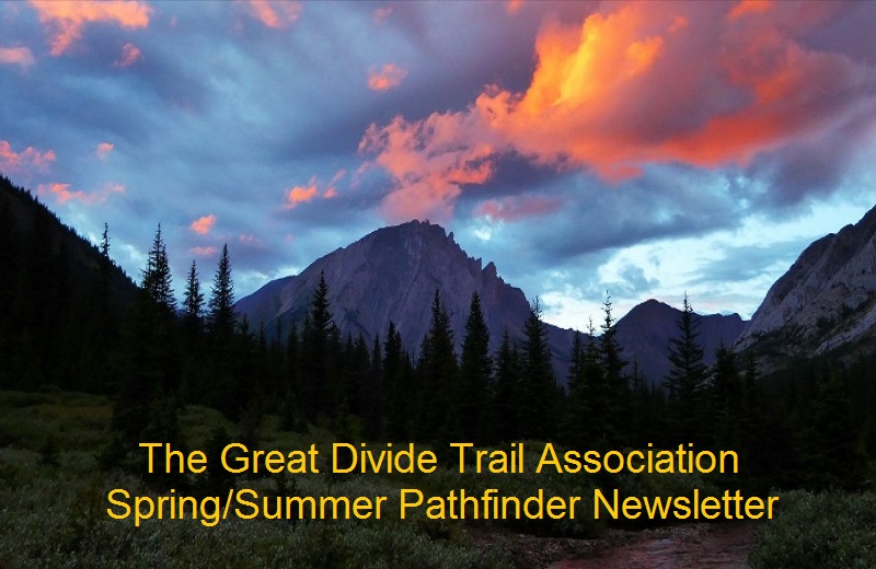
GDT Trail Crew
GDTA activities provide benefits to a wide group of people – hikers, equestrians, volunteers, and those attending our various educational functions and events. We serve trail user communities in two provinces and people who come from all over Canada and the world to hike the GDT.
We have set up our Donate webpage in association with CanadaHelps, a charitable organization that works with other charities to provide fundraising tools and assistance in processing donations. Using this service will significantly decrease our administrative workload and provide us with highly professional and secure donation forms and quick turnaround for charitable receipts. The cost for using CanadaHelps is low in consideration of the level of service it provides – averaging less than $.04 for every donated dollar.
Donations to the GDTA are always welcome. This is particularly true in the uncertain times brought on by the COVID-19 situation. Understandably, some of our main funders have had to hold their grant programs in abeyance due to the pandemic. This has resulted in a shortfall of $12,500 in our budget this year.
Its History, Its Founders, Its First Hilarious Book
By Sue L. Blanchard in collaboration with Jenny L. Feick, PhD
The history of the Great Divide Trail and the Great Divide Trail Association is in many ways the story of six young adults with the energy, determination and vision to explore a vast 5,180 square-kilometre area of Canada’s Rocky Mountain wilderness, to chart a route for the proposed Great Divide Trail in what was called Project: Great Divide Trails.
Like Canada’s early pioneers, Jenny Feick (rhymes with hike) and her colleagues (Mary Jane Cox, Chris Hart, Dave Higgins, Cliff White, and Dave Zevick) identified, described and mapped potential routes for the 1,200-km trail along the continental divide in the summer of 1974. They did this work long before the days of Google Earth, GPS, the internet, cellphones, satellite phones, drones, or lightweight backpacking gear.
Funded by then Prime Minister Pierre Trudeau’s Opportunities for Youth employment program, armed with clipboards, pencils and topographic maps, they became surveyors and cartographers in their own right.They made good on an idea first proposed by the Girl Guides of Canada in 1966 and advanced to Parks Canada by Jim Thorsell in 1970 after his extensive trail surveys in 1968-69: Build a trail along, across and adjacent to the border of Alberta and British Columbia.
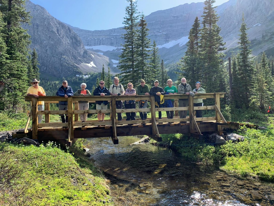
Some of the Project: Great Divide Trails crew at their base of operations in the Kinnears’ back yard in Coleman, Alta. in June 1974 – (top) Cliff White, Mary Jane Cox (now Kreisel), (bottom) host Bill Kinnear, Dave Zevick and Dave Higgins, Coleman, Alta., summer of 1974. (Photo by Nettie Kinnear)
After the project, Feick, Higgins and Cox interested others in this grand idea, including Lani Smith and Jeff Gruttz. All five are still involved with the GDTA today. By April 1976, they founded the Great Divide Trail Association with Brian Prior as first President. Smith, Gruttz and others began to establish the Great Divide Trail that summer, despite 32 consecutive days of pouring rain.
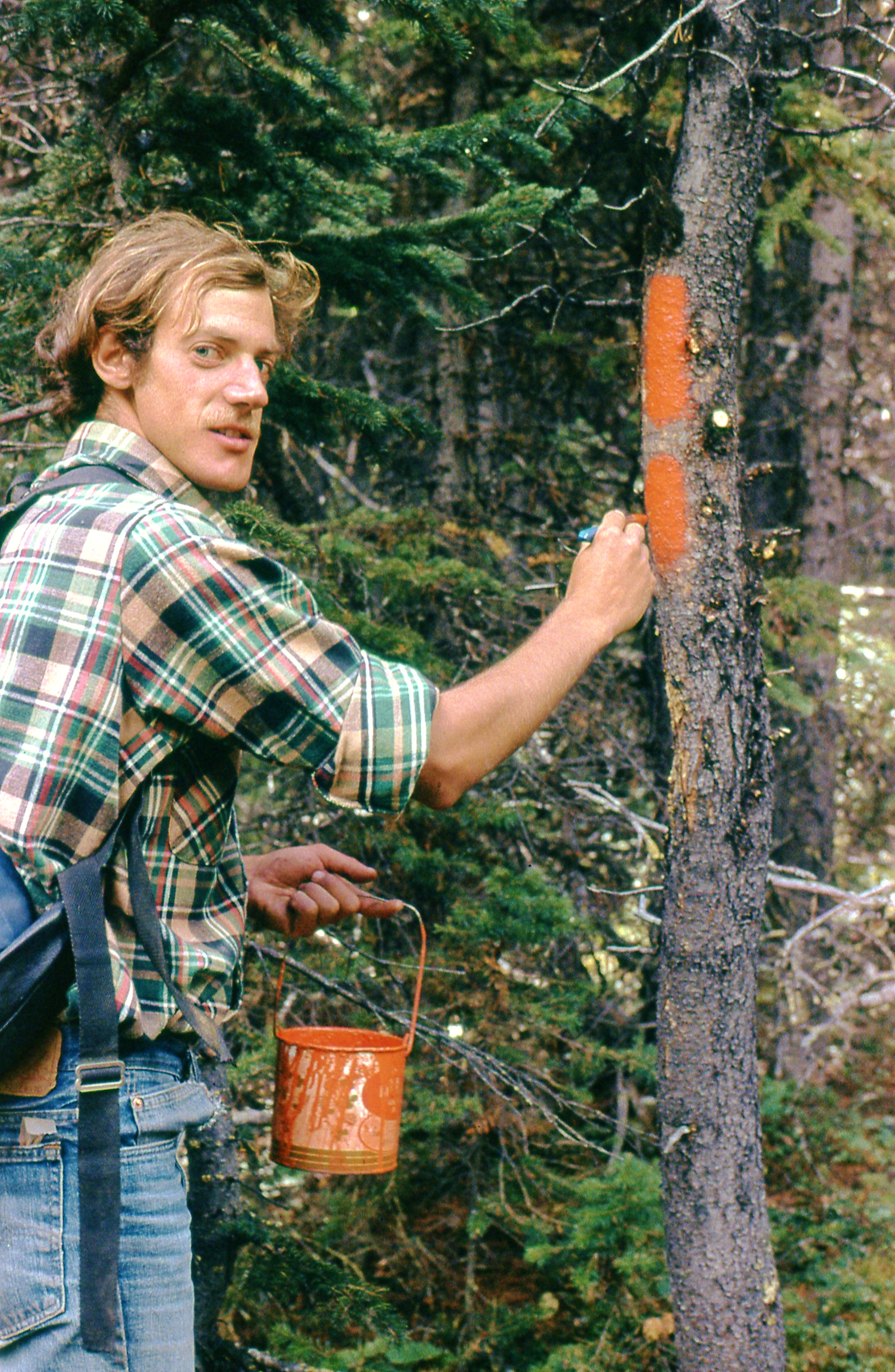
Lani Smith painting a double blaze on the GDT in 1979. (Photo by Dave Higgins)
Fast-forward to “Tales of the Great Divide”
Today, Feick and her GDT friends meet for reunions to recall the good old days. Their exploits as intrepid blazers of the Great Divide Trail are covered in a sweeping hefty volume called “Tales from the Great Divide, Vignettes on the Origins and Early History of Canada’s Great Divide Trail and Great Divide Trail Association”.
Edited by Dr. Jenny Feick, now retired from her 36-year career with Parks Canada and the BC Ministry of Environment, “Tales from the Great Divide” contains humorous stories and anecdotes from the early days of the trail. It’s also an emotional account of the various trying and daring exploits or “misadventures”, as Dave Higgins notes in Chapter 3.
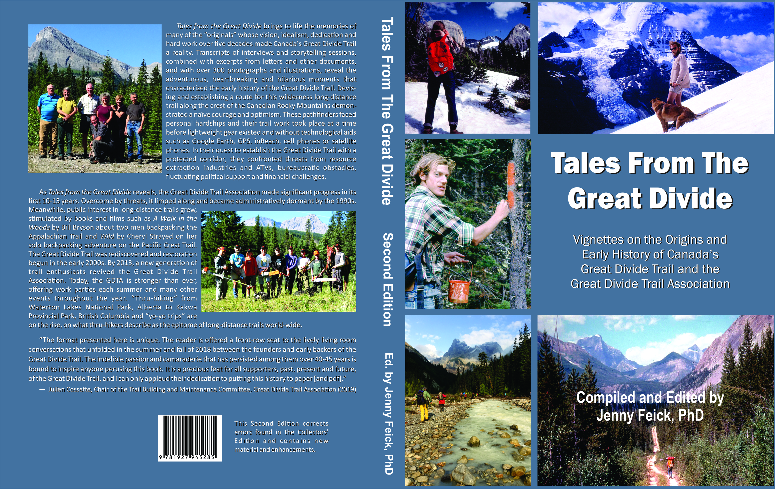
Cover of the Second Edition of “Tales from the Great Divide”, published in June 2020.
In one misadventure described in the book, a tree skewered the Project: Great Divide Trails crew’s 1962 Volkswagen. Chris Hart had kindly loaned the blue notchback sedan he bought for $75 to Higgins and Feick for their week of trail survey work.
“To us, it was a treasure,” notes Feick, “because the way they built Volkswagens back then, they could go anywhere. This car could go places a four-wheel drive pickup couldn’t go.”
The story goes that Higgins and Feick drove down a steep hill on an abandoned mining road and parked in the wilderness. Later, after completing their day’s trail survey work, when they drove up the road, a dead, leaning lodgepole pine dented the roof of the sedan and then broke through the top of the windshield, spraying glass everywhere and ‘shish-ka-bobbing’ the car!.
“(The pine) went right across my shoulder and ripped my jacket,” explains Higgins in the story. “We instinctively ducked.”
After ascertaining that they were both unscathed and extricating the car from the tree, they had to drive back to their base in the Crownest Pass without a windshield. When it began to rain, they turned on the windshield wipers so it looked to onlookers as if they still had a windshield. Dave remembers that whoever sat in the front passenger seat could stand up through the windshield and wave at the other traffic. “It was a lot of fun,” he notes.
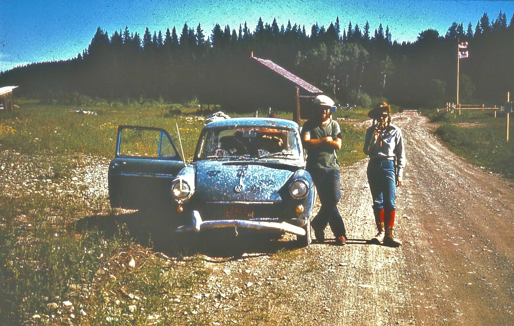
Jenny Feick and Chris Hart with ‘Old Blue” the infamous VW from Project: Great Divide Trails (after the windshield was replaced), at the US/Canada border in the Flathead Valley, BC, July 1974. (Photo by Dave Higgins)
Other Life-threatening Moments
As you read “Tales from the Great Divide”, you discover that every one of the Project: Great Divide Trails crew members faced a life-threatening experience during the course of their trail survey work during the summer of 1974. Cliff White, the project’s leader in 1974, describes how he unexpectedly emerged from a forested trail into an overburden pile just as a giant mining truck began dumping its next load of massive rocks. “Making Molehills of Mountains” tells his sad and scary story of the Erickson Creek Valley in BC.
The History of the Great Divide Trail
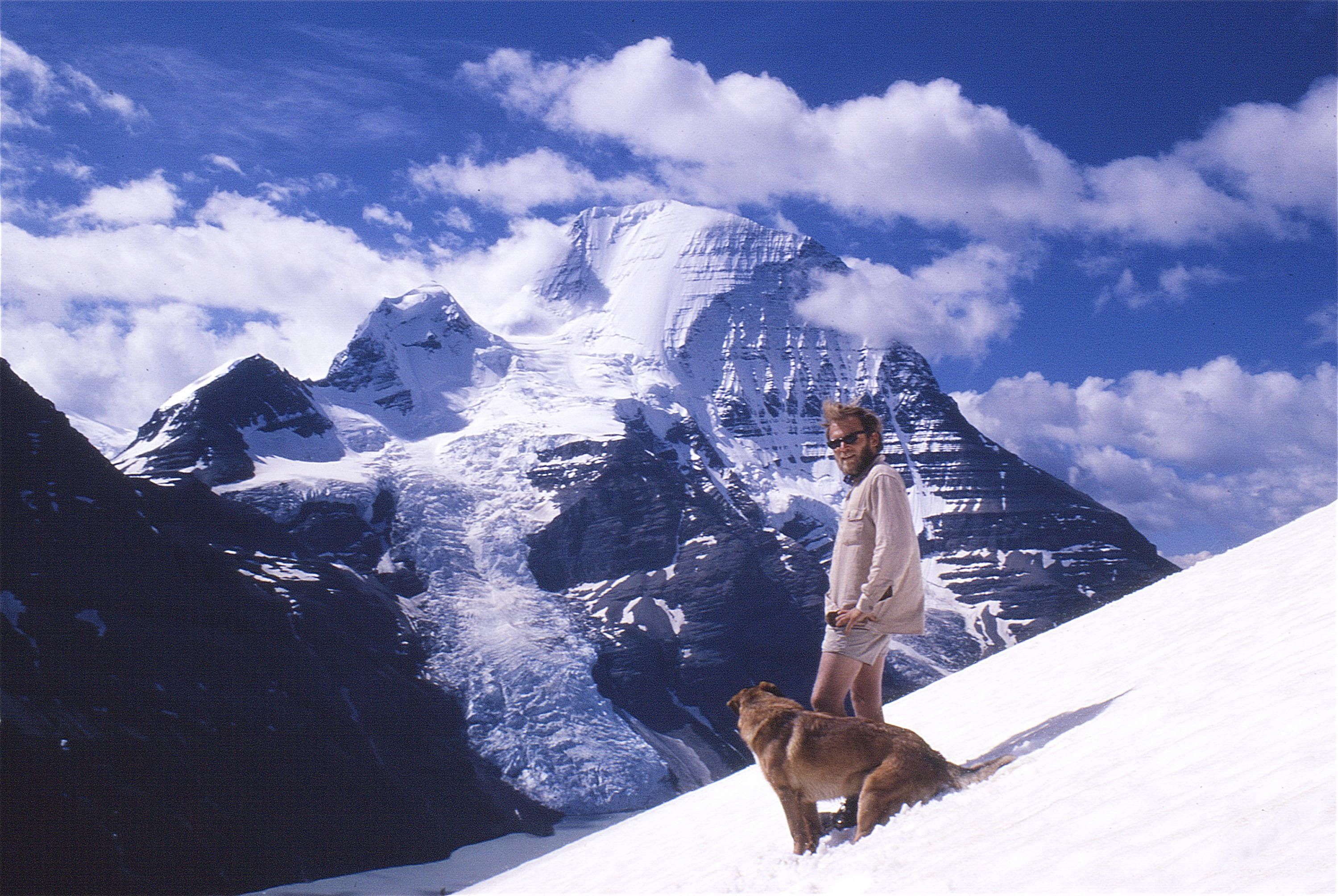
Jim Thorsell and “Dawg” at Mount Robson Provincial Park, BC in 1970. (Photo by Mike Misko)
The 1960s to mid-1980s looked like a promising time for the GDTA trail crews and the trail they surveyed. Dr. Jim Thorsell, the pioneer of the concept in the mountain parks, no doubt understood the GDT’s great future when he penned a provisional trail guide in 1970. In 1971, Brian Patton and Bart Robinson included Thorsell’s provisional trail guide in the first of several editions of their widely used “Canadian Rockies Trail Guide”. From 1976 to 1988, GDTA volunteers in organized work parties, supported with funding from the Alberta government, cleared and maintained over 110-km of the GDT and associated access trails on the Eastern Slopes between Banff and Waterton Lakes national parks. Higgins maintained his dedicated involvement in establishing and mapping the GDT throughout this time. Gillean Daffern included descriptions and maps of the GDT in her Kananaskis trail guides, and Gem Trek Maps put the GDT on their maps.
Everything changed in the mid-1980s. By 1987/88, GDTA volunteers became discouraged by the changes in government policies favouring resource extraction and motorized recreation over watershed protection and non-motorized outdoor recreation in the headwater areas along the Great Divide. Logging companies made clearcuts over the GDT, or just left a narrow strip of trees along the trail that fell over during the first major windstorm. The Line Creek Mine in the Elk Valley of southeast BC annihilated the series of historic trails, wagon roads and routes selected in 1974 as an ideal means to get from North Fork Pass south to Highway #3 in the Crowsnest Pass. The GDTA Board decided to put the organization into a state of administrative dormancy. Higgins, Feick and others continued with informal trail maintenance.
Meanwhile, people began rediscovering and backpacking the GDT. After losing their way along an unmaintained segment of trail in 2003, Dan Wallace and Wayne Marshall, who worked at SAIT in Calgary, decided the GDT needed TLC, and so formed the Friends of the GDT.
First Friends of the GDT Work Party, Cataract Creek, 2004. L – R: Wayne Marshall, James Prescott, Andrew Higgins, Dave Higgins, Dan Wallace, Jason Unger, Jeff Gruttz, Nigel Douglas, Star, the horse, and his human, Chris Morrison. (Photo by Jeff Gruttz’s self-timer)
In 2000, Dustin Lynx released his first guidebook “Hiking Canada’s Great Divide Trail”. Although volunteer-built sections of the trail were missing in the guide’s first edition, the third edition, published in 2018, pieces together the six major routes that form the continuous trail and notes its official length by GPS as nearly 1200-km. One also learns about the Great Divide Trail Association, and how settlers and Indigenous groups once traveled the trail while hunting and trading.
In 2012, the Friends of the Great Divide Trail met to discuss how best to continue trail maintenance, and to begin approaching government for formal protection of the Trail. Although maintenance had been quite successful, the informal nature of the volunteer group made obtaining the necessary permits increasingly difficult. A decision was made to charter a new organization dedicated to the Trail. In the course of investigating a new charter, the group learned that the Great Divide Trail Association was dormant but not extinguished. They were able to file Articles of Continuance and resurrect the GDTA by 2013. Brad Vaillancourt of Vancouver BC, who thru-hiked the GDT in 2006, served as first President.
The GDTA Today
At a talk she gave in mid-May 2020 via Zoom teleconference to the Alpine Club of Canada in Victoria, BC, Feick remarked “The new GDTA brings together the pioneering work of Jim Thorsell in the mountain parks, with the work of Project: Great Divide Trails, and the first iteration of the GDTA, to create a 1200-km route that to thru-hikers across the world has become the epitome of long-distance hiking trails. They have become a vibrant, professional, health & safety conscious, and tech savvy not-for profit charitable organization… I’m very pleased to see so many others who still share this dream over 45 years after we did Project: Great Divide Trails. I applaud the Great Divide Trail Association’s efforts to continue to build and maintain the Great Divide Trail and a protected corridor.”
How You Can Relive the GDT’s History
On September 30, 2019 in Calgary, Feick launched the first edition of “Tales from the Great Divide” at the GDTA’s AGM. By mid-November, all 30 copies of the so-called Collector’s Edition sold. Since then, Feick has been working to complete a second edition, which corrects errors found in the first edition, and that contains new material, other improvements and refinements. People interested in purchasing a pdf of the second edition should contain her at jenny.feick@gmail.com, or check on Amazon’s Kindle Direct service this summer to get a print on demand copy. The University of Calgary’s Archives and Special Collections contains a copy of the Collector’s Edition of “Tales from the Great Divide” within the GDTA fonds. Anyone interested in viewing it can contact the archivists at archives@ucalgary.ca to set up an appointment. As you read it, imagine you’re around a campfire hearing stories of pathfinding and trail work in an era before GPS and lightweight gear, as the GDT “originals” share their memories.
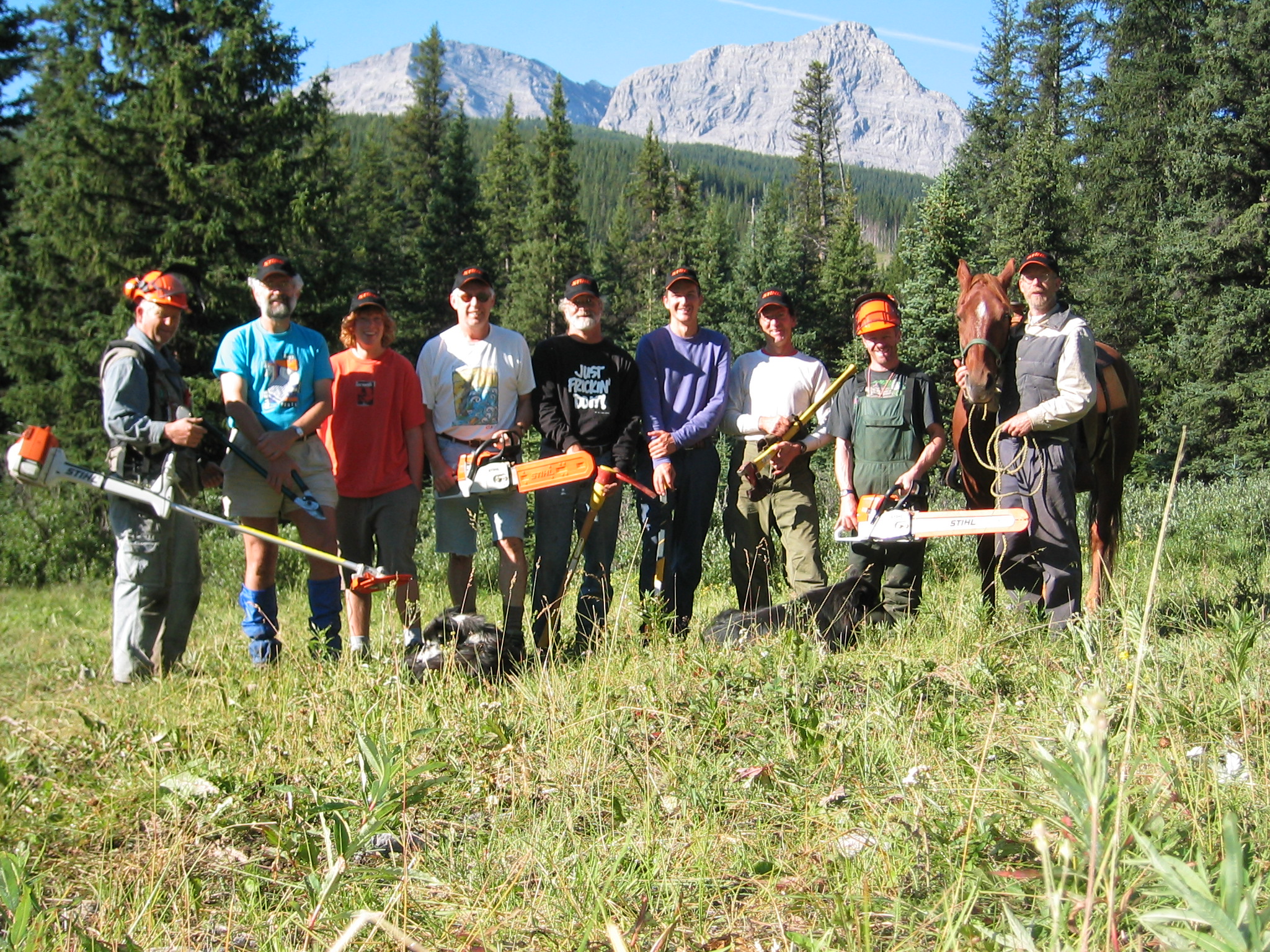
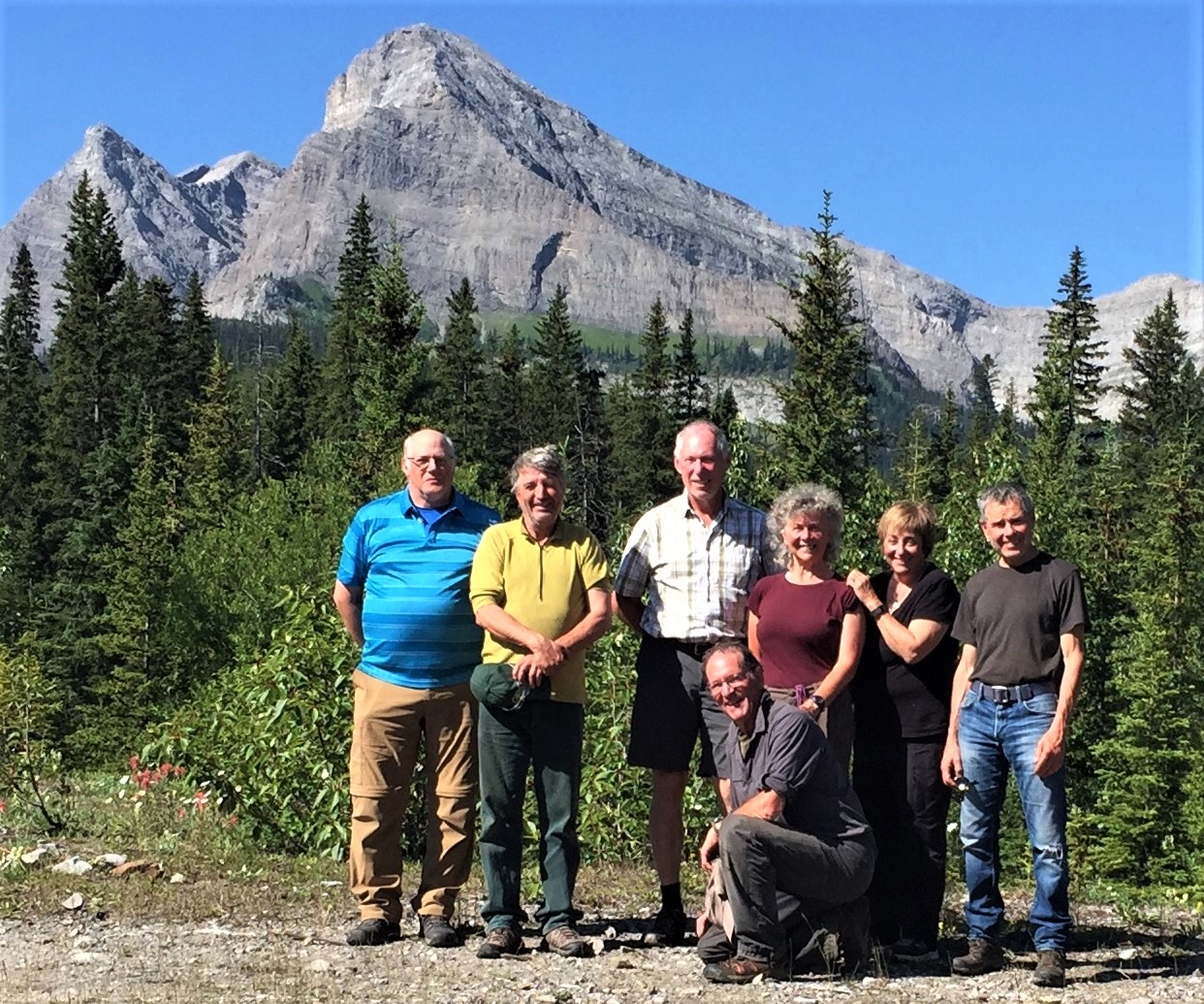
GDTA “Originals” on July 2019 Signature Trip. L – R: Lani Smith, Cliff White, Dave Higgins, Jeff Gruttz (kneeling), Jenny Feick, Mary Jane Kreisel (nee Cox) and Dave Zevick. (Photo by Margaret Dumigan)
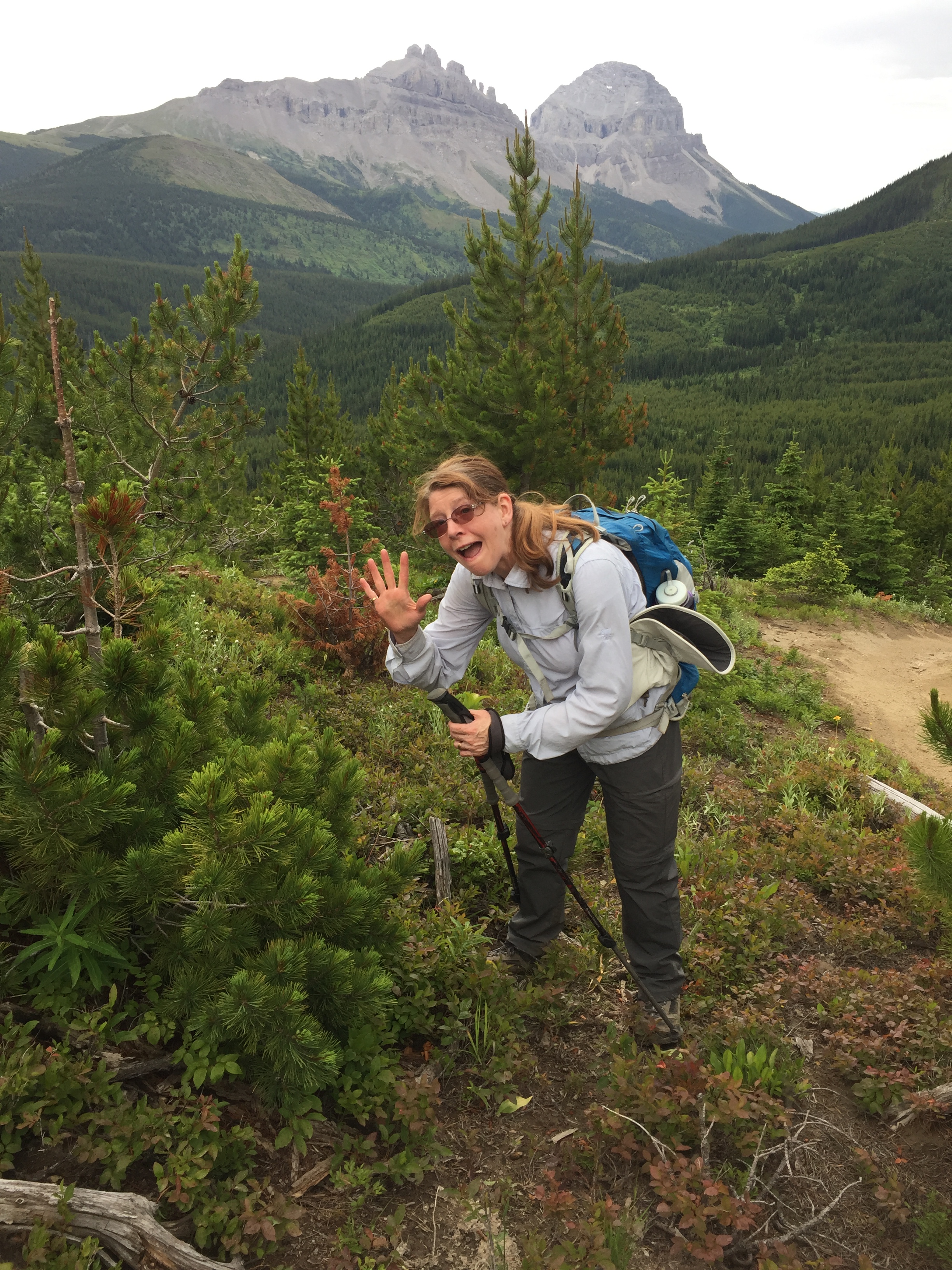
Every spring, I take great delight in getting reacquainted with my friends in the plant world. This year, especially, with the social distancing required to help slow the spread of the novel coronavirus, I’ve had to resort to hugging trees instead of embracing my family, friends, and colleagues. This spring in the vicinity of my home on Vancouver Island, I appreciated witnessing the emergence of each wildflower species. Enjoying the display of alpine wildflowers in the Rockies along the GDT provides a source of joy and inspiration that I look forward to each year. I sincerely hope that 2020 will be no exception despite the COVID-19 pandemic.
Plants are important not just for their beauty, or their values as food or medicine. Plants provide clues to the environment that can inform trail route selection. Everyone involved in trail work can benefit from learning to recognize certain plants and the stories they tell about soil, drainage and slope conditions. Knowing the difference between which plants grow in certain conditions can make the difference between choosing a route that will create erosion or other issues with perpetual frustration for GDTA volunteers and hikers or one that poses minimal maintenance requirements and provides an enjoyable hiking experience.
Some plant species prefer well drained soil. Others grow best in wet, poorly drained areas. Certain plants amazingly eke out a living in the most rugged, inhospitable conditions along high windy alpine ridges. Certain plants are resilient to human disturbance and can withstand trampling. Others are heartbreakingly fragile. Several seem to grow back with more vigour the more they are pruned! Some species are abundant; others rare or endangered and even protected by law, with prohibitions against damage or destruction.
While building trail, it is easy to view all plants as obstacles, something to clear away. Instead, listen to what the plants can tell you and you will gain practical knowledge that will make your trail building efforts more effective and enjoyable. Here are a few examples to help get you started.
Needles in Five; Keep them Alive!
Be sure you know how to distinguish a whitebark pine (Pinus albicaulis) from a lodgepole pine (Pinus contortus var. latifolia) when you are out on the GDT. As of 2012, the federal Species at Risk Act lists whitebark pine as Endangered on Schedule 1. Cutting or damaging a whitebark pine is illegal and could jeopardize the GDTA’s ability to continue to build the GDT.
Whereas whitebark pines are relatively rare and easy to route trail around, lodgepole pines are extremely common and many of them need to be cut to build and maintain trail. So, how do you tell the difference? The sure-fire way is to check the bundles of needles emerging from a twig or branch. Whitebark pines have needles in groups of five, whereas lodgepole pines have needles in groups of two. Usually, you find whitebark pine along high subalpine south and west facing ridgetops, in well-drained to dry sites with poorly developed soils or rocky talus, in other words, ideal places to locate the GDT. Lodgepole pine tend to grow at lower elevations, but sometimes they survive on the same rocky ridges where whitebark pine thrive.
The long-lived but slow-growing whitebark pine rely on Clark’s nutcrackers for seed dispersal. In turn, their “pine nuts”, which are more calorie-rich than chocolate and have a higher fat content than butter, help feed those birds, as well as other animals. White Pine Blister Rust, an Asian species introduced via European imports in the 1900s threatens all North American five-needle pine species. Climate change, mountain pine beetle, fire and fire suppression interact to compound or accelerate adverse effects. Let’s do whatever we can to identify and maintain these attractive denizens of high places.
GDTA volunteer Margaret Dumigan points out that this conifer has needles in groups of five and this is thus a protected whitebark pine.
Willow Thou Go, the GDT Shan’t Go
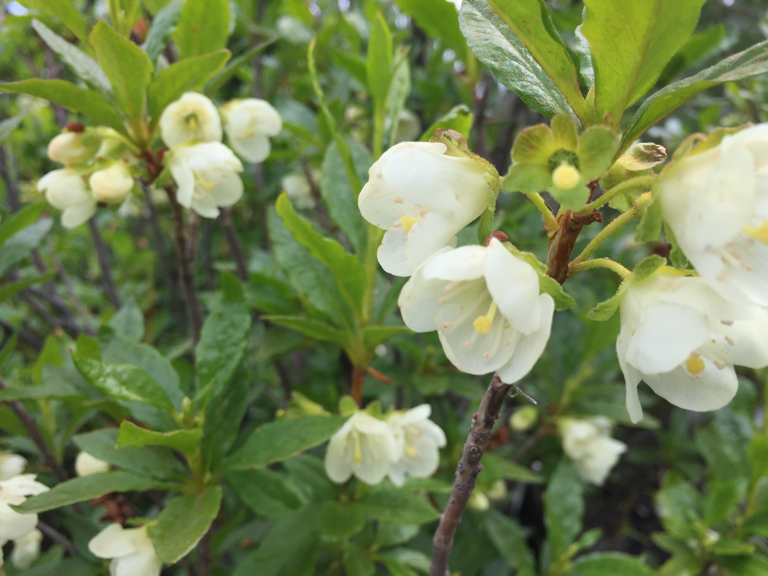
Shrubby vegetation along the GDT often poses the greatest challenge for trail builders. The tendency is to call everything a willow (salix sp.) or an alder (alnus sp.). While both exist along the GDT, many other shrub species do as well, including white-flowered rhododendron (rhododendron albiflorum), false azalea (menzisia), grouseberry (Vacciniumscoparium), buffaloberry (Shepherdia Canadensis), bearberry (arctostapahlous uva-ursi) and juniper (juniperus sp.). Why does it matter? Knowing if a shrub really is a true willow is extremely important, especially species that need wet soils like the diamond leaf willow (Salix planifolia). When routing the GDT, do whatever you can to avoid low-lying areas containing these willows, which quickly become muddy quagmires. Go upslope where the shrubs preferring drier, more well-drained conditions live.
Better to build the GDT along slopes where white-flowered rhododendrons grow, than where willows thrive.
Admire their Beauty from Afar
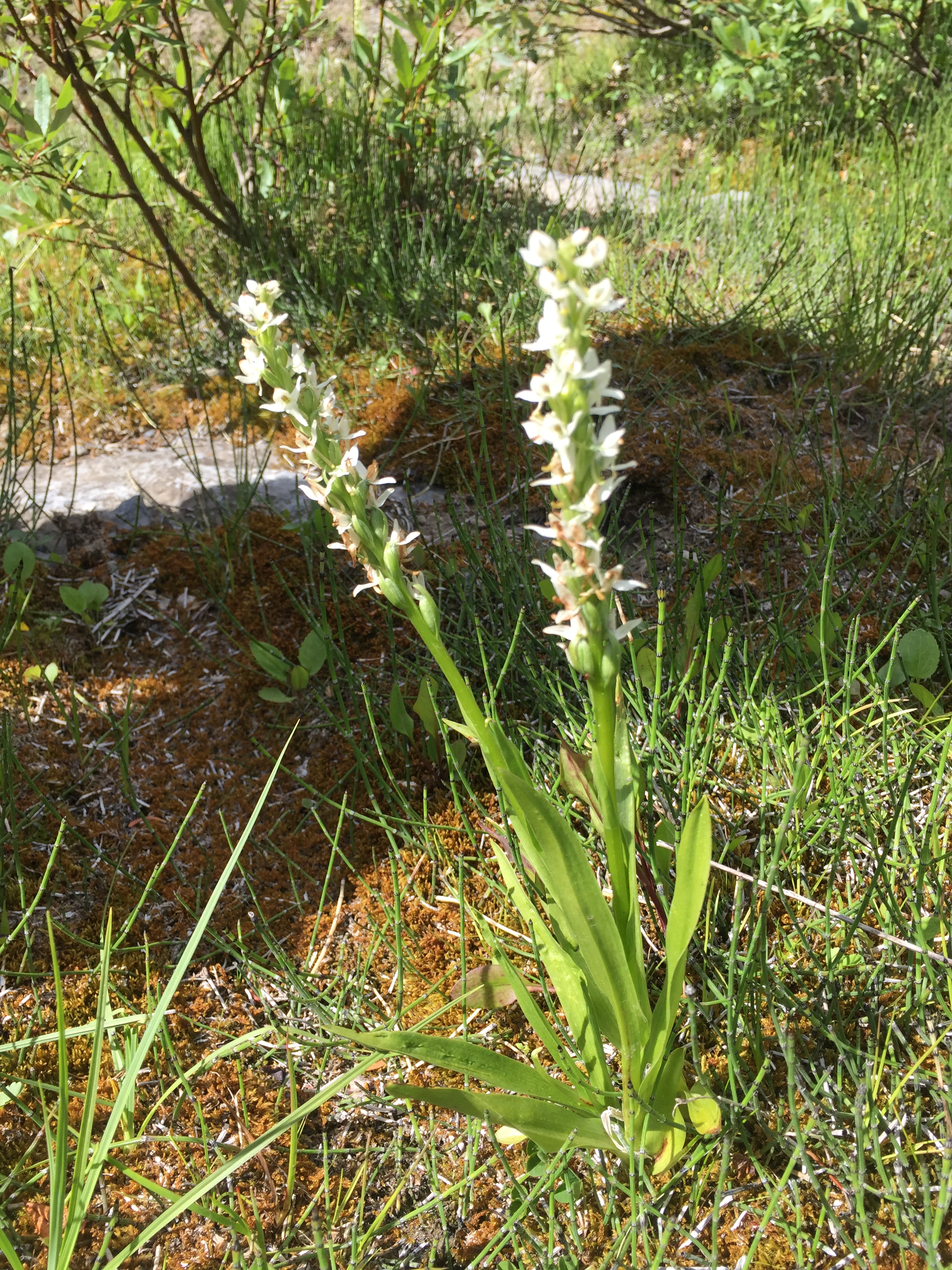
Several species of attractive and sometimes fragrant wildflowers prefer very moist subalpine or alpine habitats, including fragrant white-rein orchid (Platanthera dilatata), northern grass-of-Parnassus (Parnassia palustris), and pink monkeyflower (Mimulus lewisii). These forbs are often accompanied by sedges, horsetails, and ferns. While you want to provide opportunities for hikers to enjoy seeing wildflowers, please stay out of wet alpine meadows containing these indicator species. Generations of future trail volunteers and thru-hikers will thank you.
Pink monkey-flowers grow in wet to moist streambanks, seepage areas, meadows and avalanche tracks in the montane to lower alpine zones.The fragrant white-rein orchid indicates a wet to very wet open site where water collects, aka a wetland where no trail should be built.The GDT’s ideal trail location is on a slope with well-drained soil or a rocky ridgetop. July 2019
Jenny Feick took all of the above pictures during GDTA work parties in 2018 or 2019.
A Little Bit of Knowledge can be a Dangerous Thing
When assessing the plants in an area for the clues they can provide for trail routing and maintenance, check reliable guides to Rocky Mountain flora and seek advice from someone with botanical knowledge. Not all willows prefer wet areas. Vegetation differs depending on whether you are on the drier Eastern Slopes of Alberta or in the moister valleys on the B.C. side of the Great Divide. One volunteer inadvertently cut down a big patch of cow parsnip (Heracleum lanatum) in a meadow along the High Rock section of the GDT, thinking that it was devil’s club (Oplopanax horridus), a spiny understory shrub that grows in wet areas along with old-growth Western red cedar and Western hemlock.
Considering that bears (both grizzly and black) seek cow parsnip as a favourite food source, it may make sense to route the GDT away from extensive patches of this tall herbaceous plant. Many park agencies and communities in bear country like Canmore, Alta. now choose to locate hiking trails away from places containing high concentrations of prized bear food plants to promote peaceful co-existence between bears and people.
Although the leaves look somewhat similar, the spiny shrub devil’s club grows in wet areas shaded by old-growth cedar-hemlock forests whereas the herbaceous perennial cow parsnip thrives on avalanche slopes and other open or partly shaded areas. (Photos by Jenny Feick)
Summer of 1975, my most frightening and embarrassing hiking moment
byLani Smith
It was a beautiful calm, warm summer weekend, so we, Glen Byers, Kim O’Brien and myself, gathered at Byers house to plan a weekend hike. Weather looked great, not a cloud in the sky on Friday evening as we made plans to drive down to Crowsnest Pass area in my Red Volkswagen Beetle, named “Sparky”. It was getting late and we were all getting hungry when Mrs. Byers offered us a wonderful supper before we left Calgary. We headed out right after supper. The sun was setting now and we still had a three hour drive ahead of us, and then realized we’d be setting up our tents in Allison Creek Campground in dark.
We arrived after midnight. Sky was clear and full of stars shining brightly, with only a sliver of a moon partly glowing to shed us only a dim glimmer of light. All the campsites seem to be already taken and we didn’t spend a lot of time searching because we didn’t want to disturb and wake up a sleeping campground. We parked close to the picnic shelter and discovered it was empty. The entire campsite was in sleep mode, not a campfire was glowing, all campers were tucked away for the night. We tiptoed quietly around and decided not to spend time making noise in pitching our tents, so we collectively decided to crash in the Picnic Shelter and sleep on top of the tables inside. Quietly we gathered our stuff and laid out our mats and sleeping bags onto the tables, and whispering goodnight to each other, drifted off to sleep soon thereafter. The entire campground was very peaceful, dead asleep, absolute silence.
It seemed like a few hours of deep sleep drifted by when, still in a sleepy daze I swatted my face from an annoying itch. Being so tired from a long day and a long drive, I laid my head back on the pillow and I was out like a light.
Later in pitch blackness, dead calm night, I heard the utmost, loudest, high pitched blood curdling scream that I have ever heard in my entire life. It sounded like some young teenager was being bludgeoned to death! I could feel my heart loudly pounding in my chest. I instantly sat up, blurry eyed, glimpsed around seeing Kim literally head first, dive from her sleeping bag right through the window. Glen in one motion,just like a cartoon character, instantly sprang from lying flat out on the table to hanging upside down desperately clinging to the rafters all in one super swift motion.
“What from scary hell is happening”, both my friends screamed at me.
Well, a few short moments before, me dead to the world in sleepy land, I had felt a second itch on my face and with my eyes still shut, I instinctively had swatted what I thought was an annoying mosquito. Two seconds later, a cold, clammy feeling had slowly spreadover my entire face, cheeks, nose, and mouth getting covered over, tiny little claws grabbing and digging into my cheeks. I S-L-O-W-L-Yhad opened my eyes only part way, and had seen a creature staring right back at me. Then, only to my surprise, I released a high pitched, blood curdling scream that woke up the entire campground of a hundred or so campers, all immediately sounding car horns, banging pots and pans, in unison yelling and screaming as if their own life was in danger of a wondering attacking Bear. All clambering together, making as much noise as possible to scare off this huge frightening creature.
Glen called over to me … “Where is he, where’d he go?”I said, “Where’d who go?”
Glen’s reply … “The bear, you hurt? Did he get you? You bleeding?”
Me, sheepishly, whispered, very embarrassingly murmured … “It wasn’t a bear. It was a bat, ok?“ “A what!?” Glen yelled. I said, “I swatted a bat as he landed on my face”.
Glen and Kim could not contain their uncontrolled laughter, Glen still clinging, hanging upside down on the rafters, laughed so hard he lost his grip and fell back onto the picnic table and stilled laughter. Kim, came running back in, stared and laughed so much she was literally rolling on the ground laughing.
Glen called over to some inquiring campers that the bear left, ran away, and the danger was gone. Another hour went by before my friends and the entire campground regained themselves enough so we could get back to sleep.
The women of Her Odyssey, Bethany ‘Fidgit’ Hughes and Lauren ‘Neon’ Reed, are in the midst of a multi-year endeavor to travel the length of the Americas by non-motorized means. Their aim is to connect the stories of the land and its inhabitants, and to share what they experience and learn, with friends and followers around the world. Since beginning in 2015 the two women have covered over 20,000 of the proposed 30,000 km journey from Patagonia to the Arctic Ocean.
Route Travelled So Far
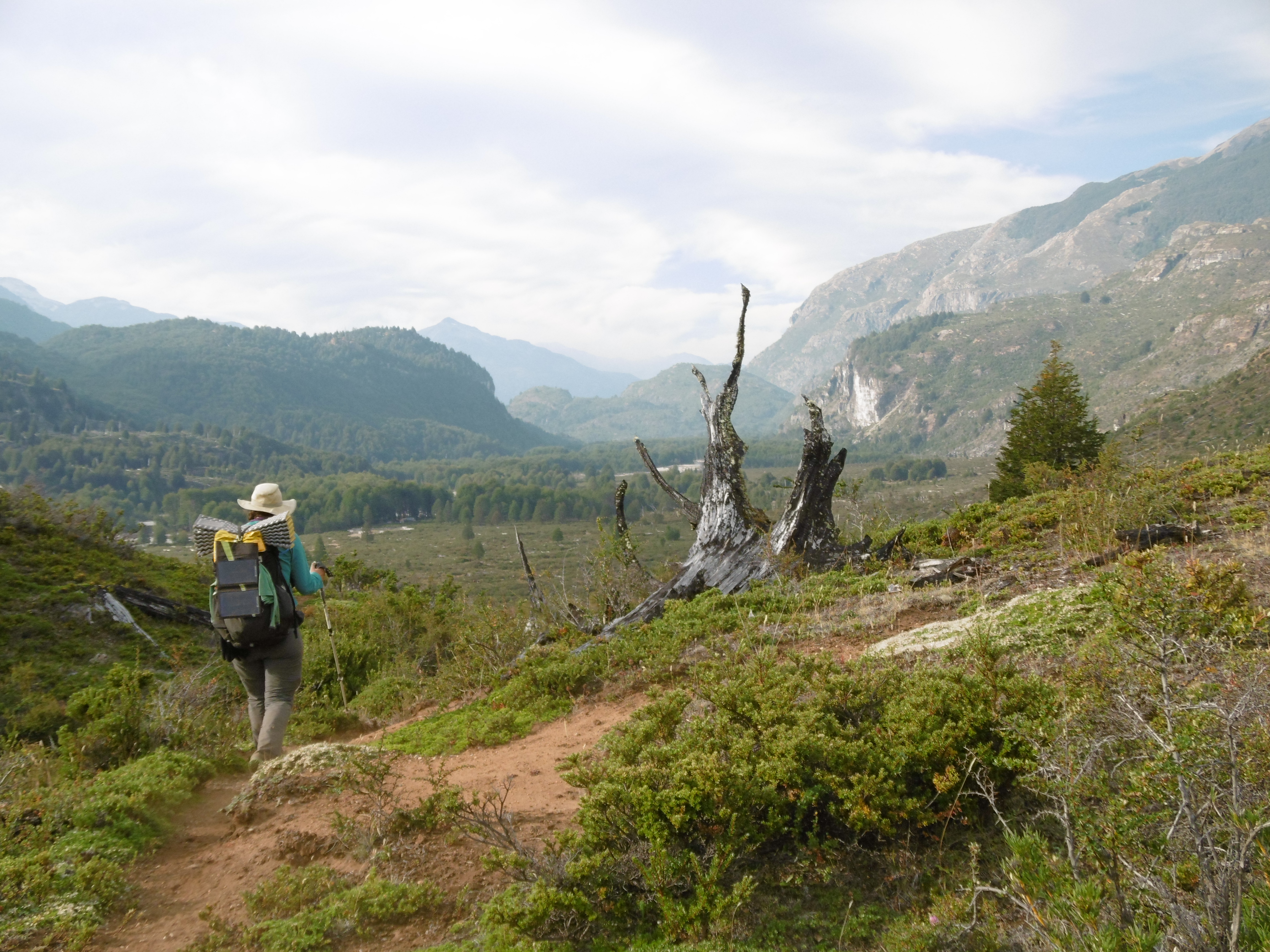
They began hiking from the Beagle Channel in November 2015. From bushwhacking and route finding through the southern cone, their route quickly took up the Greater Patagonian Trail, a long-distance route network in the southern Andes that spans 3000 km, from Fitz Roy, in Los Glaciares National Park, Argentina, to the outskirts of Santiago, Chile. The women were able to contribute to this route by being the first to ground-truth a 1000 km stretch of the Andes from remote borderlands, volcanoes, across estancias and mining complexes, through heritage forests, and into the heart of the bustling metropolis of the capital of Chile.
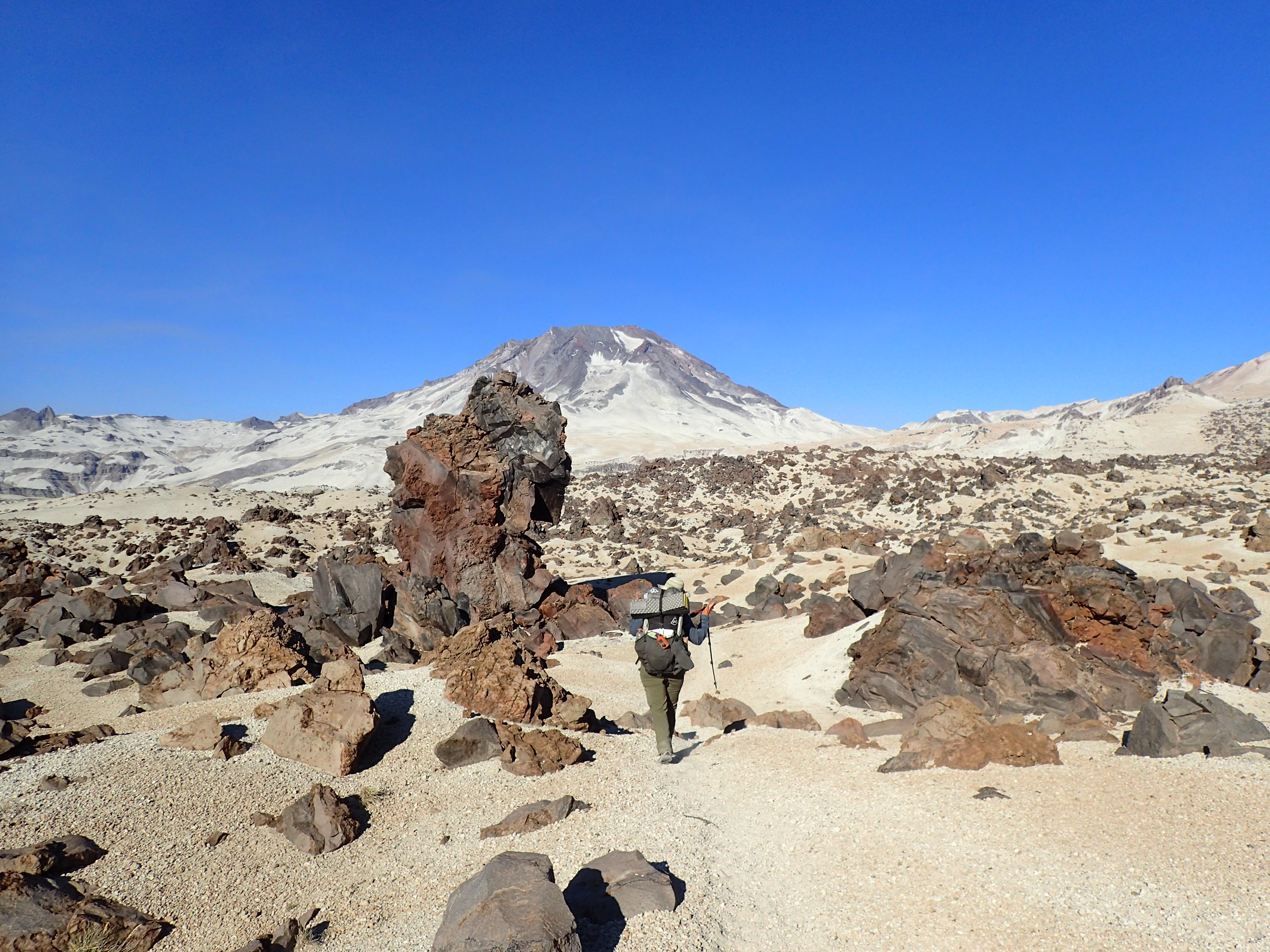
Greater Patagonian Trail, Argentina and Chile photo highlights:
Neon Thru-Hiking the Greater Patagonian Trail
Volcanoes Along the Greater Patagonian Trail
The second year of hiking, the route connected from the nascent Greater Patagonian Trail to the ancient Qhapaq Ñan, the footpath/road system of the Inca Empire. Approximating this route led the hikers onto the alti-planos, rising to above 4000 m in elevation from Argentina, across Bolivia, Peru, Ecuador, and descending into Colombia. Along one stretch the women joined forces with the Waterkeepers Alliance on the Marañon River and paddled 530 km of the wild river which inspired Ciro Alegría to write The Golden Serpent, a portrayal of Peruvian life along the river.
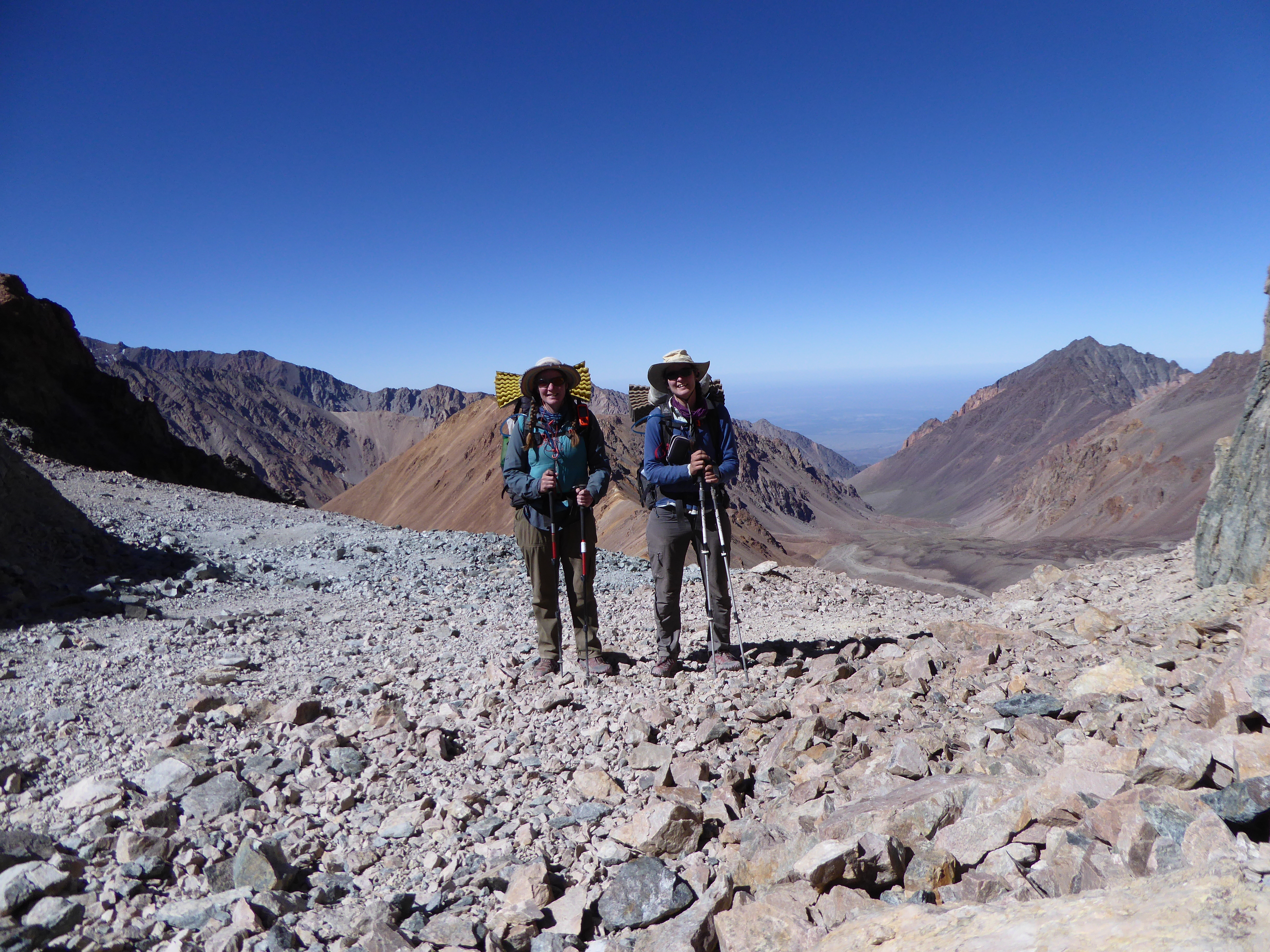
Argentina photo highlights:
The Women Atop Portillo Pass, Between Chile and Argentina in the Andes, Just East of Santiago, ChileFidgit Enroute Giving a School Lecture in Salta, Argentina (Northern Argentina)
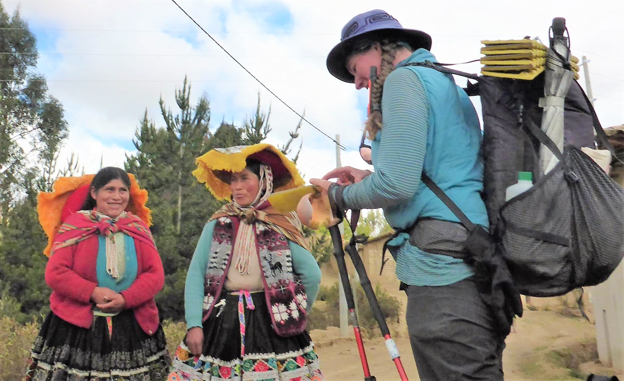
Bolivia photo highlights:
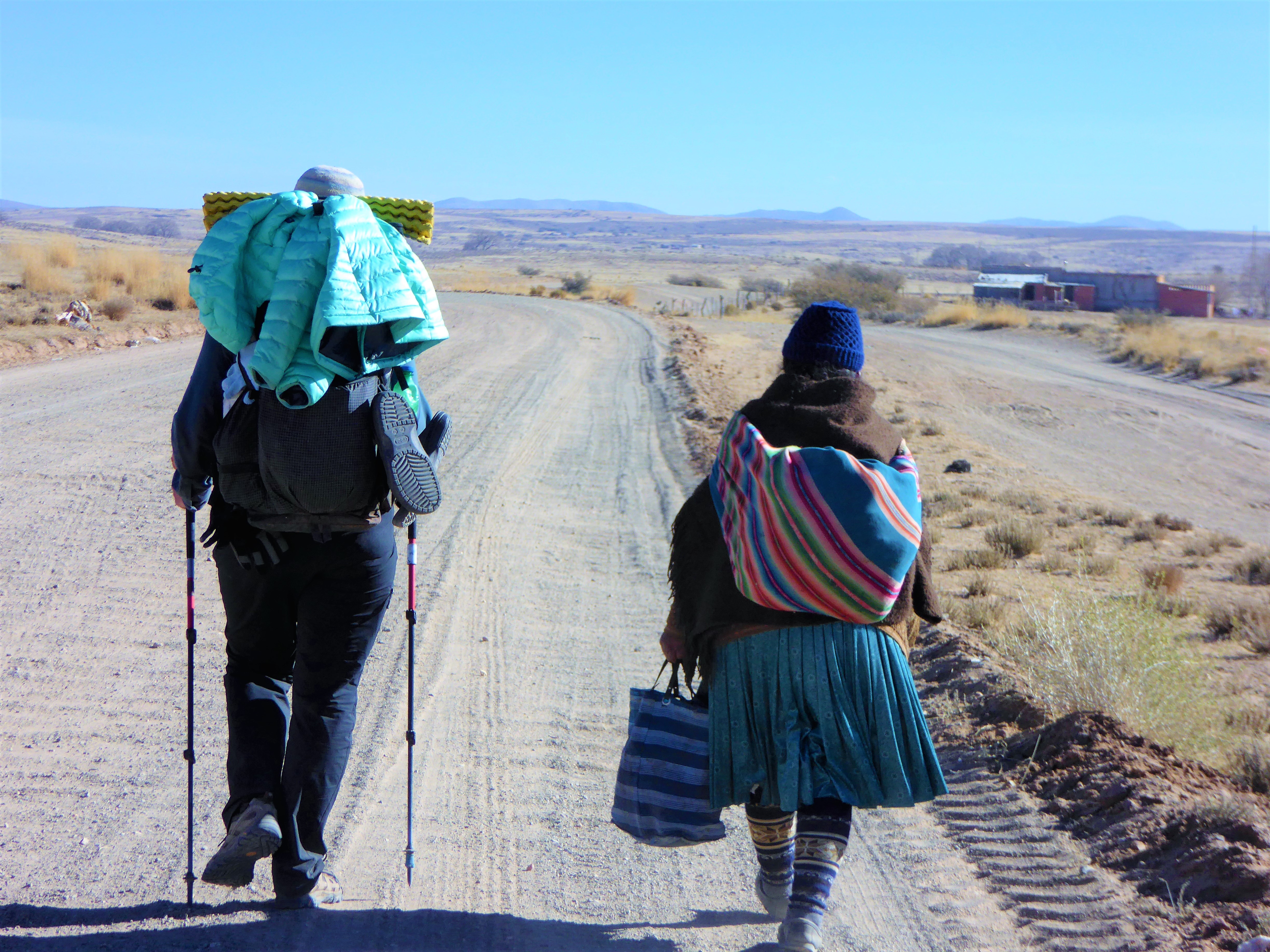
Fidgit Interviewing Quechua Woman (Cholitas) of BoliviaQuechua Family Who Gave Fidgit (left) and Neon (right) a Place to Sleep, BoliviaFidgit Walking with an Aymara Woman, in the Alti-Planos (high plains) of Bolivia
Peru photo highlights:
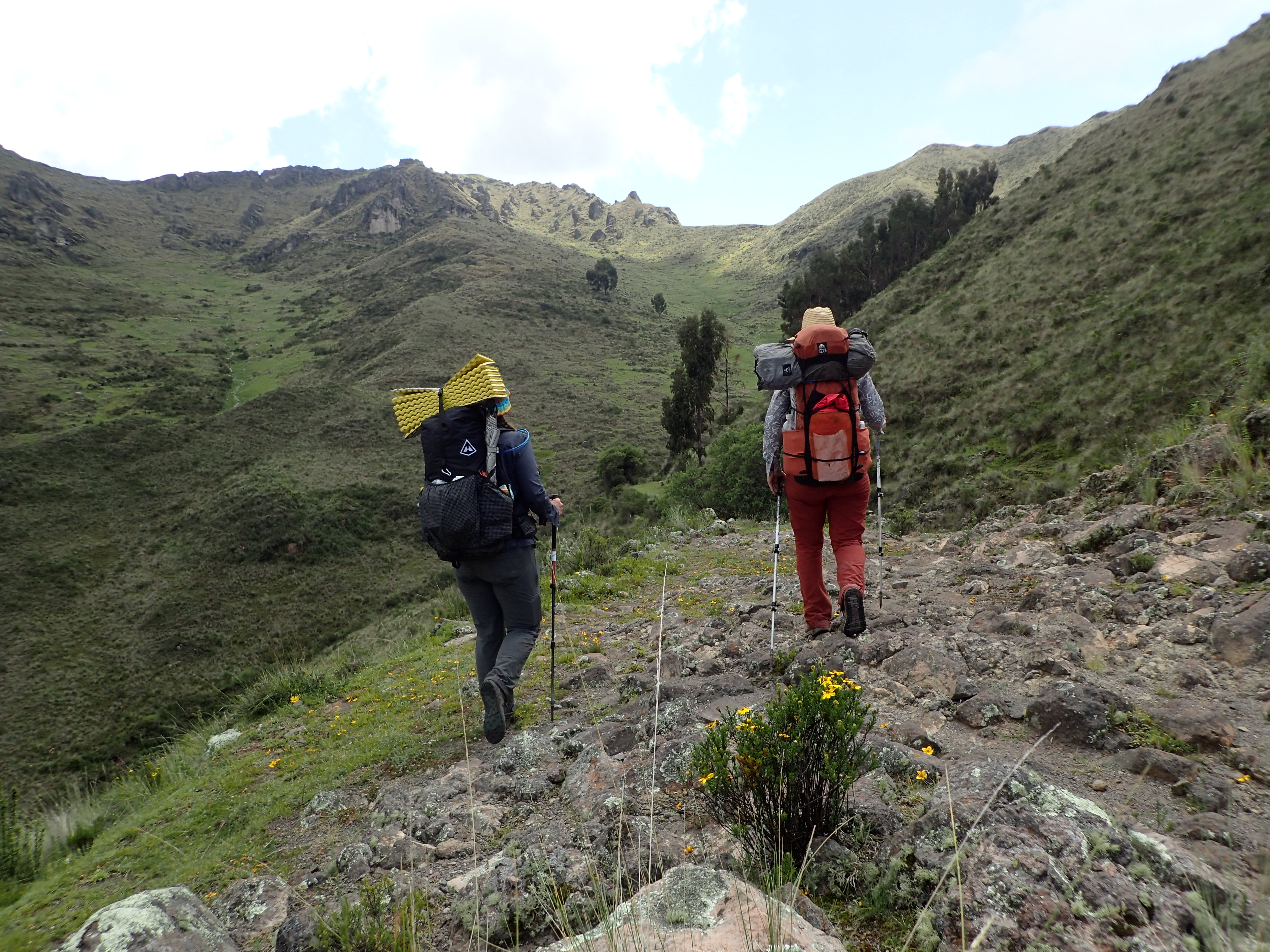
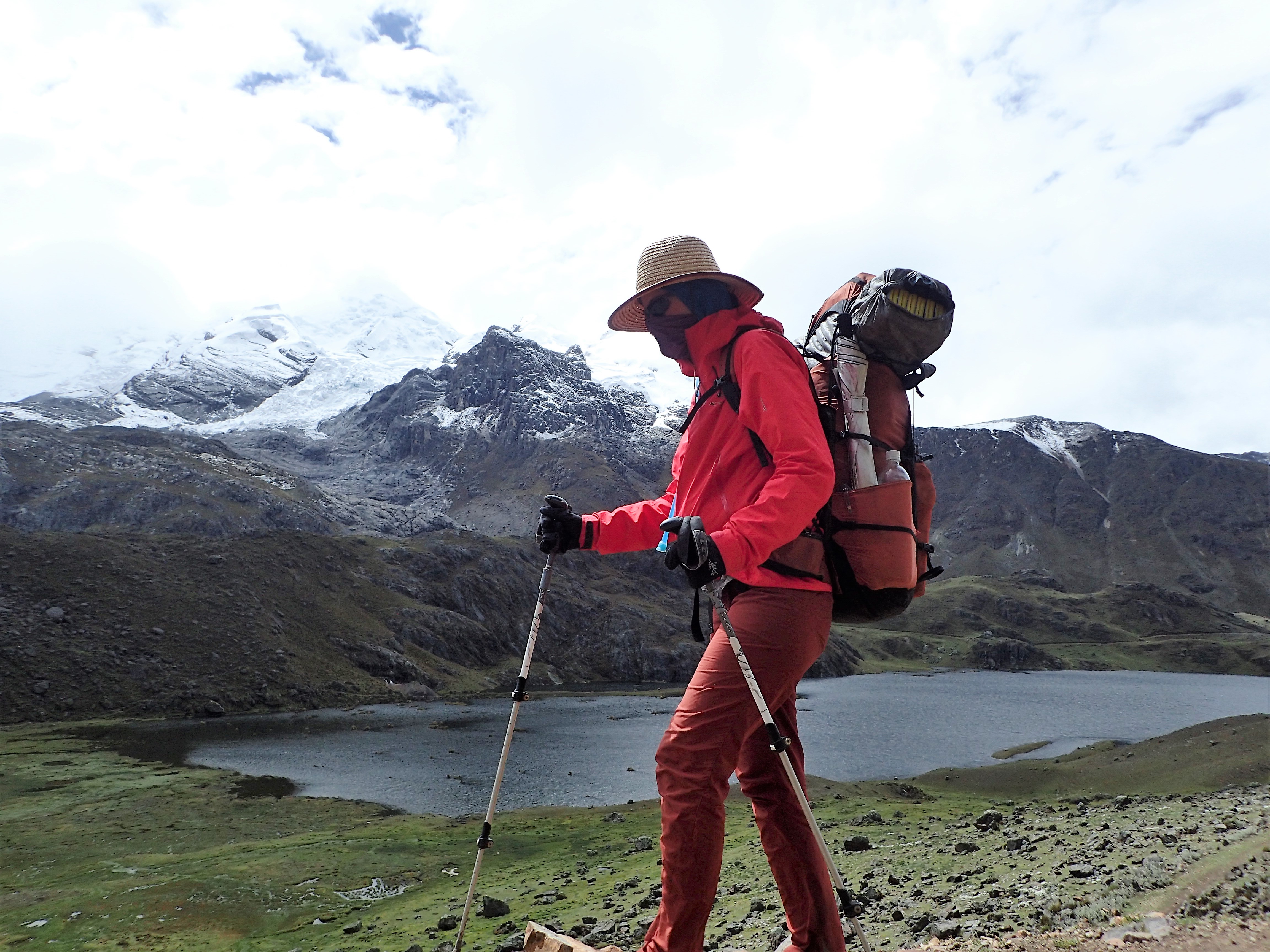
In Peru, Hiking the Quapac Nan, the Inca Road SystemAt Machu Picchu, Peru, Just Northeast of LimaNeon Hiking in the Huayhuash Range – 30 km of High Snowy Mountains, with 7 Over 6,000m, in the Peruvian Andes
In the third year, they arrived to Turbo, Colombia, becoming the first women to hike the length of South America. Central America held many lessons, as their aim to stay off roads led them into complicated political and remote jungle areas. In the end they teamed up with Trak kayaks and reversed route for a section to paddle from Lake Nicaragua down Rio San Juan, along the Caribbean coast of Costa Rica and Panama and back into Colombia, reconnecting to their South America route which had ended at Turbo. Thus, finally successfully crossing the Darien Gap after three previous efforts.
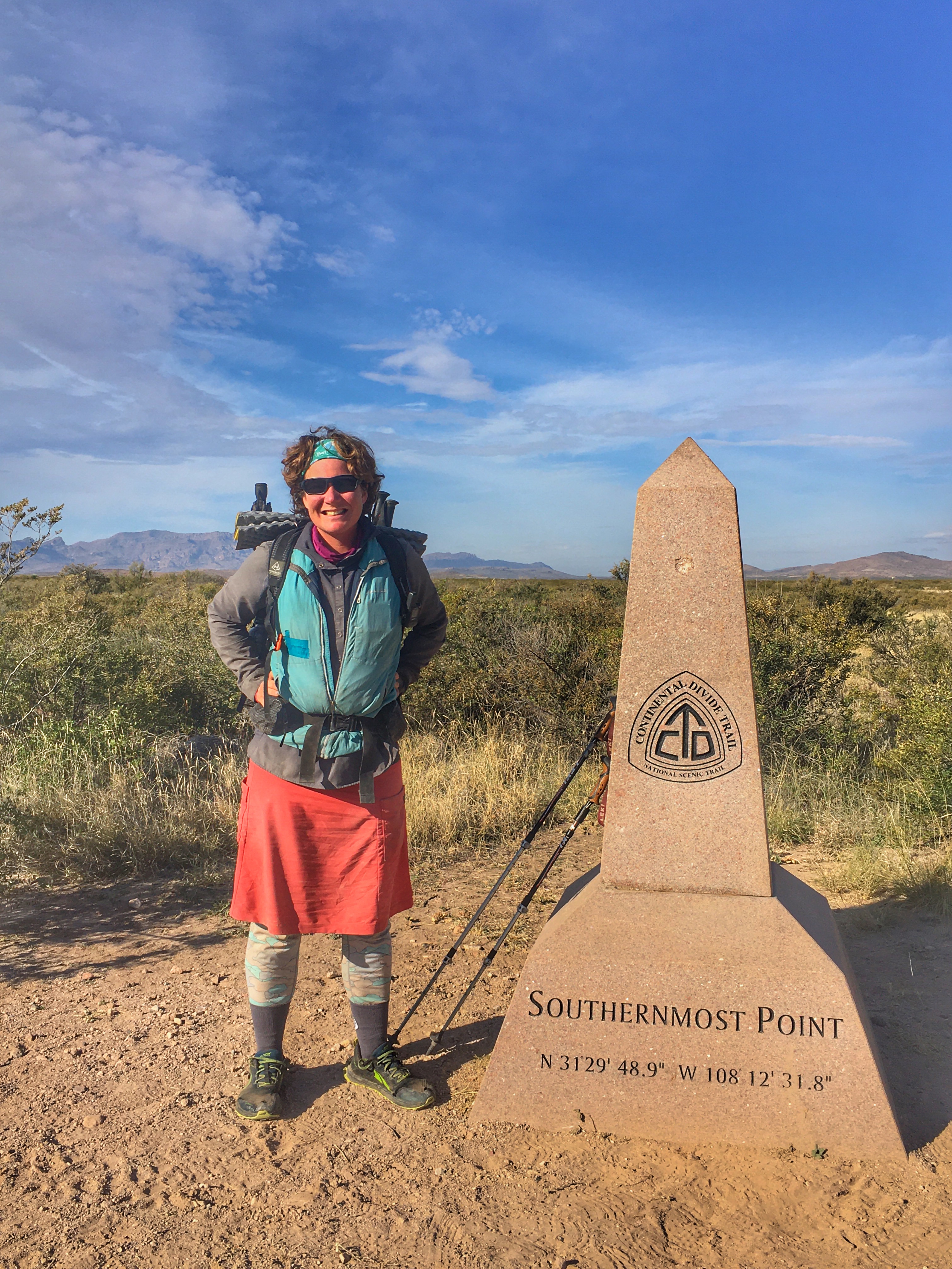
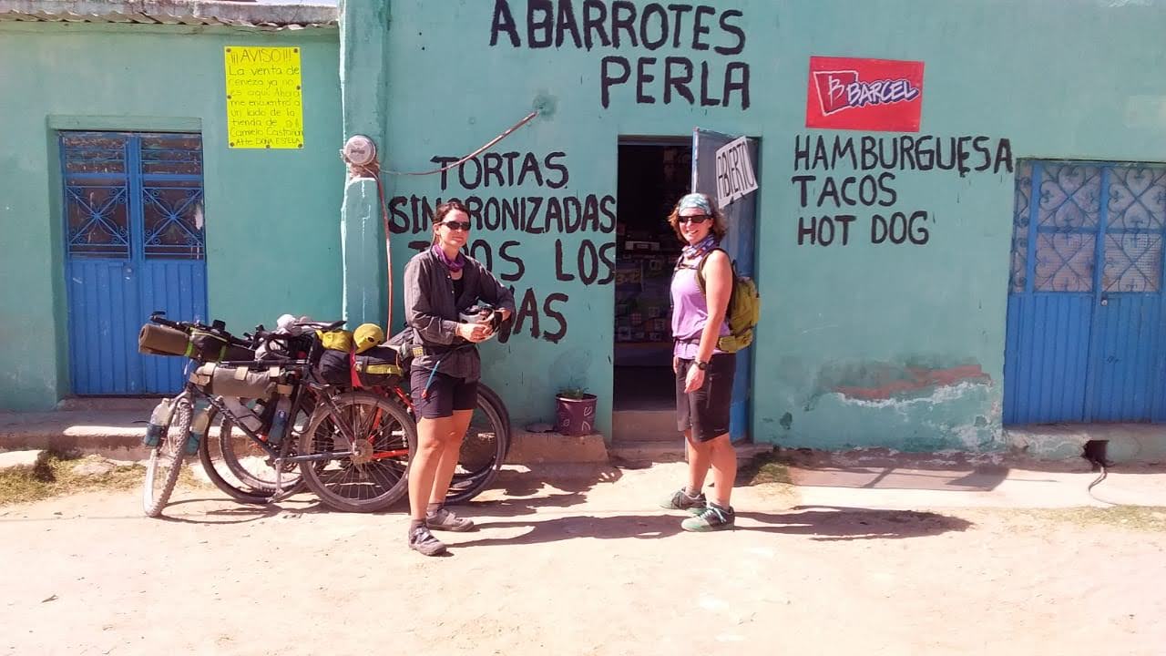
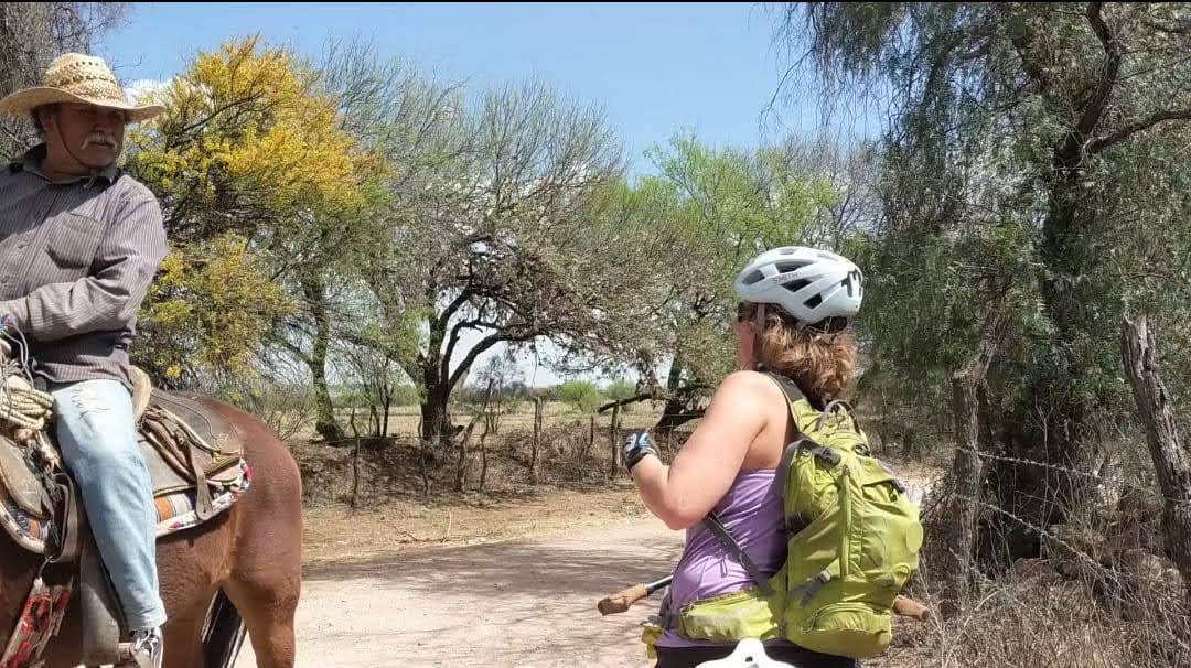
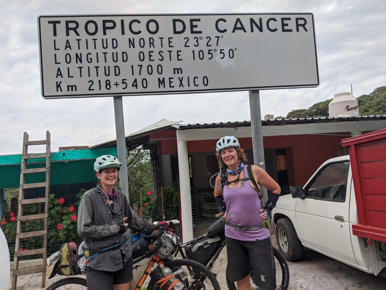
Balancing seasonal changes between the hemispheres on the fourth year of the journey, the women again chose to reverse course in 2019. While Fidgit thru-hiked the Continental Divide Trail southbound from the Canadian border, Neon, already a Triple Crowner (AT ‘08, PCT ‘10, CDT ‘13), bikepacked the new Wild West Route. In January 2020 the women came back together in San Diego and began bikepacking the Baja Divide Route. They connected this route back to mainland Mexico and pedaled as far south as Aguascalientes in the Sierra Madre Range before international reactions, and health and safety concerns due to COVID-19, prompted the women to return to the United States.
Fidgit Finishes Her Southbound Continental Divide Trail Thru-Hike
Mexico photo highlights:
Bikepacking Resupply in MexicoFidgit Getting Directions from a Rancher in MexicoTropic of Cancer, Mexico
This decision, like many on the Her Odyssey journey, was made with community in mind. It happened in Parroquia Santo Domingo in Zacateas, when a tiny abuelita came to speak with them, insisting on all she wished to share. The women here realized the decisions were not only for themselves but for all of those they would meet. Since the route through Mexico was largely through rural areas, and rural in that area means aged individuals with limited access to clean water, the decision was not about the integrity of the journey so much as it was about the wellbeing of the people who make the journey worth the effort.
Much as the decision was made in honor of the community along the route, it was informed by the community who support the odyssey. Designated safety and health personnel advise the traveling team on strategy, and their supporters and investors assist them in the ongoing financial demands of this endeavor. Since getting off route, the women have returned to their homes and have been baking, gardening, ranching, and laying plans to continue northbound once snow, borders, and health and safety concerns allow. They anticipate crossing Canada will take at least two northern summer seasons, between which they hope to return to Central America and finish connecting their South and North American routes.
The women are looking forward to hiking the Great Divide Trail, the northern terminus of which is about 100 km from the beginning of the Arctic drainage at the Parsnip River. Their aim from there will be to paddle the Parsnip into Williston Lake, which connects to Peace River, into Athabasca Lake, into Slave River, then the Great Slave Lake, which leads to the MacKenzie River, the mouth of which pours past Tuktoyatuk, into the Beaufort Sea and the Arctic Ocean. Their aim for summer 2020 will be to complete the GDT and as many sections of paddling as possible before storing gear for the winter season and returning summer 2021 to complete the six year, 30,000 km journey.
Beyond the physical journey, the Her Odyssey women pursue a number of projects and aims. Primary among these is to share the stories and experiences with an ever wider audience, thereby forging connection between communities. They do this by writing blogs about the journey and those they meet, posting videos and pictures on various digital platforms, contributing writing and photography to other pages, in person talks and presentations, education outreach efforts, and teaming up with companies and contributing to non-profits they see at work on the ground. Much like the journey itself, whatever paths open up before them, they explore.
Even more than the ground covered (which is saying something because many of these 20,000 kilometers have come hard earned), the greatest challenge is to balance these various fronts: personal development, team work, community building, while writing and sharing with a public audience. They do this work because they believe that finding common ground and connection between ourselves and with the planet is a moral imperative. If the objective is to encourage people to connect with the world around them and to pursue their dreams, the Her Odyssey team must lead by example. They aim to find a balance and consistently check in about decisions with their Core Values.
The objective is to cross the length of the Americas by non-motorized means but they do this in service to a belief in the power of connection and community. So they forge forward while trusting the process, respecting the boundaries, adapting to what nature fosters, and with gratitude for beauty and hardships alike. The two women are excited to hike the Great Divide Trail, impressed by the wealth of information and resources which have long made this particular segment of the Her Odyssey journey something worth looking forward to.
This edition of the Pathfinder Newsletter includes articles showcasing GDT hiking, information to help plan your 2020 summer on the GDT – hiking and/or volunteering, plans and goals for the GDT’s future, and an upcoming event announcement. Enjoy!
Blazing the Trail: A look at the blazes and other markers guiding the way on the GDT.
Maligne River Swim Adventure: Walk through a swift high water river crossing, successfully and unsuccessfully, for greater understanding to tackle river fords.
Sure, there are more up-to-date options available nowadays if you want to follow precisely a defined walking route, or track, through untamed spaces between two widely-separated terrestrial points on this planet. For example, you can purchase a highly sophisticated electronic gadget that receives coded digital transmissions from several even more sophisticated objects in medium earth orbit 20,200 km above the surface, with the kind (and hopefully uninterrupted) blessing of the U.S. military’s Space Force agency, and simply adhere to the course indicated by the wiggly line highlighted on your little device’s tiny display. Just don’t lose it in the next stream you cross, and remember to appreciate to the fullest your escape from modern civilization and all its trappings.
As for me, I prefer a decidedly low-tech system of physical markers, or what we old-timers call signs and blazes, to show the way (but since I’m an admitted old guy, you could have expected that!). I know – signs and blazes create clutter, are unnatural and compromise the wilderness experience (as alluded to in the previous paragraph). In my defense, though, I prefer a bare minimum of signage and loathe the traditional blaze (a slash made with an axe on a tree trunk), favouring a painted-on facsimile out of concern for the health of the tree as well as the sensibilities of the observer.
Author with quick & dirty GDT marker and blaze at Cataract Plateau, 2004
With my bias out in the open, then, here we go with my (hopefully) convincing arguments in support of the lowly paint blaze. But first, some background details:
A PATH TO ADVENTURE
When I first set foot on Ontario’s Bruce Trail in 1970, at the tender age of 16, and noticed the small rectangular white marks painted on trees leading off through the forest in both directions, what struck me was the notion that I could follow those marks for days, weeks and perhaps months, and eventually come to the famed Niagara Gorge or, in the opposite direction, the northern tip of the storied Bruce Peninsula, and who knows what treasures and experiences I’d encounter along the way? In a very real sense, those paint marks were an enticement to discovery and adventure.
A few years later, after hiking most of the Bruce Trail and learning the hard way to always be on the lookout for blazes and to not miss a change in direction, I began attending organized work outings and learned the craft of trail maintenance and, of course, paint blazing. The acknowledged pro was a fiftyish Kiwi named Chris Horne, and he taught me to make perfect two-by-six-inch blazes. The idea, Chris said, was to lessen the intrusive aspect of the paint marks by keeping them as uniform and tidy as possible, so that the hiker is less conscious of their presence. Think of official signs along highways – if they all look the same you barely notice them, unless of course, you’re on the lookout for where to turn or need reassurance that you’re still on the right road.
I also learned that the idea of rectangular paint blazes to mark trails was originated in the U.S., by the Appalachian Trail Conference in the 1950s. That footpath crosses many roads, makes innumerable abrupt turns, intersects countless other trails, and traverses long stretches of bare ground and rock. From my personal experience on over 1000 km of the AT, a uniform system of markers is crucial to staying on the main path and avoiding constant backtracking or searching for the correct route. And from the perspective of a thru-hiker doing long days on a tight daylight budget, unnecessary steps and lost time are to be avoided like the plague.
White blaze and homemade reassurance marker on the Appalachian Trail
OTHER MARKERS
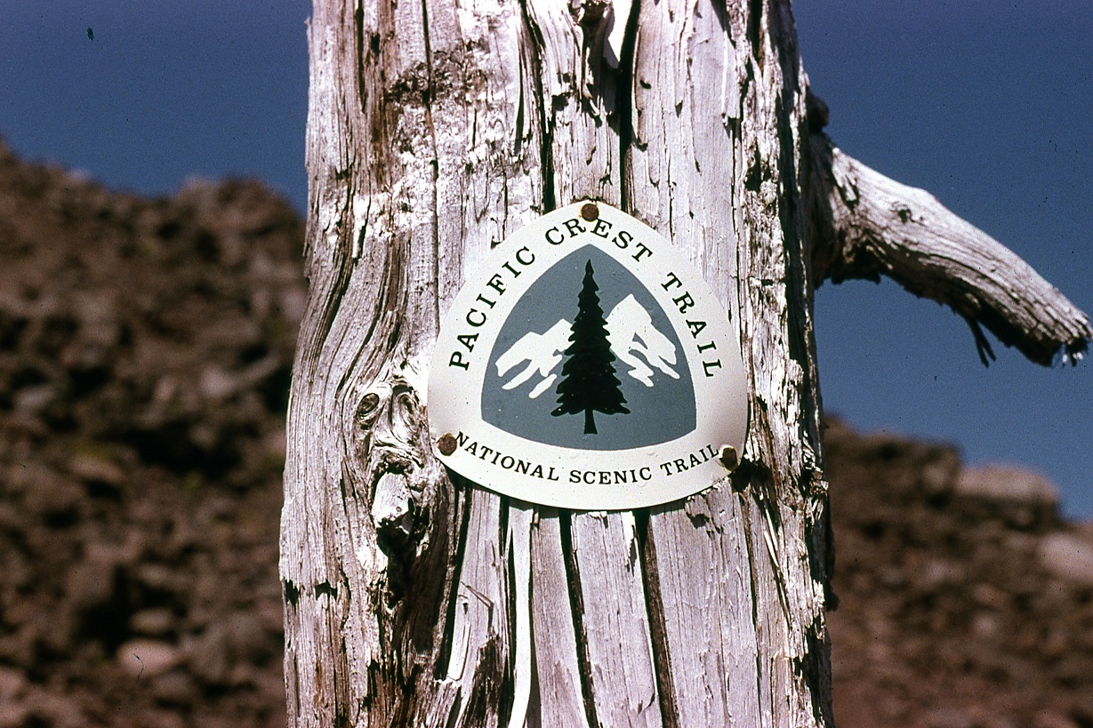
Paint blazes aren’t the only system of standardized marking used on long distance trails. There’s also what we refer to as a “reassurance marker” – a small metal or plastic placard bearing the trail’s official logo, nailed to trees or posts. For cost and other reasons, these markers are usually placed about an hour’s hike apart. Aside from confirming to trail users that they’re indeed on the correct route, for some (like the author) there’s also a kind of intangible emotional reaction when encountering this kind of marker – that they’re on the actual honest-to-goodness official path, and thus participating in a grand and marvelous endeavour.
PCT reassurance marker
Another type of marker occasionally seen (and invariably appreciated by users) is a small sign pointing the way to a campsite, access point, or perhaps a water source off the main trail. Larger, more descriptive signs can also be found, normally only at access points, but to me these are a necessary evil – like the set of rules posted at public swimming pools – an admonishment to the irresponsible to not wreck the trail and the experience for other users. One thing I like to see at these locations, though, is an indication of trail direction, e.g. north or south.
BLAZING ON THE GDT
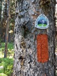
But this is a piece about trail blazing, so I’ll get back on topic and discuss what we’re doing and why on the Great Divide Trail. Years ago, 1976 specifically, we put forward a detailed proposal to the Alberta government to obtain permission to begin construction of the Trail in the upper Highwood River watershed. For consistency with other trail systems, white paint blazing was part of the proposal, and long story short, they were in agreement but requested that we use “Forest Service Orange,” which was what they sprayed on trees to demarcate blocks of forest slated for study or harvest. They even provided us, helpfully, with a pallet-load of this stuff, probably enough to paint every tree top to bottom from Banff to Waterton. An awful colour, we thought, and even worse it was a thin lacquer, suitable only for spraying. So we found, at Canadian Tire of all places, a marine grade oil-based enamel that was a close match to Forest Service Orange, and only used the other stuff as thinner!
Orange blazes go well with golden larch (if nothing else)
Why oil-based paint, you ask, instead of the more user- (and environmentally) friendly water-based latex? First and foremost, for longevity and durability. Realistically, we can’t be re-blazing every couple or even every few years. The correct paint will last decades when applied to the right surface (the smooth bark of subalpine fir is awesome). Other reasons: you can apply oil-based paint in cold or wet weather, and one coat is sufficient. As it turned out, the bright orange colour was an inspired if unintentional choice – we were out on the newly-marked Trail after an early snowstorm, and those orange blazes were easily distinguished from the patches of white snow plastered on tree trunks at higher elevations. And with the path obscured it was still possible to follow it.
Over the course of the late 1970s and early 1980s, we blazed the GDT from Fording Pass south to Tornado Mountain, a trail distance of about 100 km. As of today this is still the only section that’s so marked. With the expanded scope of the GDT in recent years, national and provincial parks are now traversed by the official route, but it’s highly unlikely there will ever be paint blazing in those jurisdictions. Not that there needs to be; unlike non-park sections of the route, there are few road crossings or unmarked trail intersections and no cutlines or logging roads to cause confusion, and all trails used by humans are more or less official and therefore signed and maintained (again, more or less!).
Non-park GDT routes of cultural significance, such as the David Thompson Heritage Trail in BC, probably won’t be blazed either, (although an occasional, well placed reassurance marker may be used) to preserve both the historical integrity of the place and quality of user experience. However the route linking Amiskwi Pass with the David Thompson trailhead, which alternates logging roads with single-track segments, is a good candidate for marking.
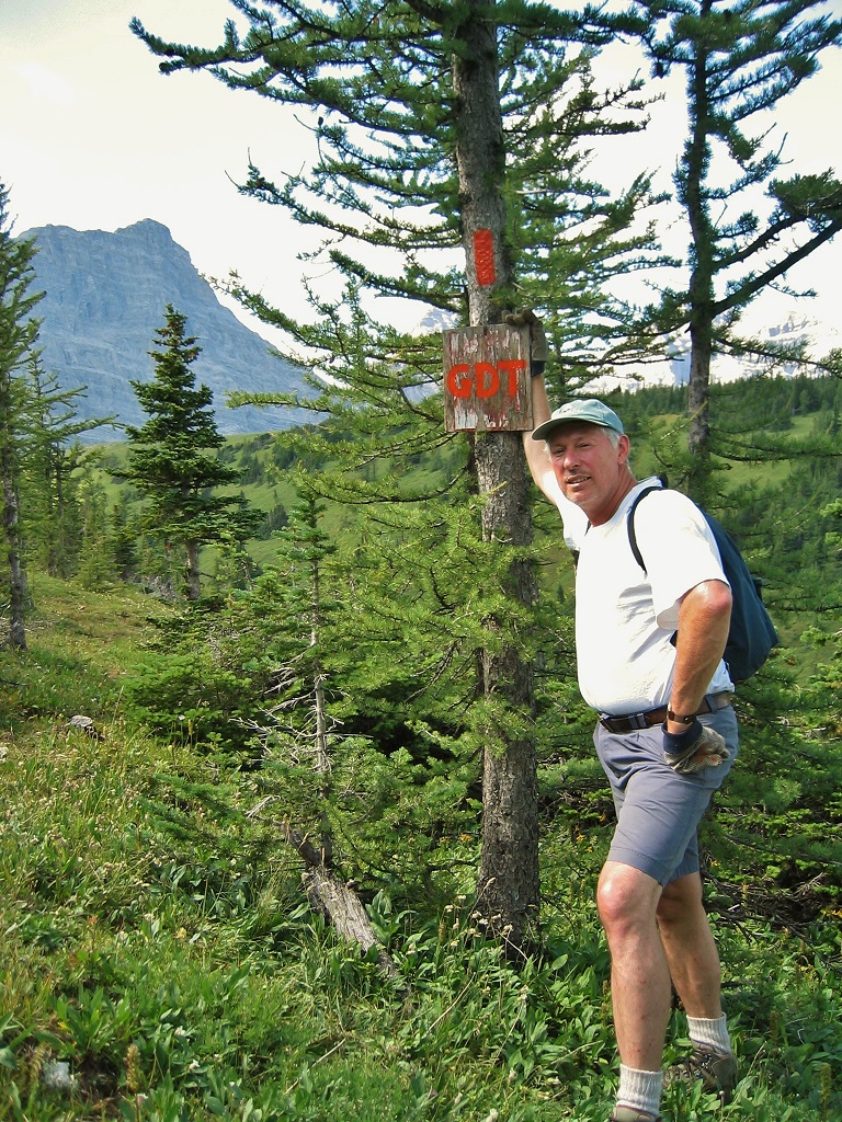
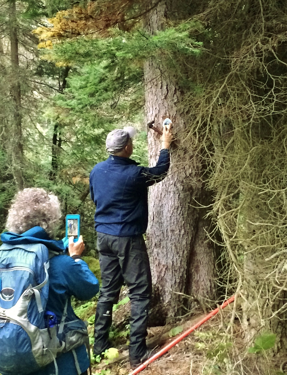
The author installing a reassurance marker on the David Thompson Heritage Trail
I’ve talked to many people who’ve hiked the entire GDT or just portions, and to date the only feedback on the blazed section has been positive. As might be expected, for most the hiking experience becomes more relaxed and enjoyable when it’s not necessary to be continuously route-finding. If there’s a negative, though, it’s that the user can become overly dependent on an uninterrupted series of blazes, which underlines the importance of ongoing inspection and maintenance, as well as good standards.
This is harder than it might seem. If the GDT was always a pathway through the forest, maintaining a uniform, unbroken system of paint blazes would be a breeze in the trees. Instead, long stretches traverse meadows, ridgetops and mountain passes, making it difficult to find and preserve blazing opportunities. Paint on tree trunks in higher-elevation exposed locations, for example, gets blasted away by severe weather within a few years. The most effective solution is an old one: stone cairns, but with the addition of a painted vertical finger of rock at the top (no particular offense intended, but commonly taken by the hapless hiker caught out in appalling weather!). Of course, this pre-supposes a supply of suitable rocks nearby, which, bizarrely, can often be hard to find in the Rocky Mountains. We’ve also tried wooden posts supported by rocks, but wind and snowslides usually make short work of them. So in the long run, it may be necessary to haul metal posts into certain locations where they can be securely anchored.
BLAZING HOW-TO’s
I’ve touched on the importance of good blazing practice, and some reasons why it should be adhered to. I’ve also mentioned that it can be tough to do that. But there are three things it’s easy to stick with in forested sections, and those are size, placement and spacing. I always instruct volunteers to paint nice neat, square-cornered blazes as close to 50mm wide by 150mm high (or 2” x 6”) as possible, so that they don’t stand out from each other. Slightly larger blazes are permitted if it makes them easier to find, for example at the far side of a clearing.
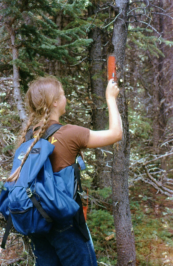
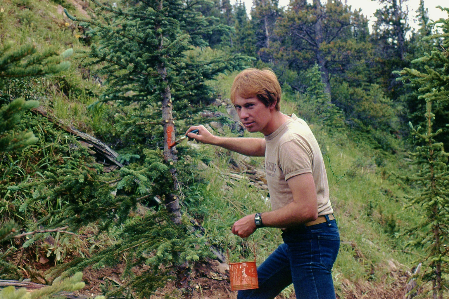
How to Blaze – Jill Frazer painting a perfect blaze on the GDT in 1979How NOT to Blaze – The author blazing too low on the wrong kind of tree, circa 1978 (before he became a pro)
Blazes should always be located just above eye level for an average height person, and if at all possible on a mature (but not TOO mature) tree that’s likely to remain alive and standing for the next few decades. The tree chosen should be visible from a point 25 to 50 metres back down the trail, and the blaze should be centred on the tree: blazes are always positioned to be seen in the direction of travel. Over the years we’ve managed to stay close to this ideal, but we’ve often painted too many blazes where the trail is perfectly obvious, creating visual pollution. Nowadays I advocate the bare minimum we can get away with – no less than 100m apart and preferably twice that distance, so that you see a blaze no more frequently than, say, once per minute unless the way ahead is hard to discern. I like this quote from Canadian climbing legend Brian Greenwood: “Blazes should make the route intelligible, but only enough so that the adventure is preserved.”
A double blaze (one above the other), indicates the Trail abruptly changes direction at that point – again, unless the way forward is obvious. In some cases the upper blaze is offset from the lower one to show which direction the trail turns. Another single blaze is usually visible from the double, confirming the new direction, for example where a footpath tee’s into a cutline.
WHAT ABOUT SPRAY PAINT?
Often, while demonstrating paint blazing techniques, new volunteers ask why I use a brush and not a spray can with a template, which would be faster and produce a more uniform result. I’m tempted to reply that I’m NOT into tagging! The next best answer is cost, but spray cans also produce a lot of waste and aren’t practical to carry in quantity for long distances. Other good reasons: handling a wet template would be a lot messier than a brush, and spray paint is so thin it requires a second or third coat, making it more likely to run down the tree trunk (the worst sin a paint blazer can commit!).
Spray paint does have a role to play, however. When we reroute a section of trail, it becomes necessary to get rid of the blazes on the old route. The most efficient and least harmful way to do this is NOT to cut them off with an axe (as I’ve seen done by vandals), it’s to paint them over with a grey-brown flat primer spray.
ACCESS TRAILS
Trails that provide access to the GDT, or access from the GDT to points of interest such as campsites, may also be marked but with blue blazes. The same system applies: one blaze – the trail continues; two blazes – the trail changes direction. Only a few such trails have been deemed worthy of blazing; usually where there’s a good chance of losing the route in a maze of old logging roads and cutlines.
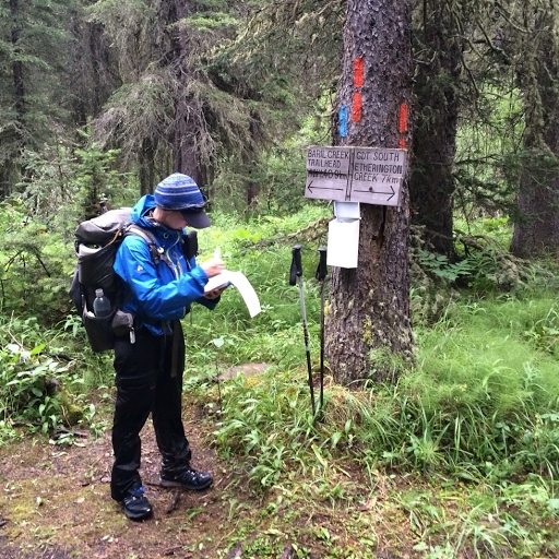
Junction of GDT and Baril Creek access trail showing blue blaze. Photo courtesy of Erin (“Wired”) Saver
THAT’S ALL, FOLKS
So there you have it – paint blazing is a time-proven system of denoting the route of a trail and helping users avoid getting lost. But it can never be a perfect system; time, nature and sometimes humans themselves take their toll on anything we add to the landscape. The fact the Trail is blazed doesn’t change the need for map (and/or GPS), good route-finding skills and plain old common sense. And that suits an old-timer like me just fine.
Several amazing videos were made by 2019 GDT thru-hikers. Here is a list of links to them. These videos are great watching during the long winter, and when dreaming of next summer on the trail. Many thanks to all the hikers that made the extra effort during their hike to shoot these videos, and then edit and post them.Note: If a 2019 GDT thru-hike video is missing from this list, it is only because we did not know about it.
This was not supposed to be a swim adventure. It was supposed to be a lovely five day loop on the GDT and one of its scenic alternates. The plan was to hike south from Maligne Lake, up the Maligne River Valley to Maligne Pass on the GDT, and then take the high route – the 6 Passes Alternate back to Maligne Lake. All on uncrowded “trail” and in an exquisitely beautiful area. Starting out, yesterday had been a “bluebird” sky day, and the sun was out again.
The Maligne River Valley has a reputation of being challenging – bugs, solitude, overgrown, disappearing trail, and the Maligne River crossing. But I had done my homework, reading what I could find on the crossing, etc., had the GPX track loaded on my phone, had done well crossing the Smoky River last year, and was looking forward to the challenge and seeing this beautiful area.
From Maligne Lake, good trail started out through beautiful forest. And there was not another soul to be seen. But there was wildlife. Some animal, maybe a marten crossed the trail ahead and went up a tree, too big to be a squirrel, too small to be a bear, black, long bushy tail….
Beautiful forest
It then clouded up and the rain began, on and off at first. Still good trail, including a bridged creek right before Trapper Creek campground.
Some creeks are bridged
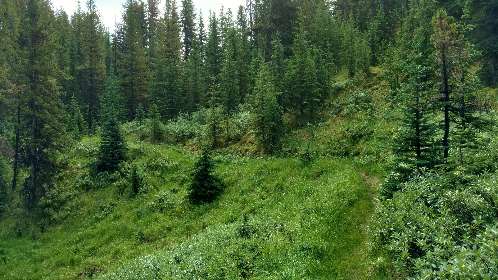
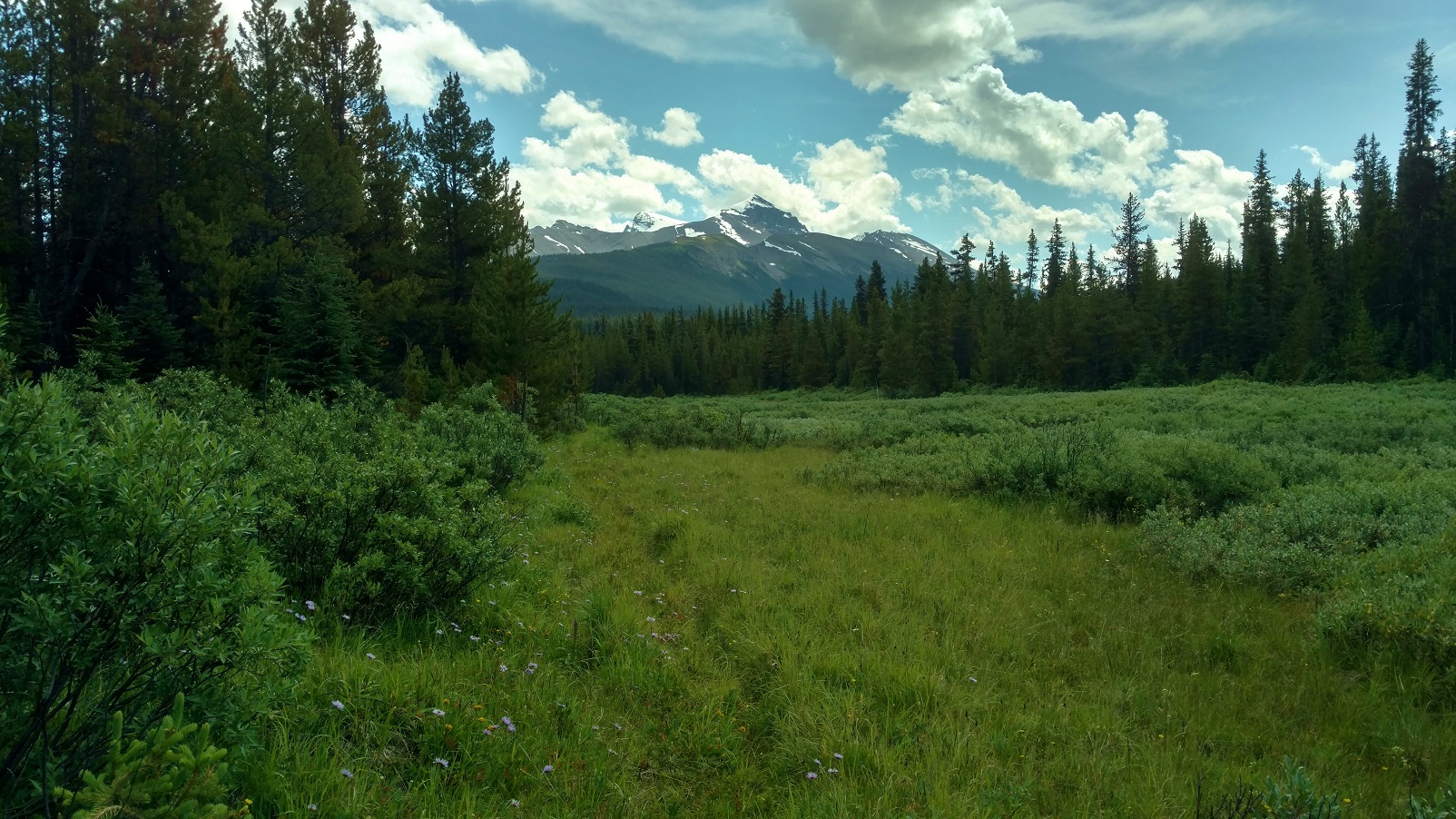
Although this trail and its camps get little to no maintenance, Trapper Creek campground was in good shape, good bear hang, picnic table, and so forth. A substantial creek about 3 km south of Trapper Creek was flowing fast but only shin deep, So crossing went smoothly, but it took some looking to find the trail after crossing. The forest began to open up into beautiful meadows and blue skies came back with distant mountain views. It was just gorgeous back here. Sure the trail was overgrown, but it was there and not hard to follow. Hey, this trail didn’t seem nearly as bad as its reputation…..
Pristine beauty
Then it clouded up and started raining with no let up. Still beautiful countryside. The Maligne River came into view and a short ways later the trail reached the river where the old bridge used to be. A part of it was still there, but definitely only as a landmark, not at all useful for crossing.
Approaching the Maligne River
Well, the Maligne River was flowing fast and high. Nothing like what the blogs or trail descriptions portrayed, that had said to expect maybe knee deep or even lower at this time of the year. But this year had set records for rain, supposedly the most since 1923 or something. Even the Maligne Lake/Medicine Lake outlet channel that had been dry for years, was flowing high this summer. On top of all that, this was mid-July; July 23, 2019 to be exact, when water levels are still relatively high due to snow melt. My inadequate homework and judgement was beginning to show. This could be a “show stopper”…. However with utmost focus and patience, I was able to successfully cross:
First, searching up and down the banks to find a good place to cross, looking for 1) a wider and therefore shallower place, 2) looking for gravel bars on both sides, 3) looking for places where the bottom could be seen so I knew it was shallower.
Finally finding a place that looked like it might be doable 1) a gravel bar on each side, with 2) a relatively short deeper section between them, deeper but the bottom was visible, and this was at a wider spot with an island in the middle. The crossing on the other side of the island was shallow with much less water.
So wanting the best possible footing, kept my boots on;
and wanting to be able to ditch my pack if I fell in, I unclipped its waist belt and top strap;
and wanting the best possible stability, hiking poles in hand, I stepped out onto the gravel bar;
and started down it, into the river.
The water gradually got deeper, over the ankles and then shins, and then up to the knees. It sure was going fast and pushing on me.
Taking it one step at a time, focusing intently, I made sure to have solid foot and hiking pole plants, before raising the other foot to take another step, which consisted of searching by feel for a solid foot plant before shifting my weight to it and lifting the other foot for another step. Repeat.
Now almost in the middle, the water was mid thigh deep and then high thigh deep, and with the swiftness it was really pushing on me. Leaning upstream, into the current, progress was slow and steady. Passed the middle without it getting any deeper. Then almost to the gravel bar leading to the island. No slips or close calls yet, so just keep the focus, keep doing what I was doing, one step at a time, yes it was hard, but I could make it.
And then I was at the gravel bar, it got shallower and easier, and then I was on the island.
Not wanting to underestimate the shallower channel from the island to the opposite shore, I didn’t declare victory yet.
The shallower channel was no higher than high shin deep, and not nearly as fast flowing.
And then it was over, I was across, on the trail on the south side of the Maligne River. Wow!
Thinking this shouldn’t be too bad, should get to Mary Schaffer trail camp late, but still with plenty of light, off I went down the trail….. Until there was no trail, no trail evidence at all, no ruts, no corridor, definitely no flagging or blazes, not even old style blazes, nothing. The GPX track showed the route followed the Maligne River. And so the bushwhacking began. And it was slow. About 2 km before Mary Schaffer trail camp, with the sun dropping, I had to stop for the night. This was getting worrisome – supposedly there was about 6 – 8km more of this bushwhacking, and my abysmally slow rate through it meant an extra day was needed. But I didn’t have an extra day of food, and hitting some of the alternate’s passes, especially the one with a short scramble, without enough fuel in me could be bad. Well what a night it was, thunder and lightning, and pouring rain on and off all night. Unable to sleep, deliberating about the situation, I finally decided, it was best to turn around and go back, that was a known quantity, although I really wasn’t looking forward to re-crossing the Maligne River. But since I had done it, I should be able to do it again… not thinking about what all this rain was going to do to the Maligne River. Very bad judgement here with this decision, but I didn’t understand that at the time.
Morning came, July 24, packed up, began the bushwhacking back to the Maligne River crossing. It was still raining. Came upon a giant female moose very close. What a treat! Giving her plenty of room, continued on and came to the river crossing before noon. Optimistically, thought this would work out OK. Until, I saw the river. It was at least a foot higher, brown muddy swirling water, and couldn’t see the bottom anywhere. I knew where to cross, and so doing it as I had successfully done it the day before, I went for it. Very bad judgement! This time it got deeper and deeper, past high thigh, crotch high, then waist high, with about 6 more feet until it looked better. Waist high was no good – too much of me in the water for the river to push against and not being able to find a next foot plant, I lost it, and the river swept me away. It was BAD! Banged against rocks. The current took me in the deep channel up against the island. Went under, and thought I was a goner. It crossed my mind, this is how people die… Then saw willow branches sticking out from the island above me and grabbed for them. Pulled my head above water for sure, but couldn’t climb out there, too deep, the bank was too steep, and the current was too strong to be able to stand. So hanging onto the willows, branch after branch eased down to the end of the island. And there in the shadow of the current was a low gravel bar that I pulled myself onto – ALIVE! So thankful just to be alive.
But my hiking poles were gone, so no way I would be able to cross even if the water dropped a foot to what I had crossed the day before. And it was still raining so it could go higher before dropping.
Fast forward…, with some wonderful help, I got back to Jasper. No broken bones, lots of black and blue marks, some scrapes, and pulled but not torn ligaments/tendons/whatever the things that hold knees together are, and important lessons learned the hard way. Among them, how not to cross a river:
Anything swift and higher than crotch deep – DO NOT TRY. Too much of one is in the water to be pushed on by the current, it just won’t work.
Anything lower, if it is pushing on one hard enough so that one is having a hard time or is uncertain or scared that they can’t keep finding solid foot holds – TURN BACK. Even though it may be lower, if the strength and endurance isn’t there, it isn’t going to work.
DO NOT rush into a decision to cross something that looks hard/scary. Think about options. Take a break, have a snack, think some more.
DO NOT just try to bulldoze through if it’s too hard. TURN BACK, search more for a better place, think about waiting for the water to drop some, possible other ways to bail out and avoid the crossing, and so forth.
Frankly, people that say they are scared of river crossings are the wise ones. I should have been more scared. Probably there is a happy middle ground, between being too scared and not scared enough, of river crossings. And that happy middle ground is probably reached by SAFE river crossing experiences and practice :>) Happy trails!