

AND OTHER TRAIL UPDATES FOR 2020
By Brad Vaillancourt, Dan Durston and Rogier Gruys
While there have been many improvements to the GDT other the past few years, there are still several sections of road walking that offer less than appealing hiking experiences, including the West Castle Road in Section A, highway walking in Coleman, the first 60 km in Section B, the Blaeberry valley in Section D, and the start of Section F out of Jasper. So in the spirit of a new decade, described below are some new and improved alternate routes that offer far more interesting, rewarding and in some cases more challenging hiking experiences that GDT Hikers should consider on their next hike to avoid road-walking. GDTA maps and the Guthook App have been updated accordingly.
SECTION A
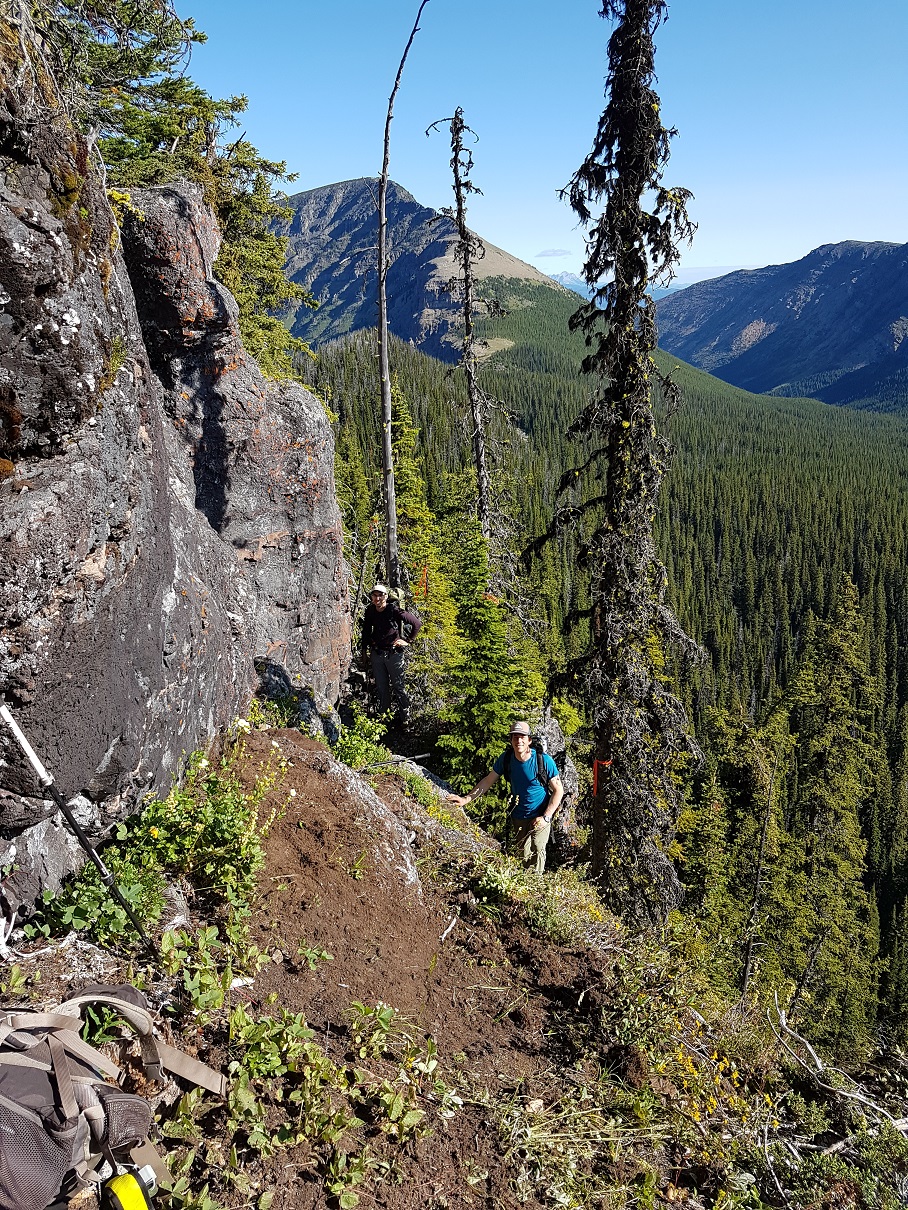
Barnaby Ridge (23.5 km vs 24 km on the GDT) is a spectacular alternate route that is significantly more scenic and rewarding than the valley-bottom dirt road that the main route of the GDT follows but requires significantly more effort. In his guidebook, Hiking Canada‘s Great Divide Trail, Dustin Lynx describes the Barnaby Ridge route as “beyond the scope of hiking” due to some difficult scrambling along the ridge, taking perhaps twice as long as walking down the valley. Other than remnant snow, the ridge is waterless but there are three campgrounds along the route, Grizzly Lake (400 metres off route) at km 6.5, Southfork Lakes at km 19 and Barnaby Lake at km 19.7. In 2019, a small crew of GDTA volunteers set out to find and mark non-technical routes bypassing the most difficult scrambles on Barnaby Ridge and assess whether the ridge could be used as the main route of the GDT.
Heading NOBO from La Coulotte Peak (a26), the first major obstacle is the immediate downclimb from the summit where hikers must scramble down steep shale-covered rock steps to reach the ridge crest, where travel becomes easier.
7 km north of La Coulotte Peak is the second major obstacle: an imposing 8m cliff about 500 metres north of the Grizzly Lake trail junction @ 49.25499, -114.33656. The cliff is too large and steep to be safely climbed in either direction without a rope. A route traversing the northeastern side of the ridge, bypassing the cliff, has been cleared and flagged, including scrubbing the route clear of vegetation and placement of a large stepping stone to considerably decrease the difficulty of the scramble. Approaching NOBO 20 metres south of the cliff, look for flagging in the trees on the east side of ridge marking the start of the traverse. Descend slightly and follow a narrow path along the steep eastern edge of the ridge, scrambling down and up a few rock steps before rejoining the ridge crest beyond the base of the cliff. The total distance of the bypass traverse is only 40 metres.
3 km farther NOBO, the second and most challenging obstacle is a 500 metre-long very narrow and rocky crest starting @ 49.280221, -114.341266. This section of the ridge is very exposed with a lot of loose rock and has resulted in more than one hiker abandoning the ridge and detouring straight down to the West Castle Road (not an easy descent). A non-technical route has been blazed traversing below the east side of the ridge that avoids all of the difficult scrambling along the ridge crest. Look for an orange blazed cairn marking the start of the route. The route contours around the east side of the ridge for 650 metres, until you reach an orange blazed arrow indicating where to start climbing. A steep but easy scramble up a rocky gully leads to a large cairn at 2400m at the north end of the narrow crest where relatively easier hiking continues north along the ridge.
The GDTA crew also cleared the trail of deadfall along the forested crest north of Grizzly Lake, but the trail through there is still quite brushy. Even with these improvements, we decided that Barnaby Ridge should remain an alternate route as the difficulty level, particularly in bad weather, is still just a bit too high overall. It is definitely a spectacular route that with these improvements deserves the attention of more GDT hikers.
Crowsnest Pass Community Trail (2.5 km vs 3.6 km on the GDT) – The main route of the GDT follows roads or busy Highway 3 for 4 km through Coleman. Hikers resupplying in Coleman will have to walk at least a portion of this distance but there is a much quieter non-motorized trail next to the Crowsnest River that bypasses most of the road walking. NOBO, after crossing the bridge over the river on 83 Street, turn left (west) onto 14 Avenue. In 180 metres you will reach a T-junction with 81 Street. Turn left (south) to find the Crowsnest Pass Community trailhead next to the Crowsnest River. Follow the riverside trail west for 1.8 km until you reach an intersection with 67 Street (dirt road). Turn right (north) and follow 67 Street as it curves northwest for 450 metres to reach Highway 3. Carefully cross the highway to rejoin the GDT at the 66th Street intersection (b1).

SECTION B
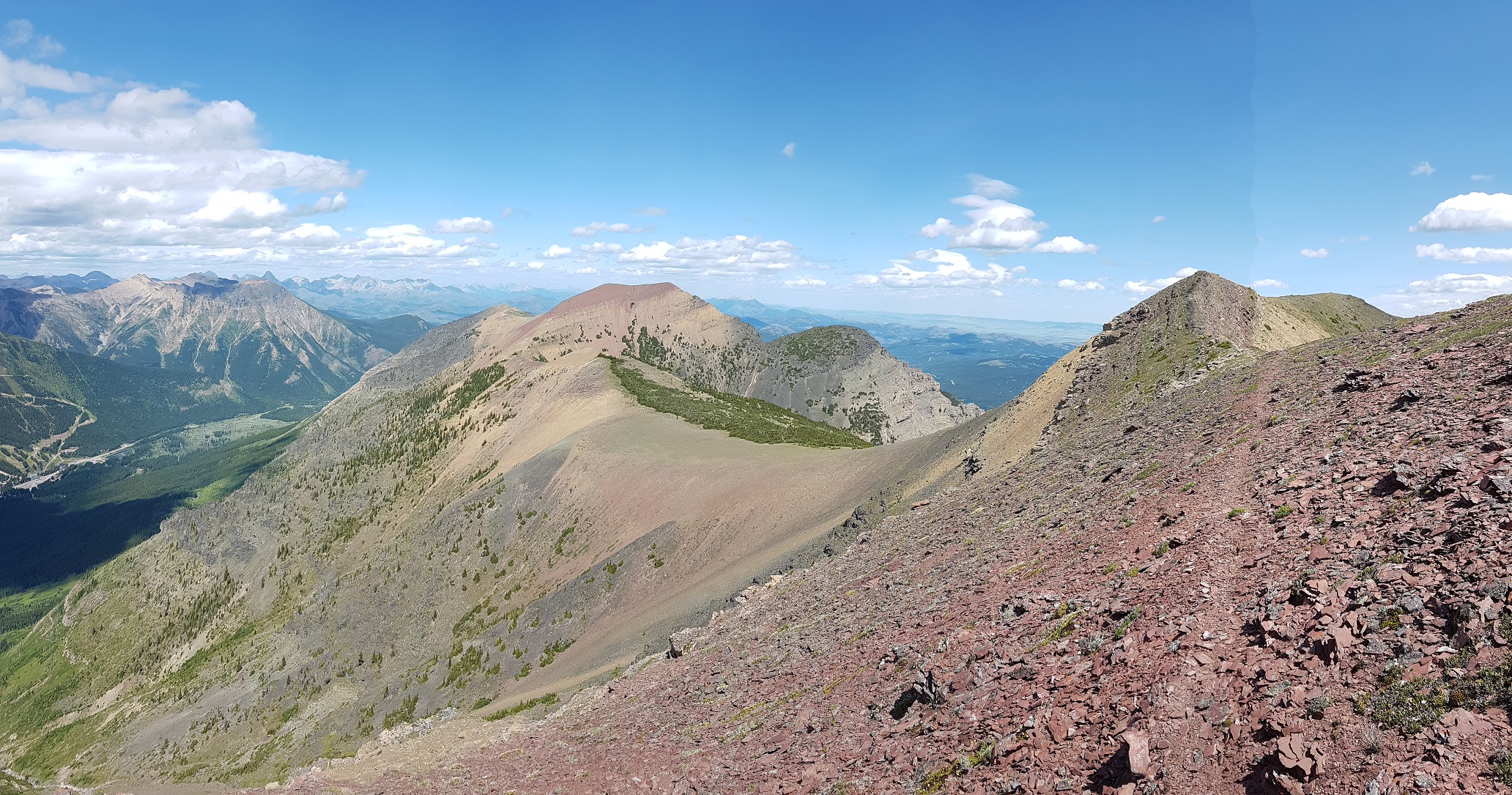
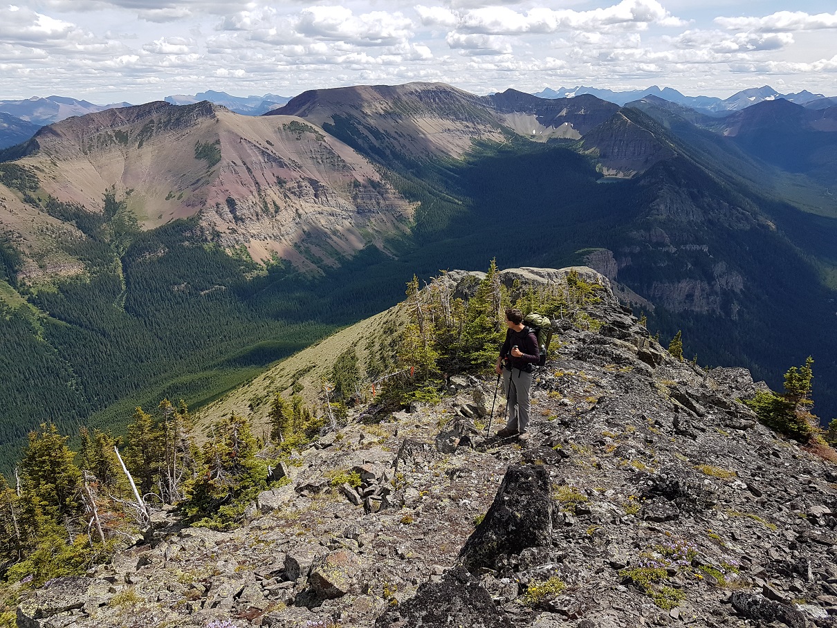
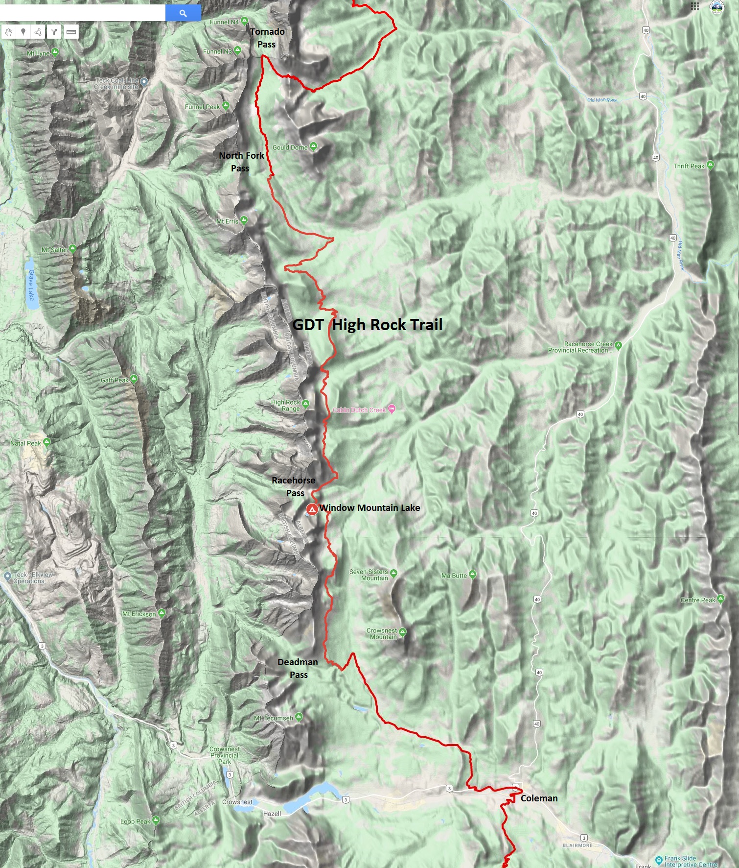
The NEW High Rock Trail (45 km vs 46 km on the existing GDT) – Construction of the High Rock Trail began in 2016 as the first new section of trail on the GDT in more than 30 years. It is a beautiful route, staying close to the Divide and above treeline for much of the route.

NOBO, the High Rock Trail begins at the Atlas Staging Area and rejoins the existing GDT near North Fork Pass (b13), eliminating more than 30 km of road walking. The GPS track has been posted to our map page where it can be downloaded. The High Rock Trail will officially become the main route of the GDT in 2022!
SECTION D
Amiskwi Ridge (8 km vs 6 km on the GDT). For those who prefer spectacular ridge walking to an active logging road, this alternate is for you!

NOBO begin 1.5 km north of Amiskwi Pass by hiking steeply on good trail (+200m over 1 km) to reach Amiskwi Lodge at the tree line, where the trail ends and 5 km of stunning cross-country ridge walking begins. Camping is not allowed at the lodge, please do not trespass on private property. Camping is available in the meadows 200 metres farther.
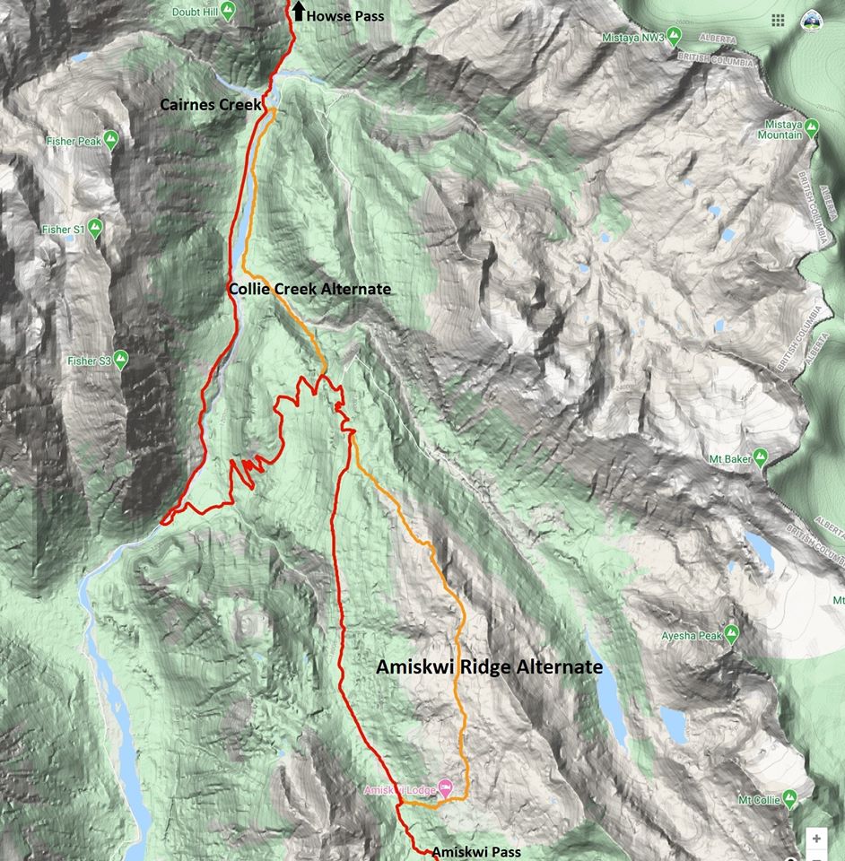
The route requires some route-finding and a short section of moderate bushwhacking. The alternate is 8 km vs 6 km on the main route of the GDT, and highly recommended. Tack on the Collie Creek alternate and you can avoid 20 km of walking on active logging roads.
Collie Creek Alternate (6 km vs 14.4 km on the GDT) is a shortcut that skips much of the road walking in the Blaeberry valley and instead offers a shorter journey on old trail and floodplain. From where it leaves the Ensign Creek FSR, the Collie Creek alternate runs 6 km to reach the David Thompson Heritage trailhead while the official GDT travels a longer 14 km on the road to reach the same point. Many hikers will prefer the Collie Creek alternate for its much shorter distance and more interesting terrain, but it does include challenges – most notably a potentially tough ford of Collie Creek.
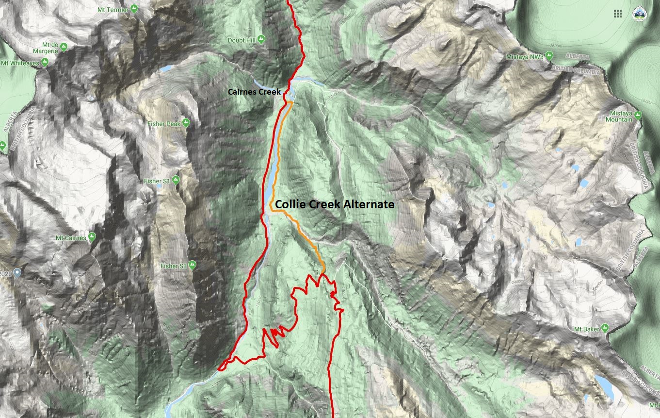
For a NOBO hiker, the Collie Creek alternate begins after 8 km of road walking on the active Ensign Creek FSR (watch out for logging trucks). The alternate leaves the GDT on the outside of a sharp switchback at 1650m elevation as you descend into the Blaeberry valley. Look for an old trail leaving the road directly at the outside of the sharp bend @ 51.678487, -116.698431. The entrance is subtle but easily found by those looking for it.
This trail descends 1.2 km (and 320m elevation) to reach Collie Creek. The trail itself is in poor condition as it hasn’t been regularly used in decades, but it is fairly easy to follow and makes for reasonably fast travel. Despite poor maintenance and a steep grade, hikers will soon see the Collie Creek floodplain through the trees, which historical floods have carved out into an impressively wide cobble strip – many times wider than the creek itself. Collie Creek flows from the Wapta Icefield which also supplies the mighty Mistaya River that you will cross in a couple days’ time (at a bridge thankfully).
When you reach Collie Creek you have arrived at the crux of the route, as you must either ford the creek or retreat steeply back to the GDT. The route ahead travels NW 1.4 km down the Collie Creek floodplain with ample cobble to walk on either side of the creek, so there is flexibility in where you ford Collie Creek but it must be done at some point. Like Cairnes and Lambe creeks ahead, the water level rises late in the day as the summer sun melts the icefield, so crossing in the morning and/or during cool weather eases the task. The suggested route crosses Collie Creek after about 300 metres in a braided portion of the reach (but this may vary from year to year). Beyond this, the slope of the creek steepens, so if you haven’t found a suitable crossing by this point then it is suggested you turn back.
Once across Collie Creek, complete the section on the cobbled floodplain, now on the north side of the creek as you enjoy spectacular views of Mt. Cairnes ahead. Atop that impressive cliff face is the Cairnes Glacier, out of which flows Cairnes Creek which the GDT later crosses. Collie Creek itself is named for J. Norman Collie, who completed many first ascents in the area including Howse Peak and the lofty (3612m) Mt. Forbes in 1902 – both of which you will see later in Section D from the Howse floodplain.
About 150 metres before the creek reaches the Blaeberry River, enter the woods on the north side of Collie Creek and follow a brushy trail for 150 metres in a NW direction to reach a large old floodplain above the east bank of the Blaeberry River. Don’t be tempted to descend all the way to the Blaeberry River, as travelling upstream along the banks of Blaeberry is initially difficult until the floodplain starts.
Once you have reached the floodplain, your task is to travel 3 km up river until you reach a new bridge (built in 2019) over the Blaeberry that will allow you to cross the river and join the official GDT at the start of the David Thompson Heritage Trail. This 3 km is mostly loosely treed floodplain that makes for enjoyable and reasonably fast travel. Route-finding along the way is straight forward with the Blaeberry River always on your left (west) to aid navigation. When you arrive at the bridge, cross the river to rejoin the GDT near Cairnes Creek Rec Site at the David Thompson trailhead (d9).
SECTION F
Jasper to Miette River Trailhead (23.3 km vs 21 km on the GDT) – The 21 km of walking next to Highway 16 out of Jasper is the longest (and possibly most dangerous) road walk on the entire GDT that many hikers justifiably choose to hitchhike rather than walk. In his guidebook, Hiking Canada‘s Great Divide Trail, Dustin Lynx suggests an alternate route via Minnow Lake that includes a gnarly cross-country section to the Dorothy-Christine Lakes trail. Combine the Minnow Lake alternate route with the historic Tote Road (described below; also included in the 3rd edition of Hiking Canada‘s Great Divide Trail) and the walk next to the highway can be completely eliminated. However, if the Minnow to Dorothy Lake bushwhack doesn’t appeal to you, there is now a second alternate route out of Jasper.
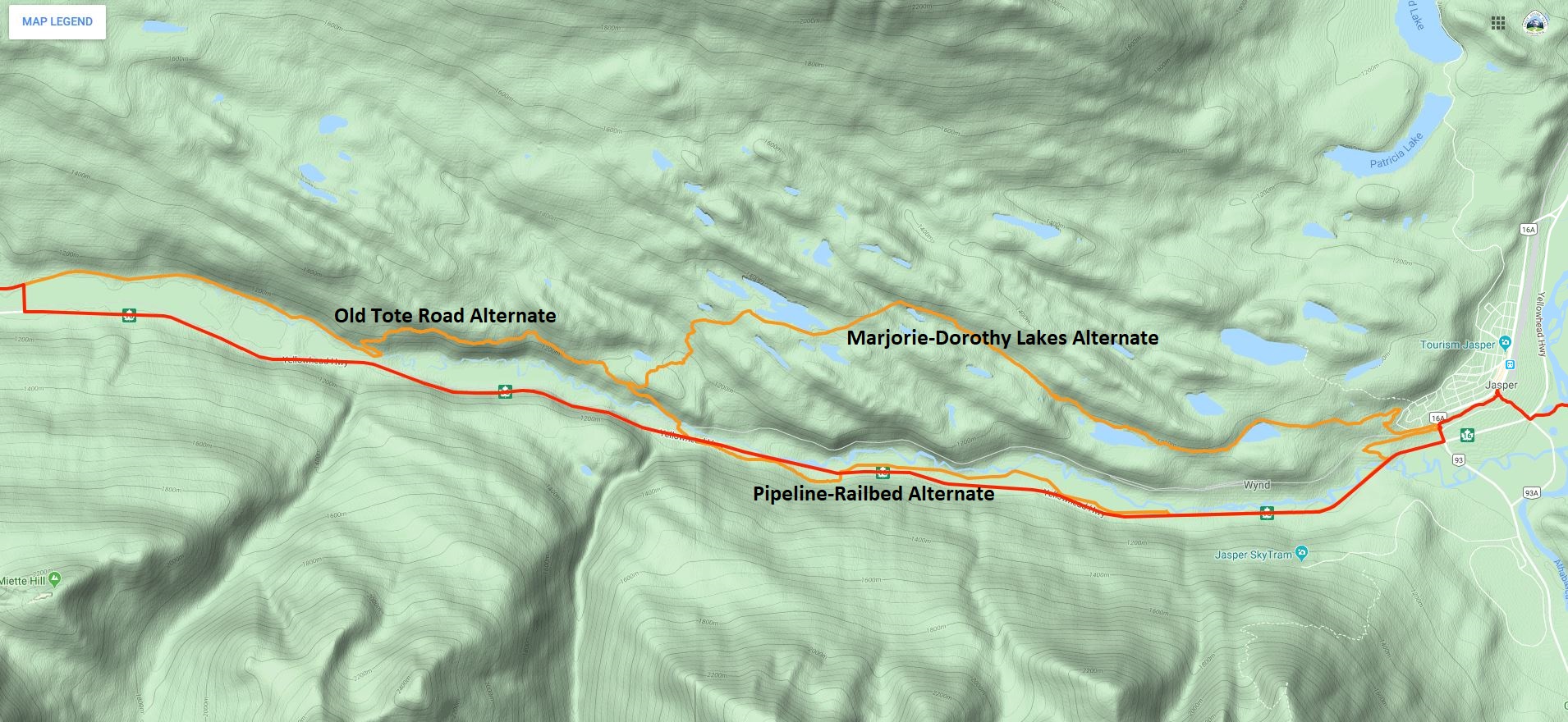
From Jasper town centre, follow the Discovery Trail (trail 11) west to where it passes under the train tracks and crosses Connaught Drive at a gated intersection with Wynd Road. Follow Wynd Road west for 500 metres to where a hiking trail leaves the road on your left (south) and continues paralleling the road. This junction may not be easy to see, but one can also continue a bit farther on Wynd Road to the official start of Trail 3J. Look for the (white) back of a directional map sign. In 625 metres, the trail takes a sharp left and heads southeast for 400 metres down to Highway 16, eliminating 1 km of highway walking. From the end of Trail 3J, hikers must walk the shoulder on the north side of the highway to the start of the pipeline route (This is the only highway walking on this alternate).
In 3.3 km leave the highway, walk through a parking lot and head towards the Miette River to reach the open, grassy pipeline right-of-way in 100 metres. The pipeline right-of-way is a winter cross-country ski route. There is no actual trail tread and in the summer it may be wet in spots but it is easy walking and much preferred over the highway shoulder. Follow the pipeline route for 4.8 km, until the pipeline turns north towards the river. Leave it and return to the highway. Note for 2020: The pipeline operators may be doing maintenance work on the pipeline this summer, which means you may not be able to walk along the route. Since the pipeline is close to the highway, it is easy to return to the highway if the pipeline right-of-way is blocked.
From this point it is another 2 km along the highway to the Dorothy-Christine trailhead but if you want to continue to avoid the highway and are feeling energetic, cross the highway and climb the slope to an abandoned railbed. The old railbed is easy to follow as it parallels the highway but heavily overgrown with alder in sections so be prepared for some serious bushwhacking. Follow the railbed for 2.3 km, until it drops back to the highway near the Meadow Creek Bridge. Cross the bridge and the highway to reach the Dorothy-Christine trailhead. From here it is still 10 km along the highway to the Miette River trailhead, but now you have the option to follow the Old Tote Road.
The Old Tote Road was built during the construction of the railroad in the early 1900s. It has not been officially maintained since then, but it is still in surprisingly good shape and easy to follow for most of the way. From the Dorothy-Christine trailhead, walk down the gravel road to the railroad tracks and cross the tracks on the official pedestrian crossing. The trail crosses a new bridge across the Miette River and heads uphill. From the bridge walk about 1 km to just before a sharp right switchback turn in the trail. The indistinct junction with the Tote Road is @ 52.873693, -118.263953 about 20 metres before the switchback, heading northwest at a slight left angle. The Tote Road is overgrown here, so this junction can be difficult to see. When coming from Dorothy-Christine Lakes, descend the well-maintained trail towards Highway 16 until the last switchback, where the trail turns sharply southeast. Look for the junction with the Old Tote Road 20 metres past the last turn.

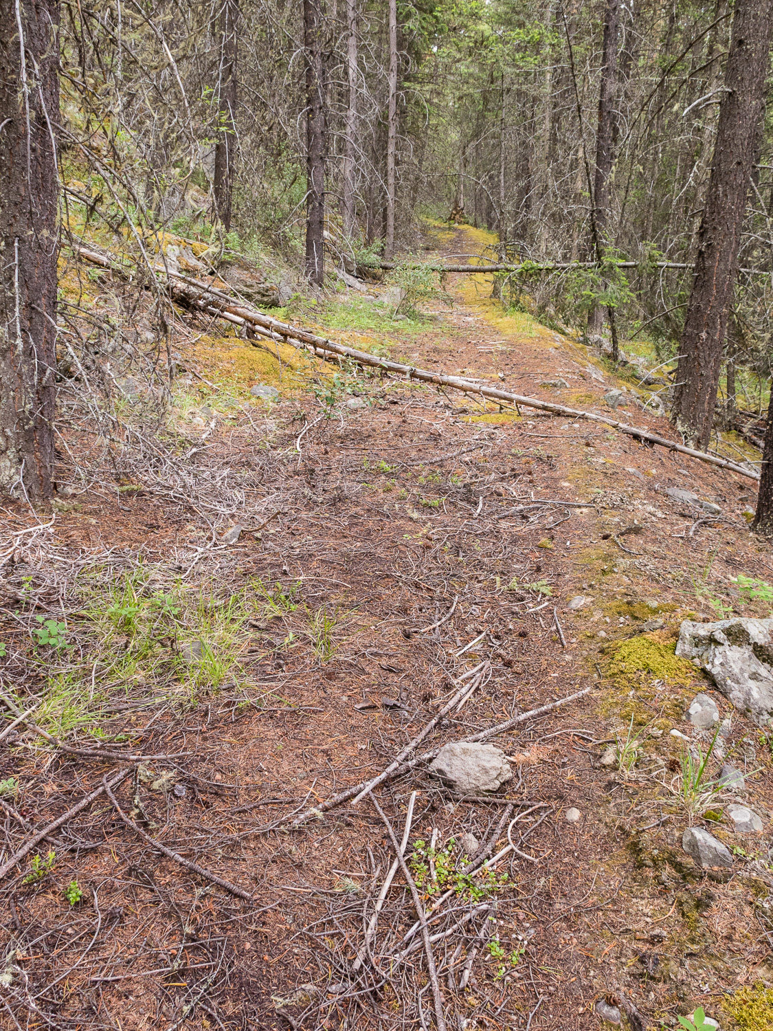
In most places, the old road looks like a faint trail but the tread is inconsistent and navigating around blowdown might cause you to lose the track. Look for rows of rocks, which were used to delineate the downhill side of the Tote Road. The road climbs steeply for the first 200 metres beyond the trail junction until levelling out. From here, the road contours along the mountainside at approximately 1200m. It is very faint to non-existent in places, so keep an eye on the canopy which in most places has a distinct opening where the road is/was. In about 600 metres, the road improves significantly and hiking becomes easier.
Continue hiking west for about 1 km to a creek bed and fire guard where the road can be difficult to find. Beyond here the road is easy to follow for 400 metres until it disappears in an open area. Pick up the road again across the meadow where it should again be easy to follow. In 1.3 km you join the old Golden Lakes Trail. Follow the surprisingly good Golden Lakes Trail 1.2 km downhill to an overgrown trailhead parking area. Follow an old road bed west out of the old parking area. In 1.4 km the road becomes an old railroad bed. Follow this beautiful railbed west for 4 km, past the Decoigne station, all the way to the Miette River trailhead (f1) to rejoin the GDT.
Aside from a bit of bushwhacking and route finding, this is a very pleasant route, and a wonderful historic alternative to walking along the highway!
OTHER UPDATES
Kiwetinok Alternate – The start of the climb up to Kiwetinok Gap now begins 650 metres farther down the Kiwetinok valley in order to avoid the worst section of bushwhacking.
Perseverance High Route – Two updates to the Perseverance High Route eliminate two difficult scrambles and enable almost entirely good travel in the first half of this alternate, south of Perseverance Mountain.

The first update is a detour that avoids the steep, loose scramble descent into upper Spider Creek basin. This section is replaced with a pleasant journey over a highly scenic pass that is slightly longer (7.6 km vs 5.2 km) but not slower as it offers much improved footing and easier hiking. NOBO, split off the original alternate route in the headwaters of Castor Creek valley, 7.2 km beyond the junction with the Jackpine Mountain Trail (g7). Here, the original route traverses above a cliff band. When possible at the end of this cliff band, leave the original route and contour around the alpine bowl you are in at 2000m to 2075m to reach the south-facing side. Contour entirely around this bowl and continue north over the subsequent shoulder just above treeline at 2040m to reach a second valley north of the original one. Descend gentle slopes below talus fields to reach the open valley bottom of this unnamed tributary of Castor Creek after 3 km, where excellent camping exists. From here, the remaining 4.5 km back to the original alternate is simple navigation. Walk a pleasant 3 km up the open valley past a beautiful green alpine lake to the obvious pass at 2275m at the west end of the valley. Once over the pass, the initial 400 metres of the descent are talus which range from medium to very large sizes. Use caution and choose a descent path that avoids the largest blocks and provides the least steep grade. After the talus, stay right (north) around a small cliff band and then continue to walk the fall line downhill as you enjoy the final kilometre of pleasant walking on gravel and marvel at the steep face south of you that the original route descended. Continue downhill and rejoin the original route at the point where views open up of the entire Spider Creek valley. Travel on the High Route is relatively straightforward until the next detour is reached in 5 km.
The second update is a detour that replaces a very steep portion of the original route at the saddle immediately south of Perseverance Mountain. This detour begins @ 53.42668, -119.7606 where NOBO you will veer right in an ESE direction to walk a gentle ramp to the valley bottom rather than descending the 40 degree slope ahead. During this 1 km descent you will have ample views of the 450m upcoming climb to the summit of Perseverance Mountain, allowing you to assess the path ahead. From where you reach the valley bottom, the ascent up Perseverance Mtn is steep but much less so than the original route. From this point, almost any route up this face will work. The suggested route links a series of benches to minimize the grade, but hikers can ascend this face in whatever style suits them with little difficulty to reach the summit. North of Perseverance Mountain substantial challenges remain, including some difficult scrambling.
Meadowlands Alternate – is a new northern access route to/from the Perseverance High Route, 9 km to the GDT + 4.8 km to Little Shale Hill = 13.8 km total vs 14.8 km on the original alternate route.
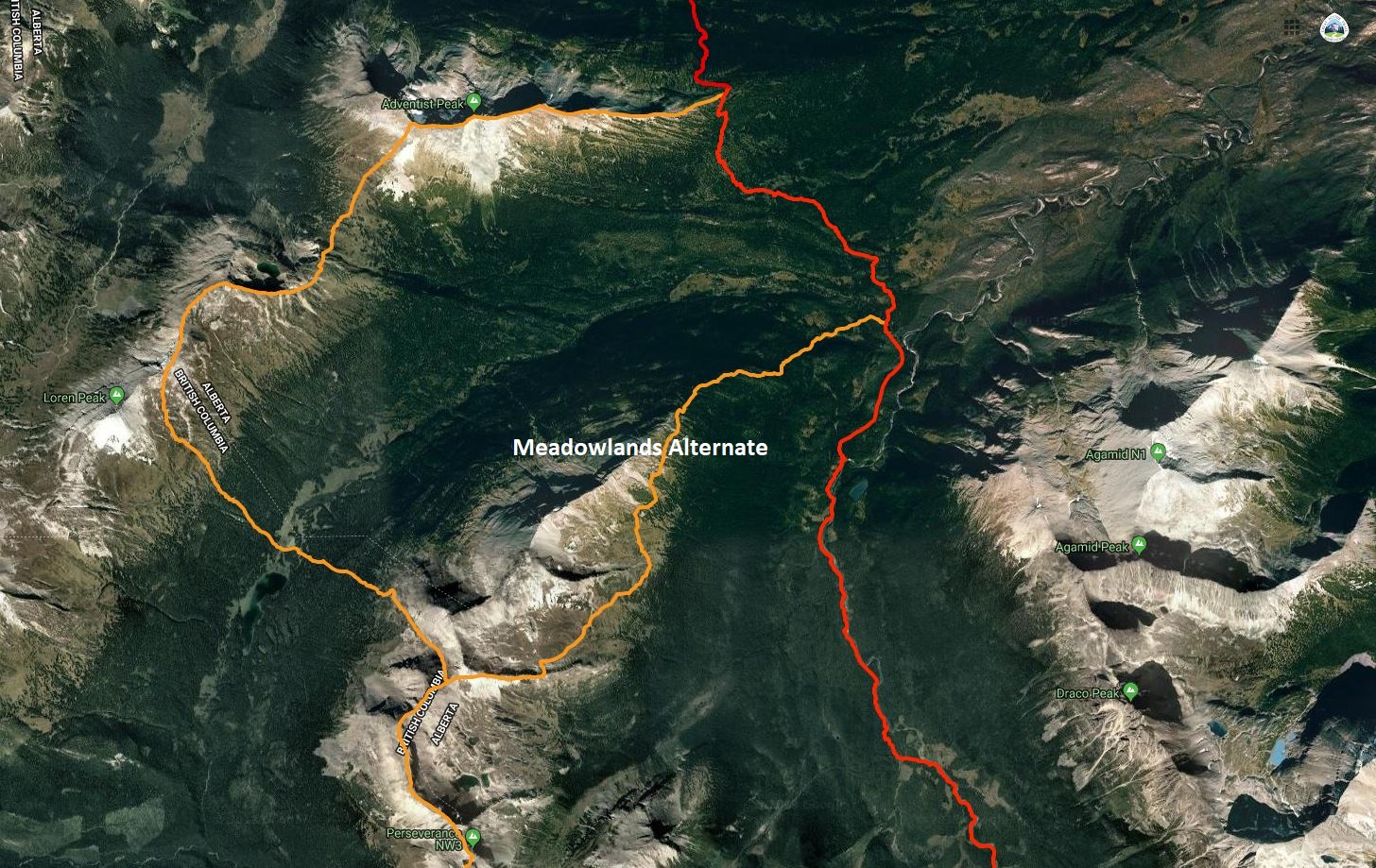
Rejoining the official GDT from the northern end of the Perseverance High Route poses a substantial challenge for anyone on this alternate. There are many ways to make this linkage. All of them include some challenges, but none more so than the northernmost section of the original alternate route which includes onerous bushwhacking through Loren Pass followed by very difficult scrambling before re-joining the GDT on Little Shale Hill. A suggested way to make this linkage that reduces the difficulty and improves the hiking quality is to continue generally along the divide of the Jackpine River and Meadowlands Creek valleys to rejoin the GDT at the ford of Meadowlands Creek.
From the summit of Perseverance Mountain, the High Route follows the watershed ridge of the Great Divide for 6.6 km as it passes above three large alpine bowls including a few challenging scrambles. As you reach the northern end of the 3rd bowl, the original alternate descends off the ridge in a NW direction. Rather than descending, continue a further 200 metres NE along the ridge to a point where you could turn north to remain on the ridge crest (a more difficult but scenic high route), but instead head east on the new recommended route following the sub-ridge that divides the 3rd bowl from a 4th bowl. After about 1 km along this sub-ridge, a short scree chute on the north side allows for a quick descent into the 4th bowl where a creek and good camping are found.
Cross the flat open bottom of this 4th bowl in a NE direction and wrap around the east end of the sub-ridge that separates it from the next bowl (5th) to the north. Cross the flat bottom of the 5th bowl and then begin to ascend gently to rejoin the main watershed ridge on the far (NE) side. Climb gently as you stay generally above treeline, while mostly letting the ridge descend to join you. By staying above treeline, you will end up back on the ridge 1 – 1.5 km NE of the 5th bowl. From here, you will walk the increasingly rounded and indiscernible ridge all the way down to the valley bottom. Below treeline you will initially encounter a mix of moderate bushwhacking and pleasant meadows until you reach the last remaining obstacle of note: a cliff band in the ridge at 1650m. Skirt these cliffs on the right (east) side and then continue to descend in a NE direction to reach the GDT at Meadowlands Creek (g10). Don’t be tempted to turn straight east to rejoin the GDT sooner, as the official route here is also a bushwhack and no easier terrain than what you are currently in. Once you reach the GDT ford at Meadowlands Creek, a faint but followable route heads north through swampy areas for several hundred metres before defined trail resumes.
Surprise Pass High Route – The GPS track for the northern end of this alternate route has been corrected to avoid the unnecessarily steep and dangerous descent off Wallbridge Mountain to Providence Pass.