“It is the worst hiking I’ve ever done in my life,” the southbounder complained, a soft accent masking the fatigue in his voice. “It took me all day just to get between camps. Terrible. Alders up to here.” His hand hovered over his head. This awful section of trail, which had him so shaken up? The Jackpine River, infamous among thru-hikers as the very worst section of bushwhacking on the entire Great Divide Trail.
A dirty smudge covered his cheek, and one pant leg was ripped from ankle to knee. To be fair, we didn’t look any better. We’d stopped for the night at Chown Horse Camp, north of Mount Robson. We only had a week left to hike the final kilometers of the Great Divide Trail, but we were struggling. The trail had gotten steadily worse after leaving Jasper. I’d torn a hole in my pants clambering over downed trees, and alders and willows had blocked the path for most of the past week. We’d spent the day fording swollen rivers past the remnants of washed out bridges. And apparently it was about to get even worse.
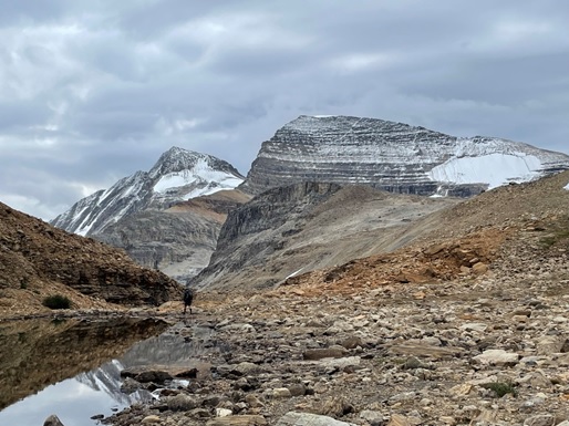
We left camp in the morning, saying goodbye to our new friend. We crossed Chown Creek over and over, until our feet went numb in the glacial water. We climbed up towards Bess Pass, blood rushing back to our feet in painful pins and needles. We crossed another valley, then up, up, up, across the trailless wilderness of the Jackpine Alpine to Blueberry Lake. Glacier-studded mountains ringed the high plateau, while streaks of virga rained down from patchy clouds.
Bushwhacking up to Bess Pass.
We set up camp at Blueberry Lake, cooking dinner in the lee of a few stunted pines. Dusk fell, turning the snow streaked peaks pink with alpenglow. Exhausted, we were about to turn in when we heard voices. Three figures emerged from the trees, carrying a strange, electronic box.
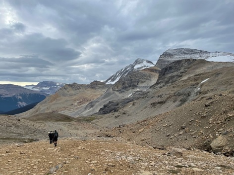
Heading down to Blueberry Lake, where we met some awesome trail crew volunteers.
“Northbound? You’re in for a treat!” One of the figures greeted us. “We just got done with the Jackpine Valley. Cleared a bunch of brush. Once you hit Spider Creek, it’s smooth sailing.”
The trail crew stayed for a while, chatting with us about our hikes and what we could expect from the next section. As the first stars popped out overhead, they wandered off to set up the trail camera they carried, and return to their tents for the night.
We rose early, anxious to get a head start on the Jackpine. After we crossed another pass, the trail descended steeply, the way frequently blocked by fallen pines. Blueberries the size of grapes lined the trail: a reward for the tough travel. We reached the river, following a rough animal track through alders that wound together above my head, forming a tunnel that blocked out the building clouds above.
“Good” trail in the Jackpine Valley before we hit the maintained section.
We forded the river, again and again, trying to stay on horse paths that were little more than faint indentations in the vegetation. The trail crew had given us hints on the easiest travel, and told us to cross the water whenever the path petered out. We couldn’t get too lost: we just had to follow the river as it meandered down the valley. But our way was frequently blocked by impenetrable vegetation, thick as a wall. Occasionally, we had no choice but to put our heads down and push through, stems as fat as my wrist grabbing at my clothes, and wet leaves whipping my face as they sprang back from my husband pushing through in front of me.
I checked my phone constantly. Not because I was worried about getting lost, but because I was counting down the kilometers to Spider Creek. Just a few hundred meters away, and the clouds that had been building all day burst. Thunder boomed and echoed across the valley, loud as a rockslide. We took refuge in a stand of pines on the banks of the Spider. Across the river, we could see a trail badge, white and shiny and new. We’d made it.
After half an hour, the storm moved off. Soaked and grumpy, we searched for the trail. The blaze was right there. But where was the trail? Surely it must be obvious? We traipsed back and forth searching, wet rain gear sticking to our skin, until we shivered from the damp. Finally, we gave up, bushwhacking towards the river. In this narrow valley, we’d find the path eventually, right?
Two kilometers later, and I’d given up completely. The trail maintenance was a lie. We’d be stuck in bushwhacking hell forever. There was no escape. I thought about resigning myself to my fate and lying down on the side of the river. The only problem was that there wasn’t a single square inch that wasn’t covered in these damn alders.
Then, appearing like a dream, a single cut stem, the white sapwood broken and bright against a ring of dark bark. Underfoot, green leaves were trampled into the mud. Another broken shrub, and then another, until the trail was lined with cut leaves and torn branches. It wasn’t pretty: the trail crew had hacked and cut with speed and violence rather than precision. But after fighting through the brush for days, I too would have taken great pride in whacking back at the bushes.
In an instant, we picked up speed. We went from a half a kilometer an hour crawl to flying down the river valley. We didn’t need to wonder where the trail went: cut branches showed the way. I didn’t need to put my head down and push through woody stems, and not a single branch smacked me in the face. After being drenched from the carwash effect of wet branches, my rain gear finally began to dry.
We followed the cut bushes all the way to Big Shale Hill. Every time we crossed what had formerly been a particularly thick patch of brush, we’d thank the trail crew out loud. “Thank you trail crew!” my husband sang out as we walked through sawdust surrounded a cut log that would have blocked the trail a few days ago. “Thank you trail crew!” I called while following neon flagging where a burn had obliterated the trail. The smell of cut pine gave the trail a festive feel, and my husband sang Christmas carols as he followed me up towards the crest of Big Shale through the fog. Trail maintenance was the best present we could have received.
Beautiful new flagging in a burn area leaving the Jackpine River.
I’ve never hiked a trail as dynamic as the GDT. You can see how much it’s changing in every blaze, every cut tree, or reroute to avoid a dirt road. We bumped into two separate trail crews in 1,100 kilometers. On my entire AT thru-hike, a much more popular trail three times as long, I didn’t see a single crew. You can feel how well loved this trail is as you hike it. You can tell there’s an entire group of people supporting it, figuring out how to make it better.
Wonderful cleared trail coming down from Little Shale Hill. Just a few days ago, this section would have been a challenging bushwhack.
I’ve heard from friends who hiked a few years ago just how hard the GDT used to be. Sure, it’s still plenty challenging now, but you can see just how much the trail has improved. If it wasn’t for the work of volunteers, we might still be fighting against the alders in the Jackpine.
So, on behalf of all thru-hikers past, present, and future, thank you. Thank you if you joined a trail crew this summer. Thank you if you’ve cut a log or flagged a route in the past. Thank you if you’re watching the GDTA website intently, waiting for opportunities to volunteer next summer. Thank you if you donated money so others could get out there and clear a path. Thank you if you volunteer behind the scenes, raising money or doing admin work. We said it out loud to your work on the trail this summer, but now I want to say it to your face. Thank you.
My name is Oliver Cautereels. After working at Pfizer Manufacturing Puurs (Belgium) for a little over one year as a project engineer on the validations and optimizations of the first production line of the Covid-19 “Comirnaty” vaccine, I accumulated so much overtime that I was able to take a long holiday from September to December.
Part of my holiday was going for my first solo thru-hiking experience. I decided to embark on the biggest adventure of my life in the Canadian wilderness. I left Waterton on Wednesday the 29th of September and arrived in Jasper on Saturday the 30th of October. According to my watch, it took me 1,281,511 steps to thru-hike this section of the GDT. My extremely limited research and preparation suggested that hiking in Canada in October would be very challenging. In this article, I wanted to share my experience of this winter wonderland with you.
“Beyond the very extreme of fatigue and distress, we may find amounts of ease and power we never dreamed ourselves to own; sources of strength never taxed at all because we never push through the obstruction” – Scott Jurek
This quote by Scott Jurek perfectly summarizes my main take away from my hike. It is incredibly fulfilling to keep pushing through your own physical and mental boundaries again and again and again. However tired I sometimes got from hiking in the knee-deep snow, the stunning views I got to enjoy while catching my breath were more than enough to keep me moving forward.
My first few days on the trail were marked with errors, even though I brought all relevant sections of Ryan Silk’s GDT Map Atlas. Somewhere in the dale between Mt. Matkin and Font Mountain, where the trail runs along the divide between British Columbia and Alberta, my mishaps started to accumulate. I lost the trail somewhere and had to climb a ridiculously steep side of the mountain covered with scuffs. I worked up a serious sweat hoisting myself up along the branches of the pine trees and the blades of grass. At the end of one of my mini-breaks to check my trajectory, I forgot to pick up my hiking poles. When I realized this a few minutes later, I was unable to retrace my exact steps. After some searching I decided to continue without my poles. They make a good excuse to go back on the trail and look for them some day.
Later on, I noticed the pocket in the waistband of my backpack was unzipped. Evidently, the specific page of the map atlas (A4 – La Coulotte Ridge and A5 – West Castle Road) was missing. At this point I was still lost, but I kept heading westwards and by some miracle encountered my first GDT-plaque on the mountain. I did however get to enjoy my first sunset on the trail.
I tried following the ridge of the mountain, but due to the falling darkness, I decided to make my way down into the valley to find a somewhat level spot to pitch my tent. Bushy pines and fallen trees harassed me on the way down and the needles of the pine trees scuffed my legs like little whips. My suffering was eased when I heard some running water. While filling my canteens, I slipped and fell in the water. A bit farther down I stumbled upon something that looked like a fire road where I was able to set up camp. Tired, lost and with wet feet I crawled into my sleeping bag. This was only my third night on the trail and I wondered what other hurdles it would have in store for me.
On my first day of Section B, I had an encounter with a grizzly on my way to the Window Mountain Lake Campground. Luckily, the astonishing creature didn’t want anything to do with me, and stormed off in the other direction. I lost the safety of my bear spray in this encounter, and like Murphy predicted, this would come to haunt me at the most inconvenient moment, namely while shoving my backpack in my tent a few days later. My spray deployed in my tent. After crying my eyes out for ten to fifteen minutes, I crammed some toilet paper in my nose and tried cleaning up the mess. Since it was freezing outside, I had to sleep in my tent. In the middle of the night, I woke up with a burning sensation on my hands and chest, which were flaming red. I stumbled to the creek near my campsite, filled my canteen and rinsed my chest repeatedly with the icy water. Even though I am a seasoned Wim Hoff practitioner, this added a whole new dimension to it. Shivering uncontrollably, I crawled back in my tent, only to notice that some of the bear spray had made its nasty way inside my sleeping bag onto my liner. I removed the liner and jumped in my sleeping bag. Never in my life had I experienced such a sensation of coldness.
Be it these two anecdotes, waking up to frozen water inside your canteen, experiencing such freezing gusts of wind on the mountain tops that your gloves and boots freeze in a fixed position while wearing them, wading through knee deep snow for miles at a time, when you put your mind to it, you can overcome almost anything and derive incredible joy and fulfillment in doing so. “Pain is inevitable – Suffering is optional”.
Everything that went wrong on my first solo experience was utterly and completely my own fault. There was no one else to blame. This taught me that it is very much okay to make mistakes. Everyone makes them. Henceforth, I will try to own up to my own mistakes without shifting the blame to someone else.
The trail is magnificent as a whole. Personal highlights of the trail for me were the climb and descent of Whistling Pass to the pristine Haiduk Lake. The climb between Little and Big Shovel Pass where you’re surrounded by mountain tops covered in snow for as far as the eye can see.
Late afternoon after waiting out a snow storm at Tobermory Creek Cabin.
Fresh morning snow on the way to Kananaskis Lakes.
Near Owen Pass (?) looking south.
Getting to the highest point on the GDT.
At the highest point on the GDT.
Skyline – somewhere between Little Shovel Pass and Big Shovel Pass.
“Happiness only real when shared” – Christopher McCandless
In October, there are almost no other people on the trail. Apart from encounters near popular day-trip spots like Kananaskis Lake, I was completely alone for most of my trip. This made meeting people all the more special and I want to sincerely thank all the wonderful people I met along the trail:
Kevin and his dog “Drifter”, who offered me a room when I arrived at the Castle Mountain Campground in the middle of the night.
Josh and Carol who offered me a lift to Coleman after I got lost in Lynx Creek.
Dan and Alannah from “A Safe Haven” who took care of me like real trail angels and recommended the GDT-app to me, which made getting lost almost impossible.
Oscar, who was doing the GDT on bike in the opposite direction. We sheltered from a snow storm in the cabin at Tobermory Creek. That cabin really saved us.
Laurie and Dave, who offered me the best tasting orange of my life near Kananaskis lake.
Liam, Vanessa and the whole crew of the Mount Engadine Lodge for making my stay awesome, offering me as much food as I desired and getting me new hiking boots since my boots broke down 150km ago!
Felipe and Sebastian, for giving me a ride from Lake Louise to Field. Sebastian turned out to be the chef of the “Truffle Pigs” restaurant, awesome food!
Cozy room and “Drifter” (doggy) at Castle Mountain. Thank you Kevin.
At “A Safe Haven”, Coleman, Alberta. Thank you Dan and Alannah for all your wonderful hospitality.
New hiking boots at Engadine Lodge. Thank you Liam, Vanessa, and all the Engadine Lodge staff.
I enjoyed all the highs and lows on my Great Canadian Adventure. The simple joy of walking in such stunning scenery and overcoming all hardships along the trail, filled me with a sense of happiness and satisfaction I had never before experienced. The Canadian wilderness is a marvelous place and I thank my lucky stars I was able to hike through it. Hopefully, you’ll get to enjoy it as much as I did. I can’t wait for my next adventure.
Oliver Cautereels
Here is a slideshow that tells the story of my hike – its beauty, its challenges, and more. Please enjoy watching it.
When it comes to stream crossings on the Great Divide Trail, that is indeed the question. Let’s see if we can come up with an intelligent answer! But first, some background and history:
The many creeks and rivers traversed by the nearly 1200 km route are barriers to safe, efficient foot travel. While “building bridges” is an obvious solution, it also happens to be a great metaphor full of positive connotations and possibilities (not to mention clichés, but let’s cross that bridge when we get to it!). I really like the notion, for example, of transcending both physical AND metaphorical barriers – philosophical differences between groups of people, for example. You can see this happening on each and every one of our bridge-building work trips. We often talk about building not walls but bridges. Hey, even the parts of songs are connected by bridges!
Famed Spanish architect and bridge designer Santiago Calatrava has this to say on the topic: “Building a bridge, in my opinion, is a symbolic gesture, linked with the needs of people who cross over it, and with the idea of overcoming or surmounting obstacles. A bridge can also be a work of art. It helps to shape our daily lives and becomes a vital experience for all the people who use it.”
Just ask Sara Dhooma, 2021 GDT thru-hiker who does a euphoric happy-dance on every bridge she encounters – you’d be forgiven for thinking these are the highlight of her trek! (check out her excellent GDT vlog on YouTube). To Sara, at least, trail bridges have their own special mystique.
I’m not inclined to disagree.
Sara Dhooma at the Cataract Creek bridge site just before construction, 2021. No happy dance this time!
I’ve participated in the building of many bridges along the GDT over the past few decades and have crossed a great many more on trails in different places around the world. For me, encountering a footbridge while hiking is always a positive experience – even the ones that are overkill or seem entirely out of place still get me to the other side without risking life, limb, or wet feet. Perhaps because on my earliest hiking trips crossing a stream without getting soaked usually involved balancing precariously on slippery rocks or whatever remnants of fallen trees happened to be close by. On the other hand, that usually added to the sense of adventure.
Fallen trees were, in fact, the first “official” bridges on the GDT, and if no naturally occurring specimens were present in the vicinity of the crossing, we might have cut down a suitable dead-standing tree, axed off some limbs, and dragged it across the creek. Needless to say, good balance and willingness to take risks were essential traits of the early GDT hiker. Later we began creating simple two or three-log bridges resting on log sills, all using native trees. Few of these efforts lasted more than ten years, but on the other hand none cost any money!
Andrew Higgins and an early 3-log bridge along the Cache Creek access trail, 2003.
The author inching his way across Cairnes Creek on fallen trees, 2018. This “bridge” lasted 3 years.
I should acknowledge here that many backcountry hikers view bridges as unnecessary, even intrusive, trail features that detract from the authentic wilderness experience; I can certainly appreciate the sentiment. In my experience, thru-hikers prefer the convenience of bridges but laying down those 40-km days means barely breaking stride as they march straight through creeks and rivers – at least the ones where it’s not overly life-threatening. Aside from the observation that dry footwear is preferable to wet, mountain streams can and do have their bad days, especially following periods of rain or hot weather in the early season. So in my view, some bridges are necessary intrusions. The main questions are: where should they be installed (or not), and what kind of structure is appropriate?
Although I’m very much of the view that a bridge should look as “natural” as possible, practical considerations can get in the way. The more natural a bridge looks, the less safe it is to use and the shorter its lifespan – the fallen tree for example. Forty-plus years of experience as a volunteer organization tells us it’s very hard to keep on top of trail maintenance in remote areas, and many damaged or washed-out bridges take years to fix or replace. The simple bridges we created in the old days seemed perfectly fine at the time – but now we’re a lot more concerned about imposing unnecessary risks on trail users, and suddenly those logs seem awfully narrow and rickety, not to mention slippery in wet conditions – and the lack of anything to hold on to just makes things worse. Thru-hiker accounts confirm that upon encountering such a bridge, many opt to wade across.
Balancing on a circa-2014 native log bridge at South Hidden Creek – photo by Erin “Wired” Saver.
Wayne Marshall and Dan Wallace were two of the catalysts for a re-boot of the long-dormant GDTA in the new millennium; one of their first priorities was to build new two-log bridges across several creeks along the original GDT. Their efforts sparked renewed interest in the Trail, and it wasn’t long before the Alberta Government got on board. Alberta Environment and Parks offered to construct new higher-quality footbridges at Cache, Lyall and Hidden Creeks, provided that we augmented their crews with some of our own workers. Later, they paid to have several well-constructed bridges built along the new High Rock Trail, and AEP continues to provide invaluable support to our mission.
Provincial government engagement has been instrumental in improving all of our trail construction standards compared to what they were in the early days. But none so much as the way we build bridges. Safety, longevity and minimizing impact to the local environment and wildlife are now the main drivers of bridge design. Native trees are still used in some cases, but increasingly we’re incorporating “foreign” materials – treated lumber for decking and handrails, cedar poles for stringers being two examples. Over the past six years these materials have been used for several projects along the new High Rock Trail and the “original” GDT in Section B, and at Lambe Creek in Section D. Fortunately for us (and stream health), the newer wood treatment products are completely benign and will not leach out of the wood fibres. These structures, built longer and higher than what they replaced, are expected to last several decades. Not exactly as natural looking as we might prefer, but like most things in life, when it comes to trail bridges there are trade-offs.
AEP and GDTA crews building the Cache Creek Bridge in 2015. Treated cedar poles guarantee long service life but need helicopter transport.
Handrails are one such compromise. Many bridges built by the GDTA over the past decade or so don’t have them – if there’s good solid decking on the bridge and no serious risk of injury from a fall, handrails are an unnecessary additional expense (unless they’re needed for structural reasons). A handrail or two will still be included if deemed necessary. At Lambe Creek in Section D, for example, it was just a bit too daunting to shuffle across two slippery logs that span a narrow gorge immediately below a waterfall. A single handrail (plus steel mesh on the logs), added during a 2019 work trip to re-open the David Thompson Heritage Trail, solved the problem.
Doug Whiteside and the just-installed handrail on Lambe Creek Bridge, 2019. Note the makeshift work platform!
In the “work of art” category, I was the designer and crew leader for a very unusual project in 2020. As part of rerouting a section of the original GDT at Lost Creek in Section B, a new footbridge was needed where none had existed before. Several factors precluded the use of local trees and there was no budget for helicopter support, so it was decided to try building a bridge entirely from treated dimensional lumber, which could be hand-carried piece-by piece to the site. An internet search revealed an ingenious concept invented by Leonardo DaVinci whereby individual lengths of wood (poles in his case) could be assembled without fasteners to create a strong arched structure. I found quite a few modern examples online, and set about building a model to sort out assembly details. Then the real thing was built on my Calgary driveway (to the amusement of my neighbours!). Each piece was lettered for easy re-assembly, then disassembled and loaded into a utility trailer for transport to the Lost Creek parking area, about 1.5 km from the bridge site. With the assistance of local trapper Rod Graham and his ATV, all the materials were moved to the site and Robert Armstrong expertly oversaw the assembly process. This was the only bridge project where previous experience with IKEA furniture was an asset!
Robert Armstrong and Paul Kent inspect assembled frame of the Lost Creek DaVinci bridge.
GDT Work Crew torture-testing the completed DaVinci Bridge, 2020 – photo by Dominique Drouin (a SOBO hiker).
The largest footbridge project ever contemplated by the GDTA – a new, permanent 17m-long structure intended for Cairnes Creek in BC (roughly the midway point of the GDT, in Section D), was engineered with laminated Douglas-fir beams, treated lumber decking and handrails, and galvanized steel gabion cages filled with many tons of rocks for one of the abutments. Designed to survive the creek’s frequent floods and last several decades, the $34,000 project was to be completed in 2021 but refusal on the part of the BC government to give their final approval has delayed it, perhaps indefinitely. Cairnes is one of the most hazardous stream crossings on the GDT, so leaving it as a ford isn’t an option. To make sure hikers had a way to cross the creek during the 2021 season, we fastened some lengths of lumber to a conveniently fallen tree some distance upstream on the floodplain, and removed them at the end of the season.
Doug Howse (a descendent of Joseph Howse) walking the planks at Cairnes Creek, July 2021.
It took two work trips in July and September, but at last we successfully installed a provisional single-log crossing over this troublesome creek. Armed with various winches, cables and tripods and a lot of ingenuity (thank you Rob Biggs and Robert Armstrong!) we managed to pull a large, heavy spruce log across the rushing creek without getting it wet. The log was raised to a safe height above the creek on log cribbing, and a thick rope handrail was added. That should do the trick for the next few years, or at least until the next massive flood. Fingers crossed!
Paul Jollymore and Rob Biggs put the finishing touches to the new Cairnes Creek log bridge.
Near that location we’re planning to install a new 22m-long, permanent bridge over the turbulent Blaeberry River that will enable the official GDT route to follow an historic trail from Amiskwi Pass to Cairnes Creek (currently known as the “Collie Creek Alternate”), bypassing 15 km of tedious logging road travel. An existing road bridge currently used by logging trucks and hikers is due to be removed soon, and without a way to safely get across the river the new route will be unusable. The proposed footbridge will need to be placed by helicopter, dictating lightweight materials to minimize weight.
Aluminum truss footbridge similar to the proposed Blaeberry Bridge, at Hell Roaring Creek B.C.
We got some experience working with a helicopter in July 2021, on the Cataract Creek bridge project in Section B. Like most GDT stream crossings, Cataract is a long way from driveable roads. It’s not accessible by ATV either, so all materials, tools and camp gear had to be airlifted. While costly, the end product is a very robust structure that should survive floods and last decades. In 2022 a similar bridge is being planned to replace a broken two-log crossing at the Oldman River.
Construction materials ready to be airlifted to the Cataract Creek bridge site. Two of the cedar poles were pre-purchased for the upcoming Oldman River bridge project.
Work crew member Stuart Mitchell admires the newly-completed Cataract Creek Bridge.
Employing helicopters on bridge projects has really moved the needle on construction costs, which started out at virtually nothing when local trees were the go-to solution, to nearly $10,000 for the new Cataract bridge. This figure, however, is still a fraction of what similar projects would cost if undertaken by the government – a volunteer workforce can make a huge difference! Even so, the proposed Blaeberry bridge will still come in at around $50,000 (although 80% of the cost will likely be covered by a grant from the Columbia Basin Trust).
Obviously, we won’t be bridging every creek and river along the GDT with costs like these! So a practical way forward is to identify which crossings are not only dangerous enough to need fixed structures to get hikers safely to the other side, but also whether the effort and expense is risky in and of itself – that is, would the structure survive periodic natural events like floods or forest fires? Many creeks and rivers in Sections F and G, for example, simply don’t have banks high enough to keep the bridge structure above flood level, and often there aren’t enough loose rocks close by to build gabion abutments. On the other hand, most of those streams are easily forded during hiking season. A good thing, because these are the most remote and therefore costly places to build good quality bridges.
Fortunately, the various National and Provincial Parks traversed by much of the GDT route have their own budgets and crews to look after bridge construction and maintenance. That is, when and where they decide a bridge is a necessity rather than a nice-to-have. In the case of some National Parks, there’s a growing tendency to downgrade certain trails to either save money or discourage human use of the backcountry. One example is the Howse River in Section D, which is being left to revert to a natural state forcing hikers to use the floodplain – which wouldn’t be such a terrible thing if the river, which must be forded multiple times, didn’t tend to rise so much during hot or rainy weather.
Typical national park timber footbridge supported on flood resistant gabions. Johnson Creek, Banff National Park. Gabions make great abutments if a supply of rocks is at hand.
The GDTA will continue to advocate for keeping important park trails like Howse River open and safe to use. But I suppose it’s a good thing most thru-hikers are the sort who feel the additional hardship and danger is an integral part of their GDT trek.
If you asked me to name my favourite type of crossing structure, I’d have to say a suspension bridge. There’s something airy and graceful about these bridges, and they seem to enhance their setting rather than detract in any way from it. Santiago Calatrava again: “Bridges with cables very easily resemble stringed instruments.” He likely had in mind one of his futuristic designs, but I think any suspension bridge, even those flimsy ancient ones spanning some ridiculously deep gorge in the Himalayas, can be described that way. Not only that, but crossing a swaying suspension bridge always adds to the adventure!
Athabasca River suspension bridge, Jasper National Park (sadly destroyed by flooding in 2014).
So why aren’t we building any of these? The simple answer is cost. For a volunteer organization like the GDTA, spending what it would take to properly engineer and construct a suspension bridge in a remote location, when there are less costly options, means we wouldn’t have funding for other initiatives. Some difficult stream crossings can only be spanned by a suspension bridge, but none of those are along the current GDT route outside of the parks.
Here’s one more good reason for building bridges on the GDT: volunteers like working on these projects. Sure, walking a section of trail that you’ve just completed is always gratifying, but there’s something extra special about standing back to appreciate a beautiful big structure that you’ve helped create with your own hands (additional gratitude, if needed, is always provided enthusiastically by passing hikers). And there are other intangible benefits to working closely with others to solve the many physical challenges. West Indian psychiatrist and political philosopher Frantz Fanon stated: “If the building of a bridge does not enrich the awareness of those who work on it, then that bridge ought not to be built.” A metaphorical assertion, possibly, but I think it would resonate with everyone who’s worked on our GDT bridges. If you haven’t had the chance to experience this yet, all you need to do is sign up for our next bridge-building trip.
I hope I’ve helped to enrich YOUR awareness of our GDT bridge strategy by writing this lengthy piece. Yes, it could have been shorter, but then – strained cliché alert! – it might have been abridged too far!
And if the “intelligent answer” to my opening question isn’t obvious by now, I think we can confidently say it’s Yes …. and No.
By Jenny L. Feick, PhD (All pictures except where noted were taken by the author.)
At this time of year the majority of the Great Divide Trail (GDT) lies blanketed by snow. Although we may feel sad not to be out on the trail right now, the snows of winter provide a valuable period of rest and rejuvenation for the plants and animals in high altitude areas, while avalanche season poses significant danger to human visitors. Since one can potentially experience snow near the Great Divide any month of the year, it’s a good idea to learn something about this magical mineral.
Her Odyssey (https://www.her-odyssey.org/) team member Lauren “Neon” Reed at snowbound Jonas Pass in September 1, 2021 (Photo by Bethany “Fidget” Hughes).
What is this white stuff anyway?
Snow consists of frozen water crystals that grow suspended within clouds when temperatures there sink below the freezing point (0 degrees Celsius, or 32 degrees Fahrenheit). Here, atmospheric water vapour condenses directly into ice without going through the liquid water stage. As each ice crystal forms, it absorbs and freezes additional water vapour from the surrounding air. The ice crystals may grow into clusters called snowflakes, lumpy opaque snow-ice pellets termed grauple, or small translucent mixtures of rain and ice called sleet, which then fall to Earth. Given cold enough conditions, the snowflakes, grauple or sleet accumulates on the ground where they undergo further changes. If on a slope, snow can also slide. Ultimately, the snow melts into liquid water, or sublimates (transitions from a solid to gaseous state) directly into water vapour in the atmosphere.
Indigenous people living in snowy environments have long used a wide array of terms to describe the diversity of snow conditions they encounter as these conditions affect their survival. Snow scientists also use numerous terms to describe different snow formations. By studying snow, how it forms, where it falls, and how the snowpack changes over time, they can better understand how snow affects our planet and our society.
The Beauty and Magic of Snow
A snowy mountain scene looks beautiful as the shapes are often softened and the palette simplified. Snow often looks uniformly white because the surface of clean snow reflects most of the sunlight that hits it. Visible light is white and most or all of the visible light striking snow or ice surfaces gets reflected back without any particular preference for a single color.
Snow enhances the beauty of mountain scenery (Cone Mountain in the Spray valley from the access trail to Mount Assiniboine on February 21, 2020).
However, snow can appear as other colours depending on circumstances. Snow filters light. As light waves penetrate snow or ice, the ice grains scatter a large amount of light. If light travels over any distance, it must survive many such scattering events. That is, it must keep scattering and not be absorbed. More of the longer-waved lower energy red light gets absorbed by snow and ice than the short-waved high energy blue light. After about a meter (3.3 feet) or more, photons emerging from the snow layer tend to be made up of more blue light than red light and the snow appears bluish in colour. That’s why when you stick your ski pole down into deep snow or dig a snow pit and peer down, it looks blue.
The snow appears bluish in the depressions around this hoar frost due to light filtration.
Nevertheless, snow can also appear red or pink in hue. However, this coloration results from a species of cryophilic, or cold-loving, fresh-water algae Chlamydomonas nivalis that contains a bright red pigment. C. nivalis and other chlamydomonads, a group of green algae characterized by single cells with two flagella at their anterior ends, which thrive in very cold, nutrient-poor conditions. Their winter bodies are red, dormant “cysts” that allow them to survive. The red pigment is an adaptation these algae have developed that helps protect them from the intense UV radiation experienced at high elevations and in ecosystems with no shade protection. This “watermelon snow” as it is often called in the Rockies, is usually seen in the summertime in high alpine areas. This pink to red snow may look and even smell appealing. However, harmful bacteria and toxic algae can contaminate snow algae. Consuming large quantities of watermelon snow has caused digestive ailments in the uninformed hiker. If you see it along the GDT, admire its beauty, but don’t eat it, just as you would avoid eating yellow snow.
The pink to red colour of watermelon snow results from an algae containing a pigment that protects it from UV radiation.
Most natural materials absorb some sunlight, giving them the colour we see. How much sunlight the snowpack reflects to the atmosphere is characterized as snow’s albedo. The red snow algae as well as dark-colored particles such as dust and soot from forest fires alter more than the appearance of snow. Since they absorb more sunlight, they significantly shorten the duration of snow cover and hasten glacial ice retreat. New snowstorms will bury dust layers, but these darker layers in the snowpack will reemerge as the top ones melt away.
The characteristics and age of snow can affect how sound waves travel, heightening them in some cases, or reducing them in others. You may have noticed that snow may make crunching, creaking, and squeaking sounds. Each layer of snow is comprised of many tiny ice grains surrounded by air. When someone or something steps on snow, these grains get compressed. As the snow compacts, the ice grains rub against each other, creating friction or resistance. Lower temperatures create the most friction among the grains of ice. Sudden squishing of snow at low temperatures produces the well-known crunch, creak or squeak. The colder the snow, the louder the crunch. When temperatures approach the melting point of snow, the grains can easily slide against one another due to the lack of friction. This produces little or no noise.
Have you ever noticed how sound changes after a fresh snowfall? When a thick layer of fresh, fluffy snow falls on the ground and your tent, sound waves get readily absorbed at the snow surface, diminishing sound. That’s one of the reasons that cross-country skiing during or just after a fresh snowfall can feel so peaceful. However, time and weather conditions change the snow surface. As the snow melts and refreezes, it transforms into a smooth and hard surface. This surface then helps reflect sound waves. Under these circumstances, sounds may seem clearer and travel farther than usual.
Fresh deep snow dampens sound waves creating a sense of peace for Nordic skiers (Lookout Trail, Peter Lougheed Provincial Park, Alta.).
The Benefits of Snow
There’s a reason why the expression “blanketed by snow” arose. New snow contains a high percentage of air (90-95%) trapped among the accumulated snow crystals. The air can barely move, which reduces heat transfer. During winter, snow provides a protective, insulating layer for the soil, slowing the flow of heat from the ground to the colder air above. The ground is relatively warm since heat stored in it over the summer is slow to dissipate. Snow close to the ground in deeper snowpack is warmer than the upper layers because it is near that comparatively warm ground. The colder the air above, the colder the snow layers near the surface will be, especially within the top 30 to 45 centimeters (12 to 18 inches). If a snowpack consistently retains a depth greater than 15 cm (six in.), the soil temperatures below stay warmer. Ironically, mild winter air temperatures and a lack of snow can cause the exposed ground below to become colder than normal. Without the snowpack’s protection, exposed soils, and plants freeze more readily. This also poses deadly risks for hibernating animals that depend on the insulating effects of snow around their dens to stay warm.
Beneath the snow (sub-nivial in Latin), lies the subnivium, a busy but fleeting microclimate where many plants and animals thrive. There, between the soil below and the icy precipitation above, temperatures hover just above freezing—relatively mild and humid to animals that above the snowpack would face lethally frigid temperatures, high winds, and greater exposure to predators.
The subnivium abounds with life. Microorganisms live out their life cycles. Fungi continue their decomposition functions. Lichens and many plants, including mosses, bearberry, and prince’s pine get enough light transmitted through the snow to remain actively photosynthetic. Some of the flowering plants that one can see along the GDT, including spring beauty, glacier lily, Western anemone, and Indian hellebore, can germinate under the snow.
This glacier lily germinated under the snow and is now ready to bloom as the snow melts.
A remarkable number of animals also carry out much of their lives under the snow, including shrews, many small rodents, porcupines, weasels, and some bird species like ptarmigan. The frosty cloak above protects them. Certain species of small mammals (e.g. voles and shrews) actively forage for food all winter and even reproduce in this sub-niveal environment. These voles and shrews tunnel away at the layer of soil just below the snow, foraging for nuts and berries and hidden insects in the unfrozen leaf litter beneath the snowpack. Voles are particularly active sub-niveal creatures. Their predators, from coyotes and lynx to owls and hawks, have had to evolve acute hearing to pinpoint the exact location of their prey under the snow, and learn specialized hunting techniques not dependent on sight.
While deep snow can impede porcupine travel, making them vulnerable to their main predator, the fisher, snowy drifts provide a steady, mild temperature range for porcupines sleeping in their dens under rock outcrops in forested areas. Willow ptarmigan spend much of the winter on top of the snow but must seek cover beneath its protective blanket when it gets extremely cold and to rest undisturbed. Unlike the grouse that seek shelter in conifers, the remarkable ptarmigan creates cozy snow caves in which to roost. Thirty cm (about 12 in.) down, these birds nestle into a warmer, more comfortable alternative to the frigid surface temperatures.
Evidence that Willow ptarmigan have emerged from their sub-niveal roosts, Stanley Glacier Trail, Kootenay National Park, B.C.
Other mountain plants and animals have special adaptations enabling them to live above the snowpack in winter all the time. Coniferous trees such as subalpine fir and Engelmann spruce that live in the snow forest zone grow tall with short branches that point down, aiding in the shedding of heavy snow. Snow affects ecosystems in varied ways, such as the timing of spring blooms, as well as wildlife migration and survival.
The tall, spire-like shape of conifers in these subalpine forests help them shed snow when it gets too heavy (Pipestone Valley of Banff National Park, Alta).
Some creatures have developed specialized feet that help to distribute their weight over a larger area enabling them to travel more easily on top of the snow. Canada lynx and their favourite prey, the snowshoe hare, epitomize this type of adaptation. The large, crescent-shaped hooves of mountain caribou with their distinctive dew clam imprint enable them to search for food in snow-covered areas that would be inaccessible to deer and moose, and to run in deeper snow than their main predators, wolves and cougars. Grouse adjust their seasonal footwear. Every autumn, the chainmail-like scales on their feet develop pectinations. These tiny, bristly projections nearly double each foot’s surface area, making it easier for the grouse to travel on snow. Each spring, these pectinations simply drop off. Ptarmigan have even more protection. Instead of fleshy bumps, the feet of these birds grow expansive feathers that act like insulated snowshoes, increasing both surface area and warmth.
Snowshoe hare tracks barely sink into deep snow whereas the Canada lynx track’s depression is a bit deeper due to its heavier weight.
People often consider the dearth of insects as one benefit of snow and winter. However, certain insects and other invertebrates can live on, in, or under snow. One of the most fascinating is the springtail, a type of ancient arthropod known as a hexopod in the class Collembola that has lived on Earth for 400 million years. Although nick-named snow fleas, these miniscule critters are no cousins to the insects called fleas, which evolved 200 million years ago. The only similarity the springtail and the flea have is size. They are both one to two mm long. A springtail doesn’t jump like a flea, using legs. It has a furcula, a tail-like appendage that catapults it nearly 100 times the length of its tiny body. Unlike a flea, it isn’t a parasite. Instead, springtails consume organic matter in the soil, which greatly helps with decomposition. They thus help distribute the nutrients throughout ecosystems and they also help to control microbes. Snow fleas can and do live on snow, though, where they periodically appear in dense colonies. Their cells contain a glycine-rich antifreeze protein that helps them withstand bitterly cold temperatures. Once snow fleas sense snow is starting to thaw, they migrate up from their mud-bound homes to feed on algae and fungi in the snow. They need moist conditions for survival, but amazingly can live without food for years by recycling their own wastes or going dormant. Springtails come in a variety of different colours — purple, red, green springtails exist, although in the vicinity of the GDT the ones you will most likely see in dense colonies on the snow surface are either black or yellow (the golden snowflea). There’s yet another reason to not eat yellow snow.
Another critter you could encounter out on the snows of the Great Divide is the northern ice crawler, Grylloblatta campodeiformis. These omnivorous insects are nocturnal predators and scavengers that actively search for small, invertebrate prey. They also venture onto snowfields, foraging for “insect-fallout” carried and deposited there by wind. Each individual adult is about 30 mm long, just over an inch, and a nice honey beige colour. The first specimen known to science was discovered in Banff National Park in 1913, high on the side of Sulphur Mountain. Ice crawlers will live beside or even right on snowfields. They prefer temperatures of about 0° – 3° Celsius although they can tolerate temperatures of 10-20 °C for short periods. This species is the official insect of the Entomological Society of Canada and appears on the ESC’s crest.
Three of the alpine snow insects you might see on the GDT in winter.
Two insects that often get called snow spiders may also be seen walking on the snow surface on mild winter days, the snow scorpionflies and wingless snow-walking craneflies. Hint: Spiders are arachnids with eight legs. Insects have six legs. These two insects have similar shapes and sizes. However, snow scorpionflies are not true flies (in the order Diptera) whereas the wingless craneflies are, even though they lack wings. Most spiders don’t do winter, although biologists have discovered a few renegade species of long-jawed orb weavers and wolf spiders in the sub-niveum surviving on springtails, craneflies and other insects able to tolerate cold temperatures.
So, the snow that seems to put our lives on the GDT on pause actually sustains the lives of many other living things. While some plant and animal species enter a state of dormancy or hibernation in late fall, others carry on throughout the snowy winter. Most people see a snowy winter landscape as empty and lifeless, but much ecosystem activity goes on below the snow.
Human beings have learned from sub-niveal animals and have used the insulating properties of snow to build snow dwellings in order to protect themselves from harsh winter weather. Even today, winter campers and climbers sometimes dig snow caves to sleep in. Although snow is cold, the air temperature inside a snow cave will stay higher than the exterior air temperature, which tends to plummet significantly at night. With the right sleeping bag and insulated foam pads, winter campers in snow caves often feel cozier than winter tent campers.
When Snow Gets Scary – The Perils of Snow Avalanches
A rapid flow of snow moving down a hill or mountainside is termed an avalanche. Three main parts make up an avalanche: the starting zone, the avalanche track or path, and the runout and deposition zone. The starting zone is the most volatile area of a slope, where areas of unstable snow can detach from the adjoining snow cover and start sliding. Given certain conditions, snow can fracture anywhere on the slope, but usually one finds starting zones high up. The avalanche track or path is the route that an avalanche follows as it heads downhill. If you see large vertical swaths of trees missing from a slope or chute-like clearings, they likely result from frequent large avalanches clearing the way as they race downhill. Avalanches can travel up to 90+ km/hr and many trees get blasted away by the even stronger winds generated in front of the advancing wall of snow and debris., Another telltale sign of avalanche activity is a large pile-up of snow and debris at the base of such slopes. This marks the runout and deposition zone where the snow and debris finally come to a halt.
Anatomy of an avalanche slope at Boom Lake in Banff National Park, Alta., showing the three zones.
Snow avalanches pose a significant risk to those who venture forth from November to May near the Great Divide in some of the accessible areas in the mountain parks and Kananaskis Country. Although avalanches can occur on any slope given the right conditions, certain locations, weather conditions, and times of day tend to be more dangerous than others.
Mid-afternoon avalanche over cliff in the upper Paradise Valley, Banff National Park.
The basic ingredients for any avalanche include a mass of snow, a slope for it to slide down, a weak layer in the snow cover and a trigger. Large avalanches get released naturally and relatively harmlessly in natural wild mountainous regions when the snowpack becomes unstable and layers of snow begin to fail. Mountain goats that dwell in these high alpine areas sometimes get killed by avalanches, providing a ready stored of fresh frozen food for hungry bears when they emerge from their winter dens in springtime. Grizzly bears often make their dens near avalanche paths in order to take advantage of this phenomenon as well as the fresh green shoots of willows, the succulent bulbs of avalanche or glacier lilies, and any unwary ground squirrels or marmots still dozy from their long hibernation. Skiers and other winter recreationalists can trigger smaller avalanches that prove deadly for people in the immediate vicinity. After one hour, only one in three victims buried in an avalanche is found alive. The most common causes of death are suffocation, wounds and hypothermia.
Several factors affect the probability of an avalanche, including weather, temperature, slope steepness, slope orientation (i.e., whether the slope faces north or south, east or west), wind direction, terrain, vegetation, and snowpack conditions. Various combinations of these factors generate low, moderate, or extreme avalanche risk. Certain conditions, such as temperature and snowpack, can change on a daily or even hourly basis.
Those engaged in cross-country skiing, backcountry ski touring, snowshoeing, and winter hiking activities need to be aware of the risks and conditions and willing to modify their plans and behavior as the avalanche danger increases. Anyone contemplating a winter trip on the GDT should take avalanche safety training such as those offered by Avalanche Canada, Alpine Club of Canada, and other organizations. To stay safe in backcountry travel in the winter requires more planning, additional skills, the right gear, and more fortitude. Less latitude for error exists. Frostbite, hypothermia, or death by avalanche threaten those who fail to plan and prepare, those whose arrogance and ego overcome their common sense, and those who make mistakes.
Snowshoers on the GDT, Floe Lake Trail in Kootenay National Park, B.C.
The snows of the Great Divide deserve our respect, admiration and appreciation. The ephemeral subnivial microhabitat can be destroyed by the movements of larger organisms overhead. As more people escape the cities to enjoy the many health benefits of outdoor winter activities, the compaction from many footsteps, skis, snowshoes and snowmobiles whittles away the sensitive subnivium. Snow ecosystems are also vulnerable to broader global environmental changes. Places like the Great Divide region characterized historically by snowy, chilly winters tend to be more susceptible to human-caused fluctuations than other places on Earth. Climate scientists expect snow cover to decrease with a warmer climate, melting earlier each spring and sometimes melting and freezing into ice instead of snow. This will affect water supplies and wildlife habitats. As the world warms, climate scientists also expect more extreme less predictable snowfall events, more avalanches, shorter less consistent snow seasons, and less snowy winter weather over time. In response, Sheila Watt-Cloutier wrote The Right to be Cold and many outdoor enthusiasts have come together in the Protect Our Winters movement.
Climate change has already disrupted snow regimes in Western Canada and we can anticipate more significant effects on alpine ecosystems over the coming decades. Those of us hiking and working on the GDT may be among the first to witness and adapt to these effects. The next time you watch snowflakes fall from the sky or look out on a snowy mountain landscape, take a moment to reflect on the beauty, fragility, and importance of snow in shaping the world as we know it, and how in turn, people affect the future of snow.
Author Jenny Feick enjoying cross-country skiing on the Great Divide (Photo by Ian Hatter).
Writing the article on the Snows of the Great Divide got me thinking about encounters we had with snow while doing the field work for Project: Great Divide Trails back in 1974. Here are a couple of Great Divide snow-related excerpts from the book Tales from the Great Divide. In these sections of dialogue taken from the book, Dave refers to Dave Higgins, Lani to Lani Smith, Jenny to Jenny Feick (rhymes with hike), Cliff to Cliff White, and Davie to Dave Zevick.
For anyone interested in reading more stories from the folks who initiated the idea of Canada’s Great Divide Trail and Great Divide Trail Association, you can still purchase a copy of the Second Edition of the book in three ways:
Order a print-on-demand version from Amazon for Cdn $85.00 (rate in US$ varies with the exchange rate) plus shipping (free for Amazon Prime members).
Arrange to purchase a printed copy directly in person from Jenny Feick, the editor, in the Invermere area for Cdn $65.00 (shipping anywhere in Canada would cost $20.00) by emailing jenny.feick@gmail.com.
From Page 25 of the 2nd edition of Tales from the Great Divide:
DAVE: [Coleman was] “The perfect jumping-off point for all of our study areas for the first two-thirds of the summer.”
LANI: “That’s where you started from?”
JENNY: “Yes. We were going south to north, with the idea that the snow would be less in the south.”
CLIFF: “As it turned out, that year was a horrific snow year. We had a heck of a time!”
JENNY: (Looking at Dave) “When we were in Tornado Pass, we had so much snow.”
DAVE: “There was still about two to three metres of snow on the ground in the [Tornado] Pass, and we were trying to find trails! So, this is not really going too well.”
Jenny Feick trying to find the Tornado Pass historic trail in Alta. despite the deep snow in late June 1974. (Photo by Dave Higgins)
From Page 49-50 of the 2nd edition of Tales from the Great Divide:
CLIFF: “The nice thing about it was that the Great Divide Trail went through there. It was never logged as you come into Banff [National Park from North or South Kananaskis Pass], and all the way down through Kananaskis Country, either between the Height of the Rockies or on the Kananaskis side, it’s in pretty good shape. So, it was a nice way to finish the summer. We had a spectacular August, if I remember right. Fantastic weather.”
JENNY: “Except for when we got snowed on at Kananaskis Lakes!”
A mid-August snowstorm in the Kananaskis valley, Alta. In 1974 made parts of the study area inaccessible (Photo by Dave Higgins) Mount Sarrail and Upper Kananaskis Lake briefly appeared before again becoming cloud-covered.
DAVE: “August 12th, we had our first snow of the season. We got well and truly snowed out there. And the Kananaskis Road at that time was being turned into a Kananaskis Highway, and we had to actually traverse [the construction area].We had to drive our little beat-up car [the VW] over Highwood Summit, which was a complete mess. Actually, I think there’s a picture of the car on that [construction area], where the little car is set in all the rocks on the road and everything. It was taken around then. But I remember having to evacuate out of there in a blizzard, basically.”
Chris Hart’s VW Sedan in the Highway 40 construction zone near Galatea Creek, Alta. Summer 1974. (Photo by Cliff White)
CLIFF: “I can remember that day. Davie and I were at Connor Lakes that day trying to get out of the pass into Abruzzi Creek. It was a really snowy day. We had to go over that pass until we got into [the] Abruzzi Creek [drainage].We sort of did that loop, but never ended up on the Great Divide Trail. It was beautiful country. That was the one thing that saved the upper [Elk] valley. It was stripped down low, but up high it was just NOT logging country. It had been burnt in 1936, so all the side valleys were burnt out. And beyond a few seismic roads, which never found any oil or gas, most of the country there was in pretty good shape. So, that was nice. It started to get pretty nice after that.”
Dave Zevick struggles up Quarrie Pass, B.C. after a mid-August snowstorm in 1974. (Photo by Cliff White)
47 Years Later – 2021
Even today, hikers should expect to encounter snow on the high-altitude parts of the GDT any month of the year and prepare accordingly. While the lingering snows of June and mid-August snowfalls along the Great Divide were typical patterns observed in the 1970s through the 1990s, climate change is making these trends less predictable. In 2021, GDT thru-hikers experienced extremely high temperatures in June through to mid-August and the first significant snow fell in the alpine at the end of August and into early September.
Lauren “Neon” Reed on her way up the snowy Jonas Shoulder on September 1, 2021, during the Her Odyssey thru-hike of the GDT. (Photo by Bethany “Fidget” Hughes)
While pandemic recovery continues and the world continues to reopen, the Great Divide Trail Association continues to consider what is best for the health and safety of the trail community that we serve. Staying active in the outdoors is an excellent way to keep your body and mind healthy, and we encourage everyone who spends time on the GDT this year to do so safely and continue to do your part to limit the spread of COVID-19.
For those considering travel on the GDT in 2022, review and adhere to current Canadian and regional COVID travel guidelines.
At this time, the GDTA supports single-day hikes or horseback rides on the GDT and longer (weekend or multi-day) trips that respect and adhere to local COVID guidelines and public health orders.
To limit the potential transmission of the virus between you and others when on the GDT, please follow these guidelines:
Check with public health agencies for information near your starting point, along your route, and at your planned destination. Any GDT travel must comply with provincial and federal guidelines and laws.
Practice 2-metre physical distancing from other cohorts at all times on the trail.
Avoid crowds, shared facilities and indoor spaces.
Stay local where possible, explore sections of the trail near your home.
Always Leave No Trace.
Backcountry use has the potential to add unnecessary stress to the healthcare system and put public safety staff at risk, including exposure to COVID-19, which could then impact resources to support search and rescue, so please keep your hiking plans conservative and your risk low.
Despite the ongoing pandemic, the GDTA continues our work with your support:
Trail Building and Maintenance trips continue to move forward this summer. Save the Date: the grand opening of the High Rock Trail is on July 22, 2022 – stay tuned.
Our Trail Protection & Advocacy Committee continues to make progress toward our goal of permanent protection of the GDT.
Our 2nd annual Trail Supporter Campaign held by our Ensuring Financial Capacity Committee raised over $21,000 and was a huge success thanks to your generous support!
Our Outreach Committee has planned several exciting virtual events in the coming months to connect the Great Divide Community even if we can’t meet in person due to the pandemic (or the weather!).
The GDTA will continue to monitor and follow the recommendations of the Public Health Agency of Canada and the Provincial Health Authorities of Alberta and BC, and provide updates as new information becomes available.
Thank you for being responsible and taking precautions to keep yourself and others safe!
By Jenny Feick, PhD, Editor of Tales from the Great Divide
Tales from the Great Divide, Vignettes on the Origins and Early History of Canada’s Great Divide Trail and Great Divide Trail Association is a self-published compendium of stories from individuals involved firsthand in the start and development of the GDT and the GDTA. First published in September 2019, Tales from the Great Divide brings to life the memories of many of the ‘originals’ whose vision, idealism, dedication, and hard work over five decades made Canada’s Great Divide Trail a reality. Transcripts of interviews and storytelling sessions, combined with excerpts from letters and other documents and hundreds of photographs and illustrations, reveal the adventurous, heartbreaking, and hilarious moments that characterized the early history of the GDT. Devising and establishing a route for this wilderness long-distance trail along the crest of the Canadian Rocky Mountains demonstrated naive courage and optimism. These pathfinders faced personal hardships and their trail work took place at a time before lightweight gear existed and without technological aids such as GPS, inReach, cell phones or satellite phones. In their quest to establish the GDT with a protected corridor, they confronted numerous threats and challenges.
The Second Edition of Tales from the Great Divide (416 pages, 300+ images) includes more than 100 pages of new material, over 100 additional images, and other enhancements. It also corrects errors found in the first edition after it was printed. This long awaited second edition was finally completed in mid-June, 2021 just as my husband Ian Hatter and I moved from Victoria on Vancouver Island to live near Invermere in the Upper Columbia Valley.
Tales editor Jenny Feick with the newly printed Second Edition in July 2021 in Invermere, B.C.
There are several ways to obtain a copy of the second edition:
Order a print-on-demand version from Amazon for Cdn $85.00 (rate in US$ varies with the exchange rate) plus shipping (free for Amazon Prime members).
Arrange to purchase a copy directly in person from Jenny Feick, the editor, for Cdn $65.00 (shipping anywhere in Canada would cost $20.00) by emailing jenny.feick@gmail.com.
Arrange an appointment to view a donated copy in the GDTA fonds within the Glenbow Archives in the University of Calgary’s Special Collections and Archives in the Taylor Family Digital Library by contacting the archivist at woelk@ucalgary.ca.
Several people who have already purchased the second edition sent me their first impressions.
“Tales From the Great Divide, 2nd edition – contains everything you want to know about the origins of the Great Divide Trail and the resulting non-profit association. Packed with a comprehensive history of the GDT and GDTA, it is also full of fascinating first-hand anecdotes from those movers and shakers who propelled the vision forward.” — Mary Jane Kreisel, Victoria, B.C. and Edmonton, Alta.
“David McCullough (Brave Companions: Portrait in History) states “How can we know who we are and where we are going if we don’t know anything about where we have come from and what we have been through, the courage shown, the costs paid, to be where we are?” Thanks so much to the GDT leadership and all those that preceded you for your vision in publishing this important part of the Great Divide Trail adventure.” — Kasy Kaczanowski, Brooks, Alta.
“A wonderful story of how young people undertook a formidable task and pioneered the Great Divide Trail in the Canadian Rocky Mountains. Young heroes and heroines describe hardships and excitements as they pioneered the Great Divide Trail in The Canadian Rockies on a mere shoestring of support.” — Des Allen, Calgary, Alta.
“No bridge plank left unturned. Extremely thorough. Comprehensive. Exhaustive research. Easy to start reading at any point. Delightful reading. Copy available for on-site perusal at the University of Calgary’s Library, Archives and Special Collections, Glenbow Collection via prior arrangement by appointment for U of C students, faculty and staff. Details here: https://asc.ucalgary.ca/contact/ “— Jeff Gruttz, Calgary, Alta.
“Thorough, informative, in depth, well-rounded. Offers a thorough and intimate perspective into the origins of the GDT. A well founded body of information which can be drawn upon to inform potential trajectories forward for the trail and its community. Thoughtfully written and laid out. The humor is just as prevalent in the conversations as the challenges faced.” — Bethany “Fidget” Hughes and Lauren “Neon” Reed of Her Odyssey, based in the U.S.A.
“Delightful read that brings alive the Great Divide Trail, from its birth, through its life – its infancy to its current growth spurt. Supported by a very impressive collection of photos, illustrations, and maps.” — Joan Pendleton, San Jose, Calif., U.S.A.
“Thanks to you, Louise [the desk top publisher who worked on Tales], and all the others for all the effort and time you have put into this – it will be a historical treasure. I marvel at all the work you and your team put into this effort. Thank you for the initiative turning an idea in to something tangible and historical… Although I am only on page 24 of the book, I am impressed with the detail included in those few pages. I enjoyed learning about the early history of the Trail and in particular the vision and dedication of Jim Thorsell when he saw an opportunity to share the grandeur of the Rocky Mountains in a unique and historic way – by foot.” — Wayne Marshall, Calgary, Alta.
“… the size and heft of the book looks intimidating and I thought it would take forever to read! But once you get by all [of] the preamble, it is an extremely interesting book. It is the first book I have read where it is a verbatim record of people talking and it surprisingly flows very nicely. I love the stories of how the GDTA came to be and especially the tales of circumstances that happened during the survey hikes. There is a massive amount of background detail included in the footnotes that further explains certain comments. I find I have to keep reading the stories to a point where the topic shifts so that the flow is not interrupted and then I go back to the footnotes to read those. I am impressed by the volume of information in this book and the thorough, detailed research. It is great to have so many photos as well to help explain or illuminate certain aspects of the story. It is indeed a labour of love and will be a valuable resource for those who are interested in keeping the history of the GTDA alive and informing others about it. Well done, Jenny!! … what an incredible legacy you have, both in being part of the hikes and surveys and now in helping to record the history. I will look forward to the rest of the read. Bummer that you did not get a photo of the tree in the car!! “ — Peggy Taylor, Victoria, B.C.
“Amazing to see how long some people have been involved with the trail! This book is on our coffee table.” — Gail DesMoulins, Municipality of Crowsnest Pass, Alta.
“I’m loving this new second edition. Wow! Wonderful. To me, the additional content made the whole book flow together. It reads better. The new edition to me has a more in-depth storyline. It holds my interest to keep reading. And of course, there are NO MISTAKES! It’s more enjoyable to read. The additions you added [like the subtitles] make this book make more sense than the first edition. It makes a much better read than the first Edition.” — Lani Smith, Olds, Alta.
The front cover of the new improved Second Edition of Tales from the Great Divide now available in print or PDF.
First Day
“Today was the hardest and most rewarding day. First part was like the Rockwall, Iceline and Molar Pass. Then lots of willow bushwhacking. Body feels good, muscles are tired. bugs are intense. Love you dearly!! Xxx” – InReach message to my wife, Megan on day 1 of my trip.
It’s about 7pm on July 12th and I’ve made it to Morkill Pass campsite. I look at my watch and see I’ve been on the move for 13 hours 47 minutes, covering 57.4km and 2,216m from Kakwa Lake. In front of me there is a fire pit, an aged horse corral and a flat spot for my tent. I begin a routine that will become a ritual over the next three weeks. First, down a protein shake as taking in protein and carbs within 20 minutes of finishing exercise is ideal for muscle recovery. Next, I need to wash. I head to the river and strip off, washing my shoes and socks thoroughly as any dirt in them could cause blisters tomorrow. After a dip and a scrub I dress in my rain jacket and pants, not for the rain but for the bugs! Mosquitos crowd every inch of exposed skin and I decided bug spray wasn’t worth the weight, something I’d rectify in Jasper even though by then I’d endured the worst of it. With no camp shoes, I ease my bare wet feet back into my wet shoes with the insoles taken out and shuffle back to my gear. Now for dinner. It’s a simple affair as I don’t have a stove. Instead, a few kms before camp I added water to my dehydrated meal – Irish Shepherd’s pie which packs a hearty 800 calories for a 100g serve. I pour on lashings of olive oil and some crushed up Pringles to sneak in yet more calories. Lying with my feet in the air I wolf it down whilst swatting mosquitoes and soaking in an immense feeling of accomplishment and reflecting on the day. I’m glad I didn’t know at this point that each of the next three days would be more challenging than this one. Then again, the scale we have to judge difficulty is based on what we’ve done previously. There is a space between the hardest thing we’ve done, and our ultimate limit which this scale can’t describe. Despite preparing for over a year mentally and physically, Section G+F would push me into this space near constantly for the four and a half days it took me to cover them, completely resetting my scale and expanding the ultimate limit of what is possible for me.
I’m conscious of the time as I want to get the most rest possible, so I force myself to move. I do some stretches and get my cork massage ball into any sore muscles – hips, calves and hamstrings are always on the agenda. I find my tobacco pouch and walk a little way to a tree that stands out to me on the edge of the campsite. Taking a pinch I kneel down, placing the tobacco on the earth beneath the tree as I had been shown and go through everything I’m grateful for – the incredible views, my legs for getting me here, even the bugs and the bushes. Expressing gratitude helps ground me, reminding me to be thankful of this experience, no matter how hard it feels at any moment. I do this every morning and evening of my trip, which helps me experience and then let go of my emotions from the day, and start hiking without any demons from the previous day’s hardship.
Finally I set up my shelter (a Dan Durston X-mid 1p) and try to slip inside without letting any bugs in, an impossible task. Now to take care of my feet – I check for blisters, popping any I find with a sterilized safety pin, then I coat them in Aquaphor – a thick balm that stops them from drying out and cracking. Thankfully I have no blisters yet, but after a couple of weeks this will take me 45 minutes every night. It’s still light outside as I set my alarm to 4am and lay my head on my stuff sack full of spare clothes.
20 minutes later, I’m still wide awake – I’m burning up and sweating so I throw off my down quilt and strip off my base layer. After a while I start to shiver, yet I’m still really warm. I lay there confused as my whole body shudders, shivering from the cold, whilst at the same time I’m sweating from internal heat. This goes on for about an hour and a half.
My mind races as negative thoughts fight to take control – Am I sick? Is this a fever? I’ll later realise it’s probably just the day’s accumulated inflammation leaving my body. I’m not able to take anti-inflammatories like Advil because I have Crohn’s disease, so to combat the inflammation I started stopping a couple of times a day and sitting in cold rivers, using them as ice baths, which helped a lot.
If this is day one, how can I possibly do this? How can I keep going?
Just see what happens. Worry about it only if it becomes a problem.
You’re an idiot and you’re never going to make it. You should give up and hike back to Kakwa.
If you need to take extra breaks tomorrow, that’s what you’ll do. Right now is not the time to make a decision.
If you can’t sleep, how will you possibly hike tomorrow?
Rest is nearly as good as sleep.
Eventually my temperature stabilizes enough that I can sleep. An hour later and my hips are so tight that the pain wakes me up. I begin a cycle of sleeping for about an hour, waking, stretching and massaging my hips until I can find a position comfortable enough to fall back asleep. I figure I managed just over 4 hours of sleep in total before my alarm signals for me to start moving again.
Surprise Pass Alternate from Wapiti Mountain, July 12th 2021.
Don’t wear shorts in Jackpine valley or this is what your knees will look like afterwards! Luckily my only ‘stupid light’ gear choice of the trip.
Learning to love river ‘ice baths’ to combat inflammation. I was incredibly lucky with the weather, but the heat definitely got to me.
Fastest Known Time
In July 2021 I hiked the GDT from Kakwa Lake to the US border in 20 days, 6 hours and 55 minutes, setting a supported Fastest Known Time in the process. One of the most common questions I’ve been asked is simply “why?”. It’s a great question, one that has many answers and has caused me a lot of reflection before, during and after I completed the hike.
Beginnings
Setting a Fastest Known Time, or FKT, has become increasingly popular over the past few years, perhaps due to races being cancelled due to COVID-19. I’d started following FKT’s a few years ago through watching the Karl Meltzer and Scott Jurek films about running the Appalachian Trail, and occasionally would catch myself looking at local trails on FastestKnownTime.com.
I started to get curious about the Great Divide Trail after instructing an Outward Bound Course near Fording River Pass in 2017. Seeing it travel off the edge of the GemTrek map made me wonder about where it went. We didn’t see another hiker in 12 days that trip, and the GDT went through more remote terrain than we were in – what was this trail!?
As I spent more time running, climbing and skiing in the Rockies, I kept thinking about it. I thought that completing a trail like this would give me all the skills I might need to look at a map, draw a line that looked appealing, and be able to travel the route – the more remote, wild and rarely travelled the better. I enjoyed trail running in the mountains more than hiking, purely because it turns a day hike into a half day, or sometimes a 2-3 day hike can be done in a single day! This just seemed more efficient, plus carrying less stuff and yahoo-ing on the downhills is really fun!
So when my first 50-miler in May 2020 was cancelled, I set my sights on a local challenge, the Canmore Quad. It involves getting to the summit of the four mountains closest to Canmore, Grotto and Lady Macdonald on the one side and East end of Rundle (EEOR) and Ha Ling on the other. Starting and finishing in town the day ends up being 50km and about 4,800m of elevation gain. Unfortunately for me though, Ha Ling was closed for trail work, so I chose the slightly further, slightly higher, and definitely steeper Mount Laurence Grassi to replace it. After 13hrs 55mins, 59km and 5,100m gained, I was amazed at my body and finished smiling, feeling undoubtedly tired, but somehow not broken. My friends had supported me throughout the day, cheering me on, setting up aid stations and running with me on one or more of the peaks. I totally surpassed what I thought I was capable of and somehow enjoyed it!
After that, my ideas started to come together. I’m not a fast enough runner to win any races, but I started to believe that if I trained enough I might be able to run 40 or 50km with a pretty short recovery. If I could do that, could I turn a week-long hiking trip into a weekend run? With this thought fresh in my mind I looked up the GDT on the FKT website and found it didn’t have many entries, the fastest time was 23 days 8 hours, held by Elaine Bissonho on the return leg of her Yo-Yo (meaning she hiked from Waterton, to Kakwa then turned around and hiked back). If I could manage 50km a day I might be able to beat her time. After a three day, 110km fastpacking trip to the Ya Ha Tinda I committed to it. I loved this trip, my friend Adam and I covered so much ground compared to when I had hiked in the same area with Outward Bound, and we only saw a couple of people horse packing the whole time. In 3 days we saw nearly everything that I had wondered about when looking at a map of the region. I even got to Forbidden Lake which I knew that at least 3 Outward Bound trips had tried to get to but never made it! The feeling of being ‘out there’, making decisions for ourselves and seeing so much each day had me hooked. I got home and started training and preparing for the GDT in 2021.
A perfect day on the Rockwall trail. Megan cooked up the best burger of my life at the Floe Lake trailhead and the thought of this propelled me forward all day. Day 11, July 22nd 2021.
Preparation Fascination
When it came to the ‘why’ of the FKT, part of the fascination about it was the preparation. It was a year of focus, research and training that completely engrossed me. I guess it was my pandemic project!
So how light could I make my kit while still staying (a little bit) comfortable and safe? Before this trip I had about 80 nights of backpacking experience. I’d always focused on being well prepared, taking an extra headlamp or layer ‘just in case’ and a secret chocolate stash we could eat during a storm. When I was instructing for Outward Bound I once loaded out for a 12 day trip in the Ya Ha Tinda with no resupply and my pack weighed nearly 60lbs! This trip was awesome, but because we couldn’t move very fast I didn’t feel like we got to see as much as I would have liked.
It took me about 5 pre-GDT trips to get my gear really dialled, but now I have a 10lb base weight that I honestly wouldn’t make many changes to if I was going at a more relaxed pace (here’s my gear list). I’d probably add a pillow and my Kindle but not much else! I also realized that running with an overnight pack puts me at a high risk of injury, and my body wasn’t strong enough. I found I could cover more ground and be less tired if I hiked efficiently with few breaks, than if I ran sections. I was also amazed at how enjoyable it is to hike with a light pack! By substituting the speed of trail running for the ability to go all day, day after day, I was able to see even more and started to love being on trail for the whole day. It’s just so freeing to cover that much ground. It also makes bushwhacking and moving over deadfall a lot easier!
Gasping for air on Northover Ridge, thanks to Nikos for the company and amazing photos – https://www.fastlight.ca/
A still morning on Northover Ridge. Day 14, July 25th 2021.
It’s in the Execution
There was the preparation, then there was the challenge in the actual doing of it all. I was struck by a comment from my coach (Joe “Stringbean” McConaughy) in our last conversation before I started my trip: “Based on your planning and physical preparation, I have no doubt you can complete this trip. The execution, however, is a completely separate thing.” Given the length of the trail, the remote nature and the reliably unreliable Canadian Rockies weather, this trip was going to be all-encompassing, and require me to find the balance between the present moment, while also planning ahead and paying attention to what was coming up if I had any chance of a successful thru-hike.
Purpose, Connection, and Support
Something I didn’t expect to be such an important part of my trip was how it enabled me to connect with others, which can kind of be split into three parts. Firstly, fundraising – I get so much from being outdoors, and I feel so lucky and privileged to be able to fit a trip like the GDT into my life. I wanted to give other people that opportunity too so I decided to use this trip as a fundraiser for Crossing the Divide, a charity that provides free outdoor education trips to disadvantaged youth. We raised just over $10,000 in total, which is so incredible – so thank you if you contributed to this! Hearing the updates of the total grow throughout the trip always gave me a huge boost.
Another thing that kept me going was connection to the GDT community. Just after Cataract Pass was where I crossed paths with the first section hiker, it was awesome to meet someone who understood what I was going though. It wasn’t until Howse river floodplain that out of the smoky horizon appeared two thru-hikers. I’d meet a few more groups that day, and about 5 or 6 thru-hikers each day after that. It was practically intoxicating chatting and connecting with everyone, and I was always sad that I had to pull myself away to keep on hiking. I definitely felt I missed some of that community feeling of hiking and camping together with people I met on the trail, sharing stories and experiences. I’d like to do another thru-hike or section where I get that opportunity. Thank you to everyone who took the time to chat, who gave me extra snacks and encouragement – I cherished it all!
Howse River Floodplain, just before meeting my first NOBO thru-hikers. Day 9, July 20.
Perhaps the biggest part was the support and encouragement I received from friends. I may have completed the trail from end to end on my own, but they all made it so special. Megan did an amazing job managing the logistics of my resupplies, rallying friends to help or meet me on the trail, and updating my social media so people could stay current on how I was doing. Hearing about how many people were messaging her, as well as what my fundraising total was always spurred me on. At Upper Kananaskis Lake day use I was greeted by a small horde of friends, including my physio who brought his treatment table to put some life back in my tired legs! On the final day from Cameron Lakes to the US Border, each km ticked off Megan would play me videos she had collected in secret from friends and family sending their love and support. These are just a couple of the great lengths everyone went to in supporting me. In all I was accompanied for about 290km, and I’m so grateful to everyone who helped out. Seeing what others were willing to do for my goal also provided motivation, I didn’t want to let them down. I know they would have my back no matter what happened, but it makes me think if you have a big goal, maybe share it with your friends and ask them to be involved in some way. I know I needed all the help I could get with this one!
The best resupply a thru-hiker could hope for, complete with physio!
Resupplied and refreshed, all smiles heading towards Elk Pass.
The End. And Afterthoughts
In the end it was a rollercoaster three weeks that I’m incredibly proud of and grateful for, but I’m not sure I’ll be repeating any time soon! I’ll still be hiking, running and skiing in the mountains though, and have more time now to stop and chat. In the end, I found purpose in having a huge goal that I slowly worked towards, joy in being outside on trails and connecting with others, and wonder at all the beautiful sights and what my body could handle when I had trained for it. I learnt a lot more that I don’t have room to share here, and love getting nerdy about gear, food, training and anything I can put in a spreadsheet – reach out if you want to know more about anything! Hope to see you out there on the trails!
Last day feels. I think this picture says it all, hard earned joy. Thanks to Megan for capturing it!
Background:Kyle & Natasha Philibert-Palmer thru-hiked the GDT in 2021 with their 8 month old son “Toothless”. They write about their adventures, including this hike, on their website http://backpacksandbikeracks.com
When we were planning a family, we had one thing in mind: We planned on sharing the outdoors and hiking with our child, and if they would allow us, go on a thru-hike with them.
We never thought at that time we would do another GDT thru-hike with our future infant son. The GDT was, in our minds, something we would do again in 10 years or so when the GDT becomes more popular, better supported and our kid could carry themselves and some of their gear. Maybe we could do part of it along with a Continental Divide Trail thru-hike if we wanted to think big.
When the pandemic hit, we initially thought it would be over after a few months and a Pacific Crest Trail (PCT) thru-hike would be feasible. But after close to a year of travel restrictions, public health measures, and uncertainty with PCT permits we found ourselves thinking, “Is the GDT feasible to hike with a baby?”. After all, we thru-hiked the GDT in 2018 and had a strong understanding of the trail and logistics, and we have been volunteering with the GDTA ever since, and the GDTA has resolved a lot of the challenges we had on our 2018 thru-hike.
After confirming our son (trail name “Toothless”) liked hiking with us (something we’ve now been doing with him since he was 3 weeks old) we started thinking about the GDT in more detail and started planning how we’d thru-hike the GDT with a baby.
Our biggest challenge would be the long food carries. Our biggest fear would be a few of the water crossings.
We helped mitigate the food carries by receiving an incredible amount of support from trail angels who would help us with resupply drops, sending resupply packages to places not on the GDTA list, staying at a lodge one night, and maintaining a good old fashioned calorie deficit at times. This would still leave our packs heavy, but it seemed doable.
For the water crossings, the GDTA built some new bridges, and for the rest we just had to see how it went. We planned a few bail points, planned major crossings to be as early as possible, and accepted the fact we might need to camp out for a day to let the water levels get lower.
We started our thru-hike on July 5th, the same day we started in 2018. This time we planned on taking longer (58 days instead of 49 days) to go less far (to Mt Robson instead of to Kakwa).
We started with uncertainty. There was an unprecedented heat wave – right when we were travelling to the trailhead and thankfully before we started. The longest Toothless had gone backpacking was 6 days (82km on the Sunshine Coast Trail) and we didn’t have a solid daily routine yet. We committed to hike Section A to Coleman, where our car was being stored at A Safe Haven B&B, and decide if we wanted to continue or not while there. If we were not having fun, or if the days are too hard and long, then we would have to call it and change our plans to doing shorter stretches and section hike instead.
The first few days in Section A were hot with more elevation gain and loss than we anticipated, but we pushed ourselves and managed to stick to our itinerary despite late starts and needing to finish early in the evening to feed Toothless dinner and get him in bed. We quickly settled into a routine of alternating between hiking as quickly as possible during Toothless’ naps and extended breaks to let him explore and play in the dirt. This was exactly the confidence boost we needed and by the time we reached Coleman, all three of us were excited to keep going on the trail.
Sections B and C provided us with more great weather and beautiful views. We spent 22 nights in row sleeping outdoors before we reached Field! In addition to enjoying the outdoors with Toothless, we got to see him ham it up and socialize with other hikers on the trail – a welcome surprise as we weren’t sure how our pandemic baby would interact with other people.
Then we hit our first major hiccup of the trip in Section D; I got an overuse injury in my ankle halfway through. So, we bailed off the trail and took 4 days off to rest before skipping ahead about 50km to Section E to stay on schedule and keep our reservations.
Section E is one of our favourites, but unfortunately, this year we had a lot of precipitation. With Toothless we planned doing the section in 11 days. Out of those days we had 7 days of rain and 2 days of snow. This made the section challenging for Toothless since he didn’t get the best of views (hard to see anything when it’s completely white or grey out) or much of a chance to wiggle around. Thankfully the water crossings were straight forward; the Maligne River had the lowest water level we have seen in the past 3 years. While we weren’t worried too much about the Maligne River ford itself, it was a good data point for the remaining water crossings north of here since we have crossed it a handful of times before. But hiking over the Notch in snow was probably the only time on the entire trip I knew we made a bad decision and regretted it. Being up on the Notch with poor visibility, snow, and a phone that turned off due to the cold while we were carrying my child made me very concerned. I was doing everything I could to keep my composure so we could focus on making good decisions as we progressed. Natasha was thankfully cool as a cucumber. A few other groups also got caught up there and we all helped each other out with navigation and ensuring we kept sight of each other.
After our experiences in Section E, we carefully looked at the weather forecast for Section F and opted to finish at the Moose River Trailhead instead of Blueberry Lake (both of which are alternatives to the Berg Lake Trail which was closed this year). Finishing at Moose River allowed us to have a more balanced forecast and cut out a couple days of forecasted heavy precipitation and snow from our itinerary. This worked out for the better and it was overall a much more enjoyable section for Toothless. Knowing how the rest of the GDT is, I was really pleased with the Moose River Trail. The floodplain and trail along the river has the same flavour as several other parts of the GDT north of this, so it felt less like we were bailing and more like we were experiencing the GDT. We also lucked out and finally experienced the trail without wildfire smoke for a sustained period – so we got to enjoy the views throughout the entire section. This was new for us because during our 2018 thru-hike the wildfire smoke was the worst north of Section F.
Hiking the GDT with our son has been the most rewarding experience I have ever had, but it is probably the most challenging thing I have ever done as well. Thinking of these things separately – hiking the GDT in 2018 was the hardest thing I had done at the time. After that, raising our son then became the hardest thing I have ever done. So adding the two together is like hard squared.
Toothless has loved hiking since our first hike with him at 3 weeks old. What he loves is he gets to be carried by his mom or dad, which means being close with us and able to interact with us. During our thru-hike on the GDT he has grown so much. He started babbling, and we make sounds together, have conversations, and sing songs. When singing or in a good mood, he likes to bounce and dance in his carrier. He also started playing peekaboo, which is completely doable in a carrier while hiking. He also still loves just snuggling with us.
He also loves seeing new things and having the opportunity to interact with his environment. Every day on trail, he got to see a new type of tree, flower, or find a new object (like a sign or bear locker) to interact with. Through the GDT he went from noticing objects that are close up to pointing to far away objects and getting our attention. On ridge walks or in a floodplain, he would point to a far away mountain range and say the same thing he says when he sees a tree he wants to touch “da; da; uh”.
He also really loves moving, climbing, and crawling. The wilderness is a great place for him to crawl over and on things. He crawled over “stairs” for the first time on trail and stood unsupported for the first time. I hope to never forget those moments.
It’s easy to be cynical of a trail when you are immersed in it. Maybe you wish there were better climbs or views in a section. Maybe you wish there was actually a trail and not a bushwhack or river route. Maybe the campsites are in poor condition. This is, I think, especially easy to have happen when you have hiked a trail before. But when you hike it with a baby you start to see the wonder through their eyes and look for new or interesting things you maybe haven’t paid much attention to before.
Even though Toothless might not have conscious memories of the trail as he grows older and we encountered several challenges, we would make the same decision again to thru-hike the GDT as a family. I hope he continues to love the outdoors as much as he does now, and that he always reminds us to stop and enjoy the small things on trail too.
Another summer, another section of the GDT completed. Woohoo! This summer it was Section D, Saskatchewan Crossing to Field (SOBO). Lynnie and I have now completed more than half of the GDT and feeling better and better that we will eventually complete it all!
Section D SOBO with the various alternates might just be my new favourite section… the variety of the terrain (floodplain, ridge walk, historical pass, spectacular pass, moraines, and glaciers – it had it all), the relatively easy start (it’s very flat if you start at Saskatchewan Crossing!), the new trail and bridges that have been built, the co-operating weather when we needed it most and the remoteness (we saw only two other hikers on the main part of section D – excluding the popular Iceline and Mistaya Canyon).
We completed Section D (~115km) in 6 days, 5 nights starting on August 21 and were joined by Dustin Lynx, author of Hiking Canada’s Great Divide Trail and River Taig, an uber experienced thru-hiker having hiked the GDT almost four times! In addition to the wonderful company, it is always nice to have along very strong hikers who can go first on the water crossings! Neither River nor Dustin had hiked the newly created route for Section D with the spectacular alternate routes. And we were all especially excited to celebrate River’s six-month post kidney donation anniversary on the hike! WOW! It was both humbling for us and exciting to celebrate with River!!!
The Team (still smiling at the end; left to right: River, Lynnie, Barb and Dustin)
Based on Dustin and River’s stories of the previous Section D, a HUGE shout out to Dan Durston, and Brad Vallancourt who created the new route including alternates, and to Dave Higgins and Doug Borthwick who have led trail building crews to Section D for the past few summers. Thank you!!
We started out in sunshine from Owen Creek (this is where Section E starts) and walked a lovely trail that was out of sight of the David Thompson highway and had great views of Mount Murchison. At the intersection with Hwy 93 we turned left and walked along this highway for about 5 km to Mistaya Canyon trailhead. It was on this highway that we met one of our thru-hiker icons for the trip, a solo hiker named Annie – a positive, strong looking 20 something year old who looked like she was on a day hike! She came into our minds a few times on the trip “wow, how did she do this on her own?” We met two other thru-hikers… more on them later.
We continued from Mistaya Canyon and joined the Howse Floodplain – they are both spectacular! With the sun still shining, we kept walking and eventually found a place to random camp.
Howse Floodplain
More Howse Floodplain
We were a bit surprised how often the main route along the floodplain did go into the forest. But the tradeoff of not having to continually cross water, appealed to most of us. River was the exception and was itching to get back out to the floodplain where there isn’t always a trail to follow, it can be faster, and the views are much better. Either way, there were also a few very steep, a bit sketchy up and down climbs to avoid dangerous crossings of the Howse River. The route also crosses Conway Creek, which would have been a lot scarier if Dustin and River weren’t there to lead the way. The other thing to watch for along the floodplain is crossing innocuous looking streams, slow moving water clouded with slit so you can’t see the bottom… they can get quite deep without much warning! So I’ve added to my water crossing learnings… pole ahead to test the depth of water!
We met our next iconic happy thru-hiker on the way to Howse Pass. He was walking barefoot and had lovely painted toenails!! Apparently, he started out with sandals but they were hurting his feet and so he reverted to no shoes as much as possible! How he did this with all the rocks, tree roots, pine needles, wood splinters, you get the picture, I have no idea.
Walking through the historic Howse Pass with the plaques and historic signage felt really special.
One of the signs at Howse Pass
We camped at Lambe Creek after a day of on again off again rain – we were soaked. No rain gear seems to prevent wetting out after hours in the rain…. that is except my bright blue poncho (picture below which nobody else would be caught dead walking in!).
It was at Lambe Creek that we met our third iconic happy hiker – Justin Outdoors. After a day of rain, he walked into camp smiling! I had to ask him if he was dry, i.e. why are you so happy?? As it turns out he was soaked as well. And I can only think that he was relieved to be camping with four wet, tired, mildly grumpy old folks on the trail. Sometimes any company is good company! Word quickly spread through our camp that Justin is a You Tuber with many thousands of followers…. check out his videos of his GDT hike this summer.
Just by Lambe Creek campsite, there is bridge over Lambe Creek which was repaired this summer by the GDTA. Lynnie volunteered on this maintenance trip … she shared some harrowing stories of folks leaning off the bridge (while properly secured) to reinforce the railing. Much harder work than thru-hiking the trail. Thank you GDTA volunteers!!!
The bridge over Lambe Creek (phew!)
Another new bridge, this one over Cairnes Creek
We had a very short day after Lambe Creek (~7 km) and camped at Cairnes Creek, as we chose to wait out the weather. We were aiming for no rain, snow, or heavy cloud cover when we tackled Amiskwi Ridge. A hard core thru-hiker could definitely do Section D in less time than we did.
The wait was worth it, the clouds cleared, and we headed up Collie Creek alternate and then onto Amiskwi Ridge alternate. Both alternate routes are fantastic – Collie Creek saves many kilometres of dirt road walking and Amiskwi Ridge has spectacular views if you are lucky enough to have the weather.
The trail out of Cairnes Creek is well flagged and even sign posted for Collie Creek alternate, there has been new trail work done there recently. It is lovely! Collie Creek was probably our toughest water crossing (fast flowing, white water looking) in Section D. But again we had Dustin and River there to lead, and so it was a-okay (definitely easier than the crossings in Section G). There was a very steep up from the creek crossing but the trail was awesome, like going up soft, cushy steps.
Lynnie Crossing Collie Creek
The trail up Amiskwi Ridge (SOBO) was another story… it starts out okay but when you come to the clear cut, it’s very tough going. This might have been because we waited too long to take a break and were hungry or it might have been because the clearcut flagging was pink and not dissimilar to the GDT flagging! It doesn’t matter… we gained the Amiskwi Ridge and it was AMAZING! This section might just be the most geologically diverse stretch of the GDT with various rock formations and fossils; we even stumbled onto a warm spring! Not to mention the spectacular views of the surrounding heavily crevassed glaciers. It is a must do on this section if the weather cooperates.
Views from Amiskwi Ridge
More Views from Amiskwi Ridge
The other alternate route that we did was the Kiwetinok Alternate and I can’t rave enough about this… First the bad news… it’s a tough go with a lot of elevation gain, loss and gain again in a short distance. The toughest part of this alternate for me was the Kiwetinok Gap which really surprised me. It gets very steep near the top of the gap and then over the top there’s a nice walk down a dry river bed until you have to find the very steep, very faint trail (looked like a bear trail to us) through the trees to get down to the meadow. The immediate hike up to Kiwetinok Pass is more demoralizing than difficult! Going SOBO, there is good trail with flagging when you first start the alternate to above the trees on the approach to the Gap and again on the way down from Kiwetinok Pass (thank you Parks Canada!). In between these two areas, you’re a bit on your own (or with GPS). And if you happen to do the alternate northbound, make every attempt to walk backwards up towards Kiwetinok Pass or turnaround often – the views are spectacular!! [NB: Kiwetinok Pass alternate is not safe in early season due to a cornice that forms on the north side of Kiwetinok Gap.]
Hiking up to Kiwetinok Gap
Hiking up to Kiwetinok Pass [notice Kiwetinok Gap top right that we just came down!]
Walking Through Kiwetinok Pass
Coming down from Kiwetinok Pass
After the walk down from the pass, the trail joins the Iceline Trail and then onto Yoho Lake campground and then Field.
The Iceline
This last part of Section D is fantastic and so worth doing (with the small exception of the last 5 km into Field which had so many horizontal switchbacks that we thought we were going uphill!). We saw the unbelievable glaciers of the Iceline, Canada’s second highest waterfall – Takkakaw Falls, a herd of 30+ mountain goats grazing around the Burgess shale fossils and spectacular views of Emerald Lake and the backside of the President and Vice-President peaks. An outstanding final day! Quick sidebar… Yoho Lake campground is gorgeous, it’s actually on Yoho Lake and comes complete with two red Adirondack chairs to enjoy the view!
I hope you get a chance to do this section with the new alternate routes… it is so worth it!

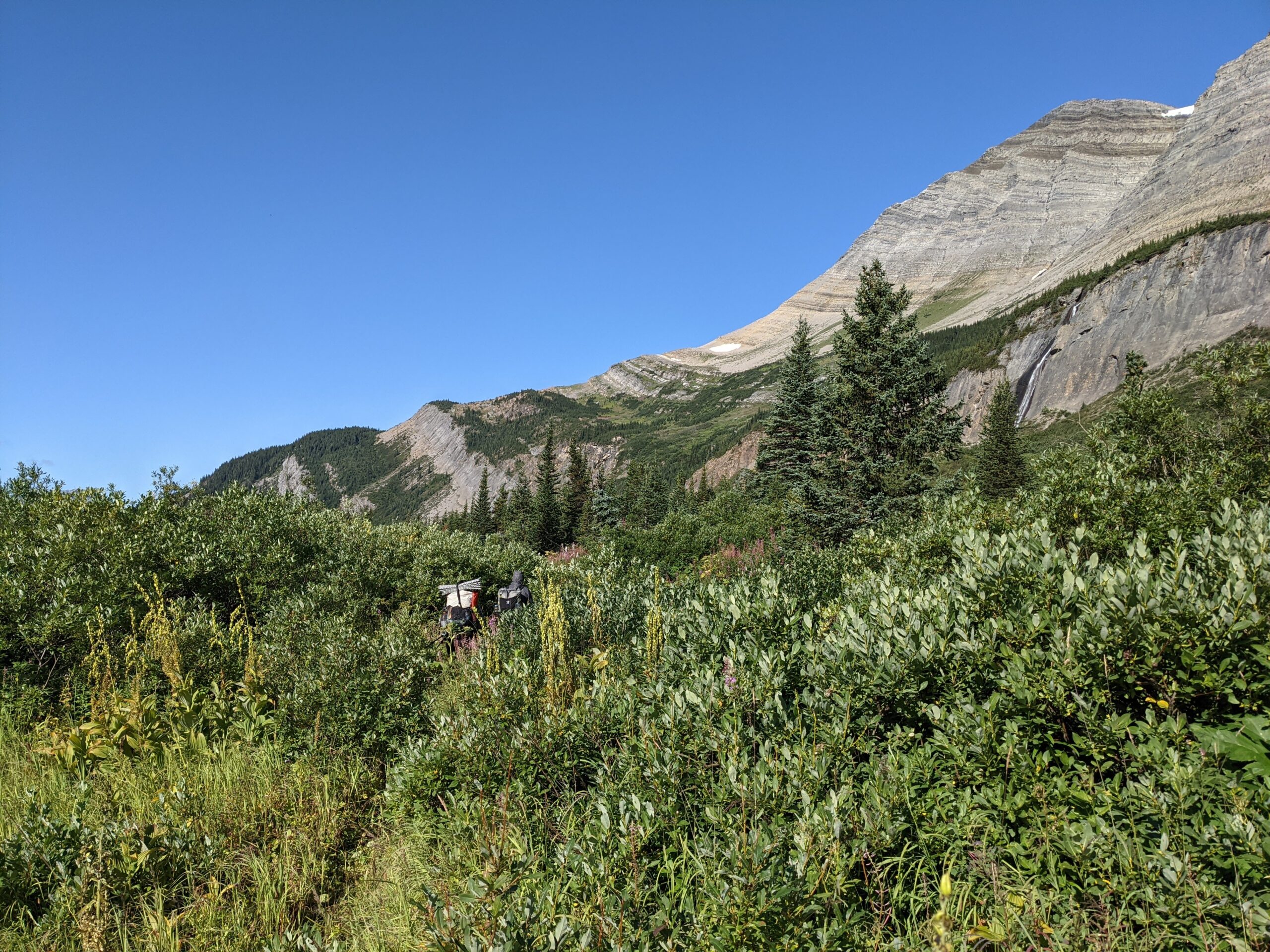
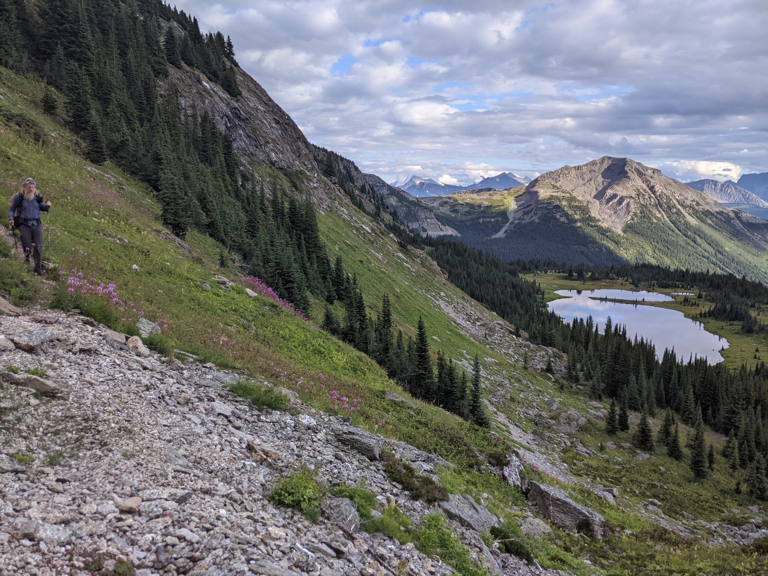
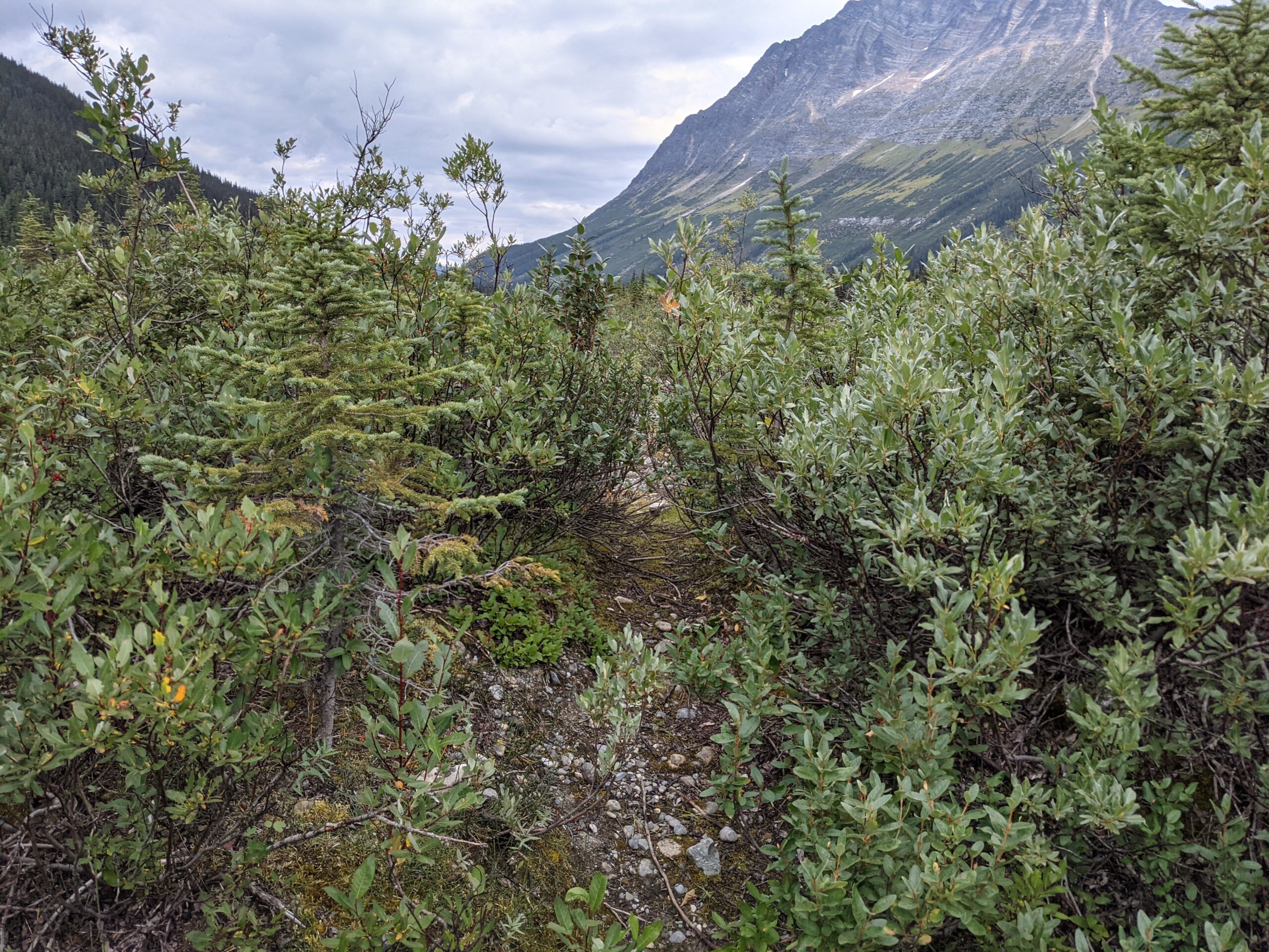
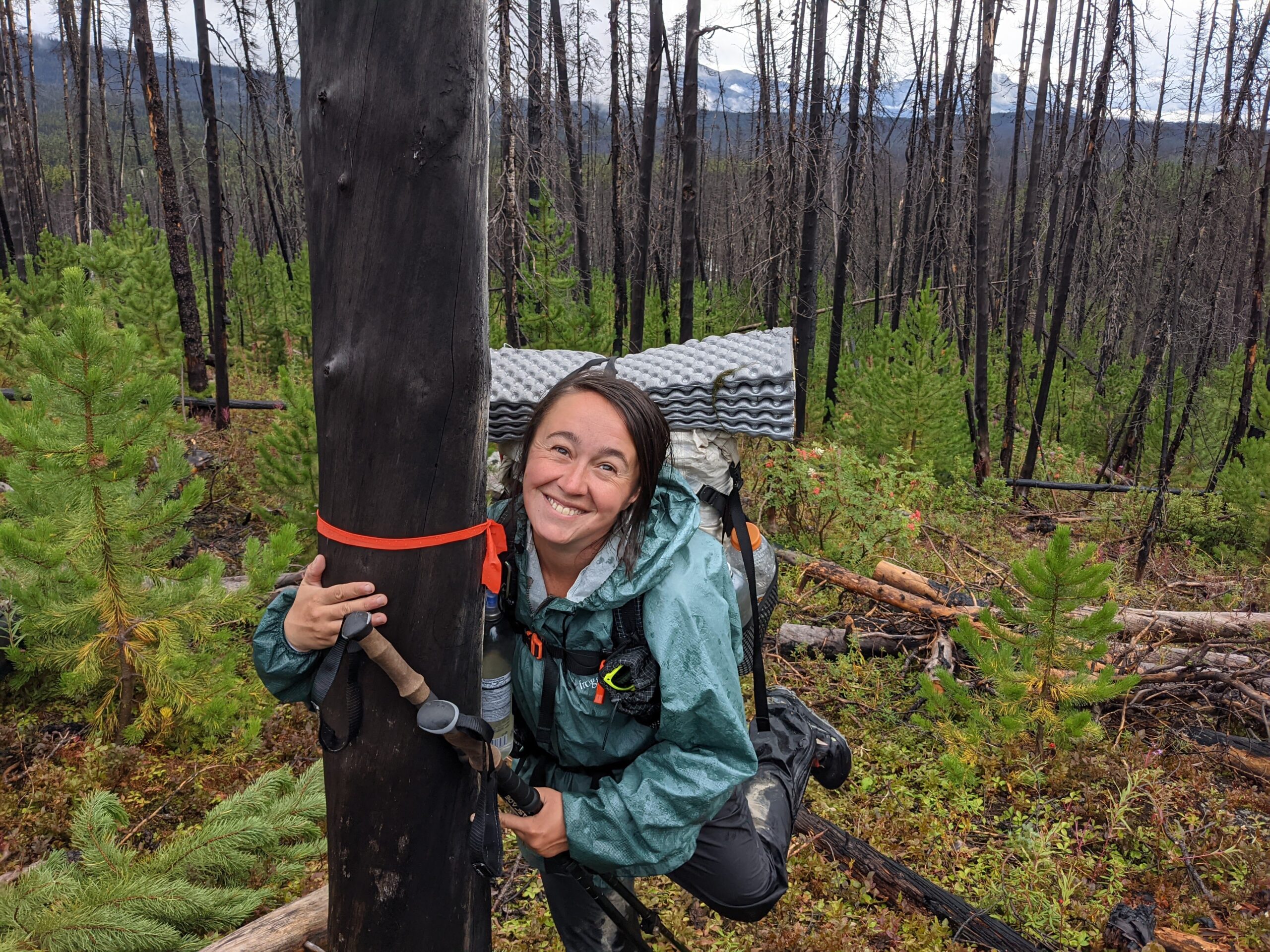
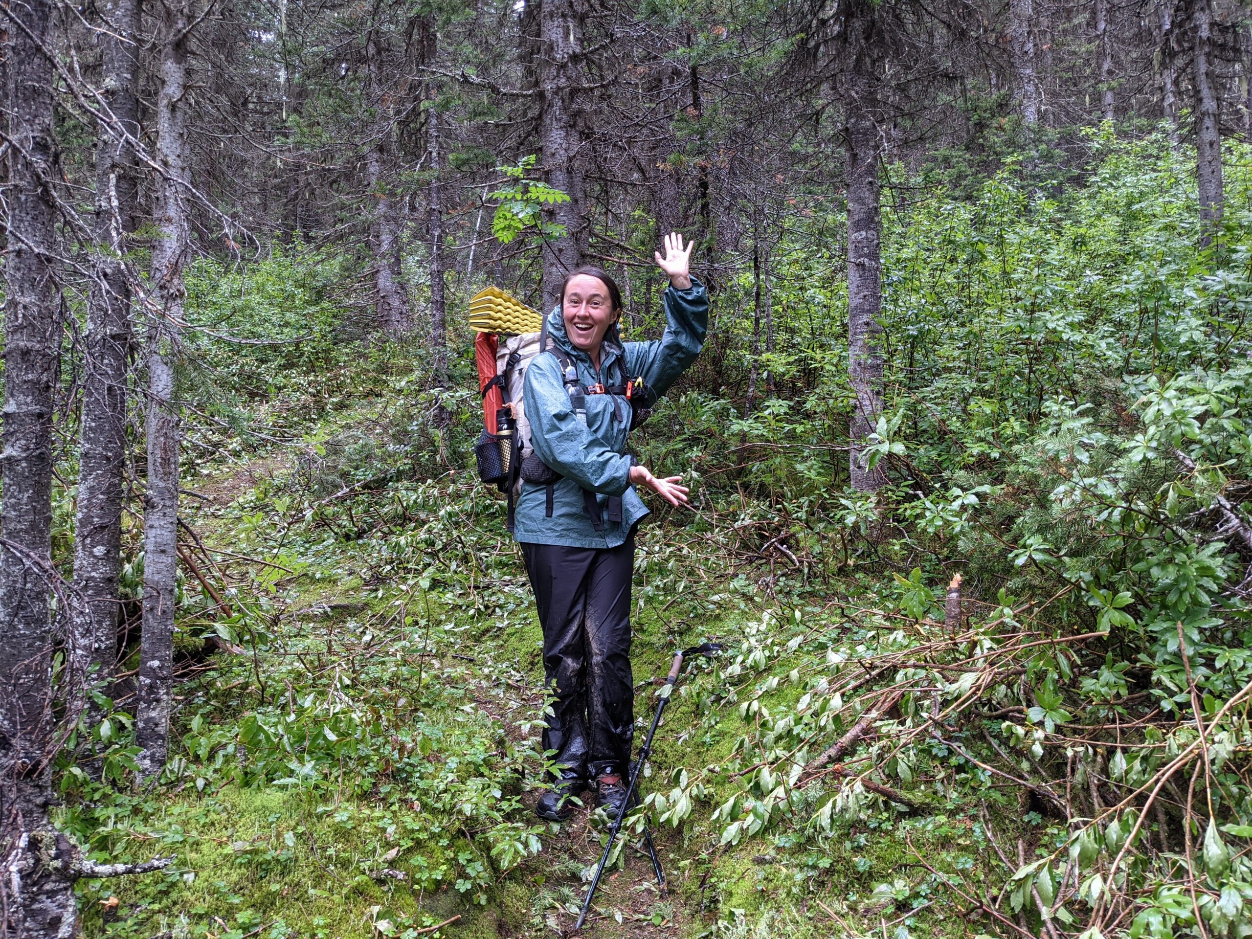

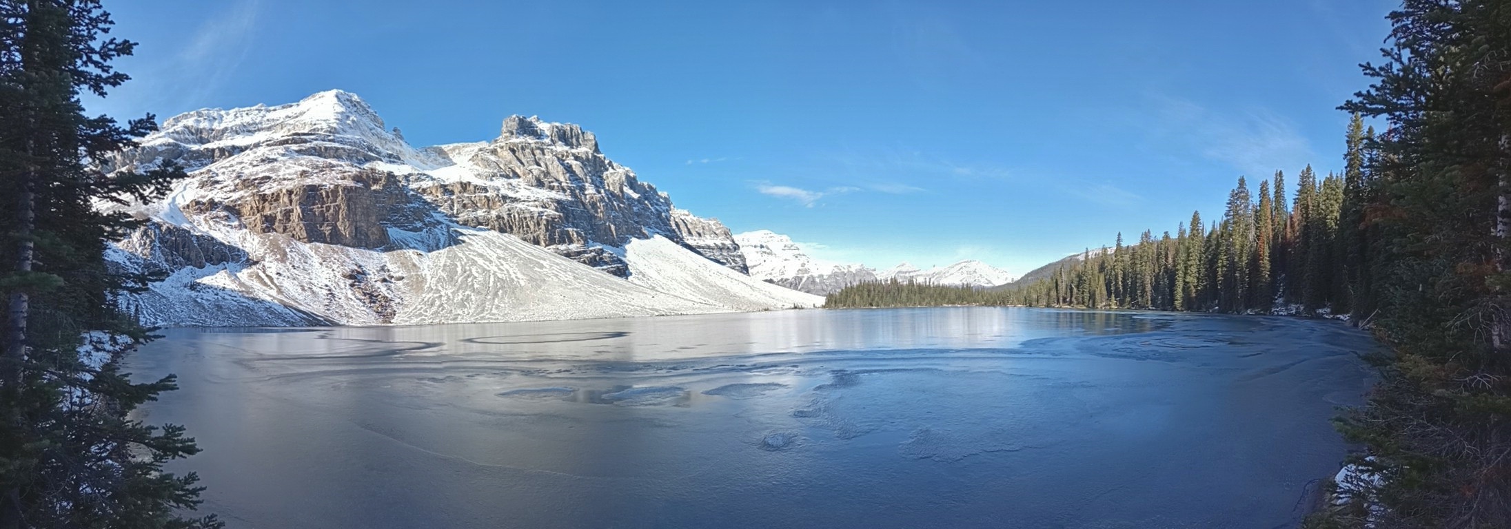

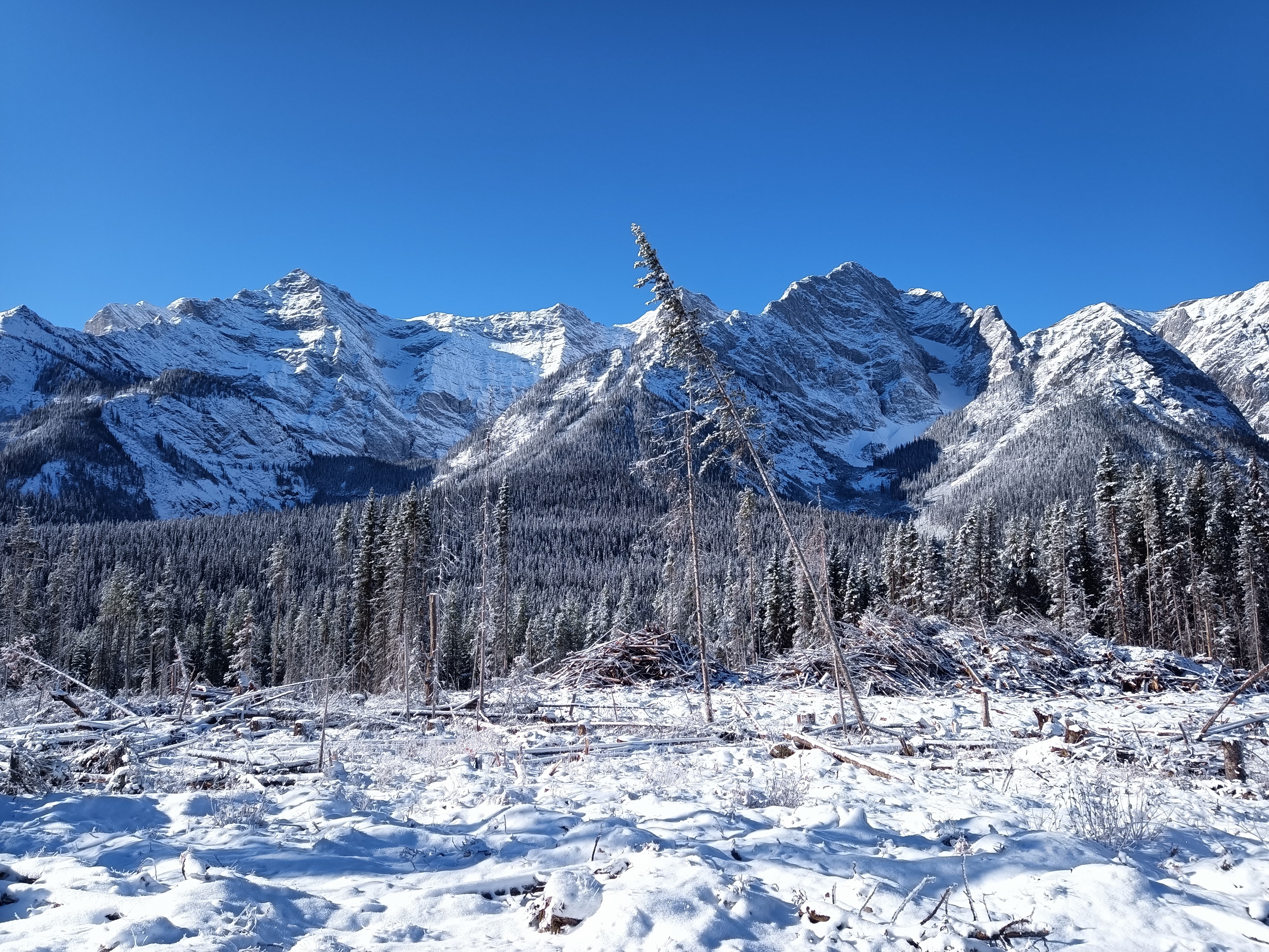
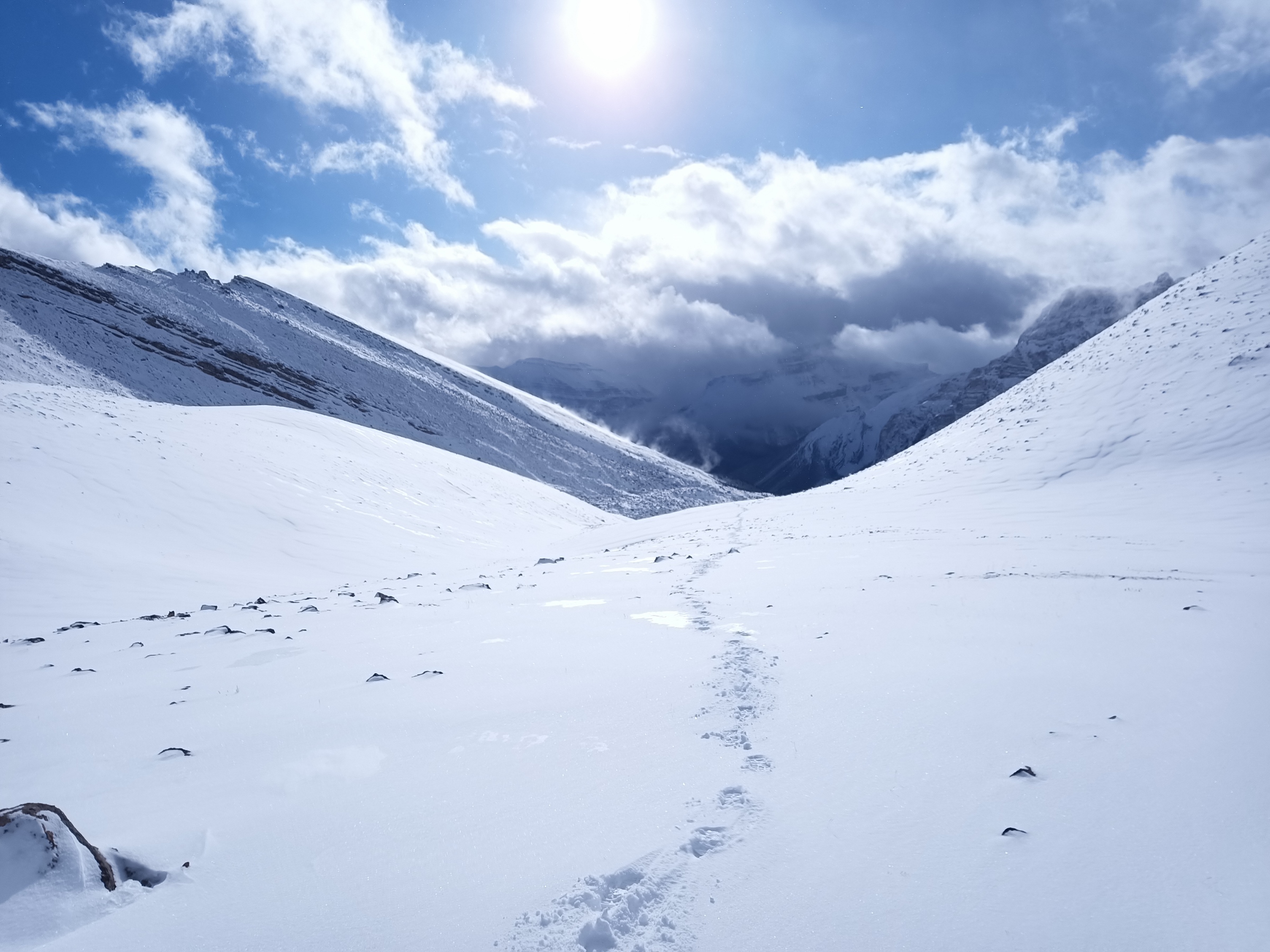
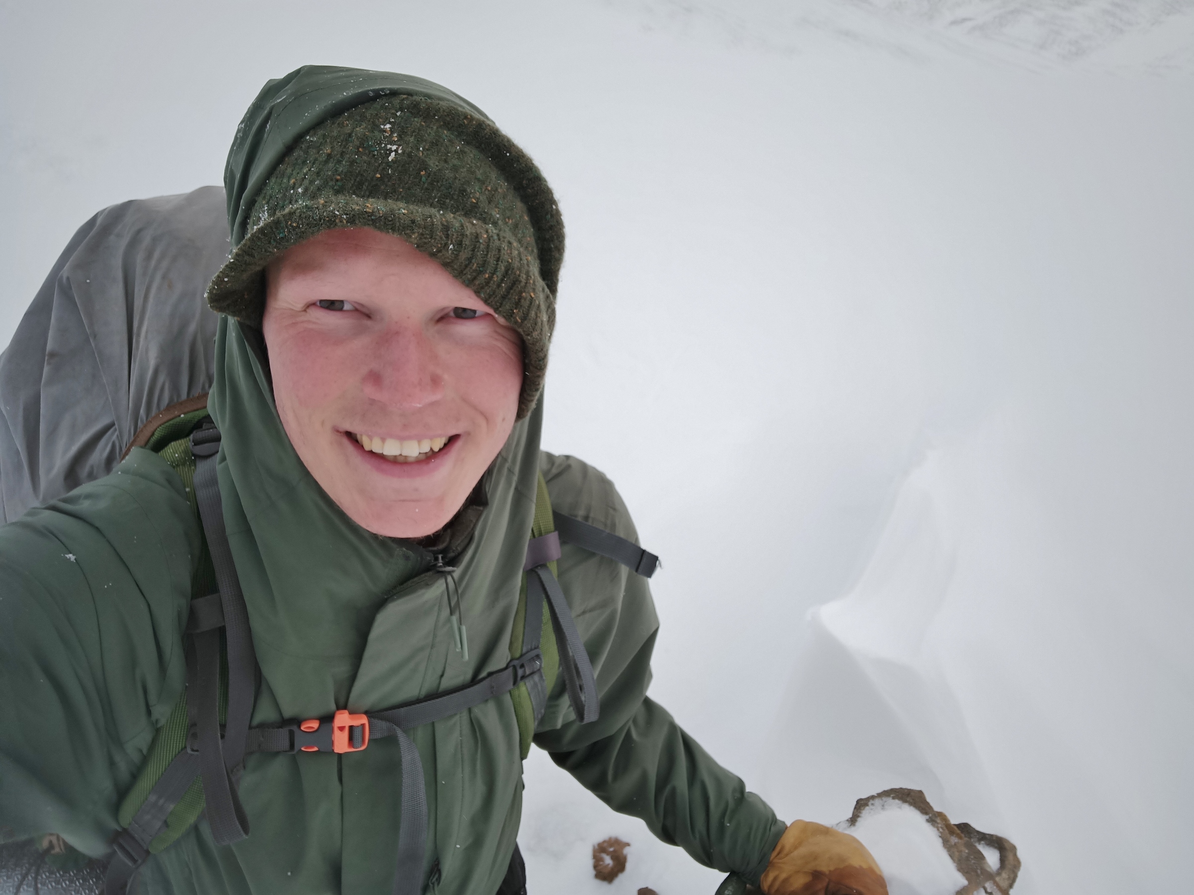
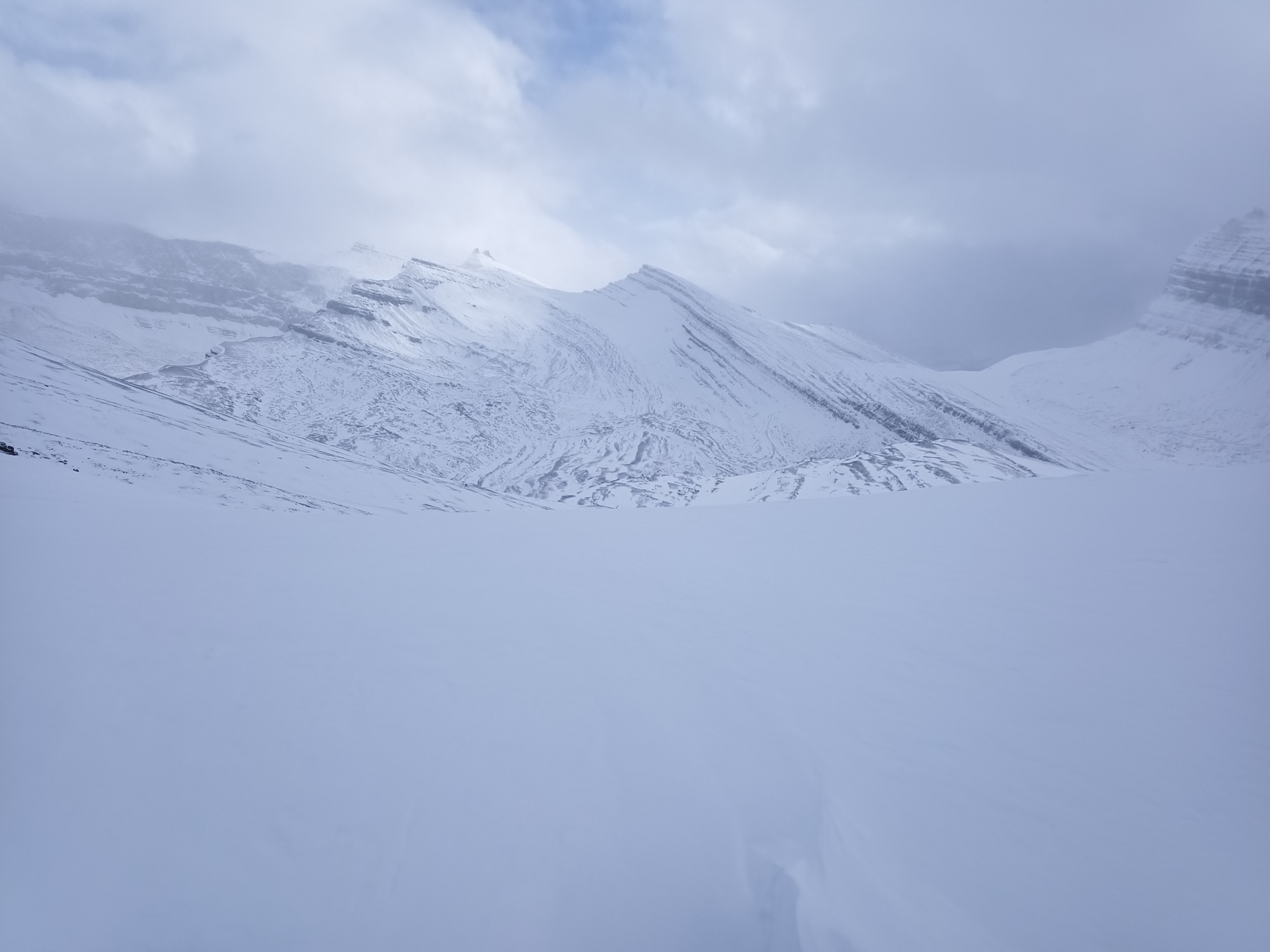
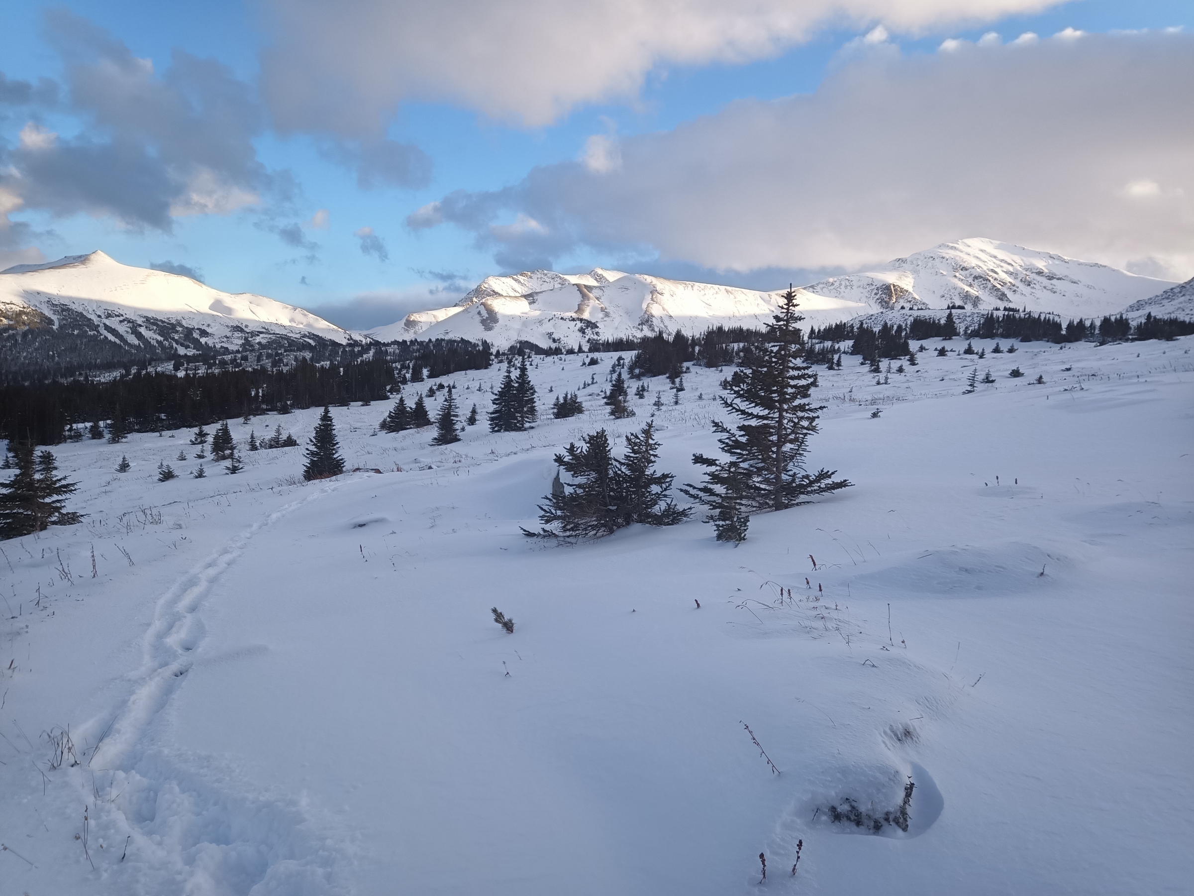


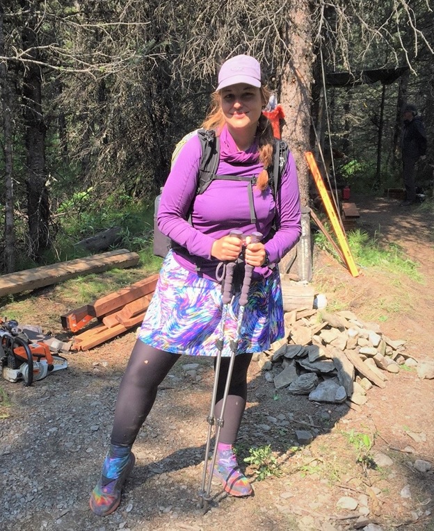
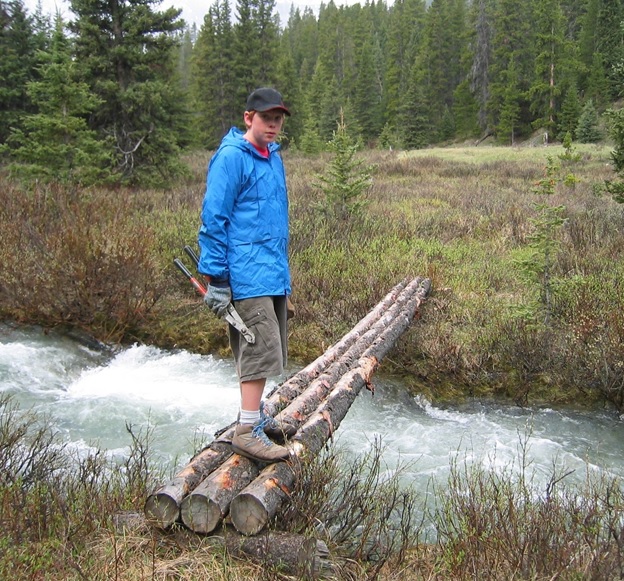
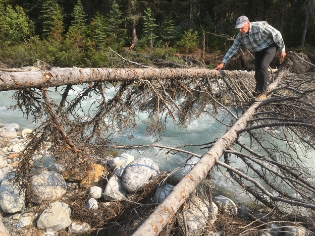
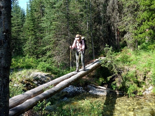

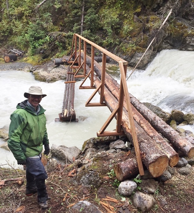
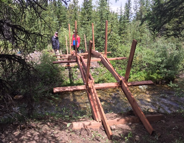
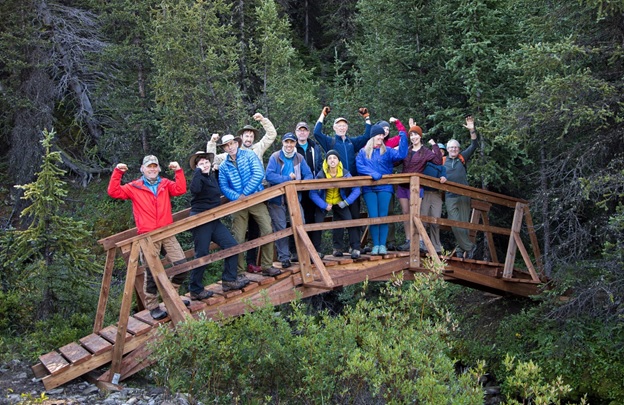
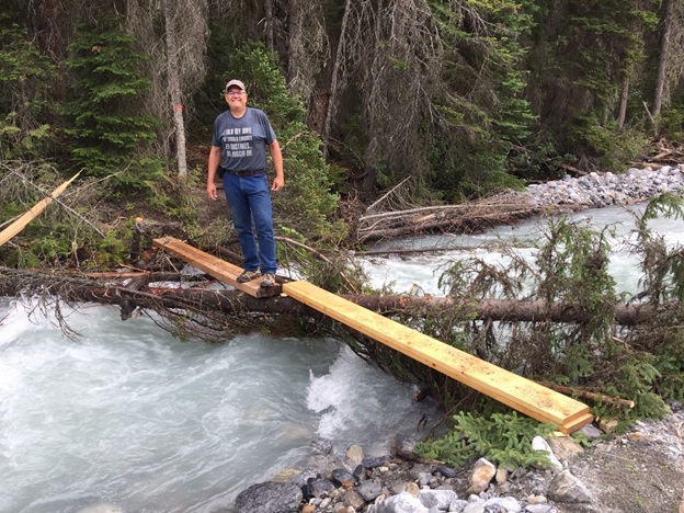
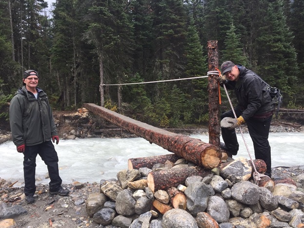
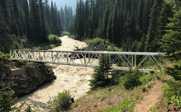
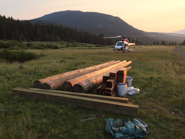
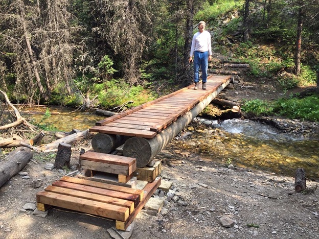
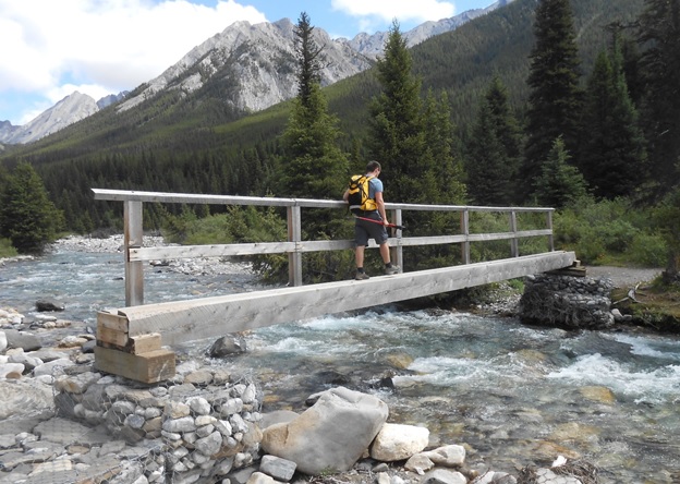
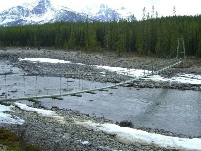

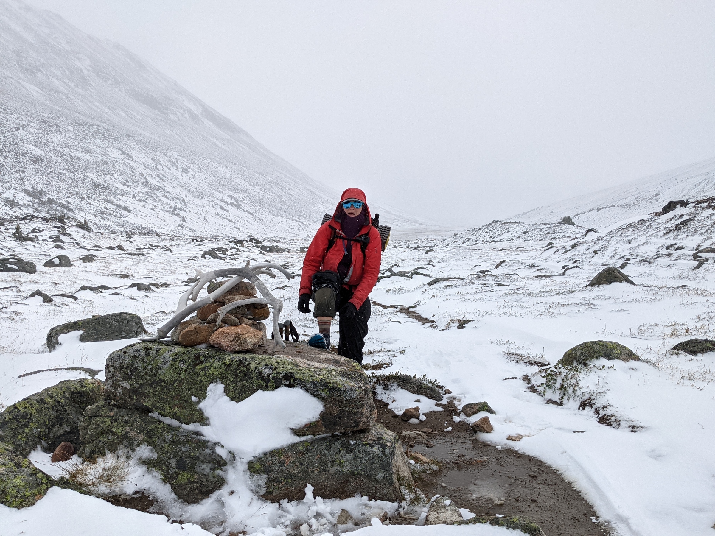

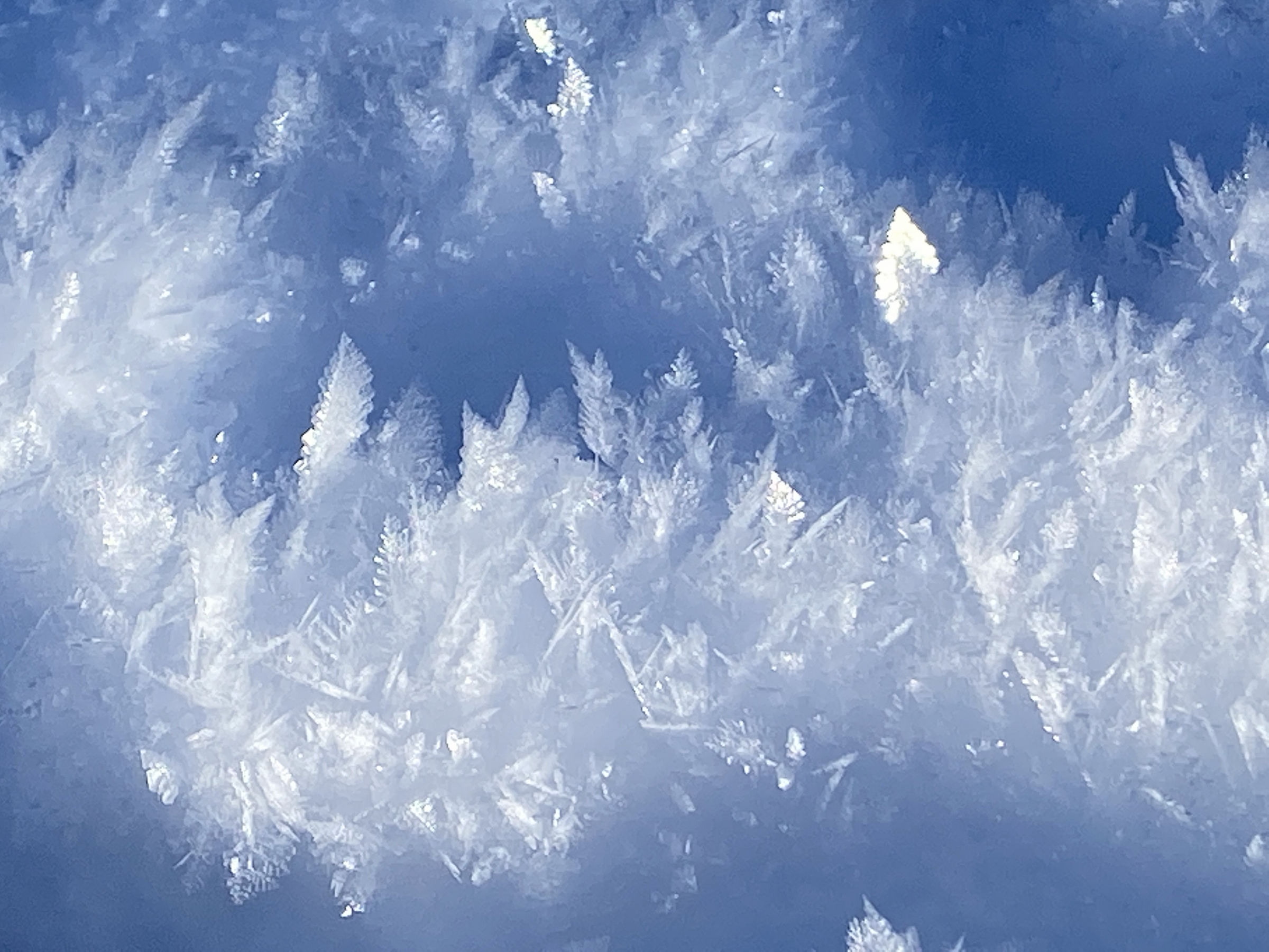
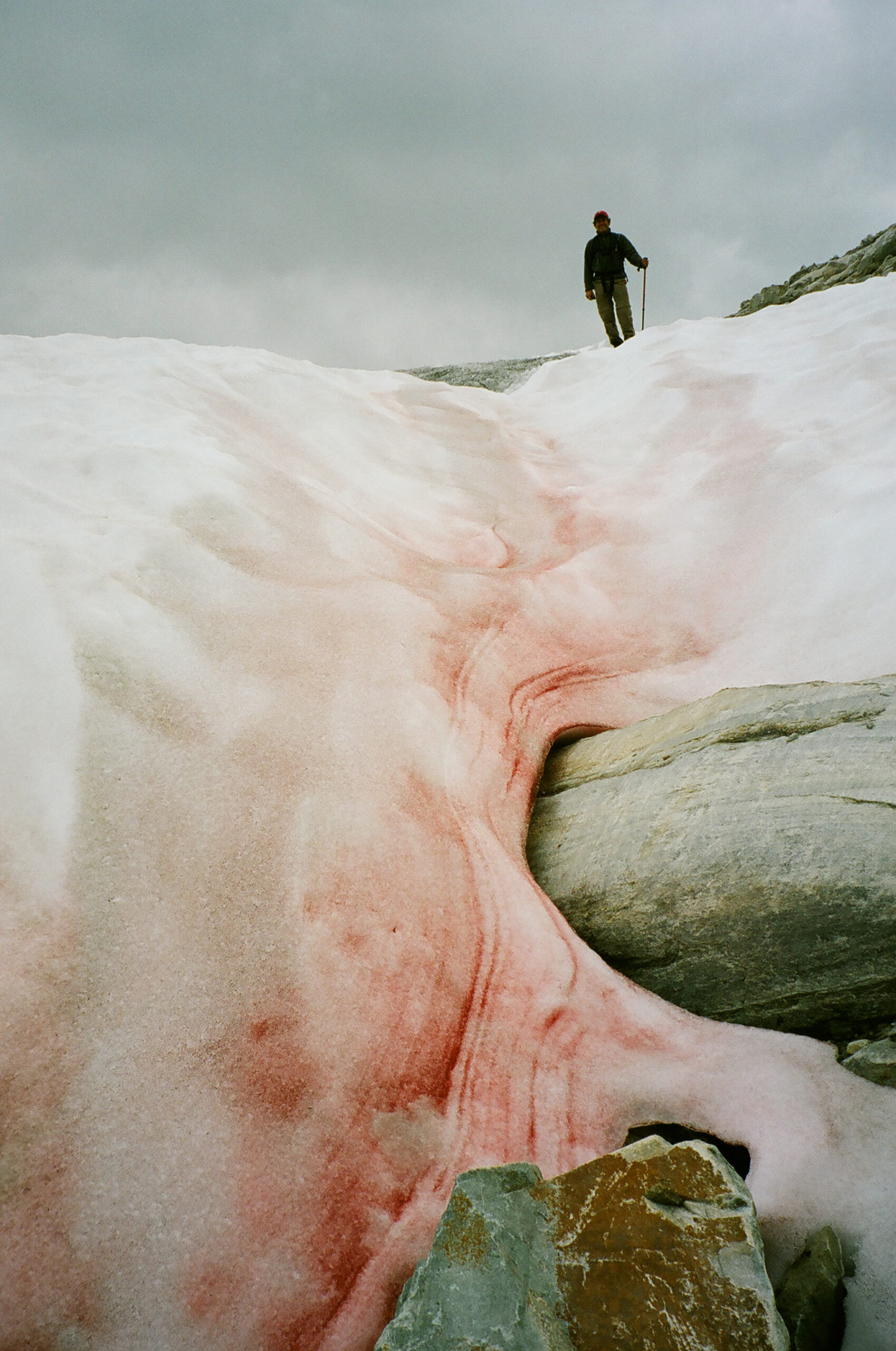
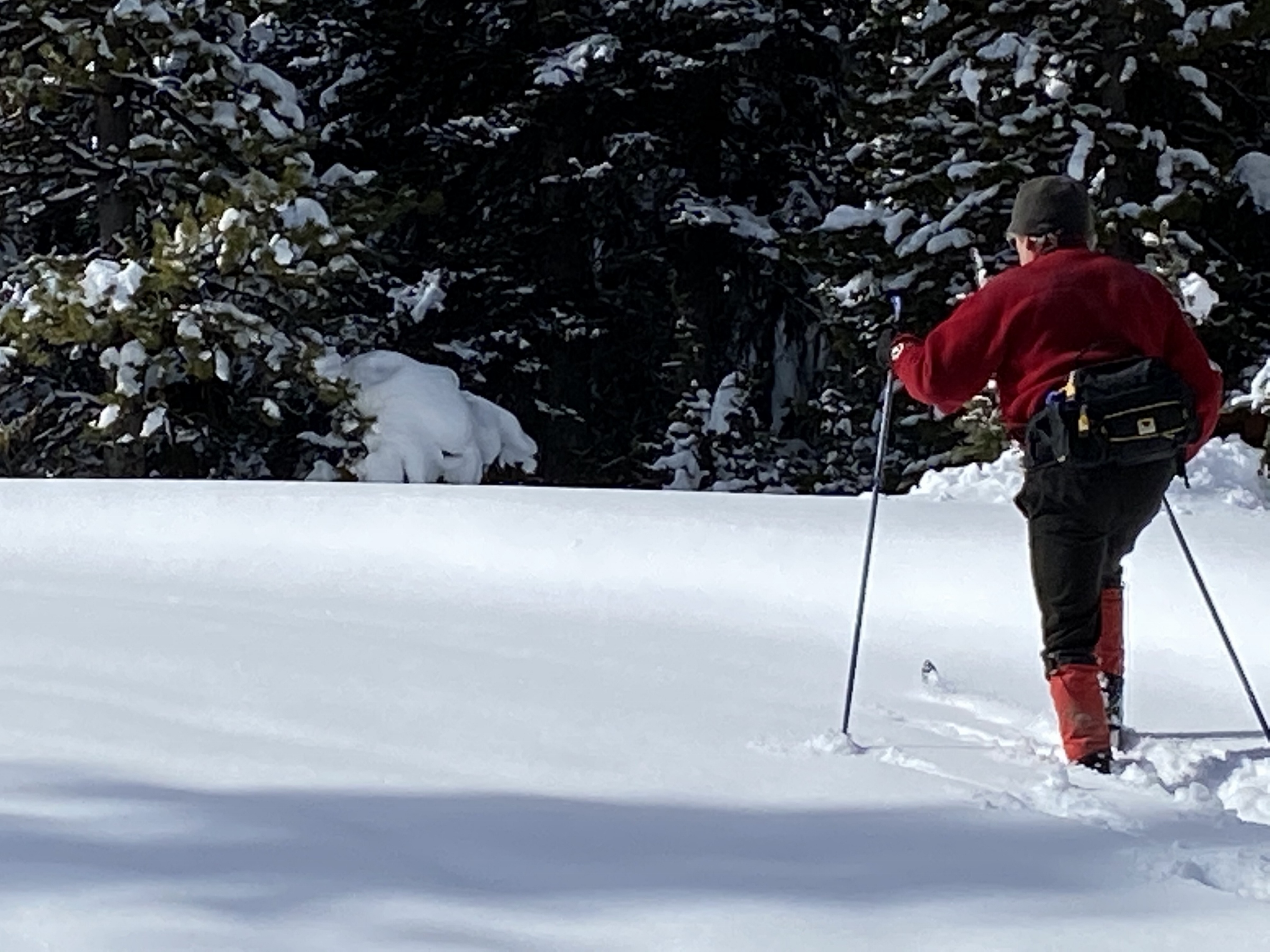
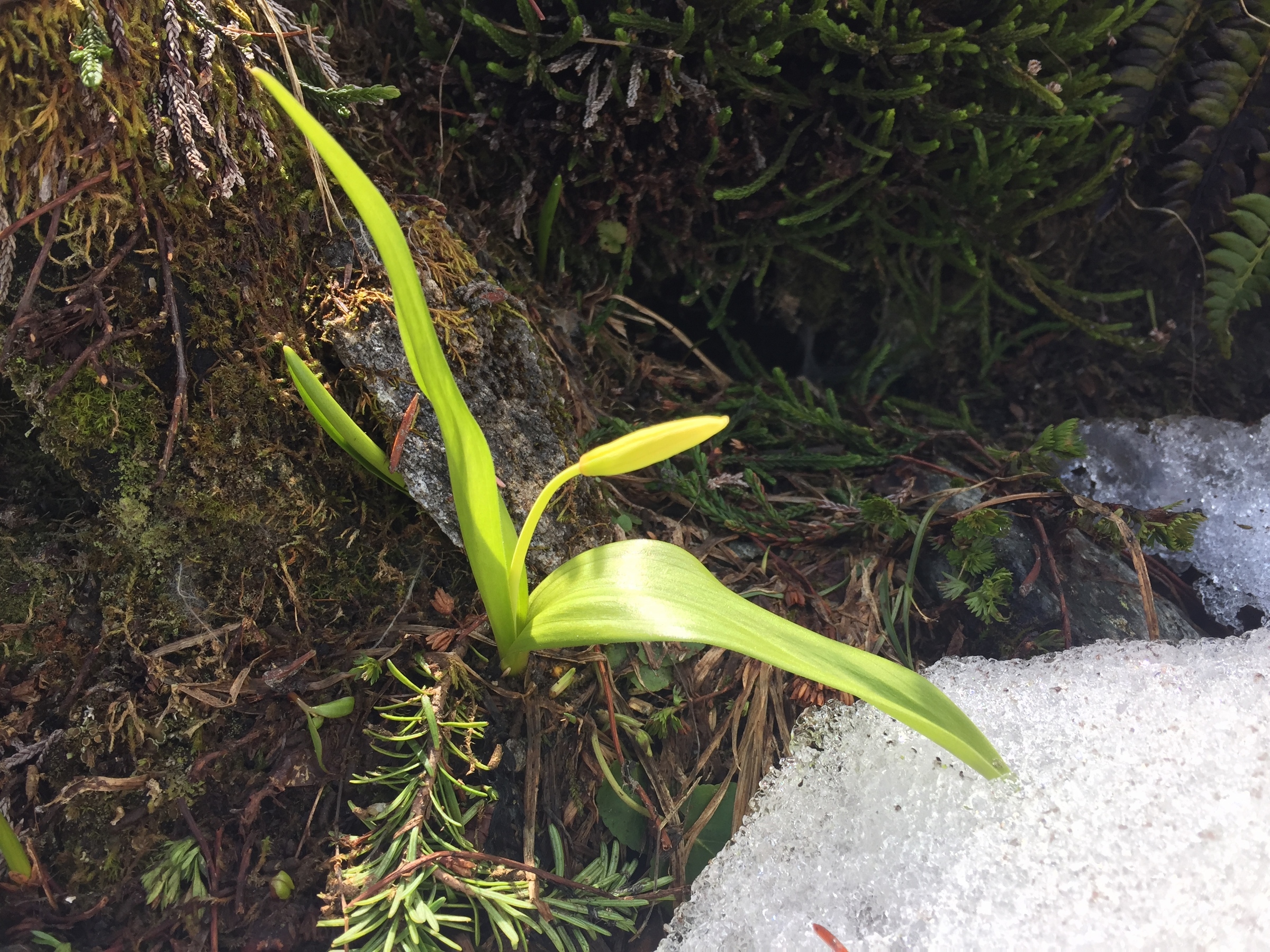
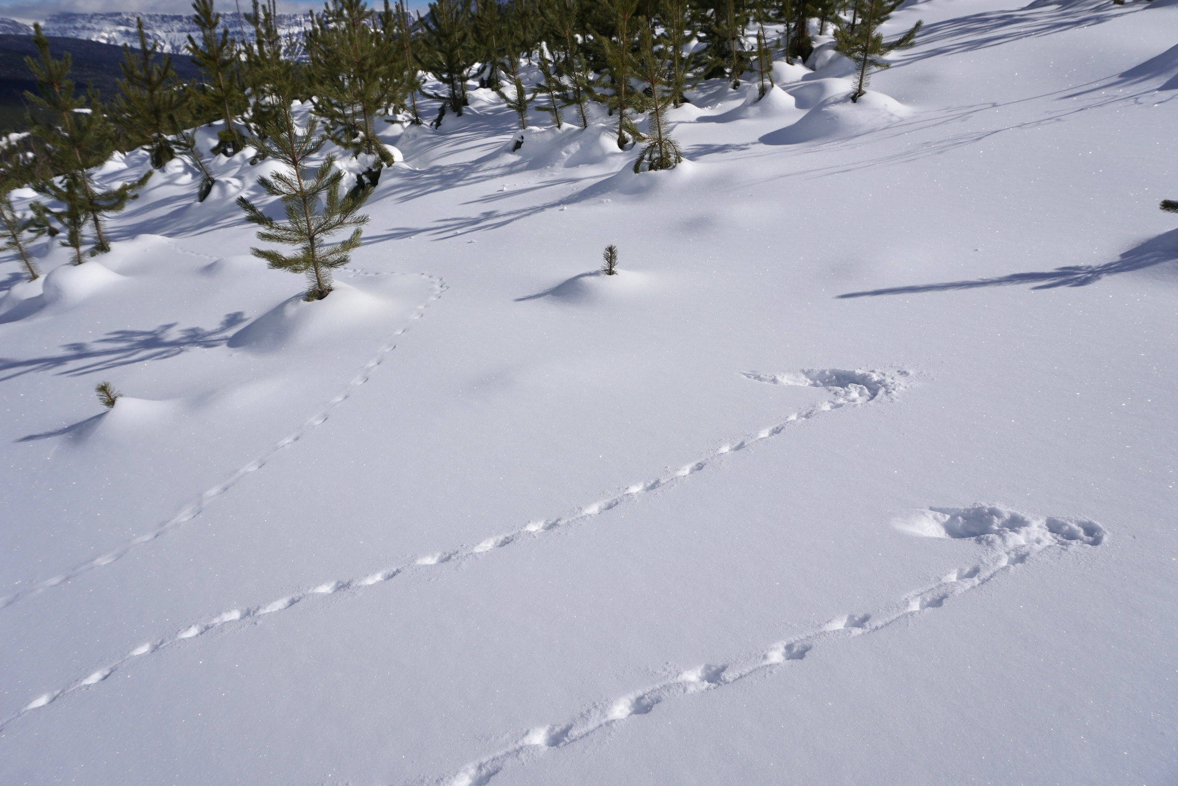
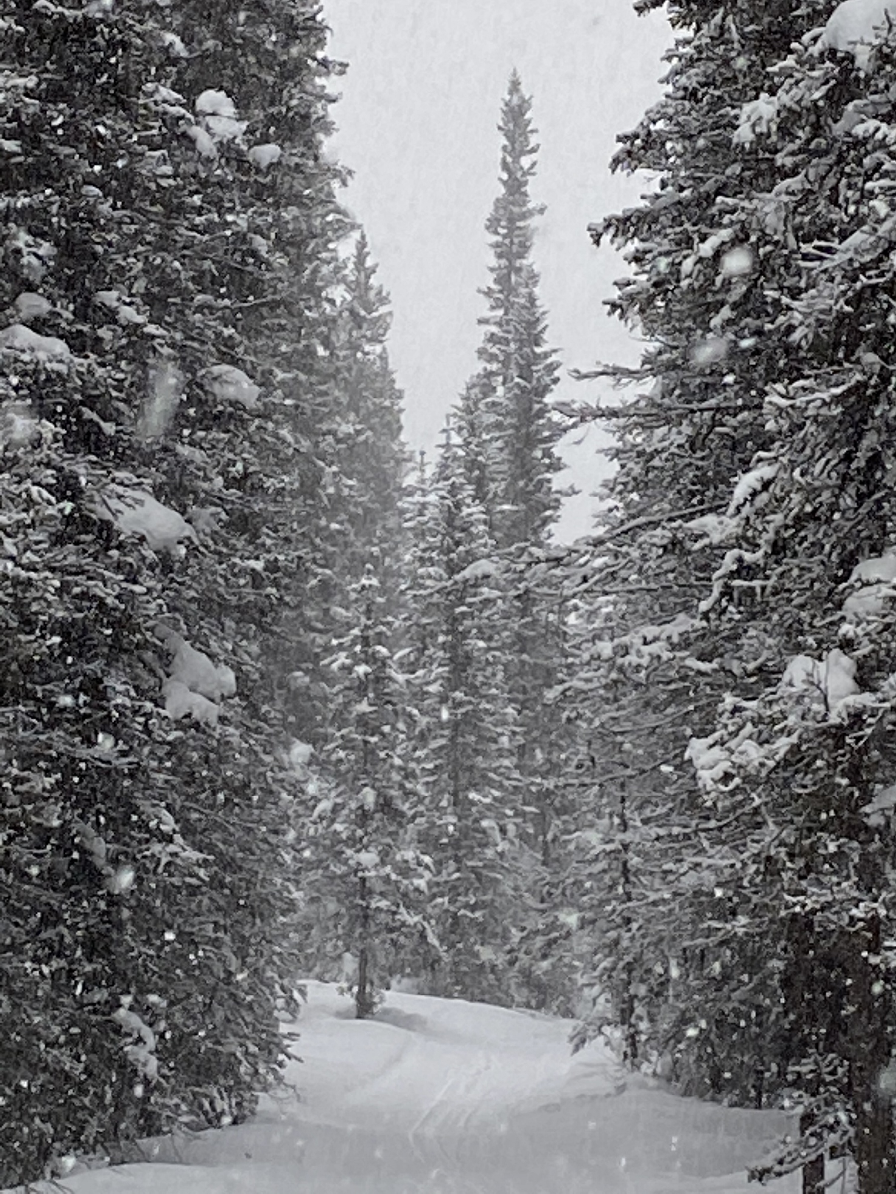
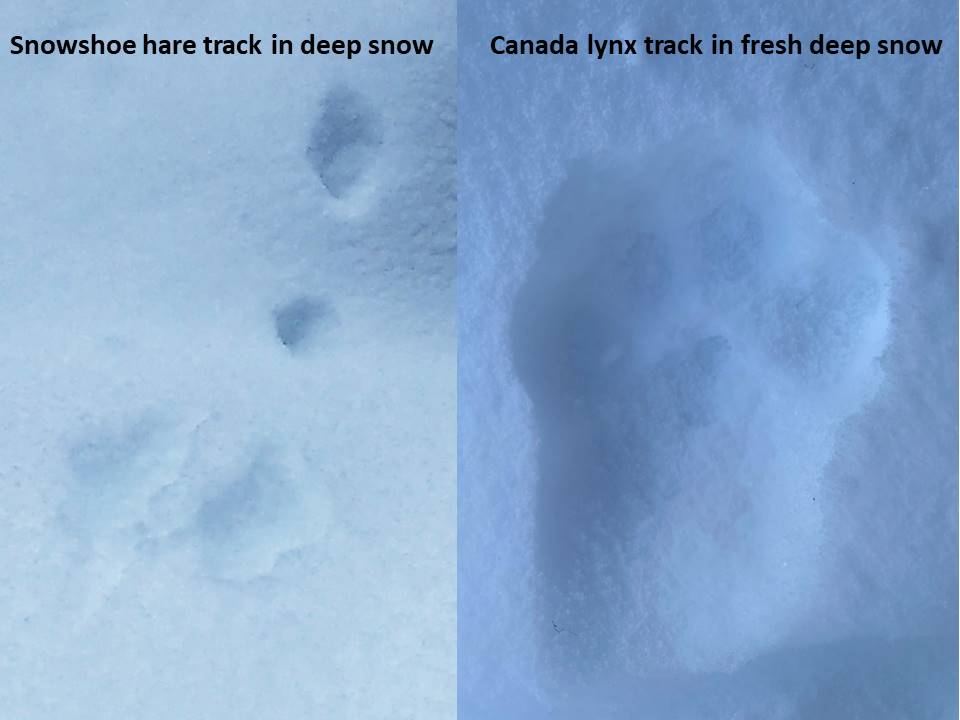
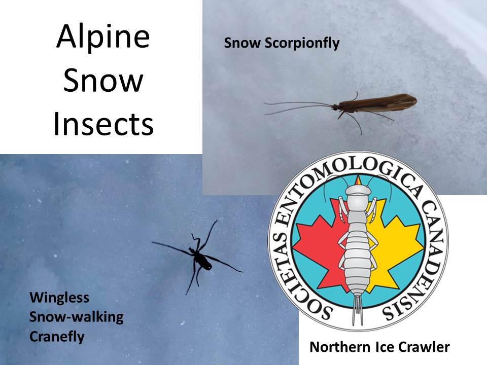
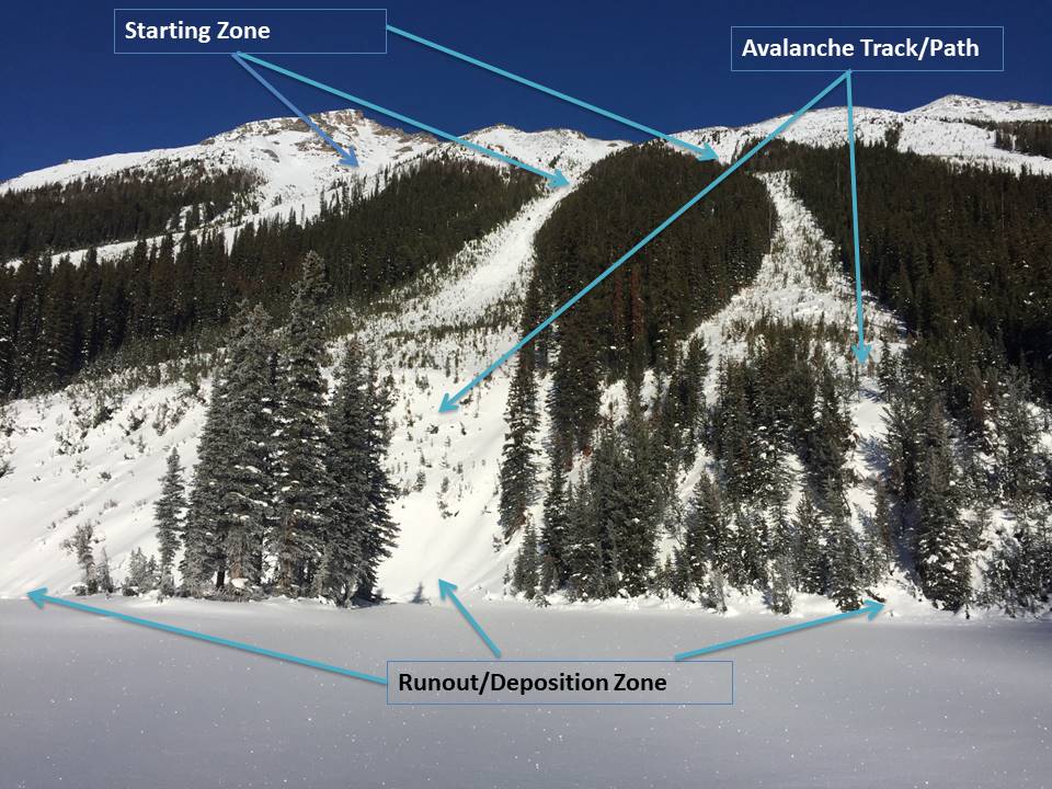
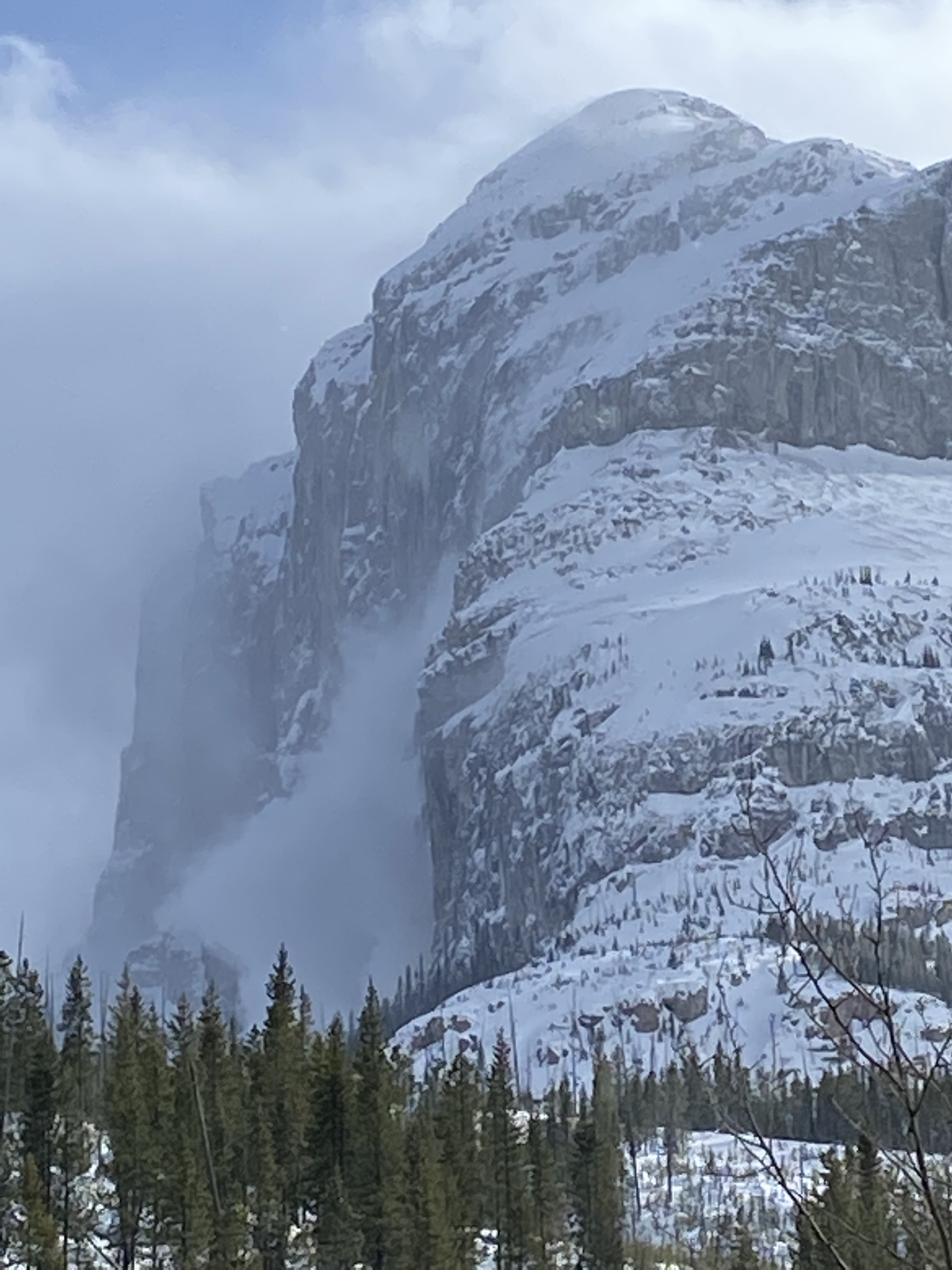

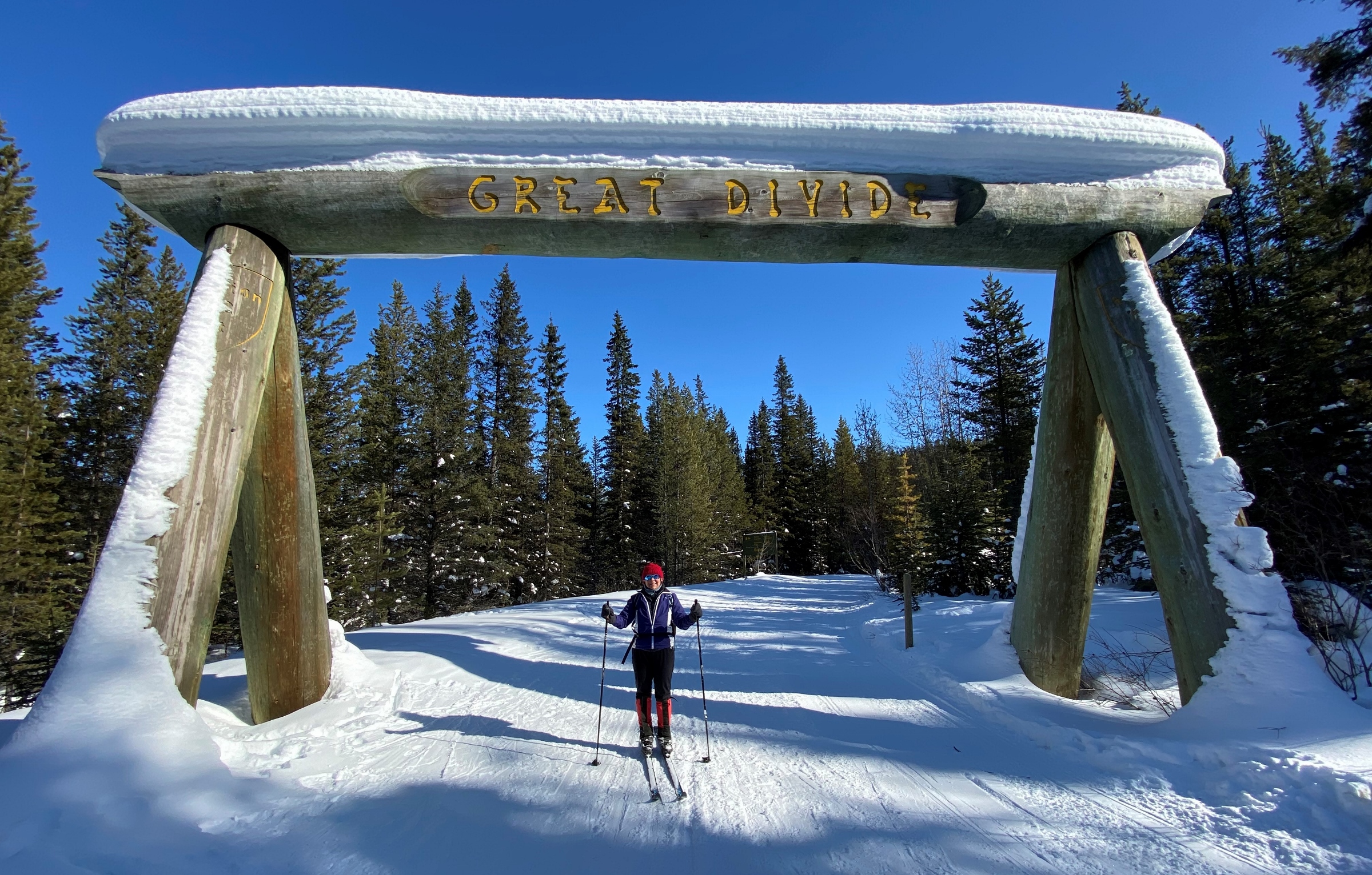

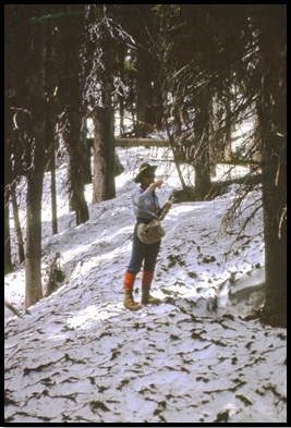
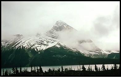
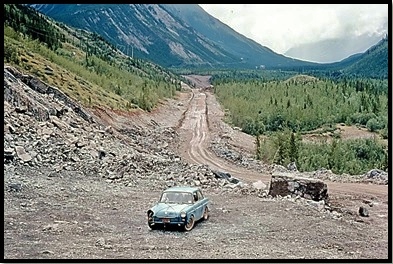

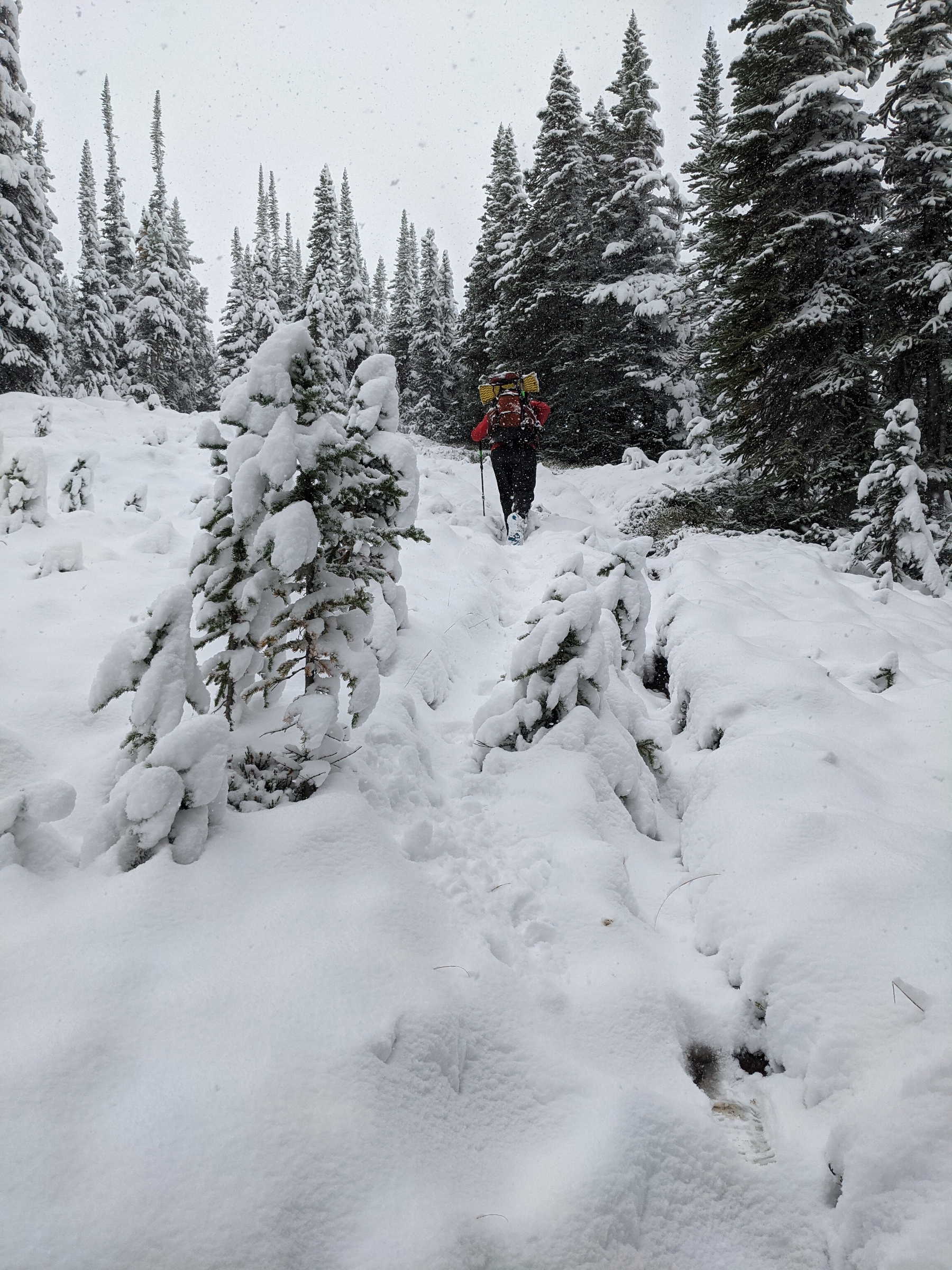

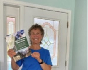
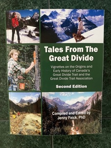

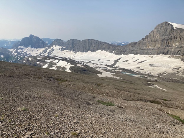


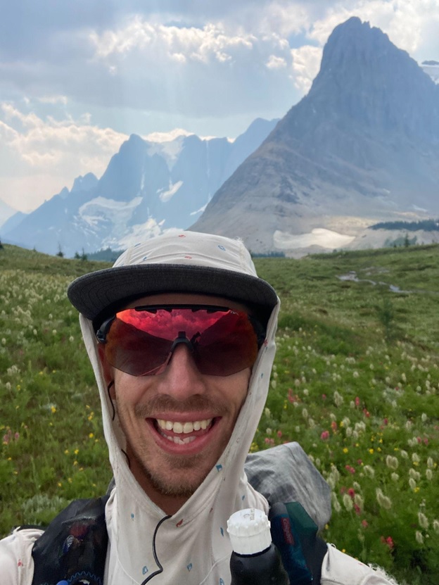
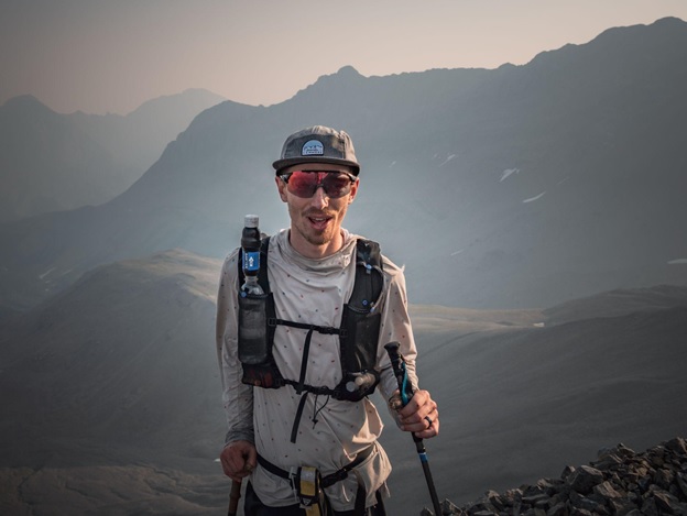
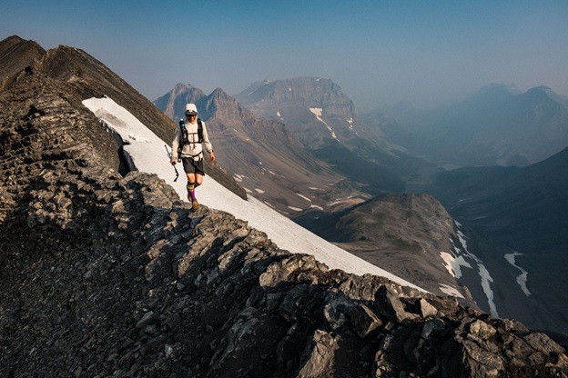
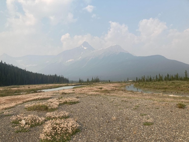

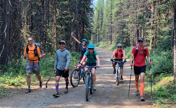

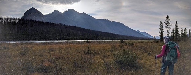
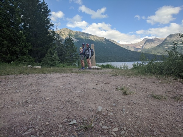
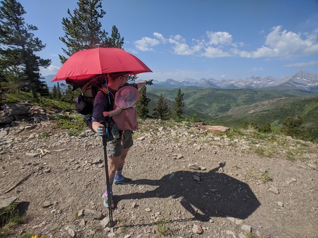
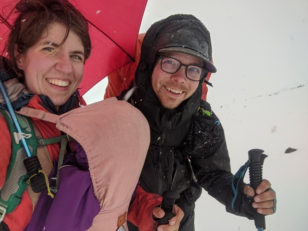
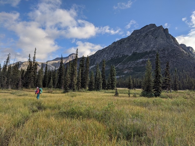
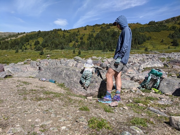

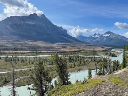
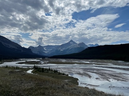
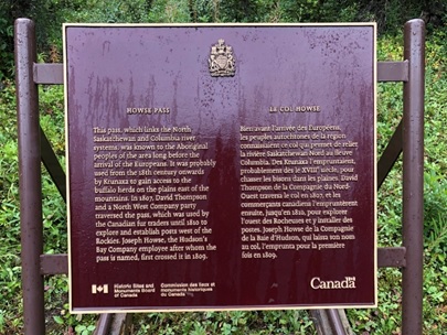
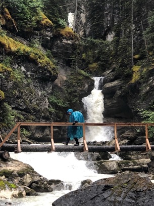
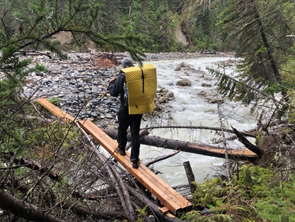
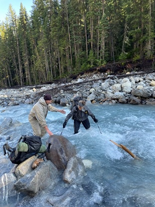
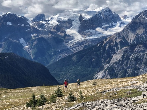
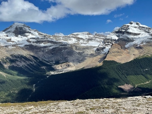
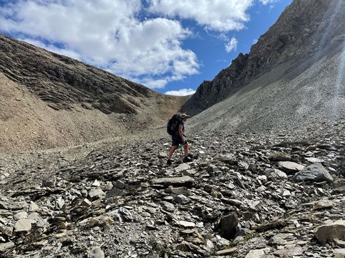
![Hiking up to Kiwetinok Pass [notice Kiwetinok Gap top right that we just came down!]](https://greatdividetrail.com/wp-content/uploads/2021/10/Section-D-11.jpg)