

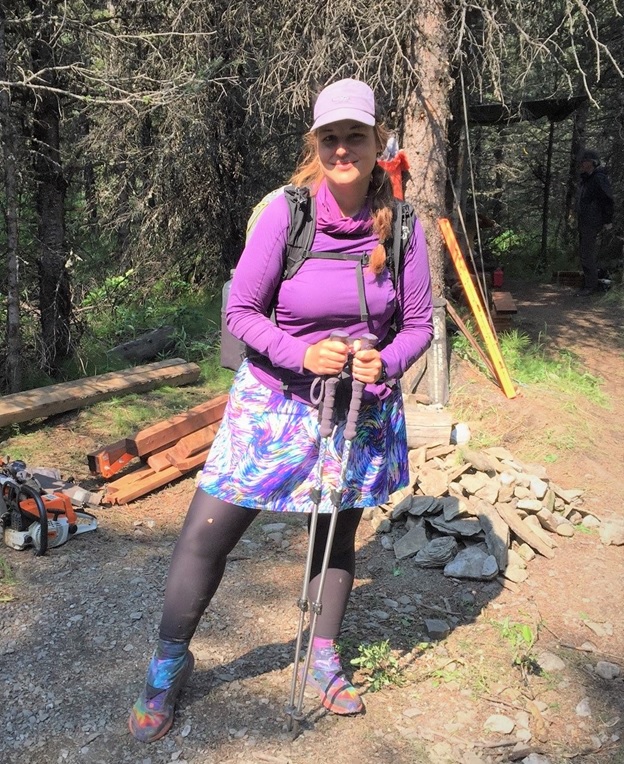
by Kelly McDonald
The Great Divide Trail (GDT) is very much a “choose your own adventure” kind of trail. While there is only a single route to follow in many areas, there are also a multitude of alternatives to choose from along the way. Some take you to entry and exit points, others to resupply points off trail, yet others offer more challenging options, scenery, or less exposed places when weather is bad. It’s important to understand the route and the pros and cons of the various options as you plan your itinerary. Due to complexity of the permitting process, remoteness and lack of resupply options, planning is an important part of the character of the GDT. Unlike the Pacific Crest Trail or Appalachian Trail it’s much harder to “wing” it or “learn as you go” on GDT.
In this article, we’ll detail the trail itself and the various routes and alternates as it winds its way from Waterton to Kakwa. The first thing you’ll need to know is that trail is divided into seven sections, labelled A to G running from south to north. We’ll start with section A and work our way up the trail. For more details on any of these sections, check out Dustin Lynx’s guidebook Hiking Canada’s Great Divide Trail.
Section A starts on the US-Canadian border and runs north to Highway 3 and the hamlet of Coleman. While Section E is often referred to as part of the trail with wild extremes, Section A is similar in that it starts with maintained and popular trails in a national park but also included what many consider the single hardest day on the GDT.
SECTION A: WATERTON TO CROWSNEST PASS – STARTING THE GREAT DIVIDE TRAIL
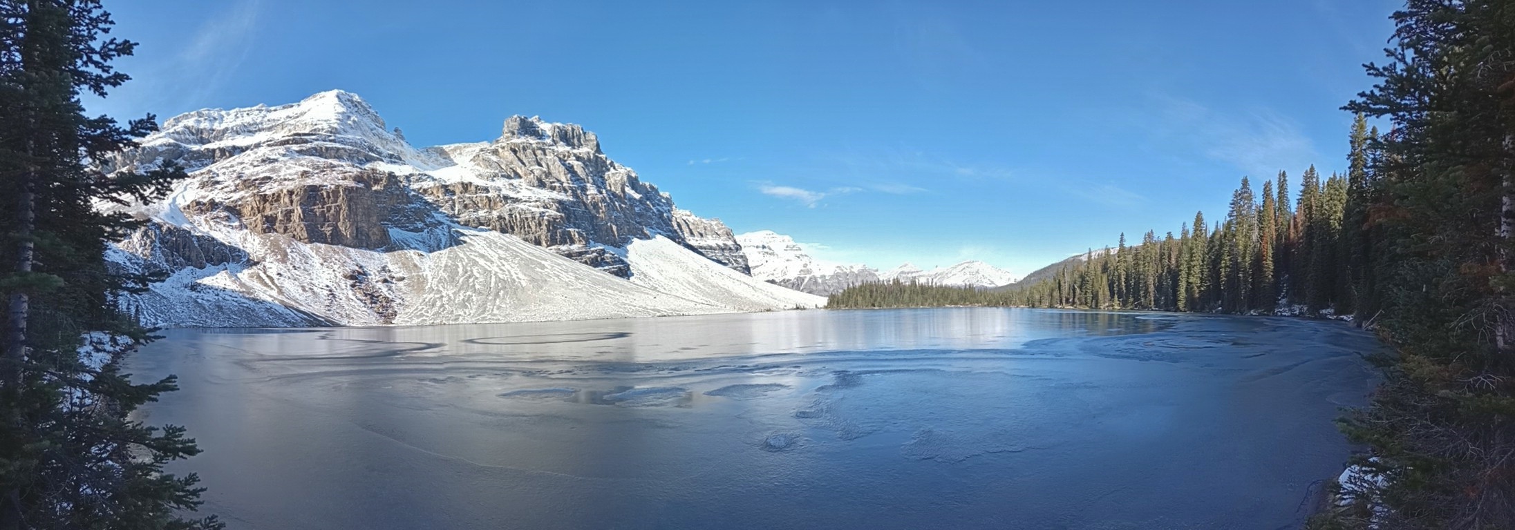
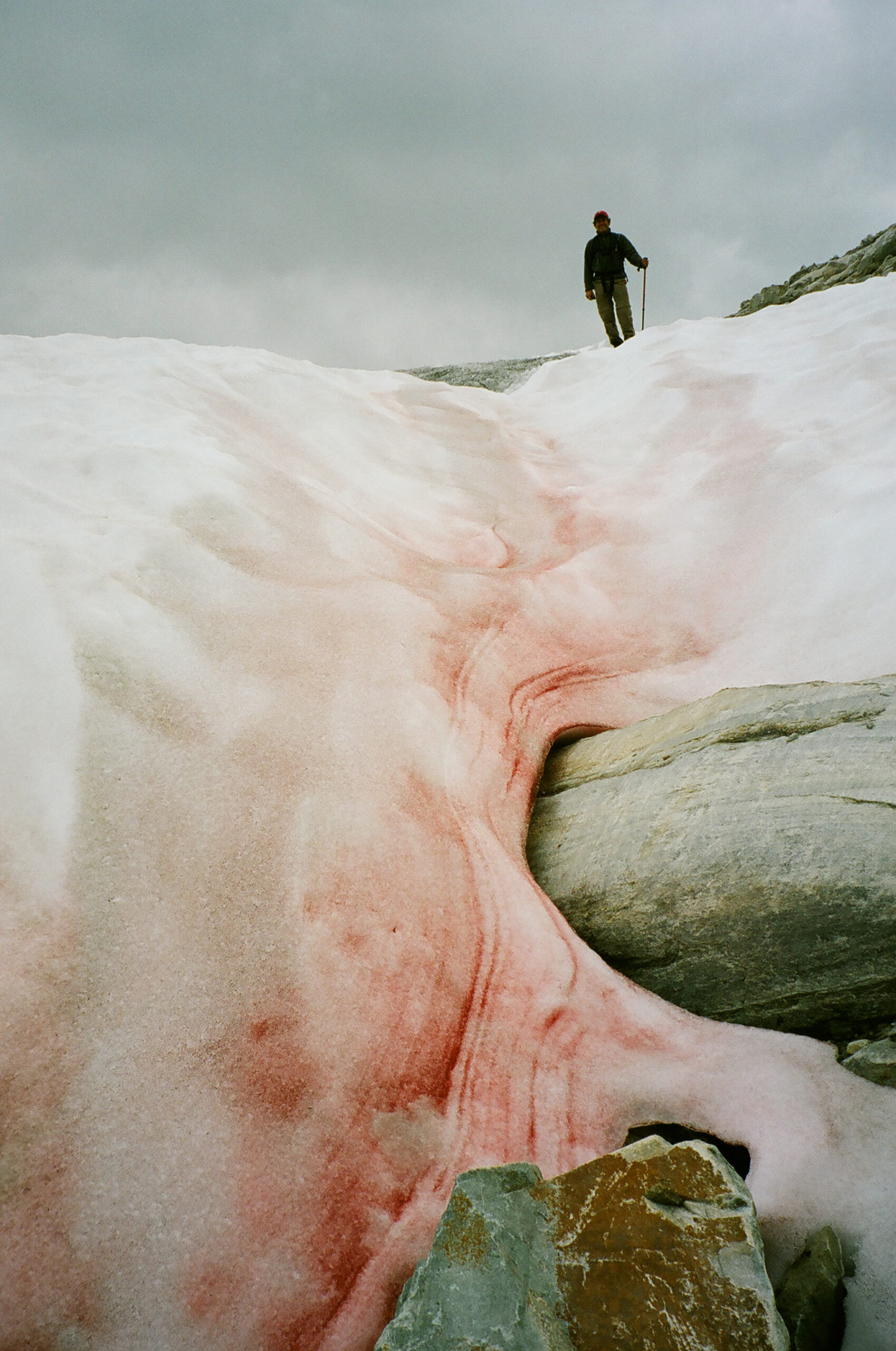
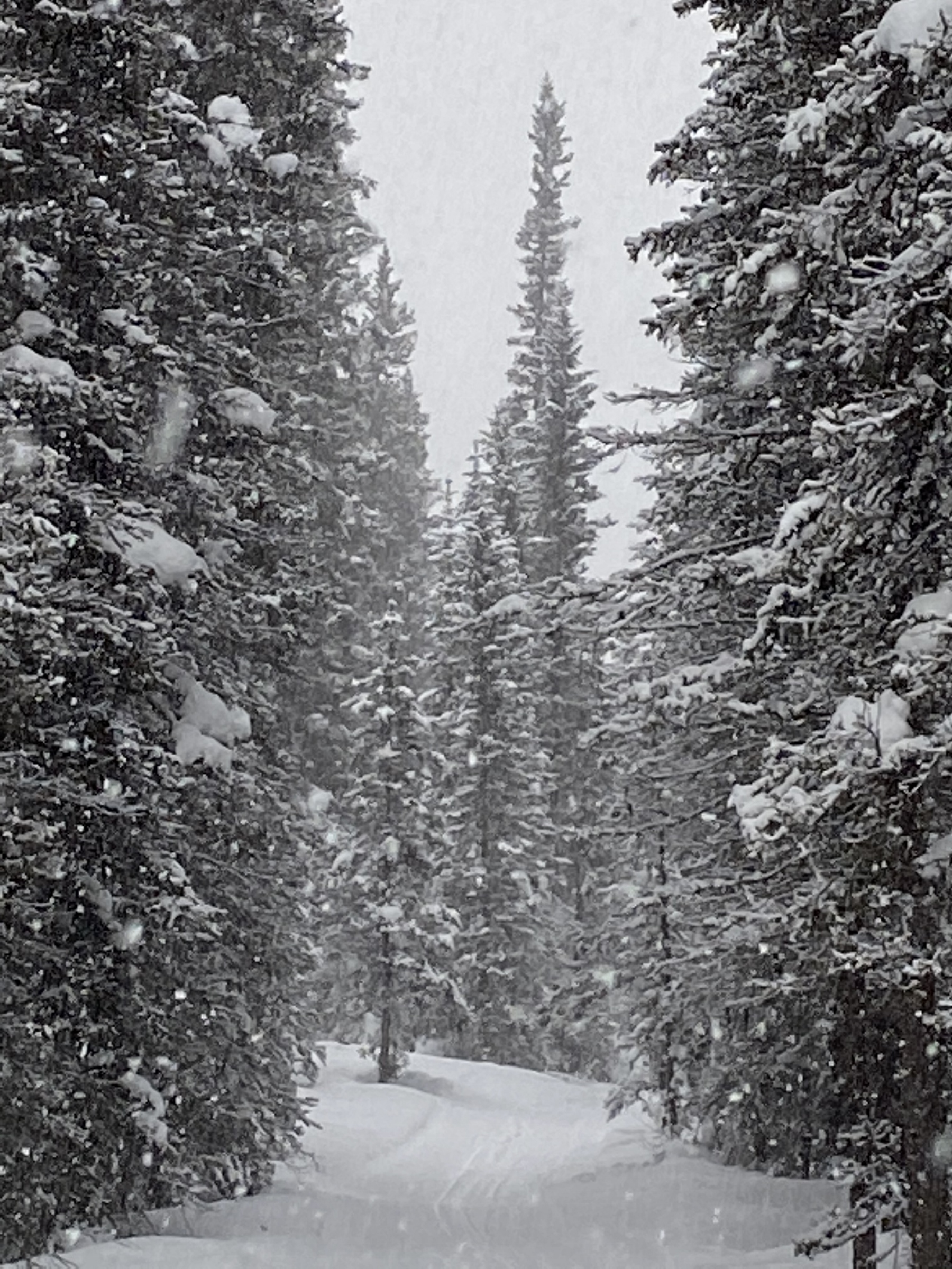
Starting at Boundary Bay on the US-Canadian border where the GDT connects with the Continental Divide Trail in the USA, the GDT heads north through Waterton Lakes National Park in Alberta. In 2017, the Kenow wildfire burned much of the park (thankfully sparing most campgrounds and facilities), but a lot of work has gone into repairing damage and improving things. This does mean you will encounter large burnt sections where there is little shade, and summer days can get hot.
To get to the international border monument marking the start of the trail, most folks will hike from Waterton townsite (and back). It’s only 6 km to the border and can easily be done in a single day. Historically, there has been a boat that takes you to Goat Haunt on the US side where you can hike to the start of the trail. This is an international border crossing and it has been closed for the past few years due to COVID. If/when it re-opens, you will require a passport or suitable ID to cross and will need to check-in with both US and Canadian customs. If you are an international traveller, ensure you can enter the US if you choose this option.

THE GDT THROUGH WATERTON LAKES NATIONAL PARK
Within Waterton Lakes National Park, trails are well maintained and easy to follow. Some portions can be very popular in the summer with day hikers, equestrians, and folks doing a quick overnight. From Boundary Bay, the trail heads north to the Waterton townsite over a few easy mountain spurs. You’re never far from Upper Waterton Lake and water is plentiful. Backcountry campgrounds are available at Bertha Bay and Boundary Bay. The townsite also has full services for lodging, frontcountry camping and resupply.
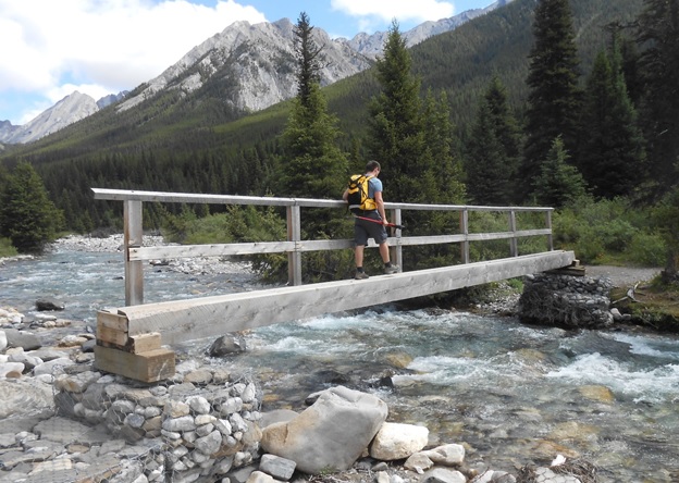
From there it’s up the valley to Carthew Creek, Alderson Lake, and the beautiful Carthew Lakes. The route over Carthew Summit is well marked with wayfinders above treeline. Once over the top, you’ll peer into remote reaches of Glacier National Park in the US and make your way back down to Cameron Lake. Cameron Lake is a busy tourist destination with a small store for refreshments and canoe rentals (last flush toilets for a while). Once you reach Cameron Lake, you’ll have two options. The main route remains in Waterton Lakes NP and follows the popular Tamarack Trail, while the Mount Rowe alternate follows an unmaintained cross-country route on the British Columbia side of the divide. Normally this alternate route is used by folks who are unable to secure permits for the Tamarack Trail or who prefer the option of random camping. Regardless, many will take the option of camping at Akamina Creek on the BC side of the divide as it’s the only place you can camp in this area.
For those following the main route, there is a short section of road walk to the Rowe Lakes trailhead. Through forest, you’ll make your way up to Rowe Meadows (grab water here) and the climb to the second highest point on the GDT, Lineham Ridge. More wayfinders mark the route. Several saddles through the burned Blakiston valley take you past campgrounds at Lone and Twin Lakes and up to Sage Pass where you leave Waterton Lakes National Park.
The Mount Rowe alternate takes you steeply up to the divide on an unmaintained route for 18 km. While shorter, the alternative isn’t a time saver and you’ll be walking a thin line of open terrain between steep cliffs and thick brush. Scenery is spectacular, but not an alternate for bad weather days, or if you’re still earning your trail legs. Load up with water before taking the Mount Rowe alternate as the only water available on route is from melted snow.
Campgrounds in this area:
- Boundary Bay – Waterton Lakes National Park (reservation and permit required)
- Bertha Bay – Waterton Lakes National Park (reservation and permit required)
- Waterton Townsite (Front country) – Waterton Lakes National Park (reservation and permit required)
- Alderson Lake – Waterton Lakes National Park (reservation and permit required)
- Akamina Creek – Akamina-Kishinena Provincial Park (first come first served)
- Lone Lake – Waterton Lakes National Park (reservation and permit required)
- Twin Lakes – Waterton Lakes National Park (reservation and permit required)
Entry / Exit Points
- South – Waterton Townsite
- North – Red Rock Parkway via Twin Lakes / Snowshoe Trail
Resupply
- Waterton Townsite
TOWARD THE CASTLE MOUNTAIN SKI RESORT
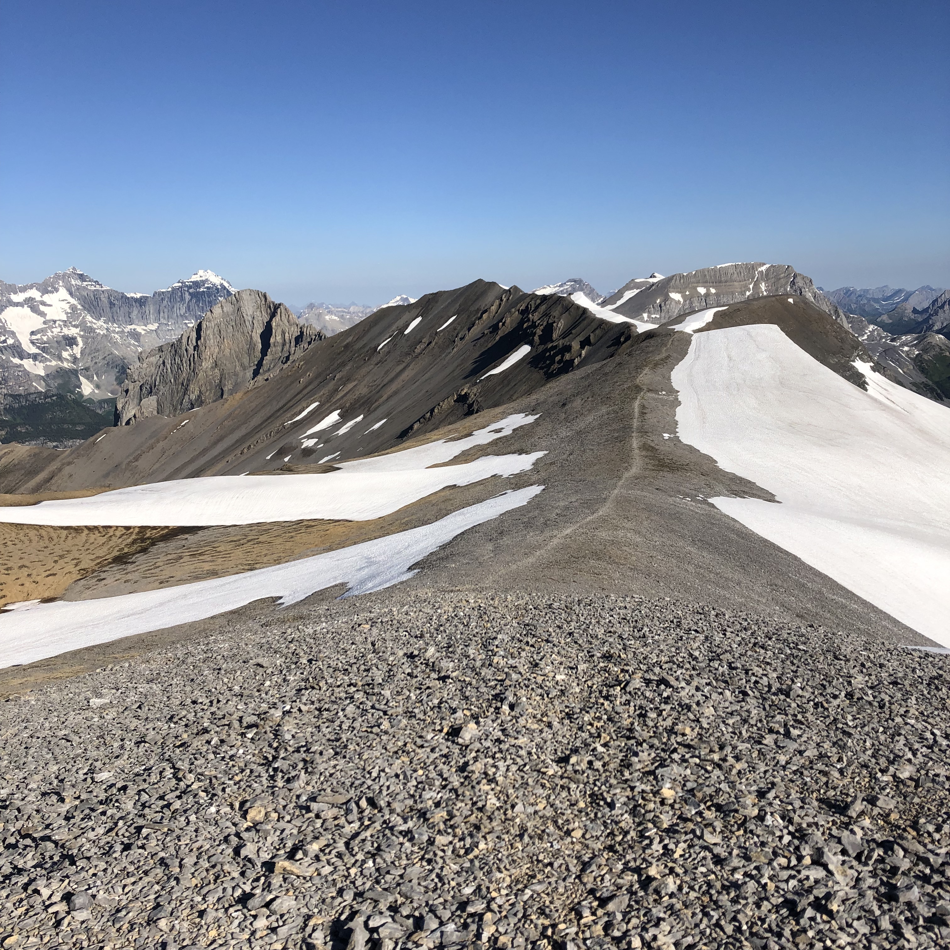
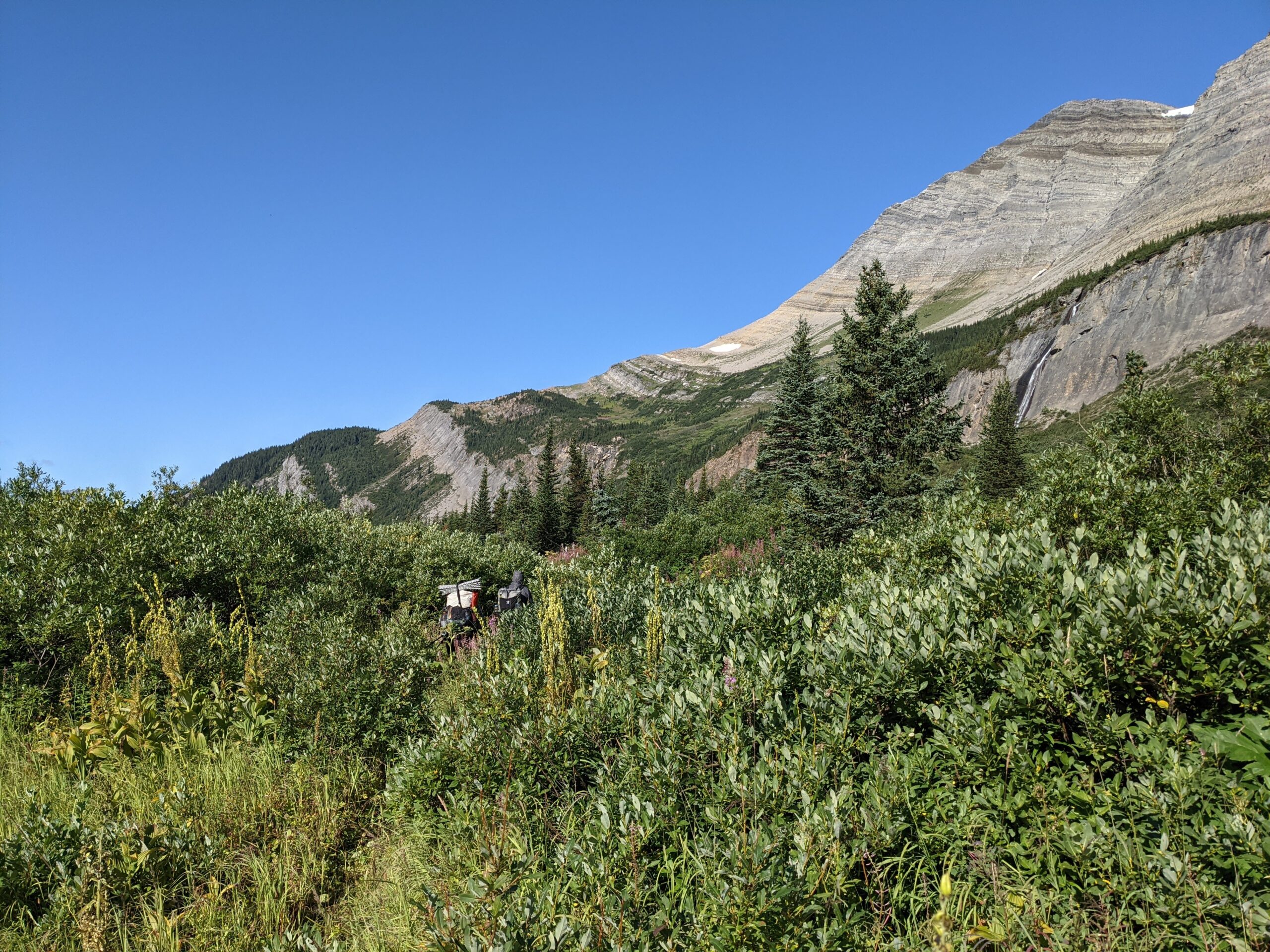
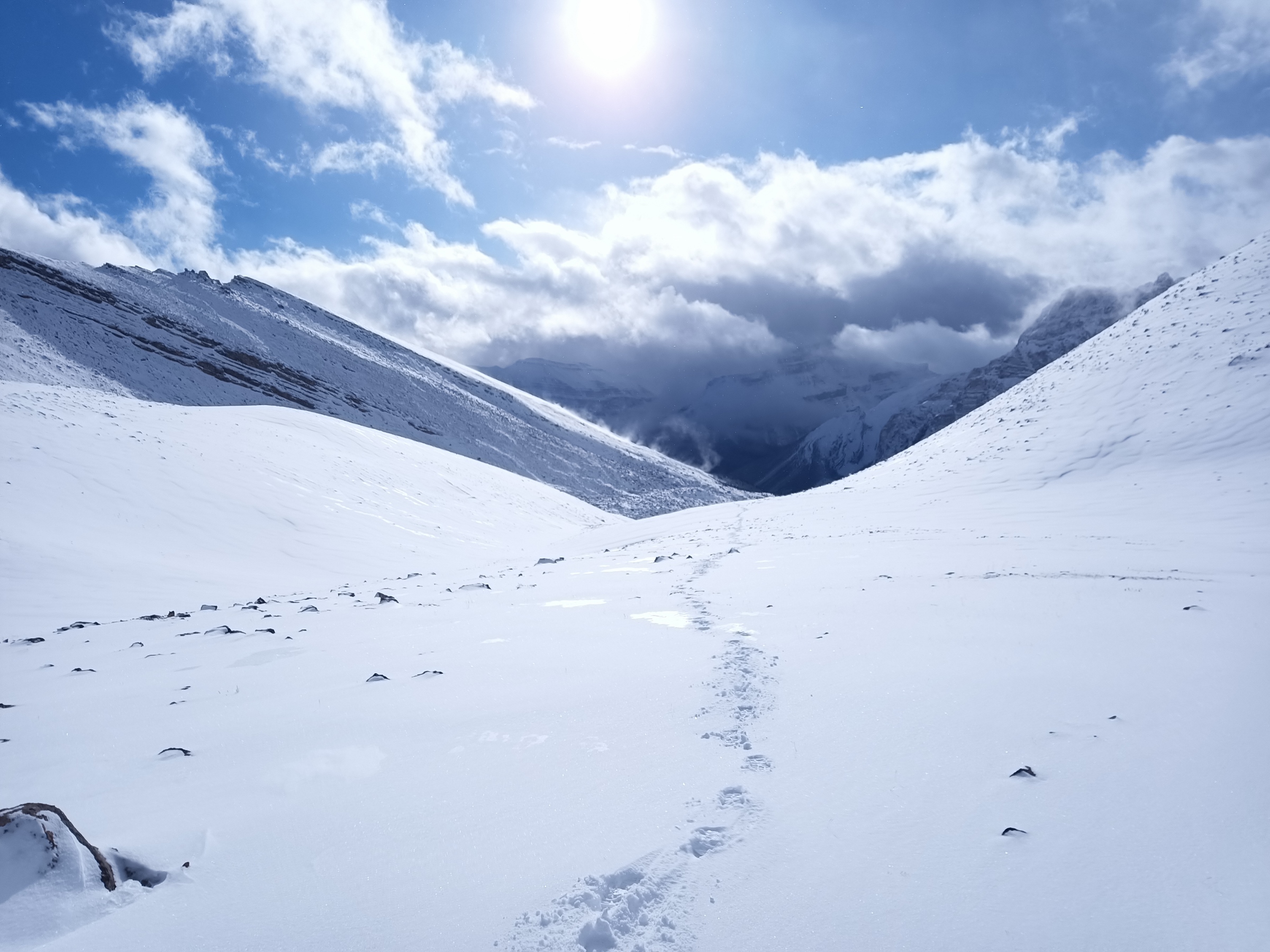
At Sage Pass, the Mount Rowe alternate and main route converge, leaving Waterton behind and straddling the divide between Castle Wildland Provincial Park in Alberta and forestry land in BC. Random camping is allowed throughout, but there are several rustic campgrounds you can use. The trail here is here is primitive and spectacular, covering several peaks and ridge walks. Quality ranges from “easy to follow” to “route finding”. You’ll encounter what many consider the most difficult day on the entire GDT on La Coulotte Ridge. You’ll want to load up on water at Scarpe Pass (particularly if you’re taking the Barnaby Ridge Alternate) and wait out any inclement weather. Do not underestimate this day.
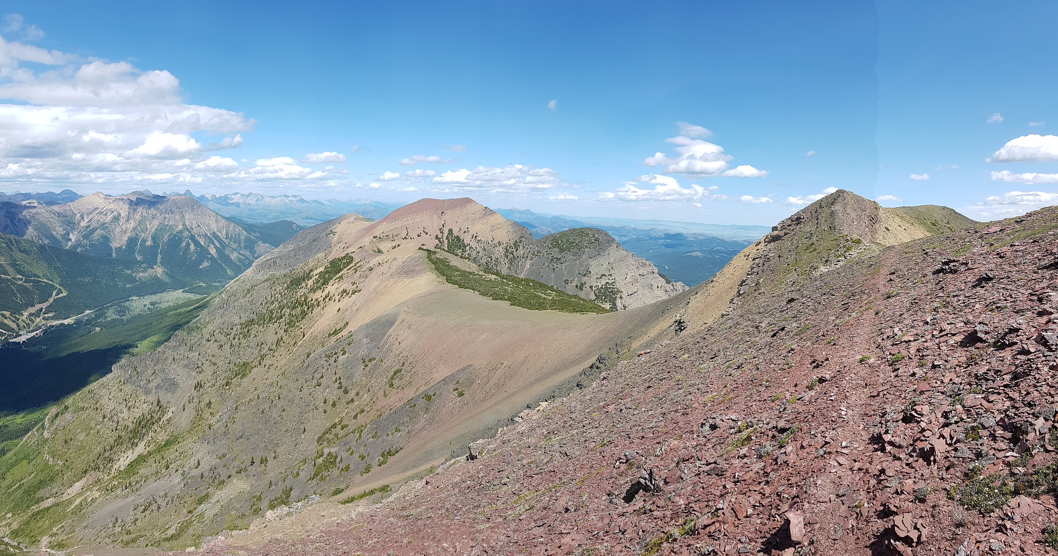
At La Coulotte Peak, the trail splits between the main route and the Barnaby Ridge Alternate. After one more steep climb, the main route drops down into the West Castle River valley along some ATV trails and Highway 774. Barnaby Ridge remains up high and has spectacular scenery, however there is some exposure, and water is limited. It should not be attempted in poor weather. Work has been done to route the trail around the hairiest terrain and flagging has been added. Many will climb down to Grizzly Lake for water and to stay the night. This alternate does bypass the Castle Mountain Ski Resort which can be reached along the main route. Some use the ski resort as a place to mail resupply boxes (call ahead to ensure they are accepting them) and there is a restaurant (check hours), but no store to buy supplies.
Campgrounds in this area:
- Sage Pass – BC Forestry (random camping)
- Font Creek – Castle Wildland Provincial Park (random camping)
- Jutland Creek – Castle Wildland Provincial Park (random camping)
- Scarpe Pass – Castle Wildland Provincial Park (random camping)
- Grizzly Lake (Barnaby Ridge Alternate) – Castle Wildland Provincial Park (random camping)
- Barnaby Lake (Barnaby Ridge Alternate) – Castle Wildland Provincial Park (random camping)
- West Castle Road – Castle Wildland Provincial Park (random camping)
- Castle Mountain – Castle Mountain Ski Resort – campground and hostel (reservation required)
Entry / Exit Points
- South – Red Rock Parkway via Twin Lakes / Snowshoe Trail
- North – Alberta Highway 774
Resupply
- Castle Mountain Ski Resort (limited)
ON TO COLEMAN
After some initial road walking, the trail moves through an area crisscrossed with old forestry roads, OHV tracks, and seismic lines. The trail can be confusing in parts, and it’s generally not well signed. The terrain itself is not particularly challenging, but you’ll want your maps and GPS to help navigate. At kilometer 129.7, the trail branches with the main route heading to the small hamlet of Coleman on Highway 3. Coleman was a mining boomtown in the first half of the 20th century but doesn’t have a lot of services today. There is a post office to send resupply boxes, motels and Safe Haven BnB is a popular spot for GDT hikers.
The alternate route takes you down a road to the larger town of Blairmore. Here you can find a grocery store, outdoor store, campground, motels and other services for resupply. From Blairmore it’s a 4 km walk to Coleman and the start of Section B.
Campgrounds in this area:
- Lynx Creek – Castle Provincial Park (permit required)
- Willoughby Ridge – Castle Provincial Park (random camping)
Entry / Exit Points
- South – Alberta Highway 774
- North – Alberta Highway 3
Resupply
- Coleman
- Blairmore (off trail)
SECTION B: COLEMAN TO KANANASKIS
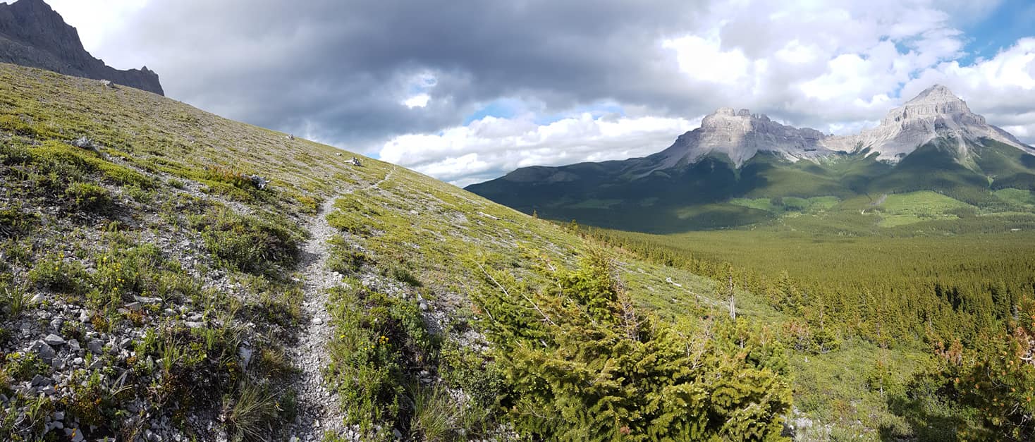
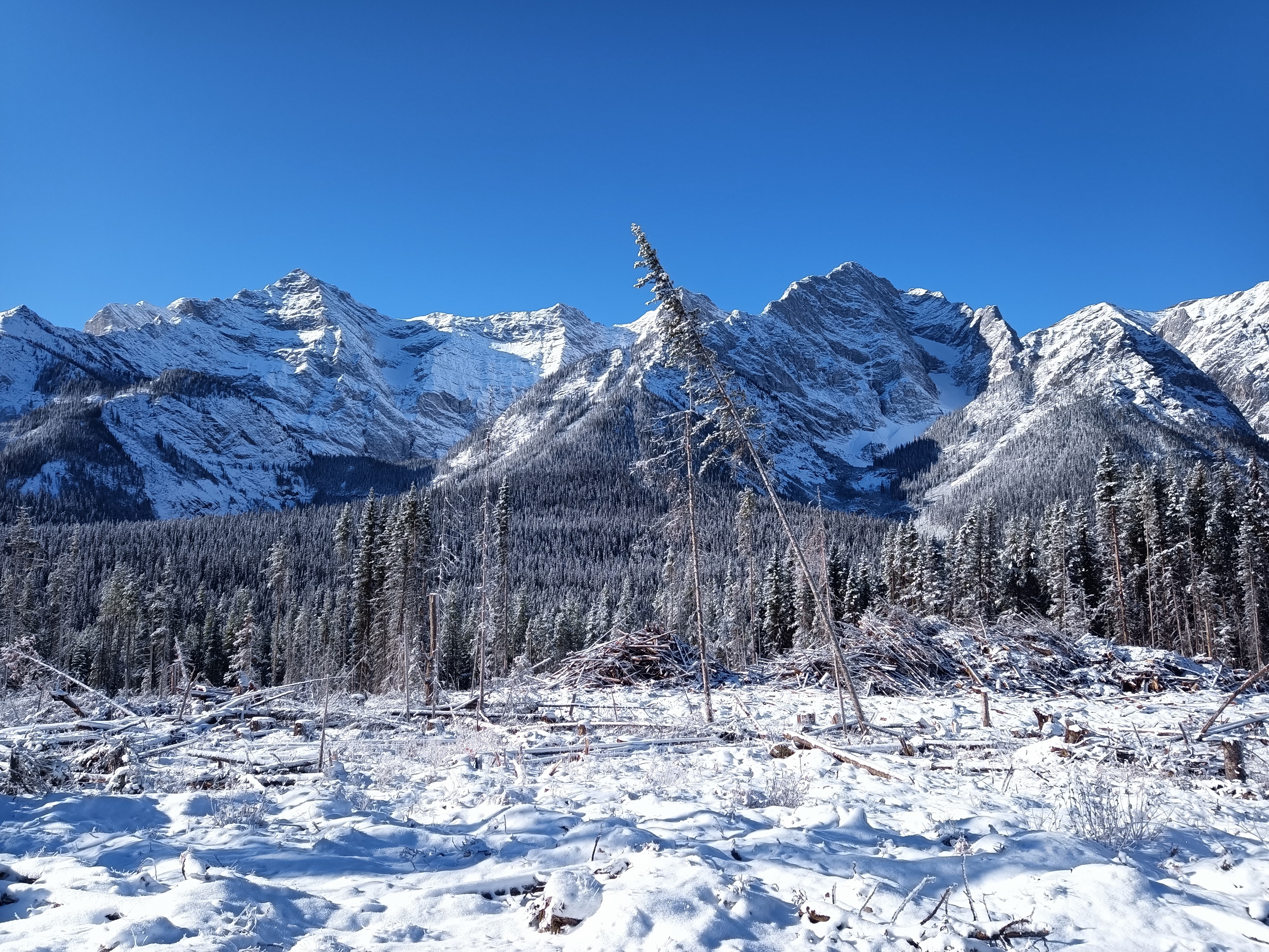
Section B of the GDT runs North from the town of Coleman on Crowsnest Highway 3 to Peter Lougheed Provincial Park in Kananaskis, Alberta. This part of the trail runs almost entirely through public land and has little in the way of developed campgrounds or facilities. Except for a small portion in the north, random camping is allowed throughout this section. You may encounter OHV users and, in some cases, active forestry operations along the trail. If you do encounter active logging, keep an eye out and respect any signage.
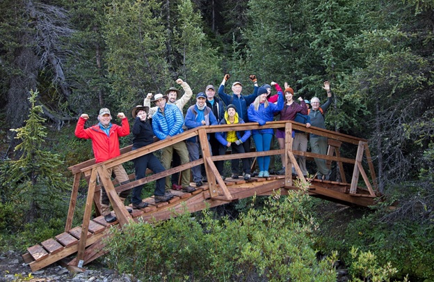
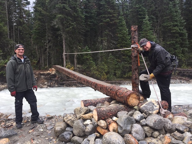
In some ways, Section B is the birthplace of the GDT. In the 1970s the first portions of dedicated trail were constructed here and work continues to this day with the new High Rock Trail completed in 2021.
ROADS AND OFF HIGHWAY VEHICLE TRAILS
The first part of the trail is largely made up of gravel roads and OHV trails. During the summer (particularly on weekends) you’ll encounter folks camping in their RVs along the Allison Creek and Atlas roads. Parts of this trail can be confusing as there are many junctions connecting a nest of old forestry roads.
Crowsnest Mountain figures prominently to the east as you may your way up the valley. Until recently the trail continued over Deadman Pass into BC, but with parts of the trail crossing private land, the High Rock Trail was built to avoid conflict with industrial users and the Fording River Mine.
Campgrounds in this area:
- McGillivray Creek – ATV staging area (Alberta Public Lands Camping Pass required)
- Chinook Lake – Alberta Parks (Reservation recommended and permit required)
- Atlas Staging Area – ATV staging area (Alberta Public Lands Camping Pass required)
Entry / Exit Points
- South – Highway 3
- North – Atlas Forestry Road
Resupply
- Coleman
- Blairmore (off trail)
HIGH ROCK TRAIL
2022 marks the grand opening of the High Rock Trail and the new official route of the GDT. Many will stay at the beautiful Window Mountain Lake for the first night as bear lockers have been recently installed. This section mainly sticks to the Livingstone Public Land Use Zone which allows a wide variety of users. You’ll gain and lose elevation as you move from one drainage to another, first North Racehorse Creek then Dutch Creek. At the headwaters you’ll encounter the old route from the BC side as you climb up to Tornado Pass, through Tornado Saddle and steeply down the other side.
Campgrounds in this area:
- Window Mountain Lake – Random cCamping (Alberta Public Lands Camping Pass required)
- North Racehorse Creek – Random camping (Alberta Public Lands Camping Pass required)
- Dutch Creek (HRT) – Random camping (Alberta Public Lands Camping Pass required)
- Dutch Creek – Random camping (Alberta Public Lands Camping Pass required)
- South Hidden Creek – Random camping (Alberta Public Lands Camping Pass required)
Entry / Exit Points
- South – Atlas Forestry Road
- North – Alberta Highway 940 (Via Oldman River Road and Hidden Creek Trail)
Resupply
- None
BIRTHPLACE OF THE GREAT DIVIDE TRAIL
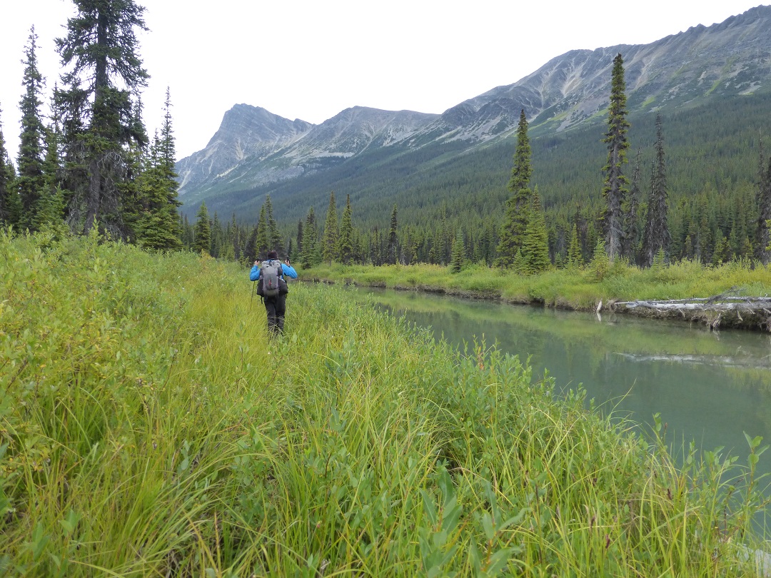
At North Fork Pass, you’ll join the original GDT and a junction with Dutch Creek Road. This road serves as the first of many access/exit point to Highway 940 on the Alberta side. While this road can be busy in on weekends, it can be fairly quiet on weekdays, so if you have to bail it could be quite a while before you get a hitch. Following the orange blazes, the trail closely parallels the divide with additional access points at Hidden Creek, Cache Creek, Soda Creek, Oldman River, Lost Creek, Cataract Creek, Etherington Creek, and Baril Creek. While you don’t see as many of the epic mountain spires as Section C, the scenery is still spectacular, particularly in and around the Beehive Natural Area. You’ll experience a lot of ups and down in this part with some nice ridge walks. Rustic camping areas are located near many of the creek junctions just mentioned. While the idea of camping on the top of a ridge can be appealing, a sleepless night as your fly flutters in the wind isn’t nearly as much fun as you might think.
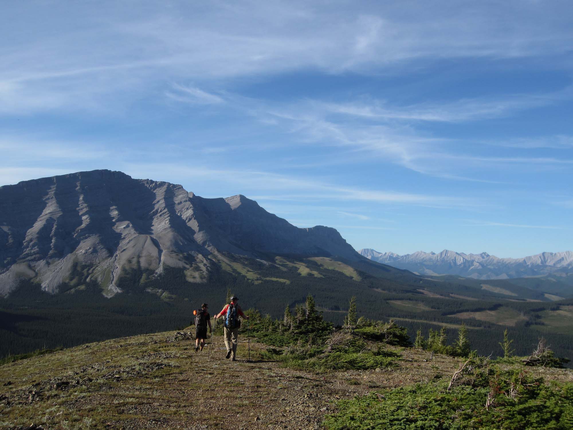
At Baril Creek the trail heads to the west and climbs up to Fording River Pass, crossing the Great Divide for the first time since La Coulotte Peak over 130 km to the south.
Campgrounds in this area:
- Hidden Creek – Random camping (Alberta Public Lands Camping Pass required)
- Cache Creek – Random camping (no permit required)
- Soda Creek – Random camping (no permit required)
- Lyall Creek – Random camping (no permit required)
- Memory Lake – Random camping (no permit required)
- High Rock – Random camping (no permit required)
- Lost Creek – Random camping (no permit required)
- Cataract Creek – Random camping (no permit required)
- Etherington Creek – Random camping (no permit required)
- James Lake– Random camping (no permit required)
- Upper Baril Creek– Random camping (no permit required)
- Fording River Pass – Random camping (no permit required)
Entry / Exit Points
- South – Alberta Highway 940 (Via Oldman River Road and Hidden Creek Trail)
- North – Elk River Road
Resupply
- Highwood House (13 km off trail at Baril Creek, limited options)
ELK VALLEY TO PETER LOUGHEED PROVINCIAL PARK
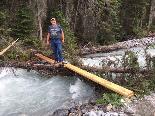
Coming down Aldridge Creek you’ll meet up with the Kananaskis Power Line Road which connects to Elk Lakes Road in about 8 km. This is the longest road walk on the GDT, but it is a lightly trafficked and well-maintained gravel/dirt road. There is a washout on the Aldridge Creek trail and the easiest way past it is to get your feet wet. Elevation gains on this section are minimal, so if you’re looking for a high mileage day, this is it. There are a few user maintained forestry campgrounds along the Elk River Road that offer outhouses and picnic tables.
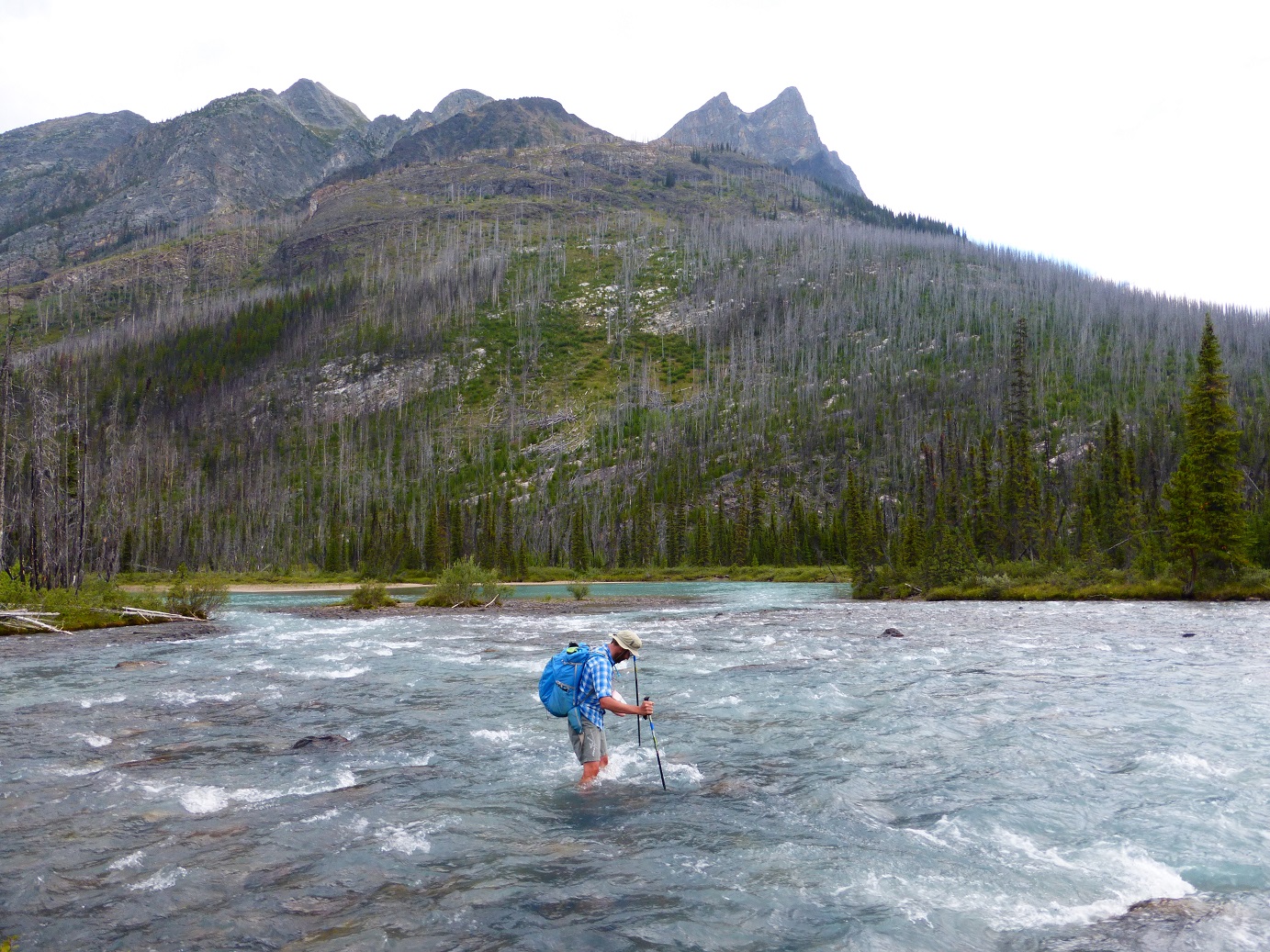
If you’re a confident route-finder, you can avoid some of this road walk by taking the Coral Pass alternate. There is an initial fording of the Elk River, which can be challenging in high water conditions. The pass is incredible and earns its name with plentiful fossilized coral, however, descending the north side involves some exposure, slippery rocks, and can be extremely overgrown. If weather is poor, the recommendation is to stick to the road.
Either way, you’ll soon come to Elk Lakes Provincial Park. From here on in, apart from a small part of Section D, you’ll be on protected lands, leaving OHVs behind for the rest of the trail.
Near the Elk Lakes trailhead, there is a cabin currently operated by the Alpine Club of Canada and a nearby campground. From here there are a few options. First is the Hydroline Trail (popular with mountain bikers), which is a straight shot up to Elk Pass along a set of power lines. There is also Elkan Creek, which takes you through forest to West Elk Pass; it’s shorter, but obscures most of the views. Lastly, there is the official Upper Elk Lake Trail, which offers nice views of the Elk Valley. At Elk Pass you will cross back into Alberta and follow Fox Creek to the trailhead at the end of Section B. There has been talk of installing lockers at the Elk Pass trailhead to allow resupply boxes to be deposited and stored – stay tuned!

Coming into Peter Lougheed Provincial Park, random camping is no longer permitted, but there are plenty of options. A full-service campground including showers, store, and ice cream(!!!) are available a few minutes away at Boulton Creek, there is a tent-only campground at Mt. Sarrail, and a third nearby campground at Interlakes. Boulton is popular with thru-hikers as you can book sites with electricity to charge all your devices. It is often booked solid on weekends, but weekdays usually have availability.
The end of Section B is a good place to build a zero day or two into your itinerary. With Section C very dependent on permits and keeping to your schedule, this will give you the flexibility to catch up if you’re running behind, or some time to enjoy the area otherwise.
Campgrounds in this area:
- Aldridge Creek – BC Forestry (first come first served)
- Weary Creek – BC Forestry (first come first served)
- Riverside – BC Forestry (first come first served)
- Tobermory Creek – BC Forestry (first come first served)
- Lower Elk Lake – Elk Lakes Provincial Park (permit required)
- Elk Lakes ACC Hut – Elk Lakes Provincial Park (book through Alpine Club of Canada)
- Boulton Creek – Peter Lougheed Provincial Park (reservation recommended and permit required)
- Mt. Sarrail – Peter Lougheed Provincial Park (permit required)
- Interlakes – Peter Lougheed Provincial Park (permit required)
Entry / Exit Points
- South – Elk River Road
- North – Alberta Highway 40 – Kananaskis Lake Road
Resupply
- Boulton Creek Trading Post (small store with limited supplies)
SECTION C: KANANASKIS TO FIELD
Section C offers some of the most scenic parts of the GDT. Starting at Peter Lougheed Provincial Park in Kananaskis it passes through several national and provincial parks, including the iconic Banff National Park, on its way to the town of Field. Most of this section is well-maintained and signed along official trails. At the same time, you will leave behind some of the seclusion you experienced on earlier sections as you hit several popular backpacking trails.
With the exception of a small portion of trail in Height of the Rockies Provincial Park, camping is only allowed in designated campgrounds and permits are required. As of this posting, national park permits (Banff, Kootenay, Yoho, and Jasper) are available for the 2022 season. If you are considering the GDT for 2022, you’ll want to look into permits as soon as possible as many campgrounds may already be fully booked. For those wanting to section hike the GDT, Section C is a great place to start if you get campground permits.
PETER LOUGHEED AND HEIGHT OF THE ROCKIES
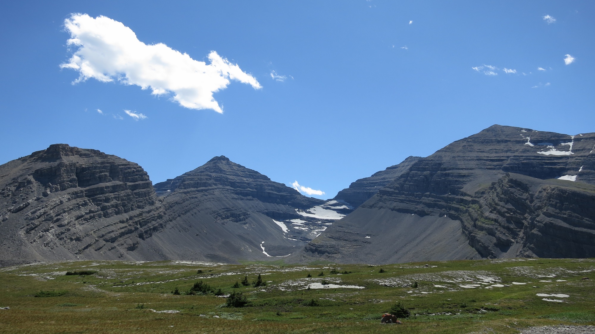
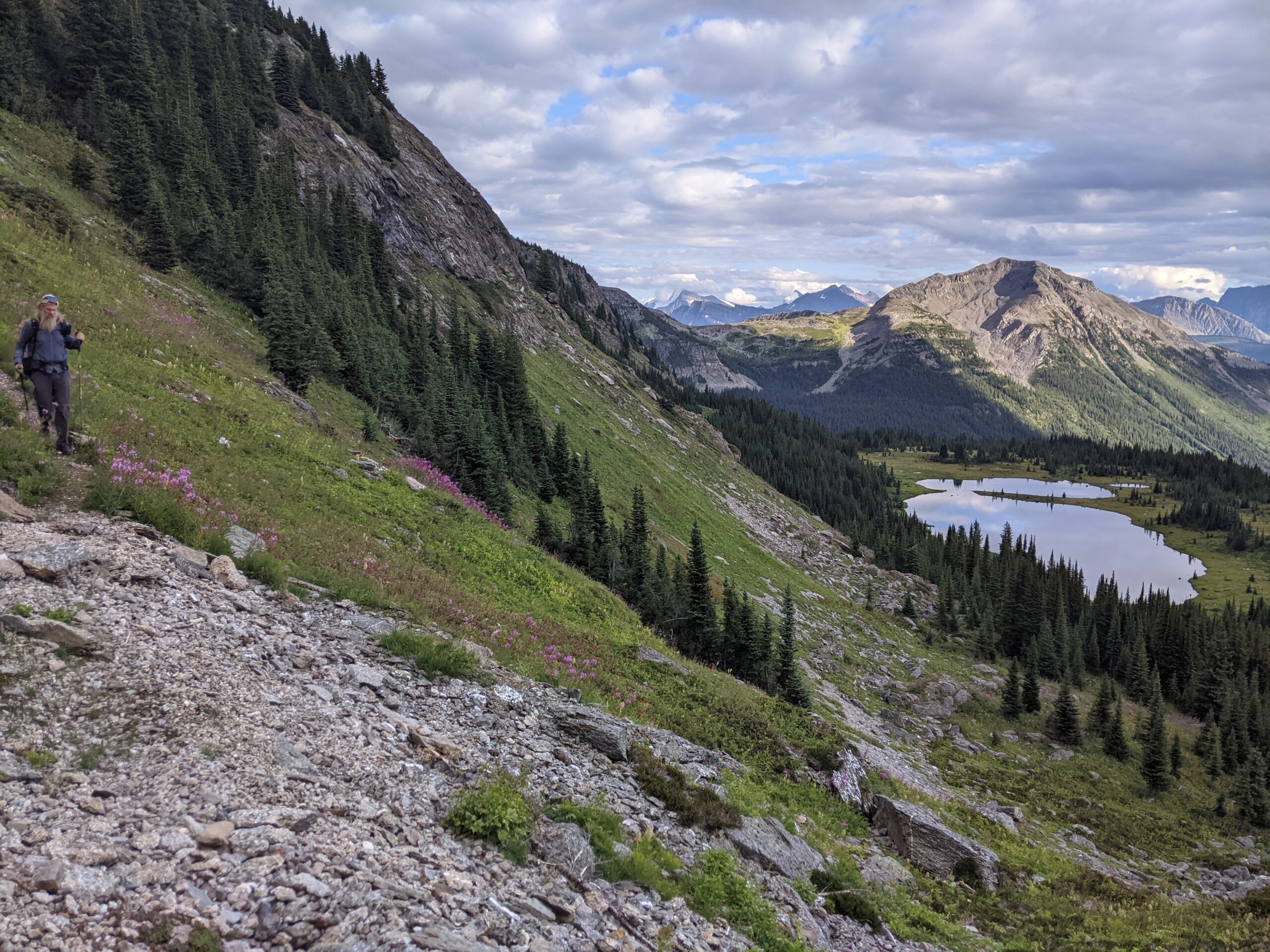
Starting at the Elk Pass trailhead in Peter Lougheed Provincial Park, hike along the shore of Upper Kananaskis Lake to the Upper Lakes trailhead. An alternate route starting from here is Northover Ridge. Rather than hiking counterclockwise toward Interlakes, you’ll hike clockwise along the Upper Lake Trail, splitting off at Hidden Lake and up the headwall to Aster Lake. Here you’ll see the imposing peak of Mount Joffre (also known as The Tooth). This beautiful high alpine valley is well worth it if you have the time. There is a small and popular campground at Aster Lake although random camping is allowed once you cross into BC. Continuing the climb to Northover Ridge, you’ll straddle the divide for 4 km with some mild scrambling and exposure. Off the ridge you’ll descend to Three Isle Lake. There is a popular campground here with lots of peak bagging options. Heading over South Kananaskis Pass, you’ll pass Beatty Lake campground and head steeply down into the Palliser Valley where the route rejoins the main GDT.
If you’re sticking to the official GDT route, the trail heads up the upper Kananaskis Valley toward a backcountry campground at Forks. Continuing up the valley you’ll pass Lawson Lake, and a campground at Turbine Canyon, an incredible narrow canyon.
Crossing North Kananaskis Pass, the trail passes back into BC and Height of the Rockies Provincial Park. It descends into the Palliser Valley (random camping is permitted here) where some river fording is required. This part of the trail is infrequently maintained and unsigned. An alternate access point is available by heading south down the Palliser River valley; however, the trailhead is only accessible along a 80 km drive on forestry roads on the BC side.
Campgrounds in this area:
- Point (Off trail) – Peter Lougheed Provincial Park (permit and reservation required)
- Forks – Peter Lougheed Provincial Park (permit and reservation required)
- Turbine Canyon – Peter Lougheed Provincial Park (permit and reservation required)
- Aster Lake (Northover Alternate) – Peter Lougheed Provincial Park (permit and reservation required)
- Three Isle Lake (Northover and South Kananaskis Pass Alternate) – Peter Lougheed Provincial Park (permit and reservation required)
- Beatty Lake (Northover and South Kananaskis Pass Alternate) – Height of the Rockies Provincial Park (first come first served)
- Palliser River – Height of the Rockies Provincial Park (no permit required)
- Palliser Pass – Height of the Rockies Provincial Park (no permit required)
Entry / Exit Points
- South – Alberta Highway 40 – Kananaskis Lake Road
- North – Albert River Forestry Road
Resupply
- None
ENTER BANFF
On a less-maintained trail, you’ll climb to Palliser Pass and enter the world-famous Banff National Park. This part of Banff is rarely travelled, but there are access/entry points at Burstall Pass and Mount Shark. There are campgrounds in this section at Burstall and Birdwood. Once in Banff NP, random camping is no longer permitted.
After the junction with the Mount Shark Trail, you’ll head up the more popular Bryant Creek Trail. There are backcountry campgrounds at Big Springs, Marvel Lake, and McBride’s Camp. Parks Canada also operates a shelter at Bryant Creek. Its a fairly basic cabin with a stove, common eating area, and shared sleeping platforms. The cabin is currently closed for reconstruction. Permits are required to stay at any of these locations.
The main GDT heads down Marvel Lake and over the high Wonder Pass where the scenery is incredible. The Allenby alternate provides a less exposed route into Mount Assiniboine Provincial Park.
Campgrounds in this area:
- Burstall – Banff National Park (permit and reservation required)
- Birdwood – Banff National Park (permit and reservation required)
- Big Springs – Banff National Park (permit and reservation required)
- Marvel Lake – Banff National Park (permit and reservation required)
- Bryant Creek Cabin (Closed) – Banff National Park (permit and reservation required)
- McBrides Camp (Allenby Alternate) – Banff National Park (permit and reservation required)
- Allenby Junction (Allenby Alternate) – Banff National Park (permit and reservation required)
Entry / Exit Points
- South – Albert River Forestry Road
- Mid – Highway 742 – Mt Shark Trailhead via Bryant Creek Trail
- North – Allenby Pass Trail
Resupply
- None
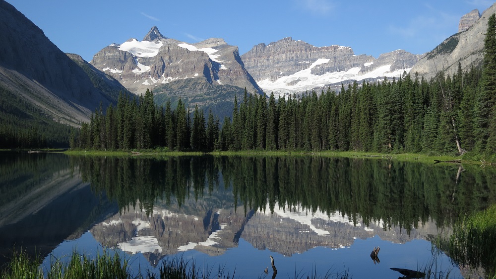
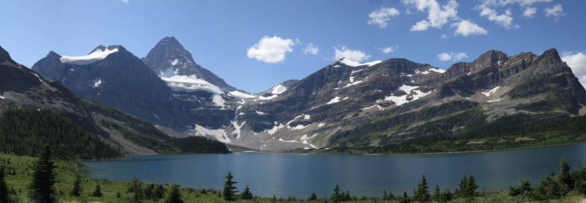
MOUNT ASSINIBOINE AND SUNSHINE MEADOWS
At Wonder Pass you enter Mount Assiniboine Provincial Park, often called the Matterhorn of North America. Assiniboine has been a popular backcountry destination since the Canadian Pacific Railway was built. Several campgrounds and huts are available, and for those with deep pockets, the Assiniboine Mountain Lodge. Tea is available to the public between 4 and 5 pm (this may be affected by COVID). This portion of the trail can be extremely busy and resupply is available via helicopter. From the campgrounds at Lake Magog and Lake Og the trail heads through the Valley of the Rocks, up to Citadel Pass, and back into Banff National Park. Since it can be hard to reserve spots at Magog and Og, some will stay at the Porcupine campground (700m off trail). It’s a pleasant hike through alpine and subalpine meadows past Howard Douglas lake and Quartz Hill, to the Sunshine Ski Resort. During the summer there is a restaurant and hiker gondola that will take you down to the main parking lot (this may be affected by COVID). Shuttle buses or taxis are available here to the Banff townsite and Lake Louise, both of which are extremely busy in the summer. Some will use this as an opportunity to exit the trail to experience the town of Banff.
From Sunshine, the trail passes over Simpson and Healy passes (George Simpson was a colonial governor for the Hudson’s Bay Company who circumnavigated the world by land in 1841). The Healy Creek alternate also provides access to the Sunshine parking lot. Descending into the popular Egypt Lakes area, there are several trails, campgrounds, and shelters operated by Parks Canada. Expect this section of the trail to be busy. Leaving the crowds behind, the GDT passes over the rarely used Ball Pass into British Columbia and Kootenay National Park, down the Hawk Creek Trail to reach Highway 93. This is the single largest descent on the trail at just over 1000m (SOBOs beware)
Campgrounds in this area:
- Lake Magog – Mount Assiniboine Provincial Park (permit and reservation required)
- Naiset Huts – Mount Assiniboine Provincial Park (reservation required, booked via Assiniboine Lodge)
- Assiniboine Lodge – Mount Assiniboine Provincial Park (reservation required)
- Og Lake – Mount Assiniboine Provincial Park (permit and reservation required)
- Porcupine – Mount Assiniboine Provincial Park (first come first served)
- Howard Douglas Lake – Banff National Park (permit and reservation required)
- Healy Creek (off trail) – Banff National Park (permit and reservation required)
- Egypt Lake – Banff National Park (permit and reservation required)
- Egypt Lake Cabin (Closed) – Banff National Park (permit and reservation required)
- Ball Pass Junction – Banff National Park (permit and reservation required)
Entry / Exit Points
- South – Highway 742 – Mt Shark Trailhead via Bryant Creek Trail
- Mid – Sunshine Ski Resort
- North – Highway 93S – Hawk Creek Trailhead
Resupply
- Assiniboine Lodge (pre-arranged via helicopter)
- Sunshine Ski Resort (might not be available in 2022 due to Covid)
THE ROCKWALL
Next up is the popular Rockwall Trail. Climbing up to Floe Lake, you’ll find the single most popular campground on the GDT, getting a spot here is like trying to get tickets to the Rolling Stones. Each year the campground is fully booked within minutes of it opening for reservations. The trail crosses several watersheds at Numa Creek, Tumbling Creek, and Helmet Creek. Each of these has both a campground (permit required) and acts as an entry/exit point. There are several good views of Helmet Falls, the second-highest waterfall in the Canadian Rockies. Leaving behind the Kootenays, the trail heads through Goodsir Pass, into Yoho National Park, and after a short walk along the TransCanada highway, reaches the town of Field.

Campgrounds in this area:
- Floe Lake – Kootenay National Park (permit and reservation required)
- Numa Creek – Kootenay National Park (permit and reservation required)
- Wolverine Pass – BC Forestry random camping (no permit required)
- Tumbling Creek – Kootenay National Park (permit and reservation required)
- Helmet Falls – Kootenay National Park (permit and reservation required)
- McArthur Creek – Yoho National Park (permit and reservation required)
Entry / Exit Points
- South – Highway 93S – Floe Lake Trailhead
- Mid – Highway 93S – Paint Pots Trailhead (via Tumbling or Helmet Creek)
- North – Trans-Canada Highway 1 – Field
Resupply
- Field
SECTION D: FIELD TO SASKATCHEWAN CROSSING
While Section D is the shortest, it has been called the most difficult part of the GDT. For the most part you’ll be on unofficial and unmaintained trails where blowdowns, overgrown trail and washouts can be common. Creek crossings are largely unbridged, so be prepared to ford rivers and streams. Some hikers have mentioned not encountering another person while hiking this part of the trail and this wilderness solitude is part of the charm of Section D. Starting at the hamlet of Field in Yoho National Park, Section D finishes up at a major highway junction and resort at Saskatchewan Crossing on the Icefields Parkway (Highway 93).

LEAVING FIELD
Field started out as a major switching point for the Canadian Pacific Railway. Prior to the construction of the spiral tunnels in 1909, the descent from Kicking Horse Pass was the location of the “Big Hill”. This extremely steep section of track required large steam locomotives to be added to trains to help them up the grade. Field was the center of these operations, but today, with a population of less than 200, it’s mainly a place for tourists, hikers, and campers. There are several B&B options to stay at within Field as well as two nearby frontcountry campgrounds at Kicking Horse and Monarch.
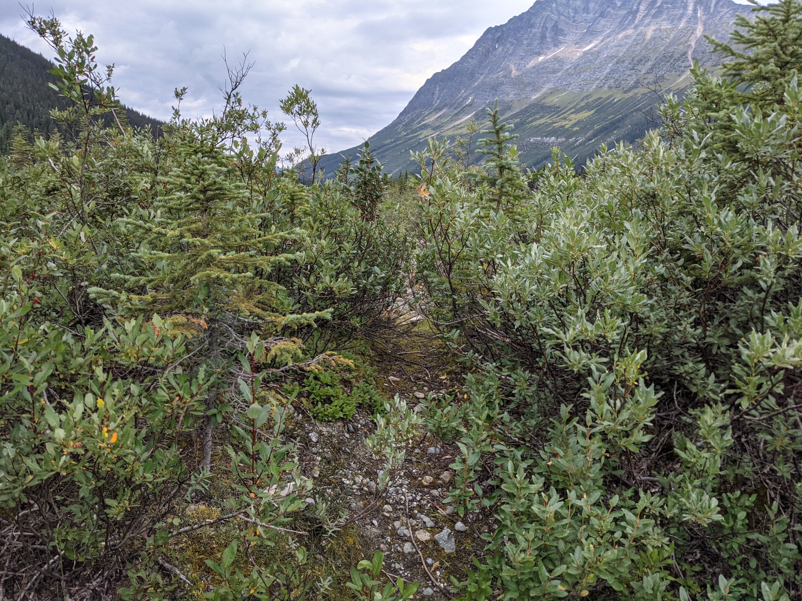
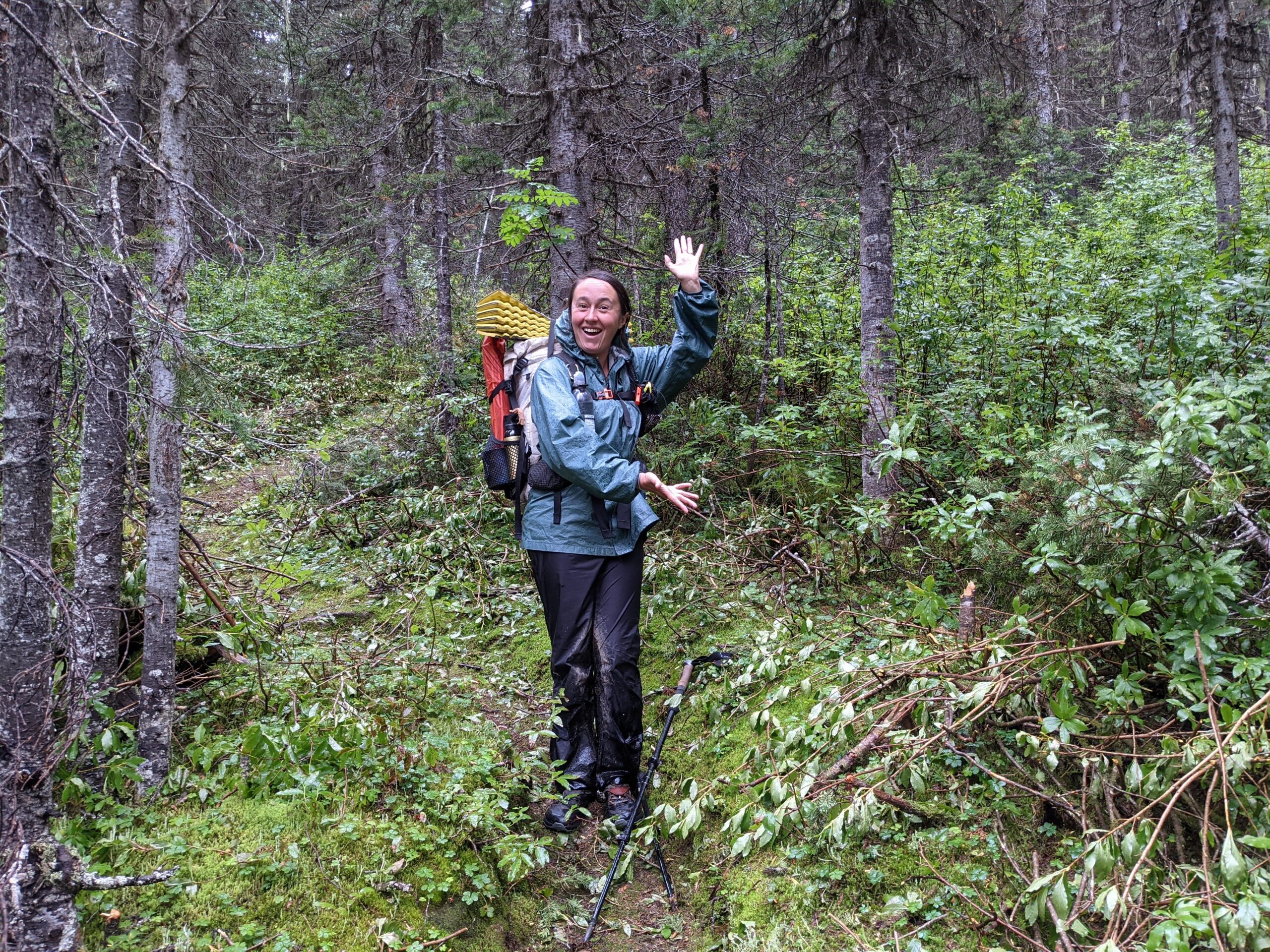
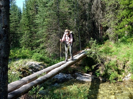
From Field, the main GDT follows the Amiskwi Valley towards Amiskwi Pass. While the first part of this trail is maintained, if fairly quickly falls into disuse and blowdowns are frequent. You’ll have to ford the Amiskwi River 3 times as you make your way up the valley. Random camping is permitted once you’re 4 km away from the trailhead, however a random camping permit is still required from Parks Canada.
An alternate route takes you steeply up to the Burgess Highline Trail, Yoho Lake campground, and onto the popular Iceline Trail. The views of Takakkaw Falls and Waputik Icefield across the valley are incredible. A campground and Alpine Club of Canada cabin are located in the Little Yoho Valley. From the campground however, you’ll climb steeply up to Kiwetinok Pass where the trail ends and 8 km of cross-country route finding begins.
Campgrounds in this area:
- Kicking Horse (Frontcountry off trail) – Yoho National Park (permit and reservation required)
- Monarch (Frontcountry off trail) – Yoho National Park (permit and reservation required)
- Takakkaw Falls (Frontcountry off trail) – Yoho National Park (First come first served and permit required)
- Yoho Lake (Kiwetinok alternate) – Yoho National Park (permit and reservation required)
- Little Yoho (Kiwetinok alternate) – Yoho National Park (permit and reservation required)
- Stanley Mitchell Hut (Kiwetinok alternate) – Alpine Club of Canada (reservation required)
- Amiskwi River – Yoho National Park random camping (permit required)
Entry / Exit Points
- South – Trans-Canada Highway 1
- North – Blaeberry Forestry Road
Resupply
- Field
WALKING THE EXPLORER’S ROUTE
Over Amiskwi Pass you’ll enter the Blaeberry River valley. Leaving behind Yoho National Park, this will be the first time you’ll have been outside of a park since entering Elk Lakes Provincial Park in Section B. Much of the trail on this side of the pass is on forestry roads until you start on the David Thompson Heritage Trail. Named after the consummate explorer, David Thompson hiked or horsebacked over 90,000 km during the early 19th century, mapping over 4.9 million square km of North America. This historical route was used by the Secwépemc people as a travel and trade route, connecting Secwépemc ancestors to the northern Stoney and to the Rocky Mountain House during the fur trade.
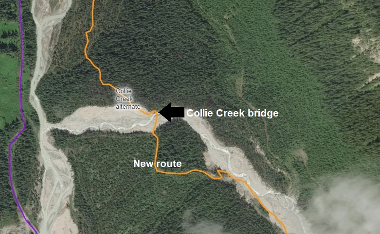
Much of the road walking can be bypassed by taking a new shortcut along Collie Creek, it does however require a potentially dangerous ford so be open to adjusting your route. Early morning crossings are recommended. Much work is being done to improve the Collie Creek Trail with the goal of making it the main route. The GDT can also be exited here down the Blaeberry River road to the Trans-Canada Highway near the town of Golden.
Campgrounds in this area:
- Amiskwi Pass – Random camping (no permit required outside of the national park)
- Cairnes Creek – Random camping (no permit required)
- Lambe Creek – Random camping (no permit required)
Entry / Exit Points
- Blaeberry Forestry Road
Resupply
- None
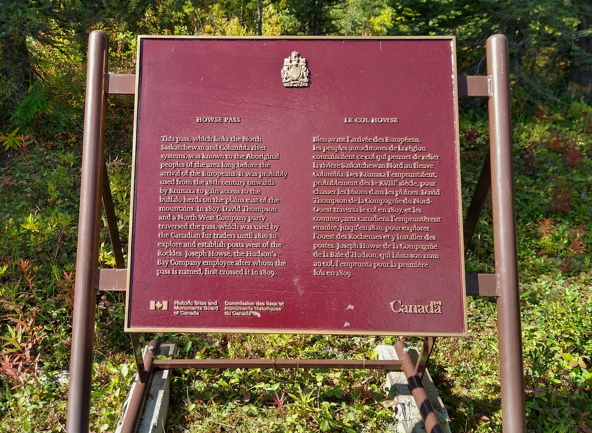
HOWSE PASS
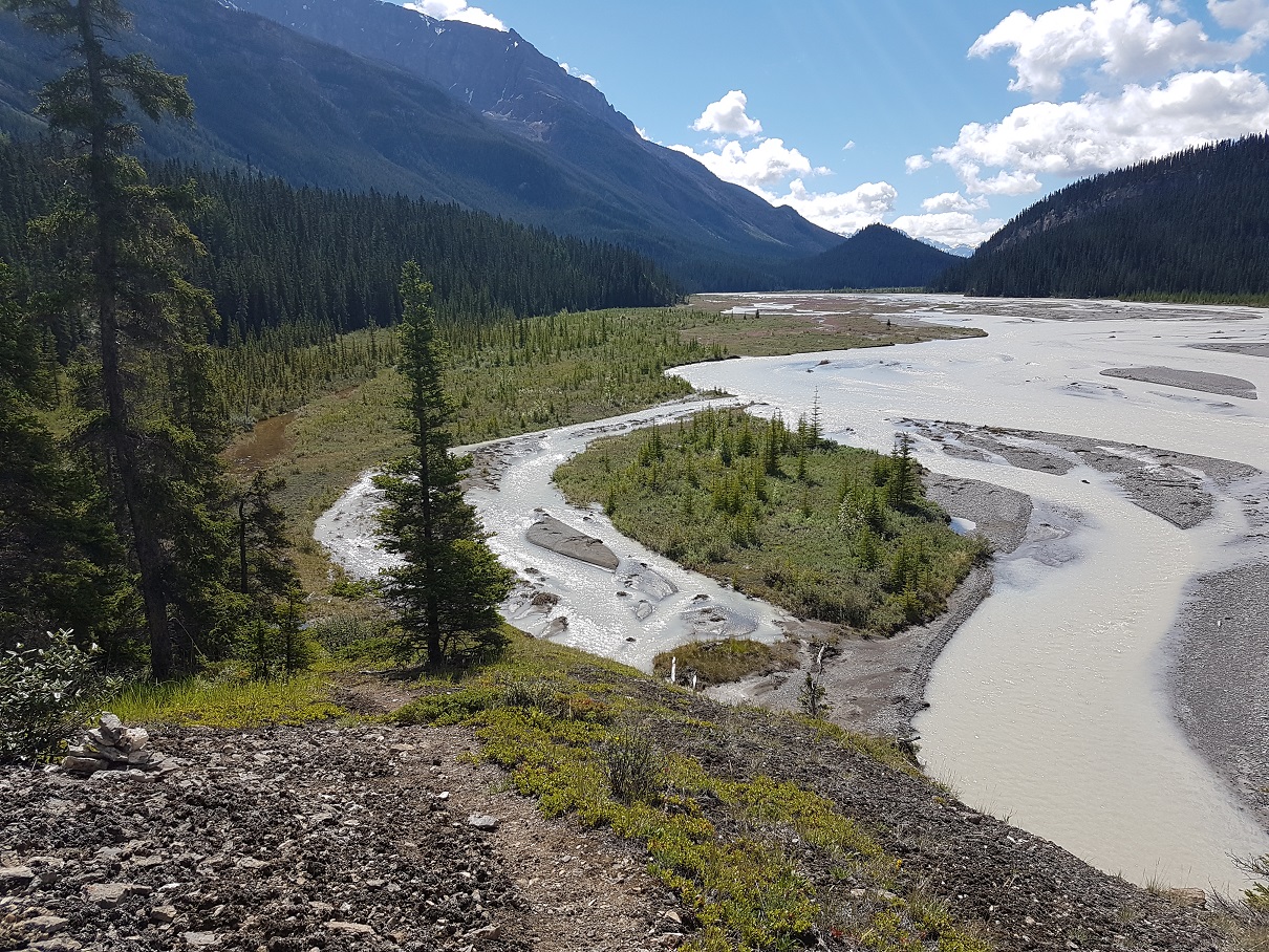
Back to the Blaeberry, you’ll climb to the seldom used Howse Pass where the trail crosses the Great Divide below the treeline, back into Banff National Park in Alberta. Today the GDT mainly follows the Howse River floodplain as the former trail is choked with hundreds of blowdowns. Prepare for wet feet on this part of the trail as the route fords the many side channels of the floodplain. After the junction with the Glacier Lake Trail (recommended only for equestrians due to the deep ford of the Howse River), you’ll rejoin good trail and head towards Saskatchewan Crossing by following the trail to the Mistaya Canyon trailhead on the Icefields Parkway (Highway 93).
At Saskatchewan Crossing you’ll find a hotel, restaurant, gas station, and well equipped (if expensive) general store. If you plan to stay here, you’ll want to book ahead.
Campgrounds in this area:
- Conway Creek – Banff National Park (random camping permit required)
- Howse Floodplain – Banff National Park (random camping permit required)
- Howse River – Banff National Park (random camping permit required)
Entry / Exit Points
- South – Blaeberry Forestry Road
- North – Highway 93N (Icefields Parkway)
Resupply
- Saskatchewan Crossing Resort
SECTION E: SASKATCHEWAN CROSSING TO JASPER
“It was the best of times, it was the worst of times”. Section E on the Great Divide Trail is a study in contrasts. The stretch between Saskatchewan Crossing and the town of Jasper passes through remote areas of White Goat Wilderness Area and the decommissioned trails of the Maligne Valley. At the same time it also passes through the extremely popular Skyline Trail and Jonas Shoulder sections of Jasper National Park. However, if you love hiking above the treeline, this is the section for you.
OWEN CREEK
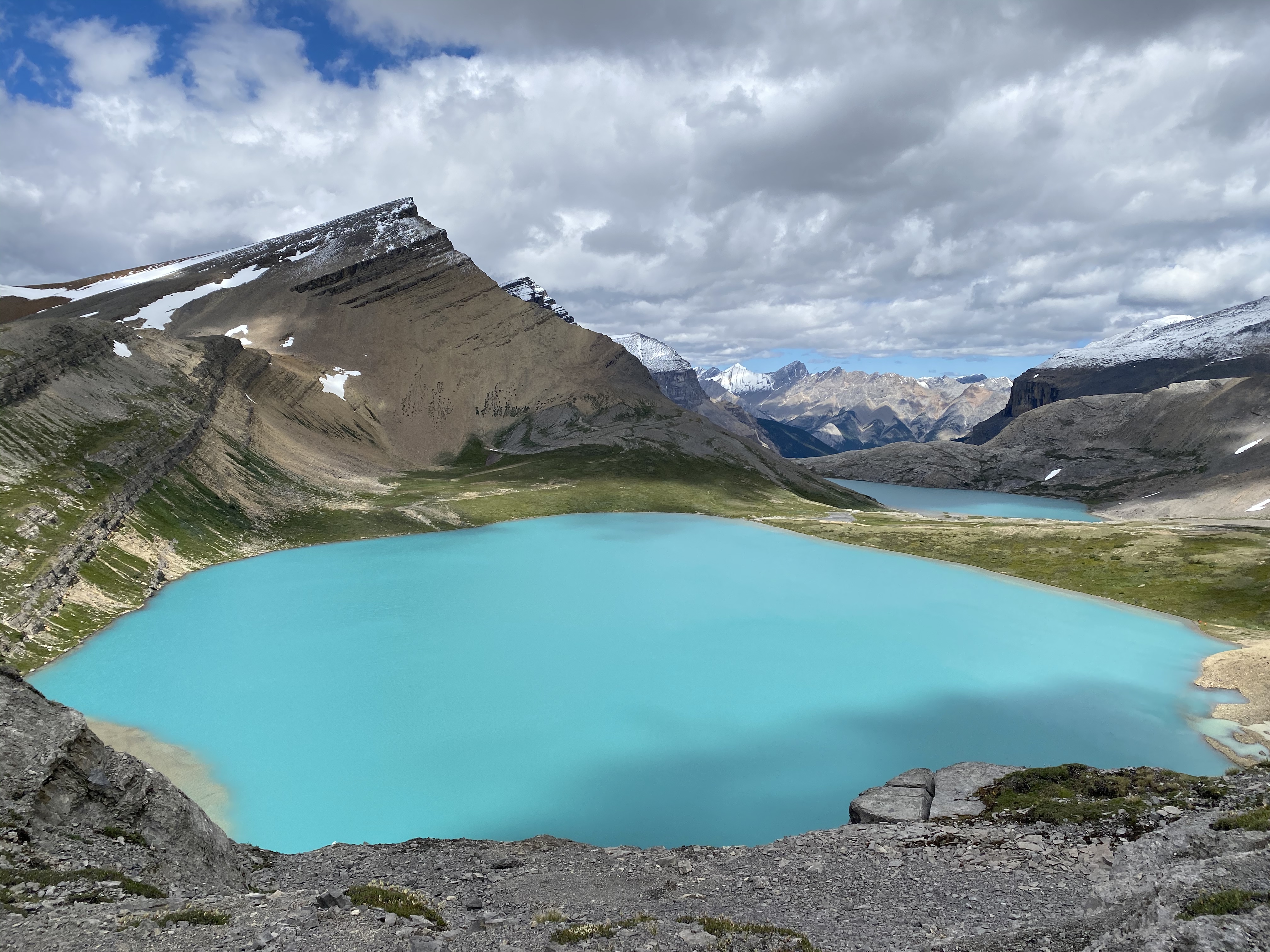
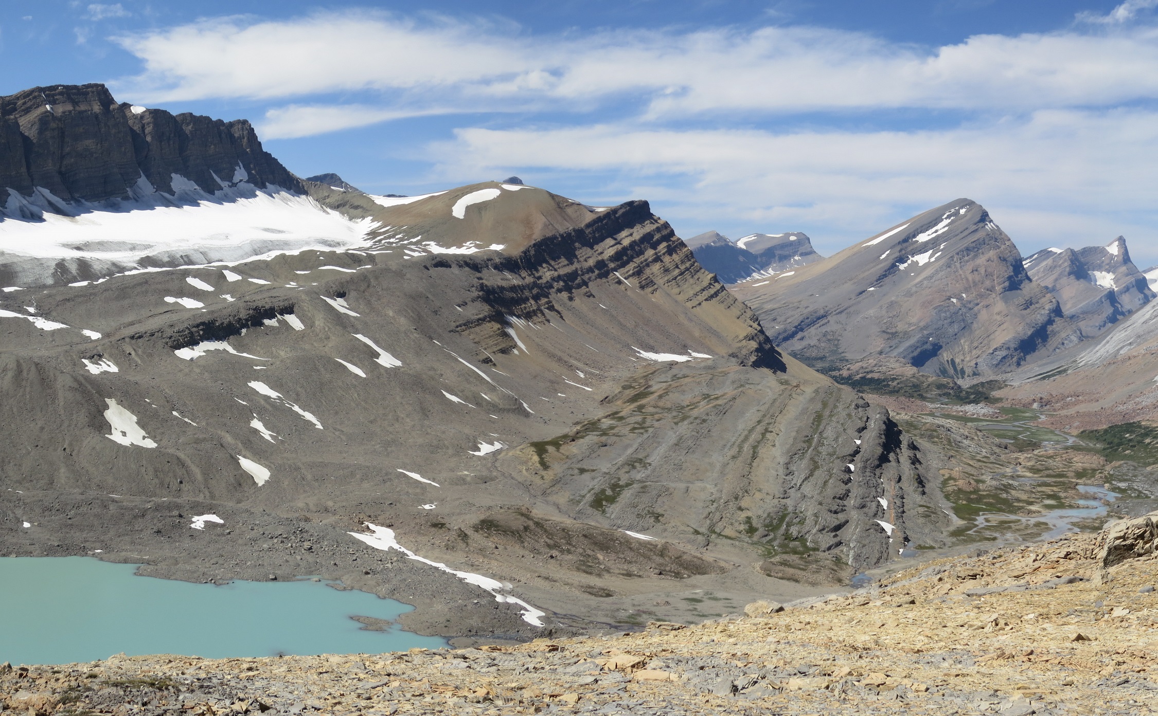
Leaving the resort at Saskatchewan Crossing, there is a short section of road walking along the David Thompson Highway. From the Owen Creek trailhead you’ll start your climb. The trail here is unmaintained and can be hard to follow. The creek quickly turns into a canyon as you struggle your way up to Owen Pass and treeline. For the next 18 km you’ll parallel a stunning rock wall through the alpine and pass by Michele Lakes, the prettiest lakes on the GDT, to reach the highest point on the GDT at 2585m.
Campgrounds in this area:
- Owen Creek – Banff National Park (random camping permit required)
- Michele Lakes – Random camping (Alberta Public Lands Camping Pass required)
- Waterfalls Creek – Random camping (Alberta Public Lands Camping Pass required)
- Pinto Creek – Random camping (Alberta Public Lands Camping Pass required)
- Pinto Lake East – Random camping (Alberta Public Lands Camping Pass required)
- Pinto Lake North – Random camping (Alberta Public Lands Camping Pass required)
- Cataract Creek – White Goat Wilderness Area random camping (no permit required)
- Cataract Pass – White Goat Wilderness Area random camping (no permit required)
Entry / Exit Points
- South – Highway 11
- North – Highway 11 via Waterfalls trail
Resupply
- None
HEIGHT OF THE CANADIAN ROCKIES
One thing that surprises a lot of people who have seen the towering peaks of the Canadian Rockies, is their height when compared to the Colorado Rockies or Sierra Nevada mountains. There are no 14ers (4267m) in Alberta or eastern BC, with the highest mountain in the range being Mount Robson at 3954m (12,972 ft). What makes the Canadian Rockies different is during the last ice age, glaciers carved out the valleys making the mountains much more prominent. The northern latitude and shorter glowing season also pushes down the treeline, making it 450-750m lower than Colorado. Combined, these makes it seem like the mountains are much higher. On the plus side, this reduces the risk of altitude acclimatization as you’ll never be over 2590m (8,500 ft).
UP TO CATARACT PASS
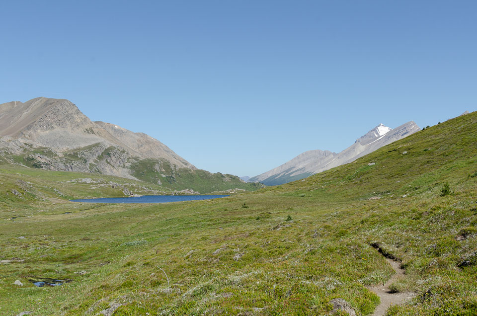
Heading over 3 mountain passes, the trail drops back into the trees around Pinto Lake. You can exit the trail here by way of Sunset Pass which takes you back to the highway. The thru route takes you into the White Goat Wilderness Area where trail maintenance is not allowed (hence the many fallen trees). The route travels up the long Cataract Creek valley to lofty Cataract Pass on the border of Jasper National Park. Along the way you’ll have a chance to see ancient pictographs. Over Nigel Pass the GDT joins the well maintained (and more crowded) trails of the Brazeau Loop. Back into the alpine, the Jonas Shoulder offers spectacular views of the valley, however as the trail heads north, it becomes less travelled and once you pass the Poboktan Creek junction (another exit to the highway), it is no longer maintained.
Campgrounds in this area:
- Boulder Creek – Jasper National Park (permit and reservation required)
- Four Point – Jasper National Park (permit and reservation required)
- Cline (off route) – Jasper National Park (permit and reservation required)
- Jonas Cutoff – Jasper National Park (permit and reservation required)
- McCready Horse Camp – Jasper National Park (permit and reservation required)
- Waterfalls – Jasper National Park (permit and reservation required)
- Poboktan – Jasper National Park (permit and reservation required)
Entry / Exit Points
- South – Highway 11 via Waterfalls trail
- Mid – Highway 93N via Sunset Pass trail
- Mid – Highway 93N via Nigel Pass trail
- North – Highway 93N via Poboktan Trail
Resupply
- None
MALIGNE VALLEY
Reaching Maligne Pass, the GDT heads down the valley into forest and several un-bridged creek crossings. Folks have reported that this section of trail has started to deteriorate with GDT hikers being the only ones to really use it. As the Maligne Pass Trail passes through sensitive caribou and grizzly bear habitat, Parks Canada limits access to two parties per day. It’s important to adhere to these restrictions and have the appropriate permits to ensure this section of trail remains open to hikers. Note the popular Six-Passes alternate route is closed in 2022 due to similar concerns of overuse in sensitive habitat areas.
Campgrounds in this area:
- Mary Vaux – Jasper National Park (permit and reservation required)
- Mary Schaffer – Jasper National Park (permit and reservation required)
- Trapper Creek (closed in 2022) – Jasper National Park (permit and reservation required)
Entry / Exit Points
- South – Highway 93N via Poboktan Trail
- North – Maligne Lake
Resupply
- None
ENTER THE SKYLINE
The path brings you to the popular tourist area of Maligne Lake. Shuttles are available here to Jasper, there is a small gift shop, a lake tour and café. Maligne Lake is also the start of the extremely popular Skyline Trail. Spending most of its time in the alpine, people from around the world come to Jasper just to hike Skyline. Permits can be hard to get, so some GDTers will hike the 40+km in a single day, or divert to Watchtower campground which is a bit off trail. A few popular tourist trails lead you from the end of Skyline and into the town of Jasper and the end of Section E.

Campgrounds in this area:
- Evelyn Creek – Jasper National Park (permit and reservation required)
- Little Shovel – Jasper National Park (permit and reservation required)
- Snowbowl – Jasper National Park (permit and reservation required)
- Watchtower (Off Trail) – Jasper National Park (permit and reservation required)
- Shovel Pass Lodge – Shovel Pass Lodge (reservation required)
- Curator – Parks Canada – Jasper National Park (permit and reservation required)
- Tekarra – Jasper National Park (permit and reservation required)
- Signal Mountain – Jasper National Park (permit and reservation required)
Entry / Exit Points
- South – Maligne Lake
- North – Jasper
Resupply
- Jasper
SECTION F: JASPER TO MOUNT ROBSON
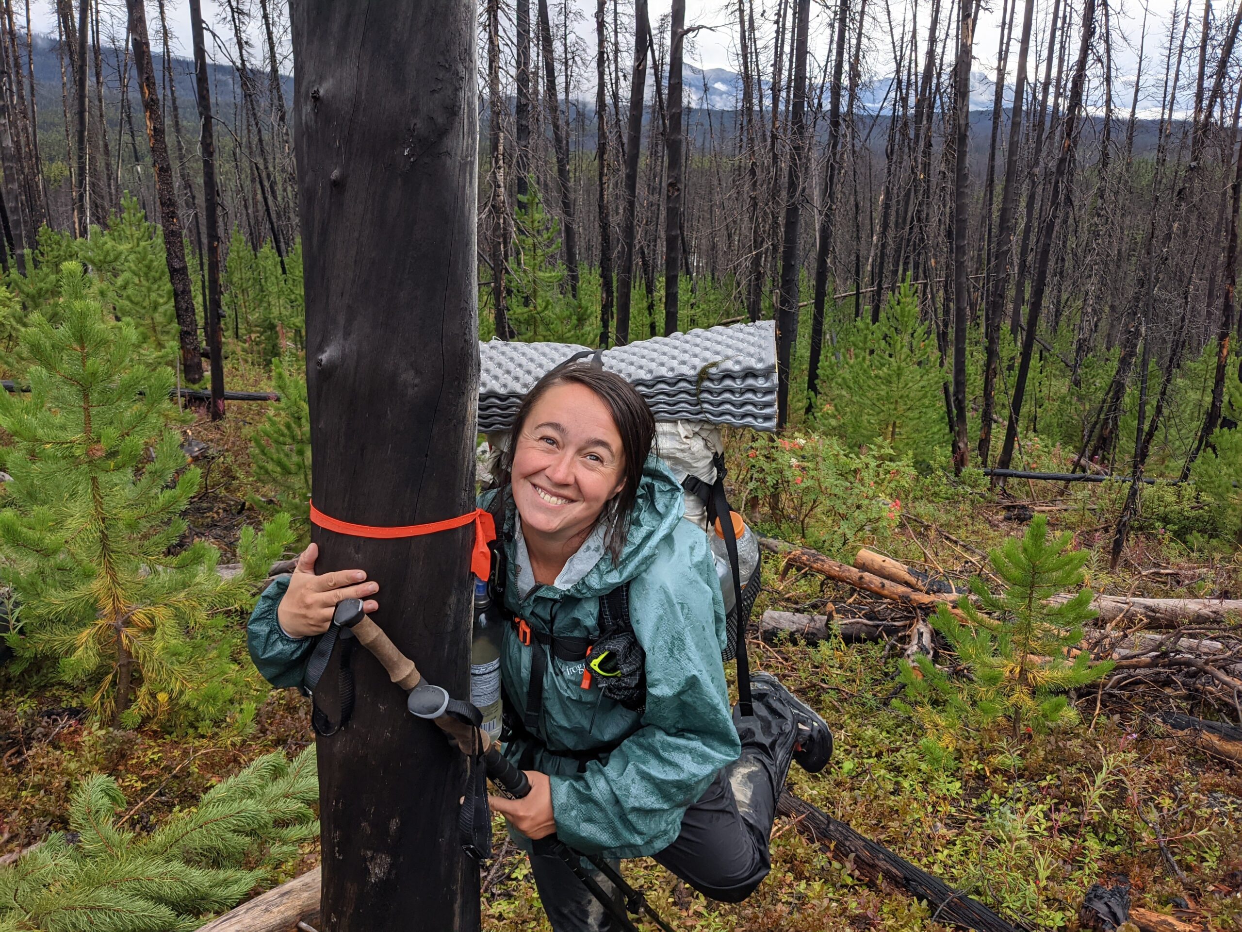
It is here where the GDT really starts to become remote. The route heads north from the more travelled sections of Jasper and deep into the hinterlands. Before attempting this section, ensure you’re comfortable with off trail navigation and being self-sufficient. It’s not uncommon to go several days without seeing anyone. On the flip side, by many accounts, this is among the most sublime sections of the GDT.
LEAVING JASPER TOWNSITE
Heading west from the town of Jasper, lies the Yellowhead highway. It’s named after Pierre Hastination, a 19th century Iroquois trapper and fur trader known for his blonde hair, earning him the nickname Tete Jaune (or Yellow Head). This is probably the most significant portion of road walking on the trail as the highway can be busy. Some will try to skip this walk and hitch the 20 km to the Miette River trailhead. Alternatively, you can avoid the highway by following a network of trails, old tote roads, and a bit bushwhacking to make it to the same trailhead. Chasing the Miette River up to its source, you’ll climb over Centre, Grant and Colonel Passes before climbing down into the adjacent Moose River valley in Mount Robson Provincial Park. A long alternate here follows the Moose River back down to Highway 16. You’ll ford the river several times as you head up the valley towards Moose Pass at its head.
Campgrounds in this area:
- Minnow Lake (Marjorie-Dorothy Lakes alternate) – Parks Canada (Permits and reservations required)
- Miette River – Parks Canada random camping (Permits required)
- Miette Lake – Parks Canada random camping (Permits required)
- Colonel Pass – Parks Canada random camping (Permits required)
- Trio (Moose River alternate) – BC Parks random camping (No permit required)
- Colonel Creek– BC Parks random camping (No permit required)
- Steppe Creek – BC Parks random camping (No permit required)
- Slide – BC Parks random camping (No permit required)
- Calumet – Parks Canada random camping (Permits required)
Entry / Exit Points
- South – Highway 16
- Mid – Highway 16 via Moose River alternate
- North – Highway 16 via Berg Lake alternate
Resupply
- Jasper
MOUNT ROBSON AND BERG LAKE
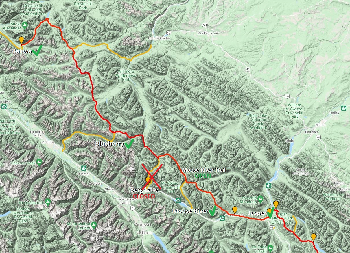
At Smoky River you’ll encounter a key decision point. This is the junction with the world-famous Berg Lake Trail. The route through Mount Robson Provincial Park was the original terminus of the GDT and many still exit here. It’s much easier to access the trailhead from here compared to the current terminus at Kakwa Lake. Others will use Mt. Robson as a resupply point. It is however, a 30-mile (50km) round trip and permits to camp along the Berg Lake trail can be difficult to obtain. The trail passes by Mt Robson, the tallest mountain in the Canadian Rockies (just shy of 13,000 ft) which drops its ice in the aptly named Berg Lake. Note: Due to flooding in 2021, the Berg Lake trail is currently closed with no details if it will be open in 2022.

Campgrounds in this area:
- Adolphus (off trail) – Parks Canada (Permits and reservations required)
- Robson Pass (Berg Lake alternate) – BC Parks (Permits and reservations required)
- Rearguard (Berg Lake alternate) – BC Parks (Permits and reservations required)
- Berg Lake (Berg Lake alternate) – BC Parks (Permits and reservations required)
- Marmot (Berg Lake alternate) – BC Parks (Permits and reservations required)
- Emperor Falls (Berg Lake alternate) – BC Parks (Permits and reservations required)
- Whitehorn (Berg Lake alternate) – BC Parks (Permits and reservations required)
- Kinney Lake (Berg Lake alternate) – BC Parks (Permits and reservations required)
Entry / Exit Points
- Highway 16 via Berg Lake Trail
Resupply
- Mount Robson
SECTION G: MOUNT ROBSON TO KAKWA
Several sections of the trail vie for the moniker “heart of the GDT”. Section B contains the first dedicated sections of trail (and where a lot of current work is being done). Section C passes through some of the most spectacular scenery in the Rockies, but it is also the most popular and crowded. Parts of Section E spend mile after wondrous mile in the high alpine. However, it is Section G where you truly encounter the rugged, remote wilderness that the GDT is known for. Once you leave highway 16 past the Jasper townsite, you won’t cross another road until you finish the trail. Here trails are rarely maintained, bridge crossings are few, deadfall is plentiful and bail out options are limited, but you will be rewarded by some of the most spectacular hiking on the Great Divide. Be prepared for up to 10-day (or longer) food carries.
THE NORTH BOUNDARY TRAIL
Continuing on the main route of the GDT, we move from section G to section F and the remote (and soggy) Smoky River valley. At Chown Creek and Bess Pass you’ll be following parts of the Jasper North Boundary Trail. This can be hiked as a separate 115 mile (185 km) thru-hike taking you through the remote northern sections of Japer National Park. From this point on, you may encounter horses on the trail so make sure to brush up on your etiquette.
Leaving the North Boundary Trail you’ll cross into the Jackpine Valley and the first of several similar decisions you’ll make from here on in. At many points the trail will splits between a high route and a low route. The high routes typically take you above the treeline, giving you incredible views of remote peaks, glaciers and valleys. On the flip side, these high routes are exposed to lightning, and often involve route finding (no trails). If conditions are good, most folks recommend taking the high routes. If weather is poor, you may have to constrain yourselves to the muddier, brushier valleys.
Campgrounds in this area:
- Wolverine North (often flooded into late August) – Parks Canada (Permits and reservations required)
- Timothy Slides – Parks Canada random camping (Permits required)
- Chown Creek – Parks Canada (Permits and reservations required)
Entry / Exit Points
- South – Highway 16 via Berg Lake Trail
- North – Highway 16 via Holmes River Road and Blueberry Lake (Jackpine Highroute)
Resupply
Some folks will make arrangements for supplies to be cached at Blueberry Lake
TAKING THE HIGH OR LOW ROAD
For the Jackpine, the main trail takes you across a ridge line with a lower alternate trail in the valley. Work is being done to clear the trail in this area, do remember to thank a volunteer if you come across a crew. You can exit the trail at Holmes River, but this is a 25 mile (43km) unmaintained route back to highway 16. At Jackpine Mountain, you can again choose to stay in the alpine along the Perseverance and Loren Lake High Routes or climb down to the Jackpine River.

The trails rejoin each other at Big Shale Hill and closely parallel the Great Divide for several miles with an optional side trip to the summit of Mount Talbot. Staying up high, the trail heads over Morkill and Fetherstonhaugh Passes.
Back down into Casket Creek valley, you’ll find a junction with the Sheep River trail and an exit to Grande Cache in Alberta. This 45 mile (72 km) unmaintained trail through the Wilmore Wilderness, has a few significant fords, but ends in town and full services.
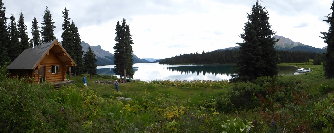
Passing into BC and Kakwa Provincial Park, the next two alternates are the Surprise Pass and Providence Pass high routes. If conditions allow, again, taking these high routes are preferred as you can enjoy beautiful views of Cecilia Lake. The two trails meet up again at Kakwa Lake and the official end of the trail. A campground and cabin mark the terminus of the GDT.
Campgrounds in this area:
- Jackpine River – Random Camping (Alberta crown land camping pass required)
- Pauline Creek – Random Camping (Alberta crown land camping pass required)
- Shale Pass – Random Camping (no permits required)
- Morkill Pass – Random Camping (no permits required)
- Casket Pass – Random Camping (Alberta crown land camping pass required)
- Copper Kettle – Random Camping (Alberta crown land camping pass required)
- Broadview Lake – BC Parks Random camping (no permits required)
- Kakwa Lake – BC Parks Random camping (no permits required)
- Kakwa Lake Cabin – BC Parks (first come first served)
Entry / Exit Points
- South – Highway 16 via Holmes River Road and Blueberry Lake (Jackpine Highroute)
- Mid – Grande Cache (Alberta Highway 40) via Sheep River Trail
- North – None
Resupply
- None
NOT QUITE DONE YET
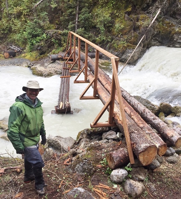
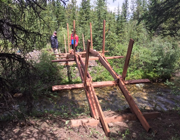
This isn’t the end though. Several bridge washouts on the Kakwa Lake road currently makes the terminus inaccessible by vehicle. From the lake it’s a 30km walk to the Bastille Creek Trailhead which is the closest you can get by vehicle (and on a rough forestry road at that). Down the road, it’s 74 km (46 miles) to highway 16. While some have managed to grab a hitch along the forestry road, others have had to walk all the way to the main highway. From there you’ll need to get a ride west Prince George (the closest Airport to the terminus) or east towards Valemont and Jasper. There is talk of BC Forestry making repairs to this road, so stay tuned for updates.
Campgrounds in this area:
- Buchannan Creek (hike out) – Random camping (no permits required)
Entry / Exit Points
- South – None
- North – Highway 16
Resupply
- You’re still here? It’s over, go home ? either that or turn around and start back south…


