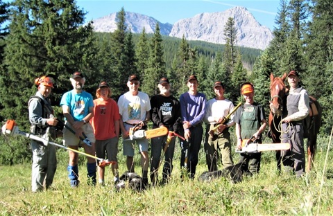
Category: Blog

Parent category of all content that could be considered a blog (as opposed to news)

  • Pathfinder Newsletter – Spring/Summer 2021

    Pathfinder Newsletter – Spring/Summer 2021

    Spring-Summer 2021

    With the arrival of the summer hiking season, the Great Divide Trail Association continues to consider what is best for the health and safety of the trail community that we serve. While pandemic recovery continues and the world slowly reopens, staying active in the outdoors is an excellent way to keep your body and mind healthy. This edition of the Pathfinder Newsletter includes information to help you safely plan and enjoy your summer on the GDT hiking and/or volunteering, donation opportunities, a book update, and GDT merchandise announcement. Enjoy!  

    1. Trail Building & Maintenance Trips Update: Trail crew trip dates and other info for 2021. Come join the fun!
    2. Trail Conditions Update: Notices and links about current trail conditions.
    3. Thinking Outside the Donation Box: Ways to donate to the GDTA for a variety of situations.
    4. Preparing for the Great Divide Trail: Key details of the preparation experience for hiking the GDT.
    5. Ordering “Tales from the Great Divide”: How to order the 2nd Edition and Collectors Edition of the stories of GDT history.
    6. GDTA Spring 2021 Webinars: Recent webinars featuring featuring trip planning, safety, and gear experts.

    If you have comments about the newsletter or would like to publish an article or event in a future newsletter, please email us at greatdividetrail@gmail.com

  • GDTA Spring 2021 Webinars

    GDTA Spring 2021 Webinars

    by Charlene Deck

    This spring, the Outreach Committee presented two webinars to help hikers prepare for the trails this summer: one on trip planning and safety and one on gear selection.

    Trip Planning and Safety

    Keri Bowzaylo, an ultra-runner, fitness professional, and apprentice interpretive guide, showed us how to plan a multi-day hike with safety and self-reliance in mind. She shared resources for setting up an itinerary and discussed the safety measures and equipment needed to ensure a successful journey. Keri will apply these principles when she runs, then backpacks on the GDT this summer.

    webinars_5

    Gear Selection

    The Gear Webinar provided a look into the packs of three hikers with distinctly different approaches to backpacking and gear selection. Through these perspectives, we learned how gear choices are influenced not only by the objective but also by the intended experience on the trail.

    webinars_1

    Jeff Schroeder, who supplied the ultralight viewpoint, has completed most of the GDT and numerous multi-day treks in the Pacific Northwest. Jeff prefers to travel in the most minimalistic way possible without sacrificing the basic comforts needed for recovery. This simple approach allows him to comfortably spend long days on the trail and be immersed in the environments through which he’s moving.

    webinars_2Ultralight backpack

    Charlene Deck is a two-time GDT thru-hiker who has been exploring the Rockies through backpacking adventures for decades. She shared a set-up that aims to strike a balance between comfort on the trail and comfort in camp for trips of various lengths. Her version of balance means never compromising on gear that will keep her warm, choosing simplicity over convenience, and knowing when good enough is good enough.

    webinars_3Thru-hiker “lodging”

    Robert MacLaine is a GDTA board member and backcountry equestrian guide who plans to ride the GDT. When he’s on his feet, he enjoys exploring off-trail as well as spending time in camp. Robert’s gear choices reflected his preference that backcountry travel be comfortable rather than merely tolerable. He acknowledges this may mean carrying more weight, but if that weight provides significant comfort and satisfaction, it’s worth it.

    webinars_4Loaded down with trail comforts

    Missed Either Webinar?

    You can check out notes from the Trip Planning and Safety Webinar and the video presentation from the Gear Webinar below.

    Trip Planning and Safety Notes
    Click to view Trip Planning and Safety Notes

    • 0:06 – Robert MacLaine
    • 12:45 – Charlene Deck
    • 24:40 – Jeff Schroeder
  • Thinking Outside the Donation Box

    Thinking Outside the Donation Box

    By Mary Jane Kreisel

    June is an exciting month for the Great Divide Trail Association! Our volunteer trail building trips in BC and Alberta are about to begin. Hikers from far and wide will soon embark on a thru-hike of a lifetime on the GDT. Others will attempt a challenging section-hike, some will enjoy a weekend backpack, and equestrians will experience the rewards of the backcountry as they ride along the trail.

    Much work goes on behind the scenes to provide supports for these wilderness experiences that we all enjoy. This also means significant financial resources for programs to build, maintain, and protect the GDT as well as provide trip planning resources for trail users.

    I am writing this article to introduce you to a new page on our website: Donation Options, which outlines the various ways we can donate to the GDTA to support these programs.

    Perhaps the simplest way to donate is through our Online Donation Form powered by CanadaHelps.  We have also introduced an Online Dedication Form specifically formatted to donate to the GDTA in honour of a person – whether this be an in-memoriam tribute or a dedication to someone for a special occasion.  This form provides a variety of e-cards to choose from including sympathy or all-occasion (birthday, wedding, thank-you) and these can be automatically sent as notification of the donation and the person being remembered or honoured.

    From my own personal experience, I know of a unique situation where donations were given in honour of a couple being wed. When GDTA members Jenny Feick and Ian Hatter got married, they were able to generate a significant amount of donations to the Young Naturalists’ Club of BC by asking their wedding invitees to donate to this charity in lieu of wedding gifts.  I think most of us who attended their wedding felt pretty good about taking them up on this donation request.  (Also, it beat having to shop around for a wedding gift!)

    Although digital forms have made life easy for us, the GDTA also welcomes donation cheques that can be mailed in – these will be honoured with tax-deductible donation receipts.

    In the past, the GDTA has received significant support from the corporate world.  We would certainly like to welcome this sector back to the fold.  Increasingly, companies are turning to corporate donation platforms such as Benevity.  Many companies have workplace giving programs and may provide a matching contribution to an employee’s donation.

    The GDTA is registered with Benevity and has a detailed cause profile listed in their charities.  If your company works with Benevity or another employee giving platform, please check to see if they will match a donation to the GDTA. We have been the recipient of generous donations from a number of individuals and companies in the past through Benevity. All donations to the GDTA through this donation platform are issued tax receipts.

    ATB Cares have partnered with Benevity to provide a matching program for individuals who wish to donate to Alberta-based charities. They currently match 20% of an individual’s donation up to a maximum of $500 until they reach their budget limit of matching funds each month. For example, if you wished to donate $50, ATB Cares will match 20% of the donation – adding an additional $10 to the donation.  For those feeling particularly generous, a $2,500 donation will net a total donation of $3,000!  This is a powerful incentive to donate to the GDTA through ATB Cares or through their online listing of charities. And don’t forget to donate early in the month before the matching funds run out!

    Planned Giving is the term often associated with end-of-life gifts to charities.  However, it can also mean a donation that is set up in advance to be distributed later.  Just recently, my husband and I started looking into ways we can provide long-term gifts to the causes we believe in.  I contacted the Edmonton Community Foundation and found out that we can set up an endowment fund in our lifetime that will continuously fund the charities we support for a long period of time.

    The Edmonton Community Foundation (ECF) and the Calgary Foundation (CF) – similar to other community foundations throughout the country – help people set up named endowments or donor advised funds in which a percentage of the fund’s invested growth is used to provide gifts to charities of choice on a long-term basis.  An endowment can be set up in your own name, in your family’s name, or in memory of a loved one.  Check out this link at the Edmonton Community Foundation to see how endowment funds work and the Calgary Foundation for a list of ways to give – please refer to their tab “Donor Advised Funds.”

    After some consideration, my husband and I have decided to set up an endowment fund with the Edmonton Community Foundation.  This will take us several years of contributions to build this fund to the ECF’s minimum threshold amount. The good news is that we will receive charitable tax receipts for all these contributions. Once the full amount is achieved, it will be professionally invested by the ECF with the intent that a percentage of the growth will be disbursed every year to the charities we have chosen. Our aim is to name a few charities including the GDTA to be recipients of this fund.

    This story does not necessarily end here since we can add more money to the endowment fund at any time during our lives. We can also designate in our wills that a specific amount or percentage of our estates go to this fund.  The remarkable thing about these endowment funds is that once they are set up, they will continue to grow over time and in turn, distribute monetary gifts to our chosen charities for as long as they remain in existence.

    Speaking of wills and estates, I will again refer to my friends Jenny Feick and Ian Hatter who have recently named the GDTA in their wills as one of their beneficiaries.  I asked Jenny why she and Ian wanted to leave money to the GDTA.  She replied:

    “Giving to the GDTA was a values-driven decision. I believe in and support the Great Divide Trail concept and the work of the Great Divide Trail Association to establish and maintain the GDT and seek a protected corridor along its route. I have a historic connection with the GDT and the GDTA as one of the so-called “originals” on the Project: Great Divide Trails crew in the summer of 1974. At the time we made the change in our wills, the GDTA had not yet regained its charitable status. Now that it has, I suppose there will be some benefits to my estate in terms of tax planning as well.”

    I also asked her what she would say to GDTA supporters about bequests to charities.  Here is her answer:

    “Bequeathing money to charities is a good way to leave a lasting legacy that reflects one’s beliefs and values and that benefits future generations…”

    It is clear that a bequest to a charity in a will is a heartfelt way for a person to express their regard for an organization and its mission. It is also an avenue to leave a legacy that will live on in that organization. There are also clear tax advantages to an estate when a donation is made to a charity.

    As you can see, donating is not a “one size fits all.” There are many meaningful ways to make a gift to the Great Divide Trail Association. I hope this article has provided some insight into how you can make a real difference in whatever way you choose to give.

  • Ordering “Tales from the Great Divide”

    Ordering “Tales from the Great Divide”

    By Jenny Feick, PhD

    Tales from the Great Divide, Vignettes on the Origins and Early History of Canada’s Great Divide Trail and Great Divide Trail Association brings to life the memories of many of the ‘originals’ whose vision, idealism, dedication, and hard work over five decades made Canada’s Great Divide Trail a reality. Tales from the Great Divide reveals the adventurous, heartbreaking, and hilarious moments that characterized the early history of the GDT. Devising and establishing a route for this wilderness long-distance trail along the crest of the Canadian Rocky Mountains demonstrated a naive courage and optimism. These pathfinders faced personal hardships and their trail work took place at a time before lightweight gear existed and without technological aids such as GPS, inReach, cell phones or satellite phones. In their quest to establish the GDT with a protected corridor, they confronted threats from resource extraction industries and ATVs, bureaucratic obstacles, fluctuating political support and financial challenges.

    tales_1

    Chris Hart and Dave Zevick survey an area that would become part of the High Rock segment of the GDT from the summit of Crowsnest Mountain in July 1974 (Photo by Cliff White)

    The idea to document the origin of Canada’s Great Divide Trail (GDT) and the Great Divide Trail Association (GDTA) emerged during a GDTA Signature Trip that took place from July 18 to 22, 2018. Dave Higgins, Mary Jane Kreisel (née Cox) and Jenny Feick, who were part of the original Project: Great Divide Trails crew, plus Jeff Gruttz and Lani Smith, who were involved in the early days of the GDTA, all signed up for the fourth GDTA work party in 2018 to build trail in the southern High Rock Section. While sitting around the campfire one evening, Wayne Marshall, one of the individuals who resurrected the GDTA after its period of senescence in the early 2000s, asked the five individuals who were involved in the 1970s to 1990s to share their recollections on how the whole idea of the GDT and GDTA started. The other volunteers relished this sharing of anecdotes and stories around the campfire. Julien Cossette, then a relatively new and active volunteer trail builder with post-graduate training in anthropology, said how important it was for all of the so-called “originals” to get their stories written down. The group felt especially motivated since Lani Smith had nearly died of a heart attack two and a half years before.

    tales_2

    The idea for the Tales project arose during the July 2018 Signature Trip when Wayne Marshall asked the five originals present to tell their story around the campfire (Photo by Jenny Feick)

    Tales from the Great Divide is a self-published compendium of stories from individuals involved firsthand in the start and development of the GDT and the GDTA. While technically nonfiction, the tales are based on recollections and the human memory is not always entirely accurate. Nevertheless, a reader can gain a good sense of the truth from the variety of information sources used. These include transcripts of storytelling sessions and telephone interviews, personal letters, and previously published written materials, photographs, illustrations and maps, plus more recently written accounts of past events, and footnotes with supplemental information.

    tales_3

    Friends of the Great Divide Trail group picture from their first work trip at Cataract Creek, Alberta in 2004 (Photo by Jeff Gruttz’s self-timer)


    The Collector’s Edition of Tales from the Great Divide (290 pages, 200+ images)
    Published in September 2019, the first edition of Tales from the Great Divide was launched at the GDTA’s AGM on September 30, 2019. Only 30 copies of what has come to be known as ‘the Collector’s Edition’ were printed. All copies sold by mid-November, 2019, and so the document is technically out of print. However, you can still order a pdf version from the editor, Jenny Feick, one of the so-called “originals” who helped initiate the GDT and the GDTA. The cost is $11.00 Canadian.

    For those in the Calgary area, a copy of the Collector’s Edition of Tales from the Great Divide can be viewed by appointment at the University of Calgary’s Taylor Family Digital Library, as it is part of the GDTA fonds within the Glenbow Archives in the University of Calgary’s Special Collections and Archives. The GDTA and the Alberta Wilderness Association (AWA) also each have a copy of the Collector’s Edition in their files.

    tales_4

    Tales from the Great Divide Editor Jenny Feick with the Collector’s Edition just before the book launch at the GDTA AGM in September 2019 (Photo by Ian Hatter)


    The Second Edition of Tales from the Great Divide (416 pages, 300+ images)
    To launch the book at the GDTA’s AGM on September 30, 2019, the first or Collector’s Edition had to be quickly assembled and rushed to completion without a final thorough proofread from start to finish. As a result, it contained numerous errors from mis-spelled names to incorrect caption labels. Despite numerous obstacles, a reasonably good first edition was produced in time for the book launch.

    Published in April 2021, this Second Edition of Tales from the Great Divide corrects errors found in the first edition after it was printed. It also includes more than 100 pages of new material and over 100 additional images. These include five segments from the storytelling sessions that were inadvertently left out of the first edition as well as additional information from people involved in the GDTA’s history and historical documents. Besides additional maps and photographs, this edition contains a Preface and various guides to orient the reader and aid the reading experience, an expanded detailed timeline, a bibliography, a list of past GDTA volunteers, newly discovered GDTA memorabilia, and an Afterword on the effects on the GDT and the GDTA of the 2020 COVID-19 pandemic and the rescinding of the 1976 prohibitions on coal mining on the Eastern Slopes of the Rockies.

    People can order a print on demand copy of the Second Edition of Tales from the Great Divide from Amazon. The cost is Cdn $85.00. The pdf is available from the editor on the Nature Wise Consulting website. The cost is Cdn $25.00. The editor will also have some copies of the print version for sale to sell after presentations about the history of the GDT and the GDTA.

    tales_5

    The cover of the Second Edition of Tales from the Great Divide (by Louise Beinhauer)


    Finding the High Rock Trail Route (an excerpt from the Second Edition)

    DAVE: (Turning to face Cliff) “But [in August] you did task Chris [Hart] and myself just to look for trail opportunities in a spot that you called the Highwood Highline. And you said, “I really want to do this, but I can’t, I’m working [elsewhere].”

    CLIFF: (Chuckling) “My days off. I’m going to scoop this; it might be a bit better.”

    DAVE: “You must have had a lot of faith in me at that point, because you said, ‘You do this one.’ (Turning to everyone else in the room) He actually sent us out to actually find a usable route through the upper Highwood [River] country. That was the key thing.”

    CLIFF: “It pulled it all together.”

    DAVE: “It really pulled it all together. (Turning to Jenny and Mary Jane) And I think it was you two…”

    JENNY: [Meanwhile] “We were doing Carnarvon [Creek and Lake area in Alta.].”

    DAVE: Yes, you dropped Chris and I off around Cataract Creek, and we hiked all the way up to the headwaters of Cataract, Lost Creek, actually, and began working our way north. And, immediately, it was the ‘Ah ha’ moment because, ‘Wow! This is about the best terrain we have seen yet.’ There were usable game trails, a few usable outfitter trails, and they all went exactly where we wanted to go. The viewscape was spectacular. At that time, the forest cover was intact all through that country, and it had the advantage of being very accessible from Calgary.”

    CLIFF: “It’s a classic hike.”

    DAVE: “Because of that, we had spectacular weather, of course, so we could fully explore that [area]. So, that was the basis of our [later] push to start building the [Great Divide] Trail. Here [in the Highwood], we have a place we could work that we could get to [from Calgary]. Even on a weekend, you could go in and get a reasonable amount of work done. And it was just painfully obvious [in the mid-1970s] that this is where you want to be. Partially, also, because on the B.C. side, it was a scene of devastation with the Fording River [coal mining] operation.”

    CLIFF: “We knew we were going to have to get around that [coal mining area].We probably thought we wanted to get into Elk Lakes Provincial Park [in B.C.] but we knew we had to get back [into Alberta].”

    DAVE: “So, this was really good, and the area had everything going for it. So, with that there, it was just so convenient and obvious that we would start our [trail] work in that location.”


    tales_6

    Chris Hart on the Highwood Highline (now called Rye Ridge) in August 1974 on what would become the High Rock section of the GDT (Photo by Dave Higgins)


    tales_7

    Members of the first GDTA trail crew on Rye Ridge in August 1976 finalizing the GDT route (Photo by Jeff Gruttz)

  • Preparing for the Great Divide Trail

    Preparing for the Great Divide Trail

    by Austin Hager

    Wow, was I shocked at how much prep is required for a Great Divide Trail thru-hike.  Still more than a month away from my start date, and I have put in well over 100 hours of preparation.  Between my partner Tanya and I sharing the load, it has been a part-time job for weeks.  This is our first thru-hike which probably means there is quite a bit of overthinking and uncertainty in the choices we are making in our preparation.  Thankfully all of this prep will lead to an experience of a lifetime and I am so fortunate we are in a position to take such a challenge and run with it.  All of this prep can be broken down into 5 boxes, and it feels REALLY good to check them off, knowing we can put more time into the remaining areas of our hike.  There are 5 main things to prepare for: permits, food/resupply, gear, training, and finding an inner purpose for hiking the trail.

    Permits
    The permit system for the GDT seems to have grown into one of the largest grumbles for hopeful GDT hikers.  With an average duration of about 50 days on trail there are a lot of campsites to book, with most of them seeming to have a unique way of booking them.  Since the trail passes through 5 National Parks and 8 Provincial Parks (in addition to several other park-like jurisdictions) there are so many different bookings to make.

    My permit experience was frantic to say the least.  When Parks Canada released all the backcountry sites for Kootenay, Banff, Yoho, Lake Louise, and Jasper on the same day it was all hands on deck.  Of our 46 nights on trail, 12 of them needed to be booked on April 16th when the reservations were released.  With over 25% of our hike at the mercy of Parks Canada’s booking system it felt like a make-or-break moment for the hike.  So many of the campsites we needed to book are on some of Canada’s most prestigious and desirable trails.  If we were unable to book certain campsites it would put us in a dilemma: do we hike anyway and knowingly camp without a permit?  Additionally, if we have to adjust some days it could potentially throw off our entire plan for things we already have booked like accommodation for our zero days or other campsites already secured.

    With 6 devices all waiting the morning of April 16th we saw immediately how many people were ready to go camping this summer.  With events cancelled, it looks like it’s going to be another Covid summer and people are ready to spend some time outside.  Between our 6 devices we had one spot in the queue system at around 9000, the others ranged between 15,000-30,000.  We created a list of the highest priority campsites to the lowest, so we could tackle the premier sites like Floe Lake right off the bat and theoretically adjust from there.  When we logged on the system was very bogged down, with tens of thousands of people trying to book all sites across the Rockies it reminded me of Burning Man tickets going on sale to the whole world at once.  With Floe Lake and Mary Schaffer in our basket the system went from bogged down to incapacitated.  Time to secure these bookings before all was lost.  After praying we could reach the checkout page we managed to secure 2… 10 more to go..  Unfortunately we did not realize that once you click “checkout” you are put back into the queue system.  By this point another device had reached the bookings page but the website was unusable.  I should mention that during this time we were calling the Parks Canada phone number on repeat for well over an hour, always resulting in a busy signal.  The website had stopped working and the phone lines were down.  My partner had already asked for 8 weeks off and I had planned on ending work mid-June.  Our life plan was at the mercy of this system that was failing to meet the demand of thousands of hopeful hikers.

    The Great Divide Trail Hikers Facebook page was our savior.  Countless posts about not being able to book anything through the website, downed phone lines and frustration.  Some GDT hikers had mentioned that if you called the park directly they could book your sites over the phone.  Meanwhile, the website had become an agonizing 3-page loop.  Click the park you want to book, wait a couple minutes, click the access point, wait a couple minutes, click the campsite and then it would timeout.  Restart this procedure and repeat for the following 8 hours.  The parks office seemed like the only available option.  I called Jasper, Banff and Lake Louise and left messages at the backcountry office.  At this point I had fully left my fate up to a voicemail.  In an age of texting, I can’t remember the last time I left a voicemail let alone received a call back.  After a few hours of clicking through the same 3-page procedure I received a call from the Lake Louise office! They were able to book Kootenay, Banff and Yoho for me.  With only some minor changes to our plan.  They weren’t able to book Jasper for me but now we had 8 of the 12 sites booked.

    After a few more hours (about 7 after we initially started) the park’s site was slowly coming back to life.  If I selected one night at a time and didn’t try to link them I could successfully add them to the cart.  By hour 8 I had finally secured 3 more sites, one site was fully booked and with the other 11 already booked it was impossible to change our plan.  Skyline Trail in a day was our fate.  Not an ungodly distance but 53km is still a big day, in fact our biggest day on the whole trail.  In contrast to other trails with less bookings I was looking forward to a big day.  Through booking the GDT sites everything has to be calculated, there isn’t really an option to go for the 24-hour challenge and see how many KMs I can hike.  So having a big day, particularly at the end of a section was a challenge I was looking for.

    The remaining bookings we have are for provincial parks and aren’t nearly as stressful.  There are more alternate options, and with the Parks Canada sites locked down, what briefly felt like uncertainty is now a firm plan.  8 hours of looking at a screen timing out is plenty of time to question whether this trip is going to even happen.  Thankfully, persistence and help from the GDT community made my permit experience troubling but we prevailed!

    Food/Resupply
    The next big chunk of preparation that will likely be the last to finish is our resupplying plan and our food situation.  I have hiked quite a bit but never tackled a thru-hike.  My longest hike was last September when we did a large chunk of Section E, from Saskatchewan Crossing to Poboktan Creek.  About 100km over 4 days.  I have heard of hiker hunger and have experienced increased appetite but I know my hunger level will grow beyond what I have ever known.  Planning for this is planning for the unknown. How much food will I want?  Will I get sick of the foot I pack?  With few options to fully resupply on trail I won’t be able to vastly overhaul my food plan.  I am stuck with my choices for nearly the entire hike.

    In addition to preparing our food we also need to mail our boxes to the resupply points along the trail.  Queue overthinking.  With a box filled with food sitting for a few weeks there are so many things that could happen.  It could get lost, get eaten (by humans or other animals), we could potentially need a piece of gear or knowingly be short on food for the upcoming section.  Currently, we are planning for 3000 calories per day in the first section and then 4000 for the rest of the trail.  With another pair of shoes at Saskatchewan Crossing or Lake Louise and a few more pairs of socks.  My naivety is driving me crazy, knowing that after the hike is done future thru-hikes will hopefully be that much easier on the mind.

    For our food, we were recently gifted a dehydrator. Currently on a crash course on meal prepping we have tried a few meals at home and were very surprised at how good they were.  Albeit, it did take a few tries to nail down the proportions (usually we just needed to double or triple the spices).  The current plan is to have 4 different dinners: beans and rice, marinara pasta, mac n’ cheese and chili.  We will also be carrying 2-4tbsp per day of olive oil to get an easy few hundred calories.

    1. Beans and Rice: Quite possibly the most famous DIY backpacking meal thanks to Andrew Skurka.  We found some dehydrated black bean flakes from OM Foods in Nelson, BC. Which happens to be our new home come August.  The rest of the recipe is super easy- instant rice, taco seasoning (bulk barn!), and some dehydrated bell peppers and corn.
    2. Marinara Pasta: We made a massive batch of marinara sauce and went overkill on the spices.  A shortage of flavour wasn’t a problem I was willing to risk.  For the pasta we are using orzo, it’s the most dense since there isn’t really any air or wasted space.  Cooking the pasta and dehydrating it makes the rehydrating process much shorter.  We also found 2kg packs of extra-lean ground beef at Wholesale Club.  We cooked it until it was very well done and then dehydrated it.  Once dehydrated and a very unappetizing consistency resembling dog food we crushed it up so it broke down into rice sized pieces.  The marinara sauce turns to a fruit-leather like consistency and rehydrates extremely well.  With some olive oil and parmesan this thing is a calorie bomb!
    3. Mac n’ Cheese: Cheese holds a special place in my heart, particularly after a big day.  As we did with the orzo, we cooked the macaroni first and then dehydrated it again.  The cheese powder we got from Bulk Barn.  We are adding some dehydrated peas for a bit of something green.  Lastly we bought a bunch of ham lunch meat, after finding some big pieces on sale we have moved to buying it pre-sliced to save some time and for better consistency.  Then cut it up into about 1cm square slices and dehydrate it.  A friendly tip- we have been vacuum sealing all of our food.  The ham is very pointy and has punctured the bag several times, we have been double vacuum sealing it and haven’t had a broken bag yet.
    4. Chili: The chili recipe came out of a bit of an experiment.  I made some chili a few weeks ago and was curious about how it would be dehydrated.  All part of our crash course on dehydrating.  I just threw it in and dehydrated the crap out of it.  I poured some boiling water on it a few days later and it came out almost identical to the initial chili!

    For breakfast I will be eating a bigger bar like a ProBar or Hornby Organic bar and I am bringing a breakfast protein shake powder to get a few more nutrients.  Tanya is going to eat granola and might bring instant coffee.

    For lunch we are planning to do a mix of quite a few things.  Previously on hikes we would bring summer sausage, Babybel cheese, and some nice crackers.  But with the resupply box being mailed weeks before we arrive sausage is out of the question.  Instead we made a big batch of hummus (with low oil) and dehydrated it, it becomes a bit like a dry, grainy dough.  We can rehydrate and add the oil on trail.  We are also buying 400 bars.  It is going to be a small fortune but I am a big fan of eating lunch while walking, or at least decreasing prep time for lunch.  The stove will only be coming out for dinner.  Hopefully this plan will work or we will have to adjust on trail with the little options we have.

    Gear. Gear. Gear.
    Living in the mountains for almost 2 months requires a certain level of gear to maintain sanity.  Fortunately some of the big purchases have been made in years past.  Tent, pad, stove, and most clothing has already been used and tested to make sure it works for us.  As I have found in the past, just because something is top-rated or it works for someone else does NOT mean that it works for everyone.  I am currently waiting for a new pack to arrive, I have smaller frameless packs for quick weekend trips and larger packs for 5+ days.  However, for the GDT I upgraded to a quilt and am not bringing some luxury items I have brought on other trips.  Now that larger pack is a bit too big.  Queue overthinking.  We are combining Section F and G with a planned duration of 10 or 11 nights, dependent on weather for the Perseverance Alternate.  I have never even come close to carrying that much food so understanding how much room I need in my pack is merely guesswork.  Given my hiker hunger at that point I feel like any estimate at this point will be so far off it is pointless.  Needless to say I agonized over pack size for weeks before finally pulling the trigger.

    As the GDT is substantially more remote and less travelled than the PCT, CDT or AT gear recommendations are much harder to come by.  This was a particular hurdle I hadn’t really thought about before.  I couldn’t read through 100 different gear lists to see what the common items were, nor does HalfwayAnywhere publish info on the GDT.  Thankfully the GDTA had a webinar with gear, I really appreciated that they had 3 distinct philosophies behind pack weight: traditional, lightweight and ultralight.  I find I am somewhere between ultralight on weekend trips to lightweight for this thru-hike.  I did have to purchase several new things specific to the GDT, rain pants in particular.  With shorter hikes “dealing with it” is a viable option.  “Dealing with it” means something different when you are hiking for weeks on end and don’t have the ability to reassess or alter the plan.  With such a long hike and so much unknown I find I am packing for my fears a lot more than normal.  While there are some things I could get to shave some grams I have finally reached a point where I think it is good enough and will definitely suffice.  The only problem I think I will have is that I will have too many warm clothes at the expense of a few ounces.

    Training
    The first 3 aspects of preparation seem to be more specific to the Great Divide Trail.  The remaining 2 are more straightforward and are required for any physically motivated goal. Training being the first.  Until the GDT I had never trained for anything, with the exception of sports teams in high school.  In the past decade my idea of training has been the Nike slogan, “Just Do It”.  No matter the sport or activity, my idea of training was just going out and doing what I wanted to do.  Outside of hiking my life is filled with climbing in the shoulder seasons and snowboarding in the winter.  There isn’t usually a lapse between most of these sports so I don’t usually find the time or the need to go out and train specifically for the next season.  All of this changed for the GDT.

    With such a big event looming I want to do everything I can to reduce any possible problems.  The risk of a physical issue on trail can be decreased through proper training.  With the snowline relatively low still training has to look a bit different than going out on big multi-day hikes.  I also have recently started developing a bit of patellar tendinosis which is queuing the overthinking yet again.  I went to see a physio preemptively to let them know what I was going to do and ask how I could best prepare my body.  My training has involved several kinds of squats and stretches for the lower body.  For the upper body I have mostly just stuck with climbing (which also includes hiking with a weighted pack to the crag).  Every week I am also trying to hike 10km twice with about 500m gain.  I will slowly be ramping up these distances over the month.  Part of these hikes will also be working towards hiking 2000km in 2021 which I will talk about in the final section.  My goal is to hike 400km before starting the GDT.  Starting the trail in decent shape will hopefully fend off any injuries and I will have muscles ready to tackle big alpine days.

    Finding My Purpose
    The final area of preparation for my Great Divide Trail thru-hike was the first part of my decision to hike the trail; finding my purpose.  I know I need an answer to why I am hiking the trail.  When it’s the third day of rain/snow mix and everything hurts I need to be able to answer the question with a meaningful answer.

    About a year and a half ago I lost someone very dear to me, she took her own life.  I had never lost anyone that fundamental to my life, nor had I ever lost anyone to suicide.  Her and I both found our love of hiking together and I want to honor her life and celebrate our chapter together while on the GDT.  Had it not been for her I don’t know if I ever would have ventured into the realm of backpacking in the same way, nor would I have had those foundational moments spent in the mountains.

    The road through grief is long but creating a plan has been extremely helpful.  It also made me think about the thousands of Canadians that take their own life every year, and how we need to do what we can to help.  I started a fundraiser, Hike4Hope.ca with a goal of hiking 2000km in 2021.  All of the funds raised will go to the Canadian Association for Suicide Prevention.  My goal is $10,000, and I am already over 40% of the way.  I have been working with CASP directly and they have been extremely supportive through the whole process and are cheering me on.  I now have over 40 people pledged and feel the support behind me.  I truly hope that this can be a small shift towards reframing and destigmatizing suicide and starting conversations around mental health.  CASP has some fantastic initiatives they are working on, including a national 3-digit hotline for crisis support.  My purpose for hiking the Great Divide Trail is to help support others by chipping away at the ever growing epidemic of suicide in our culture; through hiking I am motivated to get help for those in need and start the shift of how we talk about and understand mental health and suicide.  I am devoted to facing these problems and won’t turn a blind eye on those that need help.

    Despite all the stressful preparation and countless hours spent I couldn’t be more excited to start hiking.  I’ve been working on laying down as many kilometres as possible before the start date and the legs are already feeling strong.  I am very hopeful that many of the bumps in the preparation are due to a lack of personal experience and growing pains of the GDT and the relationship with Parks Canada.  I am happy I am part of the Great Divide Trail community!

  • Pathfinder Newsletter – Winter 2021

    Pathfinder Newsletter – Winter 2021

    Winter 2021

    As we leave 2020 behind and look forward to 2021, the Great Divide Trail Association continues to consider what is best for the health and safety of the trail community that we serve. Even while the pandemic continues, staying active in the outdoors is an excellent way to keep your body and mind healthy. This edition of the Pathfinder Newsletter includes information to help you safely plan your summer on the GDT hiking and/or volunteering, inspiration from past adventures, wildlife appreciation on the Great Divide, news on a nearby coal project, insight into committee activity, a couple of announcements, and a big Thank You to all of our donors after a very successful fundraising campaign. Enjoy!  

    1. COVID-19 Update: Enjoy the GDT safely in 2021.
    2. Our Amazing Donors: Making an impact on the GDTA!
    3. Trail Building & Maintenance Trips – Call for Volunteers: Trip dates for 2021 are now available and we need you!
    4. A Step-by-Step Guide to Planning Your GDT Hike: Step by step basics to bring order to the volumes of detail for planning a successful hike.
    5. What About Those Parks Permits…?: Why they are an essential part of the GDT experience and helpful hints to navigate landing them.
    6. Parks Canada Campground Reservations: Open April 16, 2021 at 8:00am MDT.  
    7. Identifying Tracks in the Snow: The animals are out and about in the winter. Which ones?
    8. Hiking Northover Ridge: The beauty and challenge, all in perfect weather.
    9. A Day on the GDT: The spectacular Carthew Alderson Traverse, a GDT day hike.
    10. Alberta Coal Lease Impacts on the Great Divide Trail: Information on the status of Alberta coal leases along the GDT.
    11. Committee Corner: Insights into what the GDTA committees are working on.
  • What About Those Parks Permits…?

    What About Those Parks Permits…?

    The Great Divide Trail (GDT) is unique.  It is wild!  It is rugged!  It is wilderness!  It is pristine!  It is beautiful!  If it wasn’t, it wouldn’t be the GDT.  Let’s keep it that way – it is unique.  It travels through many areas that are particularly sensitive to overuse or in some cases, in areas that are managed as low use to secure habitat for certain species.  And so requires trail camp permits that protect the trail and its environment by limiting the number of individuals at any given site on any given day, thus controlling the number of individuals in a given backcountry area of the National and Provincial Parks.  These trail camp permits are required in some places, not all places.  And of these permit-requiring places, some but not all, are popular places.  It takes a bit of effort to get permits for these popular places, but definitely is not impossible.  It wouldn’t be the GDT without these Parks permits….  BECAUSE they are one of the reasons the GDT is still wild! and rugged! and wilderness! and pristine! and beautiful!  Let’s keep it that way and put in the effort to get those permits (this effort is nothing compared to the effort to hike the GDT).  Besides, the permits are part of the GDT experience; without them, one doesn’t truly hike the GDT.

    jasper_moose_pass_4

    Permit Importance

    How do permits ensure the GDT stays wild, rugged, wilderness, pristine, and beautiful?

    Permits prevent overuse and overcrowding.  The available number of permits per night, at each trail camp, is limited.  Thus, the number of people on the trail is limited and spread out.  These limits are a reflection of what the facilities can handle and environmental impact considerations.  Minimal environmental impact and wildlife preservation are very important priorities of the Parks management, and needless to say, are necessary to preserve the wild, rugged, wilderness, pristine, and beautiful nature of the GDT.  Without these limits, the GDT would not be the GDT, it would degrade into just another long trail where one would see far too many people or worse, result in closures of sections of the GDT eliminating the contiguous nature of the trail. Let’s hope this never happens.

    Permits limit high impact human activity to small designated areas – the trail camps.  Even with quotas/limits to the number of hikers, hikers still have high impact human “activities” mostly camping activities such as cooking, clean-up, waste disposal, storage, tents, campfires, etc., that are not part of the natural wilderness order.  Again, for minimal environmental impact, fragile vegetation, and wildlife considerations, it is important to keep these high impact human camping activities in designated spots – the trail camps.  Hikers can do all their camping activities that typically scare animals, or habituate animals to humans, disturb the natural vegetation, etc., in small, widely scattered locations – the trail camps, that also have facilities (i.e. toilets, bear lockers/hangs, food areas, etc.) to minimize the environmental impact and animal disruption and habituation to humans.  An example – one caribou herd has already been extirpated in the southern half of Jasper National Park, and Parks Canada is trying their best to make sure the other two small caribou herds here are not lost too.  These environmental, wildlife, and vegetation considerations, are big reasons why “stealth” camping is one of the most harmful things a person can do in these popular Parks.

    waterton_lakes_red_rock_pkwy_bearThe animals live here.  Humans are just guests.

    Permits justify and support Parks maintenance of trails, bridges, trail camps, signage, and so forth.   As anyone who has hiked significant portions of the GDT knows, there are stretches of easy-to-follow, well maintained trail, with good bridges over tough water crossings.  And there are stretches that are overgrown, and/or hard to follow, and/or have tough fords, etc.  Parks maintenance crews (along with their partners such as the GDTA, Jasper Trails Alliance, etc.) are the ones who maintain the good sections of trail in the Parks, and the ones who oversee/manage this maintenance.  Permits help make it worthwhile to Parks to do this trail maintenance that GDT hikers so appreciate and benefit from, especially after enduring some of the unmaintained sections of the GDT.

    jasper_nigel_pass_23_bridgeNice bridge.  Thank you, Parks Canada.

    Parks require permits.  It is of paramount importance for GDT hikers to get these permits to ensure GDT support from Parks Canada and a good working relationship with Parks Canada.  Parks Canada has a mission to preserve the wildlife, environment, ecology, ecosystems – a noble mission that results in what the GDT is – wild, rugged, pristine, beautiful, wilderness – and permits are part of this mission implementation strategy.  Parks Canada also has management objectives to maintain trails, signage, bridges, trail camps, etc., – all of which benefit GDT hikers, and permits help support and justify these objectives.

    Improvements to challenging GDT stretches within the national parks are possibilities with a good Parks Canada-GDTA relationship.  Parks Canada is the GDT’s friend and host of major stretches of the GDT (more than 45% of the GDT is within national parks).  Getting Parks Canada-required permits, shows Parks Canada that one honours their rules, just as one would follow the rules of any other host/hostess or good friend.  Besides, if one doesn’t, it endangers the GDT’s existence.  A good working relationship with Parks Canada is necessary for the GDT to go forward into the future, to be there for you, your fellow hikers, your children, your grandchildren, and so on.  In the words of Parks Canada, here is their noble mission: “The Parks Canada mandate and charter“.

    Permit Pragmatism

    Obviously, to get permits, one must have a daily itinerary that identifies the desired camping spot for each night.  If the entire task of planning at such a detailed, daily level seems daunting, the GDTA website has plenty of resources to assist.  A good starting place are the GDTA’s Trip Planning Resources.  Another handy, quick reference is “A Step-by-Step Guide to Planning Your GDT Hike“ – a Winter 2021 Pathfinder Newsletter article.

    Fortunately, most GDT hikers put in the effort and get their permits.  But as on any long hike, things don’t always adhere to schedule, plans may not be 100% complete, plans may need to be changed…  Here are some tips to be able to still get all the required permits and stick with their dates.

    Plan around where permits are required – the National and Provincial Parks.  The GDTA website has some very detailed sample itineraries for all speeds of hikers – relaxed, average, and fast.  And these itineraries do a good job of planning around the permit-requiring Parks.  These itineraries provide detailed information for each night, including if a permit is required and how popular each trail camp is.  The number of popular/harder-to-get (popularity rated High or Very High) Parks permits may be much lower than anticipated:

    Pace Hard to Get Permitted Nights Total Permitted Nights Total Nights
    Relaxed 10 (5 in Section C + 5 in Section E) 28 75
    Average 7 (3 in Section C + 4 in Section E) 16 50
    Fast 5 (2 in Section C + 3 in Section E) 10 38

    Get permits as soon as possible.  You will need some permits (see Table above), but it doesn’t have to be too bad.  Be ready when the permitting process opens up, and go for them.  It varies by Park, which is good – you won’t need to be trying to get all Parks at the same time. Check out the GDTA’s detailed instructions for obtaining national park backcountry permits.

    People cancel all the time.  Keep an eye on the reservation system daily for openings needed for permits you weren’t able to get initially.  Additionally watch the GDT Hikers Facebook Group where people broadcast their intent to cancel (often closer to the date), so that you are aware and can snag any desired trail camp when they do.

    Try alternate trail camps close to your desired trail camp.  This may mean adjusting distances hiked on days, but still be doable.  An example is Watchtower trail camp in the middle of Skyline Trail (Section E).

    Add extra zero days into your day-by-day itinerary.  Use these “zeroes” to catch up if you get behind so you stay on schedule for your permitted trail camps going forward.

    Consider skipping sections and coming back to them.  Popular/hard-to-get permits are really only in two of the seven sections – C and E.  If you can’t get these permits in the crowded July/early August time period, consider skipping these stretches, and coming back later – late August/September, to hike them.  Skipping sections and coming back is common on other thru hikes – CDT, PCT, although typically for other reasons, such as weather/snow-covered trail.

    The GDT will be there next year.  If you discover too late that you should have gotten permits earlier, consider coming next year, especially if you are section hiking, as opposed to thru-hiking, and so it may be easier to find the time next year also.

    jasper_skyline_45Permitted camping at designated trail camp.

    Happy Trails!

    Permits in hand, those trail camps with their good tent pads, water sources, and other amenities, are something to look forward to.  One less thing to think about while hiking, keeping the experience most enjoyable.

    jasper_maligne_pass_34


  • Hiking Northover Ridge

    Hiking Northover Ridge

    By Barb Lauer

    It’s time to start dreaming about epic summer backpacking trips!  And the Northover Ridge should be on your list – it’s on the continental divide (directly on the BC-Alberta border), is easily accessible from Calgary as a short 1,2 or 3 day hike and is spectacular!  It’s not for the faint hearted though – ~33 km loop, more than ~1,500m elevation gain with some exposure and route-finding challenges.  It has it all!  But it’s sooooo worth it.  If you do it clockwise and get to the bit that has some exposure, you can always turn around… you would have the benefit of walking the best part of the ridge twice!

    picture 1Lynnie, Peter and I did a two-day hike of the Northover on July 23 and 24. The dates are important because the snow was probably the most dangerous part of this trip!  It was late enough in the season that there was no snow on the ridge but getting there required some unique hiking techniques (see photo below).  A few of the slopes had a hard, crusty layer from freeze thaw days.  We wished that we had spikes for two of the slopes.

    As we planned to random camp at the tarns that are in BC, we were able to take a game day decision and hike only if the weather looked great.  And we were lucky… clear, blue skies with limited wind, absolutely perfect!

    We did the trail as a clockwise loop, starting at the Upper Kananaskis Lake parking lot.  We headed around Upper Kananaskis Lake, then past Hidden Lake and up the valley towards Aster Lake campground. The first part of the trail around Hidden Lake is through some lovely trees and I don’t remember too many route-finding challenges in here, although others have mentioned them in their articles. Beyond Hidden Lake, the hike up the valley is spectacular!

    picture 2

    picture 3


    We hit our first bit of tricky snow toward the top of this long climb.  We opted to go down slightly, around the snow as much as possible, hop across the water and then up.  Mighty Lynnie led us up the other side of the stream and then lost her footing and started to slide down.  Luckily, Peter and I were right there and able to grab her ankles, one each, to steady her.  (What you can’t see in the photo below is that the snow continues down the stream, where Lynnie would have gone had she picked up any speed).  A bit shaken up but with her adrenalin flowing, Lynnie used her poles as an ice axe and knelt her way up the slope.  Peter let me go next (thank you Peter!) and I was able to photograph the technique for future hikers!

    picture 4


    A lot happened in this small area… we met very few people on the entire hike but somehow at this point we met a few gals coming down and a couple going up. Anyways, Lynnie got to the top of the snow, met a couple of young ladies, and immediately said something to the effect of “that was the stupidest thing I’ve ever done.” “Huh” the gals responded, “that was nothing, I dropped my backpack down a small down scramble up ahead and it rolled off the mountain!”.  True story.  In fact, it is such a small world that the gals were friends of a neighbour’s daughter, who when he heard we’d just hiked the Northover, shared the lost backpack story with us.  Apparently, the girls went back to look for the backpack the next weekend, no luck.  It was gone.

    We soon came to the small scramble, where the girls lost the backpack, and it was a bit of a surprise.  It’s about 5-6ft straight up with a okay holds.  The girls thought it was harder than the ridge.  When we looked back, the ground did look deceptively flat.

    We soon came to Aster Lake campground, walked around the lake and into an open area with many options for the route but no clear trail.    Many folks get discombobulated in here and waste hours hiking to Warrior Mountain (not a bad destination, just not the Northover).  If you take the faint trail on your left in this valley which becomes a pretty well-defined trail, that’s where you’ll end up, Warrior Mountain.  We were also tempted to go right out of this valley (this leads nowhere).  You want to go straight across the valley as best you can; I got out my GPX through this area and this helped.  The picture below shows Lynnie and Peter walking up out of the valley with Aster Lake off to the left in the photo.

    picture 5With this final up and around (you will pick up the trail again), you come to the tarns, which are in BC and our destination for the first night. Random camping is allowed here.  The picture does not do the site justice.  It is lovely!  But there are no trees for a bear hang and tons of marmots; a bear jar is a must.    If you do camp here, please take everything with you, TP and all.  It is a sensitive area so let’s keep it pristine.

    picture 6The next day, we did the final push up to the ridge.  This was our second sketchy piece of snow.  But with this bit of snow we were able to kick our boots into the snow and walk up.  And then we were on the ridge which was snow free and glorious!

    Here’s a picture from the ridge looking back to our campsite.

    picture 7


    Here’s one of the ridge:

    picture 1


    And here’s a photo from a safe point along the ridge looking back towards the sketchy bit.  I don’t remember the exposure feeling that bad and it certainly looks wider in the photo than I remembered.  But if you are queasy about exposure, why not turn around here?  Really.  Don’t prevent yourself from doing this hike because you think it’s too hard.  Better to turn around and see the best part of the trail twice from different directions!  And if you didn’t want to random camp, you could spend two nights at Aster Lake campground, it’s lovely.

    picture 9After the exposed bit, it’s pretty clear sailing.  There is another iffy part to the ridge, but you can hike around it (as I suspect most people do).  At the end of the ridge, there was a bit of a steep down on loose rock (which isn’t that nice but it’s okay) and then a snow run to Three Isle Lake.  We stopped at Three Isle for a quick dip and it was refreshing!  From Three Isle Lake, it’s pretty much all downhill back to the car.  There are lovely views of the valley and oddly you seem to go through a rain forest, which is beautiful.  Beyond this though, it felt like a bit of a slog after being on the ridge.  Alternatively, if you’re looking for a longer trip or doing the Northover as an alternate GDT route in Section C, you would head around Three Isle Lake and instead of turning right at the end of the lake towards Forks campground, you’d keep going around the lake and head towards South Kananaskis pass, Beatty Lake (great campsite there), onto Leroy Creek to rejoin the main GDT trail towards Palliser Pass or loop around to North Kananaskis pass, Turbine Canyon and out.

    picture 10

    It’s been a few years since we did this hike but I have to say it was a pleasure writing about it.  During this time when we can’t do much (and anyway it’s winter), writing about the trip really brought me back to the trail.  If you have a hike on the Great Divide Trail that you enjoyed and want to re-live, think about writing an article for the newsletter (email: greatdividetrail@gmail.com)


  • A Day on the GDT – The Carthew Alderson Traverse

    A Day on the GDT – The Carthew Alderson Traverse

    By Joan Pendleton

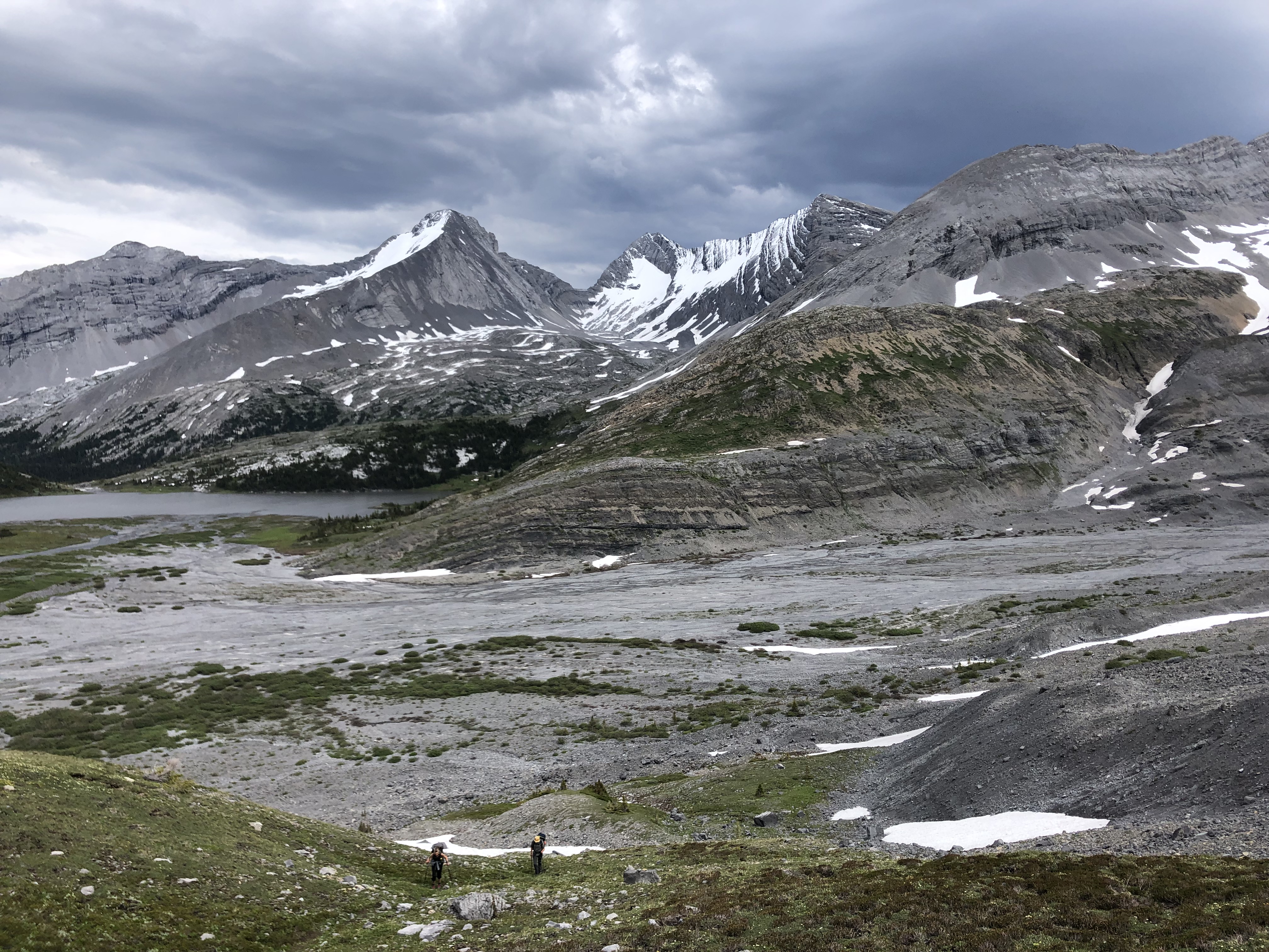
    The Great Divide Trail (GDT) is a backpackers’ trail.  Known as an epic thru-hike, it is over 1100 km long.  Divided into seven sections, with the shortest section about 100 km long, section hiking also entices backpackers.  But what if one wants to do a day hike on the GDT?  On a trail that can be easily driven to?

    The Carthew Alderson Traverse is a one-way, 20 km day hike in Waterton Lakes National Park.  It runs from Cameron Lake along the Akamina Parkway, to Cameron Falls in Waterton Townsite.  This stretch of the GDT is arguably one of the most beautiful.  It samples some of the best of what the GDT is known for – fir forests, creeks, waterfalls, meadows, turquoise lakes, high, barren passes, snowy mountain views that go on forever, and snow into July.  Shuttle service to Cameron Lake is available from The Tamarack outdoor store in Waterton Townsite.

    It was late July 2016 and during a solo trip, on my way home from Regina, I found myself in Waterton Lakes N. P. as it had been on my “list” forever to come here and hike.  Only prepared for day hiking, I car camped at the drive-in campground in Waterton Townsite, did some shorter day hikes, and explored the town – cute town.  Stopping in at Tamarack Outdoor Outfitters (now named The Tamarack), I learned about the Carthew Alderson Traverse and their convenient shuttle to its trailhead at Cameron Lake.  Yes! this had to be hiked.  I signed up for an early morning shuttle, and continued exploring the Townsite.

    Carthew Alderson Traverse Day, woke up early, had a big breakfast, packed two lunches plus snacks into my day pack, and off I went, walking over to Tamarack Outdoor Outfitters to catch the early shuttle to the trailhead.  Hikers had already started gathering on the front porch at Tamarack Outdoor Outfitters, milling around, introducing themselves, striking up conversation while waiting, as hikers do.  Mostly small groups.  Seeing I was alone, some invited me to hike with them.  I am old and slow.  They were all half my age or less, and likely much faster, so explaining a bit, I politely declined.  The bus showed up and we all piled in.  And we were off, up Akamina Parkway to Cameron Lake.  The chatting continued and before we knew it we were there.  Everyone piled off and headed for the trail.  Quite a crowd.  I held back so the fast, young ones could start first, not wanting to be continually passed in the first 500m.  Eventually, most were off down the trail, and a couple looking about my age, were still there with me.  They invited me to hike with them – Shannon and Serge from somewhere in BC.  Very nice people, and off we went, our Merry Band of 3.

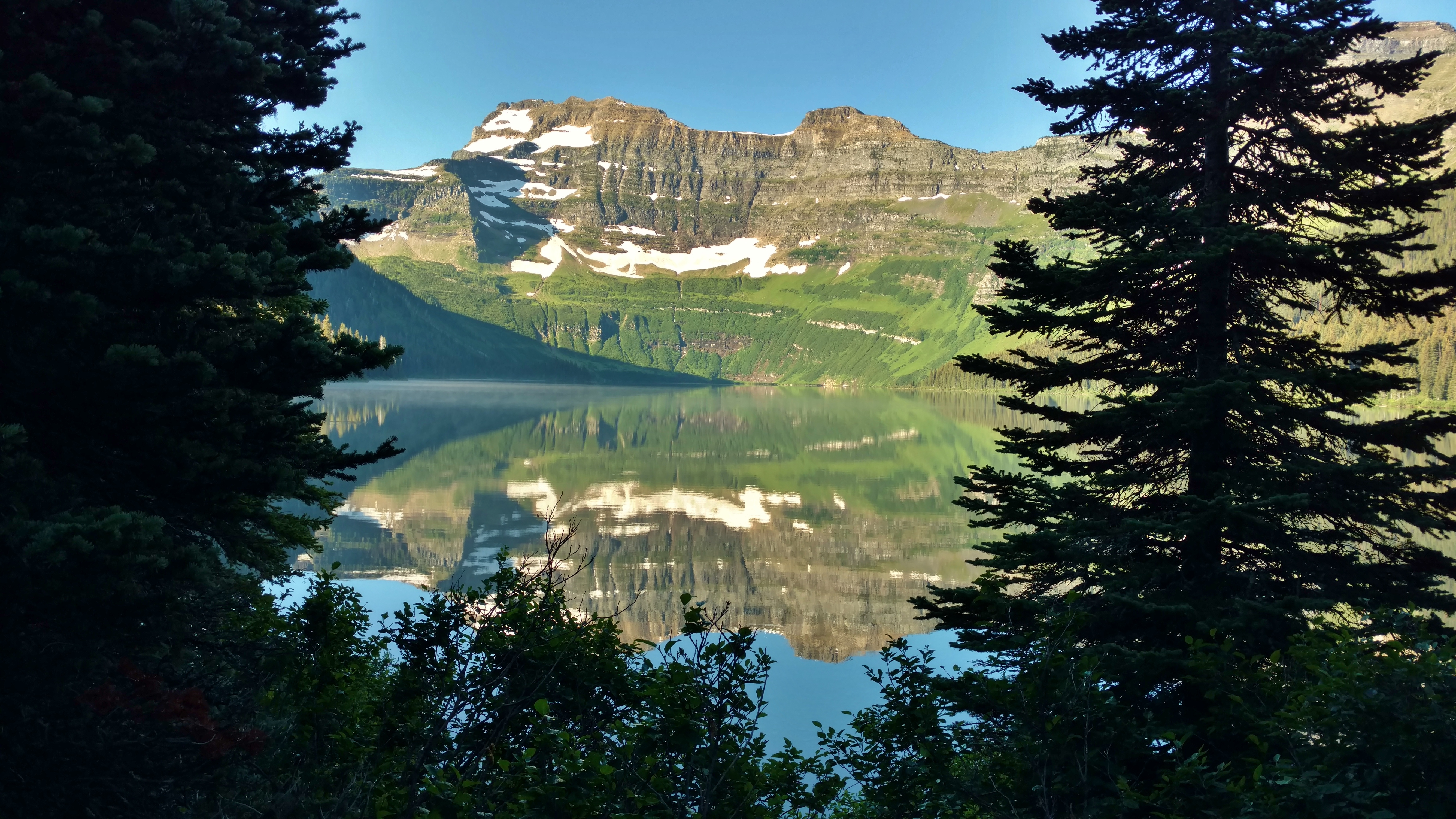
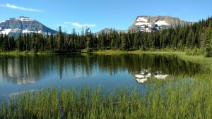
    The trail started flat, in the fir forest.  It did not disappoint; almost immediately we passed Cameron Lake with Mount Custer looming over its far end.

    waterton_lakes_cameron_lake_1
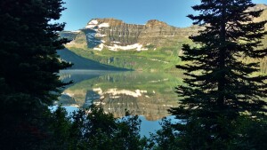
Mount Custer reflected in Cameron Lake

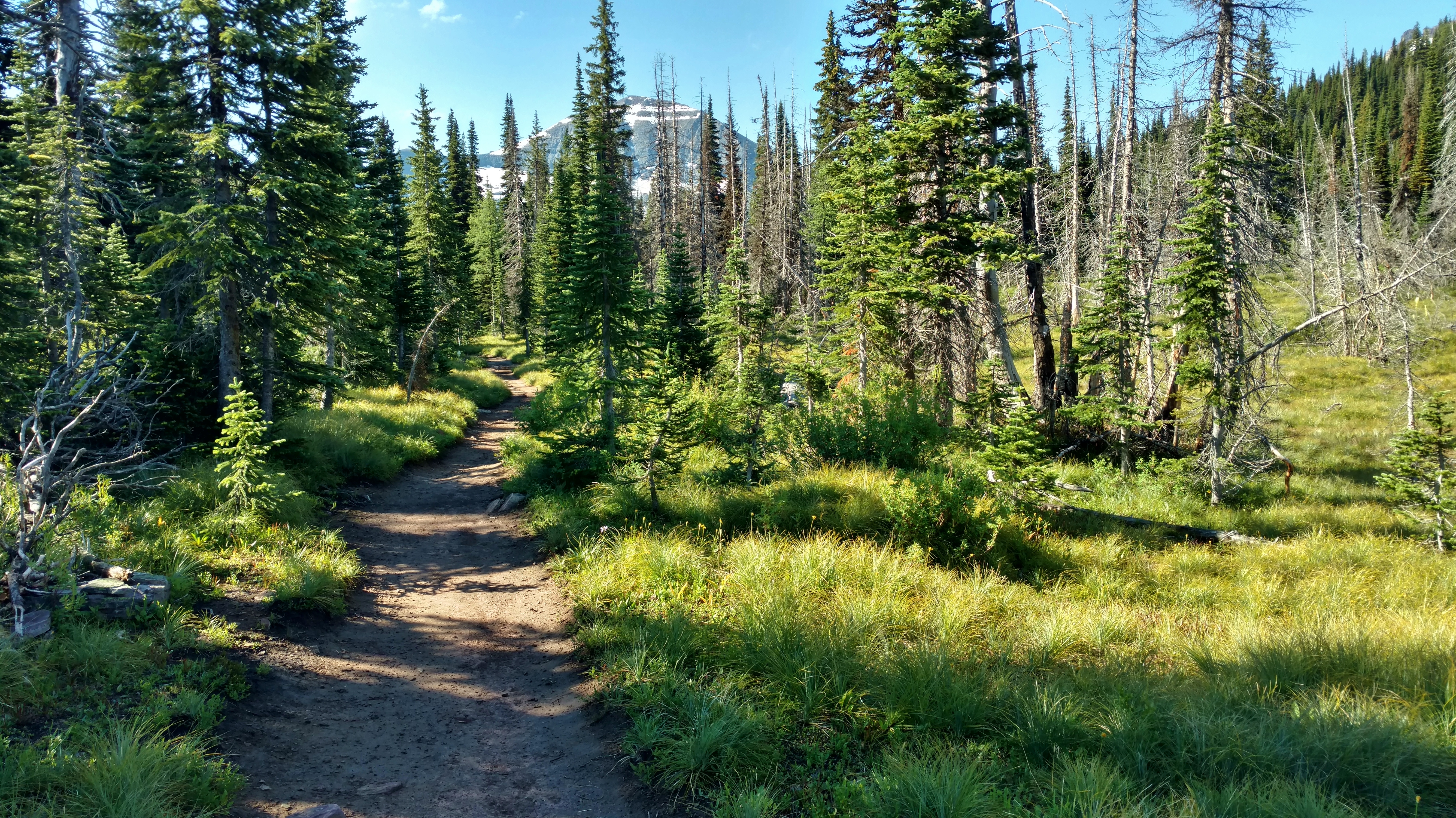
    Continuing on at a steady, leisurely pace we enjoyed the fir forest as the trail began its climb.  The climb, on long switchbacks in the cool forest, was not very steep, quite pleasant.  Gentle enough to carry on a conversation (which of course, we did).  We soon noticed the trees had thinned as we had gotten higher.

    waterton_lakes_carthew_alderson_1
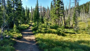
Thinning fir forest along the trail with glimpses of Chapman Peak through the trees

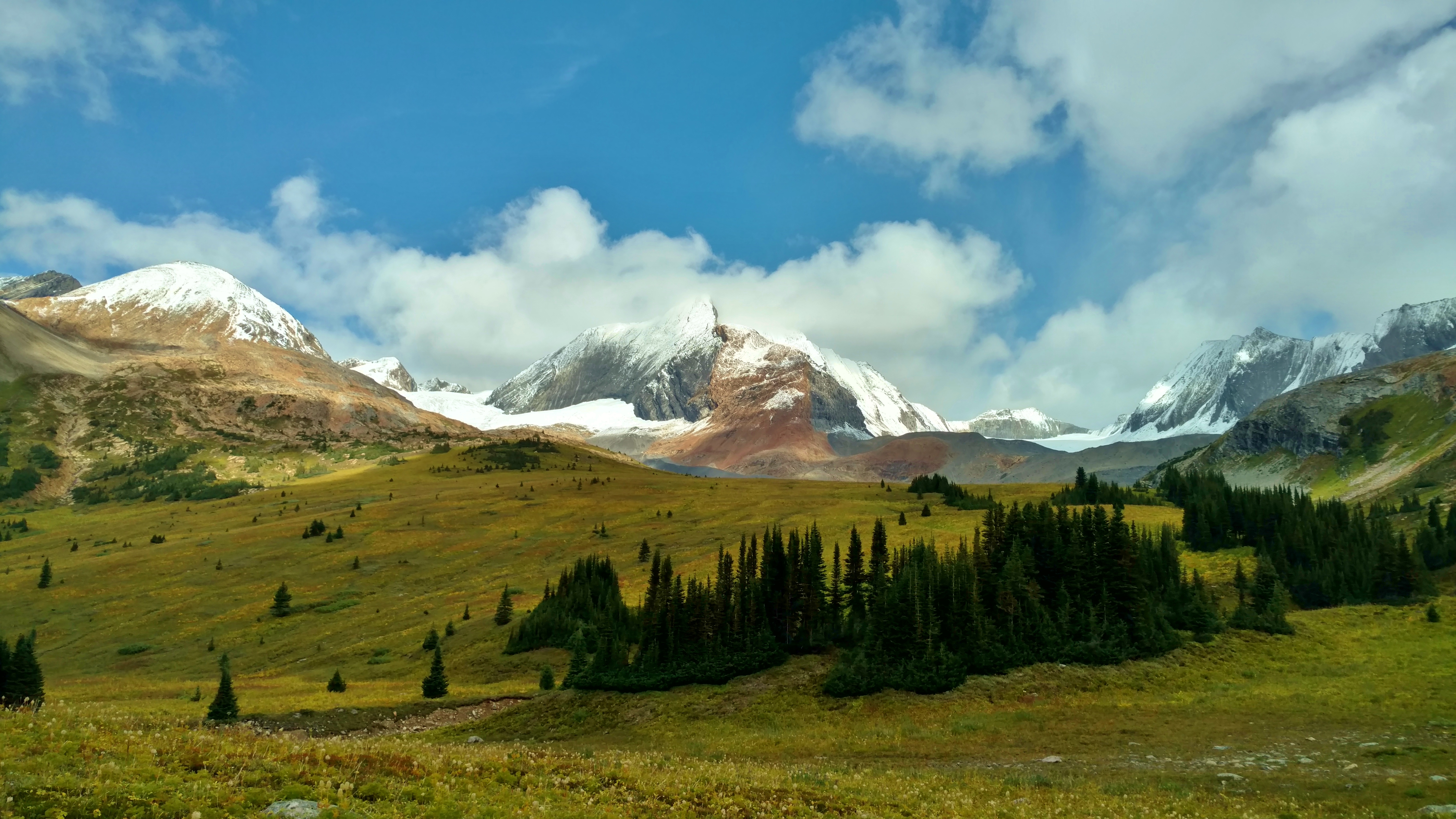
    After a few kilometers we finished our last switchback (for now), and found ourselves in beautiful, green, grassy meadows.  We soon arrived at Summit Lake.  This is a very deceiving name; there is no “summit” here at all, and we still had a lot more uphill ahead.  But what a beautiful setting!  The tops of snowy Mount Custer and Chapman Peak poked up above the trees on the far side of Summit Lake.

    waterton_lakes_summit_lake_1Chapman Peak (left) and Mount Custer (right) rise behind Summit Lake

    At Summit Lake, there was a trail junction.  One could continue straight and flat, and end up in the States, enticing, but not where we wanted to go.  Or one could turn left and start uphill again.  We turned left and started climbing again, gradually.  The scenery just got better and better.  The trail was on a hillside, with firs on the right.  On the left, a broad, very green valley of meadows and firs dropped off below.  And behind us in the distance was a wall of snowy mountains including Chapman Peak and Mount Custer.  The trail itself was lined with greenery and blooming bear-grass.  All just gorgeous!

    waterton_lakes_carthew_alderson_2Mount Custer (distant center) to the south along the trail

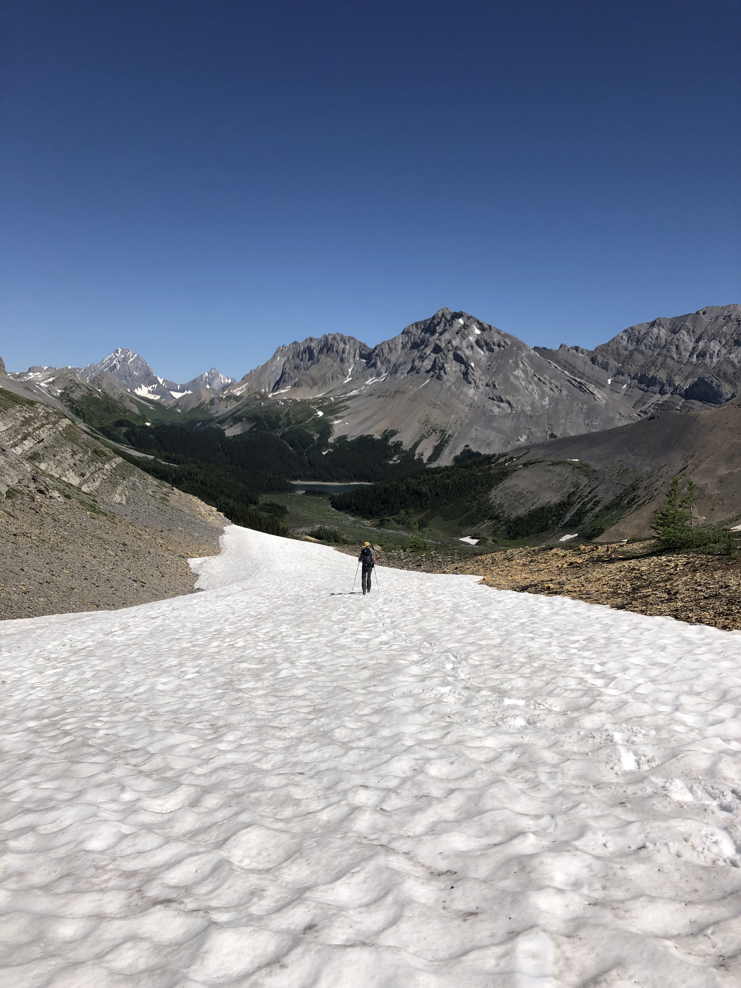
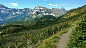
    After another few kilometers, still on the hillside, the trail curved left, and now above tree line, we found ourselves on a loose rocky slope.  Looking up the slope there was a barren, rocky saddle between two mountains – Mount Carthew and Mount Alderson.  And that was where we had to get to.  But it was still a ways off and the slope was steep.  Fortunately, once again there were long, gentle switchbacks.  And the trail was good… for a rocky slope.  We slowly made our way up, taking many scenic rest breaks along the way.  And they sure were worth it!  We had a better view of the green valley below.  And the remote North Lakes – Lake Wurdeman (left) and Lake Nooney (right), could now be seen between Chapman Peak and Mount Custer.  These lakes and the wall of mountains behind them, are all across the border, in the northernmost part of Glacier National Park in Montana.  This side of these mountains and the lakes at their bases are not accessible by trail (or road).

    waterton_lakes_carthew_alderson_3Left to right – Chapman Peak, Lake Wurdeman, Lake Nooney, Mount Custer

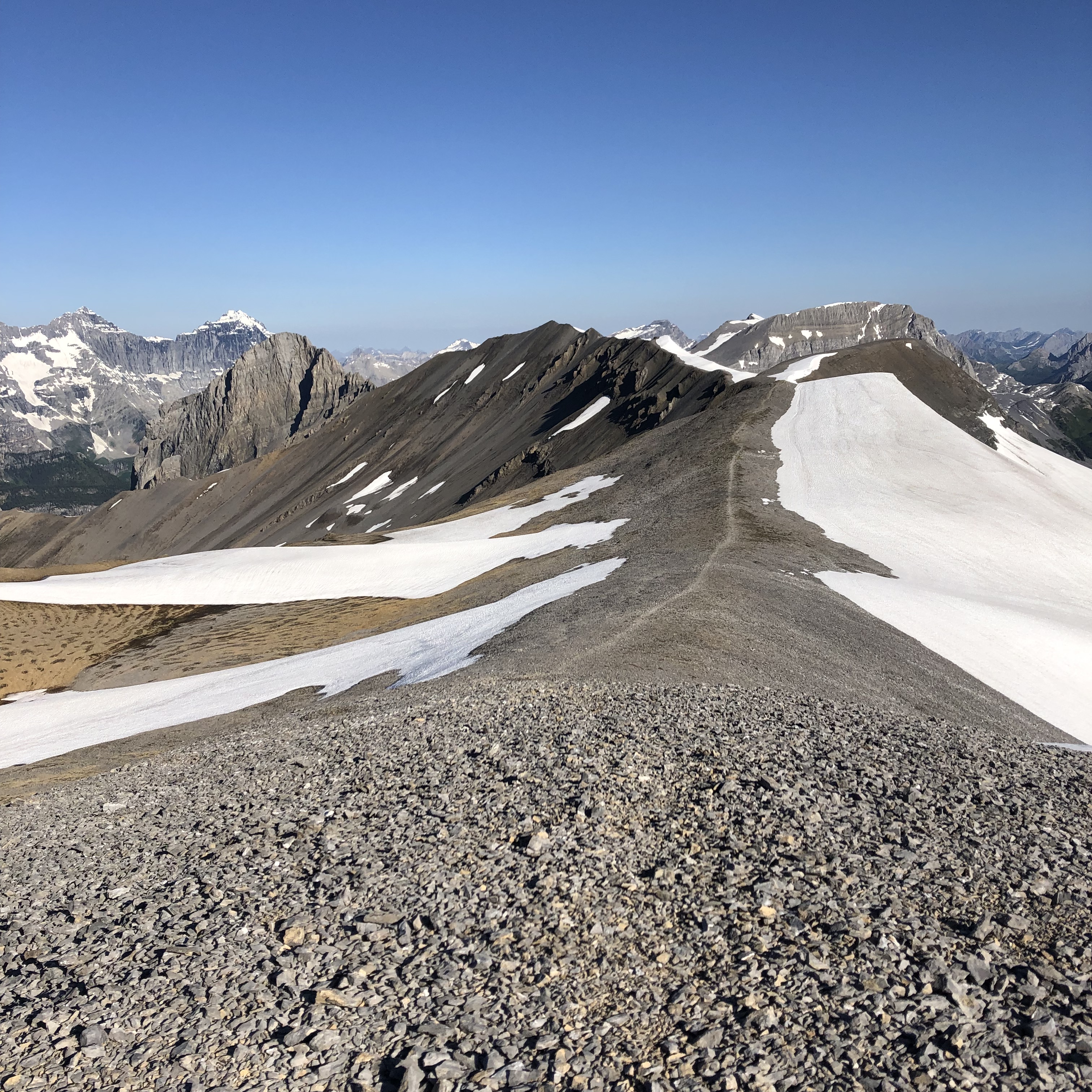
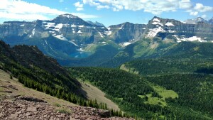
    We finally reached the saddle.  It was breezy, but not unpleasant, and the view was great!  Now at the saddle, the view on the other side to the north, opened up.  It was a very different view, but just as awesome.  The three turquoise Carthew Lakes were strung out in a line into the distance in the valley below.  The steep rocky sides of this valley were the slopes of Mount Carthew ahead on the left, and Mount Alderson ahead on the right.  In the very, very far distance in the haze, we could see the prairies.

    waterton_lakes_carthew_lakes_1
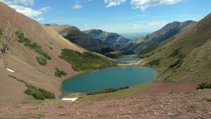
Three Carthew Lakes in the valley between Mount Carthew (left) and Mount Alderson (right)

    The trail went along the ridgeline of the saddle for a ways.  Behind, to the east, a shoulder of Mount Alderson rose up from the saddle.  And ahead was a shoulder of Mount Carthew to the northwest.  We reached the point where the trail turned right and started descending, and decided we didn’t want to leave these hard earned views yet.

    Lunch time!  We sat down on the rocky slopes to eat.  We ate slowly, conversed, and just enjoyed the scenery on this beautiful bluebird day.  After quite a long break we packed up and our Merry Band of 3 was off again.

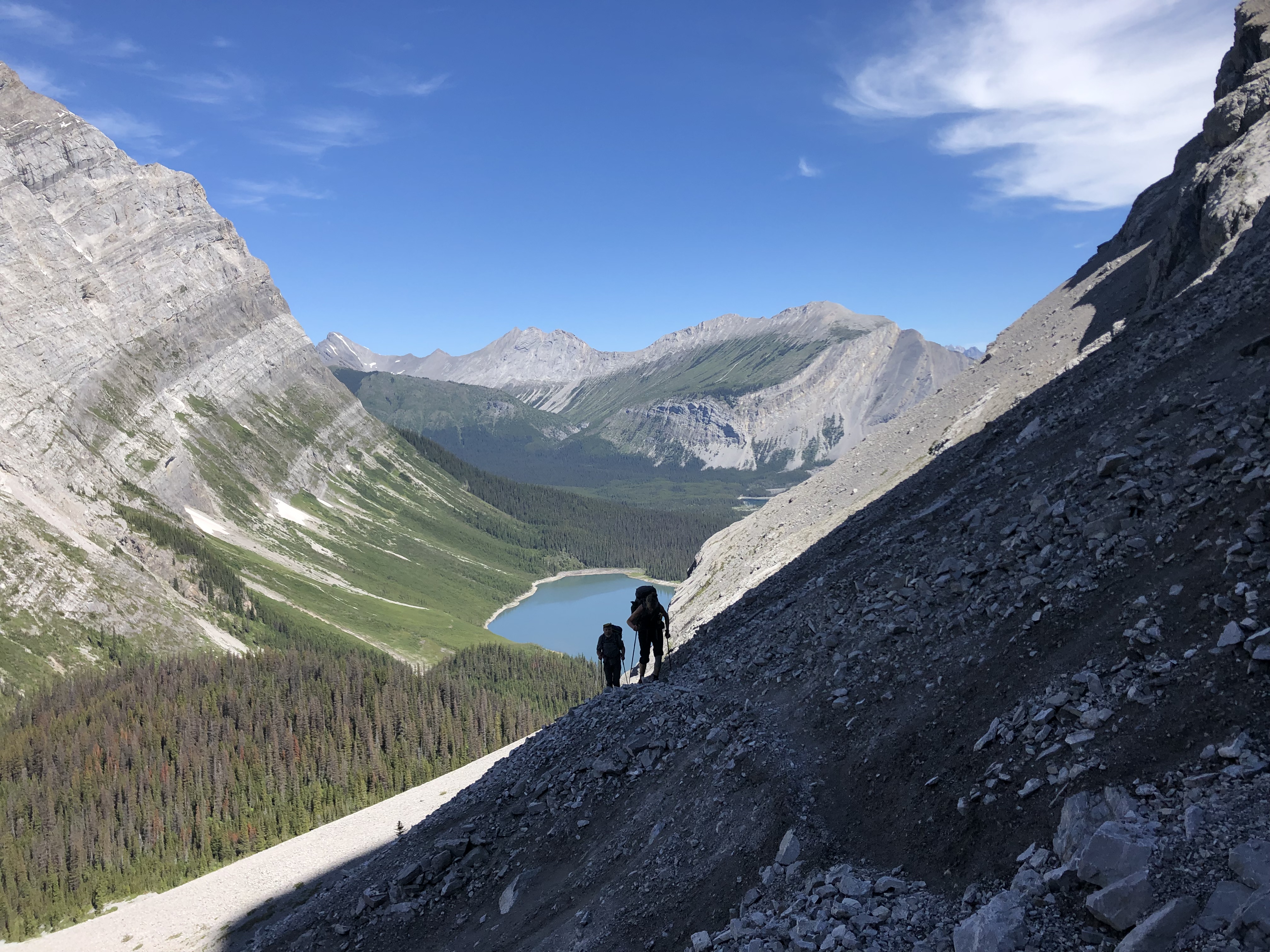
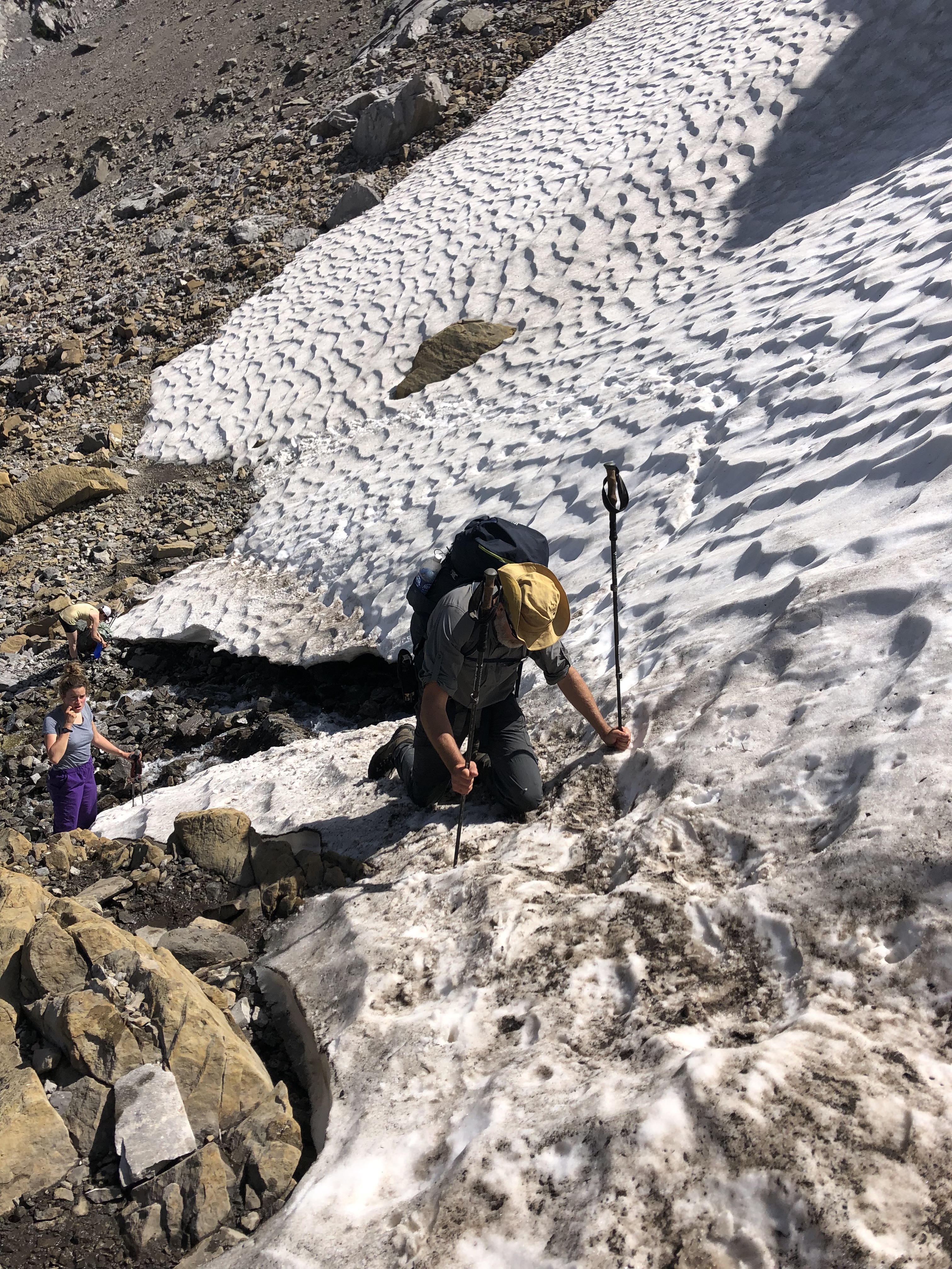
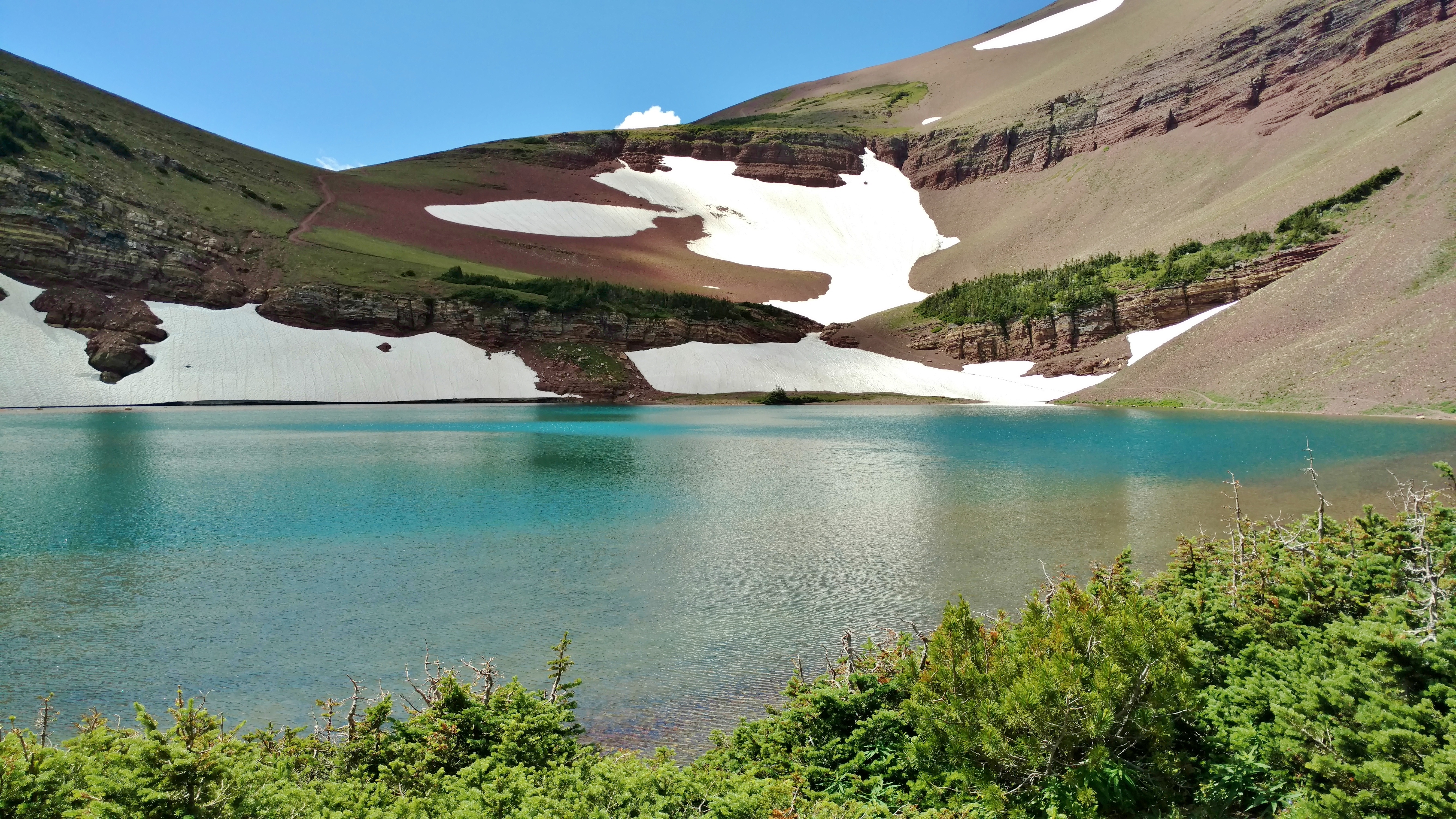
    We descended the loose rocky slopes to the first of the three Carthew Lakes.  Here on the north side of the saddle, there were still snow patches in late July.  The trail crossed a snow patch that went right down to the edge of the lake.  The snowy slope above the lake was steep enough that we wished we had spikes, but we didn’t.  Carefully making our way across, we all made it without falling in the lake.

    waterton_lakes_carthew_lakes_2First Carthew Lake, the trail crosses snow just above the lake

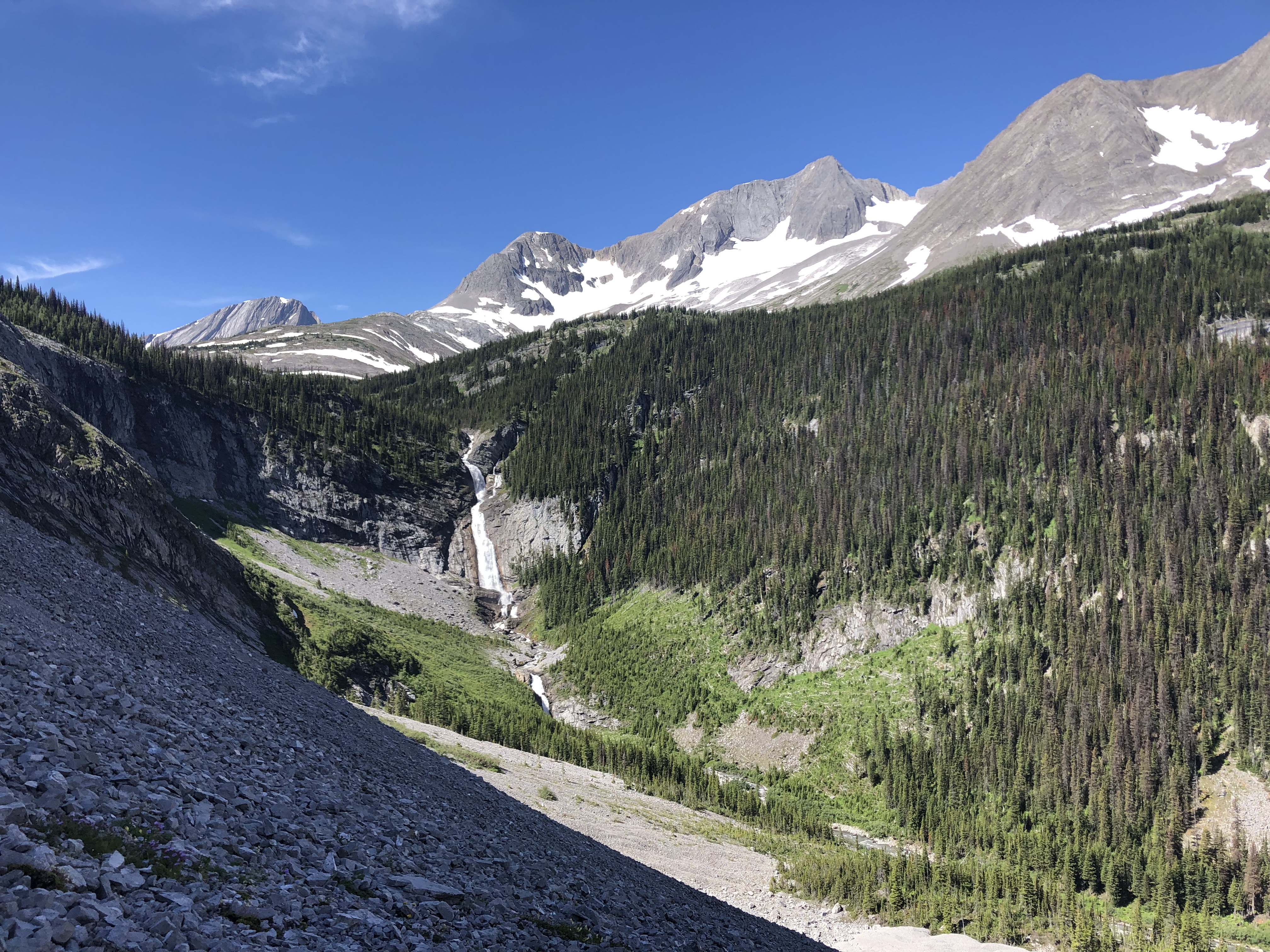
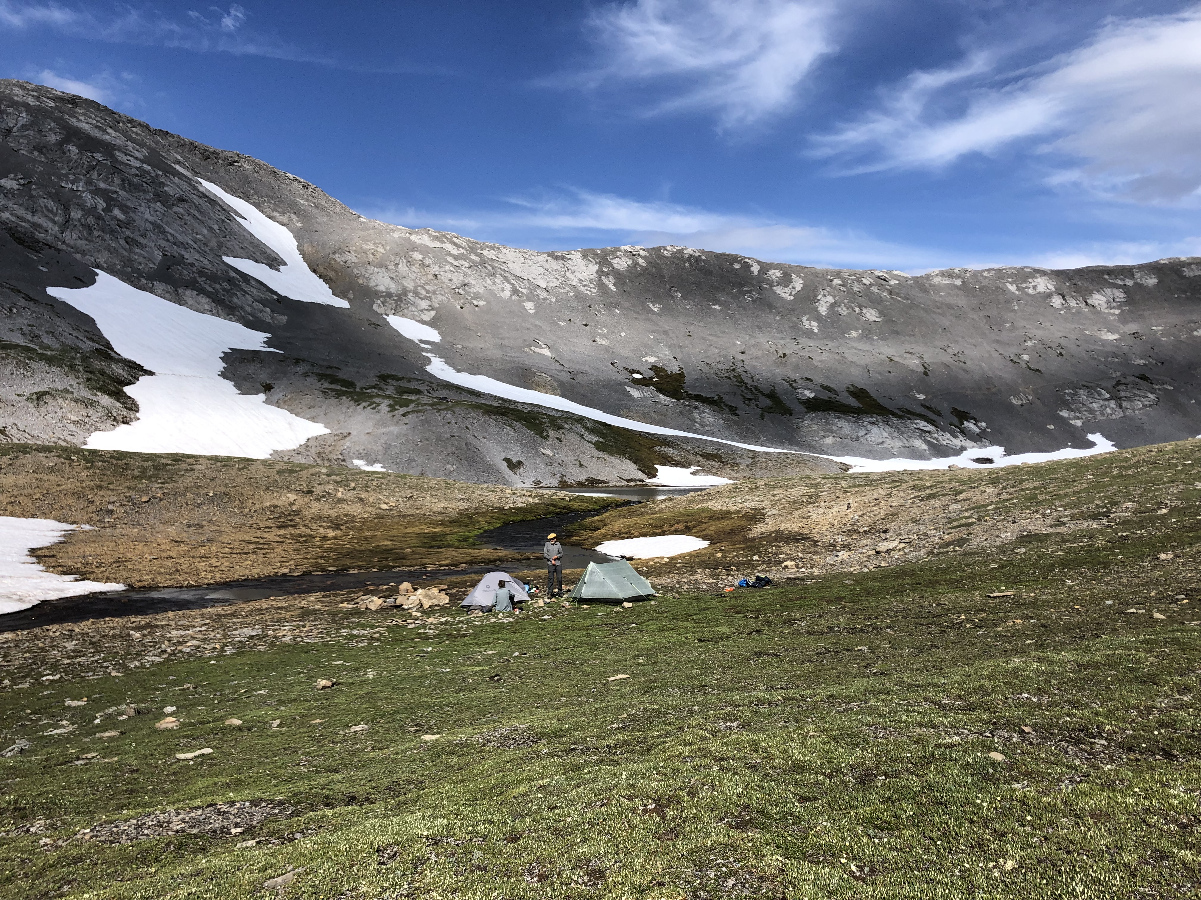
    From here, the trail ran along the west shorelines of all three Carthew Lakes.  The lakes were connected by creeks, and the outlet creek of the third lake was Carthew Creek.  Leaving the third Carthew Lake behind, we descended down a short slope back into grassy meadows.  Veering right after this short descent, we met up with Carthew Creek cascading down as a waterfall.  The trail crossed Carthew Creek at a break in the waterfall and soon came to a short spur trail that led to Alderson Lake where there is a trail camp.

    Traveling on and continuing to gradually descend, the trees, small at first, re-appeared.  Soon we were in a full-fledged fir forest.  In the forest, the trail ran in the Carthew Creek Valley for about the next 6 km.  Carthew Creek could be heard, but not seen, at the valley bottom.  The hike was getting long now.  The Merry Band of 3 was munching on trail mix as we hiked on down the forested valley.  It was a beautiful forest, but after the earlier dramatic views, we were all eager to get back to town.  After about an hour of this forest hiking, louder water sounds could be heard, and we reached the bend to the right in the trail where Carthew Creek emptied into Cameron Creek.  Now we followed Cameron Creek downstream on a steep hillside, with a view of Waterton Townsite below, in the not too far distance.

    Before we knew it, our Merry Band of 3 popped out of the trees at Cameron Falls and paved road.  It was late afternoon, about 4pm, and we were all rather tired.  We wished each other well and said our good-byes.  What a glorious day!  What a beautiful 20 km of the GDT!


  • Alberta Coal Lease Impacts on the Great Divide Trail

    Alberta Coal Lease Impacts on the Great Divide Trail

    In May 2020, the Alberta government rescinded, without public consultation, its 1976 Coal Policy, banning open-pit mining on Category 2 lands since they were deemed vital to environmental protection.  This decision to rescind exposed these Eastern Slope headwaters to coal exploration and strip-mining, and resulted in more than 350 new coal agreements.

    As a result of an outcry across the province, on January 19, 2021, Alberta’s Energy Minister, Sonya Savage, announced a temporary pause on future coal lease sales and the cancellation of 11 coal leases.   On February 8, Minister Savage further announced a change of course, and that the Alberta government is “keeping the 1976 Coal Policy in place and committing to consult on a modernized policy”, and applications for additional exploration in former Category 2 lands will be prohibited pending “widespread consultations on a new coal policy”.

    The Great Divide Trail Association (GDTA) is pleased the government appears to be listening to Albertans who seek a voice in land-use decisions that affect these valuable headwaters, sensitive ecosystems, and critical wildlife habitats. However, the threat certainly remains with many coal leases remaining intact.  Among these intact leases are lands at the northern end of Willoughby Ridge, overlapping 4.5 km of the Great Divide Trail (GDT) – See maps below.

    GDT-CoalAgreements-sectionB-01 GDT-CoalAgreements-HighRockTrail-01 GDT-CoalAgreements-sectionA-01


    Coal exploration alone, including the installation of drill sites and exploratory roads, can negatively impact the environment and the GDT experience. However, the development of open-pit coal mining in or near the GDT’s corridor will most certainly negatively impact the world-class wilderness recreation experience the GDTA has worked hard to build over more than 40 years.  It will also reduce the environmental gains the GDTA has achieved while building and maintaining an environmentally sustainable trail along the Great Divide of the Canadian Rockies.

    The GDTA joins the voices of those Albertans who advocate for rigorous and collaborative land-use planning, where attention to the long-term impacts on water, soil, wildlife, and Alberta’s unique wilderness legacy are fully factored into policy.