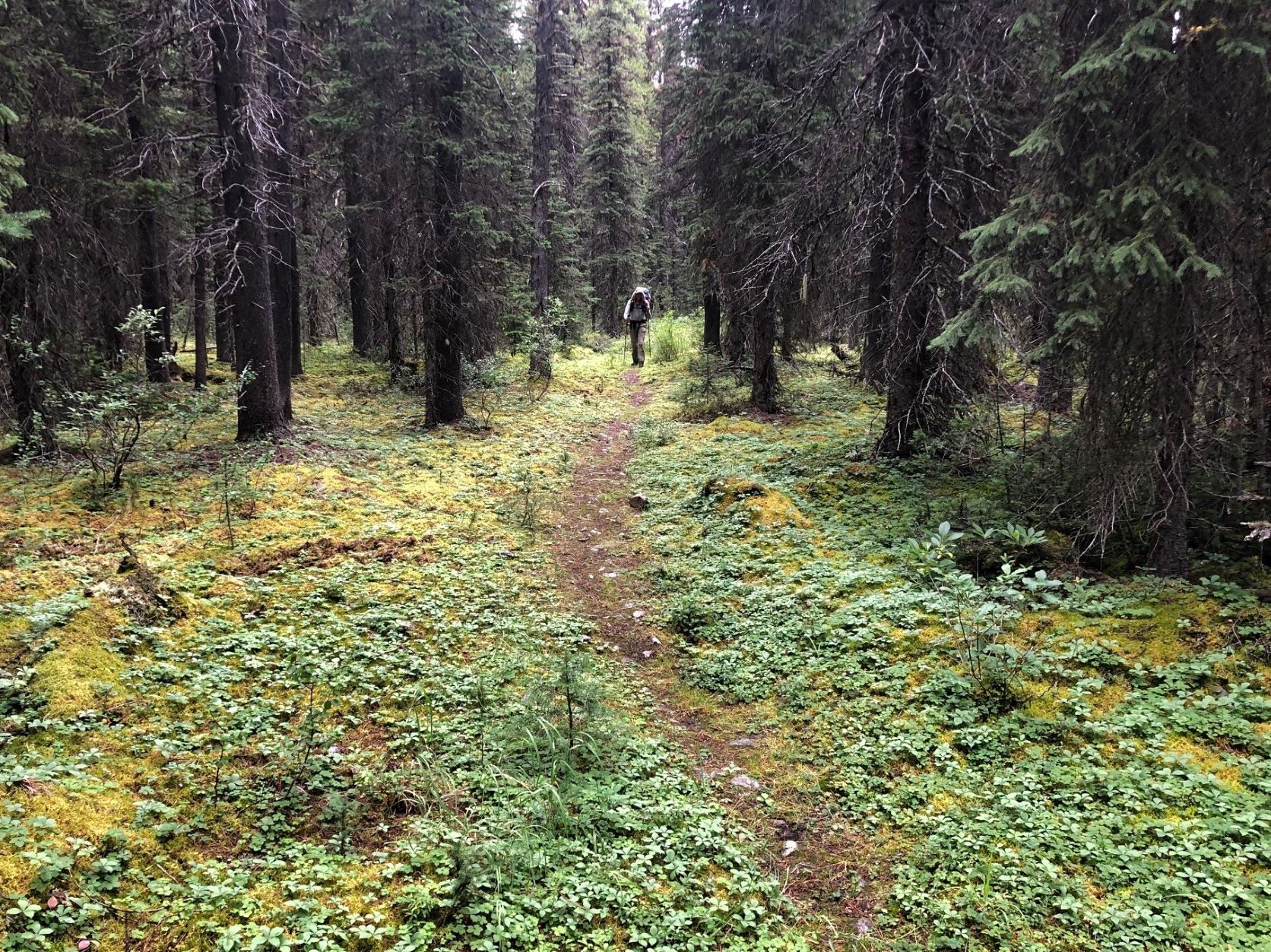
I haven’t done much trail work before. I don’t live near a long distance trail, and I’m a thru-hiker, through and through. That means my summers are for hiking. If I’m going to get on a plane for a couple of hours, it’s going to be to hike the Great Divide Trail, not to spend a weekend working on it. Sure, I’ll donate some money, become a member, and even write the odd piece for a newsletter. But that’s about as much as I thought I could do, living halfway across Canada from my favourite trail.
That all changed last spring. I opened the same email we all got from the GDTA with a list of dates and locations of work weekends. “That looks really fun,” I complained to Steve, my husband. “Shame we can’t go. Oh well. Maybe when we live closer.”
“What are you talking about?” he said. “We’ll be in the Rockies around then for our summer adventure. We can add a weekend to our trip. Maybe the one around Canada Day on the High Rock Trail.”
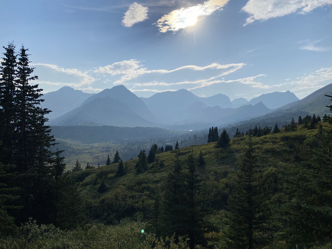
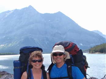
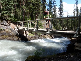
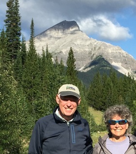
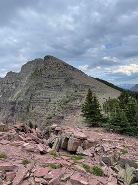
Exploring the High Rock Trail on our 2021 GDT thru-hike
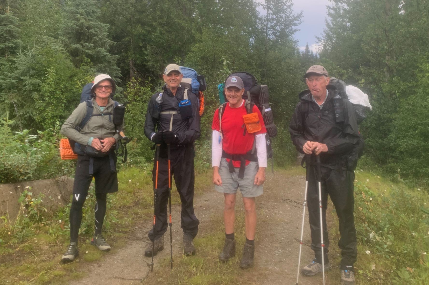
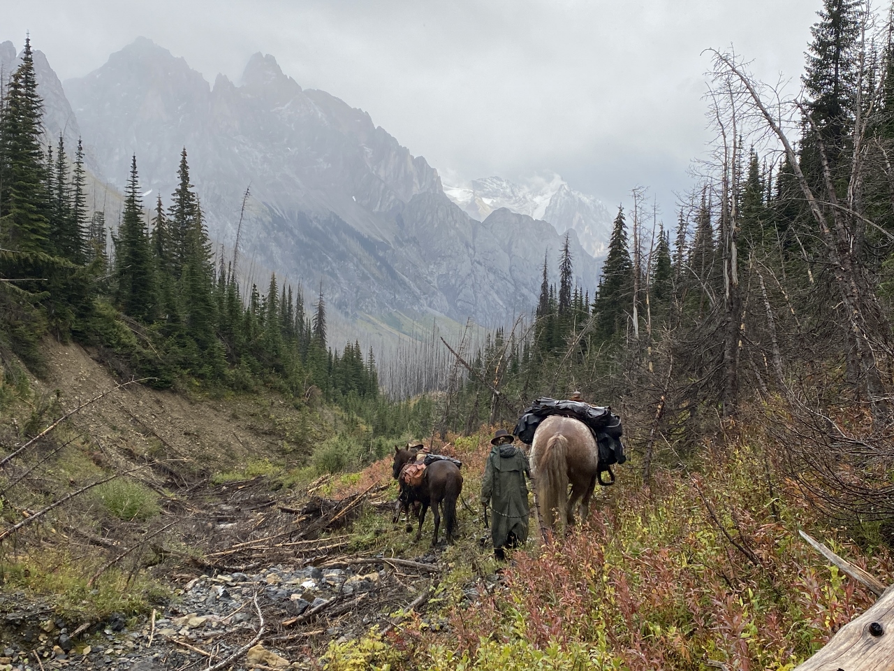
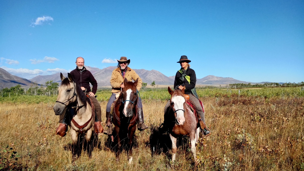
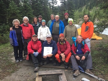
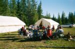
So at the end of June, we pulled into a clearing a few kilometers away from the High Rock Trail a day before the trip was supposed to start. Steve, Joe (our friend from our 2021 thru-hike) and I were greeted by canvas wall tents, a smoking firepit and GDT legend Doug. We wandered off to set up our tents, and by the time we returned to the firepit, Emily and Julien had arrived, also a little early.
“Well, we’re supposed to be building trail for an equestrian bypass around Window Mountain Lake this weekend,” Doug told us once we were settled. “But no one else will be here until tomorrow afternoon. Emily and Julien are going to go scout a route to get some of the trail off the ATV tracks tomorrow. Maybe you’d like to go with them?”
Go bushwhack through trailless subalpine forests underneath one of the most stunning rock walls in the world, getting scratched up by branches and potentially a little lost? It sounded like a thru-hiker’s dream. Helping choose where future thru-hikers would walk would just be a bonus.
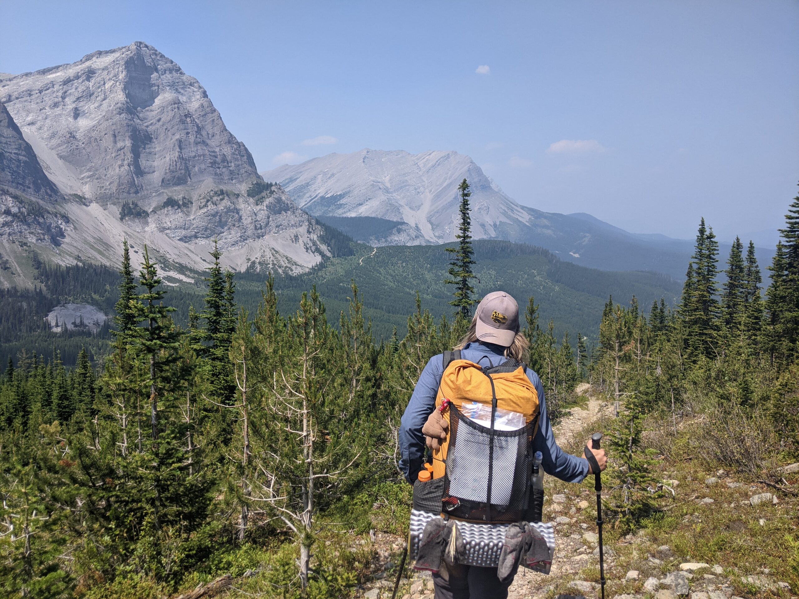
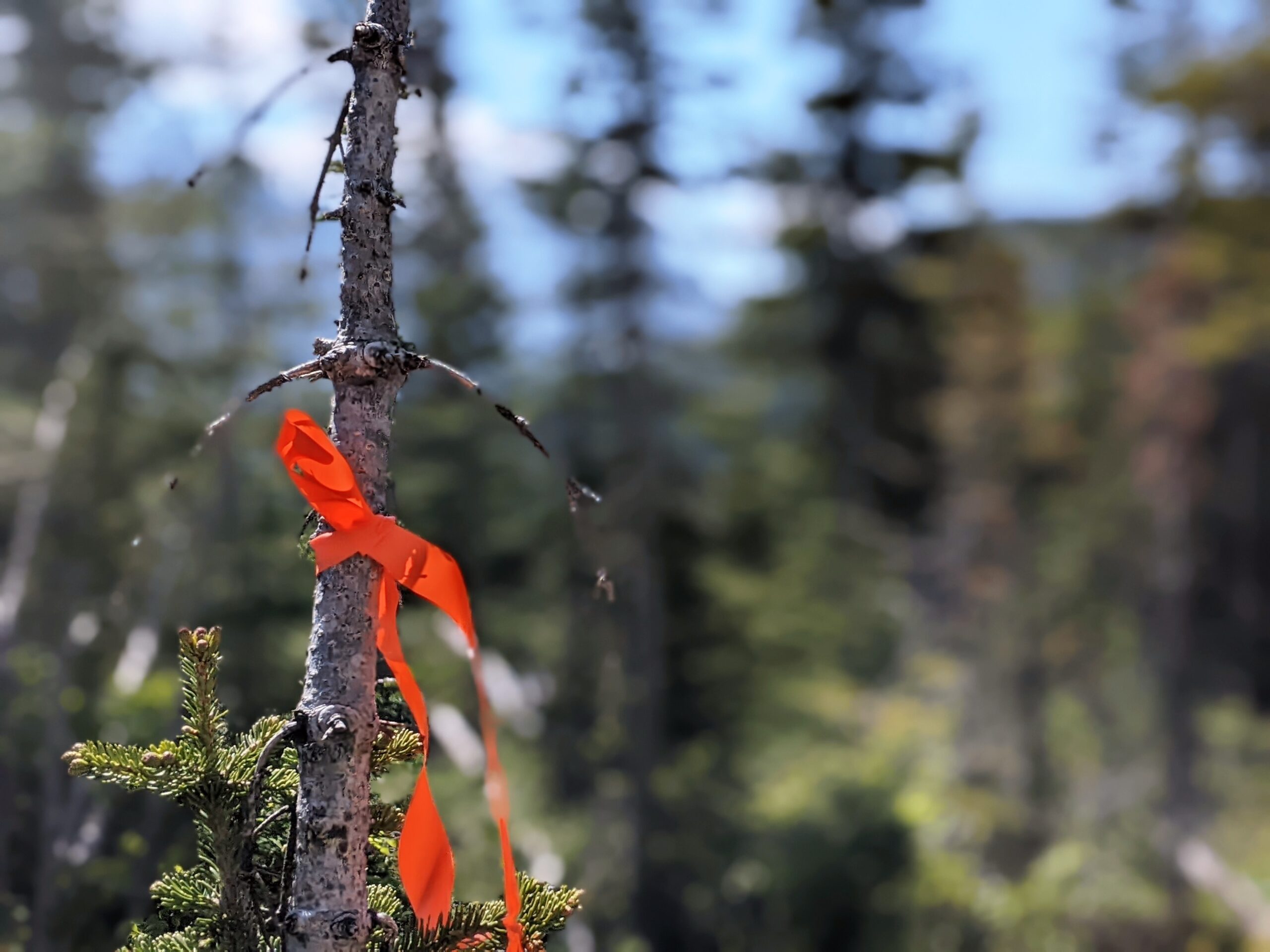
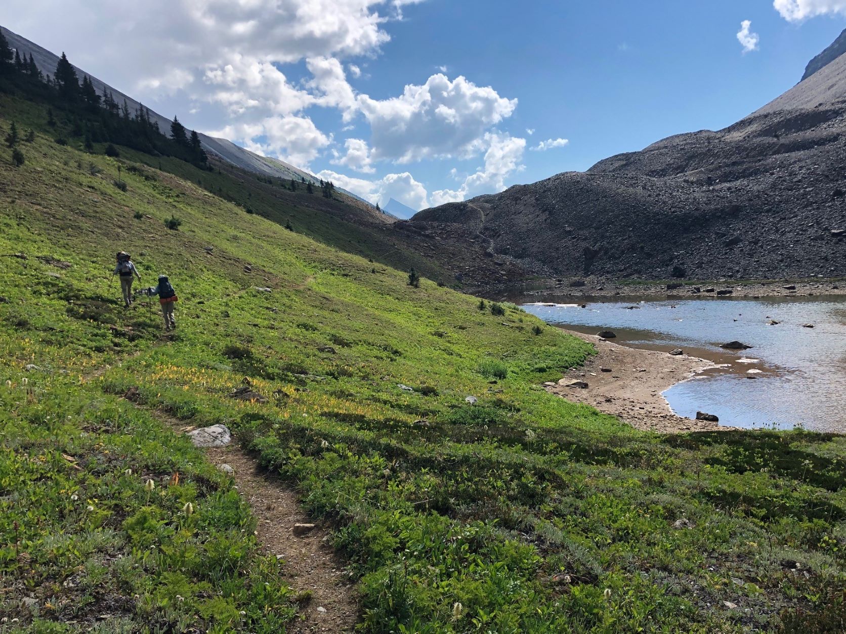
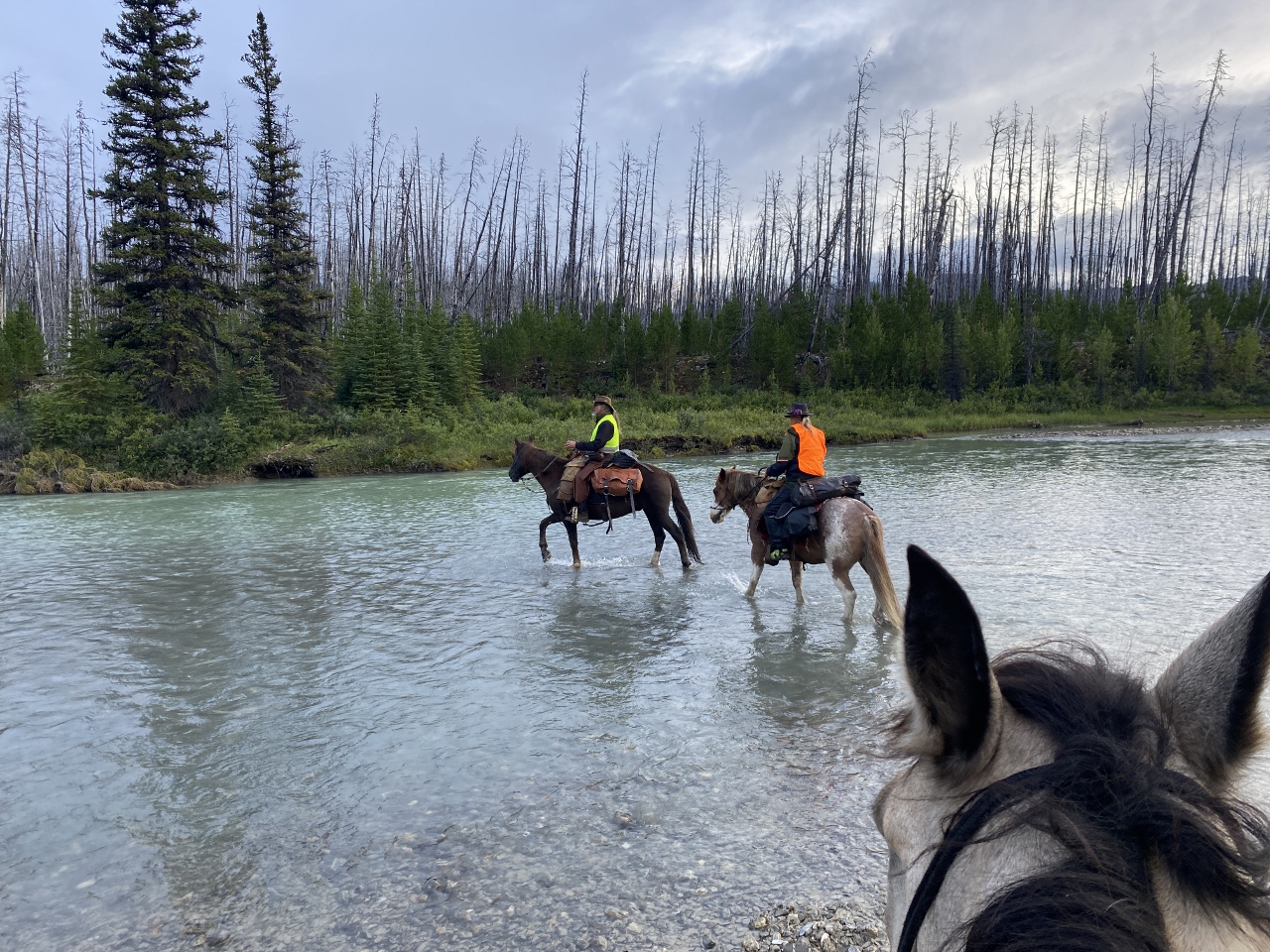
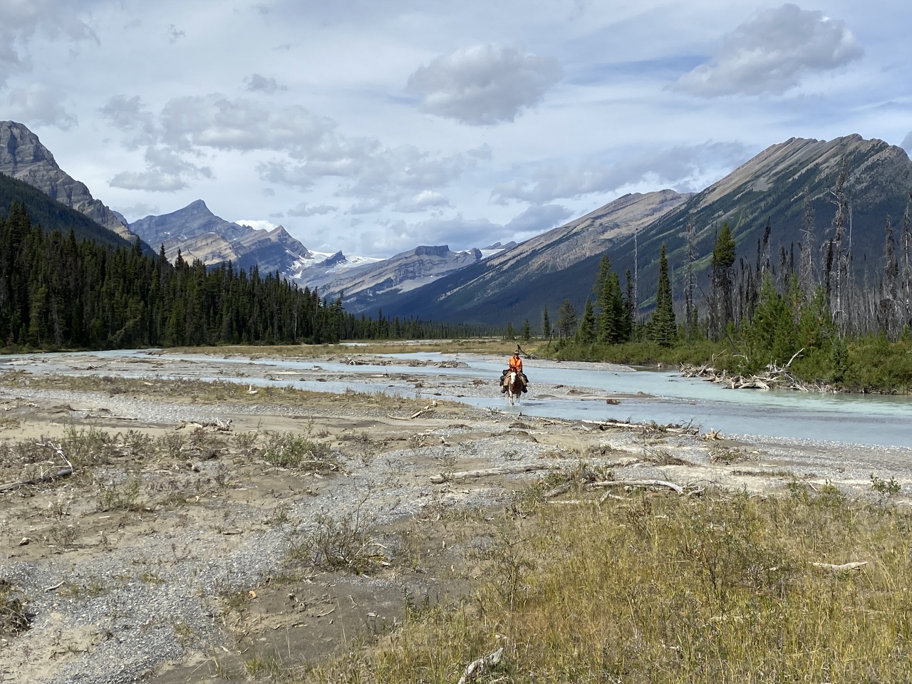
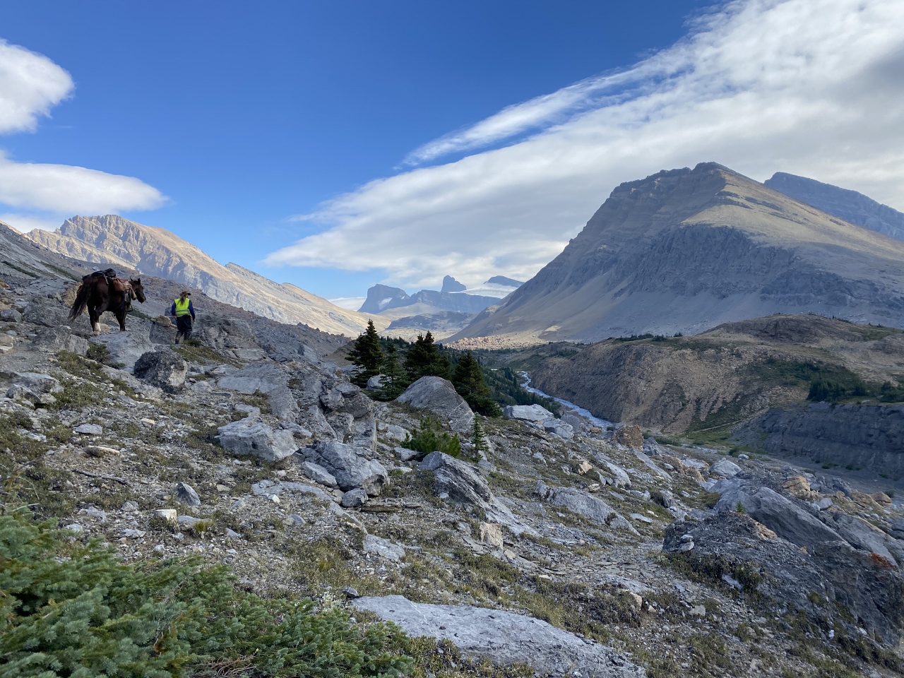
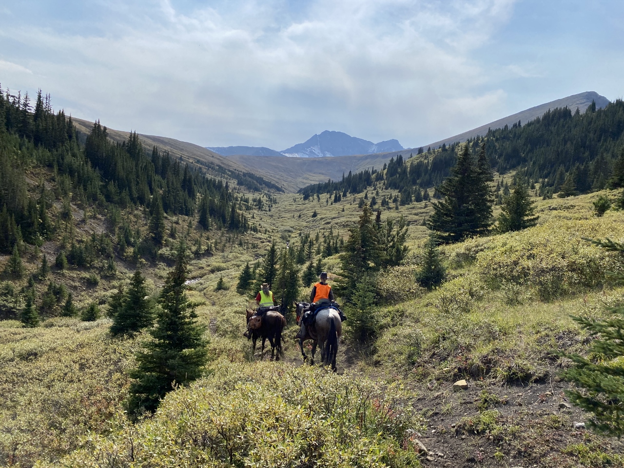
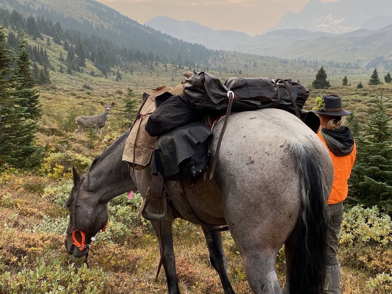
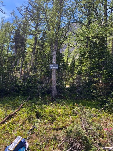
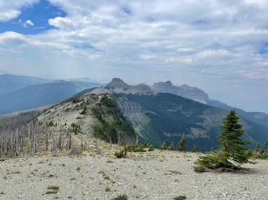
In the morning, we loaded up with orange flagging tape, lunch, and our normal hiking gear. Julien led the way up towards Window Mountain Lake on an ATV track, where we connected with the GDT.
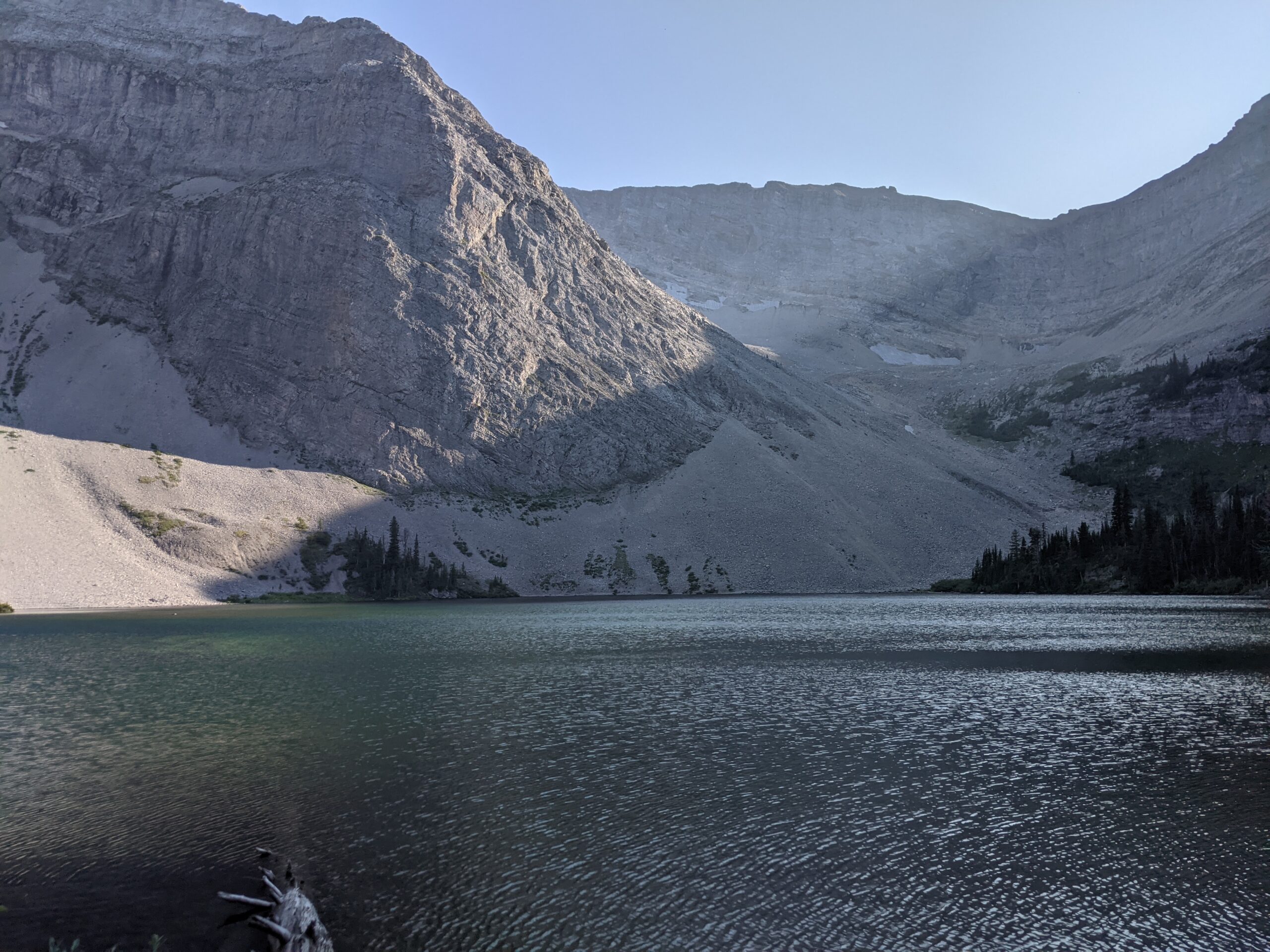
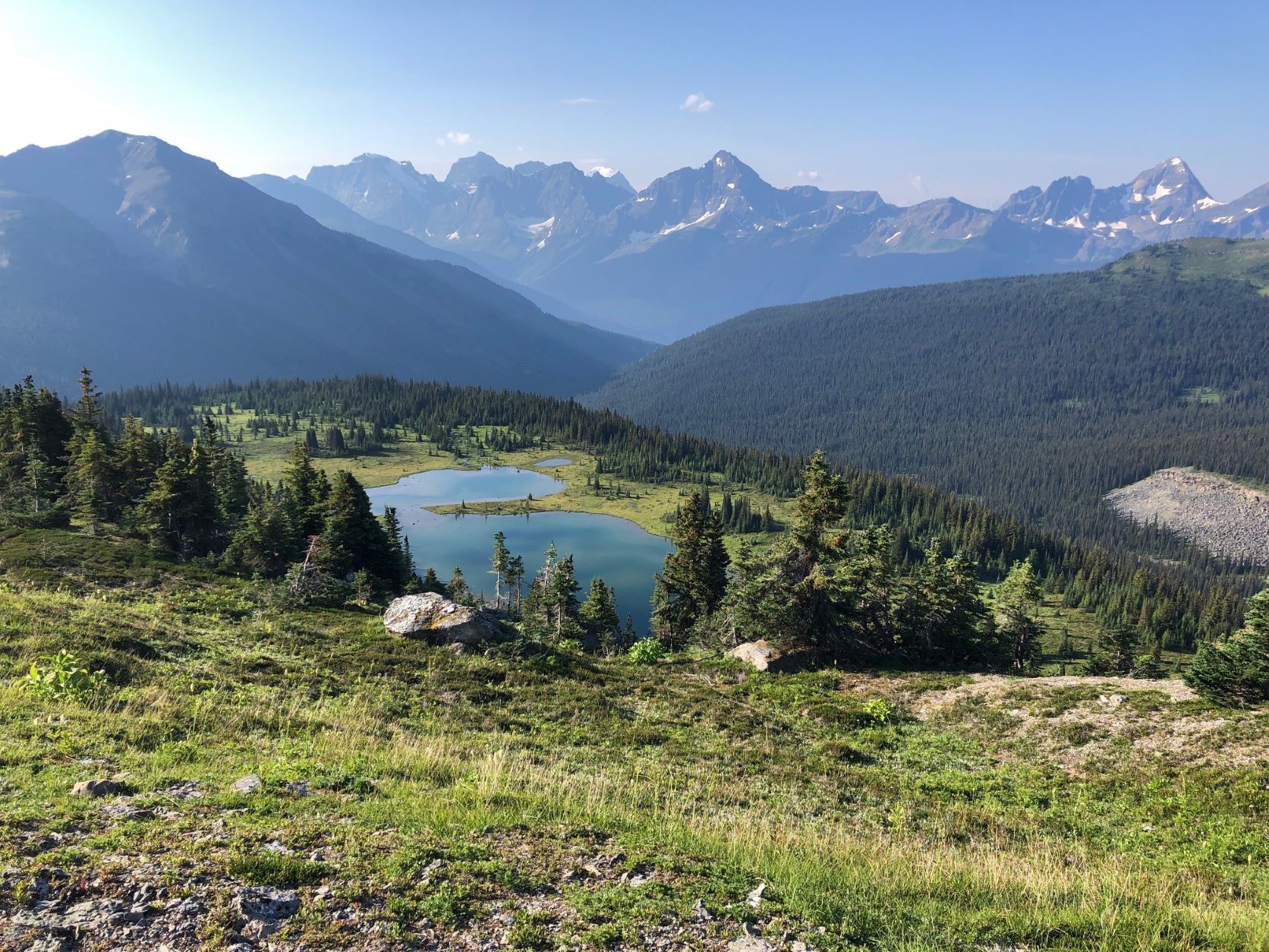
Jaw dropping Window Mountain Lake
If you’ve hiked the High Rock Trail, you know Window Mountain Lake. It’s a highlight: up there with Floe Lake. Massive snowy rock walls ring a clear green lake, and campsites dot the surrounding trees. It’s popular with weekend hikers, section hikers and thru-hikers alike. It’s one of the best bits of the High Rock Trail, if not the entire GDT.
The ATV trail preceding it is another story. Rutted, eroded and steep, you’re more likely to be buzzed by four wheelers than to see other hikers or cool wildlife. Rerouting the trail away from the ATVs would significantly improve the wilderness experience on this section.
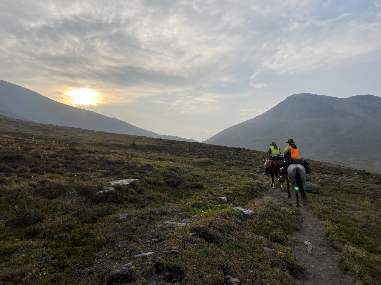
We headed away from Window Mountain Lake, bushwhacking towards an already completed section of singletrack. We jumped small streams, wandered through bogs and climbed over avalanche debris, before finding a clear route through a mostly open spruce forest. Julien and Emily taught us the best way to tie flagging tape to indicate switchbacks, and how to find the steepness of our potential new trail. By the time we were ready to quit, we had a good idea of where the trail would go. It was by no means perfect, but it was a start.
Flagging a route surrounded by stunning scenery
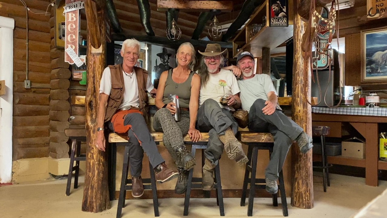
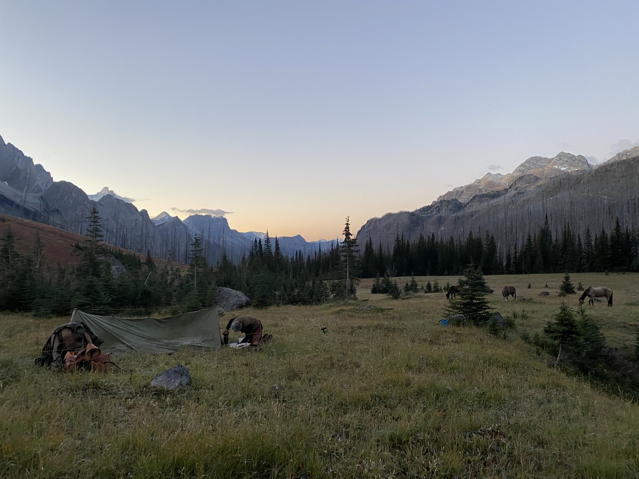
Tired and happy, we returned to camp. The rest of the work party had arrived, including a few familiar faces from our thru-hike in 2021. We made some dinner and settled around the campfire to eat.
One of my favourite things about thru-hiking is the community. I’ve met most of my closest friends on thru-hikes, and even met my husband on the Pacific Crest Trail. There’s an instant connection: you’re out there doing this crazy thing, and so are they. You build connections quickly and deeply, in a way that just doesn’t happen in the “real” world. I certainly wasn’t expecting to find a sense of community doing trail maintenance. But here we were, instantly clicking with a bunch of awesome, outdoorsy people.
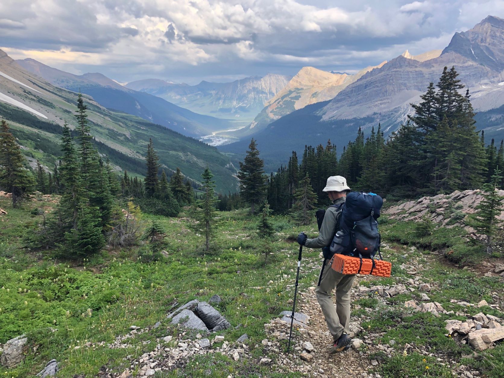
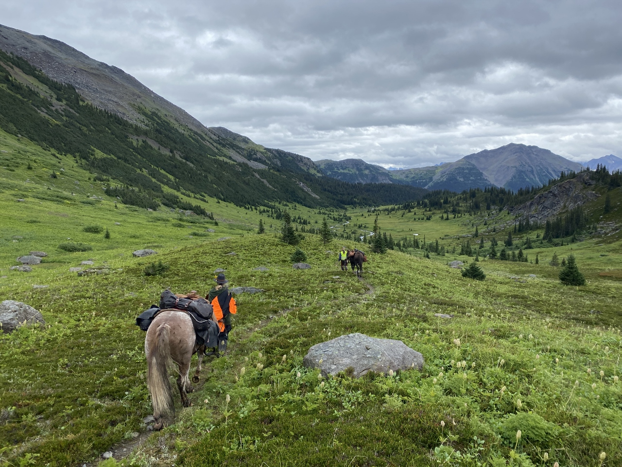
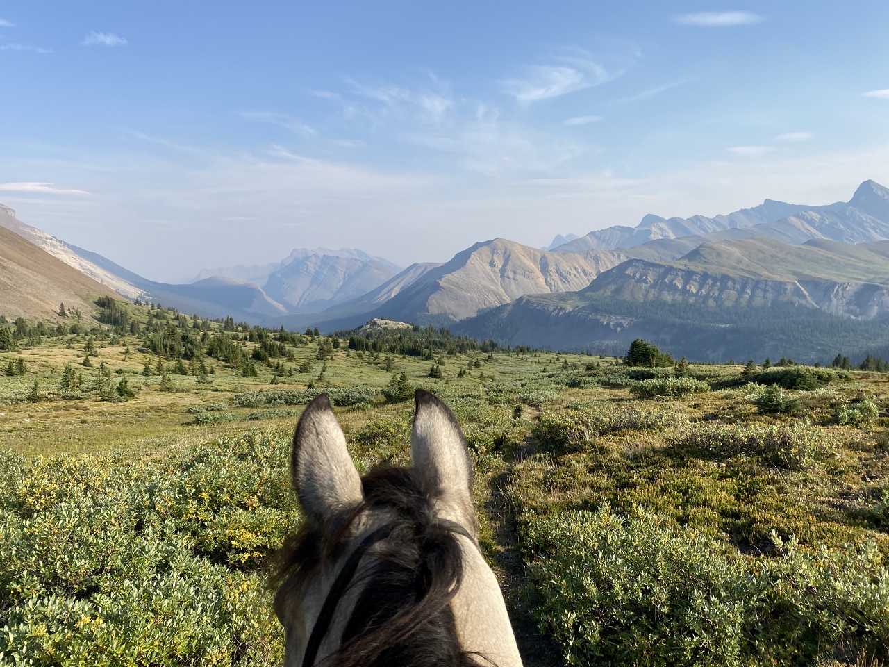
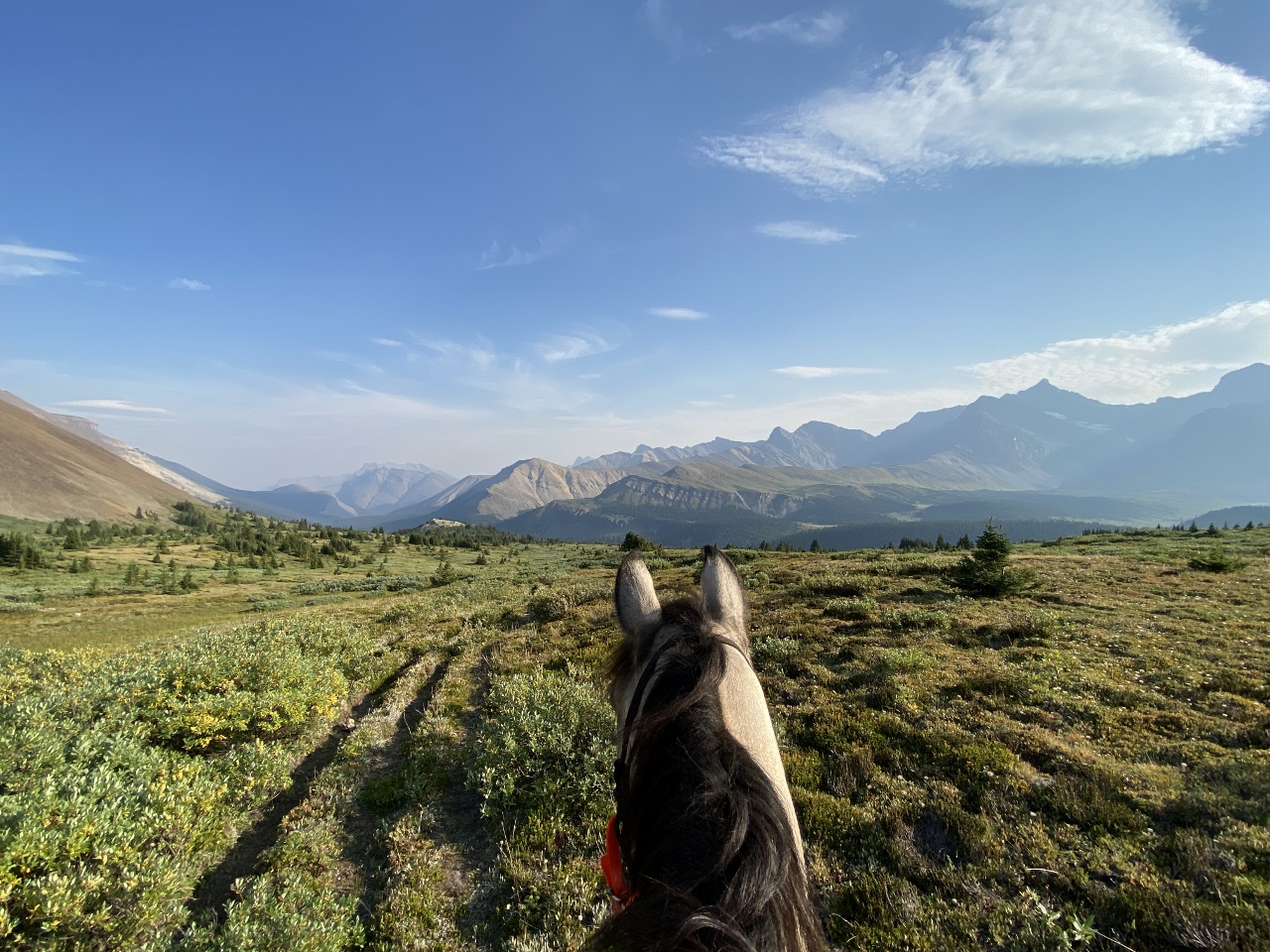
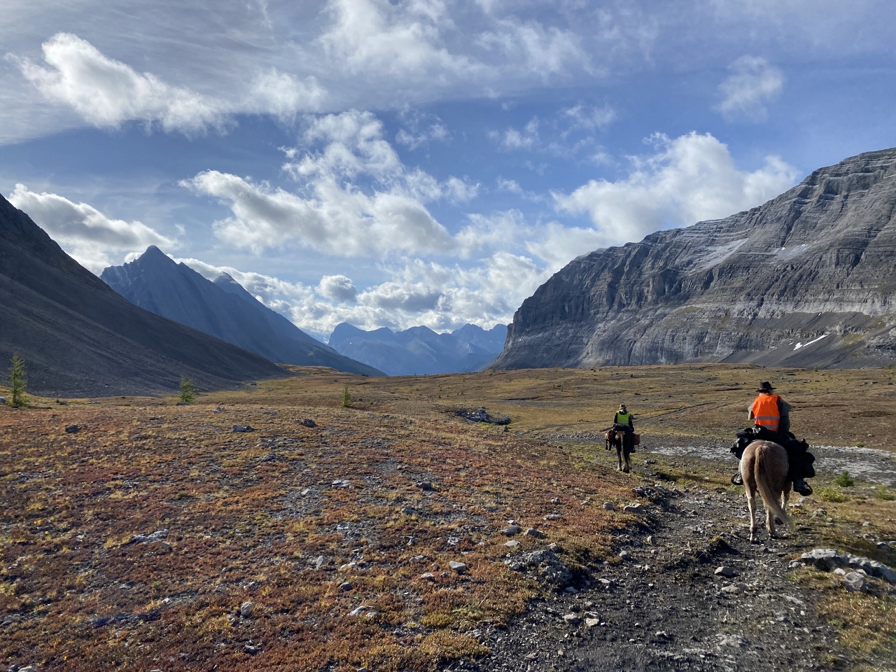
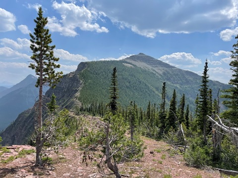
Day two dawned bright and sunny: perfect scouting weather. The rest of the group headed off to move rocks and build switchbacks, but we hiked back up to the HRT with Julien and Emily to pick up where we left off.
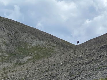
Hopefully one day the trail will go right here
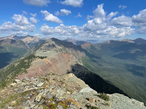
It didn’t take Julien long to find a route hugging the rock wall. “What do you think about going up here?” he asked. “We can connect back to the route we found yesterday at the top of the hill and miss the worst of the ATV trail.”
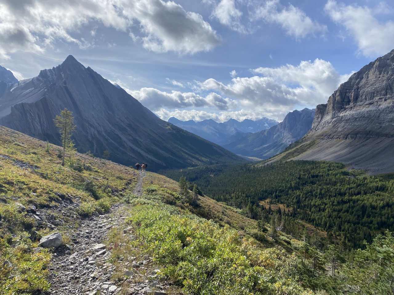
We looked at it for a while. The terrain this close to the sheer cliff face was mostly open: easy to navigate through with no bushwhacking. But new trees grew close to the scree slopes at the base of the wall. It looked like an avalanche had taken out their predecessors. I thought about some of the worst sections on the GDT: climbing through a pile of trees snapped like matchsticks at the approach to Tornado Saddle, or being delayed by 45 minutes north of Mount Robson by a wall of avalanche debris as tall as a house.
We debated for a little while. We were here during an epic high snow year with a late melt, earlier in the season than most hikers would come through and the path was clear of snow. There were no big trees around: it looked like they were swept away before they got large enough to block the path. We decided it would probably be fine (sorry future hikers if we are wrong!)
Flagging tape to mark prospective trail
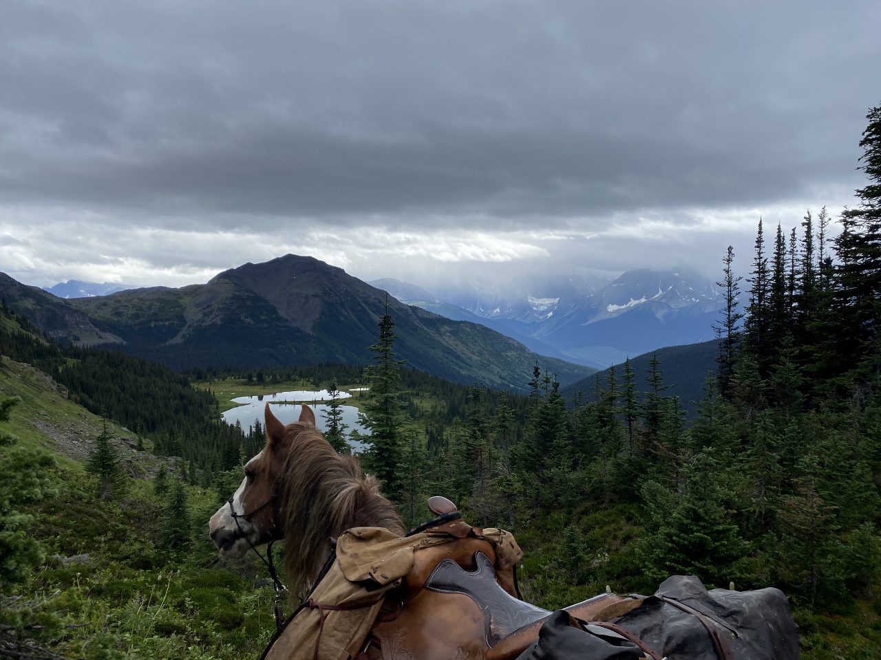
We spent the morning flagging a path that curved along an open rise, with 360 views of the cliffs above us and the valley below. Clouds built on the peaks, and after lunch we hurried back to camp, racing the thunderstorms.
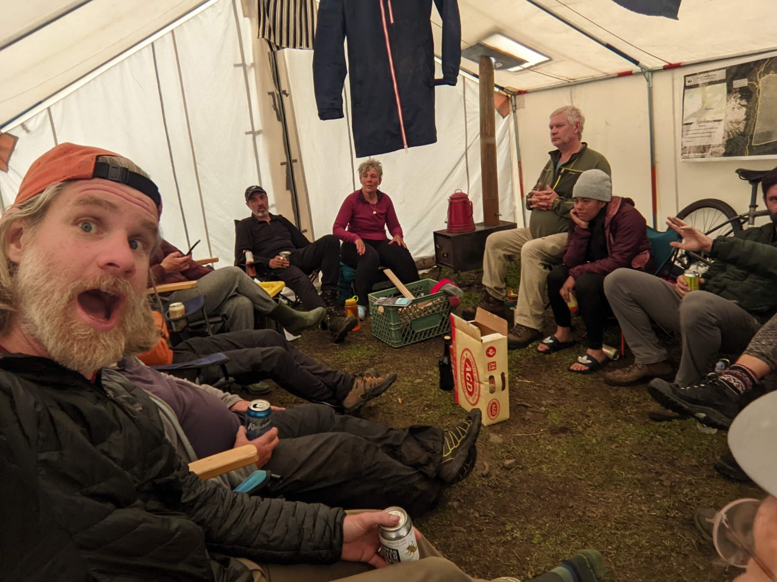
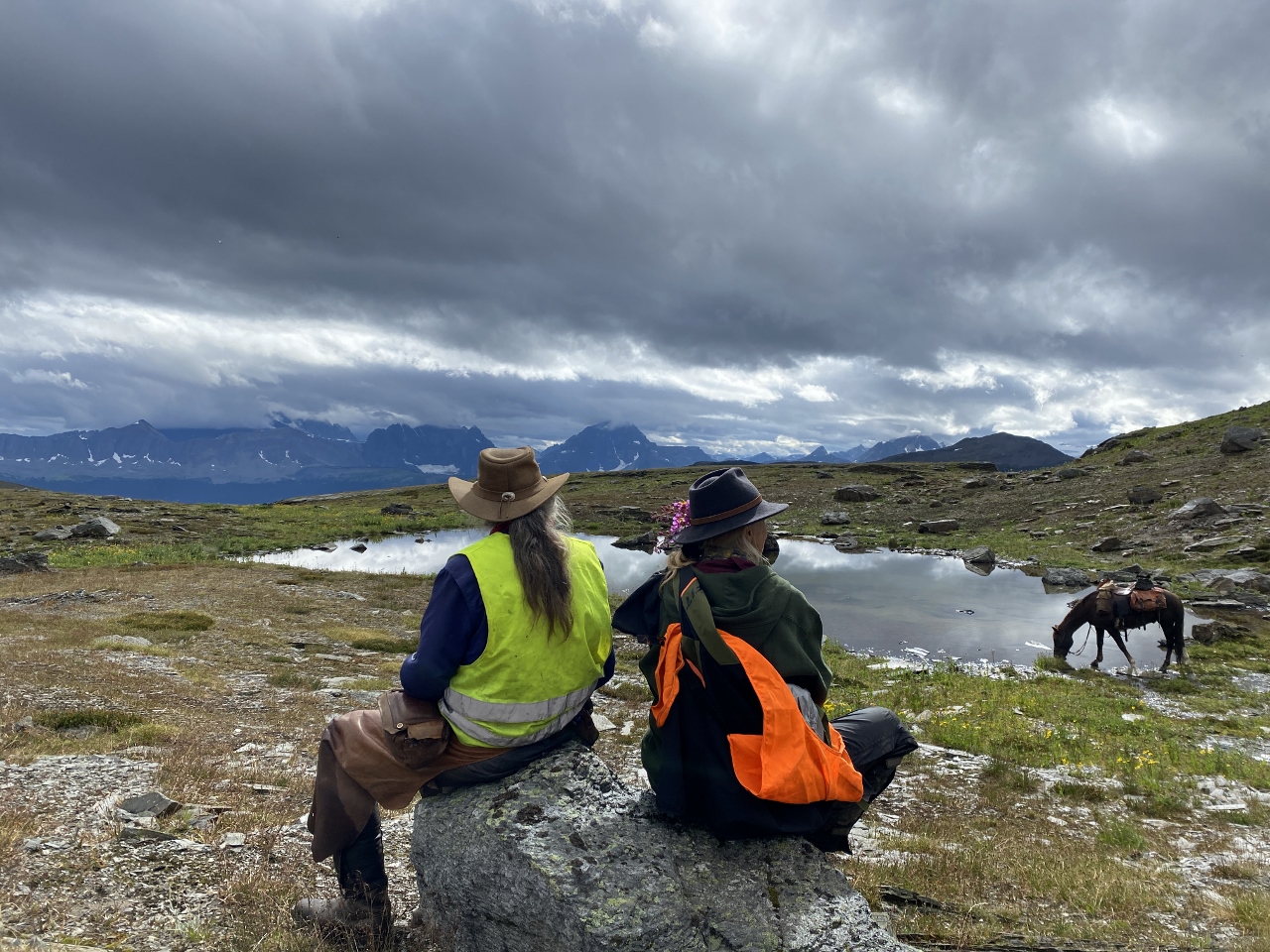
By the time the other group returned, the storms had turned into drizzle. We huddled in one of the canvas tents, setting our camp chairs into a circle. Someone passed around a bottle of whisky. We told stories and shared hiking advice, until everyone forgot about the rain outside.
Bad weather but good company
Rain canceled our last day of work. We took down our soggy tent, and loaded up the car, ready to drive to the next adventure. But we’ll be back this year. Trail work is incredibly rewarding, and it’s important for thru-hikers to give back to the trails they love. We wouldn’t be able to hike without the hard work of volunteers. The entire High Rock Trail wouldn’t exist without GDT trail building crews. And while it’s vital for us to contribute to building trails, it’s also just a really good time. We’ll sign up for a trip as soon as we can. We’ll time our summer adventure around it, hiking in the Rockies after a rewarding trail work trip. And I hope I’ll see you out there.
I know what you’re thinking – what would possess a guy in his late 60s to even think of attempting the toughest, wildest, most remote part of the Great Divide Trail? Especially after watching videos of thru-hikers struggling through the ordeal of impassable deadfalls and blowdowns, endless choking willow, and daunting fords?
Only one small thing really – the fact that I’d resolved to complete the entire GDT, come hell or high water (pun intended)!
So when I learned last spring that GDTA president Doug Borthwick was organizing a small group of members to do this hike in August 2022, I “invited” myself along without a second thought. Second thoughts came a little later when I saw the prices of all the ultralight equipment I’d need to replace all my old-school backpacking gear. Next came the realization that I’d actually never attempted a backpack trip of this length and difficulty – the closest being a 2-week trek of shorter distance over pristine National Park trails with two resupplies enroute – when I was a more sprightly 25-year-old.
On the plus side, this trip would follow a very active spring and summer, doing work trips on the GDT and hiking a section of the Appalachian Trail – so hopefully I’d be in good enough shape to allow a reasonable chance of success.
In the event, Doug decided this wasn’t the case for himself. He’d suffered a severe bout of Covid after the final work trip of the year on the High Rock Trail, and decided not to attempt the hike, opting instead to provide logistical support to our group and several other grateful hikers needing a lift to or from the end of the trail at Bastille Creek near Kakwa Lake.
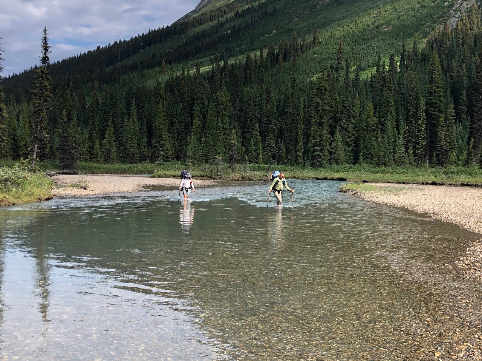
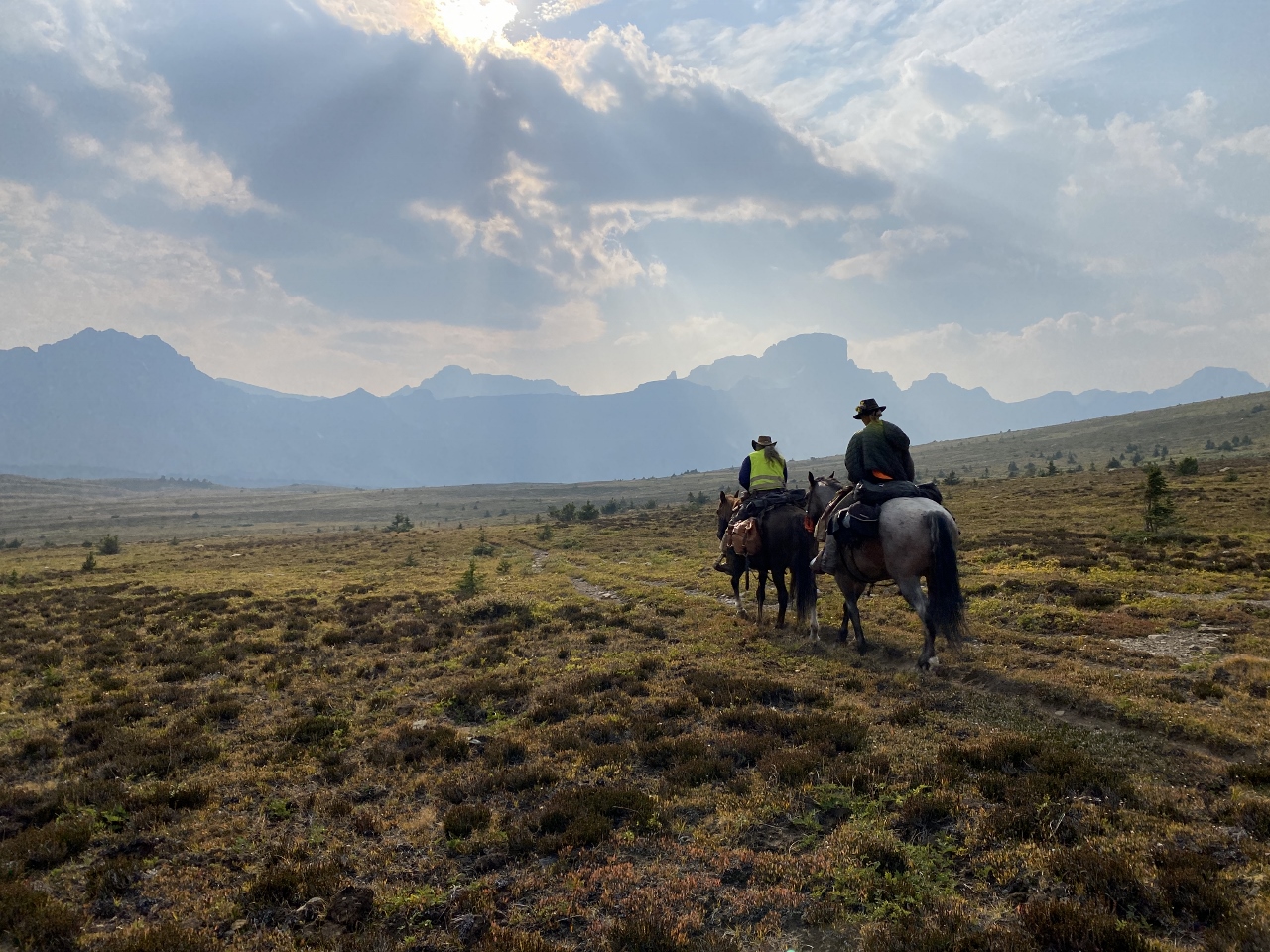
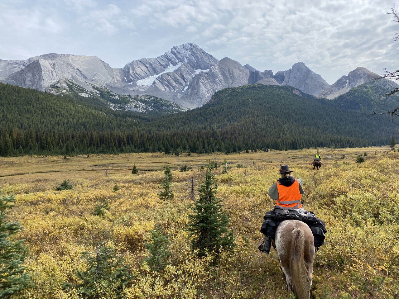
August 13th found our hiking party of four bouncing and splashing over the final 30 or so kilometres of decommissioned forestry road in Doug’s sturdy pickup. A lone outbound figure came into view a short distance from the trailhead at Bastille Creek – it was none other than ‘Pez’ (Johannes Beiser) from Germany, whom we’d last encountered in early July just north of Coleman at the start of the High Rock Trail. Pez had the distinction of being the first GDT hiker over the new Allison Creek bridge and the new reroute built to access the bridge – which we’d just opened minutes before he arrived on the scene. It was great to renew acquaintances and hear about his adventures on his successful thru-hike.
Then it was time to say goodbye and thanks a million and wish you were coming with us, etc., to Doug (who was eager to get turned around and give Pez a ride back to civilization). And so began a 15-day trek to where the GDT pops out on Highway 16 west of Jasper – a trail distance of 265 kilometres, or 280 including the out-and-back to access our resupply at the Blueberry trailhead. My hiking buddies were fellow GDTA volunteers Paul Jollymore, Stuart Mitchell, and Ernie Slatter – all in their 60s as well. Doug called us the 4 Musketeers.
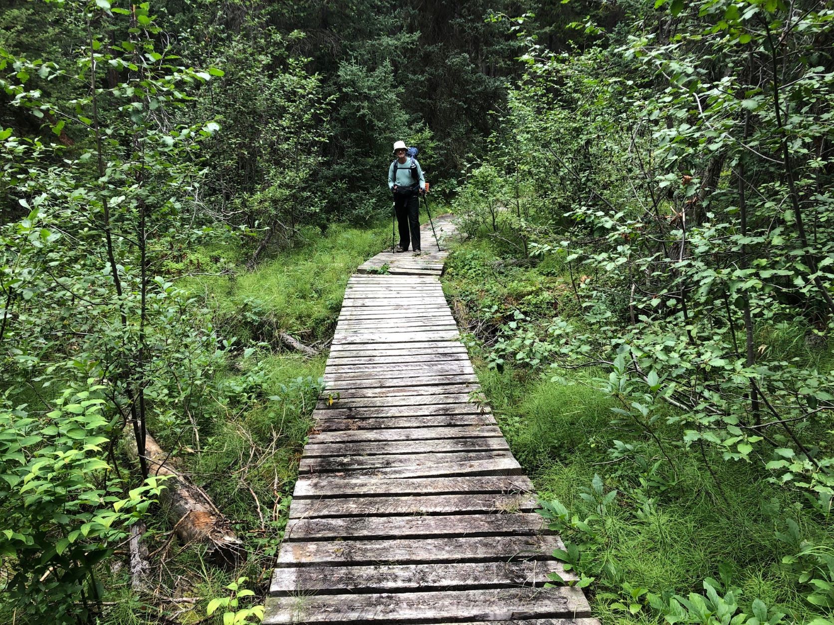
A few words to describe the initial 28-km access to Kakwa Lake itself: it’s the bare minimum that must be traveled on foot (and that might soon double, as the BC Forest Service has stopped doing any maintenance on about 30 km of road to Bastille, possibly even pulling out several bridges on side-creeks rendering vehicle travel impossible). The route is a long-since abandoned section of the forestry road that’s reverted to trail status. Although used in winter by snowmobilers, it’s mostly single-track and includes one significant ford of Buchanan Creek at the 11-km mark (Note: a new footbridge was reportedly built here sometime after our trip, by persons unknown). Many areas are muddy and there’s a near-bushwhack alongside McGregor River where the old road has been washed away in places.
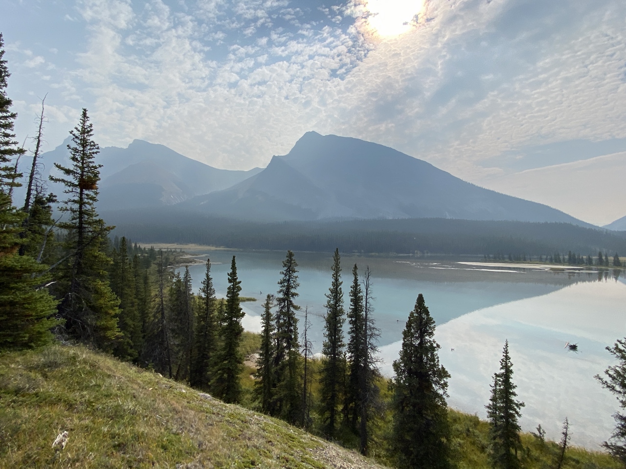
Arriving at the lake is something of a revelation, though, not least due to the pristine cabin that awaits hikers coming from both directions – kept that way in 2022 by park hosts Donna and Dan. That night we shared the place with David and Erika, an American couple that began their 2022 GDT trek at Mt. Shark near Canmore (profiled on their YouTube channel, Adventure Muffin Productions).
“The 4 Musketeers” at Bastille Creek – Paul, Ernie, Stuart and Dave (his expression indicating more second thoughts!!)
Willow-covered meadows at Providence Pass, looking south.
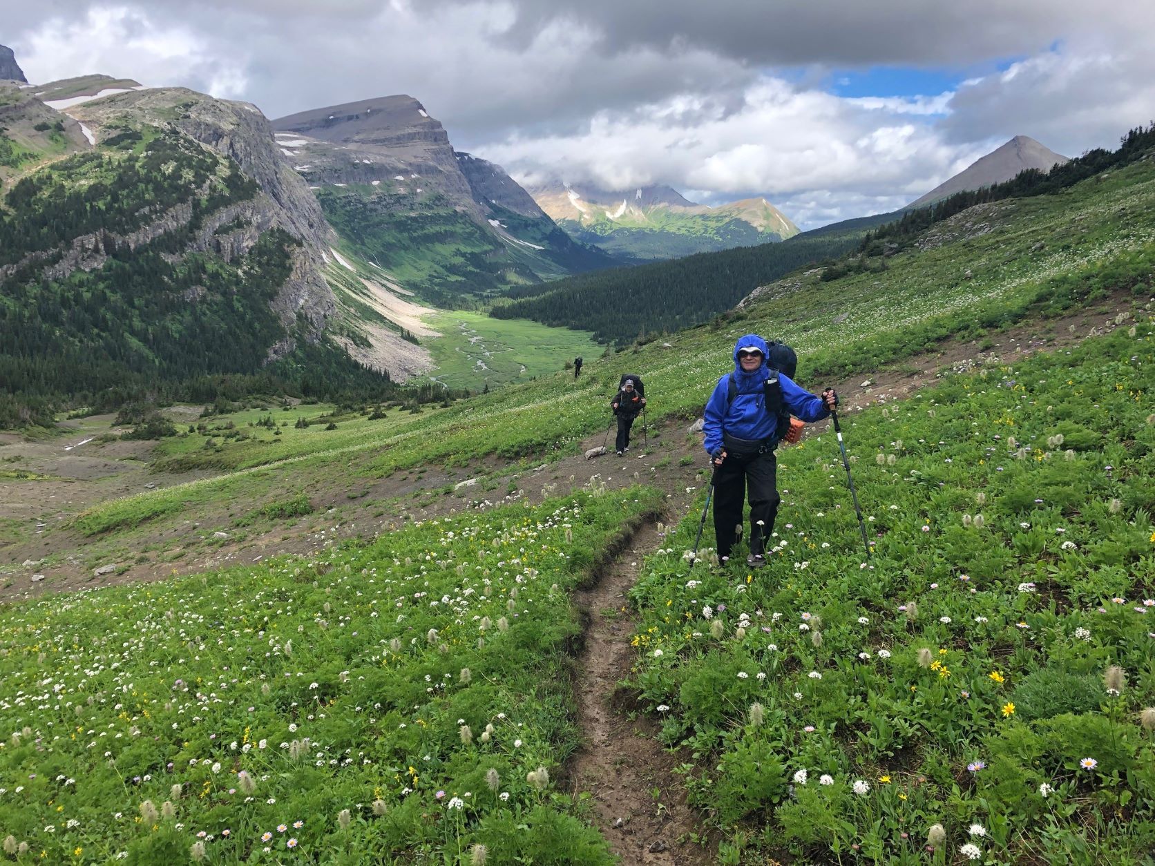
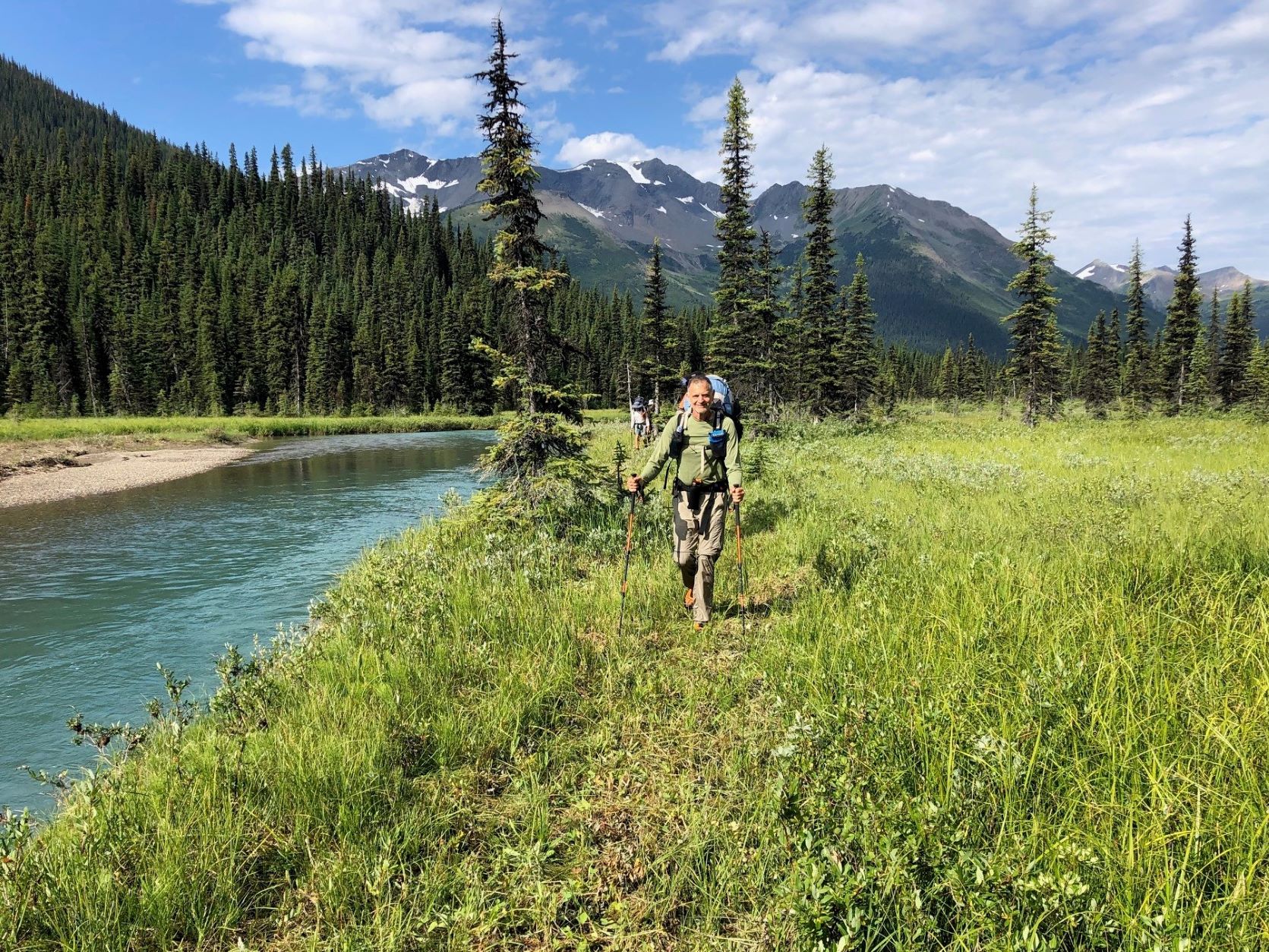
The next morning found us on the GDT proper at Kakwa River, just a short walk from the cabin, negotiating the first of dozens of creek and river fords we’d face over the next 2 weeks. Then it was literally a walk in the park as Dan had just brushed the willows for the first couple of kilometres of the extensive meadowlands the GDT route meanders through on its way towards Cecilia Lake, 15 km from the northern terminus. Reality hit after the manicured part, though – keeping to the trail became a team effort as one or two of us consulted the FarOut App and the others scanned the sparse tree cover for GDT reassurance markers or flagging tape. Short segments of actual but overgrown trail were interspersed with grassy meadows where we’d lose the route and have to fan out to find it again. This was to be the on-and-off pattern for the next couple of weeks. I sure missed my orange paint blazes! On the plus side, at low-elevation Providence Pass we caught sight of a majestic bull caribou which might have gone unnoticed if we had a trail tread to stare at the whole time.
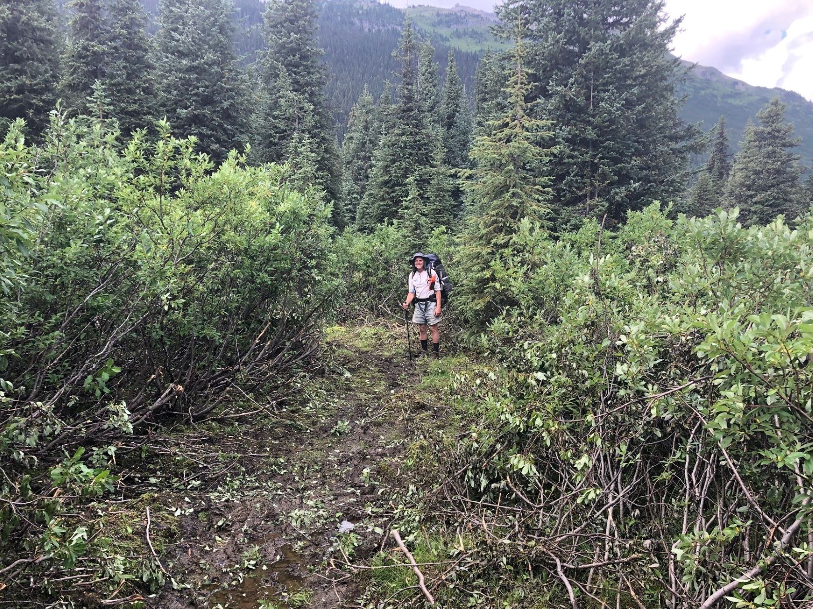
Another not-so-great-for-hikers aspect of Section G is all the boggy, spongy, sodden terrain – it’s a feature of most valleys in this country, even where the land is sloped. The region seems to contain a sizable volume of Canada’s fresh water resources! And wherever tree cover is sparse, willow often takes full advantage, growing up to 2 metres high and making foot travel tiring and frustrating.
The size and extent of willow growth, and its tendency to fill any space where there’s enough water and sunlight, is staggering. We wondered whether all this willow was a more recent phenomenon, for surely it would have made horse travel very difficult if it was like this in earlier years. Some scientists claim that higher carbon levels in the atmosphere are encouraging leafy plants to thrive in places where growing conditions are otherwise marginal. Who knows – maybe there’s something to that. Any experts out there?
We’d already decided our trip would follow the official GDT route, avoiding the scenic alternates so we could get a sense of what this northern extremity of the GDT was really like and identify sections requiring maintenance or improvement. Needless to say we identified a lot!
Why did we do this trip southbound? Well partly for logistical reasons but also because we’d encounter the mostly NOBO thru-hikers face-to-face – find out where they’re from, hear their overall impressions of the GDT, and get first-hand trail reports. We met three that very first day, and many more in the following days.
That night’s camp objective was an alpine lake just south of Surprise Pass, about 22 km from Kakwa, but as the day wore on and route-finding consumed more and more time, that became more and more doubtful. A tricky ford of Cecilia Creek didn’t help the schedule, and neither did some serious willow-bashing between there and the Pass. We ended up 4 km short, finding a tolerable spot to make camp. The mosquitoes were atrocious and we hoped it was just that area, but alas they would be an attribute of every camp for the remainder of the trip!
What would not be repeated for the next week, however, was the rain that fell all that night and into the next morning – as luck would have it we were blessed with an awesome run of warm, crystal-clear days (apologies to Barb Lauer and her Section G hiking party, who did this route at the same time of year in 2020 and got rained on continuously – read all about it in the Autumn 2020 Pathfinder).
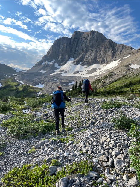
Paul on the way up to Surprise Pass, with upper Cecilia valley and Kakwa Provincial Park beyond.
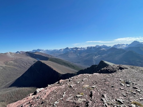
Big Shale Hill – a mere 400 metre ascent (700 m for NOBOs!)
View of the Jackpine Valley from Big Shale Hill – eat your heart out, Barb!
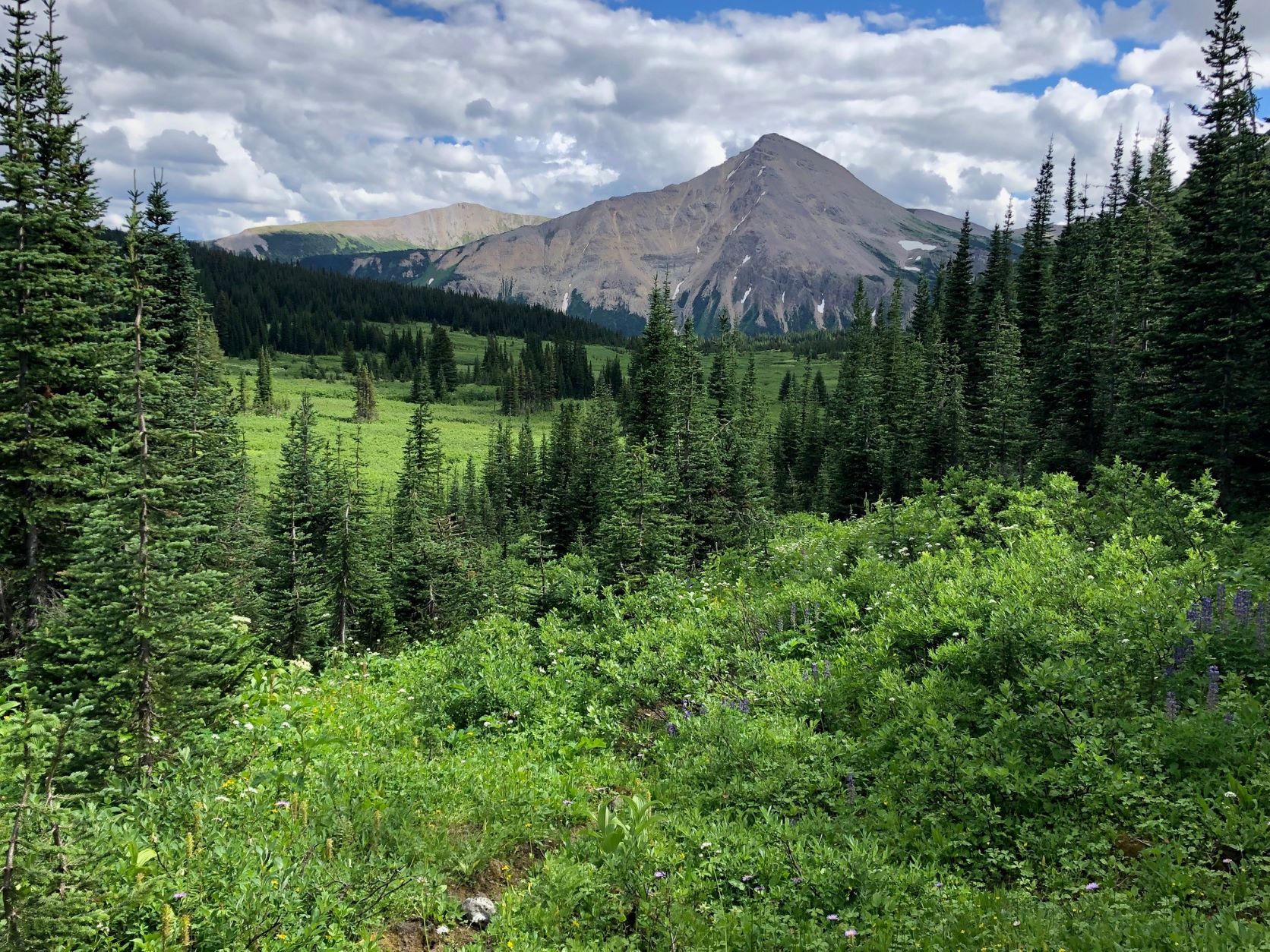
For the next several days we followed the GDT through beautiful valleys and across high passes and ridges in a spectacular wilderness setting with a backdrop of glaciated peaks in every direction, while criss-crossing the continental divide multiple times. The 360-degree views from Big Shale Hill are not to be missed!
On the way down from the summit ridge, we encountered cleared trail for the first time since Kakwa Lake, 70 km back. This was the start of the amazing work done by the GDTA’s Jackpine trail crew in 2021 and ‘22, a much-appreciated contrast to the overgrown, deadfall-littered trails we’d been contending with to that point! From there on, we enjoyed a clear, easy-to-follow route throughout the Jackpine valley (with all 20 fords of the river!) and up to Blueberry Lake. Timing is everything, huh?
One of the 20 Jackpine River fords – rather enjoyable on a nice day!
A smiling Ernie cruisin’ along newly brushed trail in the Jackpine Valley.
A good example of willow cleared out by GDTA crews, with Stuart for scale.
Blueberry Lake is the junction of a 7.5-km access trail that descends almost 1000 metres to the Holmes River Forestry Road. At the exact midpoint of the trip, it was ideal for picking up provisions previously stored there for us – well, it would’ve been a lot more ideal if the trail wasn’t so rough and overgrown! But you gotta play the hand you’re dealt, and maybe we were just spoiled by then.
Leaving Blueberry, the Trail ascends quickly to the scenic highlight of the main route in Section G – a 3-kilometre alpine amble right on the Divide through rough, rocky terrain, with extensive views in all directions, including a tantalizing glimpse of towering Mt. Robson to the south. There’s no trail tread here, so cairns would be a welcome improvement to avoid having to constantly monitor the GPS track, draining precious battery capacity.
Beautiful Blueberry Lake – a very nice spot to camp for 2 nights.
Mount Robson seen in the centre distance from the Blueberry Alpine.
Soon the GDT enters Jasper National Park for the first time, at Bess Pass, after a steep descent from Bess Shoulder on a very rough bit of trail. At this point, about 150 km into the trip, it occurred to me that much of the GDT route from Kakwa uses old trails that don’t always follow the path of least resistance, i.e. along stream valleys and across passes. No, they often climb up and over difficult-to-reach high spots like Casket Shoulder, Big Shale Hill, Blueberry Alpine and Bess Shoulder. How did they get there? For that matter, how did any of the trails in the region get there? We surmised that most of them were created by and for guided hunting parties in the days before hiking became popular, when travel by horse was the most efficient way to get around – and, I suspect, big game could often be found in those upland locales.
Horse travel along what’s now the GDT is rare these days. We saw little evidence they were using the trail, although many low-elevation campsites obviously had annual visits by horses, probably in the fall hunting season.
Paul starting down from Bess Shoulder, with Chown Floodplain in the distance. Rough trail ahead!
Paul and Stuart pausing on the floodplain to admire Chown Glacier.
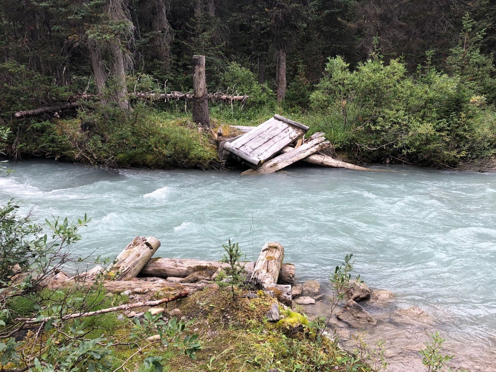
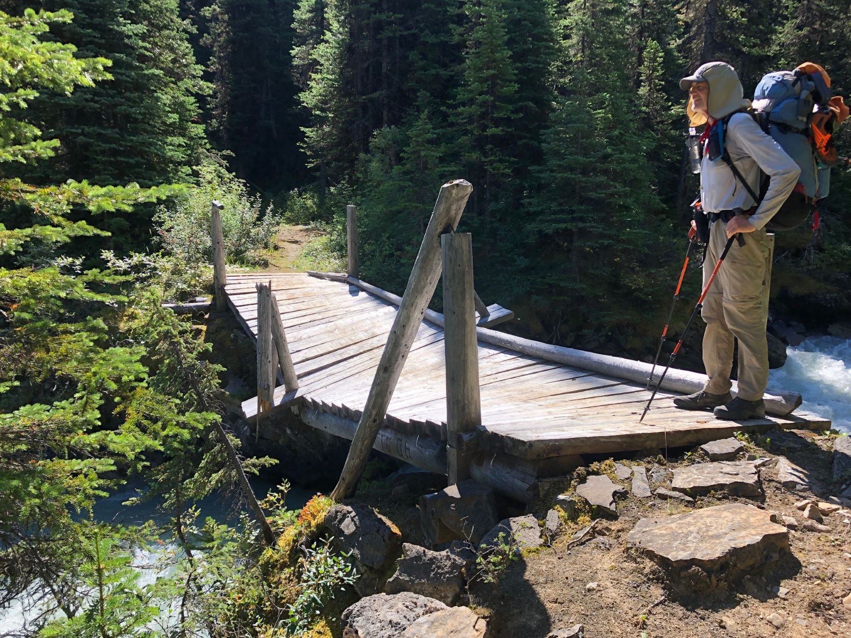
If we were expecting better trail conditions in the National Park, we were in for a disappointment. As I discovered later, all the trails used by the GDT north of Jasper have been officially deemed redundant, and no maintenance has been done for a number of years. Deadfalls and overgrowth abound, and of the many formerly bridged streams, only one still has a usable bridge and it’s not long for this world – check out the picture! When it’s gone, hikers will be in for a tough bushwhack and ford.
Remnants of Chown Creek Bridge – what happens when you give up doing maintenance.
Ernie at the only remaining bridge in Sections F and G.
The North Boundary Trail is a case in point. As someone who’s spent decades building and maintaining trails, exploring this one was a revelation. This GDT segment of the much longer NBT, along the Smoky River, was obviously constructed by skilled people who located, cleared and built a trail that would stand up to the passage of time and thousands of pack animals without degrading. Ernie told me this trail was in use as the main access to Mount Robson from Grande Cache before the highway was constructed through Yellowhead Pass, and possibly pre-dates the railway as well. It’s truly a thing to behold – cleared to 3-4 metres of width, gentle grades, and places where rock retaining walls were built up to support the trail on steeper ground. Sturdy, wide bridges were created using local timber and renewed periodically.
And sadly, this piece of Canadian heritage is being allowed to degrade and pass into history. Hopefully the GDT will be its saviour, but this won’t happen unless our organization is successful in convincing the “powers that be” that their current backcountry trails policy should be revised, for the sake of safety if nothing else.
North Boundary Trail – a master work of trail engineering and a treat to hike.
Strolling south through marvelous Moose Pass on the way into Mt. Robson Provincial Park.
After a long day’s travel along the North Boundary Trail, the GDT fords the Smoky and ascends to drop-dead-gorgeous Moose Pass, savouring the alpine for a few breathtaking kilometres as it gradually descends into Mount Robson Provincial Park. The trail is slightly better here, owing to BC Parks’ policy of allowing organizations like the GDTA to work with approved partners (in this case the Backcountry Horsemen of BC). The upper Moose River valley wasn’t overly hard to navigate but things improved dramatically after fording Upright Creek, and we followed just-cleared trail all the way to our campsite at Colonel Pass. A big shout-out to the GDTA crew and the aforementioned equestrian group! What did I say about timing?
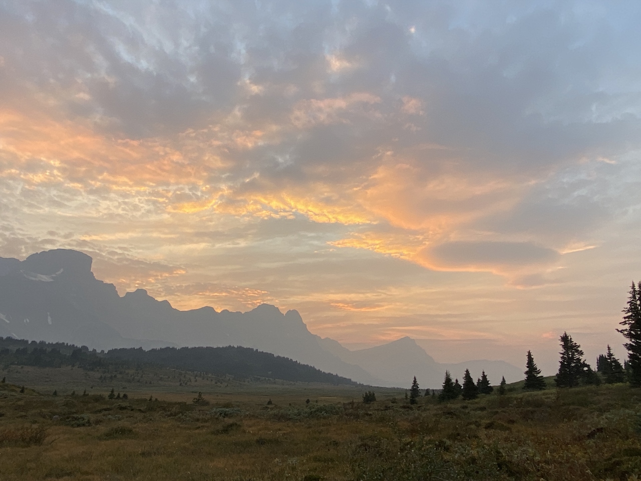
Our second-last day, from Colonel Pass to Miette Lake, was enjoyable despite some blustery wet weather. The sweeping environs of Miette Pass (AKA Centre Pass) are a thing to behold, although the best wildflowers would have been seen a month earlier. A 3-km section of GDT once again has no trail to follow, but it’s pretty hard to get lost southbound. NOBO hikers, however, need to find one specific bit of orange flagging to locate the trail at the end of the tread-less segment.
Then, on our final day, we started down the Miette River Trail. Once again I was super-impressed with the quality of construction and the work that went into building this trail. Certain boggy areas along its 20-km length have, or should I say HAD, sturdy well-constructed boardwalks. About half the route is high above the river, in the forest, on a very steep slope. Long ago it was cut by hand into the hillside by people who were evidently obsessed with doing things properly – the trail keeps to a perfect, gently descending contour despite changes in the terrain, like gullies, and the need to remove large trees in the way. We don’t go to that much trouble building new trail these days (nor, I suppose, would we want to).
Sadly (again), this trail is being left to revert to a natural, or as Parks Canada puts it, a “wildland” state. Which is to say it will eventually become unusable. Ostensibly, Miette and the North Boundary Trail don’t get enough use to justify the expense of maintaining them, but that argument wouldn’t explain why Parks workers have been dismantling sections of boardwalk still in perfectly serviceable condition. More likely, current policy serves to discourage human use of the backcountry outside of specific areas that receive a lot of use, like the Skyline Trail for example. Just my opinion!
Still-intact Miette River Trail boardwalk – what a treat after all those bogs!
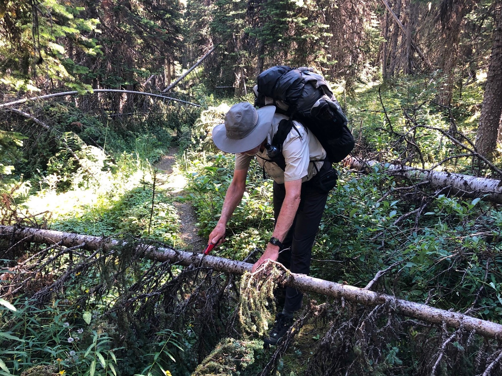
The author attacking “leaners” with the folding saw – what happens when you have a trail work addiction!
One “luxury” item I stuck in my pack at the last minute before leaving home was a small folding Corona saw. That turned out to be an inspired decision – not only was it super-useful for cutting firewood in camp, but having it on hand meant there was no excuse for not clearing the innumerable small-diameter “leaners” and “sweepers” that blocked the trail like railway crossing gates. Getting under, over or around these things is awkward and annoying. It took less than a minute to take care of each one, and over the course of the trip we must have cut out a couple hundred of these suckers! I think the GDTA should add a saw like this to the recommended gear list. (Note: it’s unlawful to cut any vegetation in the National Parks, unless you’re riding a horse and need to – hey, maybe I’ll take a horse with me next time!)
FINAL THOUGHTS
I’d highly recommend hiking this amazing part of the GDT if you haven’t done it yet. Yes it’s tough going, but trail conditions are improving every year. If a thru-hike is your plan, what you’ll find remarkable is how the landscape changes from one end of the Trail to the other, even though you’re in the Canadian Rockies the whole way. While the southern end is characterized by drier, less spectacular (but still breathtaking) terrain that’s never far from signs of civilization, as you travel north the mountains become more impressive, the creeks and rivers become deeper and swifter, and glaciers become a common sight. But you’re usually still only a day or two’s hike from a road. Once you leave Highway 16 near Jasper, however, you’re in a true wilderness the rest of the way. Everywhere you look are big mountains clothed in imposing glaciers, with cascading streams and waterfalls tumbling down their slopes.
You might be reading this thinking “I wonder if I could do this part of the GDT?” As long as you’re in good shape and have a reasonable amount of backpacking experience, then I’d say go for it! Having at least one or two buddies is essential, as is doing the trip in late summer or early fall to avoid the highest water and the nastiest bugs. But unless you’re in superb condition, willing to hike from dawn till dusk, and able to put up with a lot of discomfort, then plan on averaging 15 to 25 km per day (ours was 18) and resupply at Blueberry (we camped for 2 nights at the junction, hiking down with empty packs). Many thru-hikers are able to make 30 to 40 per day, but they’re often doing all F and G without a resupply. Park Host Dan told us some hikers arrived at Kakwa with zero food left, and he served up fresh-caught trout on more than one occasion, including to one person who was vegan!
An important point: The 2021/22 trail maintenance done in these sections has made a huge difference. And in mid-August 2023 the GDTA plans to clear and mark 28 km of poor trail between Sheep Creek and Kakwa Lake, and bridge the tricky ford at Cecilia Creek. So there’s never been a better time!
Lack of easy access to the northern terminus of the GDT at Kakwa Lake will be the main limiting factor, I think, for a lot of people wanting to do this hike. Conceivably, hikers will need to allow 2 to 3 extra days to walk the approach route if the road gets decommissioned. Margaret Gmoser, who at age 77 is likely the oldest person to have hiked Section G, describes in the Autumn 2022 Pathfinder how she solved the problem by hiring a helicopter to deposit her party at Kakwa. That might be a good option if the cost can be shared with a few others.
I’m extremely thankful to have had the opportunity (and the ability!) to cross Sections F and G off my to-do list. And it was also great to have three awesome guys to share the experience with. Now for Section E!!!
by Brent Wray; photos by Brent Wray; videos by Peter van der Gugten
I’ll never forget the text message that changed my life. It was from Curtis, a Willmore Wilderness guide and outfitter I’d ridden a 10-day pack trip with in July 2021.
“Hey Brent, that guy I was telling you about is riding the Great Divide Trail in 2022 and looking for company. You interested?”
It was now late October. I’d just finished checking out both the guy and the GDT online. The guy was Peter van der Gugten, a Swiss guide and adventurer, who travels the world doing epic, ultra-light long-rides on horseback.
“Hell, yeah!” I responded.
A few days later Peter interviewed me from Switzerland, via FB Messenger, asking about my riding and backcountry experience. I told him I’ve owned and ridden horses for years, successfully started a few colts, done a couple horseback treks, plenty of hiking and camping, but nothing of this magnitude. I’ve always wanted to, though! He said he’d discuss it with his riding partner and get back to me.
Three days later he contacted me and said, “Ok, you’re our #3. Welcome to the Adventure!”
Then began a serious baptism into route planning, researching trails, learning to use GPS, optimizing clothing and gear, acquiring permits and permissions and conditioning myself and my horse.
Route planning was interesting. I’d started with the standard backpacker route, but quickly found out there are many areas where horses aren’t permitted. Fortunately, an equestrian route is in development, which I was able to obtain, along with some great intel on certain sections that might be problematic.
Obtaining permits also proved interesting. National Parks require backcountry camp sites to be booked well in advance, as well as grazing permits. It is extremely challenging to know exactly where you’re going to be three weeks into a trail; trail conditions, bad weather, or a lame horse are just a few uncertainties making it a virtual impossibility. You do the best you can. Provincial Parks may also require letters of permission.
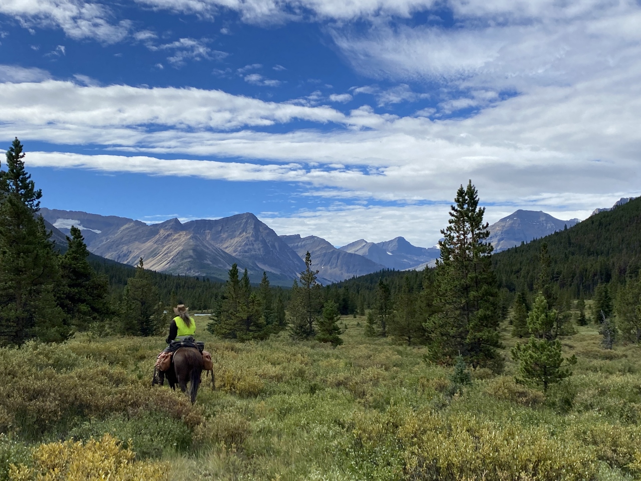
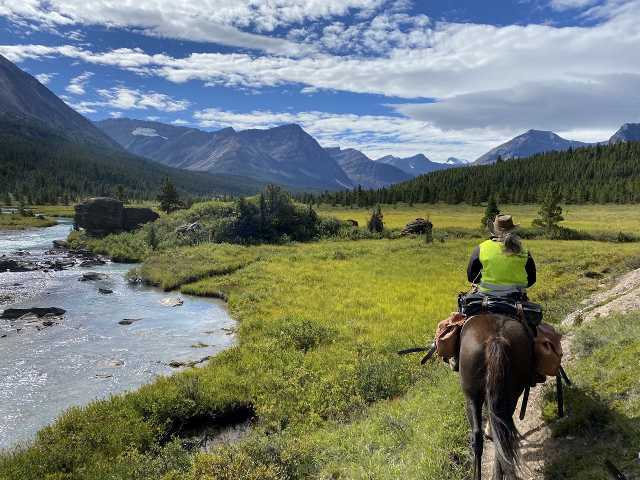
On August 22, we met for the first time at the Waterton Park gates with huge smiles, big hugs and tremendous excitement about our upcoming adventure. Tina Boche was the other member of our party; a long-rider in her own right, she owns a horse academy in Germany where she trains horses, mules and people, teaching riding, packing and driving. We consolidated gear and horses into my truck and trailer, then drove to Grande Cache the next day. One more day of preparations and we hit the trail August 25.
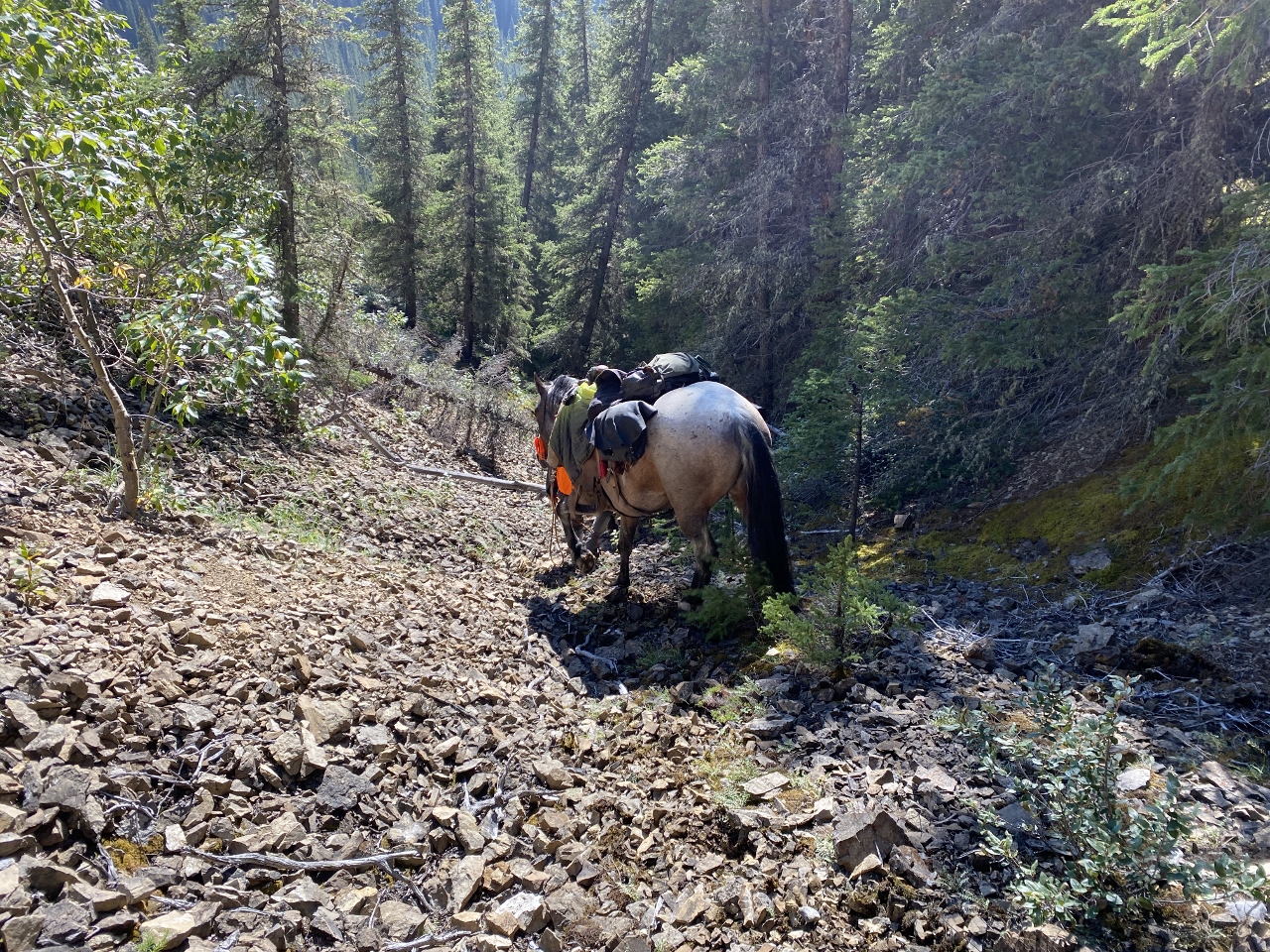
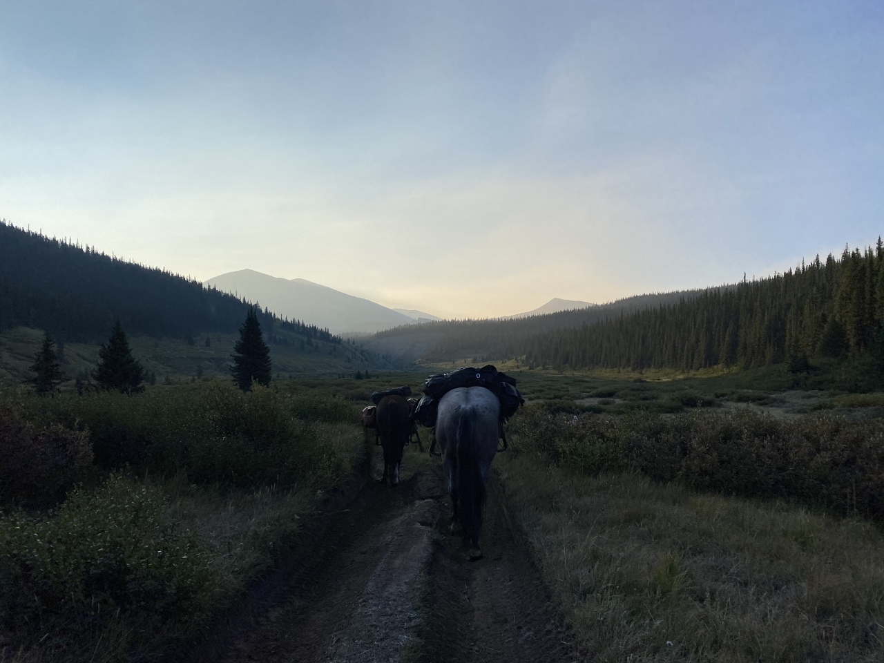
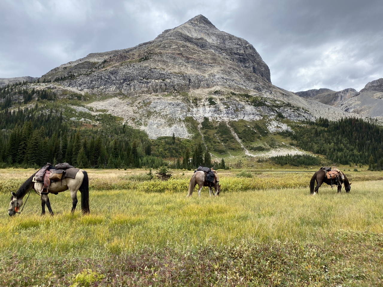
We travelled ultra-light, with saddle horses only. To make it easier for the horses, we dismounted and walked all steep terrain or tough, technical stretches, stopping every 2-3 hours to allow the horses a grazing break. At night horses wore a mixture of hobbles, bells and tracking collar, and were contained in portable electric fence on the best grass we could find. For us, on clear nights, we’d sleep under the stars; but most nights we’d sleep side-by-side, sardine style under a tarp shelter. As for meals: breakfast consisted of coffee and oatmeal; lunches: meat, cheese, nuts, dried fruit and water; dinner was Mountain House dehydrated backpacker meals fortified with extra protein, along with tea to drink.
A second Peter, Peter G, would be driving my truck and trailer as support and shuttle vehicle, meeting us in pre-planned, strategic locations and providing emergency support, if required. We communicated via Garmin InReach messaging. For navigation, we had redundant Garmin handheld GPS. We all carried Powerbanks for recharging electronics on the trail.
Leg 1
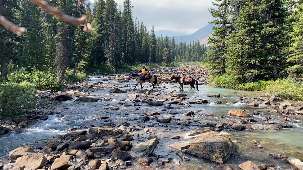
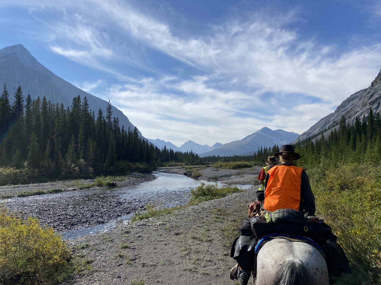
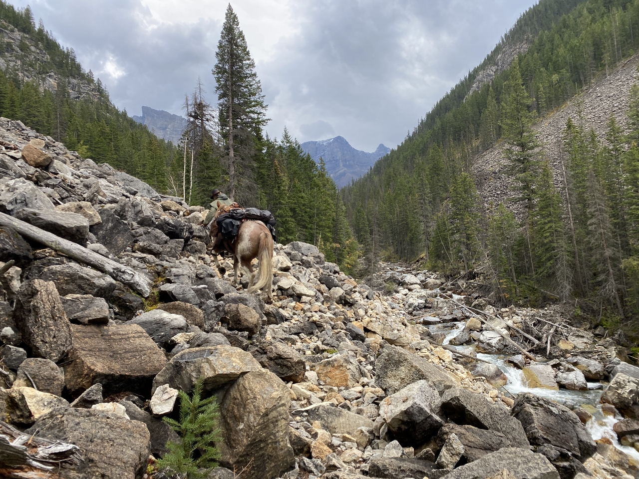
Leg 1 of our journey was Grande Cache to Jasper. Peter rode Rodeo, his Kentucky mustang; Tina rode Ahi, Peter’s Criollo from Argentina; and I rode Charlie, my Morgan from Alaska. All horses were shod with Duplo composite horseshoes. The trail was great and travelling easy for the first couple days, but our no-trail shortcut to connect to the Great Divide Trail from Ptarmigan Lake was a painfully slow bushwhack through thick brush, deadfall, bog, rough terrain and intermittent rain. After the better part of two days, we finally hit the GDT. Nothing makes you appreciate a trail like two days without one. Gratitude!
We were very grateful for the trail clearing efforts of volunteers from the Great Divide Trail Association and Back Country Horsemen of BC along the Jackpine River. It had consistently come up in my trail research as a long, nasty bushwhack through thick willows. Instead, we were treated to a wide, clear corridor that was almost a superhighway after what we’d been through.
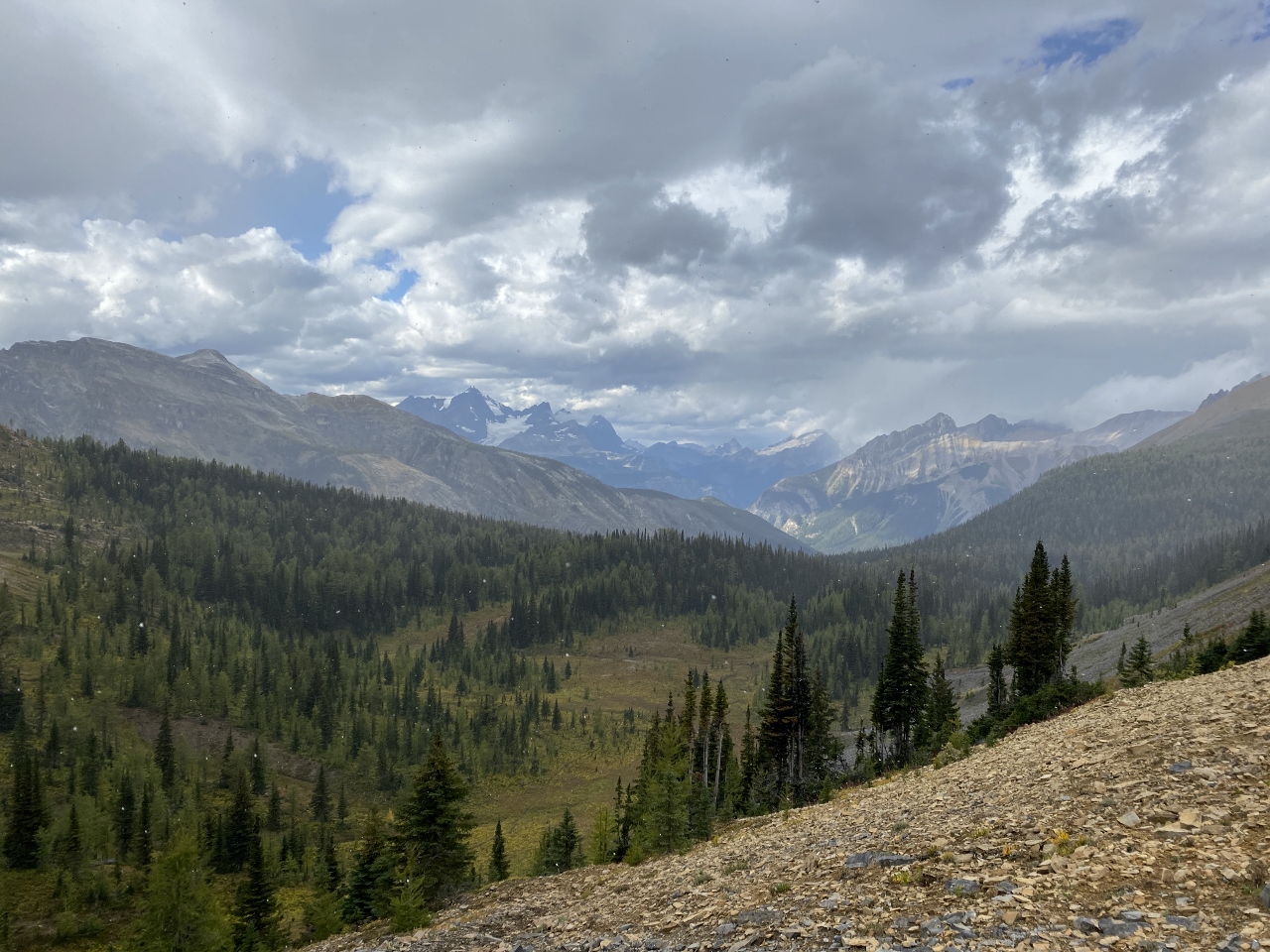
After a steep grind up out of the Jackpine River valley, we were rewarded with epic views above Blueberry Lake, over Jackpine Pass, past Mount Bess and Chown Glacier. Weather steadily improved as we worked our way down the Smoky River, crossed spectacular Moose Pass and followed Moose River out to where our shuttle driver was waiting with the Adventure Rig. Longer than planned, tougher than anticipated, but we’d made it. Leg 1 was complete!
August 28, 2022
August 29, 2022
August 31, 2022
September 1, 2022
September 2, 2022
Leg 2
With all North-South routes through JNP closed to horses, our planned Leg 2 route was to start at the Cardinal Divide, onto South Boundary Trail, then through the Blackstone/Waipiabi Public Land Use Zone (PLUZ) to Saskatchewan Crossing. Tina’s horse, Ahi, had a sore front leg, so she stayed behind with Peter G while he recovered, so it was just Peter and I for this stretch.
All was going according to plan, until it came time to cross the Brazeau River into the Blackstone/Waipiabi. It was running way too high, fast and deep for us to cross at Dowling Ford, so we decided to stick to the South Boundary Trail, crossed the Brazeau further upstream, and over rugged Nigel Pass to the trailhead on Highway 93. Thanks to our Garmin InReach we were able to communicate the change in plan and meeting place to Tina and Peter G, our driver.
September 3, 2022
September 4, 2022
September 6, 2022
Leg 3
Leg 3 was from Saskatchewan Crossing to Banff. Ahi’s leg was still sore, so we got a loaner horse from Astoria Outfitting (Dixon) and Tina rejoined us. Herd dynamics came into play and our two horses weren’t very welcoming to the newcomer, so after getting beat up by both of them and a zap from our portable electric fence on the first night, he decided to go home, resulting in an extra 28 km of unnecessary travel. Fortunately, we caught him, got back on the trail, enjoying great trail, then lost the trail, endured a nasty bushwhack, found the trail again and made our way into Banff National Park to great trail and amazing scenery, over Clearwater and Pipestone passes, eventually pulling out at Lake Louise.
September 9, 2022
September 10, 2022
September 11, 2022
September 12, 2022
September 13, 2022
Leg 4
Ahi was recovered, so our driver took our loaner horse back and after a rest day we embarked on Leg 4 of our journey, Banff to Coleman. The horses must’ve really enjoyed their time off, because after grazing peacefully and lulling us into a false sense of security, they headed back to the trailhead on the first evening. It was many kilometers later and the wee hours of the cold, rainy morning before we caught them and got back to camp. They’d usually been hobbled when turned loose to graze, but they’d been so good we’d allowed extra freedom. So much for their rest day in Banff; no good deed goes unpunished, I guess. Hobble-free privileges lost.
Up, over Allenby Pass the next morning, we left BNP at Palliser Pass, crossing into Height of the Rockies Provincial Park, where we traversed three rock slides along Joffre Creek, endured a grinding climb over Sylvan Pass and then got our butts kicked as we worked our way through an old burn on the Middle Fork of the White River. At Connor Lakes, we decided we’d call it quits the next day in the Elk Valley. Tired horses, another mountain pass to cross and bad weather in the forecast, it was the right call to make.
September 17, 2022
September 18, 2022
September 19, 2022
September 20, 2022
September 21, 2022
Epilogue
So, after four weeks on the trail, covering 750km, we loaded up and went back to Waterton. All in all, an epic adventure, tremendous new friendships, a world of new opportunities and a whole new level of appreciation for a great mountain trail horse.
September 24, 2022
Needless to say, a trip like this doesn’t happen without the support of an amazing group of people. We are incredibly grateful for all those who supported us with their time, energy, skills, homes and knowledge: Tania, Caro (Duplo Canada), Frederic, Christine, Curtis and Melanie (Indian Trail Adventures), Rocky (Entrance Ranch), Gunner (Astoria Outfitting), Sean and Steve (Banff National Park), Kerry, Eric, Guy and Deb, Jenika and Ashleigh (Alpine Stables) and of course, spouses, family and friends who held the fort at home.
And here is the detailed story embedded in this two-part video series. Enjoy!
Life on the trail is full of the unexpected; weather and trail conditions can quickly change, there may be wildlife encounters, injuries, slips and falls, turn-arounds, fatigue, dehydration…the list goes on! If there’s one thing that a hiker can count on at the end of the day though, it’s that they’ve likely worked up an appetite for a well deserved, nutritious and tasty meal. While there are plenty of options for quick and convenient pre-made dehydrated and freeze dried meals, they can become quite costly. Oftentimes the sodium levels in pre-made meals are off the charts, the vegetables are skimpy, and they can lack serious flavour. By preparing and dehydrating our own meals, we have full control over what we’re fuelling our bodies with, and it can be really fun to get creative in the kitchen while planning our next big adventure – even if that big adventure is just a day hike.
A favourite go-to dehydrated meal that’s easy to prepare and allows for a lot of wiggle room in the recipe to add or omit different ingredients is a tried and true burrito bowl. Feel free to follow this recipe as it is, or use it as a loose guideline to create your own unique dish that suits your own palate and adheres to any dietary restrictions or preferences that you may have.
When making these burrito bowls, you can dehydrate each individual ingredient separately and then divide all ingredients into four servings; alternatively, you can mix all ingredients together before dehydrating. If you choose to dehydrate each ingredient on its own, it is best not to chop the spinach or cilantro. Instead, dehydrate them whole and once they’re dried, crumble them with your hands. For a bit of extra delicious fat, add some fresh avocado to your prepared meal once it’s time to eat. Enjoy!
Backpacker’s Best Burrito Bowls
Yield: 4 servings
Ingredients:
1 lb extra lean ground beef*, cooked
2 cups spinach, finely chopped
1 3/4 cup water
1 cup quinoa
1 cup of your favourite salsa
1/2 cup BBQ sauce**
1/2 can black beans, rinsed and flattened slightly with back of a spoon
2 medium sized tomatoes, finely chopped
2 red or orange bell peppers, finely chopped
1 yellow onion, finely chopped
1 bunch cilantro, chopped
1-2 jalapeno peppers, minced
3-4 cloves of garlic, minced
3 tbsp taco seasoning
1 tbsp olive oil
A few dashes of your favourite hot sauce for some extra heat
*this ingredient may be omitted; ground chicken or turkey may also be substituted
**any BBQ sauce will do, but Sweet Baby Ray’s Original is especially tasty in burrito bowls
Instructions:
Add oil to a skillet over medium heat. Once the pan is hot, add the onion and garlic and cook until fragrant, about 1-2 minutes. Remove from the pan and set aside.
Into the same pan, add the ground beef and cook thoroughly, stirring continuously. Once the meat has been cooked through, transfer to a strainer and run hot water over the meat to remove any residual fat. Removing as much fat as possible is important because dehydrated foods high in fat will typically spoil faster than those with lesser amounts.
Once the meat has been rinsed with hot water, transfer it into a bowl and add the taco seasoning and jalapeño peppers. Stir well to combine.
Combine the quinoa and water in a medium pot. Bring to a boil over medium heat, cover, and reduce the heat. Simmer for 15 minutes.
Remove the pot from the heat and let it sit, covered, for about 10 minutes. Remove the lid and fluff with a fork.
In a large bowl add cooked quinoa, cooked meat, and all remaining ingredients. Stir well.
Spread the mixture evenly and as thinly as possible over dehydrator trays lined with parchment paper.
Dehydrate at 145°F for 8-10 hours rotating the order of the trays every couple of hours to ensure even drying. As the mixture dries, it will become bark-like; break large pieces up to ensure it is completely dry.
Once completely dry, remove from the dehydrator and divide into four individual portions.
To rehydrate the meal, add enough boiling water to just cover the dehydrated mixture. Let it sit for about 20 minutes, or until all ingredients are soft and fully hydrated.
For best results, rehydrate food in an insulated container, such as a Hydroflask or Thermos. Usually, about 20 minutes is enough time to rehydrate a meal, but sometimes, depending on the size and type of food that has been dehydrated, it may take longer.
All pictures are by the author unless otherwise credited and along the GDT unless stated otherwise.
“Above all, do not lose your desire to walk. Every day I walk myself into a state of well-being and walk away from every illness. I have walked myself into my best thoughts, and I know of no thought so burdensome that one cannot walk away from it.” – Soren Kierkegaard
Since we were in high school together in the early 1970s in Kitchener, Ontario, Dave Higgins and I were aware of some of the health benefits of doing physical exercise outdoors in nature. Fortunately, we had an excellent “outdoor pursuits” component to our physical and health education courses at Cameron Heights Collegiate Institute with knowledgeable, skilled and inspirational teachers. The CHCI Outdoors Club that Dave led got us out hiking not just on local trails but also on the Bruce Trail along the Niagara Escarpment, our first exposure to the long-distance trail phenomenon. Dave and I became the youngest people to serve on the Board of Directors of the new Grand Valley Trail Association, which established a long-distance trail along the Grand River. Through these trail organizations, we met fit, healthy older folks who kindly took us out cross-country skiing and hiking, instilling in us a love of physical exercise in the great outdoors. This led to our interest in participating in the trails surveys in 1974 to find a route for the Great Divide Trail between Banff and Waterton Lakes national parks.
Dave Higgins surveys the Cataract Plateau for Project: Great Divide Trails in 1974 (Photo by Chris Hart)
The initial gains we experienced related to general physical fitness, particularly cardiovascular health, strength, and endurance. However, what we didn’t fully appreciate until years later were the benefits to our immune systems, our cognitive wellbeing, and even our spiritual health. Multiplied across the country, the benefits of being physically active outdoors in nature has led to positive societal repercussions for the health care system and the economy. On another level, people who experience wild places often, like us, become advocates for the protection and care of these areas. When governments conserve these wild places, clean air, clean water and natural biodiversity persists. Then the many ecosystem services these areas provide will endure, including those that ameliorate global climate disruption.
While we have individual personal experience relevant to this topic, it’s anecdotal. Scientists have been studying the health benefits of outdoor physical exercise, including long-distance walking in natural surroundings, for decades. Examining some of the articles and books about their research yields the following six physical benefits and seven mental and emotional benefits of long-distance hiking in natural areas, such as Canada’s Great Divide Trail.
Physical Benefits
1. Hiking Helps Heart Health
The most obvious benefit of long-distance hiking is its effect on your cardiovascular health. Hiking elevates one’s heart rate, which helps improve aerobic fitness and endurance. It strengthens your heart muscles. As with any physical activity, when you hike, your heart must work harder to pump blood and oxygen throughout your body and into all your muscles. Over time, this improves heart function. So, as you hike day after day, your body adjusts to new fitness levels and you will be able to hike longer distances, at a faster rate, over more challenging terrain, without feeling as breathless or fatigued.
These hikers along the GDT in the Oldman River headwaters in 1990 gained cardiovascular fitness
Studies demonstrate that going on regular moderate hikes over time significantly reduces hypertension, improves glucose tolerance, and decreases ‘bad’ cholesterol levels. Studies in Japan have also shown that walking in forests, especially coniferous forests, lowers both blood pressure and heart rate. Thus, long distance hiking can also improve cardiovascular health markers such as blood pressure, blood sugar levels, and cholesterol.
2. Hike to Live Long and Live Well
Research shows that not only does hiking at a brisk pace for at least 30 minutes each day help to drastically reduce one’s chances of developing heart disease, it also lowers the risk of contracting some cancers and developing dementia in older age. Besides improving short term health, hiking also helps build a foundation of health as we age. Sunlight kick starts the body’s production of Vitamin D, which alleviates stress, and gives some disease protection. While not a guarantee, hiking increases the likelihood that you will live a longer and healthier life.
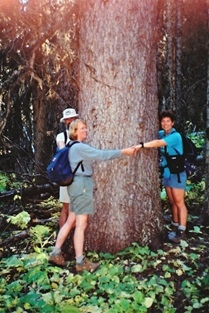
Research on shinrin-yoku (orForest Bathing) in Japan revealed health secrets of trees stemming from the higher concentration of oxygen that exists in forests and the presence of plant chemicals called phytoncides, part of a plant’s defense system against bacteria, insects, and fungi. Exposure to these natural air-borne oils delivers measurable health benefits for humans, including enhanced immune functioning. Evergreen conifers, including pine, cedar, spruce, and fir produce the most phytoncides, so walking through the subalpine and montane forests that flank the GDT offers immense health benefits. Trees really are worth hugging!
James and Priscilla Prescott and Jenny Feick hug an ancient Engelmann spruce in the Hidden Creek headwaters along the GDT in September 2000 (Photo by Chris Junck)
3. Stride into Stability
As you stride along a trail, your leg and core muscles constantly engage, contracting to provide stability and helping you to balance yourself as you negotiate uneven terrain. As these core stabilizing muscles strengthen over time, your sense of balance improves. As you hike, informed by the nerve endings in the fascia of your feet and legs, your brain processes every log, rock, root, patch of mud, and puddle. It gauges what it will take to step over or around such obstacles. With practice, one’s brain becomes more adroit at assessing and responding to these barriers, and as a result, balance gets better. Thus, hiking helps boost proprioception, the mind’s awareness of the position and movement of the body in relation to its surroundings.
Strategic use of trekking poles can further improve one’s poise especially while crossing creeks or descending steep terrain. As one gets into middle-age, using them can also save wear and tear on knee, hip, and ankle joints, enabling one to hike well into one’s 60s, 70s, and beyond. Maintaining a good sense of balance is one of the most important skills needed as one grows older since falls account for the majority of reasons why elders enter long term care facilities.
Jenny Feick working on her balance while backpacking across logs over Lost Creek on the GDT in 2000 (Photo by Chris Junck)
4. March for Your Muscles
Besides building up the stabilizing muscles in the legs and core to enhance your balance, hiking also strengthens the other muscles of the body including the arms and back. Hiking exercises nearly every major muscle group in the body. Walking uphill engages big muscles on the front (quadriceps) and back of your legs (glutes, hamstrings, and calves) while hiking downhill engages the fine muscles around your ankles, the sides of your hips, and your inner core. If you use trekking poles and carry a moderate to heavy backpack, you will significantly strengthen your arm and back muscles. Long-distance hiking really is a full body workout! As such, to avoid strain and injury, one should physically train for a major backpacking trip with shorter trips, gradually building up your strength to carry weight and keeping your pack weight reasonable.
Jenny Feick and Ian Hatter backpacking on the GDT by Upper Kananaskis Lake in 2011
5. Hike Up to Build Up Your Bones
High impact, weight-bearing activities like hiking up a steep trail while carrying a pack on your back helps to improve bone density (the amount of bone mineral in your bones) by strengthening your actual bone tissue. By strengthening your bones they will be less likely to break under moderate stress and you reduce your risk for osteoporosis. The dose of vitamin D from sunlight will also help your bone health.
6. Hike for Healthy Weight
Doctors recommend that adults get at least 150 minutes (2.5 hours) of physical activity every week. However, when hiking the GDT, you will get far more than 2.5 hours of hiking per day. The number of calories burned while hiking depends on many factors, including one’s existing weight, Body Mass Index or BMI[1], gender, plus the aerobic intensity, distance, and duration of the hike, and the fuel (calories from food) that you consume. During multi-day long-distance hikes, people tend to replace excess fat with muscle. This can result in gradual weight loss, but not always. Muscle weighs more than fat, so with some people, they will look slimmer and feel better even though they may weigh a bit more. Skinny individuals lacking in muscle tone may also gain weight, becoming lean and strong.
Maintaining one’s energy levels with enough calories from nourishing food can prove challenging on long-distance trails and requires careful planning. Setting out to use long-distance hiking as a means to lose weight quickly could prove disastrous on wilderness routes like Canada’s GDT, especially during bouts of cold, inclement weather. One must also be wary of getting used to consuming a lot of calorie dense foods while on a long-distance trek. That habit needs to change after you complete the hike, or else the pounds will pile on and that hard-earned muscle will turn back to fat.
Mental & Emotional Benefits of Hiking
1. Hiking to Get Smart
Research reveals that what is good for the circulatory system is also good for the nervous system. When you hike, more blood flows to your brain, carrying with it oxygen and important nutrients. This increased blood flow improves connections between neurons in the parts of the brain that are in charge of memory and cognitive function.
Evidence shows that older adults who exercise regularly have improved memory compared to those that don’t. In a paper published in The Neurology Paper in 2008, older adults who never exercised showed clear signs of cognitive decline. After six months in a walking program, their mental decline reversed appreciably. Another study at the University of California measured the cognitive abilities of 6000 women over 65 years old. They discovered that the women who walked the most had the least mental decline.
Science proves that getting exercise, especially outside in nature, helps individuals focus and improves the ability to process information. Walking keeps your mind sharp and alert, which is a good thing on the GDT, which is prime bear country.
2. Wandering into Wonder and Mental Wellbeing
Many studies support the idea that connecting with nature improves mental health. Whether we are taking in the immensity of a dark sky filled with stars, waking up to the spectacular glow of a sunrise over the Rockies, or gazing out at a field of beautiful alpine wildflowers, these brief moments when we feel a sense of wonder and awe in nature help us feel happy and contented. Appreciating such beauty triggers the brain to relax and experience positive feelings like gratitude.
Ian Hatter takes time to appreciate nature as he hikes the GDT in the Healey Pass area
Given the existential threats in the world today, many people experience stress and suffering. The rates of mental illnesses like depression and anxiety have increased in the past decade. Evidence abounds that spending time in nature can help focus our attention on the present, be it the view we see, the red squirrel we hear chattering away, or the scent of conifer forests. This helps create a sense of conscious calm, providing an antidote to our otherwise hectic bad news bombarded lives. The feelings induced by hiking in nature can help dissolve chronic “rat race” type stress and induce optimism. Dr. Paul Piff, assistant professor of psychology and social behavior at University of California Irvine, asserts that spending time in nature can evoke “a reduced sense of self-importance relative to something larger and more powerful”. In particular, inhaling the phytoncides found in coniferous forests helps to calm our nervous systems, reducing both psychological and physiological stress.
Jenny Feick enjoying the fragrance of the subalpine forest along the GDT near Beehive Mountain, AB (Photo by Ian Hatter)
3. Trek Your Way to Confidence
A 2010 study found that even five minutes of vigorous outdoor exercise a day can help people feel more confident. This is because when one challenges oneself, that sense of accomplishment can lead to improved self-esteem. Travelling the GDT may not always feel great at the time, particularly as you slog up a steep grade while swatting mosquitoes. Yet trekking on a taxing long-distance route can lead to you feeling stronger, more capable, and self-sufficient, with the wherewithal to tackle whatever the world throws at you.
A related benefit of long distance trips on the remote sections of the GDT is to experience and appreciate solitude. Walking one step at a time forces you to slow down, calm your thoughts, and feel immersed in nature.
Lone hiker at Numa Pass along the GDT, Kootenay National Park
4. Saunter to Sleep Deeply
Numerous medical studies demonstrate that regular exercise can help improve sleep patterns and relieve insomnia. Moderate exercise increases the amount of slow wave sleep one gets. During this deep sleep, the brain and body rejuvenate. Human growth hormone is released, which supports healthy growth in the young and builds a healthy immune system in fully grown adults. Besides helping us to feel tired and in need of rest, exercise helps to stabilize one’s mood and decompress the busy mind chatter that can lead to negative thinking. This enables the mind and body to relax. Also, being outdoors and receiving natural light affects sleep patterns. As Shawn Stevenson explains in his book, Sleep Smarter, exposure to sunlight, especially in the morning, prompts the production of melatonin (the sleep hormone) at night. Exposure to phytoncides in coniferous forests also appears to induce better deeper sleep.
Fresh air and exercise helps us sleep well, which improves immune system function
In some people, vigorous, challenging exercise, particularly late in the day, can rev up one’s system, making it more difficult to fall asleep. Nervous anticipation about a particularly difficult section of trail the next day can also interfere with getting to sleep. This can be exacerbated if one feels cold and/or uncomfortable due to not having the right gear. Being well prepared and setting realistic daily distance goals should ensure you gain the sleep benefits of hiking the GDT.
5. Sound Healing
Parks and other wild areas can offer the opportunity to listen to natural sounds and avoid human-related noise, a rare combination in our increasingly urbanized world. A study published in 2021 in PNAS examined evidence of the health benefits of natural soundscapes in national parks across the United States and quantified the incidence of restorative acoustic environments there. The researchers found 36 publications examining the health benefits of natural sound. Meta-analyses of 18 of them revealed comprehensive evidence for decreased stress and annoyance and improved health and positive affective outcomes. Examples of beneficial results included decreased pain, reduced stress, boosted mood, and enhanced cognitive performance. The results confirmed that natural sounds improve health, increase positive affect[2], and lower stress and annoyance.
Ian Hatter listening to the rushing waters of the upper Kananaskis River in 2011
Their analyses revealed many national park sites that had a high abundance of natural sound and low human-generated, including mechanical and electronic sounds. Water sounds, such as a gurgling brook or a waterfall, tended to be the most effective at improving positive affect, while bird songs proved best for reducing stress. The study’s lead author, Dr. Rachel Buxton, a research associate and conservation biologist in the Department of Biology at Carleton University in Ottawa, suggests people close their eyes, and be mindful of the sounds they hear when visiting a favorite park. “These sounds are beautiful and good for our health – they deserve our protection,” she added. This research augments the substantial body of evidence that proximity to nature and time spent outdoors improves human health and well-being.
“Silence is a part of our human nature, which can no longer be heard by most people. Close your eyes and listen for only a few seconds to the world you live in, and you will hear this lack of true quiet, of silence. Refrigerators, air conditioning systems, and airplanes are a few of the things that have become part of the ambient sound and prevent us from listening to the natural sounds of our environment. It is our birthright to listen, quietly and undisturbed, to the natural environment and take whatever meanings we may from it. By listening to natural silence, we feel connected to the land, to our evolutionary past, and to ourselves.”
Ian Hatter meditates at the one square inch of silence site, Olympic National Park, Washington State
6. Hiking Offers a Chance for a Technology Fast
The average American spends 93% of their time indoors, and some ten hours a day on computers or other electronic screen devices engaging in social media, more time than they spend asleep. People hiking the GDT today rely more on technology than previous generations. The GDT app for iPhones makes finding the GDT route easier, especially in unmarked sections. Devices such as inReach and Spot give us peace of mind in case of emergencies. Our ability nowadays to make and post videos of our GDT trip allows us to widely share our experiences with a huge audience.
While there can be safety and other benefits to using technology on the trail, don’t let it interfere with the opportunity to mindfully enjoy nature (Photo by Ian Hatter)
However, these technologies bring unintended consequences. Continuing to live our on-trail lives through our iPhones and other devices takes time, time you could be mindfully experiencing nature or resting your mind. Too much focus on technology during a long-distance backpacking trip can lead to stress and anxiety. Keep in mind that software engineers design social media apps to be addictive. Make sure you have periods of time when you experience nature on her terms, without any device mediating what’s happening. Use your hike as an opportunity to disconnect from any addictive dependence on social media and to live in the moment. Don’t scroll when you stroll.
7. Ramblers Rule
Rambling through the Rockies on the GDT helps build a sense of community. If you enjoy hiking long distances over multiple days, chances are you will be traveling in the same direction as other walkers who you will end up getting to know while walking. Long distance walking offers a great way to socialize with these other hiking enthusiasts. Meeting fellow hikers can foster new friendships.
People connect when participating in GDTA work trips like this one in 2018 in the Blaeberry Valley, BC. (Photo by Jeremy Bateson)
Joining the GDTA and participating in group activities such as trail work trips, educational webinars, and live presentations creates social bonds that can help you feel a part of something worthwhile. If you need more community connections in your life, join the GDTA and consider hiking portions of the GDT. It’s a safe way to meet and befriend other people who enjoy hiking in nature and long-distance trails. They may end up being a friend for life, like Dave and me.
Dave Higgins and Jenny Feick in July 2017 on the GDT below Mount Erris, AB (Photo by Ian Hatter)
How Can We Give Back?
During the COVID-19 pandemic, numerous people learned about the health benefits of recreating outdoors in nature. While outdoor recreational spaces played an important role in keeping citizens healthy, local parks became overrun with people. Parking, toilet facilities, and trails became strained beyond capacity. Instead of viewing parks and protected areas and long-distance trails as a cost, we as a society, and our government representatives, need to see them as an important investment in the physical and mental wellbeing of Canadians. Trails and parks enable self-care that helps prevent or delay chronic illnesses such as heart disease, diabetes, and dementia. Facilitating long-distance hiking through natural areas should be considered as part of a Canadian health care strategy. All of us who benefit from hiking in nature can give back by supporting and encouraging the protection of natural areas and establishment and maintenance of trails for non-motorized users.
Jenny Feick backpacking through Valley of the Rocks, Mount Assiniboine Provincial Park, B.C. in 2010 (Photo by Ian Hatter)
[1] Body mass index (BMI) is a value derived from the mass (weight) and height of a person. The BMI is defined as the body mass (in kilograms) divided by the square of the body height (in metres). Body mass includes all body tissues – muscle, fat, bone, fascia, skin, organs, etc. It is expressed in units of kg/m2. Tables or charts that show BMI as a function of mass and height using contour lines or colours for different BMI categories are usually used to determine an individual’s BMI. The BMI can be used as a means to classify someone as underweight (under 18.5 kg/m2), normal weight (18.5 to 24.9), overweight (25 to 29.9), and obese (30 or more).
[2] Positive affect is the psychological term for a more positive outlook or disposition and the experience of joy and interest.
This edition of the Pathfinder Newsletter includes a few key announcements, and articles showcasing adventures on the GDT, accomplishments this year, volunteer recognition, trail crew fun, event reports, and special interest topics. Enjoy!
It is with great pleasure that we announce GearTrade‘s online GDT Store. GearTrade, one of the GDTA’s corporate supporters, has recently added a GDT Logo Merchandise product line.
Although starting small with stickers, patches, and buffs, this product line is set to expand over the coming months. Check it out at the SHOP button in the upper right of all GDTA webpages. Visit it regularly to watch for new items appearing.
Proceeds from the sale of all GDT Logo Merchandise at Geartrade, go to the GDTA to help protect, promote, and maintain the Great Divide Trail.
GearTrade was founded in 2012 in Okotoks, Alberta by an outdoor enthusiast and entrepreneur who saw a need for an outdoor gear marketplace. Over the years, this local business has flourished with online sales throughout North America.
“However, it is still the little touches, customer service, and professional advice that matter most to us. We strive to take the time needed to make sure our customers walk away with the right product for their next adventure.” — GearTrade
Save the Dates – Autumn Events
November 4-6 – Banff Film Festival We will have a booth at the Banff Film Festival. Details here. Come, swing by, say “Hi” and catch up on the latest news with the GDTA. Location: Banff.
December – 3rd Annual Trail Supporter Campaign Join us in enabling 2023 GDT projects – trails to clear, bridges to build, willows to whack, and other exciting key projects in the plans, by remembering the GDTA in your Holiday Season gifts.
For all our Southwest Alberta hikers / geography keeners….. which number is closest to the number of glaciers, or visible remnants thereof, contained in the most southerly drainage basin traversed by the GDT, the Oldman River drainage basin? Clue: this is a semi-trick question.
0
3
5
8
12
16
20
25
32
================================================
Closest answer – 25. While there are not any glaciers in the Oldman River’s ALBERTA section of its drainage basin, there are several in MONTANA’S Glacier National Park in the Oldman basin. Two Oldman tributaries flow northward from Montana into the Oldman River upstream of Lethbridge: the St. Mary River, at approximately 11 km upstream of Lethbridge, and the Belly River, an additional roughly 19 km upstream. A third river, Waterton River, empties into the Belly River south of Fort Macleod.
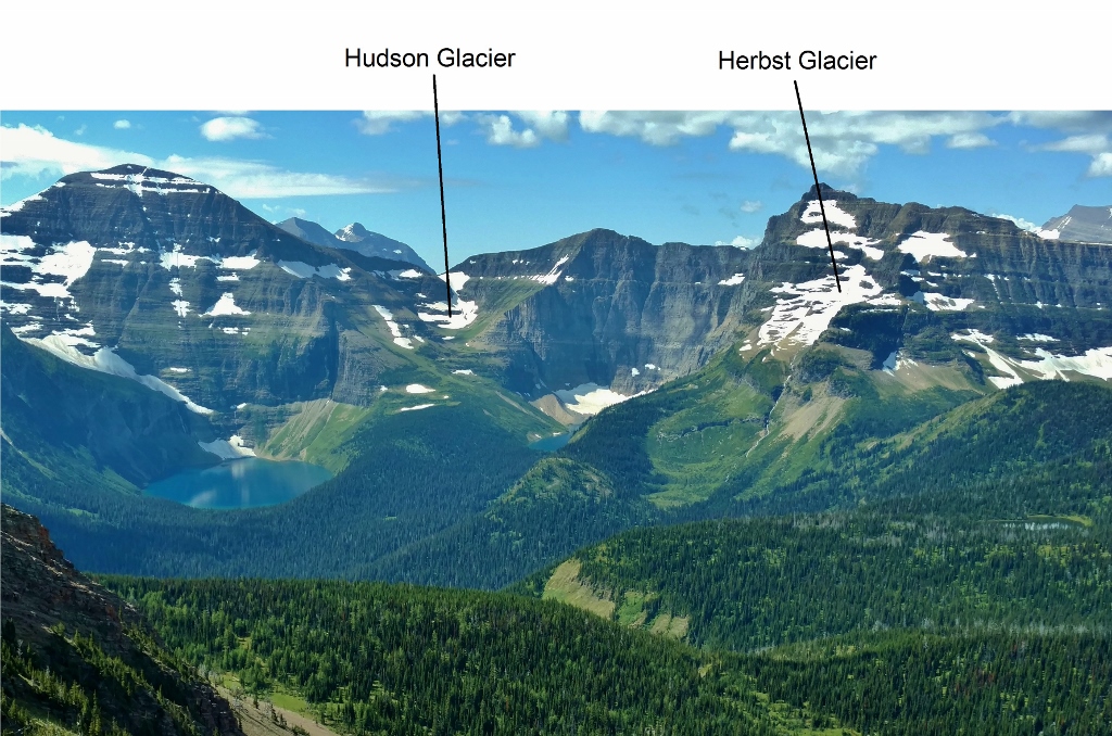
Glaciers (or remnants) in the Waterton River’s headwaters (perhaps others): Carter Glaciers (2+), Dixon, Thunderbird, Hudson, Herbst. Total – 6+
Herbst Glacier below Mt. Custer. Hudson Glacier between Lake Nooney and Lake Wurdeman on the wall just south of the lakes. Seen looking south into Glacier N.P., USA, from the Carthew-Alderson Trail in Waterton Lakes N.P., Canada.
Glaciers (or remnants) in the Belly River’s headwaters (perhaps others): Ahern, Ipasha, Chaney, Shepard, Whitecrow, Miche Wabun, Old Sun. Total – 7
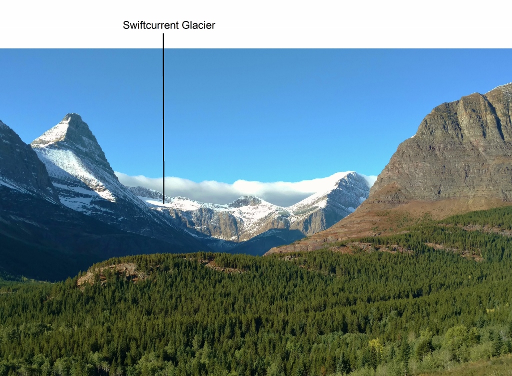
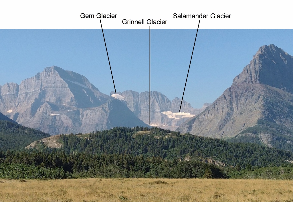
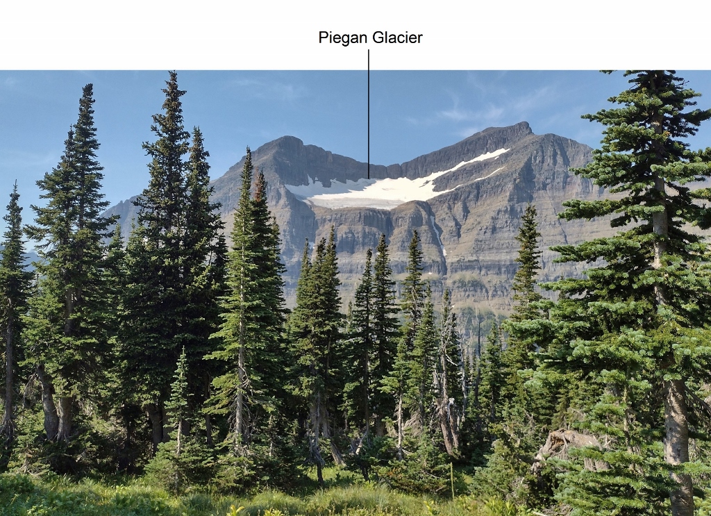
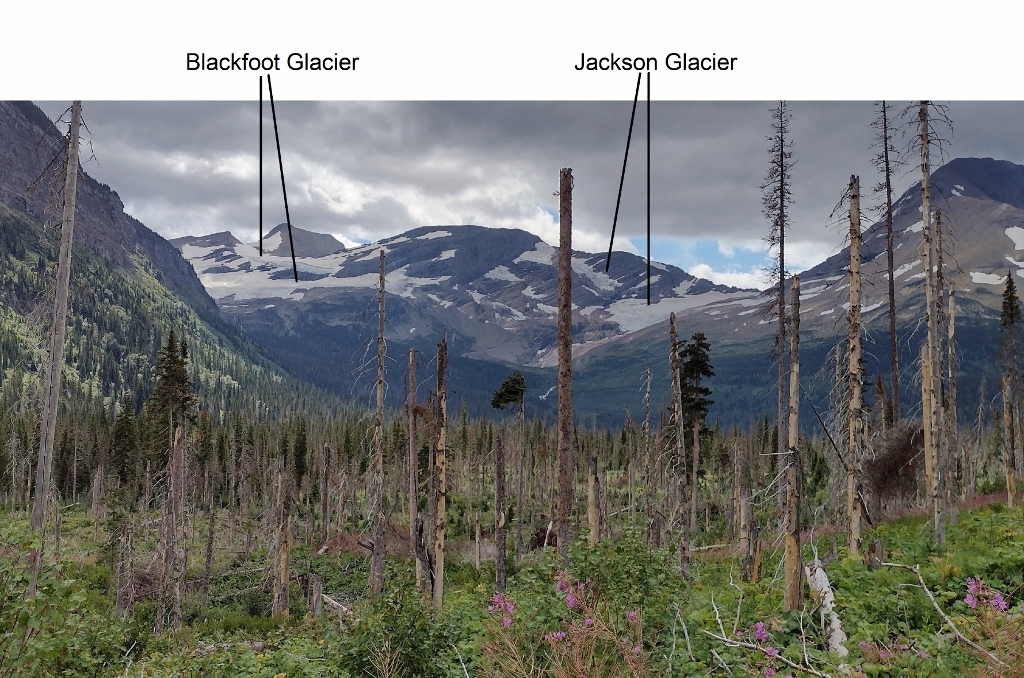
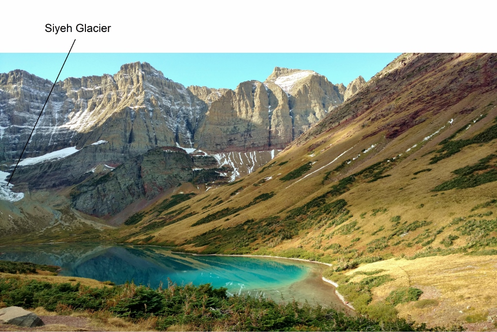
Glaciers (or remnants) in the St. Mary River’s headwaters (others as well?): North Swiftcurrent, Swiftcurrent, Salamander, Grinnell, Gem, Siyeh, Sexton, Piegan, Red Eagle, Logan, Blackfoot, Jackson. Total – 12.
Swiftcurrent Glacier below Mt. Grinnell (left). Seen looking southwest from Swiftcurrent Pass Trail in Glacier N.P., USA.
Left to right: Gem, Grinnell, and Salamander Glaciers. Grinnell Glacier is mostly hidden from this angle, in its bowl. Seen looking southwest from near the Many Glacier entrance to Glacier N.P., USA.
Piegan Glacier. Seen along Piegan Pass Trail at the meadows just below Piegan Pass. Glacier N.P., USA.
Blackfoot Glacier and Jackson Glacier. Seen along Gunsight Pass Trail, Glacier N.P., USA.
Siyeh Glacier (extends out of the picture to the left) above Cracker Lake. Seen looking looking southwest from Cracker Lake Trail in Glacier N.P., USA.
Background:
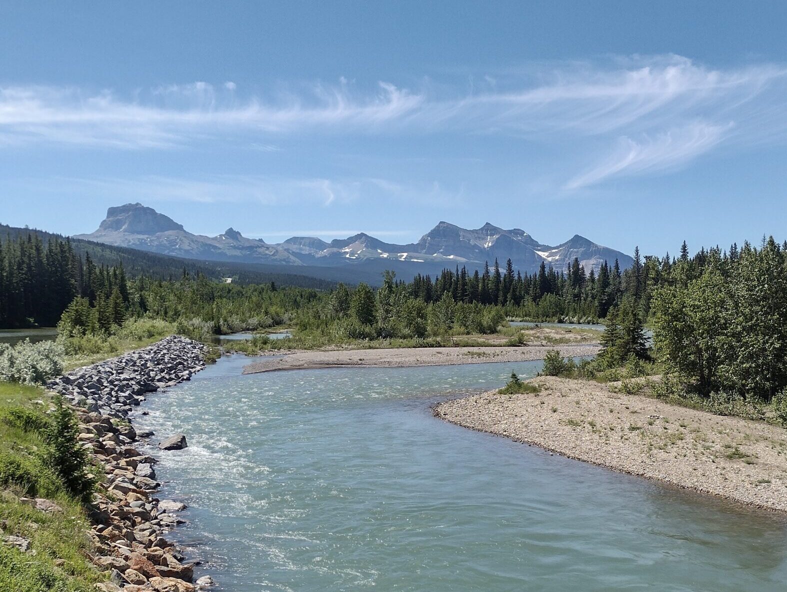
My interest was aroused for further research when I read this about the Oldman River’s flow rates:
“Streamflows peak in early July, then recede steadily into late summer as the mountain snowpack disappears, and are sustained through the fall by run-off from glacier melt and whatever rain happens to fall”
Say what? Glacial meltwaters flow into the Oldman River? Not the Oldman River with which I’m familiar in Alberta! Ah yes …. but the Oldman River’s drainage basin extends into Montana. Why of course: Glacier National Park!
During lockdown in the UK, everyone became obsessed with something. From hoarding toilet paper to home fitness, anything to stay sane. My obsession of choice was the Great Divide Trail. A wild thru-hike over 1100 km from Waterton at the US border to Kakwa Lake, tracing the divide between British Columbia and Alberta. The fault line of the Rockies. It looked wilder and less well known than other long-distance trails and that was part of its appeal to me. I have a note on my phone from the 30th of December 2020 with a link to the Great Divide Trail Association and their wealth of resources on the trail, including detailed itineraries and first-hand accounts. My plan was, and still is, to hike the entire trail.
Fast forward to 2022, I saw a window of opportunity to volunteer, and trail build with the GDTA and fulfill a dream of mine to see the GDT for myself and walk at least some of it. The trip surpassed my cabin fever driven expectations and has renewed my desire to see more than the High Rock Trail section I worked on.
I flew from London to Calgary airport in early July and went via Jasper to see a friend and then onto Crowsnest Pass to begin trail building.
Doug and Kate welcomed us all with open arms. The first day of trail building presented a few language barriers. Tools such as a “rogue hoe” or a “‘mattock” were unfamiliar to me, don’t even get me started on the Pulaski. Doug’s practical demonstration fortunately bridged the gap. Every day began with a hike to our work spot and finished with a hike home. Sometimes we’d sneak a swim at Window Mountain Lake, if we still had fuel in the tank after a day of unearthing and then smoothing large volumes of dirt.
Window Mountain Lake
There was no greater feeling of satisfaction than completing even 5 metres of trail. To see it transformed from rough shrub to a red carpet for horse and hiker alike. I took pride in nailing this sign and GDT crest at the right height.
On the way up the HRT
We ate together each night, thanks to the excellent camp cook – Hailey. We would return from a swim in the Lake to bottomless bowls of Mac and cheese or chilli. This luxury isn’t part of every trip, but we were lucky enough to get the full glamping experience.
I am grateful to the GDTA and everyone on the trip for such a warm welcome to Canada. It’s a truly community-centred organisation with advocacy for the maintenance and promotion of the GDT at its heart. I am hoping to come back next year and hike the entire trail, and to reunite with old friends again at resupply points. I am also in the process of making a film on the history of the GDTA and would love to speak to anyone who has been involved. Please get in touch via email joeygompels@gmail.com.
Safety Meeting at Camp. 8am Sharp. Taken on film camera
Every summer for the past four, the mighty Lynnie Wonfor and myself have hiked a section of the GDT. It’s been awesome, something to look forward to every year, an opportunity to reconnect with the trail, hikers and volunteers. This summer we were planning to hike section A with Lynnie’s daughter, Sophie, and then Lynnie and I would go on to hike section B. A stretch goal, a mighty plan that didn’t quite work out. The day before we were meant to depart our driver, my husband, tested positive for Covid. So the plan was changed – Lynnie and Sophie would start section A and I would stay behind. Well, with my fear of missing out, the weather so nice, testing negative and feeling strong, I gave it four days and headed out. I was more than a bit conflicted though. I wanted Lynnie and Sophie to have the mother daughter experience and I didn’t want to give them Covid. My plan was to hike alone.
I went onto the GDT via Red Rock canyon in Waterton, bypassing the start of section A, as I’d hiked it before. My plan was to hike the Barnaby Ridge Alternate and then to finish section A at Coleman. I was excited about hiking on my own, as I wanted to give it a go. Sheesh, more on this below.
The first day, I rocked it. I took the Snowshoe Trail and was soon at Sage Pass. I ran into Lynnie and Sophie (photo below) some place before Font Creek campsite and kept going owing to the reasons above.
Sophie and Lynnie headed for Font Creek campsite.
Enroute to Jutland Creek campsite.
Still enroute to Jutland Creek campsite.
I stopped for dinner at Jutland Creek and went onto Scarpe Pass to spend the night. I’d seen no one since running into Lynnie and Sophie. I’m at Scarpe Pass at about 7pm and can’t find the water. I know there’s water there, from the guidebook and there are marmots around. I’m thinking I’m on my own, it’s getting late, my brains not working (a function of hiking alone) and so I opt to hike back to Jutland creek. It’s only 20 minutes, all good. Who should I meet there but Lynnie, Sophie and two thru hikers. After a day on my own (yup, that’s right after one day), it was great to see people!
The next day, it was off to La Coulotte Peak and Barnaby alternate.
Looking northbound towards La Coulotte peak.
A bit about the Barnaby Ridge Alternate.. it’s probably the most challenging section of the GDT that I’ve hiked (and I’ve completed sections C, D, E and G with lots of alternates including the Northover Ridge, Six Passes, Kiwetinok). There is scrambling with a backpack, walking along cliff edges, steep ups, steep downs and walking on dubious scree. The crux is getting down La Coulotte Peak but it doesn’t stop there, it was challenging through to joining Barnaby Ridge.
The trail thins out a bit after Scarpe Pass but there is a trail. The La Coulotte ridge can be narrow with steep up and downs. You have to watch your footing. Getting up La Coulotte peak, was absolutely fine. It’s a grind but nothing too tricky. There were lots of footsteps to follow.
Getting down La Coulotte peak was a different story. I checked the app and read about folks who walked towards the west and around the cliff band and did not scramble over it. I had a look and thought why not? The why not, is that the scree is very loose, if you lose your footing you’re going to slide for a bit and then head over a few cliff bands. As I did this route, at one point my front foot went loose. I steadied myself and then considered turning around but with a backpack, thought no way. So, I continued, walking like I was doing a river crossing, three points of contact and very slowly. It worked out but I wouldn’t recommend this route. The next challenge was to navigate two more cliff bands. I checked out going east around them but I didn’t like the loose rock underfoot. And as I’d seen a number of videos where people, scramble over, I thought I’d try it. The second rock band was fine and gave me confidence. I haven’t done a lot of scrambling with a backpack.
Looking back towards La Coulotte Peak.
The final rock band looked okay too or so I thought. On my last step down, I had to stretch to get to the ground. As I was reaching down, the rock I was balancing on gave way. I was going down. Somehow I managed to grab a small tree enroute and so didn’t slide far. But it did shake me up. I had a rest, stopped the bleeding, bandaged up my legs and elbow, and gave some thought to what now. I wasn’t ready to go back up La Coulotte and so I continued on.
The next bit of ridge after coming down La Coulotte peak.
I kept going along the ridge for maybe one and a half kilometers (got up the peak in the photo above) and thought what am I doing… I don’t know if I’ll see anyone else on this route, there are still many tricky bits to navigate and I do not even have a full first aid kit! SHEESH! So I turned around. It was going to be a long day but a known day. About a kilometer later, I met up with Lynnie and Sophie! They said join them, they had Polysporin and iodine! What a relief!! I had a short cry and joined them, keeping a distance for reasons explained above. The rest of the hike into Grizzly Lake seemed long (probably because I’d already walked part of it). There was one tricky bit with loose rock and then loose rock on rock to get down but it was okay. And then you see the first lake and think you’re almost there…. but you’re not. It’s further along the ridge. Finally arrived at Grizzly lake, it’s an awesome campsite!
Last peak to come down before Grizzly Lake. The rock was loose here. You can just make out Lynnie or Sophie on the top. Once down this, you can see the first lake.
The next day, the plan was to go to Barnaby Lake and navigate the two GDTA flagged routes to avoid serious scrambling. About 13.5 km, how hard can that be? Well very hard! It took us an average of a km/ hr. We rolled into Southfork Lakes at about 9:30 pm and called it a day. The GDT flagged sections were great. Thank you GDTA (and Dan Durston). It was nice to have the route clearly marked with flagging. The rest of the time we relied on the Far Out app for the most part. Sometimes there was trail and sometimes there wasn’t.
The top of the up scramble, the second GDTA flagged section.
We had one tricky bit this day. Rather than going up the last unnamed peak, we followed a clear trail around it. The scree was loose at times but it felt okay. But then as we came around and looked to hike down to the pass, there were cliff bands everywhere with loads of loose rock. It was a bit overwhelming for those of us who already took a tumble on this trip! And it was 7:30pm. Have to say, that Lynnie was amazing at this point and successfully found the trail using the app. When we looked back, this section scramble didn’t look that bad, you can see the weakness in the rocks. It was a different picture from above, late in the day with tired bodies.
Looking back at the down scramble from the unnamed peak.
As we walked the Barnaby Ridge Alternate, I kept wondering where is the very wide ridge that was featured in the GDTA marketing literature? Well, we finally found it at about 8pm on day two of the Barnaby ridge alternate. It’s the true Barnaby ridge and it is lovely!!
Barnaby Ridge.
If you are interested in only hiking the Barnaby Ridge and do not want to scramble in a backpack, I’d strongly recommend doing it as a short backcountry trip. The trailhead is where the GDT alternate route meets hwy 774 , AllTrails calls it the Syncline Barnaby staging area. Hike to either Barnaby Lake (awesome small campground by a lake with sheltered campsites) or Southfork Lakes (more random camping but closer to the ridge). With a base here, you can hike up to the ridge and Southfork Mt and go along the ridge for as long as you like.
After camping at Southfork Lakes, we separately decided to come off the trail. I woke up feeling run down and thought Covid might be hitting me (it wasn’t, it was just the result of lack of sleep in a wind blown tent). Sophie and Lynnie thought that they’d done the best of section A and it was time to get ready for Sophie’s next adventure. Lynnie and I planned to come back later in the summer to finish A.
I’m still wondering how I feel about the Barnaby Ridge Alternate route. I’m not someone who enjoys hiking with lots of exposure and I do think that there was a bit of exposure and you had to be careful with your foot placement on the steep ups and downs near the edge. It is a physically demanding section; I wouldn’t plan for your normal 25 km thru hike day on this section.
I have a great deal of respect for the folks who thru hike the trail alone. I can’t imagine a more difficult challenge! After this very small experience, I would give it another go. But only after an exhaustive search that turned up no one willing to go with me, and only if there was no scrambling. Been there, done that.
Postscript: Lynnie and I did go back to Waterton in September but as the weather was amazing, we opted to do the Rowe Alternate instead of the last part of section A. Zoe, Lynnie’s daughter, joined us for this short adventure. I loved it! With light backpacks, cooler weather (less need for water), bright blue skies, autumn colors, very little wind and strong bodies, I think it was my favorite hike all summer! I’ll write this up for the spring Pathfinder newsletter. Whoohoo!!!
Rowe Alternate from Mt Festubert, looking towards Mt Rowe. We walked along this entire ridge!
In February our group of six committed to 10 days of hiking SOBO from Kakwa Lake to the Blueberry Lake exit of the GDT. For me the push was to do the route before I hit 80 – I’m 77. We had no luck finding a ride up the Walker forest road so I decided to hire Robson Heli Magic and save up my pension cheques.
By August 17 one of our members had cancelled due to Covid. The skies were blue and as if by magic our pilot Sofie deposited us by the cabins at Kakwa Lake. Three lucky hikers got a flight out to McBride. We had a warm reception from Donna and Dan, the custodians, and by lunch time we headed up the flagged trail to the Mt Ruth/Providence alpine. That evening we watched the sunset beside a beautiful tarn and we couldn’t believe our good fortune.
The next day we took a tree line route to Providence Pass and hiked the Surprise Pass Alternate. On the descent from the plateau we saw a caribou and calf and had a fabulous dip in one of the tarns. We camped on a gravel flat before the descent to join the trail to Surprise Pass the next day.
Joining GDT from Surprise Pass Alternate route
The following two days were on trail – sort of. This involved bogs slogs, route finding and willow whacking. We met three NOBO solo hikers who were eager for the end. The camping at the cowboy camps was fine. We appreciated the cleared trails on the south side of Big Shale Hill and the north side of Little Shale.
Because of our continuing good weather and our extra days cushion we opted to tackle the Loren Lake High Route. Soon we were scrambling around Adventist Peak and skipping over lots of boulders in order to make a high camp before a thunder storm rolled in.
The next morning had us up at 5 am in anticipation of wet bushwhacking along the Divide route to Loren Pass and the steep climb through rhododendron to the alpine basin which leads to Perseverance Ridge. We had our only rest afternoon camping in this beautiful place.
Left to Right: Helen Sovdat, Marg Saul, Jim Baker, Heather Ware. Photo by Marg Gmoser
We woke up at 5 am again expecting a long day on the ridge. It took us 11 hours to travel 12 km up and down the ridge line. Some class 2 and 3 climbing was required and a comfort level with exposure. Near Perseverance Mountain we met Fly – a solo NOBO hiker. He had only three days of food left so we gave him things we could spare. We wondered how he’d manage on the long walk out the Walker road. We were relieved to camp by a tiny snow filled tarn at the end of the day.
Our last night was magical. We camped by one of the Holmes lakes which scored 11 out of 10 for a dip. One member went in three times.
August 26 was a 16 km push to Blueberry Lake and the steep trail down to the Holmes forest road where we had left a car. The trail had all the standard Kakwa features – mud, bog, bugs, bush, devils club and the reward of blueberries and huckleberries.
Thanks to all the trail maintenance crews and to my wonderful travel mates – Marg Saul, Helen Sovdat, Heather Ware and Jim Baker.