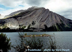
Who would think that World War One (WWI) had anything much to do with the Great Divide Trail (GDT)? When I received a copy of Canmore and Kananaskis History Explorer by Ernie Lakusta as a gift from some hiking pals, its pages brought a surprise that quite a number of Rocky Mountain peaks are named after either WWI generals or battleships. Some of these mountains appear along the GDT through Kananaskis, Smith-Dorrien and the Spray Lakes sections. With the centenary of WWI beginning in 2014, it is fitting to feature a few of these peaks in this series. Starting with the most southerly of the peaks I have chosen, we have Mt.Indefatigable.
It is one of the ‘battleship’ peaks. The 2670-metre peak was named in 1916 by A.O. Wheeler of the Boundary Commission after a ship that took part in the Battle of Jutland. In the Spray Range, it looms over Upper Kananaskis Lake. Though the Stoney Indians named it Ubithka mabi (‘mountain of the nesting eagles’), Wheeler renamed the peak Mt.Indefatigable. According to Lakusta, Wheeler disregarded the mandate of naming based on natural history and ‘in a fit of patriotism’ named most of the mountains surrounding the Upper Kananaskis after WWI generals and ships.The battleship Indefatigable was part of the British cruiser squadron at North Sea Battle of Jutland late May 1916 between the British Royal Navy and the German High Seas Fleet. The Indefatigable was commanded by Captain C.F. Sowerby and had the ominous distinction of being the first ship sunk at this battle. One of the cheapest built by the British Royal Navy, it and many sister ships suffered the same fate of lacking armour to resist attack. Indefatigable received two direct hits and sank 17 minutes after entering the battle. Only the captain and two crew of 1020 members survived. This ship was named for a more robust vessel, another Indefatigable, a 44 gun 18th century frigate which destroyed the French battleship Droits de L’Homme during the Napoleonic War in 1787.
In 1964 Geological Survey reported gypsum on Mt. Indefatigable’s slopes. It was a daunting task to build a road to the mining lease owned by Alberta Gypsum and only one carload was ever removed. The road can be seen as a thin line traversing the slope.
There is no official first ascent, but there is record of Walter Wilcox setting up a tripod on the south summit in 1901. Today it is a popular scramble and a mountain one sees traversing the GDT early in the Kananaskis to Field section in Dustin Lynx’s book (p 109) ‘Hiking Canada’s Great Divide Trail.’
What a delight to come across a booth of eager volunteers promoting the Great Divide Trail Association (GDTA) at the recent Banff Mountain Book and Film Festival. I chatted with Dave Hockey, one of the board members, while he swiped my credit card through a device on his smartphone. He demonstrated to the other volunteers how to collect an electronic payment for a membership. How amazing! I had just become part of an organization dedicated to what was a little-known wilderness route when I had hiked it almost 20 years ago.
Dave Hockey on the GDT at Beehive Mountain
Dave is a tall, middle-aged guy with a big smile and an even bigger voice. He told me a bit about his recent hike on the Pacific Crest Trail (PCT), the long trail recently brought into the public’s psyche through “Wild”, the book and, especially, the movie. He described how land managers have had to adopt a quota system for thruhikers (those hiking from point A to B). Where there used to be a dozen people camped out at a resupply and staging area like Kennedy Meadows in California, there could now be hundreds! I couldn’t imagine it. When my then girlfriend, Julia, and I hiked it in ’94, we were considered vagabonds and no one could understand what we were doing out there.
In 2016, the Great Divide Trail (GDT), or at least the idea of it, turns 50 years old. With leaders like Dave and a dedicated group of volunteers who are as adept at using a brush saw as writing letters to government authorities, the crowning trail of the Rockies is about to become reality.
In case you had to go back and read it twice—yes, the GDT is that old! The first recorded mention that I can find of the route goes back to the minutes of a national parks standing committee meeting in 1966, in Banff and Jasper (Whyte Museum and Archives). At that time, the Girl Guides of Canada proposed that the parks create a hiking trail along the continental divide, 1,200 kilometres along the Alberta–British Columbia border in the Rockies. Soon afterward, a local architect and present-day holder of the Summit of Excellence Award, Philip DeLasalle, submitted plans to Banff National Park to build a series of shelters every 15 kilometres on the trail in three of the national parks, to spur outdoor activity and hiking as a way of life.
This was an exciting time for hikers. South of the border, the USA had passed the National Trails System Act, in late 1968, which officially mandated the founding of the Appalachian Trail on the east coast and the PCT on the west, with an additional 14 trails in the hopper. Jim Thorsell must have sensed that excitement when he published a provisional trail guide for the GDT in 1970.
His description of the trail through Jasper, Yoho, Kootenay and Banff national parks appeared in the very popular Canadian Rockies Trail Guide the following year. That guidebook, now in its ninth edition, spread the word to hundreds of thousands of people and far outside Canada.
By 1974, the USA had thousands of kilometres of continuous trail in development. Where were the long-distance trails in Canada? We had the 800-kilometre Bruce Trail in Ontario, but nothing in the west, certainly nothing to rival the PCT. That’s when a group of students at the University of Calgary got together with the Alberta Wilderness Association and received a grant from the Government of Alberta to explore and survey a potential route for the GDT south of Banff National Park all the way to Waterton Lakes National Park, near the US border.
Cliff White, a retired wildlife biologist speaks favourably of his time on that crew. In a 2001 Backpacker article, he is quoted as saying, “We got to hike all over and get paid for it—kind of. There were three groups of two. We had three old cars we wrestled down muddy back roads, then we’d spend days hiking around, surveying the terrain.” (See more at www.backpacker.com/trips/international/canada-s-great-divide-trail.)
These students went on to found the GDTA as a non-profit organization that built trail and advocated for protected areas along the corridor surrounding the trail. Their efforts produced the only existing trail built and signed as the GDT—about 100 kilometres of it, largely in Kananaskis Country, south of Highwood House. That first incarnation of the GDTA lasted for over ten years.
When I hiked the GDT in 1996 between semesters at the U of C, the word on the GDT was out there but detailed information about the route outside of the national parks was sparse. After hiking the route, I decided to hold on to all my research and write a guidebook — which became another degree all on its own! Rocky Mountain Books published the guide, describing what I called a wilderness route, in 2000. I warned would-be hikers that it’s not like the PCT and that they would need topographical maps and perhaps even a gadget called a GPS — the handheld models were new at the time.
Fast-forward a decade and the GDTA is once again in existence, and here is Dave grinning widely and talking about a rising and vibrant membership. The brochures are sleek, but the handshake is real. One of the GDTA’s goals is “to obtain formal recognition and protection of the Great Divide Trail Corridor”. Shaking Dave’s callused hand, I believe it to be true.
Now, all that remains is to look at my calendar to see if I can join the next trail maintenance gathering and meet others who are as energized about the GDT as Dave and I are. Perhaps I’ll see you there too.
Areas of Interest
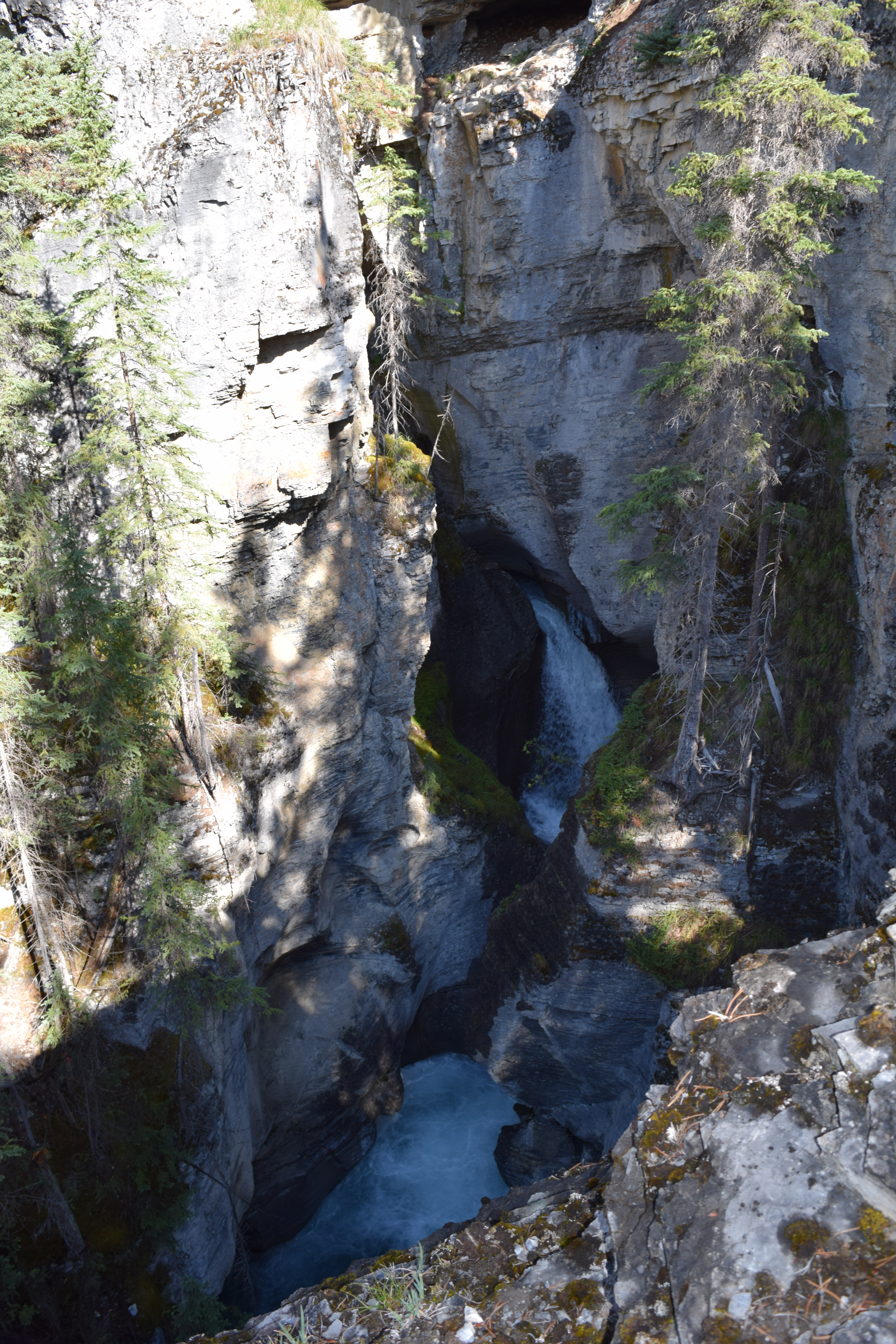
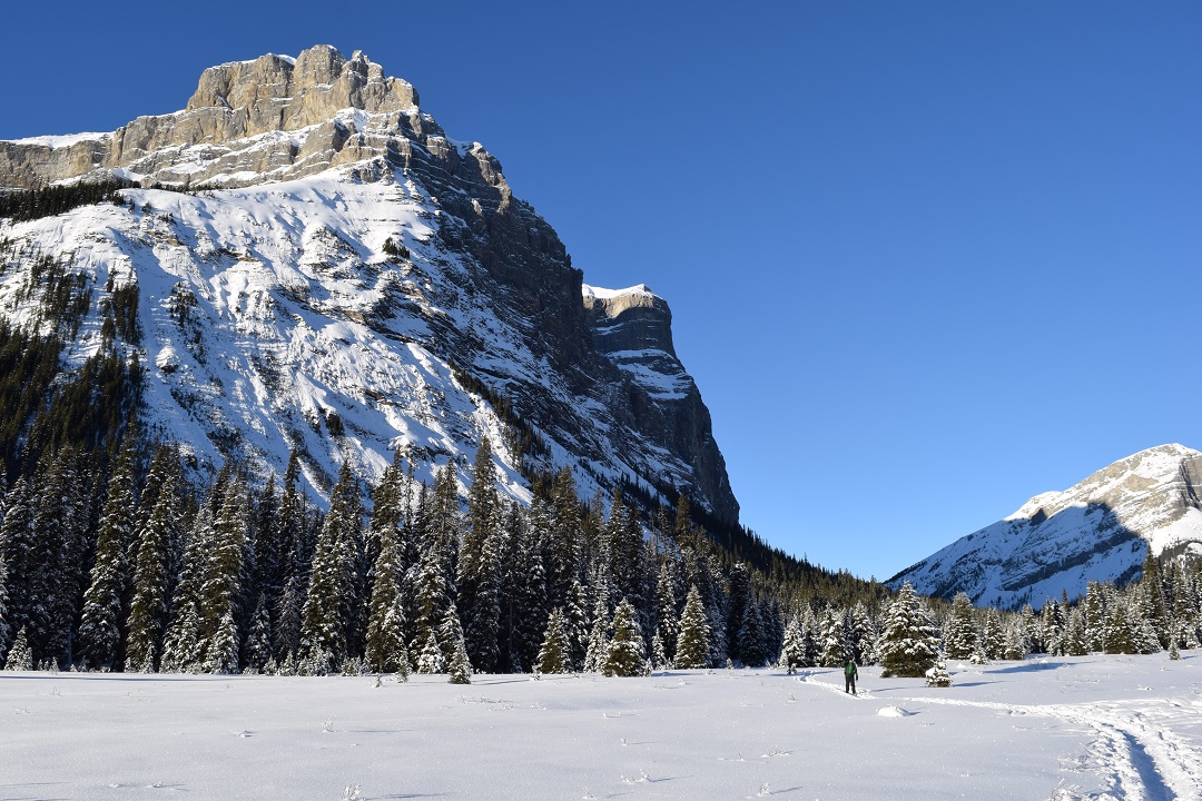
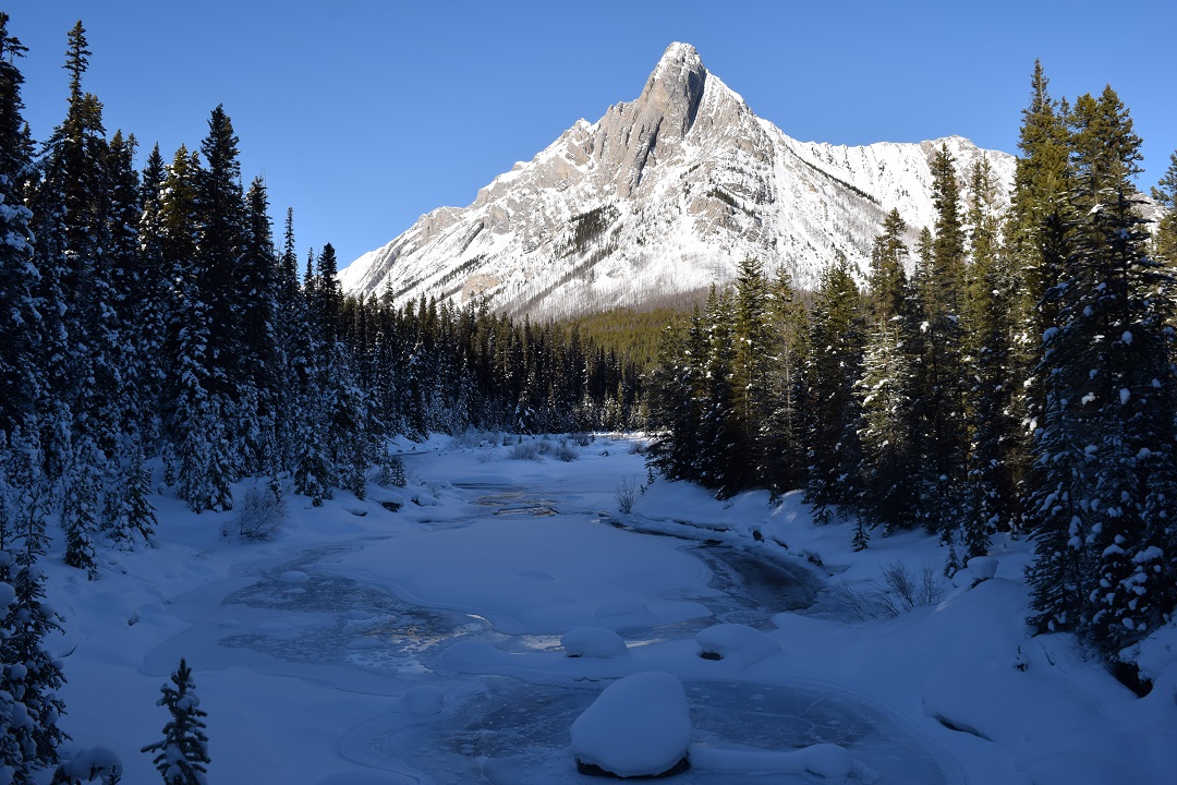
The GDT is 1,200 kilometres long and is accessible at many places. One of the most gorgeous spots is Owen Creek, the first drainage outside the Banff National Park gate on the David Thompson Highway no 11, west of Nordegg. There is a small pull-out there and you need to walk for only about 20 minutes to reach the incredibly scenic gorge north of the highway. Turn around after 20 minutes or perhaps you’ll feel the tug to continue north for another 20 days. That’s the true magic of a long wilderness trail: it beckons you.
Owen Creek canyon
Dustin Lynx is the author of Hiking Canada’s Great Divide Trail (2nd ed, Rocky Mountain Books 2007). He lives with his family in Canmore, where he can be close to the trails he loves. Recently, he started a publishing company called Imaginary Mountain Surveyors. One book was shortlisted for the Mountain Fiction and Poetry Award at the Banff Mountain Film and Book Festival in 2013, and another won that prize in 2014. Hiking is a lifelong passion for Dustin; writing and publishing are a couple of ways that he has found to share that inspiration with others. Find out more at www.imaginarymountains.com.
Crowsnest Mountain (photo by Bradley Vaillancourt)
When I asked some intrepid GDTA thru-hikers what mountain should be next in this series a resounding answer was Crowsnest Mountain. But it is not just the purview of those who hike this trail, but also lucky travellers along Highway 3 in Crowsnest Pass may gaze at its grand beauty. Specifically it lies in the Canadian Rockies in the Crowsnest River Valley between Allison Creek Valley and McGillivary Creek Valley at Latitude 49°42’20” Longitude 114°34’20” in the Municipal District of Ranchland #66, Alberta, and is found on Topo map 82G/10.
In Section 7 (Coleman to Alexander Creek) of Dustin Lynx’s Hiking the Great Divide Trail you will find much of the GDT on motorized trails and gravel roads. Ideally the route would lie nearer the Divide. But to quote Dustin Lynx, “the castellated peaks of Seven Sisters and Crowsnest Mountain are your ever present companions” giving a bit of interest to a rather uninteresting walk.
According to Place Names of the Canadian Alps, George Dawson, in his Geological Survey of Canada 1883-1884 noted that the Crowsnest mountain, pass, and river where originally named by the First Nations because of the big black birds which nested in the area. The Cree may have been referring to the ever present Common Raven, Corvus corax.
There is an interesting story about the first ascent in 1904. None other than Edward Whymper, British mountaineer who did the first ascent of The Matterhorn, was interested in bagging Crowsnest peak, a mountain claimed to be ‘impossible of ascent.’ In July of 1904 he travelled to the vicinity, hired Swiss guides and sent them out to check out the route—but these men could not resist! They summited, leaving a flag, and telegraphed Whymper at his camp in Lake Louise for further orders. Whymper was not happy his employees had stolen his distinction of first ascent. Alan Kane’s Scrambles in the Canadian Rockies confirms the “tourist route” used today is much easier and was first ascended in 1915 as a solo trip.
Crowsnest Mountain has also been called the ‘upside down mountain’ with poems written to this unique feature. It is not upside down; however, the rock at the top is older than the rock at the bottom. The upper cliffs are limestone of Paleozoic age, while lower are younger Mesozoic rock. A sheet of rock from the High Rock Range to the west, was pushed upwards and eastward riding over the younger rock. Over the eons streams have cut away the sides of Crowsnest Mountain and left the peak isolated, a beautiful island of old rocks sitting on younger rocks, a geologic, and very beautiful feature, called a ‘klippe,’ German for cliff or crag. All in all, a mountain to be revered from the Great Divide.
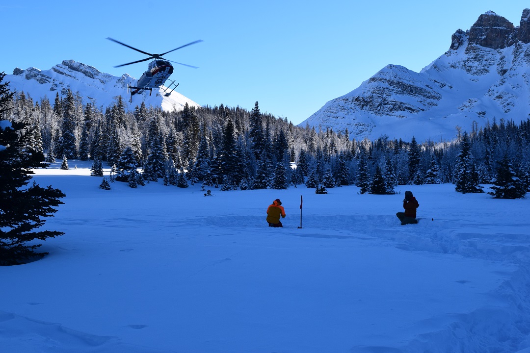
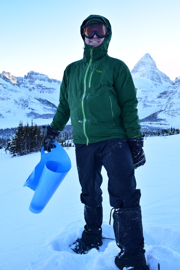
An eight minute helicopter ride above snow covered valleys and meadows, past sheer Rocky Mountain faces and a sharp left over Assiniboine Pass across the Great Divide into British Columbia and there I am stumbling out of a helicopter and post-holing my way to the cooking shelter. Little did I realize that my brief, but beautiful preview of Bryant Creek would be extended into an eight hour adventure. That was a year away.
Touchdown at Assiniboine
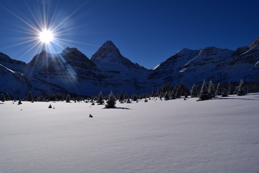
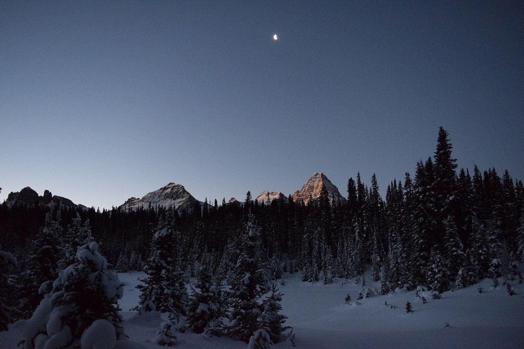
What a wonderful way to bring in the New Year with three days of exploring Mt. Assiniboine Provincial Park pristinely blanketed in a foot of snowy powder from the base camp of the cozy Naiset Huts. Mt. Assiniboine, the Matterhorn of the Canadian Rocky Mountains, greets us every morning as we set out in our snowshoes. In the shade, every part of me is so frozen I can barely feel the -30°C, so we seek out patches of sun peaking between the sister peaks of Mt. Assiniboine.
Snowy Mt. Assiniboine
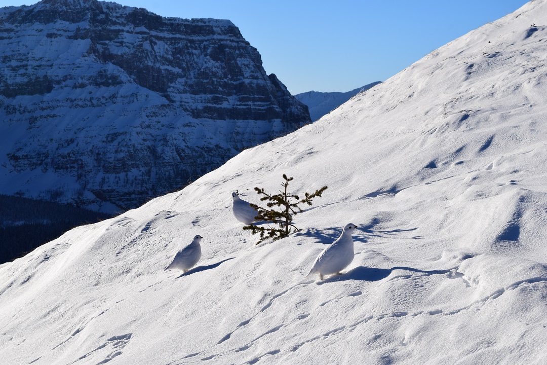
On New Year’s Eve we decide to tackle the Nublet for a better vantage point of the lakes and meadows lapping at the toes of the continental divide. We switchback up in our snowshoes on top of ptarmigan tracks and enjoy frozen chicken wraps at the chilly sub-summit of Nub Peak (even our water bottles were almost frozen solid!). The way down on crazy carpets is much faster and we ruffle the feathers of snow chickens as we woo hoo our way down. Who needs skis? Cheese fondue and good conversation with new friends carries us to midnight when we all leave the warmth of the cooking hut to howl at the moon. Good-bye 2015!
Crazy carpetingPtarmigan
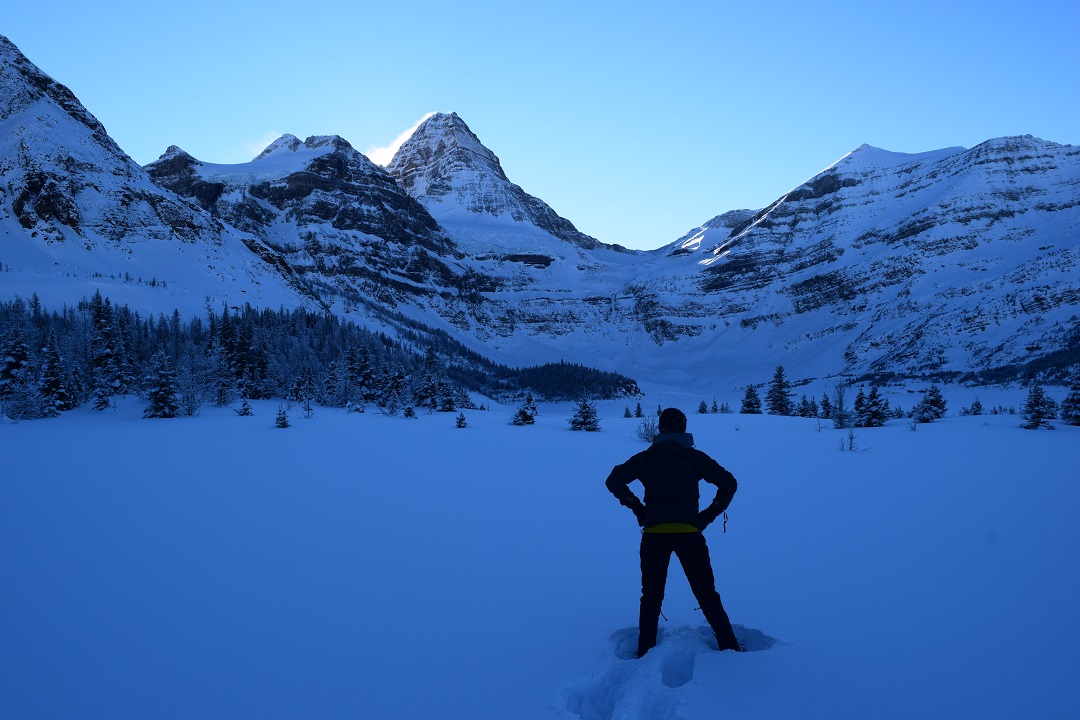
The New Year begins with contemplation of 2016 resolutions under the guidance of Mt. Assiniboine and a snowshoe pursuit of Wonder Pass. The short day and trail breaking results in Wonder Pass just out of reach, but we make time to create a crazy carpet luge named “Wonderful Pass.” We savour the warmth of the cooking shelter, big dinner and good company on our final night because we know that the next day on the Great Divide Trail we will be more than playing in the snow with the 28 kilometres back to our car.
New Years resolutions with Mt. AssiniboinePristine winter conditions on the way to the elusive Wonder Pass
When we leave, it is still dark and my burnt out headlamp is not the deterrent you would assume it to be as the moonlight on the winter wonderland lights my way. As we connect with the Great Divide Trail at Assiniboine Pass, dawn is tickling Mt. Assiniboine’s ribs. We cross the divide back into Alberta and into Banff National Park. From there it is a power snowshoe through shady forests to patches of sun in frozen meadows. My ears are overtaken with the crunch of every step. The silence is deafening when I stop to take in the magical surroundings.
Early start for short winter daysMoon and dawn lit Mt. Assiniboine
The Great Divide Trail is quiet with only a handful of skiers which contrasts from its high summer traffic, a winter perk. The sun dips behind the Rockies just after lunch and we never feel it on our faces again as we push on past Bryant Creek Cabin, Big Springs and Mt. Shark off the Great Divide Trail and onto wide, crunchy groomed ski trails. As we leave the backcountry behind, we meet Canmore’s Nordic community all out enjoying the first ski of 2016.
Bryant Creek meadowWinter Mt. Shark
What took eight minutes by helicopter takes eight hours on foot. The power of my own two feet is maxed out and my face is numb, but I feel alive and like I have started 2016 trying to be a better me doing the things I love. The winter Great Divide Trail still boasts wilderness majesty under all the powder. I feel as if I am part of the privileged few to share in the secret rewards of adventuring on the frozen Great Divide Trail.
NEW FOR 2016: Online reservations for the 2016 hiking season (May – October) for Jasper National Park’s camping and accommodations will open on Wednesday, January 13, 2016 at 8:00 am MST.
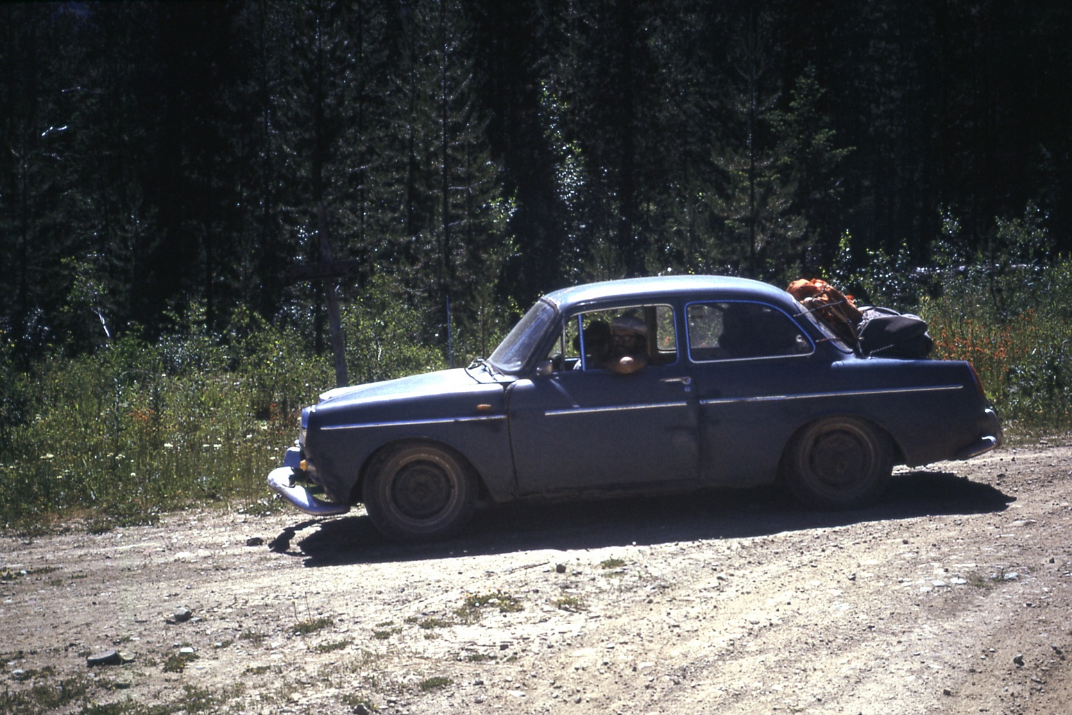
All the recent brouhaha surrounding Volkswagens rigged to pass emissions testing brings to mind the time we had our own jury-rigged VW, which is a much happier story as it was instrumental in helping us survey the original route of the Great Divide Trail.
In the lead up to our 3-month-long trail study project in 1974 (which resulted in a final GDT routing plan between Waterton and the Kananaskis area), my five colleagues (Mary-Jane Cox, Jenny Feick, Chris Hart, Cliff White, and Dave Zevick) and I found ourselves short one suitable vehicle for transport to and from the various study areas along both sides of the continental divide. By “suitable” I mean something capable of traversing hundreds of kilometers of rough backroads, fording rushing creeks, and carrying up to four people plus backpacking gear. But I also mean something that could be had for no more than $100, which, of course, would immediately exclude anything reliable enough to do the job. Good thing we were all too young and naïve to realize that!
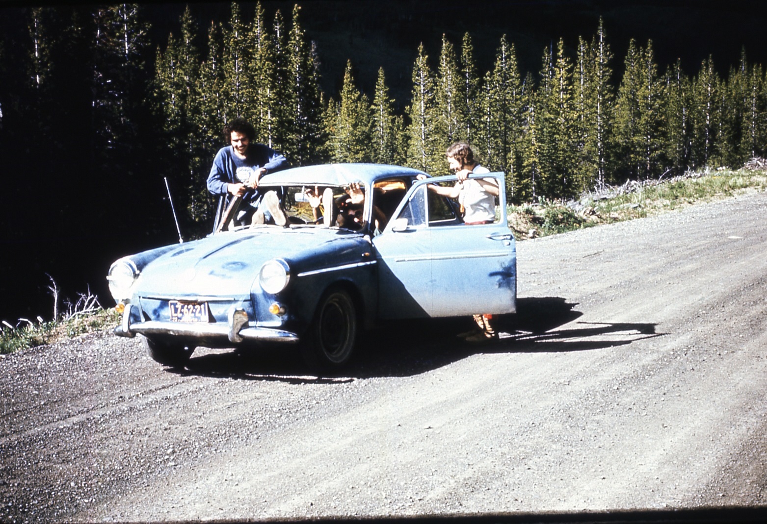
Looking (almost) ship shape!
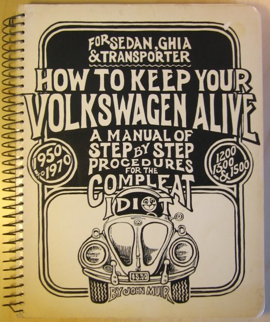
As luck would have it, Chris located and purchased what seemed like the ideal candidate: a sky-blue 1962 VW “notchback” sedan. A bit on the small side, maybe, but it had a killer feature: you could put packs in both the front AND rear trunks, or under both the bonnet and the boot if you happen to be English (the location of the engine wasn’t entirely obvious, at first). Chris also scrounged the most user-friendly maintenance manual I’ve ever seen, appropriately titled “How to Keep Your Volkswagen Alive, for the Compleat Idiot” – a thick tome filled with hand-drawn illustrations, earthy advice on love and the proper use of torque wrenches, and the admonition to “Be kind to your ass, for it bears you.”
A bit rusty here, there and everywhere, our new acquisition wasn’t in terrible shape – well, not after we patched a gaping hole in the floor with a piece of plywood. At least the engine ran, and the brakes and lights seemed to work, most of the time. Shifting the worn-out gearbox, however, required a new skill: “double-clutching,” a complex sequence of clutch-and-accelerator applications. But the good news? Chris underspent the budget by half!
Confidence built when “Blue,” as Chris dubbed the car, made the trip from Calgary to Crowsnest Pass without trouble. Week One of the project found Jenny and me surveying the area just north of the Pass. We’d dropped off Chris and Dave in their assigned area a few days before, Chris warning me to take good care of Blue. We were descending the switchbacks of the old Vicary Mine access road, yours truly at the wheel. I didn’t think anything of it when Blue brushed the underside of a dead lodgepole pine overhanging the road in the same direction as our travel, and later that day we headed back up the steep road, in second gear with the engine roaring in complaint at the effort. Rounding a bend, I spotted the overhanging pine and, remembering how we’d slid neatly under it, kept going, pedal to the plywood. Not smart. The tree must have settled a bit lower from our previous passage, because this time the brittle tip caught on the windshield molding and broke right through with an enormous crash and spray of shattered glass and branch fragments!
When at last all was still, I glanced past the tree trunk in the direction of my partner, half-expecting the worst, and was relieved to see her staring back at me, albeit with an expression of pure shock on her face. “I didn’t want to look,” she exclaimed. “I thought your head would be missing!”
I almost replied no, I’d already lost it before we even got near the tree. But we’d been spared, this time at least. We quickly exited to survey the damage, shards of glass and piles of sticks and bark falling from our laps. It was NOT a pretty sight!
The long straight tree trunk had gone right through Blue! Or, more accurately, I had managed to skewer the car like a big chunk of beef bound for the grill. The top 2 metres of tree trunk protruded from the rear passenger side wheel well, right above the tire. What a sight! “I must’ve kept the gas on,” I explained, rather lamely. “I’m sorry!”
“Well, I’m just glad we’re both alive,” Jenny said with relief in her voice, “but Chris might want to kill you for wrecking his pride and joy!”
“Doesn’t look THAT bad,” I lied. “Maybe we can back it off the tree.” Fat chance, I thought, but worth a try anyway. So I got back in, and when Blue’s engine started right up I took it as a good sign. It was a bit more than the usual three minutes finding reverse, but then the car slowly extracted itself, assisted by gravity on the steep hill. Then it was just a matter of removing the remaining windshield fragments and cleaning up the mess, then driving to the meeting point to pick up Chris and Dave.
Jenny was right – Chris DID want to kill me. But I promised to buy a new windshield, and we amused ourselves on the way back down the Forestry Trunk Road to Crowsnest Pass by standing and waving at all the passing vehicles through the new opening, the person in the passenger side rear given the job of holding a towel over the other new opening to keep the dust to a minimum. In the Pass, however, it was raining so we turned on the wipers to (hopefully) avoid attracting the attention of passing RCMP cruisers, certain that if we were ever pulled over our precious car would be impounded as a hazard to other motorists.
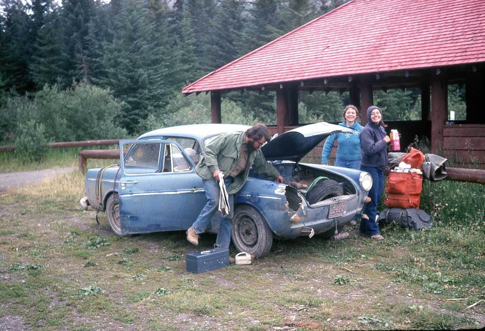
Look Ma – no windshield! (On the way back to Coleman after the skewering)
That was only the start of the fun. The following week Blue’s generator had a meltdown (literally). At the local wrecking yard we found a dead Beetle and bought the generator. One small concern: it had a shaft sticking out of both ends, whereas Blue’s only stuck out one end. No huge problem – we took a hacksaw and cut the un-needed end off. But when we got it all installed and hooked up, the dashboard generator light still wouldn’t go out. It was then we noticed the direction arrow stamped on the generator housing – facing opposite to the way it was actually rotating. “Think we cut the wrong end off, Dave?” Chris snickered, and Jenny added, “Maybe you should’ve read the manual.” Good points, both, but luckily I’d made one of those electromagnets with a battery, wire and a nail in elementary school, and remembered that reversing the wires also reversed the magnet’s polarity, so with fingers crossed we took the generator apart and swapped the two large wires inside. Presto – back on the road again!
A week or two later the clutch cable snapped just as we pulled onto Highway 3, a couple of miles west of Fernie. We pushed the car the rest of the way into town, to the only garage that was open, only to have the mechanic tell us it would be at least a week before he could get a new cable, adding insult to injury by declaring, “Next time don’t buy a foreign car!” As the saying goes, necessity is the mother of invention – so we spliced in a piece of electrical wire, Western Union style, and went on our way.
By the end of July the rough roads had taken their toll on Blue’s already worn-out suspension, and both front wheels were constantly going into fits of violent shuddering. Bill Kinnear, at whose Coleman property our group was based, had one of his shop staff at Crowsnest Collieries weld something behind the front wheels, and that solved the shuddering problem – even if the car handled like a go-kart from that point on.
The one thing we could have put to very good use is duct tape, but in 1974 Red Green was still a couple of decades in the future. Instead we employed anything at hand, like boot laces and bungee cords, to keep Blue’s various bits and pieces from separating and disappearing for good. Still, by the middle of August the car was missing a headlight, a mirror, the front bumper, all four hubcaps, and who knows how many random nuts and bolts.
A little worse for wear!
Blue’s final mission at summer’s end was the inevitable trip to the junkyard in Calgary, but sadly it came up a bit short – a mile or so west of the city limits, a front wheel broke clean off and rolled into the ditch. The car had to finish its trip in humiliating fashion at the rear of a tow truck.
But Blue had nothing to be ashamed of – the plucky little VW had done everything we asked of it, like climbing to fire lookouts, crossing mountain passes, and fording dozens of creeks and rivers, often with water halfway up the doors. And with its rear-mounted engine, it had great traction in the mud. I can’t count how many times we drove right past stuck 4×4’s, huge smiles on our faces. Blue truly was an indispensable member of our survey team.
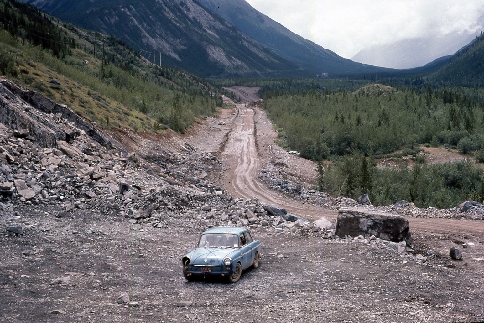
Blue near the Kananaskis Highway construction
Needless to say, I personally developed a real soft spot for Volkswagens and went on to own several over the succeeding years – although never again did I manage to run a tree through one! And I suppose time will tell if Volkswagen (the company) survives its own self-inflicted skewering as well as Blue did.
TRAILS: Fall colours are here! The GDT is experiencing good late season trail conditions with mainly dry trails at lower elevations. Expect snow above 2000 metres, some wet and slippery trail conditions, and nighttime and early morning temperatures below freezing. Be prepared for all weather conditions when travelling into the backcountry.
ELK RUTTING SEASON WARNING: It is elk rutting season until mid-October. Warning signs that read “ATTENTION – Elk Mating” have been posted at areas where elk herds often gather. Be aware that bull elk become extremely aggressive during rutting season so keep at least 30 metres away from all elk and never get between a male and female elk.
TRAIL CLOSURES:
Elk Lakes Provincial Park: Extensive repairs and construction on the trail between Lower and Upper Elk Lakes to be carried out throughout 2015 hiking season. Detour to West Elk Pass by taking the Elkan Creek trail from the parking lot trailhead. Lower Elk Lake campground is still accessible but hikers are asked to exercise caution in this area during construction.
BEAR WARNINGS:
Yoho National Park: Special caution is recommended while travelling or camping in the Field townsite and surrounding areas due to a large adult black bear that is frequenting the Field townsite, attracted to the fruit of Mountain Ash and Crab Apple trees. Report all bear sightings to Banff Dispatch: 403-762-1473. (29SEP2015)
Jasper National Park: A grizzly bear is frequenting the Skyline Trail and campgrounds in the area. Extra caution and bear spray is recommended when hiking in this area. Please report all bear sightings to 780-852-6155. (1SEP2015)
Jasper National Park: The Brazeau Loop, Nigel Pass and Poboktan Creek trails are open but a bear warning is in effect. Two grizzly bears have broken into cabins along the South Boundary trail to access horse feed. While they are no longer appearing at cabins and have not shown aggression to people, they may return to the area. Recommendations to minimize the potential of a bear encounter: Travel in tight groups of 4 or more; make noise to alert bears of your presence; carry bear spray; and keep a clean campsite, secure all food and garbage on designated bear cables or in bear storage lockers. Please report all bear sightings to 780-852-6155. (30JUL2015)
TRAIL NOTICES:
The trail from Sage Pass (a17) to Scarpe Pass (a24) was cleared and blazed in August 2014 and is in good shape. From Scarpe Pass, the trail disappears up to La Coulotte Ridge and the hiking becomes significantly more difficult until you reach the ATV track (a27) heading down to the West Castle Road.
The Aldridge Creek Trail between Fording River Pass (b31) and the Kananaskis Power Line Road (b32) was cleared and restored in July 2015.
Cairnes Creek (d9): The bridge is washed out making this a potentially dangerous ford. It is recommended to cross early in the morning when glacial melt is lowest.
The damaged Lambe Creek bridge (d10) was removed in September 2015. It is recommended to ford the creek further downstream.
The Howse Pass Trail from Conway Creek (d12) to the Glacier Lake trail junction (d14, 15 km) is in very poor condition. The trail is overgrown, with hundreds of wind-fallen trees across the trail. Hiking in the Howse River floodplain is a viable alternative if the Howse River is low enough to ford.
The Owen Creek Trail was cleared in July 2015 up to km 5. Beyond that point, the trail is in poor shape with several washed out sections. Expect challenging hiking for 3 km including skirting along steep creek-side cliffs and rock-hopping in the creek itself. At km 6, do not take the trail heading up away from the creek (it is a deadend). Look for orange blazes marking the correct route staying near the creek.
The Maligne Pass trail in Jasper National Park has been decommissioned and is in poor shape. The trail from Pobokton Creek (e20) to Maligne Lake (e25, approx 42 km) is no longer being maintained by Parks Canada so expect deteriorating and overgrown trail conditions; long pants are recommended. The Maligne River bridge has been removed but the river can be easily forded in normal summer conditions (knee deep in mid-summer). Most other bridges are still in place. Read Nathan Dahl’s August 30, 2015 Maligne Pass trail update here.
The Yates Torrent Bridge is gone at the crossing of the Coleman Glacier outflow (near f16) so attempt to cross early in the morning when glacial melt is the lowest or be prepared for a fast and potentially dangerous creek ford.
ACCESS TRAIL CLOSURES:
Kootenay National Park – Due to washed out bridges, access to Numa Creek Falls and Trail remains closed.
Access Roads Update:
Construction work on Highway 40 continues from south of the winter gate to Junction Highway 541; expect delays.
Access to the northern terminus of the GDT in Kakwa Provincial Park is via the Walker Creek Forest Service Road. The Walker Creek FSR has been repaired from Highway 16 to km 33.5. While travelling the remaining 50 kilometres on the Walker Creek FSR, attention is required to navigate the surface as it is uneven, rutted, slippery and very rough. The road is not recommended for anything other than a 4×4 high clearance vehicle. The last 10km from Bastille Creek to Buchanan Creek are particularly rough and muddy and might not be driveable by vehicle so be prepared to walk this distance on foot. Thanks to Canadoug for the update!
The Red Rock Parkway in Waterton Lakes National Park is closed for the season until approximately May 2016 to allow for reconstruction of the parkway and the lower parking lot at Red Rock Canyon.
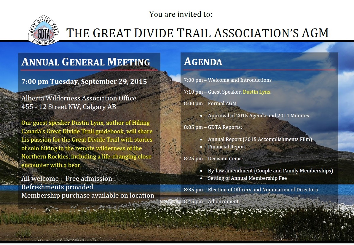
The Great Divide Trail Association’s Annual General Meeting will take place on September 29, 2015 at 7:00 pm at the Alberta Wilderness Association office in Calgary.
Join us for an evening of storytelling with Dustin Lynx, author of Hiking Canada’s Great Divide Trail, as he describes his solo adventure packrafting and hiking the Muskwa-Kechika wilderness of the Northern Rockies. Exploring the option of extending the Great Divide Trail to the Yukon, Dustin will entertain with stories of big rivers, remoteness and aggressive bears while sharing his passion for hiking long distance wilderness trails.
Meet the Great Divide Trail Association volunteers to learn more about their dedication to maintaining, protecting and promoting the GDT. We welcome the public as well as our membership to take part in our Annual General Meeting following the presentation. Become involved and enjoy refreshments and good company as we make decisions regarding the future of this special wilderness trail.
TRAILS: Fall is here! Expect snow above 1500 metres, some wet and slippery trail conditions, and night and early morning temperatures below freezing.
ELK RUTTING SEASON WARNING: It is elk rutting season until mid-October. Warning signs that read “ATTENTION – Elk Mating” have been posted at areas where elk herds often gather. Be aware that bull elk become extremely aggressive during rutting season so keep at least 30 metres away from all elk and never get between a male and female elk.
WILDFIRE UPDATES: There are no fire bans on the GDT. Campfires are permitted in designated fire pits.
TRAIL CLOSURES:
Elk Lakes Provincial Park: Extensive repairs and construction on the trail between Lower and Upper Elk Lakes to be carried out throughout 2015 hiking season. Detour to West Elk Pass by taking the Elkan Creek trail from the parking lot trailhead. Lower Elk Lake campground is still accessible but hikers are asked to exercise caution in this area during construction.
Banff National Park: Og Pass trail and Upper Assiniboine Pass trail within Banff National Park are closed from August 1 to September 30, to increase public safety, and to minimize displacement of grizzly bears from prime food sources at a critical time of the year. Hikers are permitted to access Mount Assiniboine Provincial Park via the lower Assiniboine Pass trail or the Wonder Pass trail.
BEAR WARNINGS:
Waterton Lakes National Park: Special caution is recommended while travelling or camping in the Waterton townsite as a black bear is frequenting the area and has obtained unsecured human food. Be prepared to encounter a bear at anytime in and around this area. (04SEP2015)
Jasper National Park: A grizzly bear is frequenting the Skyline Trail and campgrounds in the area. Extra caution and bear spray is recommended when hiking in this area. Please report all bear sightings to 780-852-6155. (1SEP2015)
Jasper National Park: The Brazeau Loop, Nigel Pass and Poboktan Creek trails are open but a bear warning is in effect. Two grizzly bears have broken into cabins along the South Boundary trail to access horse feed. While they are no longer appearing at cabins and have not shown aggression to people, they may return to the area. Recommendations to minimize the potential of a bear encounter: Travel in tight groups of 4 or more; make noise to alert bears of your presence; carry bear spray; and keep a clean campsite, secure all food and garbage on designated bear cables or in bear storage lockers. Please report all bear sightings to 780-852-6155. (30JUL2015)
TRAIL NOTICES:
The trail from Sage Pass (a17) to Scarpe Pass (a24) was cleared and blazed last year and is in good shape. From Scarpe Pass, the trail disappears up to La Coulotte Ridge and the hiking becomes significantly more difficult until you reach the ATV track (a27) heading down to the West Castle Road.
The Aldridge Creek Trail between Fording River Pass (b31) and the Kananaskis Power Line Road (b32) was cleared and restored in July 2015.
Cairnes Creek (d9): The bridge is washed out making this a potentially dangerous ford. It is recommended to cross early in the morning when glacial melt is lowest.
The Lambe Creek bridge (d10) is badly damaged so it is recommended to ford the creek further downstream and avoid using the broken bridge.
The Howse Pass Trail from Conway Creek (d12) to the Glacier Lake trail junction (d14, 15 km) is in very poor condition. The trail is overgrown, with hundreds of wind-fallen trees across the trail. Hiking in the Howse River floodplain is a viable alternative if the Howse River is low enough to ford.
The Owen Creek Trail was cleared in July 2015 up to km 5. Beyond that point, the trail is in poor shape with several washed out sections. Expect challenging hiking for 3 km including skirting along steep creek-side cliffs and rock-hopping in the creek itself. At km 6, do not take the trail heading up away from the creek (it is a deadend). Look for orange blazes marking the correct route staying near the creek.
The Maligne Pass trail in Jasper National Park has been decommissioned and is in poor shape. The trail from Pobokton Creek (e20) to Maligne Lake (e25, approx 42 km) is no longer being maintained by Parks Canada so expect deteriorating and overgrown trail conditions; long pants are recommended. The Maligne River bridge has been removed but the river can be easily forded in normal summer conditions (knee deep in mid-summer). Most other bridges are still in place. Read Nathan Dahl’s August 30, 2015 Maligne Pass trail update here.
The Yates Torrent Bridge is gone at the crossing of the Coleman Glacier outflow (near f16) so attempt to cross early in the morning when glacial melt is the lowest or be prepared for a fast and dangerous creek ford. Thanks to Christine Friesen for the update!
ACCESS TRAIL CLOSURES:
Kootenay National Park – Due to washed out bridges, access to Numa Creek Falls and Trail remains closed.
Access Roads Update:
Construction work on Highway 40 continues from south of the winter gate to Junction Highway 541; expect delays.
Access to the northern terminus of the GDT in Kakwa Provincial Park is via the Walker Creek Forest Service Road. The Walker Creek FSR has been repaired from Highway 16 to km 33.5. While travelling the remaining 50 kilometres on the Walker Creek FSR, attention is required to navigate the surface as it is uneven, rutted, slippery and very rough. The road is not recommended for anything other than a 4×4 high clearance vehicle. The last 10km from Bastille Creek to Buchanan Creek are particularly rough and muddy and might not be driveable by vehicle so be prepared to walk this distance on foot. Thanks to Canadoug for the update!
The Elk River FSR will be closed periodically at 123km, 142km, and 145km for bridge replacements between September 1 to September 30. Use the Round Prairie FSR (4WD required) on the east side of the Elk River as a detour.
The Red Rock Parkway in Waterton Lakes National Park is closed for the season until approximately May 2016 to allow for reconstruction of the parkway and the lower parking lot at Red Rock Canyon.


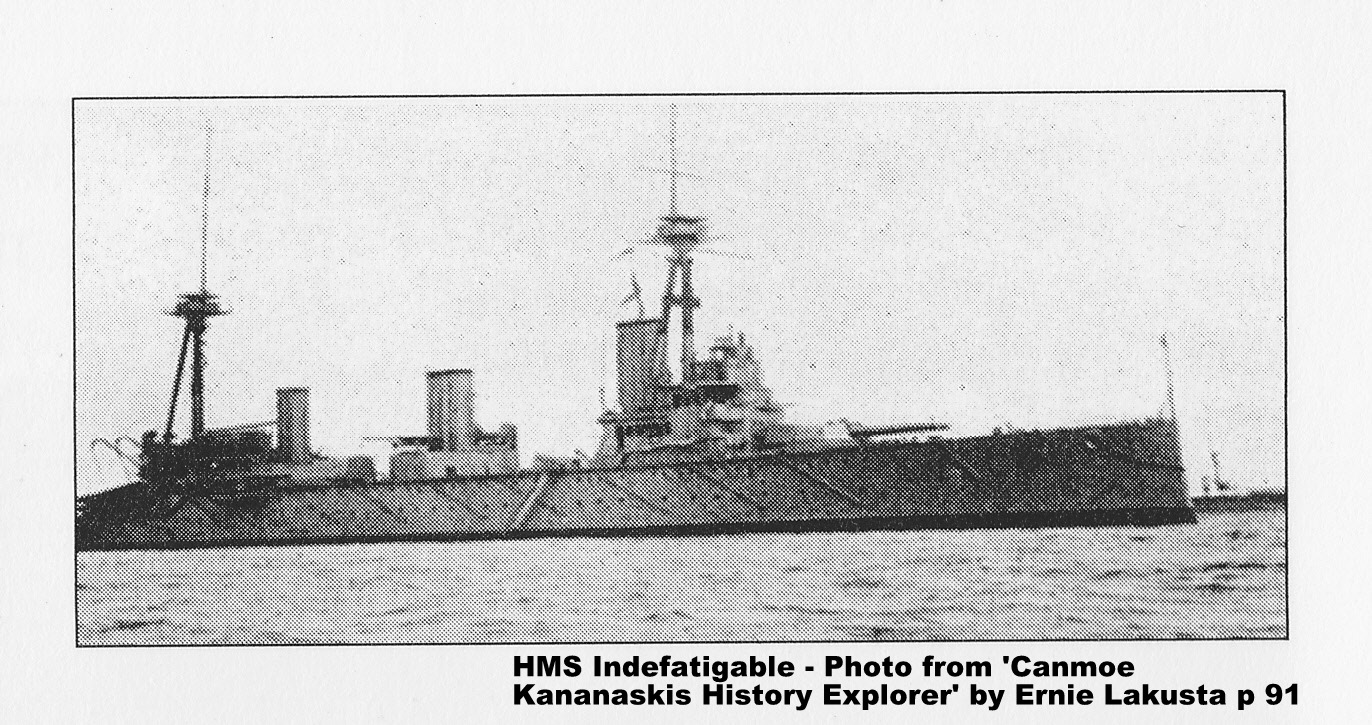 The battleship Indefatigable was part of the British cruiser squadron at North Sea Battle of Jutland late May 1916 between the British Royal Navy and the German High Seas Fleet. The Indefatigable was commanded by Captain C.F. Sowerby and had the ominous distinction of being the first ship sunk at this battle. One of the cheapest built by the British Royal Navy, it and many sister ships suffered the same fate of lacking armour to resist attack. Indefatigable received two direct hits and sank 17 minutes after entering the battle. Only the captain and two crew of 1020 members survived. This ship was named for a more robust vessel, another Indefatigable, a 44 gun 18th century frigate which destroyed the French battleship Droits de L’Homme during the Napoleonic War in 1787.