Category: Uncategorized

  • GDT in Backpacker Magazine

    GDT in Backpacker Magazine

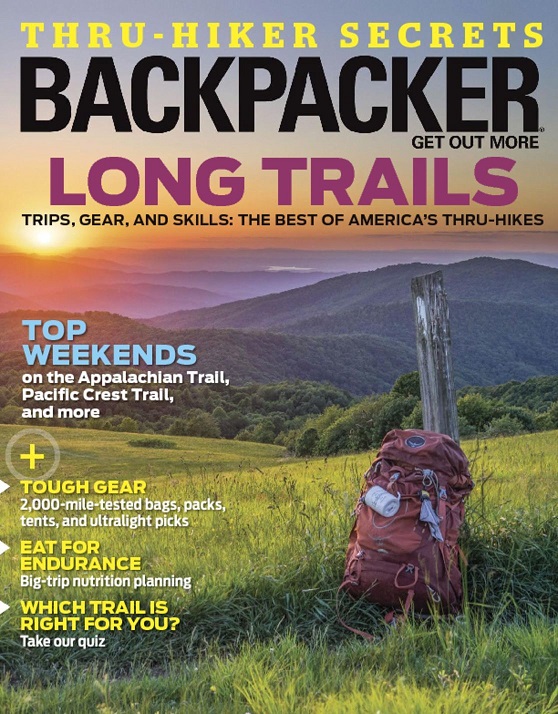
    Backpacker Magazine’s Long Trails edition awarded the Great Divide Trail the title of “Wildest Thru-Hike” – Check out the article by Ted Alvarez here.

    Few blazes, fewer trail angels: Canada’s Great Divide Trail offers a rare chance to go back in time and experience the birth of a thru-hike.

    backpacker-cover-january2017

  • Free 2017 Parks Canada Discovery Pass

    Free 2017 Parks Canada Discovery Pass

    To commemorate the 150th anniversary of Canadian Confederation, Parks Canada is offering 2017 Discovery Passes for free. For all of 2017 this pass gives visitors unlimited access to National Parks, National Marine Conservation Areas and National Historic Sites across the country. Note that campground fees are not included in the Discovery Pass. Go to the Parks Canada website for more information. pc-canada-150


  • Moose River Project – The Valley Sentinel

    Moose River Project – The Valley Sentinel

    Every year, horseback riders and hikers from around the world travel through the mountains on the Great Divide Trail behind the Robson Valley highway corridor.

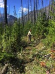
    “Fires made travel very difficult through a large section of the trail within Robson Park, so travellers were challenged navigating their way with downed burned timber – like a logger’s version of ‘pick-up-sticks’, boggy muskeg, and river crossings when the trail was elusive and impassable from bog, muskeg, or blow-down on either the east or west side of the Moose River,” explained Eileen MacDonald, Chair of the Robson Valley Chapter of the Backcountry Horsemen of BC (BCHBC).

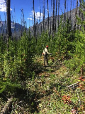
    This past summer, the Robson Valley Chapter of BCHBC, Mount Robson Provincial Park staff, and the Great Divide Trail Association, pooled resources and manpower to work on the GDT for a week from August 12 – 20.

    trail-clearing

  • Trail Tales: A Thru-hiker Account

    Trail Tales: A Thru-hiker Account

    By Fabian Kurte

    The bachelor’s thesis is done. The certificate is still not printed but I am already dreaming about the wild North American Rocky Mountains. I want to get away; for a while at least. Experience some of the nicest backcountry, do it at my own pace. Soon I find out about the “big” trails. Pacific Crest Trail, Continental Divide Trail, Appalachian Trail, but somehow those sound too worn out, too crowded, too developed and too long to be achievable during my summer break. Luck finds me reading a blog written by Erin “Wired” Saver and I am hooked. At this point, I don’t know if it’s just her good writing and pretty pictures, but I want the same wilderness experience she’s talking about on the Great Divide Trail in the Canadian Rocky Mountains.

    hikefabFabian making his way through the wilderness

    I organize the most important parts or my trip and fly to San Francisco. I try to get the rest of my thru-hiking plans sorted while travelling through the US and grow more excited every day, telling people about my big summer plans. Unfortunately a lot of things go wrong. A friend of mine cannot join me as planned, the guide book is sold out, an ultra-light tent I ordered doesn’t arrive, some of the campgrounds I need to book are already full, the Canadian postal service is about to strike and then a knee injury interrupts my training. Staying positive, I see that the long-term weather forecast predicts a warm, dry summer thanks to El Nino.

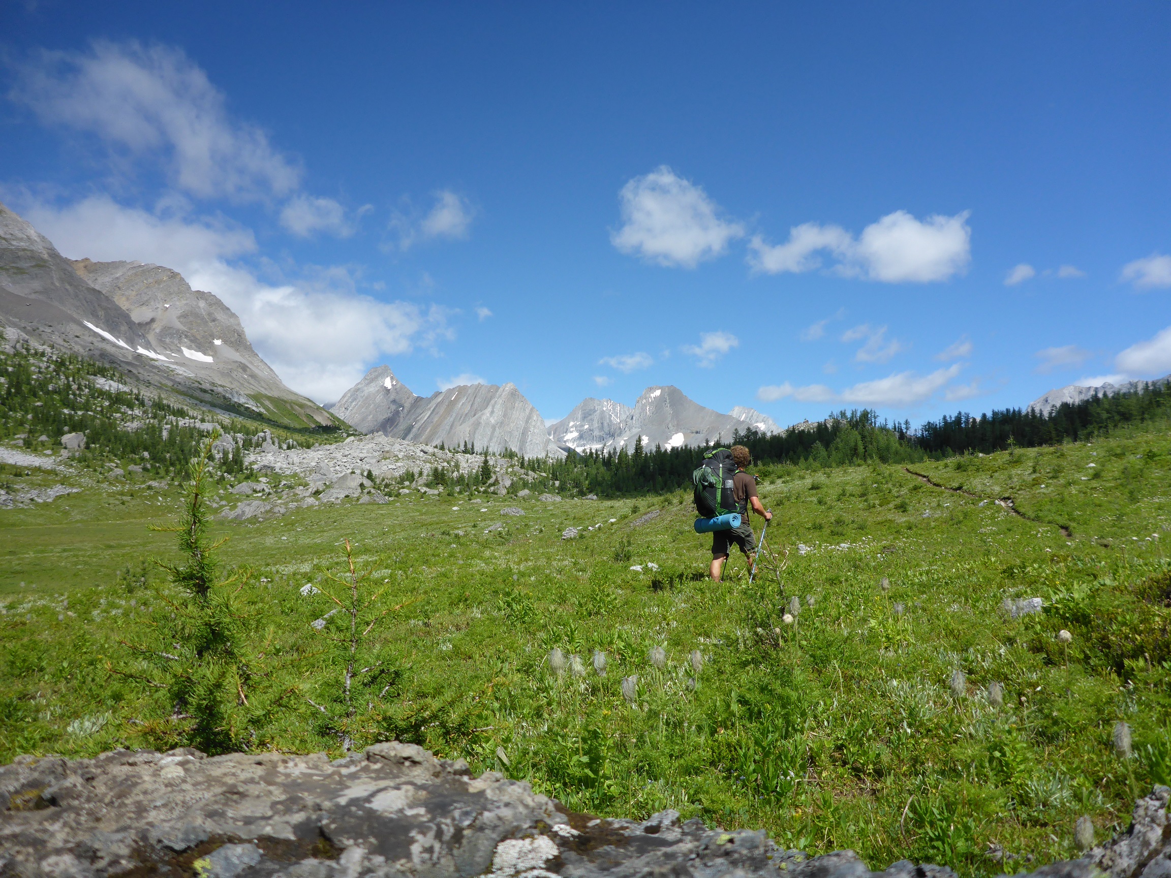
    Suddenly it’s my planned start day. I hitch-hike to Waterton and begin my adventure. I develop a routine as I fight my way north, up a hill, down a mountain, along a river and through valleys. The trail is versatile and every day something new overwhelms me whether it’s a staggering mountain view, a raging river or a meadow of gorgeous wildflowers. I meet many different people from those on horseback for a few days of backcountry adventure, to weekend hikers to a person hiking all the way to the Arctic Ocean. Even though I don’t know much about each person, I feel we are connected. This trail attracts special kinds of people looking for wilderness. I love this trail from the first to last day. The scenery, the wildlife, the trail itself, the solitude and the inspiring people I meet on the trail give me everything I had wanted in this summer.

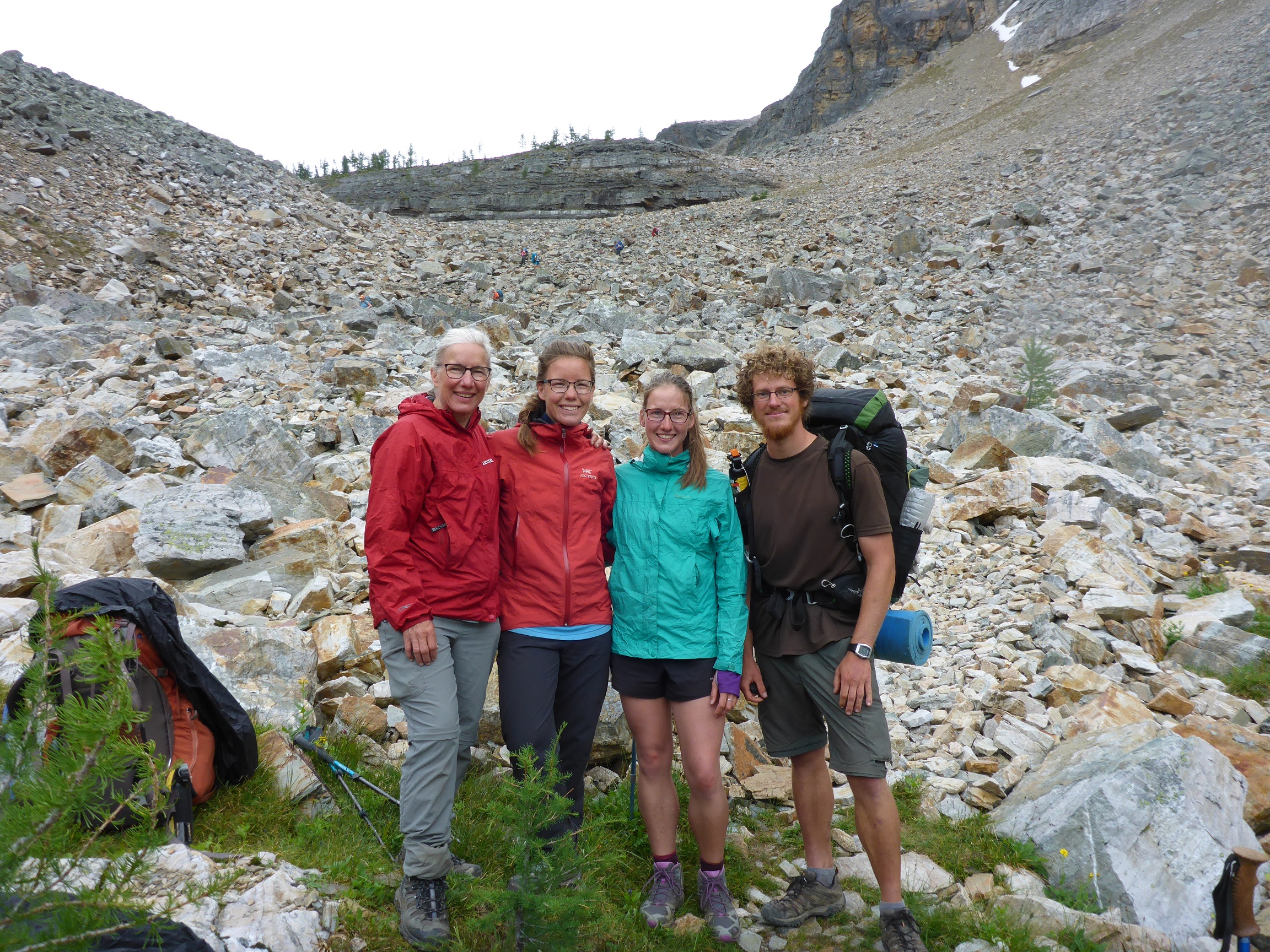
    fabian-and-other-hikersFabian and fellow thru-hikers meet up on the trail.

    As a bonus to my thru-hike I was incredibly lucky the annual GDTA Signature Trail Maintenance Trip fit into my schedule! Along with 25 other volunteers, I spent five days in the backcountry building new trail, a first in thirty years for the GDTA! It was an extraordinary feeling taking part in this and after my time building trail with these people, I knew I belonged. I feel that this community is something you won’t find very often in your life. The work was hard but the food was amazing (and not just because I ate cereal, energy bars and pasta every day before). We had great talks and learned a lot about the trail and its history. After these days building trail, I continued on my thru-hike with a better understanding of how much work these guys put into the GDT to make it accessible for me and all the other crazy hikers. Thank you once again to all the volunteers and members at the GDTA!

    The GDT wasn’t my first long backpacking trip, but there were still a lot of new things to learn and overcome. For example, I had never hiked in big carnivore country before. Hiking through grizzly bear territory gave me an unpleasant feeling but at the same time it also inspired me. Bears, wolves and cougars are part of the wilderness in the Canadian Rocky Mountains and walking in the tracks of these animals is one of the reasons why this hike is so special. I battled with these opposing thoughts often. When the trail disappeared or when I was standing in the mud up to my shins I would think, “why am I doing this?!” while at the same time thinking, “don’t complain, this is what you came for!”

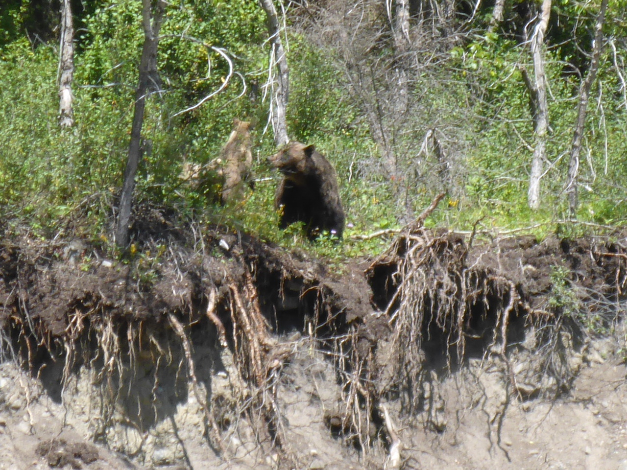
    Even though I had seen quite a few bears, I hadn’t run into any problems until the day I got to Aldridge Creek. I was hiking down the washed out creek, looking at this and that, whistling every now and then to warn the bears. Suddenly, I saw movement out of the corner of my eye. A big grizzly bear was sitting about thirty metres away above me on the edge of a wash out eating berries. She had her back towards me and hadn’t noticed I was there.  My mind raced along with my heartbeat. Shall I make some noise? Shall I go back or just continue?

    grizzfabianGrizzly Bear encounter is all a blur.

    I was still standing in the middle of the creek when two little cubs appeared and I knew it was time to go. I walked quietly and quickly continuing downstream while grabbing my bear spray. Suddenly, the bear caught wind of my scent and freaked out. She blared loud and deep and sprinted to the very edge of the wash out. I was frozen in shock at how fast she was and how vulnerable I was standing in the creek. She reached the edge and carved her claws in the ground and stopped. Standing there she blared once again down the river in anger, looking to the left and right searching me out. She pushed herself onto her hind legs and put her nose in the wind. As her gaze moved in my direction, I felt that she became calmer. To my relief she dropped down, walked along the edge, looked at her cubs and decided to leave things be. Looking through my pictures later in my tent that evening, I realized how much fear had taken over. Every picture was completely blurred.

    The rest of the trip wasn’t so frightening. I was surprised how fast the time went by and suddenly I was already hiking north of Jasper! The days grew cooler, a snowstorm on the Skyline Trail resulted in an emergency descent and then one morning while I was hiking through thick brush, I realized how brown everything was. Autumn had begun and it was time to go home.

    I finished this wild and solitary section at one of the most scenic places on the trail, Berg Lake, in Mount Robson Provincial Park. As I left the GDT behind and walked down to the Highway, I was overwhelmed by the speed of life. Two days later, I was back in Germany caught up in the flow. With appointments to keep, forms to fill and studies returned to, I quite often wish I was back on the trail reveling in a pace of life determined by my own two feet in the Canadian Rocky Mountains.

  • Oh The Peaks You Will See: New Trail, New Peaks!

    By Jen Peddlesden

    This past July, the Great Divide Trail Association (GDTA) members created new trail in the Dutch Creek Area, circumventing the difficult and sometimes precluded route of the Great Divide Trail (GDT) in British Columbia. You can read more about trail creation here.  This new trail, means new peaks to admire. The High Rock Trail opens views to two impressive mountains: Gould Dome (or Gould’s Dome) and Mount Erris.

    2016-goulds-dome-jp-2Striking view of Gould’s Dome

    The moniker Gould Dome was originally applied to another mountain. Lieutenant Blakiston of the Palliser Expedition 1857-1859 named what we now know as Tornado Mountain, ‘Gould’s Dome,’ after a well respected  British ornithologist, John Gould. The name did not stick. Fifty-seven years later, the Boundary Commission renamed it Tornado Mountain in respect of its positon in a storm centre and local climbers’ experience thereon. Not wishing to disrespect John Gould,or Lieutenant Blakiston the Commission transferred the Gould name to a nearby lower peak. Gould Dome (2891 m) was first ascended in 1913 by ‘Bridge’ (Morrison P. Bridgland), a Torontonian, a climber, and a respected and tireless Dominion Land Surveyor. Gould Dome is 2891 m and is in the Upper Dutch Creek Valley just east of North Fork Pass right in the line of sight of the new High Rock Trail.

    2016-mount-erris-brad-vMount Erris backdrop for lunching volunteers during High Rock Trail building

    Mount Erris is another peak in view for a number of kilometers along The High Rock Trail. The divide runs along the ridge of this mountain – BC on the west side, Alberta on the east. At 2825 m it is the highest peak in the High Rock Range between North Fork Pass and Crowsnest Pass. The first ascent was by the Topographical Survey in 1913, and it was named by ‘Bridge’ in 1916 after a coastal headland in Mayo County Ireland. One of a number of peaks in the chain of mountains along the divide, it provides a pleasant days scramble though getting there may take longer than the ascent! (See Alan Kane’s guidebook ‘Scrambles in the Canadian Rockies.’) Mount Erris’ east slope provided a magnificent view as trail building volunteers rested at lunchtime during the trail building across the valley. Such restful and inspiring views are a lot of what traveling the GDT is all about and it is fulfilling to know that the work done this summer will provide a more pleasant and beautiful route for future hikers.

  • 2016 Annual General Meeting

    2016 Annual General Meeting

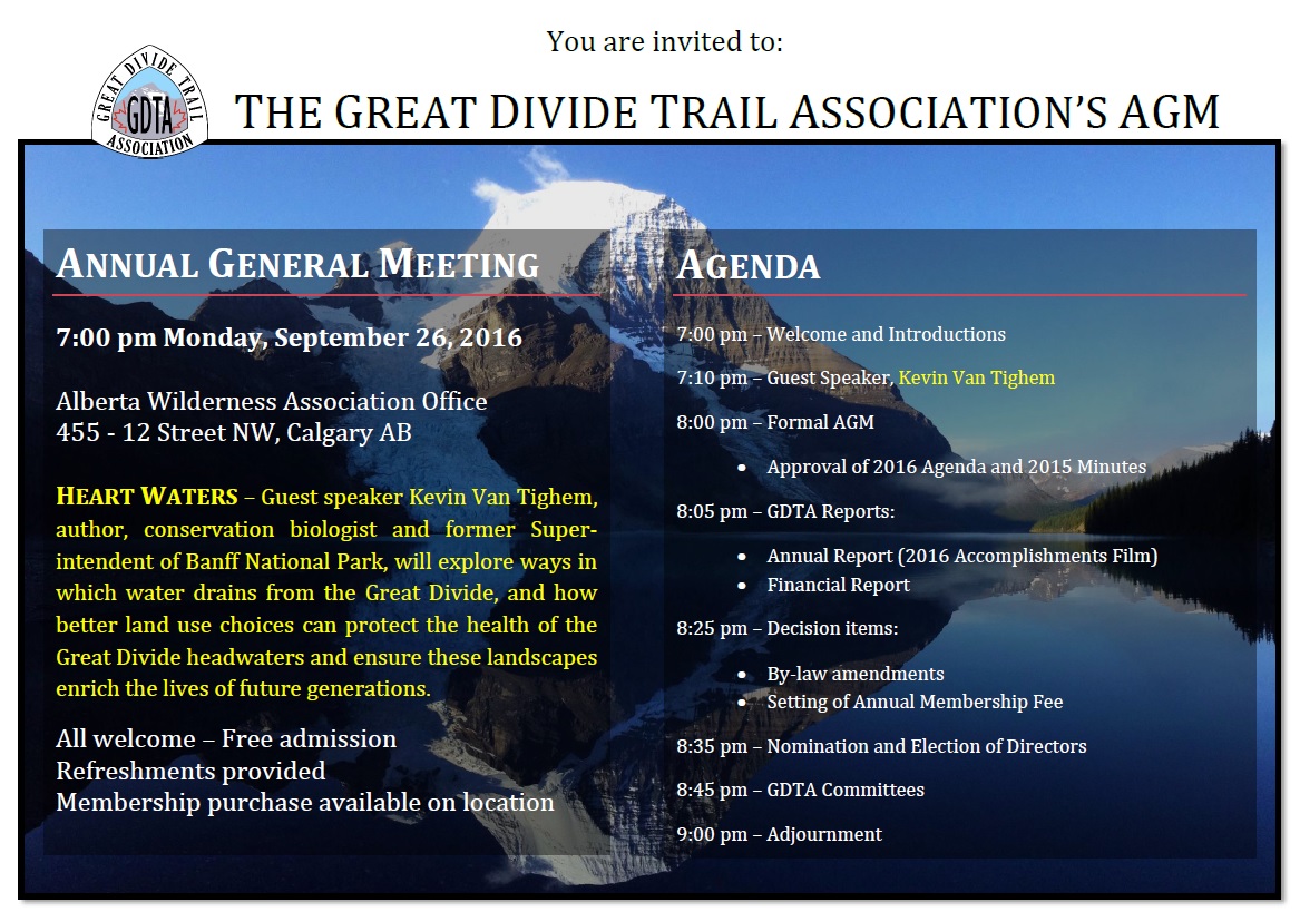
    The Great Divide Trail Association’s Annual General Meeting will take place on September 26, 2016 at 7:00 pm at the Alberta Wilderness Association office in Calgary. Everyone is welcome and admission is free.

    Join us for an evening with one of Alberta’s 50 most influential people, Kevin Van Tighem, as he shares thoughts from his book Heart Waters and explores what the view from the Great Divide Trail tells us about our land use choices and our water future. This illustrated talk will showcase the ways in which water drains from the Great Divide to the rivers below while exploring how better land use choices could protect against future droughts and floods while restoring trout streams, protecting wildlife habitat, and ensuring that the dramatic beauty of our headwaters landscapes enrich the lives of generations to come.

    We welcome the public as well as our membership to take part in the formal portion of our Annual General Meeting agenda following the presentation. Meet the Great Divide Trail Association volunteers to learn more about their dedication to maintaining, protecting and promoting the GDT, and how you can get involved. Enjoy refreshments and good company as we make decisions regarding the future of this special wilderness trail.

    GDTA AGM Invitation-2016

    RSVP to http://greatdividetrailassociationagm2016.eventbrite.ca

  • An Origin Story

    An Origin Story

    By Christine Smith

    My love of the Great Divide Trail happened by chance. It was the winter of 2010 and Rich, my partner in all things great, bought me a book for Christmas. It was Emerson Sanford and Janice Sanford Beck’s Life of the Trail 1 Historic Hikes In Eastern Banff National Park. It was a habit we had that when we went to bed Rich would read to me.  I would lay there feeling the stresses of the day melting away, imagining what it would be like to hike the trails mentioned in the books, the vistas I would see, the mountains towering over me, the glaciers, the trees and wild flowers.

    I would witness the birth of rivers at their headwaters as if I was the first one to discover them. Not to mention the wildlife! Perhaps encounters with the rarely seen caribou or mighty grizzly? I could almost feel the sun on my face, smell the fresh air and experience the complete silence enveloping me. Imagine, no city noise, no people, no day-to-day job stresses. I wondered what it would feel like to be truly free. What would it be like to have no  commitments, no responsibility to anyone but myself? What would it be like to walk the face of this earth like the early explorers to this area of the Canadian Rockies?

    Once we finished the book, these dreams might have gently faded, but it just so happened that in the back of this book were other suggested readings, one of which was Dustin Lynx’s Hiking Canada’s Great Divide Trail. The words jumped out at me from the page, “Trekking the Continental divide from the US border to Kakwa Lake is a demanding adventure”. I hastily purchased the book at MEC and looked forward to a good read. The book it turned out was a trail guide consisting of detailed maps, trail descriptions, mileages, campground locations. “Hey!” I thought, “It looks like it is all laid out here for us”. It looked like the beginning of a plan.

    Once we read the trail guide the conversation went something like this:
    Me: That trail looks amazing.
    Rich: Yes, It does.
    Me: I would like to do that trail.
    Rich: Me too.
    Me: We would have to quit our jobs.
    Rich: Yes, we would.
    Me: Want to?
    Rich: Sure.
     

    It was the beginning of a great adventure culminating in our first attempted thru hike on Canada’s Great Divide Trail in 2012 and our second in 2015. Looking back now, I realize I had formulated a very romantic idea in my mind of what hiking this trail would be like. In reality, I can’t remember once singing “Climb Ev’ry Mountain” while twirling around on any of the mountain passes. However, for the most part all my expectations were met. I did see all the beauty of nature from the hanging glaciers on the Rockwall trail to the beautiful blue waters of Michelle Lakes. We pitched our tent in the midst of a field of wildflowers awaking to their bobbing heads. We stood on the highest pass of the Great Divide Trail in total silence where I gazed above the mountain tops, the valleys, and trees and I felt at that moment completely happy I was there; just being and existing in that moment. I even got to have that close up experience with a few grizzly bears as well. Perhaps too close.

    Rich and I continue to plan new adventures. There are always new areas to explore and new challenges to meet on the GDT. All I know is when the Rockies are in view they call to me, “Come home!”

  • Oh The Peaks You Will See: Veteran Peaks – Part 2

    Oh The Peaks You Will See: Veteran Peaks – Part 2

    By Jen Peddlesden

    The idea for this historical look into mountains named for WWI people and events was inspired by a book given to me by friends, Canmore and Kananaskis History Explorer by Ernie Lakusta. The centenary of WWI is an opportunity to look at this world changing event, and no doubt those people who were exploring our Rockies felt that its monumental effect on the world should be memorialized in stone — thus the many Kananaskis peaks of the British Military Group.  North of Mount Indefatigable, discussed in the Spring Pathfinder, along The Great Divide Trail you will see Mount Sir Douglas and Mount Birdwood, our Veteran Peaks discussed in this Summer edition.

    Mount Sir Douglas, in the Spray Range, was named for Sir Douglas Haig.  This imposing peak, which you will encounter between the Palliser and North Kananaskis passes, is 3411 m. Haig, commander of the British forces in France from 1915 to 1918, was the 1st Earl Haig of Bemersyde and the son of a wealthy Edinburgh distiller—his early advancement a result of patronage, and marriage to Queen Victoria’s maid of honour also helped! This mountain and Haig Glacier are named for a man who said ‘every position must be held to the last man…each one of us must fight to the end.’ And so they did. Under his command at the Battle of the Somme, 620,000 British and French men lost their lives. Haig’s ‘attack at all costs’ mentality was criticized by many, even by the British Prime Minister at the time, Lloyd-George.

    280px-Mt_sir_douglas
    Mount Sir Douglas – Photo by Wiki

    The first ascent of Mount Sir Douglas was in 1919 when Dr. J W Hickson hired Ed Feuz, a local Swiss guide, to join him in the ascent. They navigated to the twin summits handily by 5pm and left two cairns on each summit which can still be seen from Palliser Pass today.  At the same time, another party, lead by Swiss guide Rudolph Aemmer, and including a colleague of Feuz’s, Val Fynn, was in the area hoping to be first to the top. Passing by the Aemmer/Fynn camp next day, Feuz commented to Fynn’s wife “I wonder why they didn’t go our way, where we went yesterday?” Feuz responded to the dumbfounded wife with a cheeky “Don’t worry, that ridge Rudolph and your husband are on will make a fine second ascent.”

    Mt Birdwood WIlliam Marler 2006
    Mount Birchwood – Photo by William Marler 2006

    Had Dr. Hickson and Feuz looked north from the twin summits, they would have seen a spectacular looking mountain perched along the Spray River Valley: Mount Birdwood. Ah, finally a name that conjures the picturesque and natural; however, it was named for Sir William Riddell Birdwood. Known as ‘Birdy,’ this British commander lead the Australian and New Zealand corps in WWI. The first ascent of the 3097 m peak was in July 1922 and led by a familiar name, Rudolph Aemmer. Near the top they reached a chimney with smooth sides and few handholds. After 7 ½ hours, Rudolph summited Mount Birdwood by standing on a fellow adventurers back, perching on his shoulders, and finally reaching the top with a supporting shove. Some times you just need that extra friendly push to go the distance on the Great Divide Trail!

  • The Best of the GDT

    By Brad Vaillancourt & Doug Borthwick

    Don’t have time to hike the entire GDT and looking for the best day, weekend or week on the Great Divide that isn’t completely booked up (like the Rockwall and Skyline trails)? Check out these outstanding trails that showcase the Best of the GDT! (Note these are all one-way trails that begin and end at different trailheads so two vehicles or a shuttle will be required.)

    DAY HIKE: Peaks, Lakes and Waterfalls – The Carthew-Alderson Trail in Waterton Lakes National ParkCarthew
    With breathtaking vistas, crystal clear lakes, cascading waterfalls and wildlife viewing opportunities, on the reward-for-effort scale it doesn’t get much better than this. Beginning on the shores of stunning Cameron Lake, the Carthew-Alderson trail quickly starts gaining elevation on long, sweeping switchbacks. Catch your breath at Summit Lake at kilometre 4, before continuing the climb into the alpine to the trail’s high point at Carthew Summit (2310 m) at kilometre 7.5. Take an extended break to enjoy the spectacular views in every direction including the towering peaks of Glacier National Park to the south in Montana.

    From Carthew Summit the trail descends to the east, where in the far distance you can see the Rocky Mountains suddenly end and the flat plains of the prairies begin. As you descend towards Carthew Lakes on the red rock slopes of Mount Alderson you might feel more like you are walking on Mars. Continue around upper Carthew Lake where snow patches can linger late into the summer, and keep your eyes open for Rocky Mountain Bighorn Sheep and Grizzly Bear as you are walking through their backyard.

    Descend the steep trail from lower Carthew Lake past the cascading outflow from the lake, down a couple switchbacks to Alderson Lake. A short side trail takes you to the shores of this emerald lake set in a huge natural amphitheatre surrounded by mountain peaks on all sides. This is the site of the inviting Alderson Lake campground. 6.5 kilometres from Alderson Lake, the trail ends at Cameron Falls on the western edge of Waterton townsite (1280 m).

    Trip-planning:

    • Trailhead directions: Take the hiker’s shuttle (free in 2016) from Waterton townsite to Cameron Lake and begin the hike at the Carthew-Alderson trailhead (1660 m).
    • Permits: Not required for a day hike.
    • Distance: 20 km
    • Difficulty: Moderate. The trail is excellent but the elevation gain is significant.
    • Elevation gain: 650 m

     WEEKEND HIKE: The Summit of the Great Divide – David Thompson Highway to Pinto LakeMichele
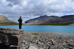
    Begin at the Owen Creek trailhead just east of the Banff National Park gate on the David Thompson Highway (Highway 11). After a short climb you will come to an incredible slot canyon. Owen Creek has carved a deep ravine that you can straddle and view cascading 30 metres below your feet. A short walk farther will take you back to the banks of the now more placid creek where you can picnic and get great views of the Wilson Icefield.

    Continue on up the creek bed, scrambling over boulders and small waterfalls, to the first of three high passes. Cross-country travel across a scree slope brings you to Michele Lakes. Before you head down to the lake, climb the 30 metre berm to the cliffs above the lakes to marvel at Michele Lakes deep aquamarine beauty from high above. Bring a fishing pole to try your luck for the elusive California Golden Trout for which these lakes are renowned.

    After a break lakeside, climb to the highest point on the GDT at 2590 metres, where there is a rumour of a bottle of fine Canadian rye whiskey hidden somewhere in the cairn at the top of the lofty pass. Sign the summit trail register and then head down the steep scree to Waterfalls Creek where there is a good campsite before attempting to find the hidden route up the next high pass (look for orange blazes).

    From the third pass, it’s an easy trek on good trail down to Pinto Lake. The main campground on Pinto Lake is on the north shore but the best campground is on the south-east shore, where in the morning you can enjoy your coffee watching the sun melt the mist off this almost always serene shoreline. If you are lucky you may find the geo cache from the Calgary Olympics. This was cached over 20 years ago and contains some really neat stuff. It’s near the shoreline at the base of a giant spruce which is broken and burnt from a lightning strike a couple of years ago. Finish the weekend by heading over Sunset Pass back into Banff National Park to the Sunset Pass trailhead on the Icefields Parkway (Highway 93).

    Trip-planning:

    • Trailhead directions: The Owen Creek trailhead is 6 kilometres east of Saskatchewan River Crossing on the David Thompson Highway, 80 kilometres north of Lake Louise. The Sunset Pass trailhead is 16 km north of Saskatchewan River Crossing on the Icefields Parkway.
    • Permits: A National Park Wilderness Pass is required if you plan to camp in Banff National Park (on the Owen Creek trail or the Sunset Pass trail)
    • Distance: 40 km
    • Difficulty: Difficult. Portions of this route involve cross-country travel (i.e. no trail) so good route-finding skills, and a map and a compass are required.
    • Elevation gain: This route climbs 4 high passes with elevation gains of 1065 m, 240 m, 310 m, and 415 m.

    BONUS: This trip can be extended by continuing down the Cline River from Pinto Lake to Cataract Creek in the Whitegoat Wilderness. Follow the primitive Cataract Creek trail to its headwaters, passing some ancient pictographs along the way. A steep, cross-country climb will bring you to the top of Cataract Pass where you will cross into Jasper National Park and be treated to amazing 360 degree views of a massive col surrounded by glaciers and waterfalls. Descend from the pass and follow the Brazeau River to Nigel Pass, where a trail junction leads to the trailhead parking lot on the Icefields Parkway. Additional distance: 40 km and one additional pass with an elevation gain of 740 m.

    WEEK-LONG HIKE: Meadows and the Matterhorn (of the Canadian Rockies) – Mount Shark trailhead to Sunshine Village via Mount AssiniboineAssini
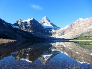
    This trail crosses the continental divide four times and is a wilderness highlight reel of crystal clear alpine lakes, wildflower meadows, and endless views, with the iconic beacon of Mount Assiniboine towering above.

    Start from the Mount Shark trailhead (1700 m) and hike 6 kilometres on the Watridge Lake trail to reach the GDT, just inside the Banff National Park eastern boundary in the shadow of towering Cone Mountain. The trail follows Bryant Creek upstream, beginning mostly in the forest but the views improve farther up the valley as the trail breaks into open meadows. 7 kilometres from the Watridge Lake trail junction, turn left (west) onto the Marvel Lake/ Wonder Pass trail. Views just keep getting better as the trail climbs the open slopes above impressive Marvel Lake up to Wonder Pass (2280 m) on the BC-AB border and Banff-Assiniboine park boundary.

    As you descend into Mount Assiniboine Provincial Park from Wonder Pass, the larch trees begin appearing in greater numbers. This area is spectacular in the fall when the larch needles turn gold. Pass by the Naiset Huts (a good place to stay if the weather turns nasty) and stop for afternoon tea at Assiniboine Lodge, soaking up the stunning views of Lake Magog and Mount Assiniboine. Magog campground is about 1 kilometre from the lodge and is a good place to set up basecamp for a couple days to allow yourself time to explore the many side trails in the area, such as Nub Peak or Sunburst and Cerulean Lakes.

    After prying yourself away from the jaw-dropping beauty of the core area of Assiniboine, continue your hike through vast alpine meadows to Og Lake with its lakeside campground (a good option if the Magog campground is full). Fill up your water bottles here as it is a long (yet scenic) walk through the Valley of the Rocks and up and over Citadel Pass (2365 m) to the next reliable water source at Howard Douglas Lake. Next to Howard Douglas Lake is the last campground on the trail before reaching Sunshine Village. From the lake you’ll walk through Sunshine Meadows, famously filled with wildflowers in early summer, 6 kilometres to the trailhead at Sunshine Village (2200 m).

    Trip-planning:

    • Trailhead directions: To get to the Mount Shark trailhead, drive about 40 km south of Canmore on Highway 742 (the Smith-Dorrien Spray Trail) and turn right (west) at the sign for Mount Shark. 5 km down this road is the trailhead parking lot. To get to the Sunshine Village trailhead, take the Sunshine Ski Area exit 9 km west of Banff on Highway 1 and follow Sunshine Road for 9 km to the parking lot. White Mountain Adventures operates a shuttle bus to Sunshine Village from the parking lot or from Banff.
    • Permits: A National Park Wilderness Pass is required if you plan to camp in Banff National Park. Campgrounds in Mount Assiniboine Provincial Park are available on a first-come first-served basis. Reservations are recommended if you plan to stay in the Naiset Cabins near Assiniboine Lodge.
    • Distance: 50 km
    • Difficulty: Moderate. Excellent trail with two high passes.
    • Elevation gain: This route climbs 2 high passes with elevation gains of 580 m and 430 m.


  • A GDT Honeymoon

    A GDT Honeymoon

    By Pete Michelinie and Cassidy Metcalf

    My wife Cassidy and I took to the Great Divide Trail in July 2015 for our honeymoon and had an amazing adventure.

    To give you a brief background, I have been in love with long distance hiking since walking the Appalachian Trail after graduating from trade school in ’08.  Serious wanderlust later took me on the Pacific Crest Trail in ’10 and Continental Divide Trail in ’12.  I decided to put my education to work  and took a job in Vermont building furniture.  On the day of my interview I met Cass, who had just returned home after living in Costa Rica for a few years.  Soon after meeting we began to date, then we moved in together, then we hiked the Long Trail, and then the Annapurna Circuit, where at 16,000′ on a snowfield heading towards Talicho Tal I proposed… and she said yes! So you get the idea, we are both have itchy feet and love adventuring, which naturally led us to the GDT.

    gdt-honeymoonThe idea about hiking the GDT came to us while hearing a talk given at the 2013 ALDHA West gathering where I was receiving my triple crown award.  Cam “Swami” Honan gave a great talk about his mega-hike he did in 2012/13.  Out of all the trails he hit in North America the GDT seemed to be very near and dear to him.  Cass picked up on it and was the one who really pushed for the idea of walking it for our honeymoon.  I couldn’t say no.

    We set off July 14, 2015 from Waterton Lakes National Park and headed north.  I am a big advocate for technology-free hikes, and so we were free of cellphones, GPS, and digital cameras.  There is nothing like the reward of finding yourself when navigating with map & compass, and I wanted Cass to know the feeling.  She got the gist of it by the end of the hike, but I was our lead navigator for most of the trip.  She was the naturalist, carrying a massive (by light-weight hiking standards) field guide to the North American Rockies.  We were soon identifying all plants and animals we saw, eating Fireweed leaves and chives with dinner almost every night, Huckleberries for breakfast and lunch if we were lucky.

    The trail took us through some amazing country.  The views were stunning, the weather was harsh at times, and the trail was all over the map.  The sections in National & Provincial Parks were great, but in between there was some grade A bushwhacking.  In one section we didn’t see another soul for 5 days straight.  Nobody, not even an ATV or car from far away.  I had never experienced isolation like that before on any trail.

    Hiking the GDT on our honeymoon was the test of all relationship tests.  We experienced extreme highs; wilderness like no other, beautiful vistas, and enjoyable terrain – followed soon thereafter by some of the most difficult hiking I’ve ever known.  The first three days included a triage of hardships; hail and lightning on an exposed ridge, knee crushing terrain, and getting lost in the wilderness.  Pulling through in one piece, healthy and happy, made it all the more rewarding & memorable.