Category: Uncategorized

  • Paula Duncan’s Great Divide Trail

    Paula Duncan’s Great Divide Trail

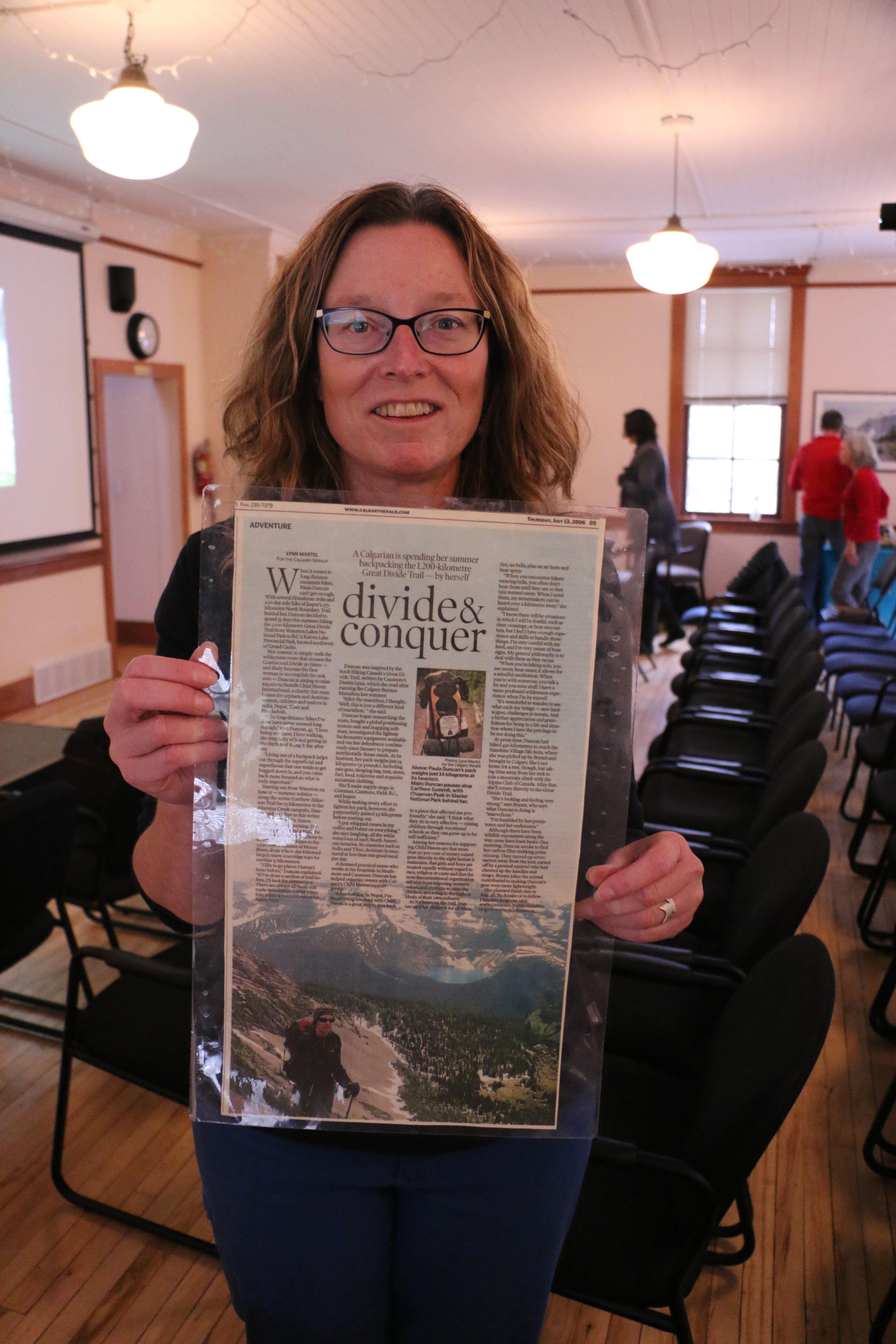
    Paula Duncan, one of the first women to solo hike the Great Divide Trail, entertained a sold out crowd at the GDTA AGM on October 2nd, 2017. Paula kicked off her talk with why she prefers solo hiking. “I like it for many reasons, the most compelling of which is that I find it to be a more profound experience… I’m more mindful and more aware of what’s going on around me, experiencing nature on a deeper level, kind of like a mindfulness meditation.  I treasure the rare experience of being in places completely away from human generated sound.  Also walking at my own speed, going for as long or as short in a day as I choose and challenging my own route finding skills.”

    Paula DuncanIt’s been 11 years since Paula had her GDT journey and she had a lot of fun looking back on the trip in preparation for sharing her story with us. Here are Paula’s top tips for planning a trip on the GDT:

    • Physio/Fitness:  targeted pre-hike exercises based on a physio assessing her weak points
    • Food:  dehydrate your own food, it saves a lot of money!  It’s amazing what you can dehydrate, even leftovers.  And it’s important to bring nutritionally dense food; in addition to calories for fuel, you need to consider what your body requires to repair itself under consistent heavy use.  It goes with the territory that long distance hikers will lose weight, and we now know that healthy fats should be a part of our diet, so include them prior to, and during your trek.
    • Feet:  If your shoes don’t quite fit, and you are prone to blisters, try raw washed and combed sheep wool on your hot spots, under your socks.
    • Skills:  Learn how to read a river, how to find a safe crossing, and practice moving in streams. (River crossings scared Paula more than bears).  If you have any fly fishermen pals, they can help you learn those skills!  You will also need to have solid routefinding experience, and always be aware of possible alternative routes… You will encounter a variety of conditions; possible floods, impassable rivers, fires, wildlife closures.  Or you might want to do something different just for fun!
    • Mental prep:  Books, particularly those of the early Rocky Mountain explorers, also other expeditions, such as “The Worst Journey in the World Antarctic 1910-1913” by Apsley Cherry-Garrard.  (Download for free on google play, or audiobook free from Librivox).   As part of the Scott Antarctic expedition and research team, Apsley was one in a group tasked with the objective of obtaining emperor penguin eggs; researchers were intent to obtain these eggs, as emperors were thought to be the most primitive birds on the planet, and hoped the embryos might provide evidence of an important evolutionary link.  With this objective a party of three set out in the dark of an Antarctic winter, pulling two sledges loaded with over 700lbs of gear.  They were out for six weeks, in temperatures as low as -70s Fahrenheit.  Their clothes were frozen, one time so stiff Apsley wrote he couldn’t move his neck, and had to pull with his head tilted back.  They crawled into stiff frozen sleeping bags at night; they suffered from scurvy and associated weakness, swollen painful joints, the cold was so bad their teeth shattered in their heads.  Why on earth will this be helpful on the GDT?  Well, you will have some spectacularly beautiful days, which will touch you to your core…and you will also have some difficult and painful days that will take a little more patience and determination to get through.  So, on your very worst day on the GDT, you can think of those men, and you will feel a lot better about where you are at!

    Returning from the trail is different for everyone.  After you’ve been on the trail for weeks, getting into the rhythm of walking with your pack on, you’ve probably formed a few new neurons, and then you’re back into “life”, and trying to fit yourself back into something that feels a little alien.  Hopefully you will be able to take some time, and ease into it; you get a little different sense of being, somewhat esoteric, difficult to explain to someone who hasn’t been there.  “I met this fellow, Robert Twigger, back from recreating MacKenzie’s trip from Athabasca Lake to the Arctic Ocean, in a handmade birchbark canoe.  He just looked at me, and said “Oh, you just got back, so you understand, don’t you”?  Neither of us could really articulate what that was about, but we definitely understood.” 

    Paula summed up how the GDT thru-hike stayed with her and affected her in four ways:

    1. Simplify consumption: “I think as a result of moving on foot at a slow, human pace and being removed from marketing and petroleum products for such an extended period of time,  I became profoundly aware how influenced we are by these things, and the unsustainability of it all in the long run.  It became a consistent and unavoidable theme towards the end of the hike, a realization which caused much conflict for some time following, particularly in terms of how to reconcile my own actions with this knowledge.   It’s a very big picture, and much is interconnected.  In simple terms, it made sense to consume less, and to be more mindful regarding consumption.”
    1. Headwaters: Along the GDT are numerous headwaters, which became an incentive to learn more about our waterways, both geographically and ecologically.  “I’m now more aware of who is downstream?  What is upstream?  What products am I putting into the water?”  I also have become involved in Parks Canada projects as a volunteer, particularly in aquatics research.
    1. Wilderness:  “I seek out the old ways, longer distance wilderness routes now seldom used, more bushwhacking and river crossings, but i love the remoteness and the challenge.  Many of these are not so far from home! I don’t throw out old guidebooks or maps, and I listen to stories of older area residents, as these provide records of such places otherwise forgotten.”
    2. Gratitude:  “The kindness of strangers and so many people who helped me out along the way, or just sent their good vibes along.  Gratitude for those who went before: the First Nations people, explorers such as David Thompson, the Palliser Expedition, James Hector, Mary Schaffer, Milton and Cheadle.   Today it’s the guidebook writers, (surely a labour of love, things change so quickly!!).  For keeping seldom used trails passable: commercial outfitters, recreational horse packers, and in particular I can’t tell you how many times I was grateful to the trail crews.”

    “Overall, what I took away ….  be a more mindful consumer, consume less, and I like the quote from Aldous Huxley “be a little kinder to one another.”

    Paula has mostly lived in Canmore for the past 30 years, so she’s fortunate to have the opportunity to spend a good deal of time in the mountains,  She’s also been fortunate enough to travel and experience hiking in other countries.  Of all of the countries that Paula has visited Nepal had the greatest influence on her life. It gave her a first taste of long distance hiking as well as other profound life lessons.  Most striking was the exceptional generosity of the Nepalese people, many with less in their homes than what was in her backpack, but always willing to show hospitality and to share with no strings attached.  She came away with a profound appreciation and gratitude for her experiences and wanted to give back somehow. 

    Paula raised funds for Child Haven when she walked the GDT which meant creating media awareness for her thru-hike.  Child Haven was founded by an amazing inspiring Canadian couple, Bonnie and Fred Cappuccino. Bonnie and Fred had 2 children of their own, and then adopted 19 mixed ethnicity kids from around the world, back in the days when this was unheard of.  When that family grew up, Bonnie and Fred weren’t finished yet, they started homes for children in India, Nepal, Tibet and Bangladesh.   The homes operate on a Gandhian philosophy, so girls and boys are treated equally, and without regard to race, caste, religion.   The organization is secular, children are raised according to the highest ideals of their own cultures.  Paula’s been involved for many years with Child Haven, mostly with arranging past fundraisers for Child Haven in Calgary and more recently in the Bow Valley.  If you want to find out more about Child Haven, see www.childhaven.ca.

    Thank you Paula for sharing your story with us!

  • GDTA Crew Leaders Training

    GDTA Crew Leaders Training

    By Jeff Gruttz

    Sure, we all ‘know’ trails BUT are our volunteers fully cognizant of how sustainable trails are built and maintained? When our focus is enjoying the scenery or getting to the next campsite it’s not an easy task to understand how those ‘been there forever’ trails were constructed.

    Calgary is at the fortunate confluence of multiple streams of a wide range of trail construction expertise. Doubly beneficial is the willingness of many individuals to share their experience with others. Whether it’s high-standard paved urban pathways, on-street bicycling facilities, equestrian trails, single-track walking or mountain biking trails, back country log bridges, via feratta or cable rope ways the knowledge sharing is there for the asking.

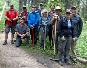
    GDTA volunteers were fortunate to have a two day volunteer crew leader training session led by David Mills of The Calgary Mountain Bike Alliance (CMBA) in mid-June. David was very knowledgeable of International Mountain Bike Alliance (IMBA) trail building techniques. David refined his capabilities through many years of trail building with CMBA volunteers and paid crew on a multi-use trail network in the Station Flats area just west of Calgary in the Elbow River watershed.   

    OLYMPUS DIGITAL CAMERA

    Are we reading your thoughts: “What do mountain bike trails have to with our GDT interests in long distance hiking trails?” The best answer is the following: It’s the reason why Parks Canada Agency hired the former IMBA Canada Trail Care Crew leader, Mark Schmidt, to assess ALL national park trails and design a strategy for their sustainability. IMBA’s trail building techniques are based on well-grounded engineering principles: build with the end-user in mind, move water off trails as quickly possible and build for tomorrow rather than just next week. 

    Our GDTA volunteers’ absorbed David’s classroom presentation on the first day with many interactive Q’s and A’s dispelling trail building myths (trail edge retaining logs block water outflow!) while the second day in the field enabled participants to observe and practice in part the previous day’s theory. David was fully humble with several mentions of ‘we could have done this better’ and ‘here’s how we’ll correct that trail issue for the future.’

    Any and all questions about trail construction techniques were addressed including: maximum gradients, trail out sloping, grade reversals, soil types and textures, clearing and tread widths, climbing and switchback turns, crossing gullies, tool limitations, hazard identification, value of planning, dealing with conflict, learning styles, volunteer encouragement / management and FUN.

    OLYMPUS DIGITAL CAMERA

    Crew leaders gained an appreciation for trail building as an art rather than 100% all-encompassing engineering techniques. An ability for GDTA leaders to share their new learnings with crew members will go a long way towards building the best new trail possible within our means while minimizing future maintenance requirements.  Don’t hesitate to ask crew leaders this summer ‘why’ the trail is routed where it is or if a grade reversal should be included on what appears to be a sustained gradient. Our collective expertise can only grow if we understand and share basic trail building principles and practice correct techniques!  

  • June 2017 Trail and Road Conditions

    June 2017 Trail and Road Conditions

    Trail Conditions Update – June 26, 2017

    It’s transition time on the GDT and wildflowers are starting to bloom! Valley bottom trails at lower elevations vary from bare and dry to wet and muddy, while trails at higher elevation are still snow covered. With warmer weather, trail conditions can change quickly, from icy in the morning to slushy and slippery in the afternoon. Plan for varying conditions – clothing layers, boots, cleats and/or poles are recommended. 

    CREEKS: Warmer weather also means rapid snow melt during the day resulting in high water levels and potentially dangerous creek crossings, so attempt to ford larger creeks early in the day when water levels are lowest.

    SNOW: Snow levels were unusually high in the Rockies but things are melting fast. Expect snow patches on north-facing slopes above 2000 metres and at slightly higher elevations on other aspects. For up to date snow level data in BC, check out the Snow Survey Bulletins and Commentaries which include links to the Snow Survey and Water Supply Bulletin and map. In Alberta, check out the ESRD’s Snow Data map.

    ELK CALVING SEASON: May 15 to June 30. Protective mother elk will aggressively protect their newborns by kicking and charging at people. Stay at least 30 metres away from all elk during this time of year. Pay attention to trail closures in known elk calving areas.

    TICKS: It’s tick season so be extra careful when in areas with a lot of underbrush. Wear long pants, gaiters and DEET, and check yourself and your clothing after your hike. 

    BEARS:  Bears are out and about in search of food. Be bear aware on the trails this summer, make noise and carry bear spray.

    WILDFIRE UPDATE: Currently there are no campfire bans on the GDT, but if you must have a campfire in the backcountry, ensure you follow the rules.

    TRAIL CLOSURES:

    • Trail 7 near Jasper is closed to hikers south of the junction with Trail 7e and north of the junction with Trail 7a due to grizzly and black bears frequenting the area next to the golf course. Detour by taking Trail 7e towards Trefoil Lakes and Trail 7b south to Old Fort Point trailhead. Equestrian uses can still use Trail 7 but are not to dismount.
    • Numa Creek Trail (Rockwall access trail) remains closed due to wash out of the bridge over the Vermilion River. 
    • Tumbling Creek Trail (Rockwall access trail) is closed from the Ochre Creek trail to the intersection of the Rockwall Trail before the Tumbling bridge due to a missing bridge at km 6.6.

    TRAIL NOTICES:

    • From Scarpe Pass (a24), the trail disappears up to La Coulotte Ridge and the hiking becomes significantly more difficult until you reach the ATV track (a27) heading down to the West Castle Road.
    • The Aldridge Creek Trail between Fording River Pass (b31) and the Kananaskis Power Line Road (b32) was cleared and restored in July 2015.
    • To protect sensitive habitat and improve habitat security for grizzly bears, hiking or travel anywhere except on official trails or designated roads in the Sunshine Meadows, Citadel Pass, and Healy Pass areas of Banff National Park is prohibited. 
    • Cairnes Creek (d9): The bridge is washed out making this a potentially dangerous ford. It is recommended to cross early in the morning when glacial melt is lowest.
    • The damaged Lambe Creek bridge (d10) was removed in September 2015. It is recommended to ford the creek downstream.
    • The Howse Pass Trail from Conway Creek (d12) to the Glacier Lake trail junction (d14, 15 km) is in very poor condition. The trail is overgrown, with hundreds of wind-fallen trees across the trail. Hiking in the Howse River floodplain is a viable alternative if the Howse River is low enough to ford.
    • The Owen Creek Trail was cleared in July 2015 up to km 6. Beyond that point, the trail is in poor shape with several washed out sections. Expect challenging hiking for 3 km including skirting along steep creek-side cliffs and rock-hopping in the creek itself. At km 6, do not take the trail heading up away from the creek (it is a deadend). Look for orange blazes marking the correct route staying near the creek.
    • The Maligne Pass trail in Jasper National Park has been decommissioned and is in poor shape. The trail from Pobokton Creek (e20) to Maligne Lake (e25, approx 42 km) is no longer being maintained by Parks Canada so expect deteriorating and overgrown trail conditions; long pants are recommended. The Maligne River bridge has been removed but the river can be easily forded in normal summer conditions (knee deep in mid-summer). Most other bridges are still in place. Read Nathan Dahl’s August 30, 2015 Maligne Pass trail update here.
    • The Yates Torrent Bridge is out at the crossing of the Coleman Glacier outflow (near f16). Do not attempt to cross at the old bridge location. Instead, ford the Smoky River farther down the valley. Attempt to cross early in the morning when glacial melt is the lowest or be prepared for a fast and potentially dangerous creek ford.
    • The bridges across Gendarme and Carcajou Creeks are out on the Jasper North Boundary Trail. These two creeks are smaller than the Smoky River, but can still be treacherous. Cross Gendarme at the horse crossing just below the old bridge (marked), and Carcajou about 100m below the trail.
    • The bridge across Buchanan Creek on the trail to Kakwa Lake, has been removed. The crossing here can be hazardous early in the year or after heavy rains. 

    ACCESS ROADS:

    • Akamina Parkway is now open to Cameron Lake. Construction on the Cameron Lake Day Use Area facilities is substantially complete. Contractors may still be on site working on the finishing touches. 
    • Access to the northern terminus of the GDT in Kakwa Provincial Park is via the Walker Creek Forest Service Road. The Walker Creek FSR has been repaired from Highway 16 to km 33.5. While travelling the remaining 40 kilometres on the Walker Creek FSR, attention is required to navigate the surface as it is uneven, rutted, slippery and very rough. The road is not recommended for anything other than a 4×4 high clearance vehicle. The last 10km from Bastille Creek to Buchanan Creek is closed due to washouts and is not driveable by vehicle so be prepared to walk this distance on foot.
  • GDT Route Updates for 2017

    GDT Route Updates for 2017

    Effective immediately, the GDTA is announcing a couple changes to the main route of the GDT as well as a fantastic new alternate route that appears in Dustin Lynx’s 3rd edition of his guidebook. These new routes are all reflected in the GDTA map and GDT App.

    Main Route:

    Wonder PassWonder Pass is now the main route of the GDT into Mount Assiniboine Provincial Park from the south. To increase public safety and minimize displacement of grizzly bears from prime food sources at a critical time of the year, the upper Assiniboine Pass Trail is closed seasonally from August 1 to September 30. Equestrians are permitted to access Mount Assiniboine Provincial Park through Banff National Park via the lower Assiniboine Pass trail.


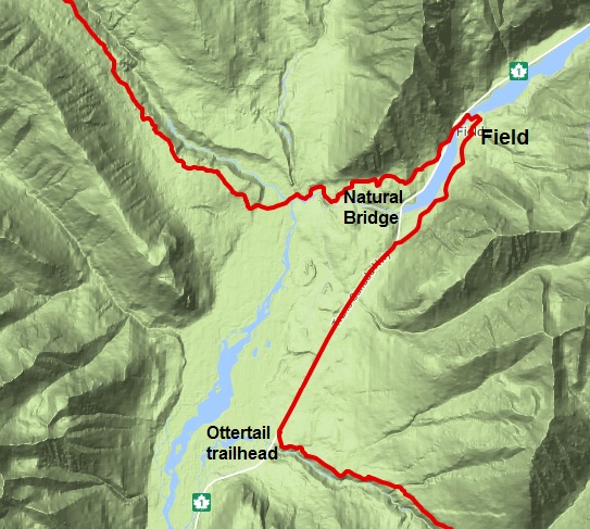
    Field - New RouteField BC – From the Ottertail trailhead in Yoho National Park, the route no longer crosses the Trans-Canada highway to follow the railway tracks to Natural Bridge. Instead, walk next to Highway 1, northeast for 4.9 km until you reach a junction with a backroad on the south side of the highway.  This backroad continues north 3.5 km on the east side of the Kicking Horse River and becomes Stephen Avenue in Field, on which the post office is located. From Field, follow the Tally-Ho Trail 4.5 km to Natural Bridge. This re-route adds some additional distance but most thru-hikers will be resupplying in Field anyway.


    Alternate Route:

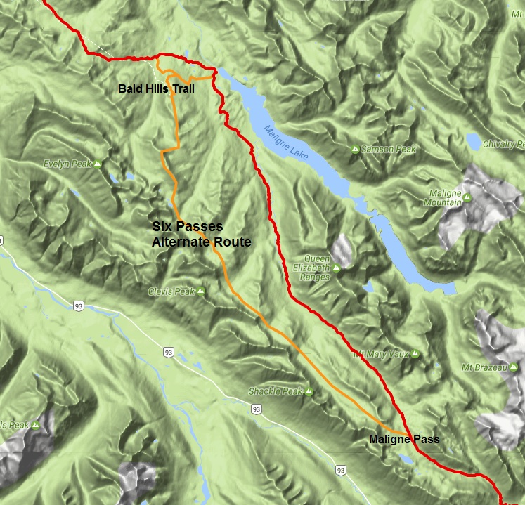
    Six Passes Alternate Route (provided by the author of Hiking Canada’s Great Divide Trail guidebook, 3rd edition, Dustin Lynx) – 36.9 km instead of 31.6 km – Hikers only. If necessary, ask the Jasper park office for a 1-night random camping permit on this alternate route.

    Six Passes Alternate Route

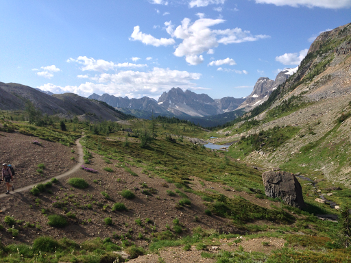
    This is one of my favorite hikes of the entire GDT, a real gem. I’ve hiked and skied it. I loved it both times and I highly recommend it. I did not include this alternate in previous editions of the guidebook because of the viable trail and facilities in the valley. When the decommissioned Maligne River trail becomes impassible however, this alternate will be the only viable link for the GDT route through Jasper National Park. It does involve some easy scrambling but nothing like the Barnaby Ridge alternate in section A or the Coral Pass alternate route in section C. The route-finding is easy and the hiking is unparalleled for cross-country travel. There is plenty of water en route between each of the passes. Don’t attempt it too early in the season due to snow and caribou calving. Late July to late September is the optimal period. The caribou-rutting season begins in late September. Parks Canada advises visitors not to travel from then until late October. They won’t issue a random camping permit for the route during periods that are sensitive for the caribou.

    The key to the alternate route is to line up all six passes and keep an eye on them as you descend through the subalpine valleys. This route follows the base of the unbroken and impressive escarpment of the Endless Chain Ridge. There are lakes, waterfalls, alpine meadows and continual vantage points. It is a strenuous route with a total 2057 metres elevation gain and 2597 metres loss. The route is suitable for running or fastpacking but there is technical footing in the lower meadows between the passes, where tussocks (small, grassy mounds) form.

    From waypoint e22 at the shallow lake on Maligne Pass, hike cross-country 2.5 km up to Pass #1 at 2492m elevation. From there, look northwest and line up the next pass in the chain. Descend into the long meadow to a low point of 2023m at km 9.5. Climb steeply up to Pass #2, 2225m, at km 10.4. Still following the rock wall northwest, descend to a low point of 2065m at km 12.1. You ascend to 2315m Pass #3 at km 13.2. From Pass #3, the route goes slightly more north, descending to a low point of 1922m at km 15.9. It angles up to a Pass #4, east of Sympathy Peak at km 17.8 and 2228m. Descent to a marshy low point of 2084m at 19 km. Ascend past two alpine lakes to 2335m Pass #5 at 20 km. Finally, descend to 1985m at 21.9 km before climbing up to Pass #6 at 2260m and 24.9 km. Instead of dropping down over this pass, as you have become accustomed to, angle up to the barren ridge crest to the north. Follow this ridge crest right up to the cairn on the impressive summit at 2568m. The route follows the ridge that goes directly east from the summit, down through some steep terrain. Be careful not to dislodge a rock if you are following someone else. It is a brief but easy scramble down. The angle of the descent lessens as the ridge broadens. The now easy ridge walk curves to the north. Stay right on the ridge crest, clambering over a couple of minor rock steps, eventually joining the Bald Hills trail at 29.6 km at a cairn on a 2374m ridgeline summit. Good, signed trail brings you down the remaining 7 km along the ridge and then down through forest to rejoin the main route at the Bald Hills trail junction, 200m from the trailhead kiosk at the Maligne Lake parking lot.

    Shortcut: There is a trail junction 2.5 km before reaching the parking lot – perhaps 750m down from the lookout, in forest. If you turn left, you will reach the Evelyn Creek campsite on the Skyline trail in 2.7 km and bypass the busy trailhead at Maligne Lake. This shortcut shaves 7.3 km off the main route, nearly making up for the extra distance of the entire alternate route.

    Happy trails!

  • Spring 2017 Trail and Road Conditions Update

    Spring 2017 Trail and Road Conditions Update

    Trail Conditions Update – May 1, 2017

    Spring is in the air! This is transition time on the GDT. Valley bottom trails at lower elevations vary from bare and muddy to slushy and icy, while trails at higher elevation remain snowbound. With warmer weather, trail conditions can change quickly, from icy in the morning to slushy and slippery in the afternoon. Plan for varying conditions – warm layers, boots, snowshoes, cleats and/or poles are recommended.

    SNOW: Snow levels are unusually high in the Rockies this spring. Avalanche conditions still exist, especially at higher elevations so always check the latest avalanche bulletins before setting out. For up to date snow level data in BC, check out the Snow Survey Bulletins and Commentaries which include links to the Snow Survey and Water Supply Bulletin and map. In Alberta, check out the ESRD’s Snow Data map.

    TICKS: Tick season has started. Be extra careful when in areas with a lot of underbrush and check yourself and your clothing after your hike.

    BEARS: With spring’s arrival, bears are leaving their dens in search of food. Be bear aware on the trails this spring, make noise and carry bear spray.

    TRAIL NOTICES:

    • From Scarpe Pass (a24), the trail disappears up to La Coulotte Ridge and the hiking becomes significantly more difficult until you reach the ATV track (a27) heading down to the West Castle Road.
    • The Aldridge Creek Trail between Fording River Pass (b31) and the Kananaskis Power Line Road (b32) was cleared and restored in July 2015.
    • Cairnes Creek (d9): The bridge is washed out making this a potentially dangerous ford. It is recommended to cross early in the morning when glacial melt is lowest.
    • The damaged Lambe Creek bridge (d10) was removed in September 2015. It is recommended to ford the creek downstream.
    • The Howse Pass Trail from Conway Creek (d12) to the Glacier Lake trail junction (d14, 15 km) is in very poor condition. The trail is overgrown, with hundreds of wind-fallen trees across the trail. Hiking in the Howse River floodplain is a viable alternative if the Howse River is low enough to ford.
    • The Owen Creek Trail was cleared in July 2015 up to km 6. Beyond that point, the trail is in poor shape with several washed out sections. Expect challenging hiking for 3 km including skirting along steep creek-side cliffs and rock-hopping in the creek itself. At km 6, do not take the trail heading up away from the creek (it is a deadend). Look for orange blazes marking the correct route staying near the creek.
    • The Maligne Pass trail in Jasper National Park has been decommissioned and is in poor shape. The trail from Pobokton Creek (e20) to Maligne Lake (e25, approx 42 km) is no longer being maintained by Parks Canada so expect deteriorating and overgrown trail conditions; long pants are recommended. The Maligne River bridge has been removed but the river can be easily forded in normal summer conditions (knee deep in mid-summer). Most other bridges are still in place. Read Nathan Dahl’s August 30, 2015 Maligne Pass trail update here.
    • The Yates Torrent Bridge is out at the crossing of the Coleman Glacier outflow (near f16). Do not attempt to cross at the old bridge location. Instead, ford the Smoky River farther down the valley. Attempt to cross early in the morning when glacial melt is the lowest or be prepared for a fast and potentially dangerous creek ford.
    • The bridges across Gendarme and Carcajou Creeks are out on the Jasper North Boundary Trail. These two creeks are smaller than the Smoky River, but can still be treacherous. Cross Gendarme at the horse crossing just below the old bridge (marked), and Carcajou about 100m below the trail.
    • The bridge across Buchanan Creek, near the Kakwa Lake trailhead, has been removed. The crossing here can be hazardous early in the year or after heavy rains. 

    ACCESS ROADS:

    • Annual Winter Closure of Highway 40 from the Kananaskis Lakes Trail to the junction of Highway 541 between December 1 and June 15.
    • 8:00 pm to 8:00 am closure of the Bow Valley Parkway (Highway 1A) from March 1 to June 25 on the 17 kilometre section of the parkway from Johnston Canyon Campground to the Fireside Picnic Area, to reduce disturbance and increase habitat security for sensitive wildlife species during critical times.
    • Akamina Parkway: Starting April 17, there will be no public access to Cameron Lake or the Carthew-Alderson trailhead until construction at Cameron Lake Day-Use Area is complete. Vehicle traffic will be stopped at the Little Prairie Day-Use Area. Visitors can travel on foot to the Akamina trailhead only via the Cameron Lake ski trail.
    • Access to the northern terminus of the GDT in Kakwa Provincial Park is via the Walker Creek Forest Service Road. The Walker Creek FSR has been repaired from Highway 16 to km 33.5. While travelling the remaining 40 kilometres on the Walker Creek FSR, attention is required to navigate the surface as it is uneven, rutted, slippery and very rough. The road is not recommended for anything other than a 4×4 high clearance vehicle. The last 10km from Bastille Creek to Buchanan Creek is closed due to washouts and is not driveable by vehicle so be prepared to walk this distance on foot.
  • Charlie Russell talks at Sold Out GDTA Fundraiser

    Charlie Russell talks at Sold Out GDTA Fundraiser

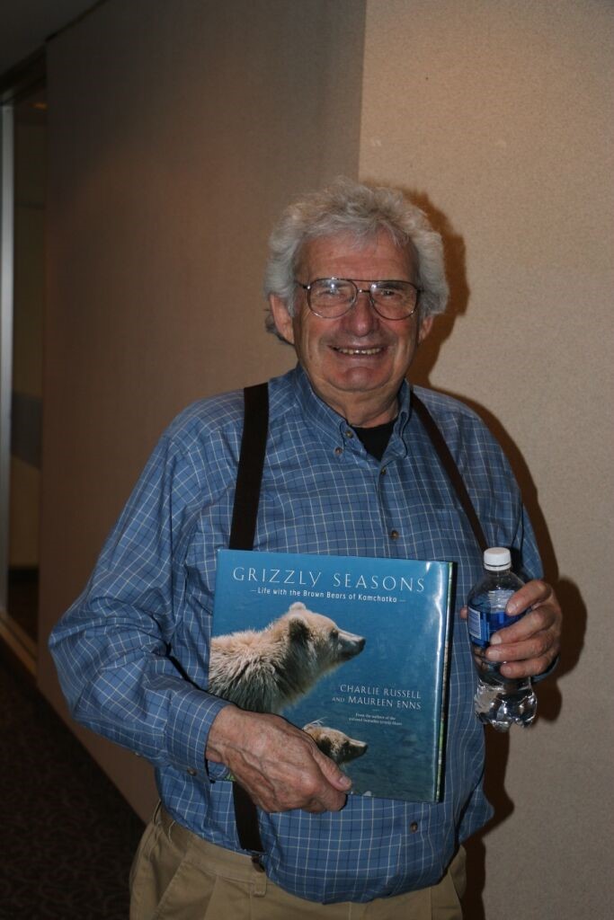
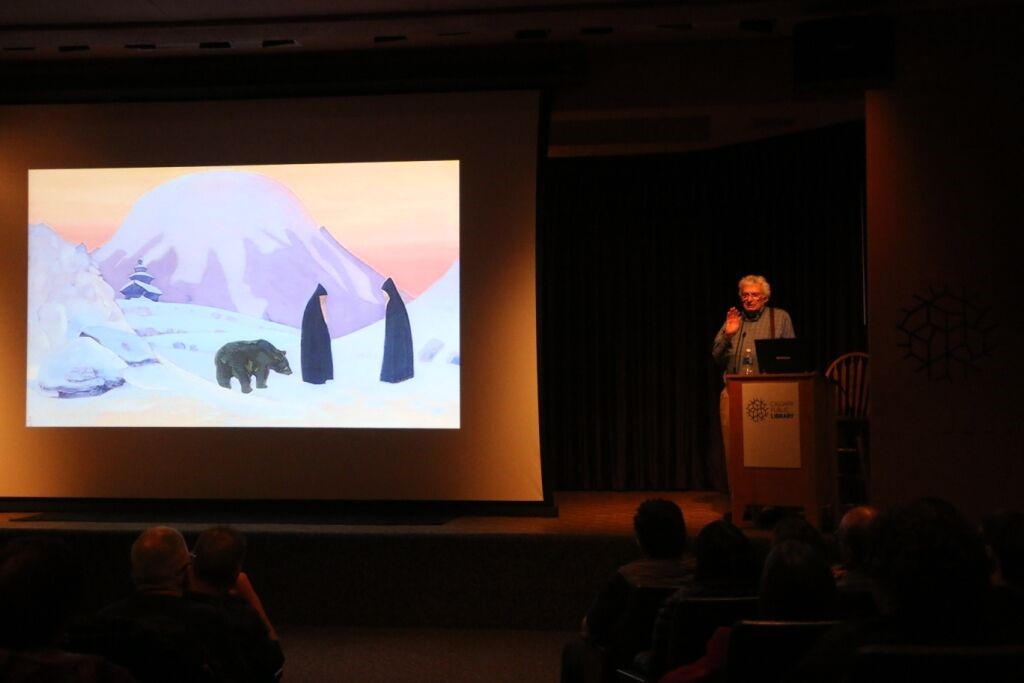
    Charlie Russell spoke to a sold out crowd of hiking enthusiasts, GDTA supporters, Girl Guides, Scouts at the John Dutton theatre in Calgary on March 21st.    charlie1

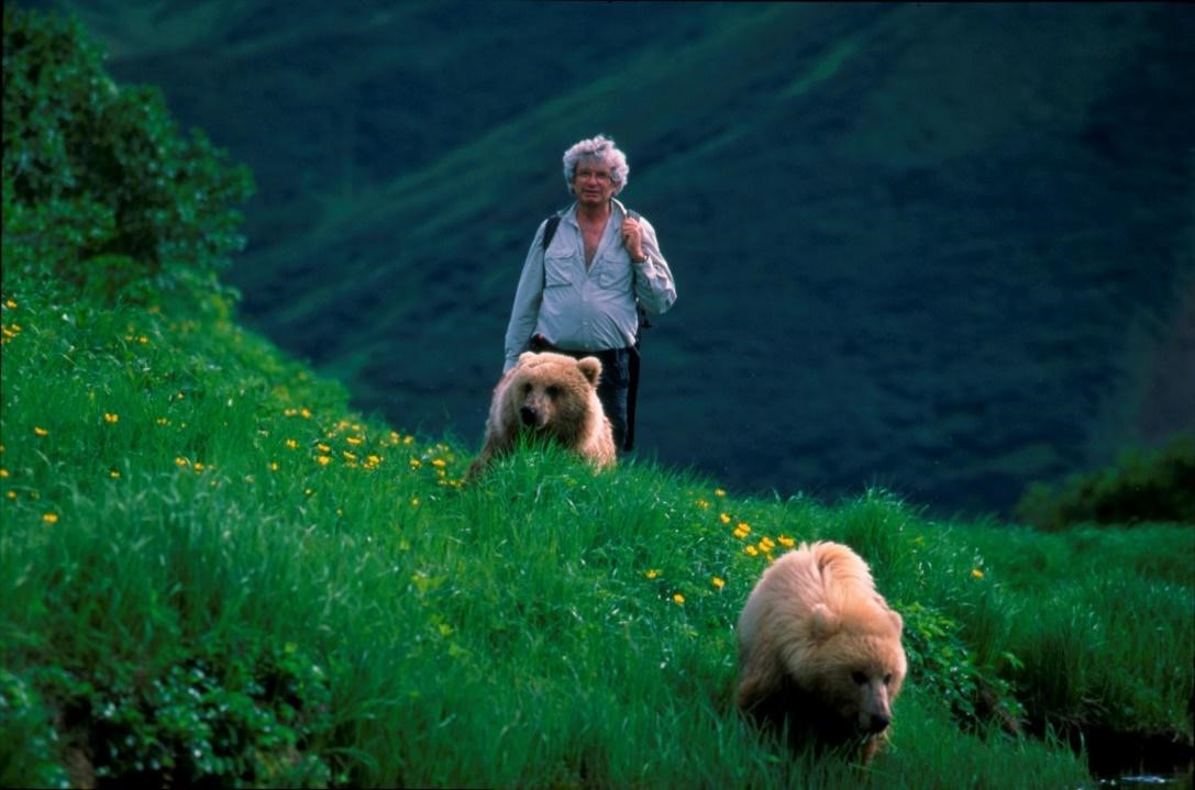
    Charlie Russell has spent the better part of 55 years studying and living with grizzlies and his philosophy boils down to: “They (grizzly bears) will trust you, if you trust them.” What makes Charlie Russell’s bear theories very special is that he not only talks about his ideas he has put them into practice. Against the advice of almost everyone he famously lived with grizzlies in a lengthy experiment in the rugged bear country of Kamchatka Peninsula on Russia’s Pacific coast.  For close to a decade he lived among a 400-strong bear colony.  The only “weapon” he carried was bear spray and he only used that to keep the mature male bears away from some orphan cubs he had rescued from a zoo.

    charlie 2

    He stayed with the Russian bears for six months a year and spent the other six months raising money worldwide to keep the experiment going.  He even built and flew his own airplane to assist in low-cost aerial surveys and to provide remote access. “I was more likely to be killed in my own airplane than attacked by a grizzly bear.”

    Charlie Russell says his experiment proves grizzly bears are not dangerous if unthreatened and understood by humans. 

    Charlie shared many moments from his time raising the grizzly bear cubs and when asked about a most inspiring moment said that it was every day, “Just imagine taking these three cubs for a walk in the wilderness every day, so many beautiful times, it was incredible.  They’d come galloping up to go for a walk and then off we would go.”

    charlie 3

    Charlie had this advice to give about encountering a bear while hiking: “If the bear was aware of you with lots of notice, get off the trail.  Bears like the trails too, it’s easier for them to walk.     If, however, you surprise a bear, you’d better have your bear spray ready.  They may go into protect mode and view you as a predator.” 

    Russell acknowledges he was once attacked by a black bear near his ranch. He says he was saved by his son, but insists “I’ve always blamed the attack on myself”.  He says he did not show the bear sufficient respect and tried to shoo it away when it blocked his path. Instead of running, the bear, presumably feeling threatened, attacked.

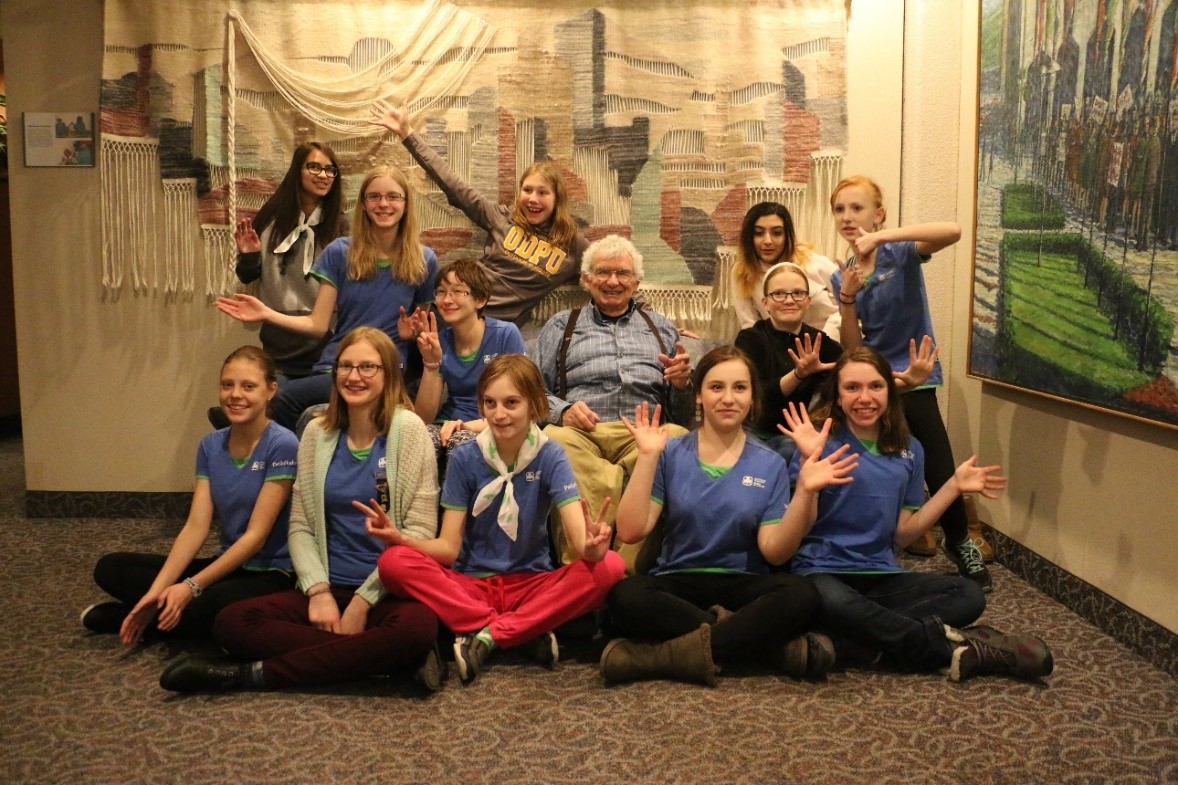
    The GDTA invited the Calgary Girl Guide Rangers to be their guests at the event on March 21st.  It’s a little known fact, but the Girl Guides of Canada dreamed up the idea of the Great Divide Trail. In 1966, the Girl Guides were the first on record to propose a trail running the length of the BC-Alberta border through the Rocky Mountains, a trail that is now known as the Great Divide Trail. charlie 4

    The Rangers from the 72nd Pathfinders Calgary attended the event and had this to say about Charlie’s talk:  “It was the opposite of what I was expecting… it was so much more meaningful and interesting than anything that we’ve seen before on bears.  I felt like we got to know them as people.” 

    The event was sponsored by DIRTT Environmental Solutions.  All money raised from ticket sales went towards the completion and long term protection of the Great Divide Trail.

  • Backcountry Kitchen

    Backcountry Kitchen

    Let’s Get Dehydrated!
    By: Shannon Budesilic

    Any back-country dehydrating enthusiasts out there? This weekend, I managed to dehydrate some beautiful kiwi (little green, sweet gems) and some saskatoons and cranberries. The saskatoons, being a little dry already, turned out a little like saska-raisins, which are cool little blue shriveled things to behold (saska-raisins…I wonder if we can patent that one?). I had to halve the cranberries to get them to dry out because of their initial juiciness. I dehydrated them from thawed/frozen (believe it or not) and they turned out great! I love adding the berries and fruit to my breakfast portions, or eating them as a sweet little snack on the trail. The apple chips I prepared are also a good quality standby with a long shelf life.

    Have you tried your hand at dehydrating lean ground beef? We, my carnivore hubby and I, always feel like some good quality protein is much needed after a few days on the trail. I will add the dried ground beef to any of my curry dishes, or to my pasta sauce (either one of these sauces dehydrates to a nice, useable leather that rehydrates quite easily on the trail). Dried meat products, like beef, if prepared properly, will last for up to six months. I may store my dried beef in the freezer prior to use, just in case.

    I also dehydrated some home-made French (split yellow) pea soup and it turned out beautifully! Basically, you make the soup (ensure the veggie or meat bits are tiny so they dry completely; or blend the soup prior to dehydrating), spread a 1 cup of soup onto a plastic dehydrating sheet, and dry it out at medium temperature until very dry. On the trail, I reconstitute with an equal amount of water (ie. 1 cup dry soup to 1 cup hot water; typically, 1:1 ratio depending on how thick your prefer your soups). Try reconstituting this in a thermos if eating out on a winter adventure (works beautifully on the trail). You can add instant rice to beef it up if you like. If you plan ahead, the thermos will allow you to rehydrate a meal (such as lunch or dinner) as you enjoy the sights along the trail.

    I know some good quality dehydrated meals are available (ie. Yamnuska), and the quality is getting better, but you can’t beat something that is homemade. For more inspiration, stay tuned for the next installment of Backcountry Kitchen!

  • Draft Castle Management Plan

    Draft Castle Management Plan

    A few weeks ago the Alberta Government proceeded with an Order in Council to make both the Castle Provincial Park and the Castle Wildland Provincial Park official. For the history of this process, you must go all the way back to 1895 when part of the area was included in the Waterton Dominion Park, now known as Waterton Lakes National Park. In the early 1920’s, the area was removed from the Park and transferred to the Alberta Government to become a Provincial Game Reserve. In 1954, the status of a Game Reserve was lost and this was the start of mining, logging, and eventually oil and gas exploration. In 1977, the Eastern Slopes Policy created areas of Prime Protection promising long term protection. Through many years of constant advocacy from groups like the Alberta Wilderness Association (AWA), Canadian Parks and Wilderness Society (CPAWS), the Castle Crown Wilderness Coalition and thousands of concerned citizens, we are now finally at a stage of protection that will persist in perpetuity.

    The Castle area has been internationally recognized for its high biodiversity and identified as a landscape that is deserving of protection. The area being part of the eastern slopes provides one third of all freshwater into the Oldman River watershed and habitat key for species including threatened Grizzly Bear, Westslope Cutthroat Trout, Bull Trout, White Bark Pine, Limber Pine and Wolverine. The area is also valued by various user groups and used for cattle grazing, trapping, hunting, fishing, OHV use and hiking. Taking all of these perspectives into consideration has made for an interesting and fulsome planning process.

    The Great Divide Trail Association (GDTA), through a contact at the Alberta Hiking Association, was invited to join the last part of the Government consultations. GDTA President, Dave Hockey, participated in the recreation working group, reviewed science reports, linear footprint models and reveled in the challenge and learning experience of working with other land managers. The largest benefit was the opportunity for the GDTA to express its organizational opinions and input as hikers and advocates for our long-distance hiking trail in the Canadian Rocky Mountains.

    The draft Castle Management Plan has now been released by the Government of Alberta for all Albertans to read and respond with their comments on the survey. The GDTA encourages you all read the plan and weigh in to help shape the future management of the Castle area. Too often we sit back and do not express approval for a job done well by the government, but this time let’s work together, share our voices and support the Castle.

  • Julia Lynx Concert: A Benefit for GDTA

    Julia Lynx Concert: A Benefit for GDTA

    The AWA headquarters was packed on Saturday, January 28 as it hosted the first event of 2017 put forth by the GDTA Outreach Committee:  Julia Lynx concert: A Benefit for the GDTA.

    Julia Lynx thru-hiked the GDTA in 1996 with her partner Dustin, an experience that eventually evolved into a comprehensive guidebook that helped revive interest in the long distance trail and still is the definitive GDT resource used to this day.

    The trail and mountain has inspired Julia’s work, which she generously shared with us on that evening.  Accompanied with friends and her daughter, Julia invited us to her living room to share her passion for the Great Divide and the outdoors.

    Those in attendance were treated to not only an intimate concert but also some slides of the trail and the wonderful stories that go along with it. The vintage photos from Julia and Dustin’s hike twenty years ago were followed with another presentation from Julia’s daughter, Tenaya, who relayed the tale of a mountain hike she did with her dad while exploring for potential new routes on the trail.

    Heath McCroy and daughter Léa joined Julia on stage and entertained the crowd to songs rendition that included, along with original composition from Julia, interpretation of pieces from Jack Johnson and Bob Dylan, among other. There was also a notable adaptation of the Robert Burns poem “My Heart’s in the Highlands” which Julia sang on the harmonium.

    This was a great evening of folk music and trail stories, the perfect antidote to warm up those cold January nights. Great work from the GDTA Outreach Committee for planning and organizing this event, and many thanks to Julia and her cohort for being part of this successful evening and sharing their passion for the GDT dream with us.

    If you would like to hear some of Julia’s music, her CD “Wild Patience” is available for order at http://www.julialynx.com/album/.

    The next scheduled outreach event will be a talk Charlie Russell: Living and hiking with Grizzlies. The evening will also feature speaker Dustin Lynx who will kick off the evening by sharing some of his adventures on the Great Divide Trail and beyond. This not to be missed event will be held on Tuesday, March 21 at the John Dutton Theatre Library, 616 Macleod Trail SE. Get your ticket today on Eventbrite.

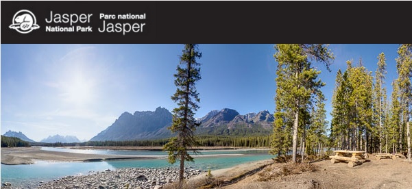
  • Jasper National Park backcountry reservations open Jan 25

    Jasper National Park backcountry reservations open Jan 25

    Online reservations for the 2017 hiking season for Jasper National Park’s backcountry campgrounds begin on Wednesday, January 25, 2016 at 8:00 am MST.

    For more information, check out Jasper’s backcountry brochure.

    JNP Reservations

    New for 2017: Maligne Pass north

    Hiking the Great Divide Trail this summer? It is now possible to book a site on the Maligne Pass route north of Maligne Pass. Note that this trail and the campgrounds along it are unmaintained, so carefully read the instructions on the reservation system.

    Note that for the Miette Lake/Pass Trail, you must call the Jasper Trail Office (780-852-6177) for a random camping permit.

    Reminder, Annual Wilderness Passes (backcountry camping permits) cost $68.70, but Parks Canada Discovery Passes are free in 2017!