

Kananaskis to Field
| Suggested start/finish | Elk Pass Trailhead to Field |
| Recommended number of days for section | 10 (relaxed), 7 (average), 5 (fast) |
| Distance | 207 km |
| Elevation Gain/Loss | 16092m / -16564m |
| Traditional Territory of the | Blackfoot Confederacy, Tsuut’ina, Stoney Nakoda, Ktunaxa, Secwépemc, and Métis |
| National Parks | Banff, Kootenay and Yoho National Parks |
| Permits required | Parks Canada Discovery Pass and backcountry camping permits in Banff, Kootenay and Yoho National Parks. Backcountry camping permits in Peter Lougheed and Assiniboine Provincial Parks |
| Alternates | Northover Ridge |

Section C offers some of the most scenic parts of the GDT. Starting at Peter Lougheed Provincial Park in Kananaskis, it passes through several national and provincial parks, including the iconic Banff National Park, on its way to the town of Field on the Trans-Canada Highway. Most of this section is well-maintained and signed along official trails. At the same time, you will leave behind some of the seclusion you experienced on earlier sections as you hit several popular backpacking trails.
With the exception of a small portion of trail in Height of the Rockies Provincial Park, camping is only allowed in designated campgrounds and permits are required. You’ll want to look into permits as soon as possible as many campgrounds in Section C are very popular and book up very quickly. For those wanting to section hike the GDT, Section C is a great place to start if you are able to get campground permits.
Peter Lougheed and Height of the Rockies
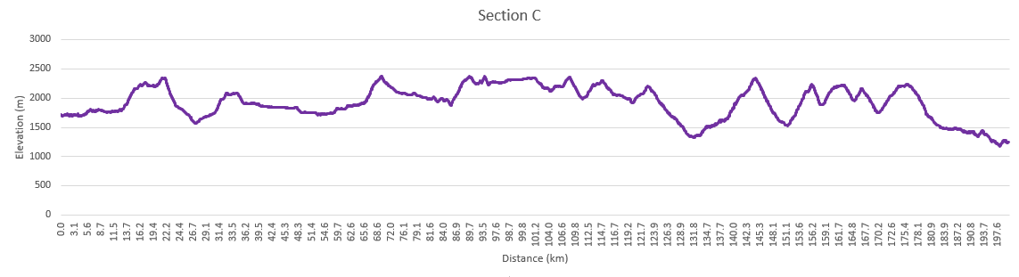
Starting at the Elk Pass trailhead in Peter Lougheed Provincial Park, hike along the shore of Upper Kananaskis Lake to the Upper Lakes trailhead. An alternate route starting from here is Northover Ridge. Rather than hiking counterclockwise toward Interlakes, you’ll hike clockwise along the Upper Lake Trail, splitting off at Hidden Lake and up the headwall to Aster Lake. Here you’ll see the imposing peak of Mount Joffre (also known as The Tooth). This beautiful high alpine valley is well worth it if you have the time. There is a small and popular campground at Aster Lake although random camping is allowed once you cross into BC. Continuing the climb to Northover Ridge, you’ll straddle the Divide for 4 km with some mild scrambling and exposure. Off the ridge you’ll descend to Three Isle Lake. There is a popular campground here with lots of peak bagging options. Heading over South Kananaskis Pass, you’ll pass Beatty Lake campground and head steeply down into the Palliser Valley where the route rejoins the main GDT.
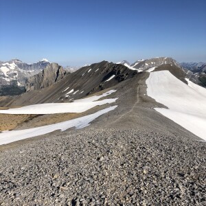
If you’re sticking to the official GDT route, the trail heads up the upper Kananaskis Valley toward a backcountry campground at Forks. Continuing up the valley you’ll pass Lawson Lake, and a campground at Turbine Canyon, an incredible narrow canyon.
Crossing North Kananaskis Pass, the trail passes back into BC and Height of the Rockies Provincial Park. It descends into the Palliser Valley (random camping is permitted here) where some river fording is required. This part of the trail is infrequently maintained and unsigned. An alternate access point is available by heading south down the Palliser River valley; however, the trailhead is only accessible along a 80 km drive on forestry roads on the BC side.
Campgrounds in this area:
- Point (Off trail) – Peter Lougheed Provincial Park (permit and reservation required)
- Forks – Peter Lougheed Provincial Park (permit and reservation required)
- Turbine Canyon – Peter Lougheed Provincial Park (permit and reservation required)
- Aster Lake (Northover Alternate) – Peter Lougheed Provincial Park (permit and reservation required)
- Three Isle Lake (Northover and South Kananaskis Pass Alternate) – Peter Lougheed Provincial Park (permit and reservation required)
- Beatty Lake (Northover and South Kananaskis Pass Alternate) – Height of the Rockies Provincial Park (first come first served)
- Palliser River – Height of the Rockies Provincial Park (no permit required)
- Palliser Pass – Height of the Rockies Provincial Park (no permit required)
Entry / Exit Points
- South – Alberta Highway 40 – Kananaskis Lake Road
- North – Albert River Forestry Road
Resupply
- None
Enter Banff National Park
On a less-maintained trail, you’ll climb to Palliser Pass and enter the world-famous Banff National Park. This part of Banff is rarely travelled, but there are access/entry points at Burstall Pass and Mount Shark. There are campgrounds in this section at Burstall and Birdwood. Once in Banff NP, random camping is no longer permitted.
After the junction with the Mount Shark Trail, you’ll head up the more popular Bryant Creek Trail. There are backcountry campgrounds at Big Springs, Marvel Lake, and McBride’s Camp. Parks Canada also operates a shelter at Bryant Creek. Its a fairly basic cabin with a stove, common eating area, and shared sleeping platforms. Permits are required to stay at any of these locations.
The main GDT heads down Marvel Lake and over the high Wonder Pass where the scenery is incredible. The Allenby alternate provides a less exposed route into Mount Assiniboine Provincial Park.
Campgrounds in this area:
- Burstall – Banff National Park (permit and reservation required)
- Birdwood – Banff National Park (permit and reservation required)
- Big Springs – Banff National Park (permit and reservation required)
- Marvel Lake – Banff National Park (permit and reservation required)
- Bryant Creek Cabin (Closed for reconstruction) – Banff National Park (permit and reservation required)
- McBrides Camp (Allenby Alternate) – Banff National Park (permit and reservation required)
- Allenby Junction (Allenby Alternate) – Banff National Park (permit and reservation required)
Entry / Exit Points
- South – Albert River Forestry Road
- Mid – Highway 742 – Mt Shark Trailhead via Bryant Creek Trail
- North – Allenby Pass Trail
Resupply
- None
Mount Assiniboine and Sunshine Meadows
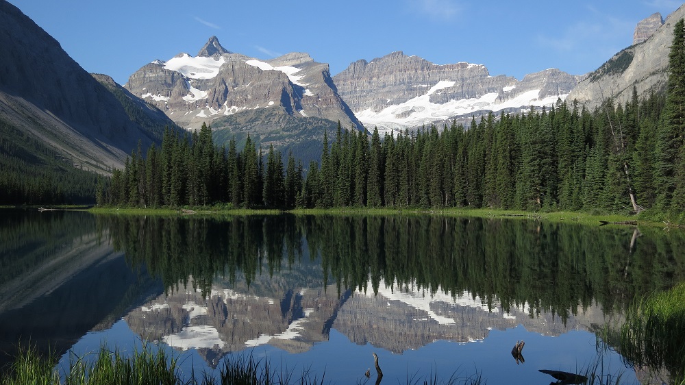
At Wonder Pass you cross the Divide and enter BC and Mount Assiniboine Provincial Park, often called the Matterhorn of North America. Assiniboine has been a popular backcountry destination since the Canadian Pacific Railway was built. Several campgrounds and huts are available, and for those with deep pockets, the Assiniboine Mountain Lodge. Tea is available to the public between 4 and 5 pm. This portion of the trail can be extremely busy and resupply is available via helicopter. From the campgrounds at Lake Magog and Lake Og the trail heads through the Valley of the Rocks, up to Citadel Pass, and back into Banff National Park. Since it can be hard to reserve spots at Magog and Og, some will stay at the Porcupine campground (700m off trail). It’s a pleasant hike through alpine and subalpine meadows past Howard Douglas lake and Quartz Hill, to the Sunshine Ski Resort. During the summer there is a restaurant and hiker gondola that will take you down to the main parking lot. Shuttle buses or taxis are available here to the Banff townsite and Lake Louise, both of which are extremely busy in the summer. Some will use this as an opportunity to exit the trail to visit the town of Banff.
From Sunshine, the trail passes over Simpson and Healy passes. The Healy Creek alternate also provides access to the Sunshine parking lot. Descending into the popular Egypt Lakes area, there are several trails, campgrounds, and shelters operated by Parks Canada. Expect this section of the trail to be busy. Leaving the crowds behind, the GDT passes over the rarely used Ball Pass into BC and Kootenay National Park, down the Hawk Creek Trail to reach Highway 93. This is the single largest descent on the trail at just over 1000m (SoBos beware).
Campgrounds in this area:
- Lake Magog – Mount Assiniboine Provincial Park (permit and reservation required)
- Naiset Huts – Mount Assiniboine Provincial Park (reservation required, booked via Assiniboine Lodge)
- Assiniboine Lodge – Mount Assiniboine Provincial Park (reservation required)
- Og Lake – Mount Assiniboine Provincial Park (permit and reservation required)
- Porcupine – Mount Assiniboine Provincial Park (first come first served)
- Howard Douglas Lake – Banff National Park (permit and reservation required)
- Healy Creek (off trail) – Banff National Park (permit and reservation required)
- Egypt Lake – Banff National Park (permit and reservation required)
- Egypt Lake Cabin (Closed for reconstruction) – Banff National Park (permit and reservation required)
- Ball Pass Junction – Banff National Park (permit and reservation required)
Entry / Exit Points
- South – Highway 742 – Mt Shark Trailhead via Bryant Creek Trail
- Mid – Sunshine Ski Resort
- North – Highway 93S – Hawk Creek Trailhead
Resupply
- Assiniboine Lodge (pre-arranged via helicopter)
- Sunshine Ski Resort
The Rockwall Trail
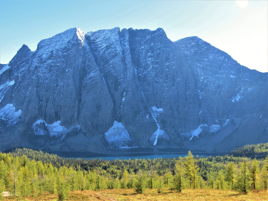
Next up is the popular Rockwall Trail. Climbing up to Floe Lake, you’ll find the single most popular campground on the GDT: getting a spot here is like trying to get tickets to the Rolling Stones. Each year the campground is fully booked within minutes of it opening for reservations. The trail crosses several watersheds at Numa Creek, Tumbling Creek, and Helmet Creek. Each of these has both a campground (permit required) and acts as an entry/exit point. There are several good views of Helmet Falls, the second-highest waterfall in the Canadian Rockies. Leaving behind the Kootenays, the trail heads through Goodsir Pass, into Yoho National Park, and after a short walk along the Trans-Canada Highway, reaches the town of Field.
Campgrounds in this area:
- Floe Lake – Kootenay National Park (permit and reservation required)
- Numa Creek – Kootenay National Park (permit and reservation required)
- Wolverine Pass – BC Forestry random camping (no permit required)
- Tumbling Creek – Kootenay National Park (permit and reservation required)
- Helmet Falls – Kootenay National Park (permit and reservation required)
- McArthur Creek – Yoho National Park (permit and reservation required)
Entry / Exit Points
- South – Highway 93S – Floe Lake Trailhead
- Mid – Highway 93S – Paint Pots Trailhead (via Tumbling or Helmet Creek)
- North – Trans-Canada Highway 1 – Field
Resupply
- Field


