Author: bradvaillancourt

  • 2018 AGM: President’s Report

    2018 AGM: President’s Report

    by Dave Hockey

    Well, I thought last year was busy, but this year was the busiest so far. We got off to a good start in November researching membership software and implementing it. This took countless hours and although we found out that the program did not meet our needs, many valuable lessons were learned and hopefully it will be our foundation for a future program to streamline our membership process. Our largest committee, the Trail Building and Maintenance Committee was in full swing looking ahead at potential new safety regulations we felt would be implemented by our government. We put money aside for chainsaw safety courses and approved all of our trips for the upcoming trail season. We also hired some interns to help with some grants and investigated charitable status but determined we just don’t have the organizational capacity to implement it, yet.

    Throughout the winter we spent time building relationships with Parks, exploring a relationship with the Army Cadets. We also signed a partnership agreement with Recreation Sites and Trail BC, to become the official trail operator of the David Thompson Heritage Trail in the upper Blaeberry valley.

    We also spent time talking with some of our corporate sponsors like the North Face who moved our organization up from the local level to National, including not only support with clothing for our Board Members and Volunteers, but hard dollars for trail work. We also applied and received the largest grant to date from Mountain Equipment Co-op, another long-term supporter. We also did some grant writing and many hours were spent by our Outreach Committee getting ready for our big spring fundraising event with Brian Keating, and our first ever pub night. We also took time to survey our board members and started working on long term strategies. Although our membership has leveled off, our email distribution list now reaches 825 people.

    The Brian Keating event was a huge success, hard not to be when you have the most exciting speaker in town, raising $8,000 for the GDTA. This was great timing as it was budget time and the trail work planning was in full swing.

    The late spring also came with good news at the Castle Parks Management Plan was finalized ensuring permanent protection for our trail within the new parks. During the summer months Alberta Parks even had trail crews working on the GDT in the park and installing our new reassurance markers. Big thank you to Julie MacDougall and the rest of the team at Alberta Parks! The good news kept rolling as the Livingstone and Porcupine Hills Public Land Use Zone (PLUZ) was also finalized, protecting our trail within it. The new recreation plans look great and work has already started to change this part of the province.

    Spring was also busy trying to get the Crowsnest Chapter off the ground with an information evening in Coleman drawing over 50 people. Then jumping right into the madness of complying with Alberta Occupational Health & Safety requirements and Parks approval of our safety plan at the last minute. This couldn’t have happened without some extreme work put in by our volunteers on the safety committee and the heavy lifting by the Greater Bragg Creek Trail Association.

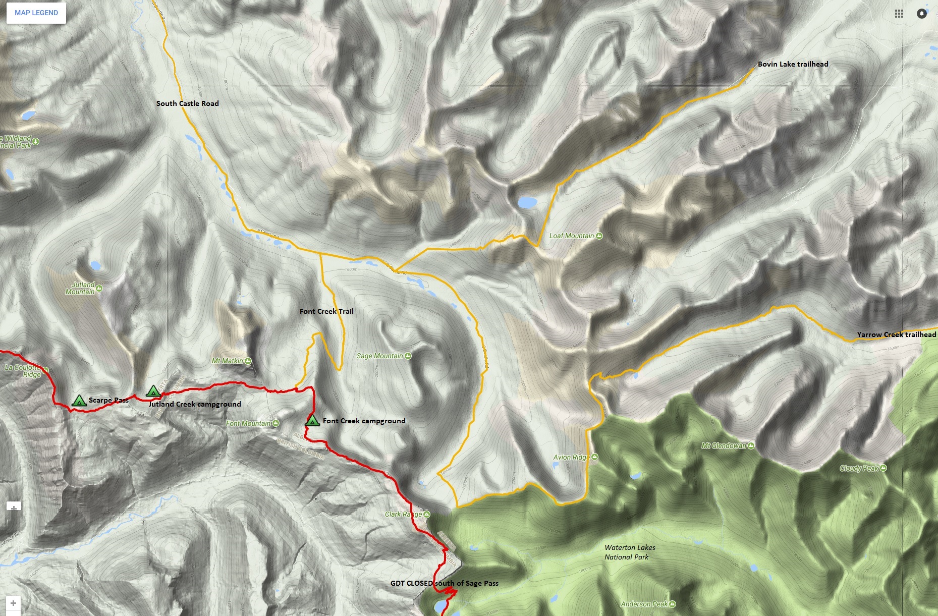
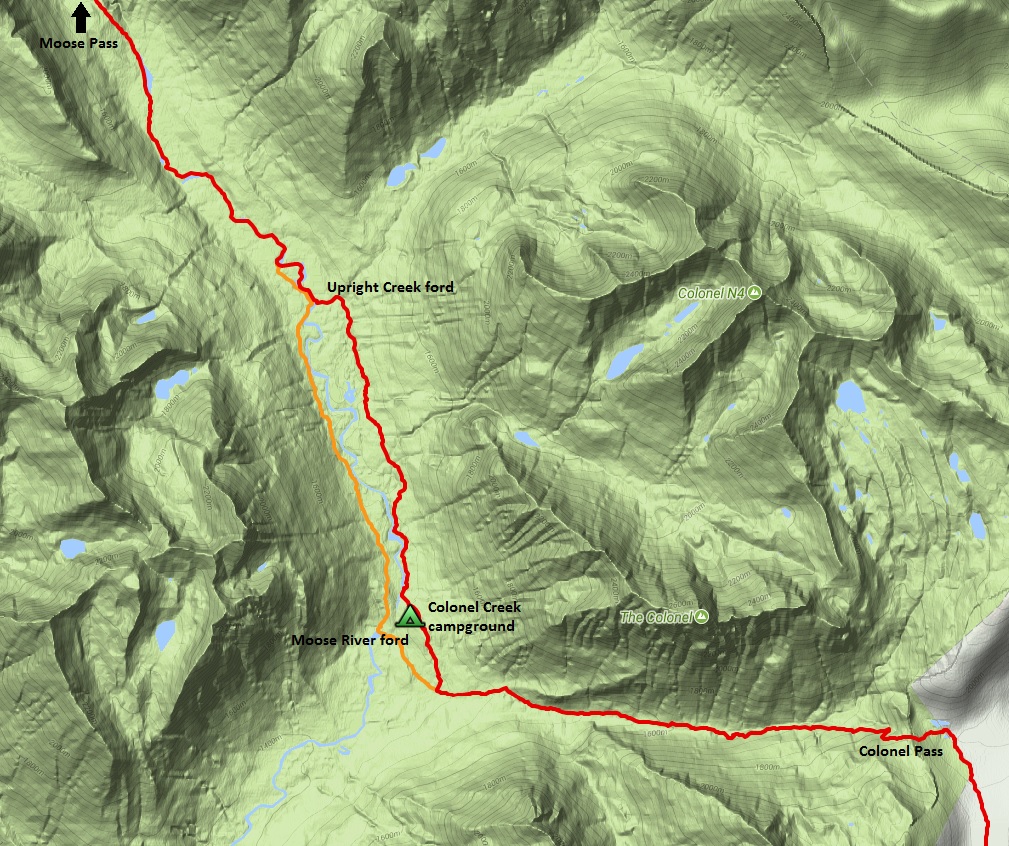
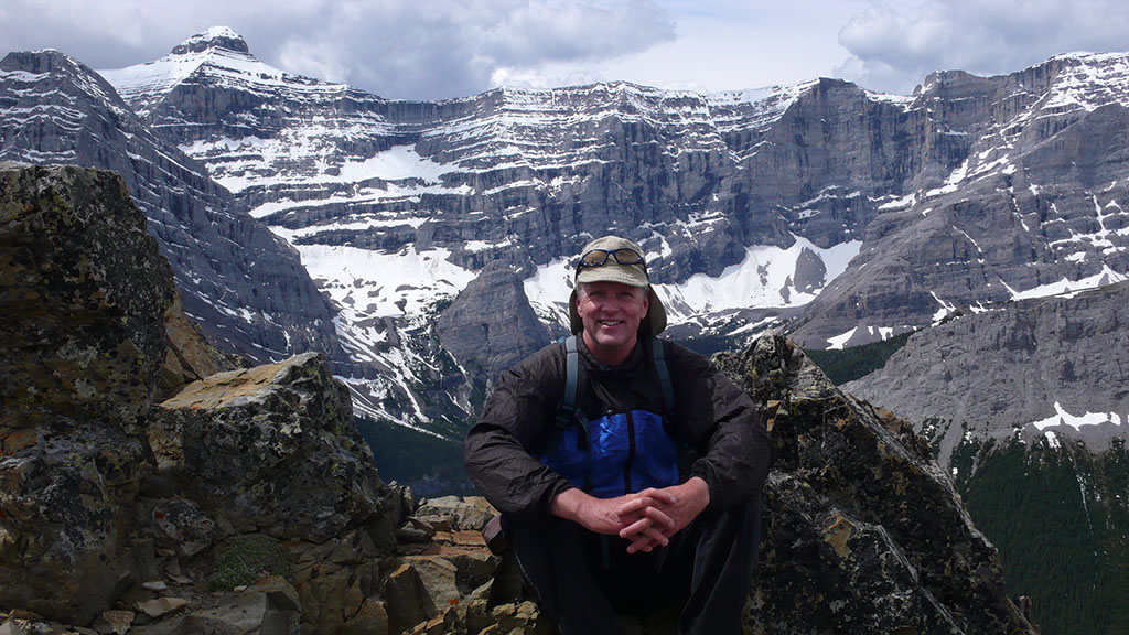
    Summer – ready, set, here we go! 11 trips involving over 100 volunteers. Think about that for a moment, an organization with 250 members gets 100 volunteers out working for it, pretty impressive I have to say. We had 7 trips along the new section called the High Rock Trail, including building a 38-foot natural timber bridge as well as another engineered timber bridge, built with the support of Alberta Environment and Parks. Kudos to Brad Jones and the team down in Blairmore for your continued support. Then a walking trip on the original section of the GDT from Fording River Pass to Tornado Pass, maintaining the centerpiece of our trail, clearing 300 downed trees, installing new reassurance markers, and assessing future trail maintenance priorities.

    Next up was the first ever trail maintenance trip in a National Park, working with the Jasper Trails Alliance to clear a section of the Maligne Pass Trail in Jasper National Park.

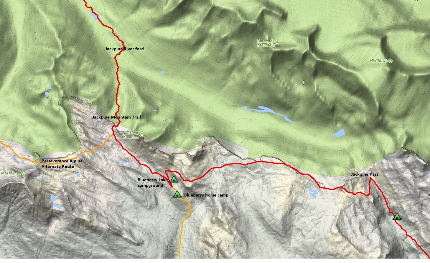
    Then, we moved on to the David Thompson Heritage Trail near Golden BC, 8 kilometres of this historic trail were restored to its former glory. Following that, a 4-day scouting trip was completed to ensure we are ready for another busy year in 2019. And finally, the very first Crowsnest Chapter trail building trip near Window Mountain Lake.

    Our GDT Trail App was also updated with more accurate route data and new alternates. You can’t believe the number of hours this takes to make it look so simple and easy to use!

    We had another summer of periodic trail closures due to a bad wildfire season, but that did not stop record numbers of thru-hikers, estimated at more than 50 in 2018, along with hundreds of section hikers. As well the 3rd edition of Dustin Lynx’s ‘Hiking Canada’s Great Divide Trail’ guidebook was released in July.

    I can’t say enough thanks for the support of our board members, sponsors, parks partners and of the volunteers who made this all happen.

    Thank you!


  • October 2018 Trail and Road Conditions

    October 2018 Trail and Road Conditions

    Trail Conditions Update – October 22, 2018

    Fall colours are here, and so is the snow! Snow has fallen on most of the GDT and early season avalanche conditions exist where snow has accumulated. Expect wet, icy and slippery trail conditions, and wet and muddy sections at lower elevations with recent rainfall or snow melt. Heavy boots or cleats and poles are recommended. Nighttime and early morning temperatures are below freezing, so be prepared for cold temperatures and shorter days when travelling into the backcountry this fall. 

    ELK RUTTING SEASON WARNING: It is elk rutting season until mid-October. Warning signs that read “ATTENTION – Elk Mating” have been posted at areas where elk herds often gather. Be aware that bull elk become extremely aggressive during rutting season so keep at least 30 metres away from all elk and never get between a male and female elk.

    BEARS: It’s pre-hibernation feeding season for both black and grizzly bears which increases the chances of running into a bear on the trail. It is easy to surprise a bear that is focussed on feeding so make noise while hiking in bear territory. Be alert, make noise, carry bear spray and if you see a bear, back away slowly and leave the area. 

    TRAIL CLOSURES:

    • Due to last year’s Kenow wildfire and this year’s Boundary wildfire, some trails and backcountry campgrounds in Waterton Lakes National Park and Akamina Kishinena Provincial Park are closed. The GDT is closed from the Carthew-Alderson trailhead (a3) to Sage Pass (a17).  
    • Numa Creek Trail (Rockwall access trail) remains closed due to wash out of the bridge over the Vermilion River. The pedestrian bridge is being replaced and will be installed in fall 2018. Numa Creek Trail will be cleared in spring 2019 and access to the Rockwall from this location will be restored for mid-summer 2019.
    • Trail 7 near Jasper is closed to hikers south of the junction with Trail 7e and north of the junction with Trail 7a due to grizzly and black bears frequenting the area. Detour by taking Trail 7e to Mildred Lake from where you can take several different trails (4a, 7b) to reach Old Fort Point trailhead. Equestrians can still use Trail 7 but are not to dismount.
    • The Elysium Pass, Virl, Dorothy and Christine Lakes trailhead is closed during construction of the Meadow Creek Bridge, expected to continue until November 2018. During this time, the Marjorie-Dorothy Lakes Alternate Route and Elysium Pass Alternate Route will not be accessible from this trailhead.

    TRAIL NOTICES:

    • In 2017, approximately 35 km of the GDT was burned by the Kenow Wildfire between Bertha Bay campground and Font Creek (a19). Some trails that have been damaged by wildfire may require environmental analysis or heavier engineering, and closures could be in place for many months, for the health of the trail and the surrounding landscapes as well as the safety of hikers, park staff and volunteers. The GDTA will continue to monitor and assess the condition of these damaged trails and provide updates as they become available. 
    • From Scarpe Pass (a24), the trail disappears so hikers must route-find up to La Coulotte Ridge, where the hiking becomes significantly more difficult until you reach the ATV track (a27) heading down to the West Castle Road. 
    • A large avalanche has destroyed about 200m of trail near Tornado Pass (b16). A detour route has been flagged starting at 49.920405N, 114.667765W and intersecting with the GDT again at 49.957641N, 114.658199W, just below Tornado Saddle. 
    • Leroy Creek has washed out approximately 100m of the trail obscuring the location of the creek ford. Look for cairns on either side of the creek marking the crossing.
    • The first few kilometres of the Amiskwi Trail were cleared in August 2018, but the rest of the Amiskwi Trail is in poor shape much of the way to Amiskwi Pass. Expect brushy, overgrown conditions, poor or non-existent trail requiring some route-finding, and several fords of the Amiskwi River. 
    • Cairnes Creek (d9): The bridge is washed out making this a potentially dangerous ford. There are two large trees down across the creek allowing hikers to cross. If these trees wash away, it is recommended to ford the creek early in the morning when glacial melt is lowest.
    • The David Thompson Heritage Trail was cleared from Cairnes Creek to Lambe Creek in September 2018.
    • The damaged Lambe Creek bridge (d10) washed away in 2015. A small piece of the old bridge and a temporary log bridge allow hikers to cross. If the temporary bridge washes away, it is recommended to ford downstream where the creek is wider and shallower, and cross early in the morning when glacial melt is lowest.
    • The Howse Pass Trail from Conway Creek (d12) to the Glacier Lake trail junction (d14) is in very poor condition. The trail is overgrown, with hundreds of wind-fallen trees across the trail. Hiking in the Howse River floodplain is highly recommended when the river is low enough to safely ford.
    • Parks Canada has advised that GDT hikers are able to hike through the Mistaya Canyon/Howse Pass trailhead during the parking lot closure as long as the closed area is avoided.
    • The Owen Creek Trail was cleared in July 2015 up to km 6 but there has been some new deadfall since then. Beyond that point, the trail is in poor shape with several washed out sections. Expect challenging hiking for 3 km including skirting along steep creek-side cliffs and rock-hopping in the creek itself. At km 6, do not take the trail heading up away from the creek (it is a deadend). Look for orange blazes marking the correct route staying near the creek.
    • The Maligne Pass trail from Pobokton Creek (e20) to Trapper Creek (e24) is no longer being maintained by Parks Canada so expect deteriorating and overgrown trail conditions; long pants are recommended. The Maligne River bridge has been removed but the river can be easily forded in normal summer conditions (knee deep in mid-summer). Most other bridges are still in place. The Six Passes Route is a cross-country alternative to the overgrown trail for hikers with route-finding experience – Read more here.
    • The Yates Torrent Bridge is out at the crossing of the Coleman Glacier outflow (near f16). Do not attempt to cross at the old bridge location. There are two options: (1) ford the Smoky River in the floodplain; or (2) ford Yates Torrent approximately 500m upstream (location was flagged in 2017). At both locations attempt to cross early in the morning when glacial melt is the lowest or be prepared for a fast and potentially dangerous creek ford.
    • The bridges across Gendarme and Carcajou Creeks are out on the Jasper North Boundary Trail. These two creeks are smaller than the Smoky River, but can still be treacherous. Cross Gendarme at the horse crossing just below the old bridge (marked), and Carcajou about 100m below the trail.
    • Hikers have reported that Wolverine campground and the surrounding trail are flooded. Detour around by following higher ground through the forest west of the trail and campground.
    • The bridge across Buchanan Creek on the trail to Kakwa Lake, has been removed. The crossing here can be hazardous early in the year or after heavy rains. 

    ACCESS ROADS: 

    • Akamina Parkway and Red Rock Parkway in Waterton Lakes National Park are closed.
    • The Walker Creek Forestry Road is driveable to the Kakwa trailhead but a high clearance 4WD vehicle is recommended. A washout at km 66 may be impassable to non 4WD vehicles.
    • For more information on road conditions, check out Alberta 511 and Drive BC.
  • September 2018 Trail and Road Conditions

    September 2018 Trail and Road Conditions

    Trail Conditions Update – September 25, 2018

    Fall weather has arrived in the Rockies and that means autumn colours and fresh snowfall. Snow has fallen on much of the GDT at higher elevations and is causing wet and muddy trail conditions. Wet and cool weather means fire danger ratings in the Canadian Rockies have improved significantly and all fire bans on the GDT have been lifted. Be prepared for colder temperatures and shorter days when travelling on the trail this month.

    ELK RUTTING SEASON WARNING: It is elk rutting season until mid-October. Warning signs that read “ATTENTION – Elk Mating” have been posted at areas where elk herds often gather. Be aware that bull elk become extremely aggressive during rutting season so keep at least 30 metres away from all elk and never get between a male and female elk.

    BEARS: It’s pre-hibernation feeding season for both black and grizzly bears which increases the chances of running into a bear on the trail. It is easy to surprise a bear that is focussed on feeding so make noise while hiking in bear territory. Be alert, make noise, carry bear spray and if you see a bear, back away slowly and leave the area. 

    TRAIL CLOSURES:

    • Due to last year’s Kenow wildfire and this year’s Boundary wildfire, some trails and backcountry campgrounds in Waterton Lakes National Park and Akamina Kishinena Provincial Park are closed. The GDT is closed from the Carthew-Alderson trailhead (a3) to Sage Pass (a17).  
    • Numa Creek Trail (Rockwall access trail) remains closed due to wash out of the bridge over the Vermilion River. The pedestrian bridge is being replaced and will be installed in fall 2018. Numa Creek Trail will be cleared in spring 2019 and access to the Rockwall from this location will be restored for mid-summer 2019.
    • Trail 7 near Jasper is closed to hikers south of the junction with Trail 4g and north of the junction with Trail 7a due to a grizzly bear attack in the area. Detour by taking Trail 4d to Edith Lake from where you can take several different trails (4, 4a, 4d, 7b) to reach Old Fort Point trailhead. Equestrians can still use Trail 7 but are not to dismount.
    • The Elysium Pass, Virl, Dorothy and Christine Lakes trailhead is closed during construction of the Meadow Creek Bridge, expected to continue until November 2018. During this time, the Marjorie-Dorothy Lakes Alternate Route and Elysium Pass Alternate Route will not be accessible from this trailhead.

    TRAIL NOTICES:

    • In 2017, approximately 35 km of the GDT was burned by the Kenow Wildfire between Bertha Bay campground and Font Creek (a19). Some trails that have been damaged by wildfire may require environmental analysis or heavier engineering, and closures could be in place for many months, for the health of the trail and the surrounding landscapes as well as the safety of hikers, park staff and volunteers. The GDTA will continue to monitor and assess the condition of these damaged trails and provide updates as they become available. 
    • From Scarpe Pass (a24), the trail disappears so hikers must route-find up to La Coulotte Ridge, where the hiking becomes significantly more difficult until you reach the ATV track (a27) heading down to the West Castle Road. 
    • A large avalanche has destroyed about 200m of trail near Tornado Pass (b16). A detour route has been flagged starting at 49.920405N, 114.667765W and intersecting with the GDT again at 49.957641N, 114.658199W, just below Tornado Saddle. 
    • Leroy Creek has washed out approximately 100m of the trail obscuring the location of the creek ford. Look for cairns on either side of the creek marking the crossing.
    • The first kilometre of the Amiskwi Trail was cleared in August 2018, but the rest of the Amiskwi Trail is in poor shape much of the way to Amiskwi Pass. Expect brushy, overgrown conditions, poor or non-existent trail requiring some route-finding, and wet fords of the Amiskwi River. 
    • Cairnes Creek (d9): The bridge is washed out making this a potentially dangerous ford. There are two large trees down across the creek allowing hikers to cross. If these trees wash away, it is recommended to ford the creek early in the morning when glacial melt is lowest.
    • The David Thompson Heritage Trail was cleared from Cairnes Creek to Lambe Creek in September 2018.
    • The damaged Lambe Creek bridge (d10) washed away in 2015. A small piece of the old bridge and a temporary log bridge allow hikers to cross. If the temporary bridge washes away, it is recommended to ford downstream where the creek is wider and shallower, and cross early in the morning when glacial melt is lowest.
    • The Howse Pass Trail from Conway Creek (d12) to the Glacier Lake trail junction (d14) is in very poor condition. The trail is overgrown, with hundreds of wind-fallen trees across the trail. Hiking in the Howse River floodplain is highly recommended when the river is low enough to safely ford.
    • Parks Canada has advised that GDT hikers are able to hike through the Mistaya Canyon/Howse Pass trailhead during the parking lot closure as long as the closed area is avoided.
    • The Owen Creek Trail was cleared in July 2015 up to km 6 but there has been some new deadfall since then. Beyond that point, the trail is in poor shape with several washed out sections. Expect challenging hiking for 3 km including skirting along steep creek-side cliffs and rock-hopping in the creek itself. At km 6, do not take the trail heading up away from the creek (it is a deadend). Look for orange blazes marking the correct route staying near the creek.
    • The Maligne Pass trail from Pobokton Creek (e20) to Trapper Creek (e24) is no longer being maintained by Parks Canada so expect deteriorating and overgrown trail conditions; long pants are recommended. The Maligne River bridge has been removed but the river can be easily forded in normal summer conditions (knee deep in mid-summer). Most other bridges are still in place. The Six Passes Route is a cross-country alternative to the overgrown trail for hikers with route-finding experience.
    • The Yates Torrent Bridge is out at the crossing of the Coleman Glacier outflow (near f16). Do not attempt to cross at the old bridge location. There are two options: (1) ford the Smoky River in the floodplain; or (2) ford Yates Torrent approximately 500m upstream (location was flagged in 2017). At both locations attempt to cross early in the morning when glacial melt is the lowest or be prepared for a fast and potentially dangerous creek ford.
    • The bridges across Gendarme and Carcajou Creeks are out on the Jasper North Boundary Trail. These two creeks are smaller than the Smoky River, but can still be treacherous. Cross Gendarme at the horse crossing just below the old bridge (marked), and Carcajou about 100m below the trail.
    • Hikers have reported that Wolverine campground and the surrounding trail are flooded. Detour around by following higher ground through the forest west of the trail and campground.
    • The bridge across Buchanan Creek on the trail to Kakwa Lake, has been removed. The crossing here can be hazardous early in the year or after heavy rains. 

    ACCESS ROADS: 

    • Akamina Parkway and Red Rock Parkway in Waterton Lakes National Park are closed.
    • The Walker Creek Forestry Road is driveable to the Kakwa trailhead but a high clearance 4WD vehicle is recommended. A washout at km 66 may be impassable to non 4WD vehicles.
    • For more information on road conditions, check out Alberta 511 and Drive BC.
  • August 2018 Trail and Road Conditions

    August 2018 Trail and Road Conditions

    Trail Conditions Update – August 30, 2018

    WILDFIRES: Fire hazard ratings have reduced in the Rockies. Rain has improved the air quality somewhat but smoke and haze may be present in valleys due to forest fires burning near the GDT.

    • SECTION A TRAIL CLOSURE: Due to the Boundary wildfire, the GDT is closed from the International Boundary (a1) to Bertha Bay campground. 
    • SECTION A RE-OPENED: The GDT has re-opened from Sage Pass (a17) to Castle Mountain Resort (a30). 
    • SECTION C TRAIL RE-OPENED: The GDT has re-opened from Ball Pass (c22) to Tumbling Pass (c30). 

    CAMPFIRE BANS: Campfire bans are in effect for all portions of the GDT in BC. Fire Advisories are in effect for Waterton Lakes, Banff, Kootenay, Yoho and Jasper National Parks where campfires are only allowed in metal fire pits or boxes provided by Parks Canada. No random fires are allowed in these parks. 

    BEARS: It’s berry season! Berry bushes border trails, roads and campgrounds on the GDT, and black and grizzly bears are feeding on berries right now. Be bear aware on the trails this summer: be alert, make noise and carry bear spray.

    • BANFF NATIONAL PARK and PETER LOUGHEED PROVINCIAL PARK: A defensive grizzly bear feeding on a carcass in the Burstall Pass area was involved in a contact encounter causing human injury. Extra caution is recommended when travelling in this area. Burstall Pass access trail is closed.
    • KAKWA PROVINCIAL PARK: August 28 – An animal carcass was found on the Kakwa Pass Trail at 53.959141, -120.137961. Hikers should avoid this area and stay north near this location when hiking through. Make noise and carry bear spray along the trail.

    TRAIL CLOSURES:

    • Due to last year’s Kenow wildfire and the existing Boundary wildfire, some trails and backcountry campgrounds in Waterton Lakes National Park and Akamina Kishinena Provincial Park are closed. The GDT is closed from the International Boundary (a1) to Sage Pass (a17).  
    • Trail 7 near Jasper is closed to hikers south of the junction with Trail 4g and north of the junction with Trail 7a due to a grizzly bear attack in the area. Detour by taking Trail 4d to Edith Lake from where you can take several different trails (4, 4a, 4d, 7b) to reach Old Fort Point trailhead. Equestrians can still use Trail 7 but are not to dismount.
    • Numa Creek Trail (Rockwall access trail) remains closed due to wash out of the bridge over the Vermilion River. The pedestrian bridge is being replaced and will be installed in fall 2018. Numa Creek Trail will be cleared in spring 2019 and access to the Rockwall from this location will be restored for mid-summer 2019.
    • The Elysium Pass, Virl, Dorothy and Christine Lakes trailhead is closed during construction of the Meadow Creek Bridge, expected to continue until November 2018. During this time, the Marjorie-Dorothy Lakes Alternate Route and Elysium Pass Alternate Route will not be accessible from this trailhead.

    TRAIL NOTICES:

    Trail conditions are generally good but expect some wet and muddy sections during periods of rain. Warm weather means rapid melt during the day resulting in high water levels and potentially dangerous creek crossings, so attempt to ford larger creeks early in the day when water levels are lowest.

    • In 2017, approximately 35 km of the GDT was burned by the Kenow Wildfire between Bertha Bay campground and Font Creek (a19). Some trails that have been damaged by wildfire may require environmental analysis or heavier engineering, and closures could be in place for many months, for the health of the trail and the surrounding landscapes as well as the safety of hikers, park staff and volunteers. The GDTA will continue to monitor and assess the condition of these damaged trails and provide updates as they become available. 
    • From Scarpe Pass (a24), the trail disappears so hikers must route-find up to La Coulotte Ridge, where the hiking becomes significantly more difficult until you reach the ATV track (a27) heading down to the West Castle Road. 
    • A large avalanche has destroyed about 200m of trail north of Dutch Creek campground, near Tornado Pass (b16). A detour route has been flagged starting at 49.920405N, 114.667765W
      and intersecting with the GDT again at 49.957641N, 114.658199W, just below Tornado Saddle. 
    • Leroy Creek has washed out approximately 100m of the trail obscuring the location of the creek ford. Look for cairns on either side of the creek marking the crossing.
    • A windstorm blew through Yoho National Park in July 2017 resulting in many blown down trees. The Ottertail Trail was cleared in August 2018, but there may still be some debris on the trail near Goodsir Pass but these are fairly easy to get around.
    • The first kilometre of the Amiskwi Trail was cleared in August 2018, but the rest of the Amiskwi Trail is in poor shape much of the way to Amiskwi Pass. Expect brushy, overgrown conditions, poor or non-existent trail requiring some route-finding, and wet fords of the Amiskwi River. 
    • Cairnes Creek (d9): The bridge is washed out making this a potentially dangerous ford. There are two large trees down across the creek allowing hikers to cross. If these trees wash away, it is recommended to ford the creek early in the morning when glacial melt is lowest.
    • The damaged Lambe Creek bridge (d10) washed away in 2015. A small piece of the old bridge and a temporary log bridge allow hikers to cross. If the temporary bridge washes away, it is recommended to ford downstream where the creek is wider and shallower, and cross early in the morning when glacial melt is lowest.
    • The Howse Pass Trail from Conway Creek (d12) to the Glacier Lake trail junction (d14) is in very poor condition. The trail is overgrown, with hundreds of wind-fallen trees across the trail. Hiking in the Howse River floodplain is highly recommended when the river is low enough to safely ford.
    • Parks Canada has advised that GDT hikers are able to hike through the Mistaya Canyon/Howse Pass trailhead during the parking lot closure as long as the closed area is avoided.
    • The Owen Creek Trail was cleared in July 2015 up to km 6 but there has been some new deadfall since then. Beyond that point, the trail is in poor shape with several washed out sections. Expect challenging hiking for 3 km including skirting along steep creek-side cliffs and rock-hopping in the creek itself. At km 6, do not take the trail heading up away from the creek (it is a deadend). Look for orange blazes marking the correct route staying near the creek.
    • The Maligne Pass trail from Pobokton Creek (e20) to Trapper Creek (e24) is no longer being maintained by Parks Canada so expect deteriorating and overgrown trail conditions; long pants are recommended. The Maligne River bridge has been removed but the river can be easily forded in normal summer conditions (knee deep in mid-summer). Most other bridges are still in place. The Six Passes Route is a cross-country alternative to the overgrown trail for hikers with route-finding experience.
    • The Yates Torrent Bridge is out at the crossing of the Coleman Glacier outflow (near f16). Do not attempt to cross at the old bridge location. There are two options: (1) ford the Smoky River in the floodplain; or (2) ford Yates Torrent approximately 500m upstream (location was flagged in 2017). At both locations attempt to cross early in the morning when glacial melt is the lowest or be prepared for a fast and potentially dangerous creek ford.
    • The bridges across Gendarme and Carcajou Creeks are out on the Jasper North Boundary Trail. These two creeks are smaller than the Smoky River, but can still be treacherous. Cross Gendarme at the horse crossing just below the old bridge (marked), and Carcajou about 100m below the trail.
    • Hikers have reported that Wolverine campground and the surrounding trail are flooded. Detour around by following higher ground through the forest west of the trail and campground.
    • The bridge across Buchanan Creek on the trail to Kakwa Lake, has been removed. The crossing here can be hazardous early in the year or after heavy rains. 

    ACCESS ROADS: 

    • Akamina Parkway and Red Rock Parkway in Waterton Lakes National Park are closed.
    • Due to wildfire and smoke in the area, Highway 93 may be closed intermittently between Castle Junction and Radium.
    • The Walker Creek Forestry Road is driveable to the Kakwa trailhead but a high clearance 4WD vehicle is recommended. A washout at km 66 may be impassable to non 4WD vehicles.
    • For more information on road conditions, check out Alberta 511 and Drive BC.
  • July 2018 Trail and Road Conditions

    July 2018 Trail and Road Conditions

    Trail Conditions Update – July 27, 2018

    Alpine wildflowers are blooming! Trail conditions are generally good but expect some wet and muddy sections and a few snow patches lingering at higher elevations. Warm weather means rapid snow melt during the day resulting in high water levels and potentially dangerous creek crossings, so attempt to ford larger creeks early in the day when water levels are lowest.

    Trail crews are out maintaining the GDT in July so make your presence known when hiking through a work area and say thanks for all their hard work!

    BEARS: Bears are out and about! Be bear aware on the trails this summer: be alert, make noise and carry bear spray.

    CAMPFIRE BANS: Fire hazard ratings are high or extreme in the Rockies and smoke/haze may be present in valleys due to forest fires burning some distance away from the GDT. A campfire ban is in effect for all portions of the GDT in BC from Sage Pass (a17) to Howse Pass (d11). A Fire Advisory is in effect in Alberta from Waterton (a1) to North Kananaskis Pass (c3). If you must have a campfire in the backcountry elsewhere, ensure you follow the rules.

    TRAIL CLOSURES:

    • Due to last year’s Kenow wildfire, many trails and backcountry campgrounds in Waterton Lakes National Park and Akamina Kishinena Provincial Park remain closed. The GDT is closed from the Carthew-Alderson trail junction (a3) to Sage Pass (a17). The Waterton Lakeshore Trail has re-opened (a1 to a3) but since the remaining portions of the GDT within Waterton Lakes National Park remain closed, Font Creek Trail is the Alternate Southern Terminus of the GDT.
    • Trail 7 near Jasper is closed to hikers south of the junction with Trail 4g and north of the junction with Trail 7a due to a grizzly bear attack in the area. Detour by taking Trail 4d to Edith Lake from where you can take several different trails (4, 4a, 4d, 7b) to reach Old Fort Point trailhead. Equestrians can still use Trail 7 but are not to dismount.
    • Numa Creek Trail (Rockwall access trail) remains closed due to wash out of the bridge over the Vermilion River. The pedestrian bridge is being replaced and will be installed in fall 2018. Numa Creek Trail will be cleared in spring 2019 and access to the Rockwall from this location will be restored for mid-summer 2019.
    • The Elysium Pass, Virl, Dorothy and Christine Lakes trailhead is closed during construction of the Meadow Creek Bridge, expected to continue until November 2018. During this time, the Marjorie-Dorothy Lakes Alternate Route and Elysium Pass Alternate Route will not be accessible from this trailhead.

    TRAIL NOTICES:

    • In 2017, approximately 35 km of the GDT was burned by the Kenow Wildfire between Bertha Bay campground and Font Creek (a19). Some trails that have been damaged by wildfire may require environmental analysis or heavier engineering, and closures could be in place for many months, for the health of the trail and the surrounding landscapes as well as the safety of hikers, park staff and volunteers. The GDTA will continue to monitor and assess the condition of these damaged trails and provide updates as they become available. For 2018, Font Creek Trail is the Alternate Southern Terminus of the GDT.
    • The Waterton Lakeshore Trail has re-opened making it is possible to hike from the International Boundary to Font Creek Trail via a connection of trails, roads and seismic lines but it will involve some route-finding and bushwhacking. Turn on the Access Routes layer on the GDT map to view this proposed “Waterton Detour” route.
    • From Scarpe Pass (a24), the trail disappears so hikers must route-find up to La Coulotte Ridge, where the hiking becomes significantly more difficult until you reach the ATV track (a27) heading down to the West Castle Road. 
    • A large avalanche has destroyed about 200m of trail north of Dutch Creek campground, near Tornado Pass (b16). A detour route has been flagged starting at 49.920405N, 114.667765W
      and intersecting with the GDT again at 49.957641N, 114.658199W, just below Tornado Saddle. 
    • Leroy Creek has washed out approximately 100m of the trail obscuring the location of the creek ford. Look for cairns on either side of the creek marking the crossing.
    • A windstorm blew through Yoho National Park in July 2017 resulting in many blown down trees. On the Ottertail Trail, there are several debris fields with fallen trees across the trail near Goodsir Pass (c36) but these are fairly easy to get around. On the Amiskwi Trail, about 1 km from the trailhead (d1), there are dozens of trees blow down across the trail that are more challenging to get around.
    • Cairnes Creek (d9): The bridge is washed out making this a potentially dangerous ford. There are two large trees down across the creek allowing hikers to cross. If these trees wash away, it is recommended to ford the creek early in the morning when glacial melt is lowest.
    • The damaged Lambe Creek bridge (d10) was removed in September 2015. It is recommended to ford downstream where the creek is wider and shallower, and cross early in the morning when glacial melt is lowest.
    • The Howse Pass Trail from Conway Creek (d12) to the Glacier Lake trail junction (d14) is in very poor condition. The trail is overgrown, with hundreds of wind-fallen trees across the trail. Hiking in the Howse River floodplain is highly recommended when the river is low enough to safely ford.
    • Parks Canada has advised that GDT hikers are able to hike through the Mistaya Canyon/Howse Pass trailhead during the parking lot closure as long as the closed area is avoided.
    • The Owen Creek Trail was cleared in July 2015 up to km 6 but there has been some new deadfall since then. Beyond that point, the trail is in poor shape with several washed out sections. Expect challenging hiking for 3 km including skirting along steep creek-side cliffs and rock-hopping in the creek itself. At km 6, do not take the trail heading up away from the creek (it is a deadend). Look for orange blazes marking the correct route staying near the creek.
    • The Maligne Pass trail in Jasper National Park has been decommissioned and is in poor shape. The trail from Pobokton Creek (e20) to Maligne Lake (e25, approx 42 km) is no longer being maintained by Parks Canada so expect deteriorating and overgrown trail conditions; long pants are recommended. The Maligne River bridge has been removed but the river can be easily forded in normal summer conditions (knee deep in mid-summer). Most other bridges are still in place. The Six Passes Route is a cross-country alternative to the overgrown trail.
    • The Yates Torrent Bridge is out at the crossing of the Coleman Glacier outflow (near f16). Do not attempt to cross at the old bridge location. There are two options: (1) ford the Smoky River in the floodplain; or (2) ford Yates Torrent approximately 500m upstream (location was flagged in 2017). At both locations attempt to cross early in the morning when glacial melt is the lowest or be prepared for a fast and potentially dangerous creek ford.
    • The bridges across Gendarme and Carcajou Creeks are out on the Jasper North Boundary Trail. These two creeks are smaller than the Smoky River, but can still be treacherous. Cross Gendarme at the horse crossing just below the old bridge (marked), and Carcajou about 100m below the trail.
    • The public cabin at Kakwa Lake will be closed for public use from July 31 – August 2, 2018 for conservation work being conducted in the park. 
    • The bridge across Buchanan Creek on the trail to Kakwa Lake, has been removed. The crossing here can be hazardous early in the year or after heavy rains. 

    ACCESS ROADS: 

    • Akamina Parkway and Red Rock Parkway in Waterton Lakes National Park are closed.
    • July 2018 – A washout occurred around km 66 of the Walker Creek Forestry Road which may be impassable to vehicles. There are no plans for repair this year but possibly in 2019. Overgrown brush past km 60 may be a particular concern for drivers. High clearance 4WD vehicles required.
    • For more information, check out Alberta 511 and Drive BC.
  • June 2018 Trail and Road Conditions

    June 2018 Trail and Road Conditions

    Trail Conditions Update – June 27, 2018

    It’s transition time on the GDT. Valley bottom trails at lower elevations vary from bare and dry to wet and muddy, while many trails at higher elevation are still snow covered. With warmer weather, trail conditions can change quickly so plan for varying conditions – boots, cleats and/or poles are recommended. 

    SNOW: For up to date snow level data in BC, check out the Snow Survey and Water Supply Bulletins or the Automated Snow Weather Station Map. In Alberta, check out the Alberta River Basins map (turn on the snow pillow layer).

    CREEKS: Rapid snow melt during this time of year results in high water levels and potentially dangerous creek crossings, particularly later in the day. Attempt to ford larger creeks early in the day when water levels are lowest.

    ELK CALVING SEASON: May 15 to June 30. Protective mother elk will aggressively protect their newborns by kicking and charging at people. Stay at least 30 metres away from all elk during this time of year. Pay attention to trail closures in known elk calving areas.

    TICKS: Tick season has started. Long pants tucked into your socks are recommended. Be extra careful when in areas with a lot of underbrush and check yourself and your clothing after your hike.

    BEARS: With spring’s arrival, bears are leaving their dens in search of food. Be bear aware on the trails this spring, make noise and carry bear spray.

    CAMPFIRE BANS: Currently the only campfire ban on the GDT is within Jasper National Park. Elsewhere if you must have a campfire in the backcountry, ensure you follow the rules.

    TRAIL CLOSURES:

    • Due to the Kenow wildfire, many trails and backcountry campgrounds in Waterton Lakes National Park and Akamina Kishinena Provincial Park remain closed. The GDT is closed from the Carthew-Alderson trail junction (a3) to Sage Pass (a17). The Lakeshore Trail has re-opened but since the remaining portions of the GDT within Waterton Lakes National Park remain closed, Font Creek Trail is the Alternate Southern Terminus of the GDT in 2018.
    • Trail 7 near Jasper is closed to hikers south of the junction with Trail 7e and north of the junction with Trail 7a due to grizzly and black bears frequenting the area next to the golf course. Detour by taking Trail 7e towards Trefoil Lakes and Trail 7b south to Old Fort Point trailhead. Equestrian uses can still use Trail 7 but are not to dismount.
    • Numa Creek Trail (Rockwall access trail) remains closed due to wash out of the bridge over the Vermilion River. The pedestrian bridge is being replaced with an estimated opening date in August 2018. 
    • Tumbling Creek Trail (Rockwall access trail) is closed from the Ochre Creek trail to the intersection of the Rockwall Trail before the Tumbling bridge due to a missing bridge at km 6.6.
    • The Elysium Pass, Virl, Dorothy and Christine Lakes trailhead is closed during construction of the Meadow Creek Bridge, expected to continue until November 2018. During this time, the Marjorie-Dorothy Lakes Alternate Route and Elysium Pass Alternate Route will not be accessible from this trailhead.

    TRAIL NOTICES:

    • Approximately 35 km of the GDT was burned by the Kenow Wildfire between Bertha Bay campground and Font Creek (a19). Some trails that have been damaged by wildfire may require environmental analysis or heavier engineering, and closures could be in place for many months, for the health of the trail and the surrounding landscapes as well as the safety of hikers and volunteers. The GDTA will continue to monitor and assess the condition of these damaged trails and provide updates as they become available. The Lakeshore Trail has re-opened but since the remaining portions of the GDT within Waterton Lakes National Park remain closed, Font Creek Trail is the Alternate Southern Terminus of the GDT in 2018.
    • From Scarpe Pass (a24), the trail disappears so hikers must route-find up to La Coulotte Ridge, where the hiking becomes significantly more difficult until you reach the ATV track (a27) heading down to the West Castle Road. 
    • A large avalanche has destroyed about 200 m of trail north of Dutch Creek campground, near Tornado Pass (b16). Hikers should traverse the scar area around the down slope side so as to avoid climbing over unstable fallen trees.
    • Leroy Creek has washed out approximately 100m of the trail obscuring the location of the creek ford. Look for cairns on either side of the creek marking the crossing.
    • A windstorm blew through Yoho National Park in July 2017 resulting in many blown down trees. On the Ottertail Trail, there are several debris fields with fallen trees across the trail near Goodsir Pass (c36) but these are fairly easy to get around. On the Amiskwi Trail, about 1 km from the trailhead (d1), there are dozens of trees blow down across the trail that are more challenging to get around.
    • Cairnes Creek (d9): The bridge is washed out making this a potentially dangerous ford. There are 2 large trees down across the creek allowing hikers to cross. If these trees wash away, it is recommended to ford the creek early in the morning when glacial melt is lowest.
    • The damaged Lambe Creek bridge (d10) was removed in September 2015. It is recommended to ford downstream where the creek is wider and shallower, and cross early in the morning when glacial melt is lowest.
    • The Howse Pass Trail from Conway Creek (d12) to the Glacier Lake trail junction (d14) is in very poor condition. The trail is overgrown, with hundreds of wind-fallen trees across the trail. Hiking in the Howse River floodplain is highly recommended when the river is low enough to safely ford.
    • The Owen Creek Trail was cleared in July 2015 up to km 6 but there has been some new deadfall since then. Beyond that point, the trail is in poor shape with several washed out sections. Expect challenging hiking for 3 km including skirting along steep creek-side cliffs and rock-hopping in the creek itself. At km 6, do not take the trail heading up away from the creek (it is a deadend). Look for orange blazes marking the correct route staying near the creek.
    • The Maligne Pass trail in Jasper National Park has been decommissioned and is in poor shape. The trail from Pobokton Creek (e20) to Maligne Lake (e25, approx 42 km) is no longer being maintained by Parks Canada so expect deteriorating and overgrown trail conditions; long pants are recommended. The Maligne River bridge has been removed but the river can be easily forded in normal summer conditions (knee deep in mid-summer). Most other bridges are still in place. The Six Passes Route is a cross-country alternative to the overgrown trail.
    • The Yates Torrent Bridge is out at the crossing of the Coleman Glacier outflow (near f16). Do not attempt to cross at the old bridge location. There are two options: (1) ford the Smoky River in the floodplain; or (2) ford Yates Torrent approximately 500m upstream (location was flagged in 2017). At both locations attempt to cross early in the morning when glacial melt is the lowest or be prepared for a fast and potentially dangerous creek ford.
    • The bridges across Gendarme and Carcajou Creeks are out on the Jasper North Boundary Trail. These two creeks are smaller than the Smoky River, but can still be treacherous. Cross Gendarme at the horse crossing just below the old bridge (marked), and Carcajou about 100m below the trail.
    • The bridge across Buchanan Creek on the trail to Kakwa Lake, has been removed. The crossing here can be hazardous early in the year or after heavy rains. 

    ACCESS ROADS: 

    • Akamina Parkway and Red Rock Parkway in Waterton Lakes National Park are closed.
    • For more information, check out Alberta 511 and Drive BC.
  • Pathfinder Newsletter – Spring 2018

    Pathfinder Newsletter – Spring 2018

    Welcome spring, from the GDTA!

    It has been a slow and soggy start to spring, but the hiking season will soon be upon us. We’re excited about this summer season as we are offering more opportunities to connect with the wilderness of the Canadian Rocky Mountains and contribute to the building and maintenance of the Great Divide Trail than ever before! This edition of the Pathfinder includes:

    • 2018 Trail Building & Maintenance Trips – Additional Call for Volunteers
    • GDT Route Updates for 2018
    • Brian Keating: A Walk in the Mountains
    • Volunteer Spotlight
    • Donor Recognition
    • Spring Trail Conditions
    • Backcountry Kitchen
    • Upcoming Events
    • GDTA Board of Directors Opportunity

    You can view the latest edition of Pathfinder here.

    pathfinder spring 2018

  • GDT Route Updates for 2018

    Effective immediately, the GDTA is announcing a couple changes to the main route of the GDT as well as an Alternate Southern Terminus due to the trail closures in Waterton Lakes National Park. These new routes are reflected in the GDTA map and GDT App.

    Alternate Southern Terminus (Section A)

    Alternate-Southern-Terminus-map2Sadly it looks like the GDT in Waterton Lakes National Park will not re-open in 2018 due to the extensive damage from last year’s Kenow wildfire so this means that Font Creek Trail will be the Alternate Southern Terminus of the GDT this year. We continue to monitor the situation closely and will provide updates as information becomes available.

    From the South Castle Road, Font Creek Trail immediately fords the South Castle River and ascends 400 metres over 5.9 km to connect with the GDT about 1.6 km north of Font Creek campground (a19). There are 3 different approaches to reach Font Creek Trail giving hikers a few options to explore. All trailhead/staging areas are 2WD accessible:

    1. Bovin Lake (aka Blue Lake) Trail – RECOMMENDED OPTION – 13.5 km on good multi-use trail. Bovin Lake trailhead is accessed via Township Road 43A, Range Road 303 & 302B, 38 km south of Pincher Creek. 6 km down the trail, about 1 km before Bovin Lake you will hit a trail junction heading south up the ridge above the lake. Take this trail up and over the ridge and descend to South Castle Road about 2 km east of Font Creek Trail.
    2. South Castle Road – 23 km walk on the old road to Font Creek Trail. The “trailhead” / staging area is 37 km southwest of Pincher Creek near Beaver Mine Lake via Highway 507 & Road 774. Beyond this point, South Castle Road is closed to regular vehicles and will likely be closed to OHVs later this year. 
    3. Yarrow Creek-Avion Ridge Trail – 30 km mostly on good trail with some spectacular ridge-walking. Accessed via Township Road 44 & Range Road 303, 41 km south of Pincher Creek. The trailhead is located at the end of a deadend spur off of Range Road 303 past a junction with a gated private road. Follow the trail around the ridge and cross Yarrow Creek to connect with the road. Follow the road for about 2.5 km to the last Shell Compressor station where you will find the Yarrow Creek Trail on the far/west end of the clearing. Follow this trail for 6.4 km to reach a small lake at the head of Yarrow Creek. From the lake look for a trail leading west up through the trees and grass near the outflow of the lake. The first part of the trail has been washed away creating a large ditch. Keep hiking up and you will hit good trail which makes a couple switchbacks in shale before reaching the Spionkop-Newman col at the top of the ridge also known as Big Horn Pass. From here follow the trail that traverses below Newman Peak to reach Avion Ridge. Follow the Avion Ridge Trail to South Castle Pass where you will connect with a trail that descends to the South Castle Road about 9 km south of Font Creek Trail.

    Moose River Re-Route (Section F)

    Moose River re-routeFollowing trail work in 2016 & 2017, the GDT once again travels on the east side of the Moose River from Colonel Creek trail junction (f11) to just past the ford of Upright Creek. Colonel Creek campground has also been cleared and re-opened. The route on the west side of the Moose River can still be used as an alternate, recommended more for equestrian use due to the challenging Moose River ford. 


    Jackpine Alpine Re-route (Section G)

    Jackpine re-routeFrom Jackpine Pass (g5), the GDT now follows the high alpine route until it reaches a junction with the Jackpine Mountain Trail (g7), which it then descends down to a well-marked ford of the Jackpine River (g8) where it reconnects with the Jackpine River valley route. Almost half of the 17.8 km Jackpine Alpine Re-route is cross-country marked only with the occasional cairn but the route finding is straight forward and the views are spectacular. 10.5 kilometres west of Jackpine Pass you will reach a junction with the Blueberry Trail (g6) and the nearby Blueberry Lake campground. The Blueberry horse camp is reached 400m down the Blueberry Trail and the Holmes River Road is reached in 7 km at a point that is about 45 km from Highway 16. From the Blueberry junction, the GDT follows fairly good trail marked with cairns and orange blazes to an unmarked junction with the Perseverance Alpine Alternate Route and the Jackpine Mountain Trail (g7). From this point, hikers have the option of continuing cross-country on the alpine route or descending 4 km on the trail to the valley bottom, noting that the alpine route is longer and gets considerably more challenging west of this junction. 


  • Pathfinder Newsletter – Winter 2018

    Pathfinder Newsletter – Winter 2018

    While the trail is hibernating beneath the snow, we here at the GDTA are busy preparing for another exciting year of building and maintaining the most spectacular wilderness trail on the planet. Keep reading to learn more about our upcoming trail trips and fundraising events. Included in this issue:

    • 2018 Trail Building & Maintenance Trips – Call for Volunteers
    • Brian Keating: Conservationist, World Traveller and Nice Guy
    • Trail Tales
    • Donor Recognition
    • Trail Permit Reservations
    • Upcoming Events
    • President’s Message

    You can view the latest edition of Pathfinder here.

    pathfinder winter 2018

  • Brian Keating: Conservationist, World Traveller and Nice Guy

    IMG_5522 - readjusted 2We’re sitting in a coffee house in Calgary’s historic Inglewood neighbourhood early on a Sunday morning.

                The sun is streaming through the window as Brian Keating, a naturalist, nature guide and a natural talker keeps a few locals enthralled. He talks of misty mornings in Africa’s Rift Valley, of snorkeling with humpback whales off the coast of Mozambique, encountering a snow leopard on a kill while hiking in the Himalayas and getting a rare chance to watch chimpanzees hunt in Uganda. Keating has been (almost) everywhere but there are still a few destinations left on his bucket list. “I want to see the wild tigers in India and go to Mongolia”.

                Keating is a charming, energetic, get-things-done kind of guy who has turned a passion for nature and travel – and talking about it – into a career. A career that started with the Canadian Wildlife Service then moved on to the Calgary Zoo, where he worked for nearly three decades. The Zoo recently honoured their intrepid former employee by creating the Brian Keating Conservation Endowment Fund.

                But while his remarkable, international success has seen him travel, many, many times to just about everywhere, he hasn’t forgotten the mountains and the plains where he grew up. “We have in our backyard,” he gestures in the direction of the Rockies, “a significant international resource. It’s as good as anywhere in the world, and sometimes, we take it for granted.”

                Keating, who is in a position to judge, calls the mountains “world class stuff, profoundly beautiful”. He has spent his life, here, in Africa and beyond, battling the pervasive philosophy that “if you can’t make money off it, then what use is it?” For Keating the Rockies, and the whole natural world move him on a spiritual level. “My church is the outdoors,” he says, “for the good of the earth we have to preserve it”.

                One of Keating’s favourite memories of the Rockies is going to Banff in 1986 with Jane Goodall (who he helped bring to Calgary for a series of talks). Goodall of course has famously spent her life studying chimpanzees in Tanzania and revolutionizing scientific thinking about the animals. “In Banff,” Keating remembers, “it was like somebody had switched on the wildlife. We saw everything: bighorn sheep head butting, coyotes diving face-first into the snow hunting rodents, and bull elk in testosterone-fueled battle, antler to antler.” Keating has maintained his links with Goodall, and continues to support her conservation efforts. He recently returned to her remote research camp in Tanzania where he tracked and observed some of the same chimpanzees Goodall has made so famous.

    On the Great Divide            Keating took his most recent walk on the Great Divide Trail (GDT) last summer and speaks highly of the way it helps hikers get into “our amazing backcountry”. The GDT stretches from the US border on the southern edge of Waterton Lakes National Park to Kakwa Provincial Park in BC, north of Mount Robson (the tallest peak in the Canadian Rockies).

                The Great Divide Trail generally follows the height of land between BC and Alberta (it crosses the provincial boundary no fewer than 30 times). Much of it is in national or provincial parks. But crucial links between the parks are maintained and improved by a group of dedicated volunteers from the Great Divide Trail Association. Every summer, self-supporting volunteer teams clear brush and deadfall, restore washouts and build, or sometimes re-build, rustic bridges over mountain streams.

                Keating says the name, Great Divide Trail, reminds him (and he is one of the few people who would be reminded of this) of the Congo-Nile Divide Trail, which roughly follows the height of land between the Nile and Congo Rivers and travels in part through the southern portion of the Nyungwe rainforest in Rwanda.

                Keating’s knowledge, vast international experience and just plain good-natured enthusiasm for mountains and plains and the creatures and plant life that live there, make him one of the most engaging speakers about the natural world, not just in Canada, but anywhere.

    Check out a video from Brian’s latest adventure to the top of an active volcano! http://www.btcalgary.ca/videos/african-volcano-touring/

    Hear Brian Keating in person at Calgary’s downtown public library on Thursday, March 15th. It will be an evening of stories with 2017 Canadian Outdoorsperson of the Year, as Brian Keating takes us on a high-energy adventure through some of the major mountain ranges of the world. Brian has hiked, explored and advocated for wildlife in such places as the Himalaya Mountains in northern India (snow leopards), in Rwanda (mountain gorillas) and of course Canada’s own Great Divide Trail. Come hear about the wildlife he has encountered and how they have adapted to life in high places across the globe.

    Brian Keating: A Walk in the Mountains
    Thursday, March 15 @ 7:00pm
    John Dutton Theatre, Central Library
    616 Macleod Trail SE, Calgary AB

    Tickets are $30 regular, $20 for GDTA Members, $15 for students and are available on Eventbrite. All profits from this event will go towards the completion and long term protection of the Great Divide Trail.