Trail Conditions Update – June 26, 2017
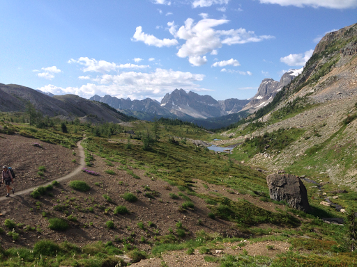
It’s transition time on the GDT and wildflowers are starting to bloom! Valley bottom trails at lower elevations vary from bare and dry to wet and muddy, while trails at higher elevation are still snow covered. With warmer weather, trail conditions can change quickly, from icy in the morning to slushy and slippery in the afternoon. Plan for varying conditions – clothing layers, boots, cleats and/or poles are recommended.
CREEKS: Warmer weather also means rapid snow melt during the day resulting in high water levels and potentially dangerous creek crossings, so attempt to ford larger creeks early in the day when water levels are lowest.
SNOW: Snow levels were unusually high in the Rockies but things are melting fast. Expect snow patches on north-facing slopes above 2000 metres and at slightly higher elevations on other aspects. For up to date snow level data in BC, check out the Snow Survey Bulletins and Commentaries which include links to the Snow Survey and Water Supply Bulletin and map. In Alberta, check out the ESRD’s Snow Data map.
ELK CALVING SEASON: May 15 to June 30. Protective mother elk will aggressively protect their newborns by kicking and charging at people. Stay at least 30 metres away from all elk during this time of year. Pay attention to trail closures in known elk calving areas.
TICKS: It’s tick season so be extra careful when in areas with a lot of underbrush. Wear long pants, gaiters and DEET, and check yourself and your clothing after your hike.
BEARS: Bears are out and about in search of food. Be bear aware on the trails this summer, make noise and carry bear spray.
WILDFIRE UPDATE: Currently there are no campfire bans on the GDT, but if you must have a campfire in the backcountry, ensure you follow the rules.
TRAIL CLOSURES:
- Trail 7 near Jasper is closed to hikers south of the junction with Trail 7e and north of the junction with Trail 7a due to grizzly and black bears frequenting the area next to the golf course. Detour by taking Trail 7e towards Trefoil Lakes and Trail 7b south to Old Fort Point trailhead. Equestrian uses can still use Trail 7 but are not to dismount.
- Numa Creek Trail (Rockwall access trail) remains closed due to wash out of the bridge over the Vermilion River.
- Tumbling Creek Trail (Rockwall access trail) is closed from the Ochre Creek trail to the intersection of the Rockwall Trail before the Tumbling bridge due to a missing bridge at km 6.6.
TRAIL NOTICES:
- From Scarpe Pass (a24), the trail disappears up to La Coulotte Ridge and the hiking becomes significantly more difficult until you reach the ATV track (a27) heading down to the West Castle Road.
- The Aldridge Creek Trail between Fording River Pass (b31) and the Kananaskis Power Line Road (b32) was cleared and restored in July 2015.
- To protect sensitive habitat and improve habitat security for grizzly bears, hiking or travel anywhere except on official trails or designated roads in the Sunshine Meadows, Citadel Pass, and Healy Pass areas of Banff National Park is prohibited.
- Cairnes Creek (d9): The bridge is washed out making this a potentially dangerous ford. It is recommended to cross early in the morning when glacial melt is lowest.
- The damaged Lambe Creek bridge (d10) was removed in September 2015. It is recommended to ford the creek downstream.
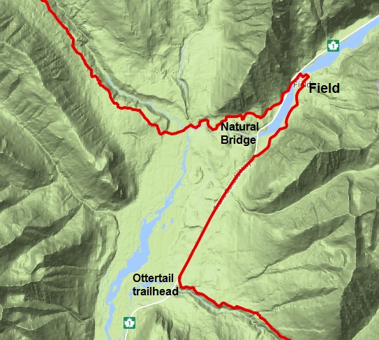
- The Howse Pass Trail from Conway Creek (d12) to the Glacier Lake trail junction (d14, 15 km) is in very poor condition. The trail is overgrown, with hundreds of wind-fallen trees across the trail. Hiking in the Howse River floodplain is a viable alternative if the Howse River is low enough to ford.
- The Owen Creek Trail was cleared in July 2015 up to km 6. Beyond that point, the trail is in poor shape with several washed out sections. Expect challenging hiking for 3 km including skirting along steep creek-side cliffs and rock-hopping in the creek itself. At km 6, do not take the trail heading up away from the creek (it is a deadend). Look for orange blazes marking the correct route staying near the creek.
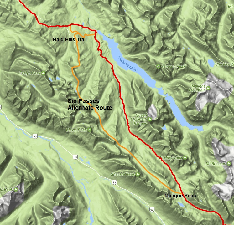
- The Maligne Pass trail in Jasper National Park has been decommissioned and is in poor shape. The trail from Pobokton Creek (e20) to Maligne Lake (e25, approx 42 km) is no longer being maintained by Parks Canada so expect deteriorating and overgrown trail conditions; long pants are recommended. The Maligne River bridge has been removed but the river can be easily forded in normal summer conditions (knee deep in mid-summer). Most other bridges are still in place. Read Nathan Dahl’s August 30, 2015 Maligne Pass trail update here.
- The Yates Torrent Bridge is out at the crossing of the Coleman Glacier outflow (near f16). Do not attempt to cross at the old bridge location. Instead, ford the Smoky River farther down the valley. Attempt to cross early in the morning when glacial melt is the lowest or be prepared for a fast and potentially dangerous creek ford.
- The bridges across Gendarme and Carcajou Creeks are out on the Jasper North Boundary Trail. These two creeks are smaller than the Smoky River, but can still be treacherous. Cross Gendarme at the horse crossing just below the old bridge (marked), and Carcajou about 100m below the trail.
- The bridge across Buchanan Creek on the trail to Kakwa Lake, has been removed. The crossing here can be hazardous early in the year or after heavy rains.
ACCESS ROADS:
- Akamina Parkway is now open to Cameron Lake. Construction on the Cameron Lake Day Use Area facilities is substantially complete. Contractors may still be on site working on the finishing touches.
- Access to the northern terminus of the GDT in Kakwa Provincial Park is via the Walker Creek Forest Service Road. The Walker Creek FSR has been repaired from Highway 16 to km 33.5. While travelling the remaining 40 kilometres on the Walker Creek FSR, attention is required to navigate the surface as it is uneven, rutted, slippery and very rough. The road is not recommended for anything other than a 4×4 high clearance vehicle. The last 10km from Bastille Creek to Buchanan Creek is closed due to washouts and is not driveable by vehicle so be prepared to walk this distance on foot.