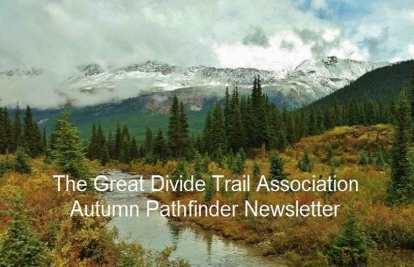
This edition of the Pathfinder Newsletter includes articles showcasing adventures on the GDT, accomplishments this year, volunteer recognition, trees of the Great Divide, and the GDTA Board going into the future. Enjoy!
Despite COVID-19, 2020 has been a busy and productive year. In addition to obtaining charitable status and opening the High Rock Trail, the Board has spent a significant amount of time reviewing the GDTA’s administrative challenges. Two key areas were examined:
The GDTA’s organizational structure
The Board’s workload
The Board is a group of highly motivated and dedicated individuals who contribute a significant amount of time to the Association’s affairs. However, there is not enough person-power to tackle what needs to be done. To address this workload challenge, at this year’s Annual General Meeting the Board presented three motions to change our By-Lawsand Articles of Continuance (a document that must be filed with the Government). These motions recommended that the Board be allowed to temporarily fill vacant Board positions between Annual General Meetings, increase the maximum number of Directors from eleven to thirteen, and if necessary, temporarily add additional Board members. All three motions were passed.
One additional By-Laws motion was also presented. As mentioned, the Board had spent a significant amount of time examining and documenting the GDTA’s organizational structure. To provide greater clarity and improved governance, a new draft policy outlining the Board’s roles and responsibilities, anddraft Terms of Reference for the GDTA’s core committees, have been developed. These Terms of Reference outline the duties for each committee. Several years ago, the existing By-Laws were created but now do not reflect how the Association conducts business. This approved motion changes the By-Laws to align them with our current structure. It also mandates that the Board must document and publish documents describing how the GDTA will function. The Board believes that this change will provide the general membership greater insight into the Association’s affairs and help potential volunteers identify opportunities for involvement in our great organization. Once finalized, these documents will be available online.
GDTA Board Members
At every AGM, we thank departing Board members for their contributions, re-elect members who desire to serve anotherthree-year term, and elect and welcome new Board members.
This year we welcome six new Board members. Four of these members were added to fill four vacant seats. Two were added to fill the newly created seats that resulted from changes to the GDTA’s Articles of Continuance, increasing the maximum Board size from eleven to thirteen.
This year we also thank Kathy Plachta, the GDTA’s Co-Treasurer, for her service. Kathy, over many years, has contributed significantly in countless ways to the success of the GDTA. Most significant were her contributions to establishing the Association’s financial systems and managing its finances and memberships. Kathy is leaving to be more involved with her growing family.We will miss her wise counsel.
Gina Van Haren, New Director
When not at work, Gina can be found hiking on the trails in the nearby Rockies, visiting the family’s farm, out at a lake, getting out for a run, dreaming up new adventures, working on some craft, or trying new recipes. Together with her mom and sister, Gina has completed about 900 km of the GDT. Gina finished an undergraduate accounting degree in Ontario and is now working in an Airdrie public accounting office. She recently obtained her CPA designation and is keen to make good use of her education and work experience on the GDTA Board.
Ben Millen, New Director
Since learning of the GDT’s existence, Ben has spent time hiking sections of the trail culminating in a thru-hike of the GDT this summer (2020). Perhaps predictably, having spent so much time on the trail and experiencing it in its entirety, Ben developed an interest in its preservation, maintenance, and further development. Involvement with the GDTA seemed for Benan almost necessary step. Ben teaches Mechanical Engineering at SAIT and is involved in the design of medical devices and consumer products. Ben has also been involved in several non-profit boards, including The New Gallery, John Snow House, The Calgary Rowing Club and Cross Country Alberta.
Josh Edwards, New Director
Josh is a father, husband, teammate, and businessperson who has been an active outdoorsman with manysuccessful multiday backcountry trips, including a 7-day volunteer vacation with the Pacific Crest Trail, a summit of Mount Kilimanjaro, a 6–day trek of the West Coast Trail and countless weekend adventuresbetween Waterton Lakes National Park and Jasper. Josh brings over 20 years of construction experience and business leadership to the GDTA. Josh has also been the United Way of Central Alberta’s past chair, theclubhouse manager for the Red Deer Titans Rugby Club and a participant in the provincial Construction Association.
Donna Rutherford, Ex-officio Member, Now New Director
During the past 11 months, Donna has been the Board Secretary and an incredibly good one. Donna works for Alberta Health Services doing program evaluation and quality improvement in their addiction and mental health services. She is passionate about backpacking and happy that she tripled her usual number of backpacking days this summer. Donnawas a founding member of Alberta’s first cohousing community, loves gardening and has hopes of volunteering upon retirement, in urban farming initiatives around Calgary. As GDTA Secretary, Donna has been actively examining ways of improving the GDTA’s document management system. In the future, she wants touse her performance measurement skills in the Board’s development and tracking of the GDTA’s strategic plan performance metrics.
Peter Claghorn, Ex-officio Member, Now New Director
Peter first heard of the GDTA at a Banff Film Festival and has not yet hiked a single kilometre of the trail. Peter has, over this past year, been chairing Board meetings as Vice-Chair of the Board and a member of the Organizational Excellence Committee and the Trail Building & Maintenance Committee, bringing to the GDTA his education, a Masters in Organization Development and his business expertise in management consulting. Despite not having hiked the GDT, Peter is well acquainted with the outdoors, working with Outward Bound, and eventually, leading Enviros Wilderness School as Executive Director for 15 years.
Doug Whiteside, Ex-officio Member, Now New Director
After hiking the GDT from Banff to Jasper in 2016, Doug has volunteered as a trail builder and provided administrative and organizational development expertise. Over the past year, Doug has chaired the Organizational Excellence Committee and acted as Vice-President. Now retired, Doug, as an executive with a local resource company, was responsible for program and project management, business development and research. He has participated on industry boards and committees, including a founding participant of the Canadian Oil Sands Innovation Alliance (COSIA). Recently, Doug hiked the GDT with his daughter, Kate, from the US border to Banff, and they were one of the first backpackers to walk the GDTA’s newly opened High Rock Trail.
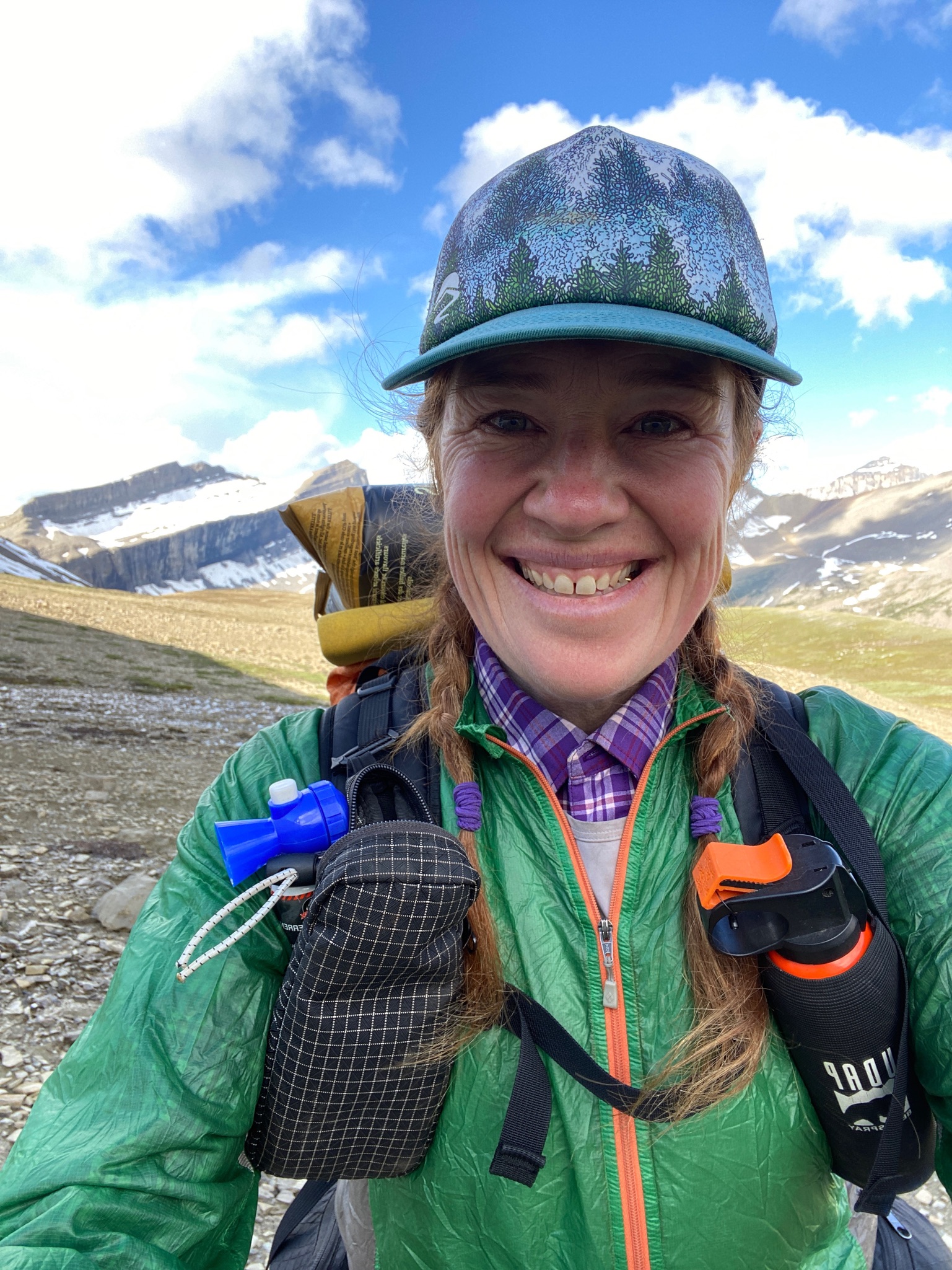
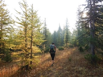
I’ve spent recent years walking thousands of miles on trails in America, always leaving the magnificent setting of our home in the Bow Valley. Routes like the Appalachian, Pacific Crest, Continental Divide, Arizona Trails, as well as more obscure and less linear walks like the Grand Enchantment, Inyo-White traverse and Lowest to Highest routes have been the best form of vacation. However, it’s been far more than harvesting miles (although I do enjoy crushing big days). In a more profound sense, this has been a path of healing. These walks have allowed for the processing of trauma, a connection with nature and thus, with self, and an arrival at the mindset of awareness that there is only one thing we have on and off trail: the moment we are in. The present moment. The beautiful moment. Hiking has allowed me to feel alive in the most meaningful ways. Hiking has taught me all these things and more.
When Covid hit, back in early March, I was down in Tucson, Arizona, ready to set out on another of Brett ‘Blisterfree’ Tucker’s obscure desert hiking routes: the 700+ mile long ‘Sky Island Traverse’. Enter the global health pandemic. I came home to Canada with the thought of staying home, an unusual concept for me.
Things shifted late spring. The idea that seemed preposterous, and irresponsible, months before, like attempting a thru-hike, now seemed reasonable. A friend I met on the CDT a few years before who worked locally messaged and asked if I’d be interested in hiking the Great Divide Trail. He was planning on setting out in less than two weeks, was I interested? I’d just finished telling my husband Peter that I looked forward to spending the whole summer at home. I’d signed up for the community garden, had planted a crop of carrots, leeks and radish to add to the collective we would harvest from, and committed to watering each Sunday.
Yet…
The idea of walking many miles through this backcountry backyard was too much to resist. I normally hike alone or with my husband, Peter ‘Windwalker’ Guzman (by the way, I’m ‘Redfeather’ on trail). He’s pretty legendary in my eyes, having walked the PCT back in 1993 and the CDT in ’94. He was a thru hiker before it was cool to be one. When I asked him about hiking the GDT he said ‘Do it. Why hang around here? I can bring you resupplies. You can do this safely. If my knee wasn’t injured, I’d be there with you. Do it!’.
I said yes.
Most people in this space have an idea of what the GDT is. I had an image of a rugged, mountainous walk, a struggle to get permits mixed with a disdain for having to be somewhere on a specific date, camp reservations, grizzly bears, black bears, wolves, moose, large and small creatures in abundance along the way, epic water crossings and navigational challenges. Yes, all of these things were there in abundance, but what I did not anticipate is JUST HOW BEAUTIFUL THIS ROUTE IS.
Of all the hikes I’ve done, the thing that I come out with is no matter the views (or lack thereof), the terrain, the toil, is this: I simply like to walk. I love to camp. I like the independence of moving through nature, being self-contained, of listening to the forest speak not just for hours but for weeks and months at a time. I like having just what I need in my pack. I take satisfaction from honing a system that I make better and adapt to the elements of each different route along the way. The athlete in me enjoys repeating a template that works so that I can get into a mental space of the movement happening through me. I enjoy simply walking all day, every day, listening, smelling, tasting and feeling my surroundings and my Self (okay maybe not smelling myself) along the way. Finding the interconnectedness of all living things during the many hours of movement. Connecting to the rhythm of breathing, of step, of wind and water. Yes, I enjoy all of this so much that I can be walking through a garbage dump and be completely content.
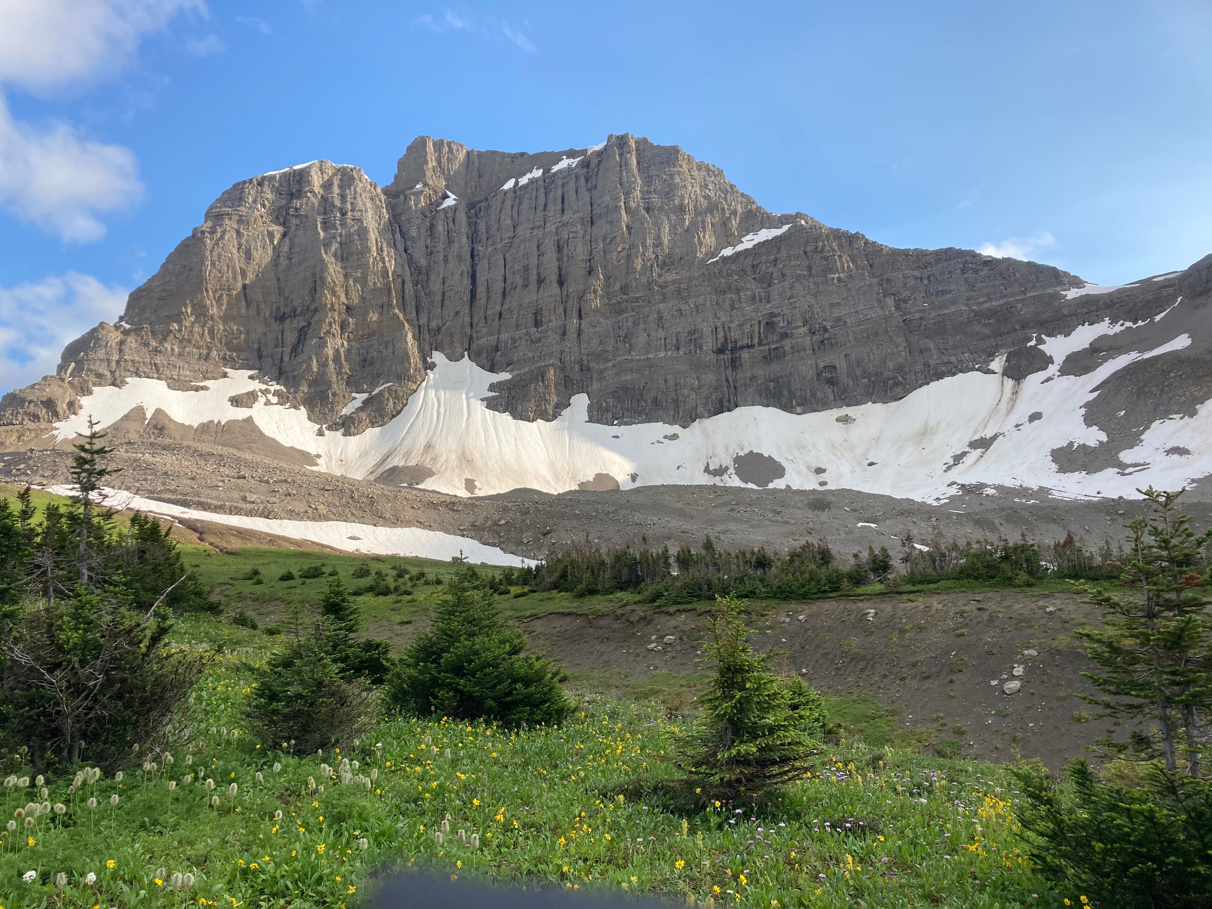
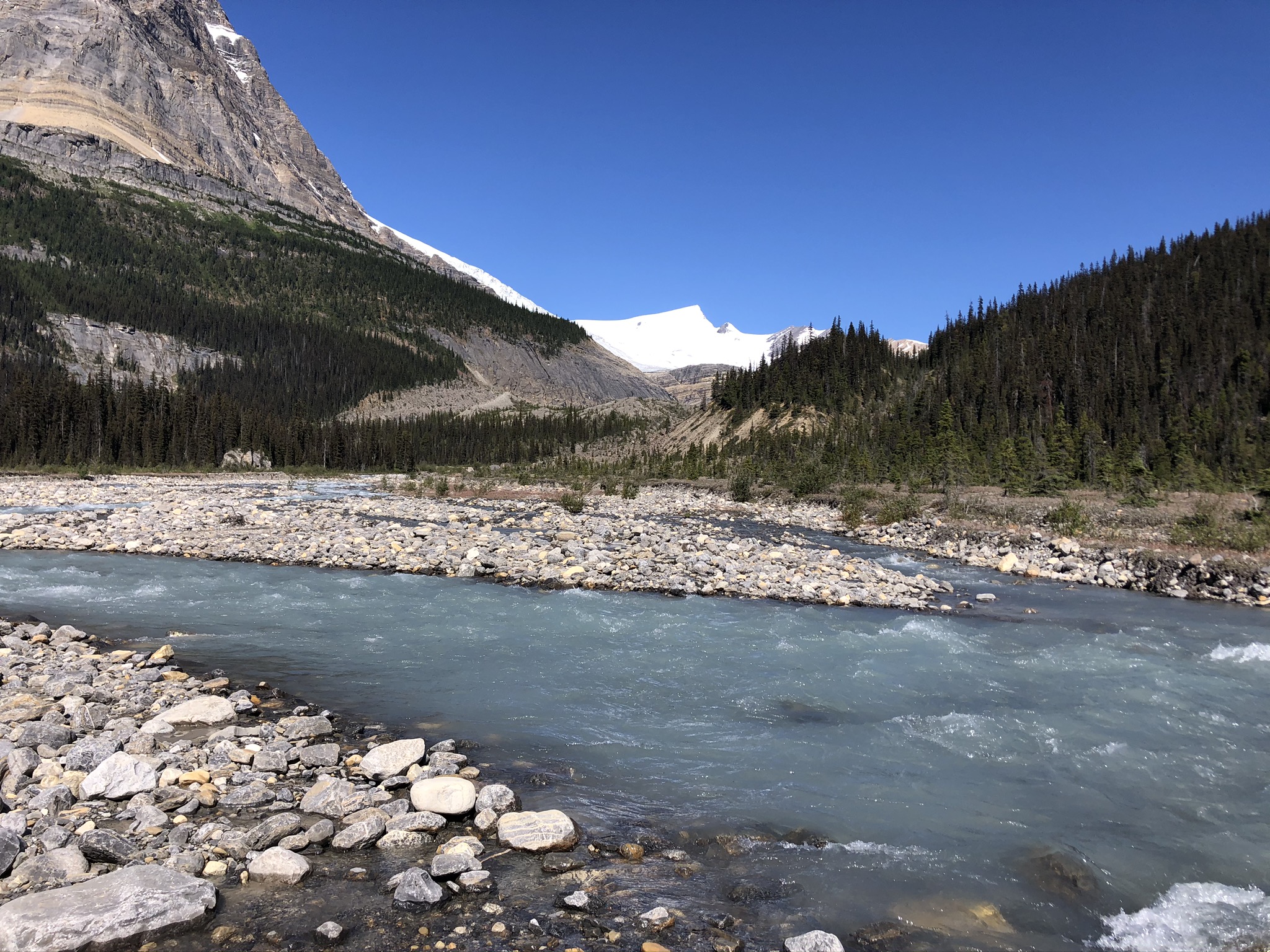
The GDT? My reflection is this: if you take the thousands of kilometres from these other trails, take their most beautiful sections, you have the GDT. It’s like the GDT cherry-picked the best sections and said here you go, enjoy. Yes, it is that majestic. That extraordinarily beautiful. It is wild, unpredictable, and comes full of challenges. The fear of bears is real, the river crossings are intense, navigating the permit/camp bookings is confusing and yes I made some serious errors even with doing everything I could to understand the matrix of these boundaries, where and when I needed a permit etc. Hiking this route with a partner is in many ways less stressful, yet hiking it alone is something very special (I did both, my hiking partner ended his walk at Saskatchewan River Crossing), my feet were wet all but two of the 33 days it took me to walk from Waterton to Mount Robson. I took the shorter option to end the walk because quite frankly I had my fill – the GDT kicked my ass in the best of ways. Yes, I do hope to come back and finish the Robson to Kakwa section one day. One day!
There is no one way to walk the GDT. I would hike the entire route again in a heartbeat. Section, NOBO, SOBO, Yo-Yo or day hike, whatever a person’s intention or constraints that allows for or limits the time they have on this route, I salute you. It’s worth it, every step of the way.
Special thanks to the GDTA and all the volunteers who make the trail what it is. I have made a donation to support the continued building and maintenance of this route and encourage others, whether hike it or not, to offer what you have: time, funds, awareness.
Clara Hughes
‘Redfeather’ on trail
6x Olympian, winter and summer
6x Olympic medalist, speed skating and cycling
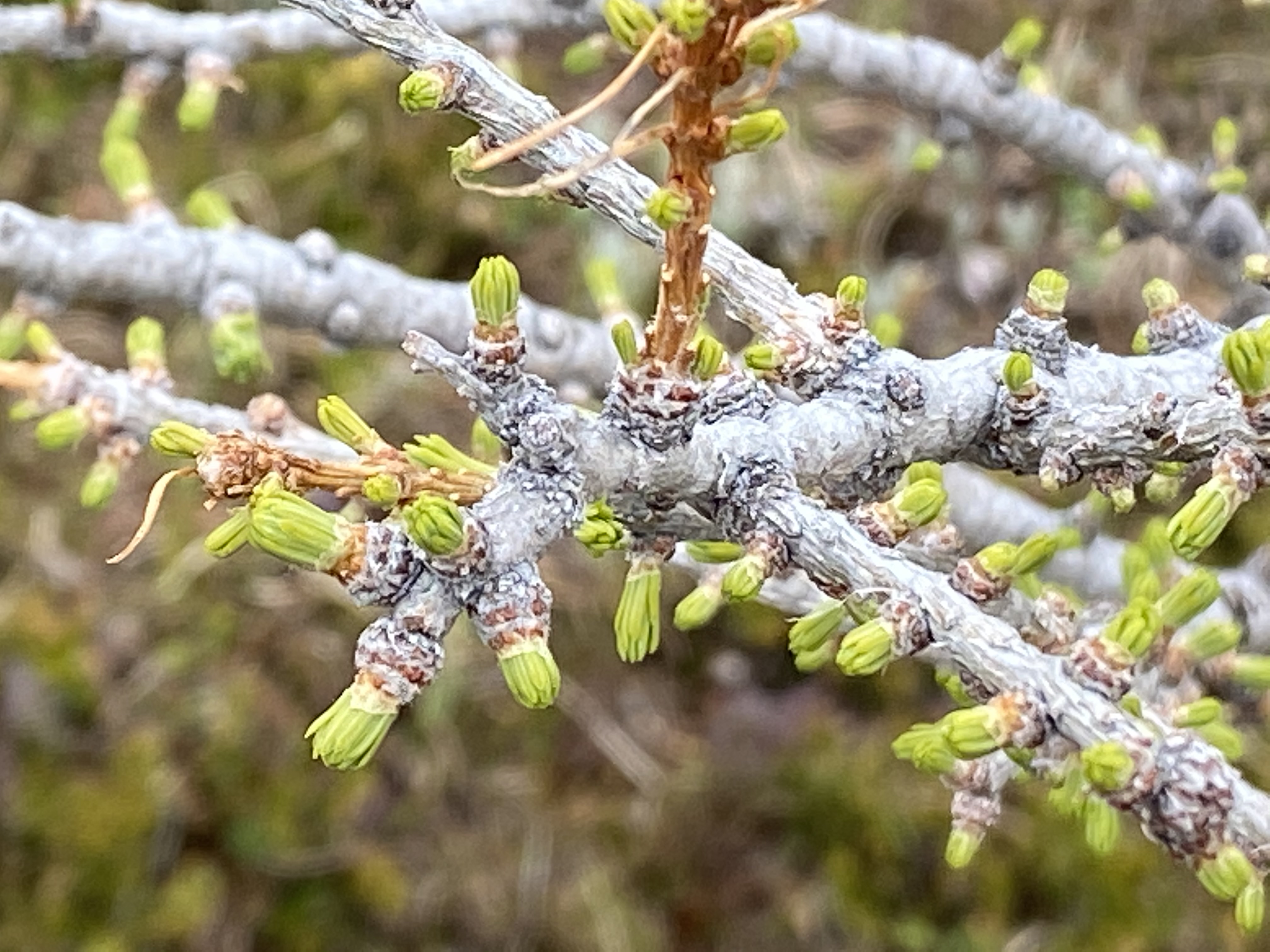
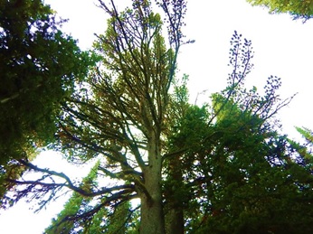
Every September, thousands of people make the pilgrimage up into the high subalpine reaches of the Rocky Mountains to take delight in the bright yellow hues of a curious conifer, the subalpine larch (Larixlyallii). Unlike other cone-bearing trees, which are evergreens, larches are deciduous like poplars, aspens, and cottonwoods. So, instead of the majority of their needles staying green and remaining on the trees all year, in the autumn larches shed their leaves, which just happen to be needles, and regrow new needles each spring.
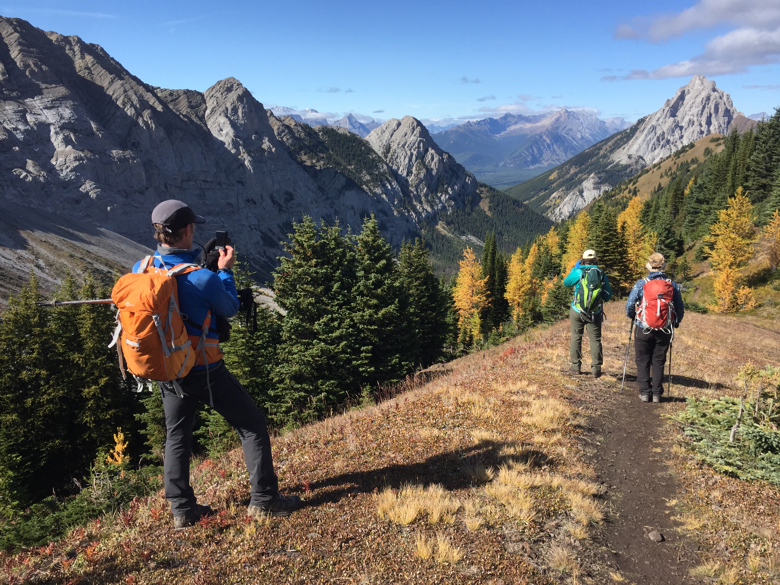
The annual fall pilgrimage to see and photograph subalpine larch now attracts thousands of people to the Canadian Rockies
Why Would a Conifer Become Deciduous?
Why would larch invest so much energy growing hundreds of thousands of new needles every spring? It turns out there are many good reasons and that they enable subalpine larch to grow in the coolest places and thus be the coolest tree on the GDT.
Subalpine larch grow at high altitudes due to special supercool adaptations
Adopting a deciduous habit enables subalpine larch to grow further up the mountain sides where the cool, harsh weather conditions prevail for much of the year. Larches begin to shed their needles in the fall when wind and snow squalls begin to take place regularly in the lead-up to full-on winter storms. By doing this, they eliminate a huge weight from their branches and reduce the surface area that the tree presents to oncoming winds. Snow can fall through the branches and land on the ground rather than getting stuck on the tree. Wind can sail past the naked branches, dissipating its force. These factors reduce the likelihood of branches breaking from the weight of snow or the force of the wind.
You will notice that larch has a straight trunk with a sparse and somewhat conical crown. The boughs are horizontal to the trunk, irregularly spaced and twisted. This maximizes the amount of sunlight a larch can access during the long days of summer, enabling its needles to photosynthesize effectively so that it generates lots of carbohydrates to store in its roots over the long high elevation winter. However, this also presents a massive amount of surface area. Other conifers that grow in the upper subalpine near treelinesuch as subalpine fir and Engelmann spruce adopt a different growth form, with short branches that point down from the trunk so that they can easily shed any snow that falls on them and present little surface area to the wind. In addition, as larch needles do not getexposed to the desiccating winds and extreme cold of high mountain winters, like evergreen conifer needles, the moisture in larch needles does not have to be replaced by water in the soil, which remains frozen and inaccessible into late spring for many other conifers.
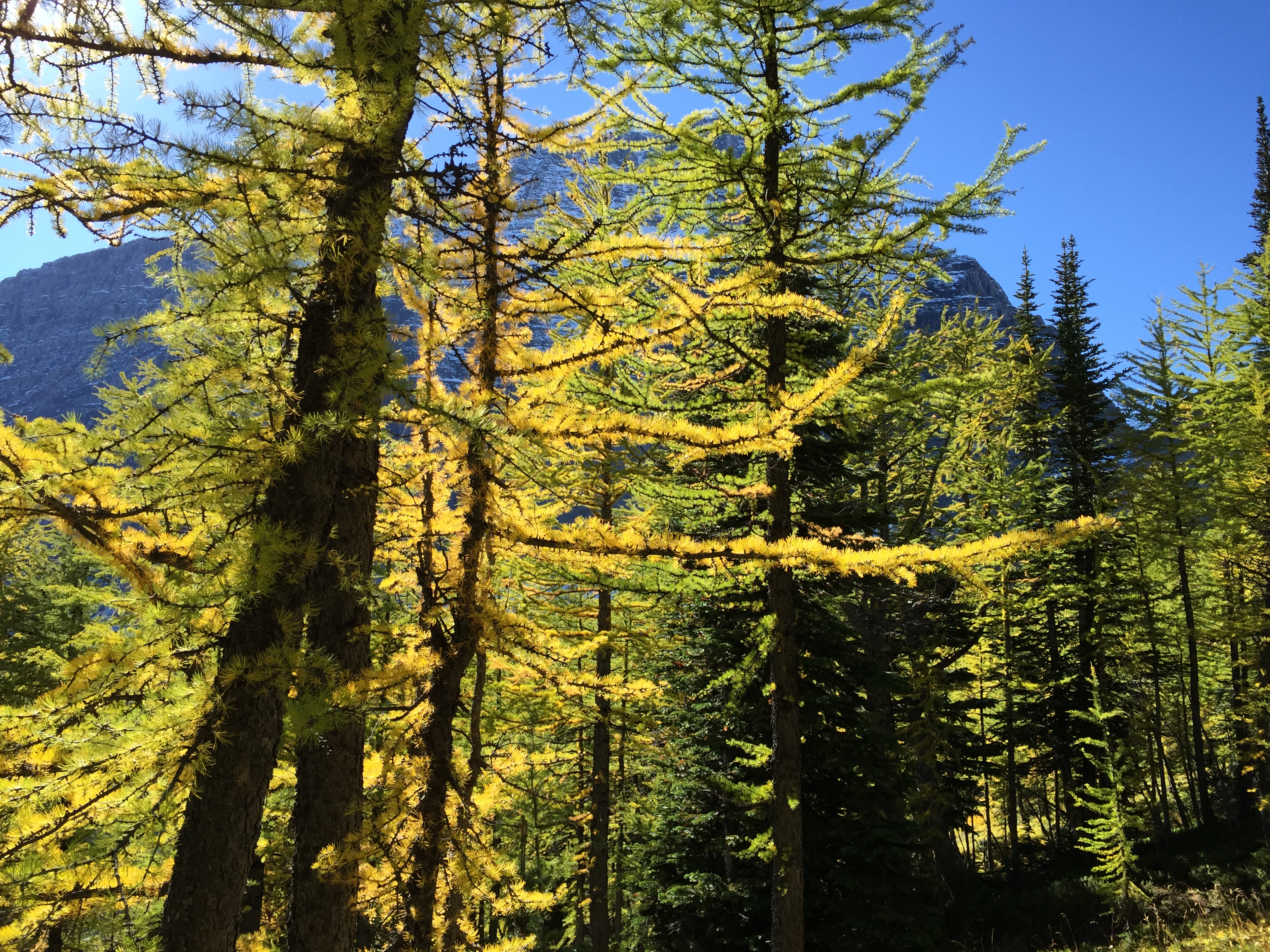
Unlike their evergreen neighbours, subalpine larch can have big horizontal branches because they drop their needles each fall
Also, the ability to recycle nutrients, especially nitrogen, through needle drop, is an important advantage in nutrient-poor environments like the thin soils and talus slopes in the mountains. Larches reabsorb a high proportion of nitrogen from their needles before these are shed, as much as 20 percent more than other species of trees. This provides the larch tree with a significant savings on an essential nutrient for the following year’s growth.
Shedding needles can also benefit the overall health of the tree. Larches use this seasonal shedding of needles to eliminate waste products, sendingtoxins taken in through their roots or from the air into the yellowing needles. By not having needles in the winter in Chinook-prone areas, larches also eliminate the risk of respiring when their roots remain frozen during periods of warmer than normal weather. Evergreens that begin to respire in warm conditions cannot replace the water they lose, killing the needles and sometimes the tree. This phenomenon,known as red-belt,appears as a band of trees with dead branches on a mountainside. The period of dormancy also appears to benefit this tree species’ health as much as good sleep helps promote human health. Experiments that provide larch with summer-like growing conditions all year long result in trees that sicken and die.
By discarding their needles subalpine larches get rid of waste products and protect themselves from winter desiccation
What Happens to Make the Larch Turn Different Colours?
What we see when the larch needles turn yellow is the result of the tree initiating that period of dormancy in response to shortening day length and lower temperatures. During the spring and summer larchneedles house numerous food-manufacturing cells containing chlorophyll. This miraculous pigment absorbs specific wavelengths of energy from sunlightand uses that to transform carbon dioxide and water to carbohydrates, such as sugars and starch, which it stores in the roots. Chlorophyll cannot absorb and use greenlight energy (wavelength of ~560–520 nm). The cells that contain chlorophyll reflect that wavelength, making plants appear green. The needles also contain carotenes and xanthophyll pigments. For most of the year, these yellow and gold pigments get masked by the large quantity of green colouring from chlorophyll. However, once the needles stop their food-making process, the chlorophyll breaks down into its constituent parts that are stored safely in the roots for the winter. The green colour then disappears, and the yellow to gold-orange colours emerge, giving the larches their three weeks of autumn glory.
Meanwhile, at the spot where the stem of the needle is attached to the node on a twig or branch, a special layer of cells develops and gradually severs the tissues that support the needle. At the same time, the larch tree seals the cut, so that when the needle is finally blown off by the wind or falls from its own weight, a leaf scar remains.
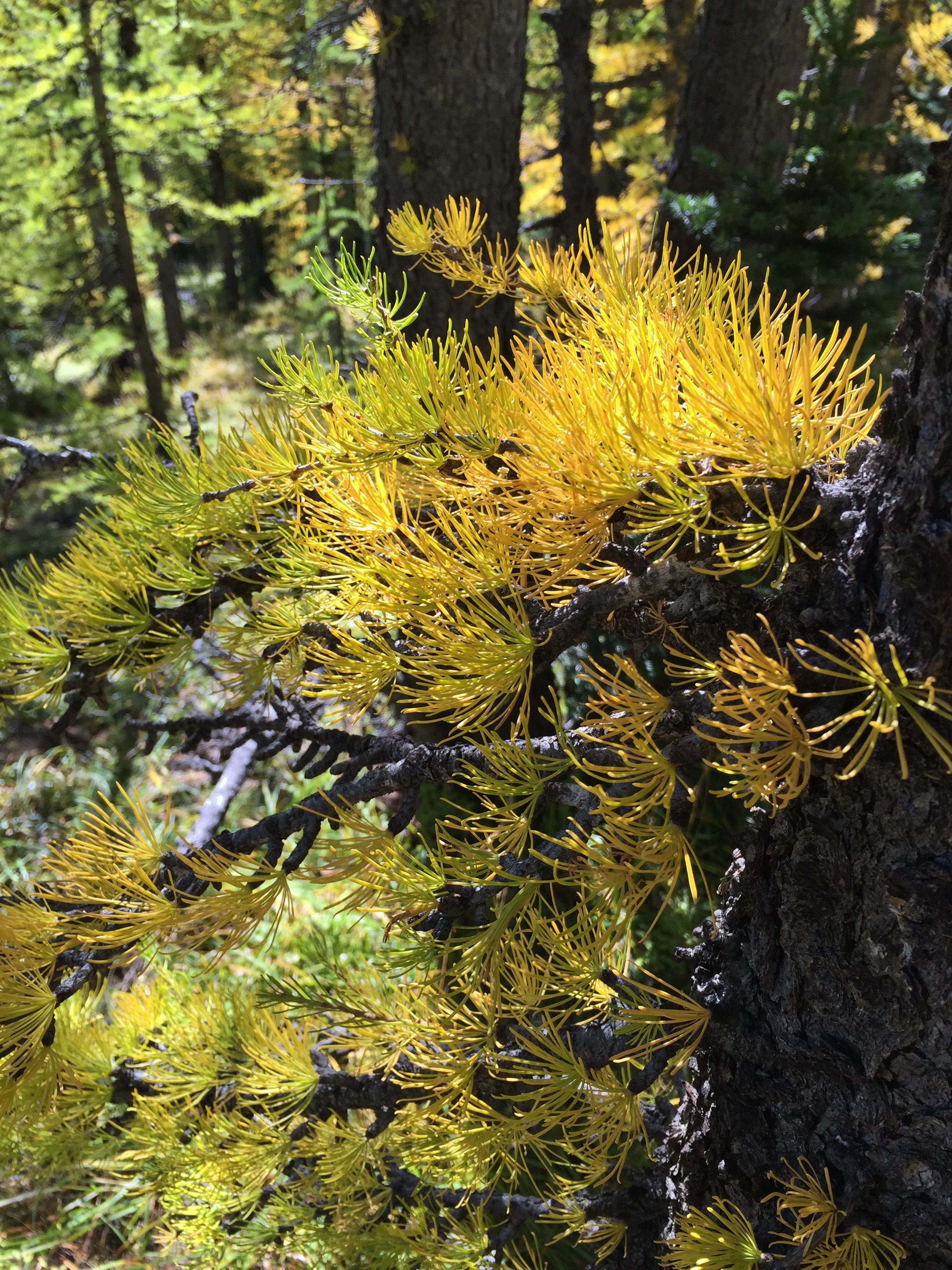
The delicate looking yet efficient subalpine larch needles
In the spring, nitrogen and the other parts of chlorophyll are brought out of winter storage and reassembled in new soft wispy needles that appear a light bright green. These deciduous needles have no need for waxy cuticles to protect them in winter, or for that matter, big doses of phenolic compounds to ward off winter herbivores, so they don’t require as much carbon as evergreen needles.Larch needles appear delicate but their design is effective in another way. Small and sparsely arranged along the branch stems, a high percentage of these needles get well illuminated since they shade one another to a lesser degree than do needles on evergreen conifers or even the broadleaves on many deciduous trees. This even distribution of light ensures full engagement in photosynthesis, the chemical process enabling green plants to make their own food. Larch needles are thus especially efficient and effective in making food to fuel the larch tree’s growth.
Subalpine larch grow fresh soft new chlorophyll-rich needles every spring
Pruning and Blazing Larches Along the GDT
From the larches’ perspective, the best time to prune them along the GDT is after they turn yellow, or better yet, during the dormant period after they shed their needles and before new ones emerge in the spring. According to GDTA blaze master, Dave Higgins, “In the hierarchy of blazing trees, they’re not quite at the top. That spot is earned by the subalpine fir. Next might be whitebark pine, if it weren’t for its protected status. Both these trees have bark that needs no scraping and one application of paint adheres very well for a long time. Larch has to be scraped and usually needs two paint applications with drying time in between. The bark of spruce is similar. Both are less than ideal because the bark continues to grow and flake off over time.”
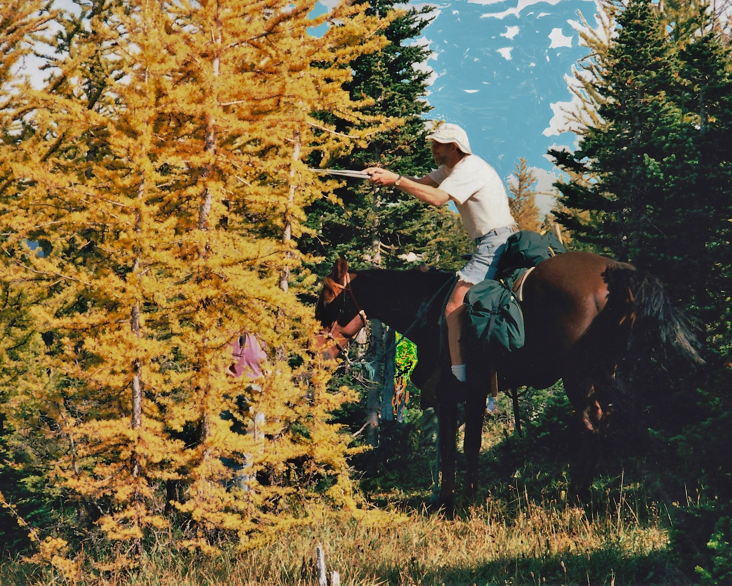
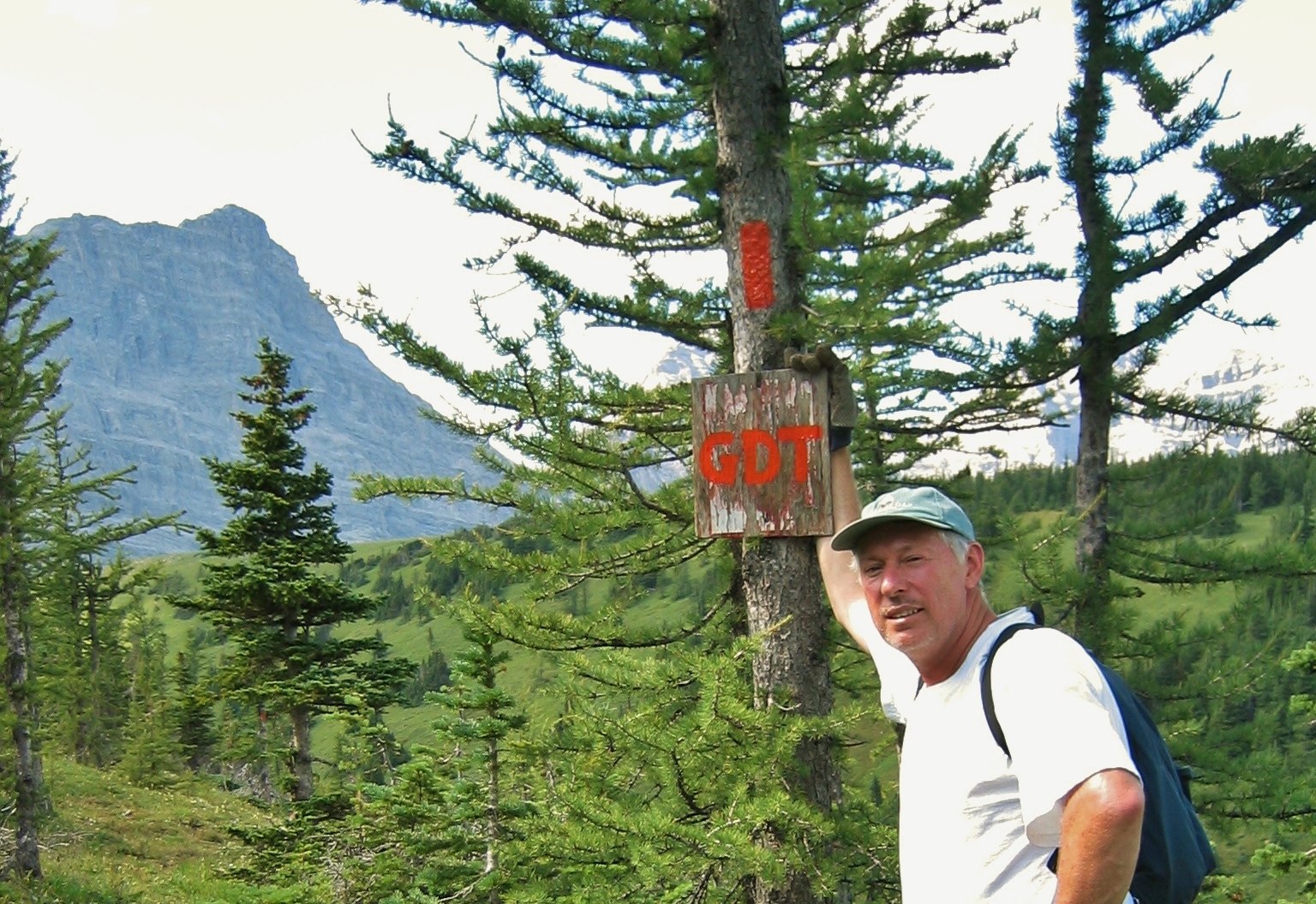
Chris Morrison on his horse Star carefully pruning larch along the GDT on the Cataract Plateau in 1998Dave Higgins with freshly painted blaze along the GDT in the Cataract Plateau area in 2004
What Larch Species Can I See Along the GDT?
As the coolest tree along the GDT, subalpine larch lives at high altitudes near the treeline from 1,800 to 2,400 m (5,900 to 7,900 ft) in the Rocky Mountains as well as in the Purcell and Selkirk ranges of the Columbia Mountains.In the Rockies, the northern limit of their range is just a bit north of Lake Louise. A disjunct population flourishes in part of the Cascade Mountains. One can find it in the high cool places of southern Alberta and British Columbia, as well as north and east-central Idaho, and western Montana, and Washington State.
Subalpine larch in the Cascade Mountains, Cathedral Lakes Provincial Park, BC
Besides subalpine larch, two other larch species grow along parts of the GDT: Western larch (Larixoccidentalis) in the south and tamarack (Larixlaricina) in the north. Like subalpine larch, they are deciduous conifers.
Western larch in the headwaters of Sage Creek, BC
Western larch occurs from southeastern BC and extreme western Alberta southward into eastern Washington, western Montana, northern Oregon, and northern and west-central Idaho. Western larch occupies relatively cool, moist climatic zones. Its upper elevational range is limited by low temperatures, while the lower extreme is limited by low precipitation.Its deciduous nature makes this species especially resistant to fire and resilient to injury. Larch trees can lose much of their canopy and still regrow their needles the following year. Its bark is also thick and protects the stem from fire. All these reasons give western larch a competitive advantage over other conifers where it grows.
The northern relative, the tamarack,tolerates extreme cold well and grows in the boreal forest zone of North America, extending down into the Eastern Slopes of the Rockies near Jasper. They can survive temperatures down to at least −65 °C (−85 °F), and commonly occur at the Arctictreeline at the edge of the tundra. Trees in these severe climatic conditions are smaller than the ones farther south, often only 5 m (15 ft.) tall. Their lack of winter needles means that they’re less susceptible to leaching of nutrients by winter precipitation than other conifers. They can also withstand extreme cold temperatures through a process called super–cooling whereby the tamarack tree cells dehydrate, pushing water into spaces outside their walls where crystallization won’t damage living tissue.
Just to confuse matters, plant breeders have managed to hybridize subalpine larch with Western larch and even with tamarack. In a few places where their ranges overlap in the USA, subalpine larch naturally hybridizes with Western larch.
Some GoodPlaces to See Larch Along the GDT
Seeing subalpine larch, especially during the fall when the needles display their spectacular golden hue, continues to be a source of joy and inspiration for mountain hikers. Growing numbers of people plan their fall hiking trips to areas specifically to view and photograph these “golden” trees. However, the increasing numbers in certain areas can disturb the peace and quiet and sense of solitude that many seek, compact and erode the soil, leave behind garbage and human waste, and disturb wildlife. So, GDT-ers, please be respectful of the larch, its fragile, high-altitude habitat, and other larch-loverswhileappreciating this cool tree.
In my opinion, some of the bestplaces along the GDT to see subalpine larch forests include:
The Tamarack Trail in Waterton Lakes National Park, Alberta
Cataract Plateau, Original GDT Section, Alberta
Mt Assiniboine Provincial Park, BC
Sunshine Meadows and Healy Pass, Banff National Park, Alberta
The Rockwall Trail, Kootenay National Park, BC
Subalpine larch forest between Numa Pass and Floe Lake along the Rockwall part of the GDT in Kootenay National Park, BC
Yo–yo hikers Dan Durston and his wife Tara Frey-Durston from Golden, BC thru-hiked the GDT from Waterton to Kakwa(northbound or NOBO) and back again (southbound or SOBO) in one season in 2017, so I asked them for their recollections about the larch they saw along the GDT. Here is what Dan had to say:“We missed the prime larch season on our yo-yo because we had to stop the hike just as the larches were starting (early September) due to fire closures, and then didn’t resume until the end of October when they were largely over. However, I did notice some nice subalpine larch in a few areas and Tara also mentioned some nice areas from her SOBO hike last September.
GDT Yo-yo hiker Tara Frey-Durston backpacks by larch (Photo by Dan Durston)
In Section B (Coleman to Lougheed), the main larches that stood out to me were along the divide near the High Rock camp. Just north of the High Rock camp in the basin before the GDT veers away from the divide (down to Lost Creek) there are some huge larches. The biggest I’ve seen on the GDT (photo attached). I think these were subalpine larch since they were at 2100m in Section B. The basins south of here along the divide are probably quite good too, but this one just north of High Rock camp had the most and largest as I recall.
Big subalpine larch by High Rock Camp (Photo by Dan Durston)
Then Section C (Lougheed to Field) has a lot of really good spots. The north side of Wonder Pass is loaded with great larch, as are most of the passes for the rest of the section. Particularly the passes just north of Sunshine, but also good spots along the passes on the Rockwall. I also note that the BC Big Tree Registry lists a subalpine larch at Wolverine Pass on the Rockwall that is the largest in BC (1.23m diameter). I haven’t stopped there to check it out, but hope to.”
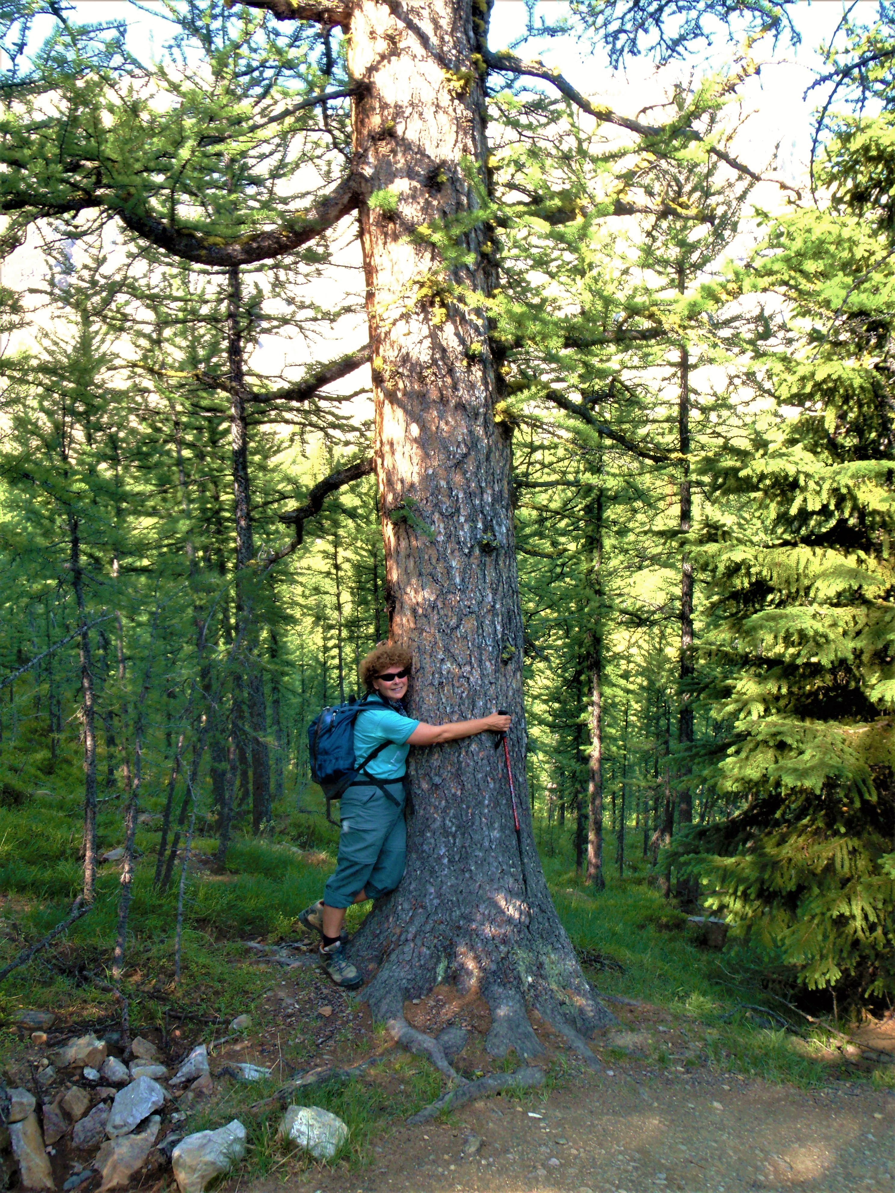
How can you not hug the coolest tree on the GDT?” says Jenny Feick near Wonder Pass, Mt Assiniboine Provincial Park, BC (Photo by Ian Hatter)
Jenny Feick took all of the pictures in this article unless otherwise noted.
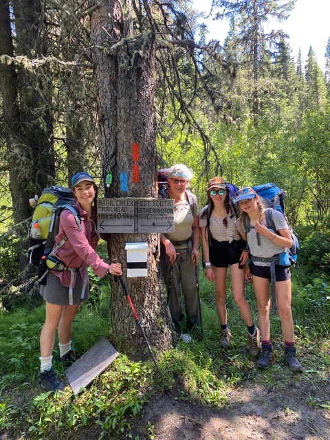
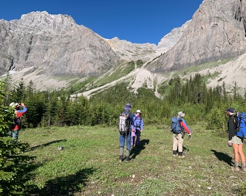
After completing the easiest section of the GDT last summer (section C, Field to Kananaskis),this summer Lynnie and I tackled the most challenging section, section G, SOBO from Kakwa to Mt Robson. An amazing achievement that would not have been possible without the help ofDustin Lynx.
Section G is a very difficult section and should not be undertaken lightly – route finding sometimes without GPS help, dubious water crossings, bushwhacking around deadfall and washed out campsites (Wolverine campsite on the North Boundary trail was completely under water), wading through thigh deep bog water, wet feet for the entire time, bugs, hiking in the dark, high mileage, not to mention the wet and miserable weather that we had on and off for days. Oh and then there was the curious grizzly who charged our campsite near Surprise Pass. In total 217 km (including walking part of the access road) was hiked over 10 days, 9 nights. The upside: spectacular views from Big Shale Hill, Surprise Pass, FetherstonhaughPass, Jackpine Pass (pictured below), to name a few and an incredible sense of accomplishment. I would not have missed this adventure for anything!
Day 8 – Jackpine Pass
There were five of us on this trip:
Mighty Lynnie – artist, GDTA maintenance volunteer and the most positive person I’ve ever met; Lynnie has hiked 2 other sections of the trail and this section, being the hardest was a personal goal for her.
Outdoor mountain expert Dustin – author of the Great Divide Trail Guidebook; he was hoping to hike all alternate routes for River Taig’s app but with the weather and the four old folks following him it proved to be too much!
Tougher than Nails Christine – ex GDTA board member; Christine has hiked all sections of the GDT twice except this one and having completed cancer treatment a year ago, finishing the trail was a significant milestone for her.
Tough as Nails Terry – Christine’s partner and at 75 years old (not a typo!) probably the oldest thru-hiker ever to hike section G.
Enthusiastic Responsible Barb – the nut that got this trip going. Ex-GDTA Board member. Hiked 2 other sections with Lynnie, looking to complete all sections over the next few years.
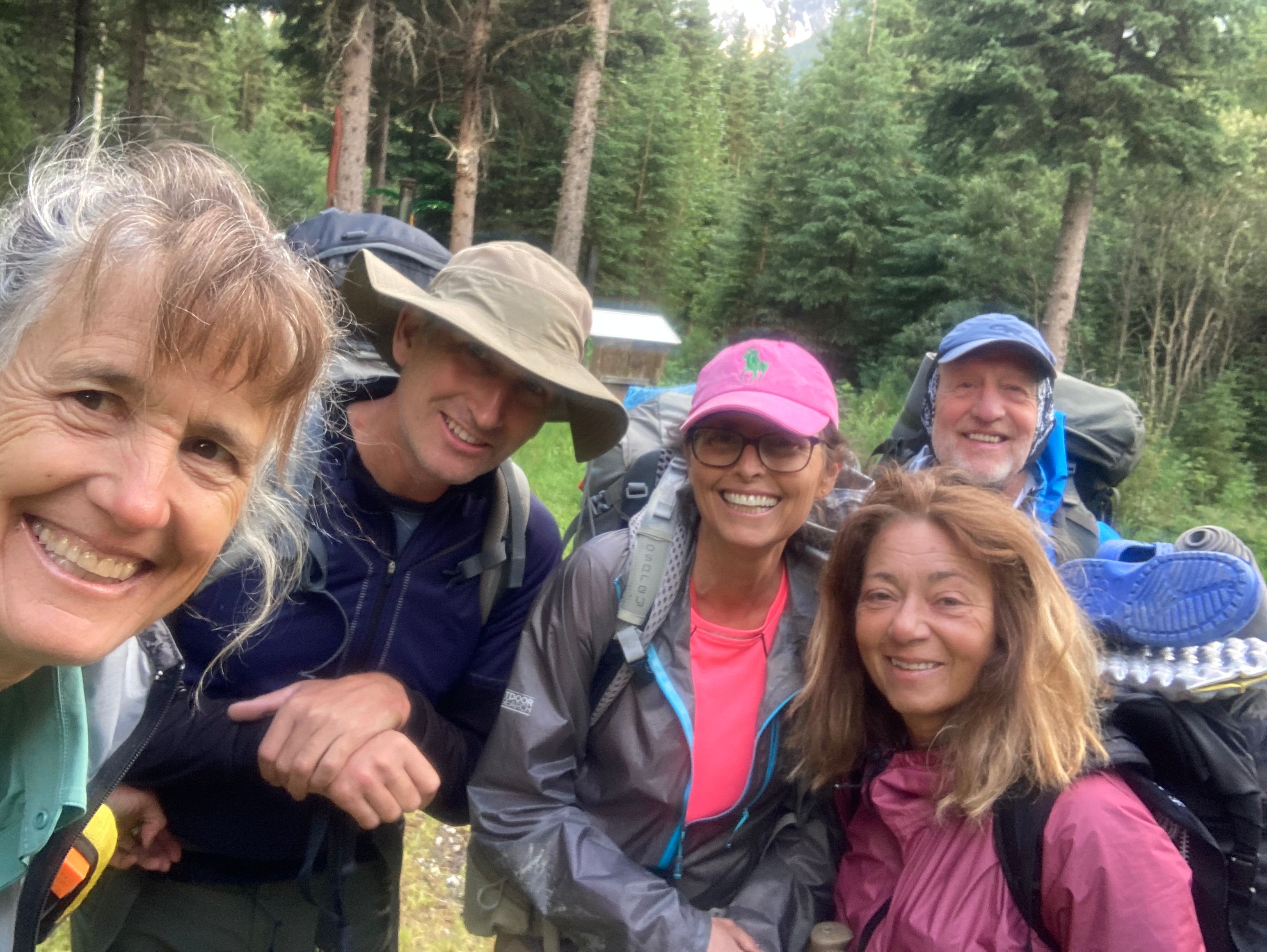
Day 1 – The start. Left to right – Lynnie, Dustin, Barb, Christine, Terry
We all had a part to play, but I have to say that if we didn’t have Dustin Lynx with us helping with route finding and water crossings, the trip would have taken us a lot longer than it did. All anyone had to say was “Dustin’s leaving” and we would all quickly fall in behind him. A big shout out to Dustin for his expertise, leadership, calm demeanor and help in getting us through Section G!
Here are a few highlights of the trip…
The grizzly charging our campsite was certainly exciting! We were random camped just below Surprise Pass. After dinner, I was standing outside our tent, which was sheltered from the wind by some trees and slightly away from the others. I was looking off at the snow in the distanceand then I thought a rock moved (in the picture below, the bear was on the skinny strip of snow, lower left). I wasn’t sure it was a bear because it looked so small and so I continued to watch it run across the snow and then the little guy stopped, and with its ears pointed up, stared at me for what seemed like hours but I’m sure was only seconds. I didn’t move, I was willing it to turn away. No luck there. It started to charge towards our tent. At this point, we sprang into action – walking with purpose to the others shouting that a bear was coming into camp and to get ready. We grouped together and shouted at the bear. He came over a small rise, probably within 100m of the camp, and then immediately veered off when it saw us (we’re a pretty mean looking group!), never to be seen again. Lynnie and I moved our tent closer to the others and from that night onwards we were more careful to camp close to each other.
Day 3 – Surprise Pass – view from the tent
That same eventful day, we had our first rather dubious water crossing, defined here to be any water crossing where Dustin took off his pack and put his phone into a waterproof bag. Although it wasn’t a wide water crossing, the water was knee deep, roaring and really moving, and the rocks were slippery. Lynnie made it across safely, after a false start, returning and going again. I followed Lynnie and used my normal approach to dangerous situations – try to use momentum and get across as quickly as possible; to be honest I was afraid of the water. Not a good strategy for water crossings! I lost my footing on the slippery rocks and went down, to be fished out very quickly by Dustin (thank you again Dustin!). For the rest of the trip, I learned a ton about water crossings and even came to enjoy the challenge.
I don’t know if you’ve watched water crossing videos, but I have to say that none of them were as scary as what we encountered on Section G (as examples: Chown River and a bridge out are pictured below) and none of the videos included the advice that was really needed.
Day 9 – Chown River crossingDay 9 – Bridge out, hardest river crossing
Here’s what I learned about water crossings from Dustin and Christine:
Go slow;
Three points of contact at all times (I use poles). Do not try and move a pole or a foot until all four points of contact are secure. If you feel one of the contact points going, stabilize and only then move one contact point. Avoid big rocks and try and find a place to jam your foot into.
Face the current straight on (going across) or even better walk into it on a diagonal if possible;
Lean into the current and if necessary,bend down into it for extra stability. On one crossing, my shoulders were getting wet with the spray, as I leaned into the current to maximize stability;
Fight the current, it’s trying to take you with it and you need to stand your ground (I know, this is obvious, but it really did feel like a fight).
Despite having plans to do as many high alternate routes as possible (I love the ups!), the only high alternate route we did was Providence Pass High Alternate out of Kakwa. I’m not sure what the official route is like but the down on this puppy was horrible, a mud slide with trees to cling to and climb over. Everyone fell multiple times and thankfully no one was injured. If you do this section and find my water bottle, please can you put it into recycling. It must have come out when I did my spectacular dead turtle fall.
As for the other high alternates, there was too much snow, ice and bad weather for us to tackle them. We even did the low Jackpine River alternate, but this was more about fitness than anything else. With Dustin aware of the route, there were no route-finding issues and lots of great water crossing practice.
We also had many wonderful surprises on this trip. We met up with Doug Borthwick (GDTA Board member), Brandon Bernadet (GDTA volunteer and GDT thru-hiker) and their friend Ernie on the way in and stayed with them at the Kakwa cabin (picture below).
Day 2 – Kakwa cabin
We met up with another young and very strong hiker, Lionel, (only the ninth person that we saw on the trail) at the moment we needed him most–the scariest water crossing ever. We camped in the most spectacular places… Mt. Bess Shoulder, for example (see picture below). And when it was getting late in the day, we were tired and had lost the trail because of blown down trees, we were able to backtrack a bit and find a wonderful, green, soft place to camp. And finally, when we thought we would never see the sun again… it came out!
Day 8 – Mt. Bess Shoulder
At times, with our wet feet, our clothes completely wet through, and with more rain pounding down, we did wonder, “is this worth it?” … And without a doubt, YES! We’ll be back on the trail next summer!
July 11th to 16th, 2020 was slated for a section of the GDT from south to north. I checked out the Oldman River crossing in June when the water was cloudy and high and decided that Cache Creek would be our entry point. By the date of our departure the river looked much better and was just knee deep.
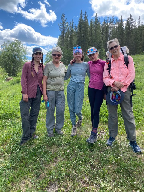
Our cheerful group consisted of two Grannies 70 and 75, two 13 yearolds and one in the middle at 39 years old. The Grannies soon realized that the teenagers had plenty of extra energy which could be put to use carrying some of the groceries.
Heather Ware, Barb Renner, Charlotte Wilson, Aria Renner Grandi, Margaret Gmoser
We had cool temperatures and lots of wind, but blue skies and very few bugs as a result. The flowers were outstanding. One night of hail and snow at High Rock campground made us happy that we had packed an extra layer.
View of The Elevators from the head of Cache Creek
We did a long day from there to the Cataract Creek campsite – not our favourite since it had limited tent sites and was bushy and dark. The trails were in good shape with the usual deadfall. Two dirt bikes had made tracks on a portion of the route where this is discouraged. This was unfortunate since they left quite a mark on the trail. There are so many other places for them to ride.
We shared our last campsite at James Lake with a mystery man who arrived in the dark and left before 6 am – perhaps a keen GDT’er. We wish him luck.
Trail junction with a GDT register box
At the end of the trail we had the lucky coincidence to meet Lani Smith, one of the GDT originators. Our youngsters were impressed that he was headed up Baril Creek on his mountain bike.
We’d like to return in the fall sometime to see all the beautiful larch in full glory.
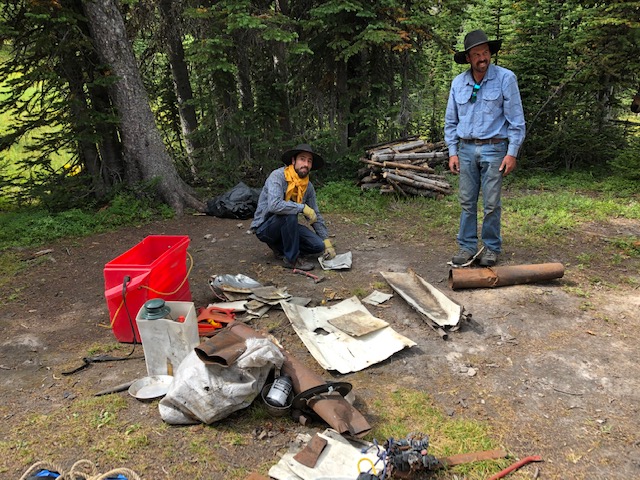
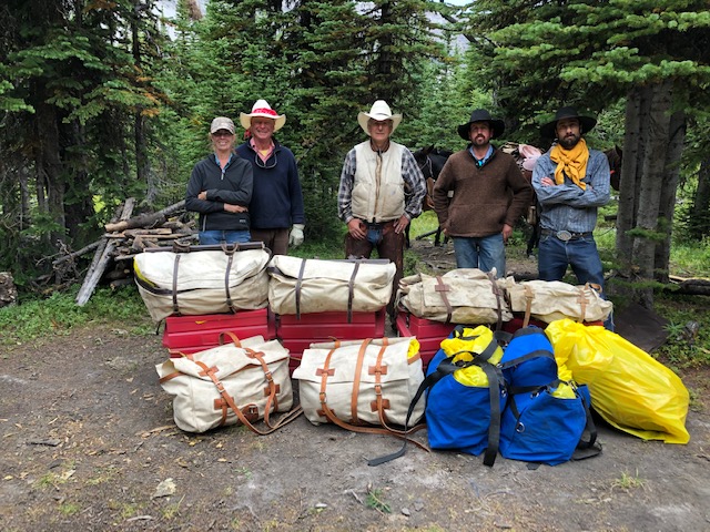
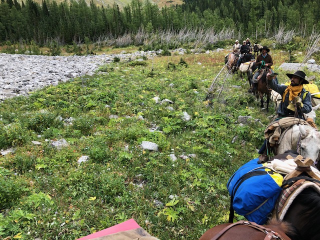
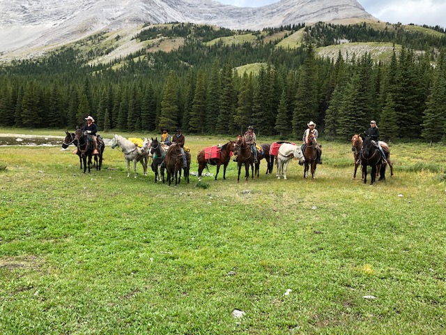
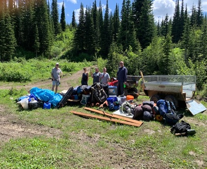
Wendy Ryan is both an avid horseback trail rider and a GDT enthusiast. From Pincher Creek, Wendy has enjoyed time on the GDT over the years, joined the GDTA, and believes in the GDTA’s commitment to preserving, promoting, and maintaining the GDT. She is also interested in horse travel on the GDT. Towards this, last year she and a friend spent time riding their horses in the Beehive area. Among the beauty, they also came across a rather junked-up old outfitters camp at the High Rock GDT campground, a popular camp with hikers despite the heaps of old junk. Wendy wanted to gather up some fellow horse packer friends and clean this mess up. And this summer they did it! Here’s their story…
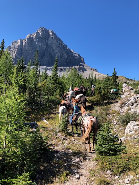
Starting out with ten riders and their horses, eight packhorses, and one mule, we had a successful weekend horse packing up Soda Creek to the Beehive Mountain, and riding along the Great Divide Trail. Not sure when the last horse pack trip would have been up into that area with that number of outdoor horsemen/women, if ever! What a sight 🙂 No trip could be ridden along the GDT without riding into Little Bear Lake, and enjoying the peaceful and beautiful view of our surroundings.
Day 1 – Approaching Beehive MountainDay 1 – Look at all those horses!
Although already mid afternoon, this was our lunch spot. A few keen people wanted to clear the trail for better travel and in not much time that was completed and far more enjoyable to ride. About 1 km in total distance was cleared. Many hands make light work. Memory Lake became our base camp for the three days and two nights, and what a perfect setting. The shallow lake is more of a pond – no more than 30 cm deep, so for our drinking water we walked back south to the headwater creek of the Oldman River.
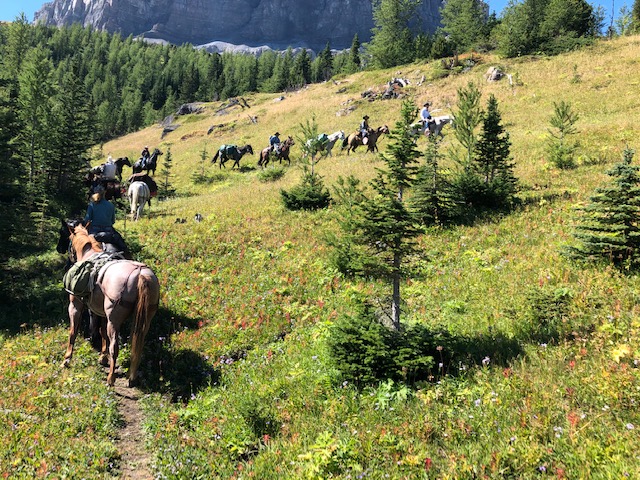
Day 1 – The majestic horse pack train spreads out in the high country under clear blue skies – what a sight!Day 1 – Passing Beehive Mountain, onward to set up base camp at Memory Lake
The next day seven riders headed up the trail onto the Mount Gass old road and the GDT hiking trail to head for the old outfitters camp about 5 km away. Since three people had to leave camp for home, as they had work or other commitments, they left shortly after us, following the main road down to the valley and the vehicles, about a 2.5 hour ride. Unfortunately on the way to the old outfitters camp, one of the main horses became ill. So Mac swapped out riding horses with Wyatt, and then Mac walked the sick horse back to our base camp. It was thought that it could have eaten some of the plentiful Death Camas in the meadow. One section of the trail back to base camp was a bit ugly with a steep down trail, and therefore making for a steep up hill on the way back to join the group headed to the outfitters camp! All went well both ways.
Since last August when James Tweetie and I rode this section, many more trees have come down, and the chainsaw was not taken as the battery packs were not useable! Perhaps another trip to clear the downed trees. Same for the Soda Creek trail to the high GDT trail.
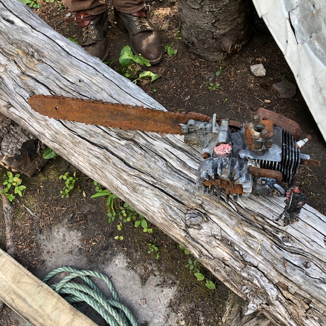
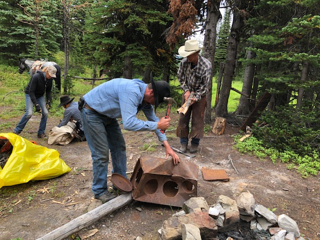
Once we got to High Rock campground (the hiker camp at the old outfitters camp), everyone flew into a flurry of activity. One person took on hand sawing all the old broken corrals up for future firewood. Several others de-nailed the aluminum roofing sheets and folded them so they would fit into the horse pack boxes. The old cache area was cleaned up including large tarps, gas cans, a winter horse blanket, cooking pots, paper plates, a lantern, ripped top garbage bags, aluminum cans uncovered, full food cans, and wire and nails pulled from trees. This was completed in one hour with the six of us. All of this was weighed and balanced into horse pack boxes and canvas bags. 275 pounds of garbage came out back to our base camp at Memory Lake.
Day 2 – Old rusty chain saw, one of the many pieces of junk removedDay 2 – Assessing the situation amid the junk at the old outfitters campDay 2 – Dismantling and cleaning out the old junkDay 2 – Junk all packed up and ready for loading onto the packhorses, 275 lbs of it!Day 2 – All packed up, the junk is on its way out
On the third and final day, with the limited horse power from Memory Lake to horse pack back out, due to everyone’s camp gear needing to go back to the vehicles on everyone’s personal packhorse, only 40 pounds of garbage came out to the valley where the vehicles were, on the only extra packhorse. The sick horse was OK to travel out the last day and finally drank some water.
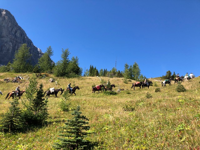
Day 3 – Group shot, horse packers on their main horses, with their pack horses
I had already talked to both Alberta Parks and SRD/Forestry as to what our mission was, and they both wanted to help by bringing the rest of the garbage out with either a quad/side by side, or fly it out. It sounds possible that it will happen in the next 2 weeks (as I write this in early September). I encouraged them to do it ASAP as there was a large grizzly in the area and he/she may rip into the bags and make a mess. (There were the old food cans we chopped open to empty and they had a smell about them!)
All I could find out so far about that old outfitters camp was it belonged to Leverne Blocks of the CNP. He hunted/guided for many years out of there and killed a lot of sheep. The #2 ram came out of Oster Creek, but not sure what year that was, or who the guide or resident was. Perhaps it was one of Bert Riggall’s ‘Three Musketeers‘!? My neighbour said he also used that camp to hunt out of it for game. Pretty sure no one hunts like that anymore in that area with horses. I will keep asking around. Leverne Blocks was killed when he went to light his smoker at home, when it blew up.
The next mission is to find out how much horse camp garbage is at the Hidden Creek GDT campground and go in and clean it up.
If you have any info about these old outfitters/hunting camps or have a copy of the ‘Three Musketeers‘, I would love to hear from you. My email address is wendydav@shaw.caI saw the written story by Bert Riggall at the Whyte Museum, but did not have a copy made. I still could. I checked online with the Willow Valley Trophy Club to see if they had a copy but did not find it. Perhaps someone will know of the story or more on the Beehive area old outfitters camps and hunting. Unfortunately all the old timers are gone!
Each year we recognize the efforts of our volunteers who have gone above and beyond to help us achieve our objectives. This year has been an exceptional year for us on many fronts, and as a result we want to recognize the efforts of these 8 individuals whose hard work and dedication were a big part of our success in 2020:
Jim and Annette Schieck – In recognition of their important contributions to the 2020 GDTA Trail Building Trips. Jim and Annette participated in multiple trail building crews this past year. Whatever job they chose, latrine, water, fire pit etc. they did with great enthusiasm. Jim and Annette were very helpful to others and willing to go above and beyond. Jim’s work as a biologist enabled us to get a bird survey done so that work on Hail Ridge could be completed this summer. Both their knowledge of White Bark pine came in particularly handy on the heavily populated south slope so that we were able to keep our trail work from damaging any of this endangered species.
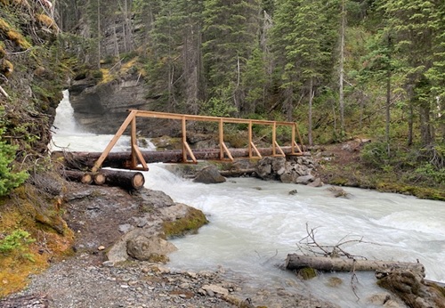
Dave Higgins – In recognition of his leadership and important contributions to the 2020 GDTA Trail Building, Maintenance and Bridge Building Trips. Dave led multiple trail building, trail maintenance and bridge building trips this year. In fact, Dave built not one but two much needed temporary bridges over Cairnes Creek. Dave has been the main person responsible for the rebuild of the David Thompson Heritage Trail and is leading the charge to get a permanent bridge built over Cairnes Creek.
Peter Labastide– In recognition of his leadership and important contributions to the 2020 GDTA Trail Building and Scouting Trips. Peter assisted multiple trail building trips this year. Peter was a major part of the organization of all crews and logistics. Peter took on the role of secretary of the Trail Building and Maintenance Committee (TBMC) very well and has been the lead for budgeting and procurement for the TBMC. He is always available for cleaning and organizing the tools and equipment.
Jud Virtue – In recognition of his leadership and important contributions to the 2020 GDTA Trail Building Trips. Jud was a first time trip leader this year and co-led multiple trips. Without Jud’s volunteering to lead a last minute trip on Section E, we may not have been able to do enough to open the High Rock Trail this summer.
Dan Durston – In recognition of his leadership and important contributions to Improve the Great Divide Trail and Support the GDT Hikers Community. Dan was a trip co-leader this year. He has been the driving force behind the improvements to notorious Section D resulting in a much more desirable hiking experience. Dan has been extremely helpful in planning and giving assistance to any and all aspiring thru hikers. He has made enormous contributions to the GDT community and continued improvements to the trail.
Dave Hockey – In recognition of your leadership and important contributions to 2020 GDTA Trail Building and Scouting Trips and Protecting and Advocating for the Great Divide Trail. Dave was the main person responsible for procuring some major grant money in a year that we thought all grant money was going to dry up. Dave was a leader on the TBMC and trip leader for multiple trips. Dave was the main person responsible for tools and supply storage and procurement for the TBMC. Dave’s incredible work was key to getting the High Rock Trail completed and opened this year despite exceptionally challenging circumstances.
Kathy Plachta – In recognition of her dedication and important contributions to GDTA Membership, Financial Reporting, Outreach and so much more! Kathy has done a superb job in managing GDTA membership and keeping GDTA finances in order over the years. Kathy has served the GDTA faithfully behind the scenes for numerous years and has been integral in maintaining and strengthening the financial health of this organization. In her positions as Treasurer and Co-Treasurer, she was responsible for keeping the books, budgeting, providing financial updates to the Board, updating corporate returns, preparing year-end statements, and administering membership renewals and donations. All of this was done efficiently and to a high standard. Thanks to her work, the GDTA is in an enviable position of being in great financial shape to weather the “COVID-19 storm”.
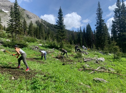
2020 was another great year for trail building and maintenance on the Great Divide Trail. Much thanks has to be given to all those on the GDTA Trail Building and Maintenance Committee(TMBC) who put in an extraordinary amount of work behind the scenes just to be able to safely put together any trips. Planning was ahead of schedule and most of the planned work trips were full by February. Then the country went into lockdown to protect citizens from a worldwide pandemic. It was at this point that all planning was put on hold and work trips were cancelled. There was a suggestion that all work parties for 2020 should remain cancelled. The TBMC worked diligently to come up with a plan to safely have at least a few work parties to get a minimal amount of work and maintenance done. After many hours of planning and strategizing they came up with a plan that would work to enable small groups to at least be able to do a little work on the GDT. In the end, what these small work groups accomplished was amazing. All told there were seven planned, advertised trips and two more unadvertised trips. A total of 57volunteers participated with many helping out on multiple work crews.
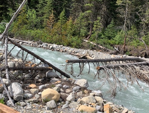
David Thompson Heritage Trail Trip – Cairnes and Lambe Creek Bridges:
It started in late June when a small unit of three volunteers gathered at Cairnes Creek. The goal was to put a temporary bridge across Cairnes Creek (the double log crossing that had sufficed for the last four years had broken over the winter), re–scout the first km of the David Thompson Heritage Trail (which still has flooding problems),perform a minor repair, and strengthen the new hand rail on the Lambe Creek bridge.
The first day the crew cut the old logs and used some reclaimed lumber to make a stable crossing.
Unfortunately two weeks later the creek flooded again and washed this temporary bridge away.
The second day saw the crew make their way eight km up to Lambe Creek to reinforce the handrail on the LambeCreek bridge. Along the way they encountered many winter downed trees across the trail which had to be cut out. They spent a few hours at LambeCreek performing a small repair to the rail and reinforcing it with the two by fours which they had carried in by hand.
On the walk back the crew took notes of the flooded sections still occurring in the first km for future trips.
High Rock Trail – Trip #1
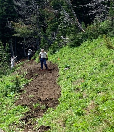
The GDTA official trips started June 24 with a volunteer crew of eight plus another crew of eight from the Outdoor Council of Canada. To safely have this large group, two separate camps had to be set up. Work on section L of the High Rock Trail (HRT) was started with hopes that at the end of four work crews, 700 meters of new tread would be built. This was all that had been cleared with chainsaws previously, and without a bird survey the crews could not chainsaw further up the ridge. Luck would have it that in the Trip #1 crew there was a biologist who would be able to survey the trail all the way to the ridge top. Now a chainsaw crew was able to further clear the rest of the route. What Trip #1 crew lacked in experience, they more than made up for with great enthusiasm, and when the smoke cleared they had built an incredible 1.1 km of new trail.
High Rock Trail – Trip #2
Trip #2 started with wet, miserable weather that would continue the whole five days. This crew dealt with some of the most consistent wet, muddy conditions ever experienced building the HRT. As well, they ran into some major endangered WhitebarkPine stands for which tread had to be gently built around. Trip #2’s tough crew of six built out another incredible 400 meters of new trail.
High Rock Trail – Trip #3
The conditions were not looking too promising for the Trip #3 crew either, as they had to contend with continuing rain for the first day and a half. Thankfully it soon cleared up and became sunny and pleasant for the remainder of their work party. The conditions were better but the terrain proved extremely rough with steep sidehill and lots of roots and rocks to contend with. This very experienced crew built some of the smoothest nicest tread ever, and by the end of their time they had hacked out another 400 meters of new trail.
High Rock Trail – Trips #4, #5, and #6
Trips #4, #5, and #6 were the last scheduled ones for the HRT for 2020, and they mostly ran concurrently. Trip #4 was camped just 1 km off the Atlas Road in section U, and with the help of a crew of Junior Forest Rangers for a day,they were able to finish tread on section U and V, and with the help of the HRT Walking Crew built a set of tricky switchbacks on section W. As well, they built a bridge over a small creek in section U. All in all another fantastic 1 km of tread was completed by this amazing mostly rookie crew.
Trip #5’screw remained camped at the start of section L, and the first day had a really tough 100 meters to complete on a super steep exposed side slope. This was slow tedious work. The second day things got a little easier through a fairly flat forest, and then they broke onto Hail Ridge which was easy – mostly just scratching out a route. Meanwhile a small chainsaw crew had worked down the other side of the ridge into some new regenerated forest. This was two days of really rough chainsaw and brusher work to get a path worked through these close growing small trees.
During the evening of the third night the Trip #6 Walking Crew wandered into Trip #5’s camp. The previous three days for them had been spent marking and mapping trail from the southern start at Allison Creek. Along the way they had built tread, met up and helped Trip #4 crew build switchbacks on section W, and cleared and marked the trail allthe way. This young enthusiastic crew of former GDT thru hikers worked two more days marking and clearing the rest of the High Rock Trail route so that there would be a possibility of making it walkable soon.
Large deadfall cleared by hand
Meanwhile Trip #5 had crossed the ridge, and by utilizing an old horse packers trail,they were making rapid progress to the end of Section J. The last day saw them work into the regenerated forest area where the forward chainsaw crew was still hacking away. All in all, this incredible crew had built another 1.2 km of trail. They did this with the help of an easy ridge and horse packers trail in the middle.
So the High Rock Trips were supposedly done, resulting in an incredible 4 km of new tread built, as well as being completely cleared, marked, and mapped.
Lost Creek Trip
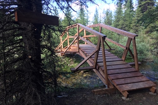
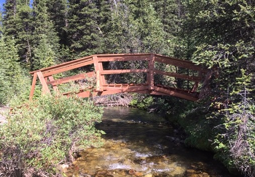
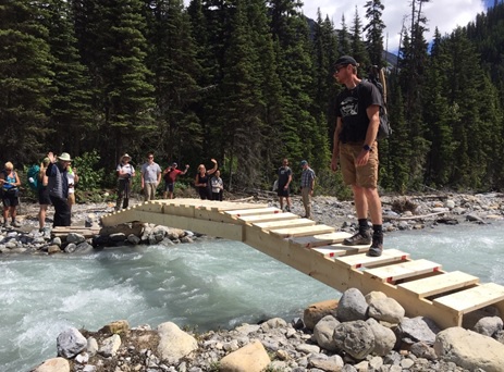
Late July saw the largest GDTA contingent of twelve working in two teams at Lost Creek. Team #1 worked to complete work started last year rebuilding the tread on the Lost Creek Trail. Team #2 was tasked with building a new bridge over Lost Creek. The weather cooperated and both teams completed their tasks to extremely high standards.
New Lost Creek bridge
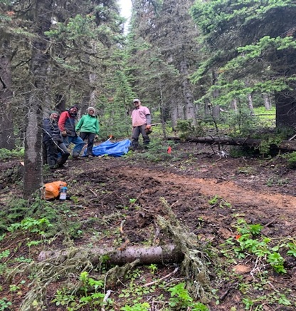
High Rock Trail – Trip #7
When the Walking Crew’s report came in, it was felt that the entire HRT was “almost Walkable”. The only really tricky part was a 1 km section at the top of Section E which was deemed too hard to follow. A decision was made to see if it was possible to get a last minute volunteer crew put together to take care of the impassible kilometer. The call went out and five veterans and one rookie answered.
The newly made up High Rock crew was designated as Trip #7, and included five fairly experienced trail builders and one rookie. They worked during the hottest period of the summer. This enthusiastic crew right away had some decision making as the marked trail was confusing. Working on some difficult side slope off the bat, they had to contend with stacking some switchbacks where none looked possible. Slowly, for the first three days they built the new tread. Each day had a bonus as GDT thru hikers started passing them, showing that the High Rock Trail was being utilized.The last day was the most difficult terrain as it hadn’t been properly cleared or brushed. Building good tread on this last bit would normally take a fairly large crew one full trip. The issue was that this was the critical area that hikers could not follow unless there was some sort of a path. Digging deep, the five remaining trail builders determined they could at least make something followable and semi-walkable. What they accomplished was an extraordinary, very walkable path.Another 1 km of tread had been built and on July 24, the new High Rock Trail officially opened for business!
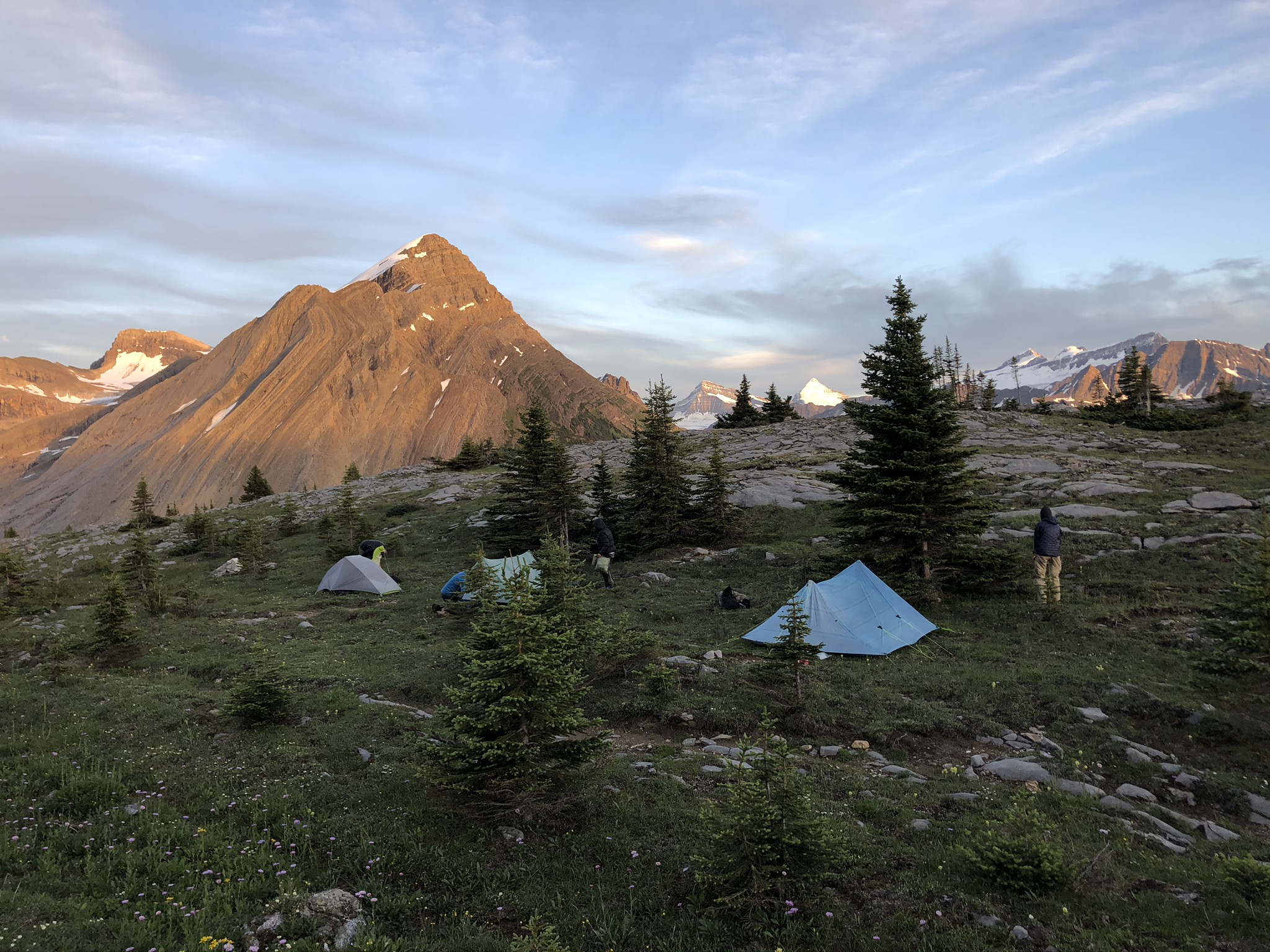
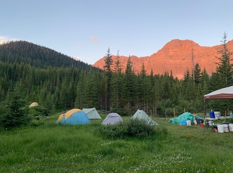
Sunset on the GDTA basecamp
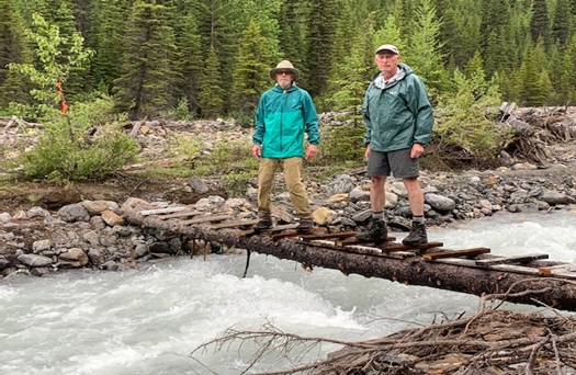
Cairnes Creek Bridge Trip (yes, again…)
Meanwhile an informal crew of six or so had come together mid July to cobble together another temporary crossing of troublesome Cairnes Creek, so that this year’s hikers might have a safe crossing.
New temporary Cairnes Creek bridge
Late Season Scouting Trips
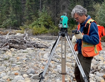
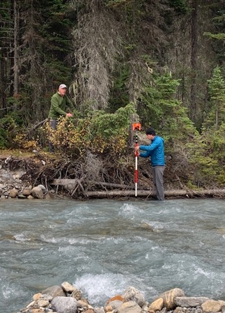
This should have been the end of the story except that there was still work to do so that preparations could be made for work in 2021. In mid September, a small crew got together again at Cairnes Creek to survey for a new permanent bridge, come up with solutions to mitigate future flooding on the first 1 km of the DTHT, and survey the new possible future route across Amiskwi Ridge and Collie Creek on the eastside of the Blaeberry River.
Surveying for a new bridge over Cairnes Creek
Additionally, scouting has taken place in early October for next year’s work on the HRT sections M,N, and O. Lots to look forward to!
Thank you to all
Many thanks to all of this year’s trail building crews, as well as the people behind the scenes putting everything together.
Thanks also go out to our sponsors and partnerswhose generosity has greatly enhanced our trail building and maintenance capabilities – They include Alberta Equestrian Federation, Alberta Environment and Park, BC Rec Sites and Trails, The North Face, MEC, Teck, Stihl, and Columbia Basin Trust.
By Brad Vaillancourt, President of the Great Divide Trail Association
To call 2020 a historic year feels like an understatement. 2020 has been one the most unusual, most challenging, most stressfulyears ever… and yet unexpectedly,2020 has also been one of the GDTA’s most successful years ever. Early in the year while the world was shutting down to deal with the growing pandemic, the Great Divide Trail Association was considering what was best for the health and safety of the trail community that we served. In March, the GDTA cancelled all in-person events, activities, and meetings, including all trail building trips. Our Outreach Committee had been poised to host a number of exciting events, but chose to cancel them before they were cancelled by health restrictions. We are hopeful we will be able to provide new outreach opportunities for the GDT Community in 2021.
But the lockdown didn’t stop us from continuing to work behind the scenes. The GDTA Board and committees started meeting virtually every month, ensuring the GDTA would be prepared when the world moved into the next phases of living with COVID-19.
Thanks to the huge amount of work by Mary Jane and our Ensuring Financial Capacity Committee, on April 1, the Great Divide Trail Association obtained Charitable status. This means that the GDTA can now issue official tax receipts for charitable donations. This is a big step for us and we quickly set up a system to accept online donations and administration of charitable receipts through Canada Helps. Even in this time of pandemic, we have received a steady number of donations from generous supporters. These donations have become especially important as many of our past grant providers and sponsors halted their grant programs and support in 2020. We want to thank all of our supporters for their past and ongoing support, we couldn’t do the work we do without you. A good example of this is the Alberta Equestrian Federation which generously awarded us an $8,000 grant to go toward our trail building activities this past summer.
Other GDTA committees continued to work hard behind the scenes in 2020, including our Organizational Excellence Committee, organizing a Board of Directors Strategy Session, developing policies and organizational improvements to create a more robust and nimble organization enabling the GDTA to better navigate this new challenging environment.
Meanwhile, our Protecting and Advocating for the Trail Committee worked hard to get and keep the GDT on the map by representing the GDTA on the Livingstone Porcupine Hills Castle Recreation Advisory group, working with CPAWS and Alberta Hiking Association to start a Crowsnest Coal working group, and attending Spray Lakes Sawmills Forest Management Plan reviews for the new 5 year operating plan.
Our Trail Building & Maintenance Committeeand Safety Committee refused to give up hope of a trail building season and worked quickly to develop a modified plan that adhered to public health restrictions and guidelines. In June, as provincial and national parks re-opened, we announced a new schedule of modified trail building & maintenance trips and put out a call for volunteers, not knowing if anyone would be comfortable coming out to build trail under the pandemic conditions.
The volunteer response was incredible, showing us that people were looking for opportunities to leave their pandemic lockdowns, get out in nature and build some trail. Like last year, we hired a Trip Coordinator which proved invaluable with very short timelines and challenging logistics due to the modified pandemic trip plans. Against the odds, by mid June we had volunteer crews out on the High Rock Trail, working hard to attempt to complete enough trail construction so that we could open the new High Rock Trail this summer, something we thought would be impossible only a few months ago.
As you may know, we started construction of the High Rock Trail in 2016, as the first new section of GDT built in more than 30 years. 5 years, dozens of trail building trips and hundreds of volunteer hours later, we celebrated the soft opening of the 45 km High Rock Trail on July 24 and saw the first thru-hikers on the new trail only days later. While the trail isn’t actually 100% complete yet, it is completely hikeable and totally awesome.
In total, we did 7 trail building trips on the High Rock Trail this summer, 1 trip on the Original GDT, and 3 trips to the Blaeberry, with almost 100 individuals volunteering over a span of 50 days on the Great Divide this summer, including groups from the Junior Forest Rangers and the Outdoor Council of Canada. And all of this done under pandemic restrictions without a single incident, other than maybe a blister or two.
Only a few months ago, as the world locked down, it looked like there wouldn’t be a hiking season this summer. But as things opened up, people quickly began looking for opportunities to staying active in the outdoors as an excellent way to keep their bodies and minds healthy. To limit the potential transmission of the virus between GDT hikers and others, the GDTA encouraged hikers to be self-supported on GDT outings, stay local, bring everything they need, avoid side trips from the trail to resupply, and always Leave No Trace.
While it may not have been quite as busy as previous years, day hikers, weekend hikers and thru-hikers were on the GDT in large numbers this summer, and for the most part, everyone did their part observing 2-metre physical distancing on the trail and minimizing interaction with people in communities along the GDT.Thank you to all GDT hikers for being responsible and taking precautions to keep yourself and others safe out there. While we don’t know what next year will look like, we feel confident that we can continue to adapt to ensure the health and safety of the trail community that we serve.
At last year’s AGM, we said thank you and farewell to four board members Barb Lauer, Darrell Aunger, Jean-Francois Cianci and Dave Hockey. We welcomedtwo new board members asChase Holthe and Robert MacLaine joined our existing board of directors, Jeff Gruttz, Deb Yanchula, Mary Jane Kreisel, Doug Borthwick and me. Later in the year, we welcomed three ex officio board members Donna Rutherford, Doug Whiteside and Peter Claghorn, who put their names forward for election at the AGM. I would like to personally thank each of the directors and ex officio board members for all the work they have done to not only allow the GDTA to operate successfully during the pandemic, but also make some significant improvements along the way. It has not been easy, but everyone has pitched in to move the organization forward.
And finally, I wish to extend my sincere thanks to the life blood of our organization, our dedicated volunteers. The Great Divide Trail Association is a membership organization built by the support of people like you. Your hard work and positive energy are what keep us doing this every year and were a huge part of what made 2020 such a success.