Category: Pathfinder

  • Preparing for the Great Divide Trail

    Preparing for the Great Divide Trail

    by Austin Hager

    Wow, was I shocked at how much prep is required for a Great Divide Trail thru-hike.  Still more than a month away from my start date, and I have put in well over 100 hours of preparation.  Between my partner Tanya and I sharing the load, it has been a part-time job for weeks.  This is our first thru-hike which probably means there is quite a bit of overthinking and uncertainty in the choices we are making in our preparation.  Thankfully all of this prep will lead to an experience of a lifetime and I am so fortunate we are in a position to take such a challenge and run with it.  All of this prep can be broken down into 5 boxes, and it feels REALLY good to check them off, knowing we can put more time into the remaining areas of our hike.  There are 5 main things to prepare for: permits, food/resupply, gear, training, and finding an inner purpose for hiking the trail.

    Permits
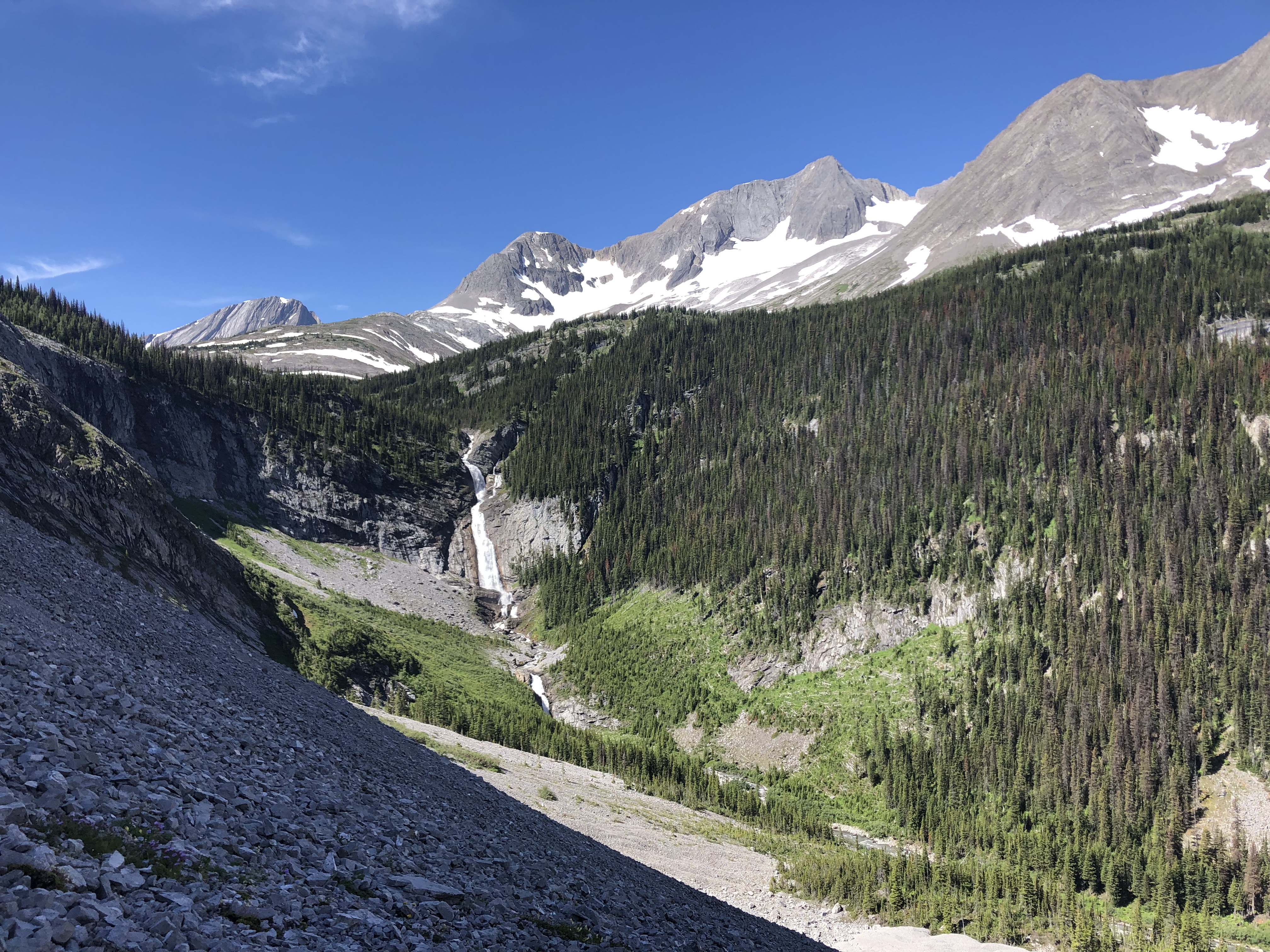
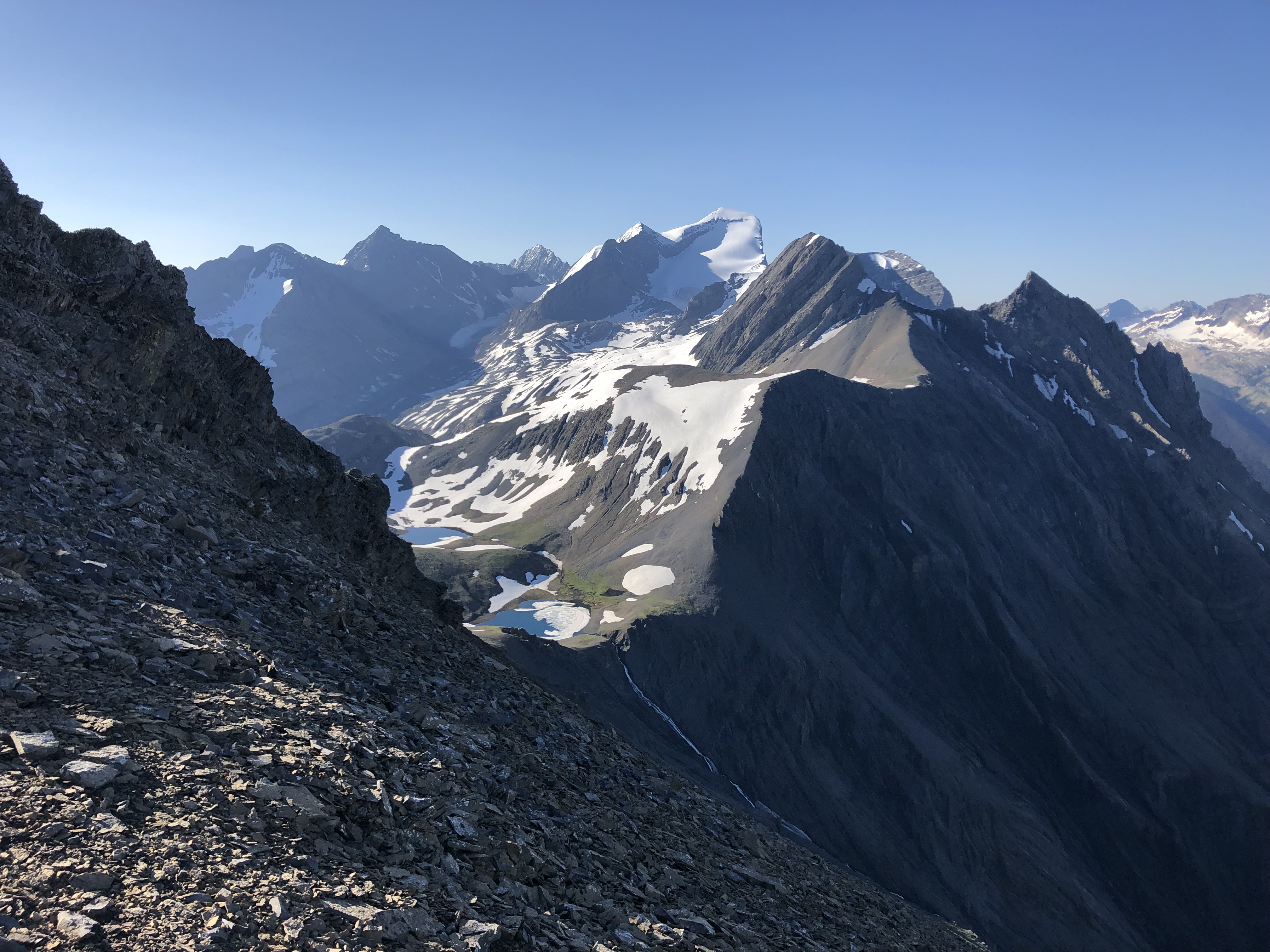
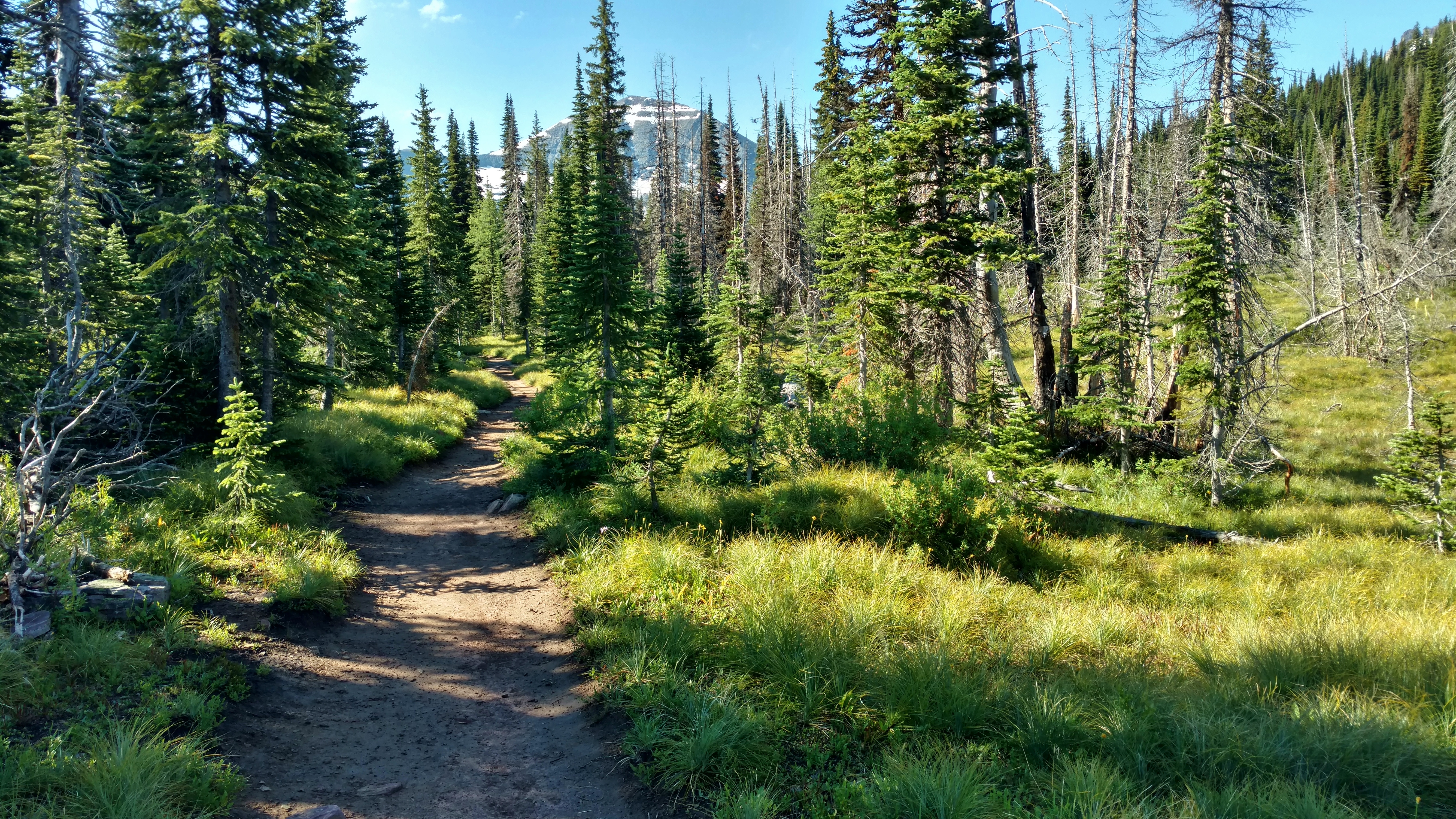
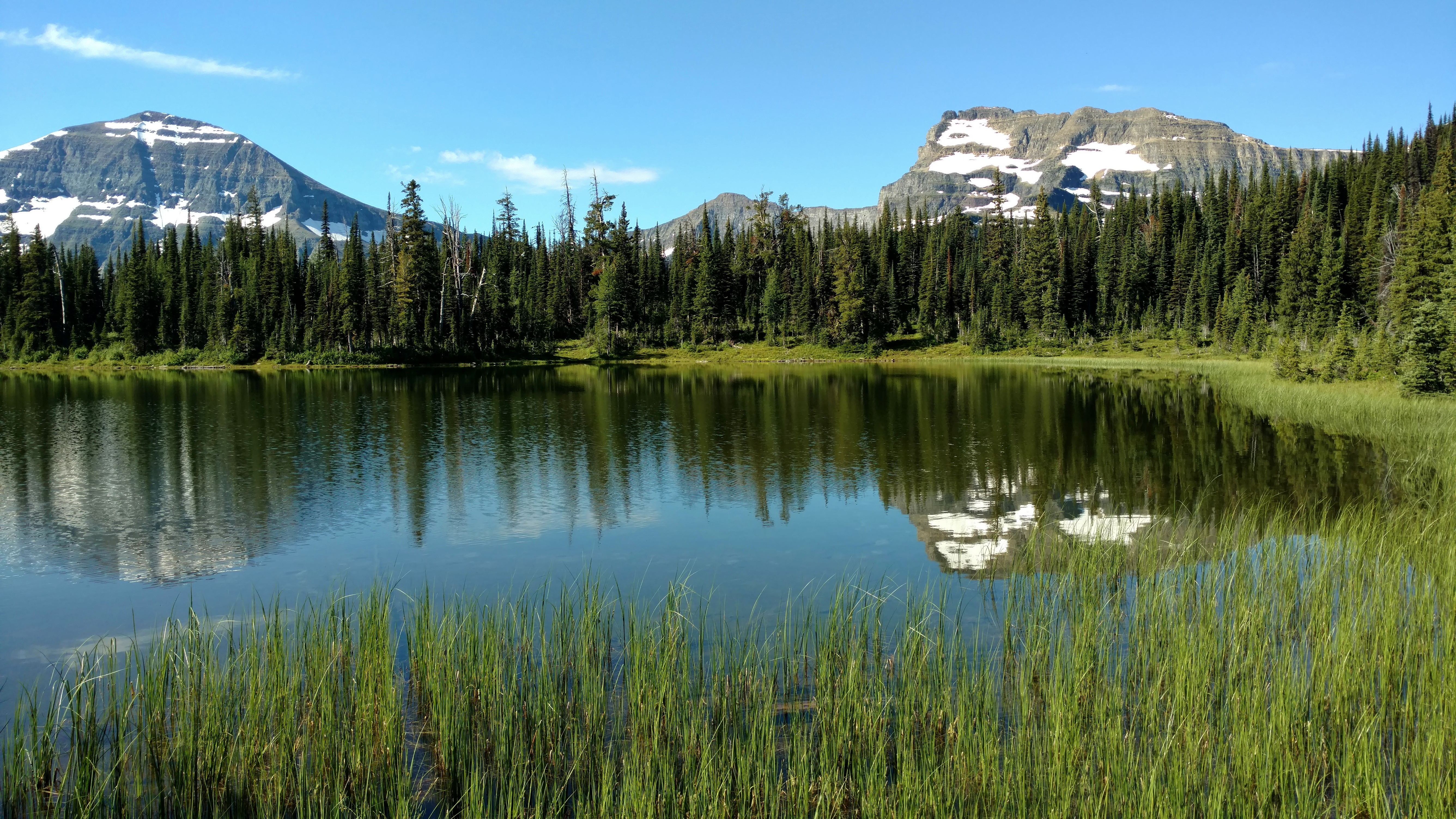
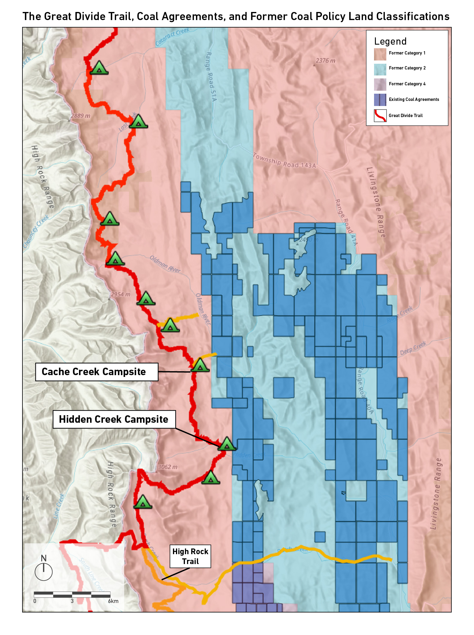
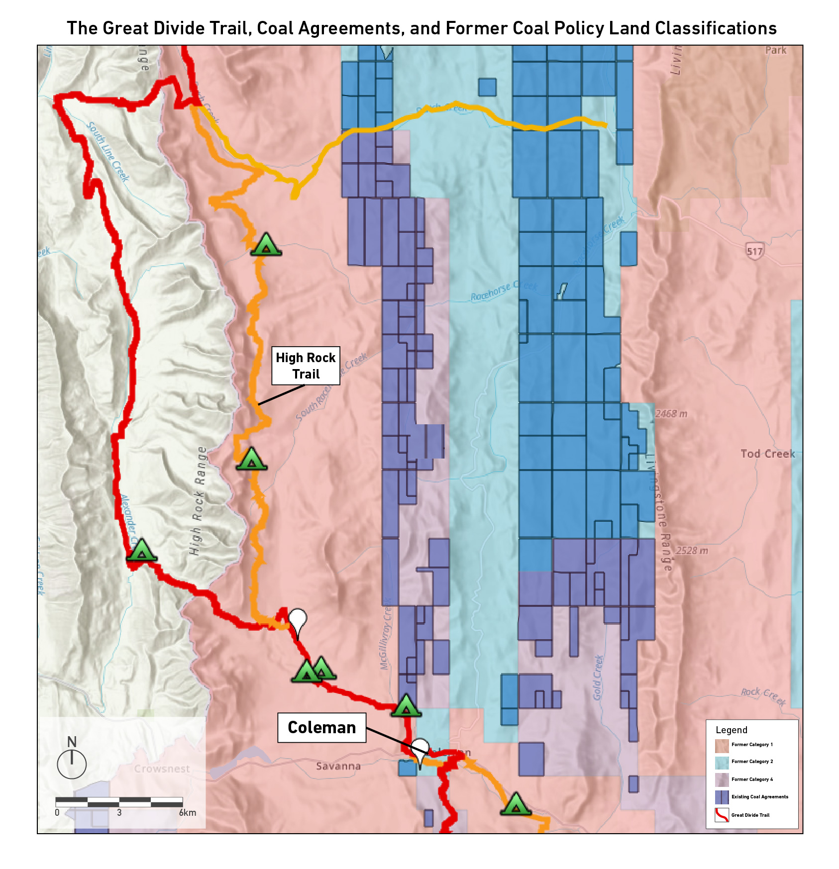
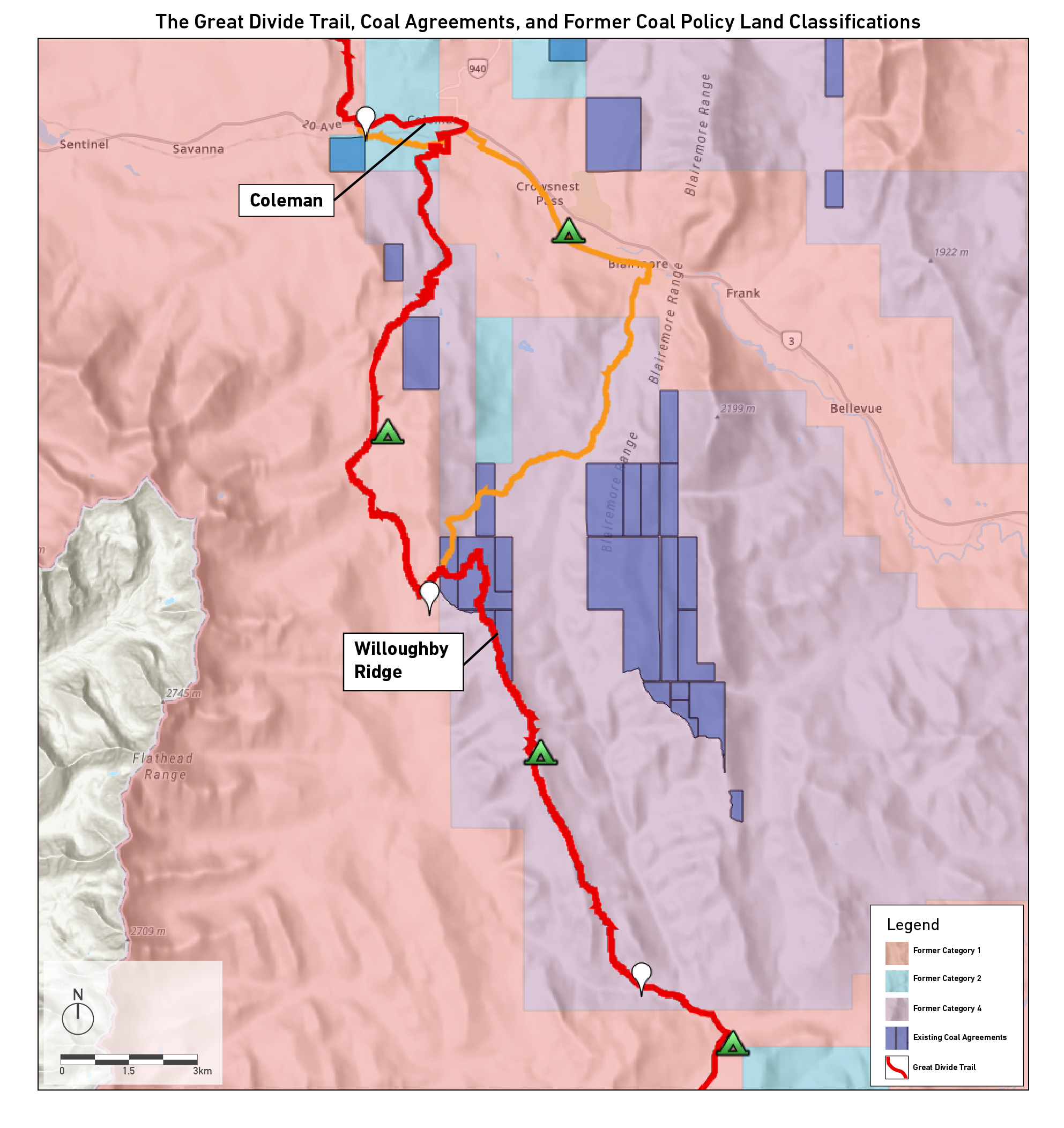
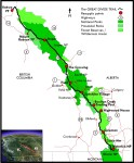
    The permit system for the GDT seems to have grown into one of the largest grumbles for hopeful GDT hikers.  With an average duration of about 50 days on trail there are a lot of campsites to book, with most of them seeming to have a unique way of booking them.  Since the trail passes through 5 National Parks and 8 Provincial Parks (in addition to several other park-like jurisdictions) there are so many different bookings to make.

    My permit experience was frantic to say the least.  When Parks Canada released all the backcountry sites for Kootenay, Banff, Yoho, Lake Louise, and Jasper on the same day it was all hands on deck.  Of our 46 nights on trail, 12 of them needed to be booked on April 16th when the reservations were released.  With over 25% of our hike at the mercy of Parks Canada’s booking system it felt like a make-or-break moment for the hike.  So many of the campsites we needed to book are on some of Canada’s most prestigious and desirable trails.  If we were unable to book certain campsites it would put us in a dilemma: do we hike anyway and knowingly camp without a permit?  Additionally, if we have to adjust some days it could potentially throw off our entire plan for things we already have booked like accommodation for our zero days or other campsites already secured.

    With 6 devices all waiting the morning of April 16th we saw immediately how many people were ready to go camping this summer.  With events cancelled, it looks like it’s going to be another Covid summer and people are ready to spend some time outside.  Between our 6 devices we had one spot in the queue system at around 9000, the others ranged between 15,000-30,000.  We created a list of the highest priority campsites to the lowest, so we could tackle the premier sites like Floe Lake right off the bat and theoretically adjust from there.  When we logged on the system was very bogged down, with tens of thousands of people trying to book all sites across the Rockies it reminded me of Burning Man tickets going on sale to the whole world at once.  With Floe Lake and Mary Schaffer in our basket the system went from bogged down to incapacitated.  Time to secure these bookings before all was lost.  After praying we could reach the checkout page we managed to secure 2… 10 more to go..  Unfortunately we did not realize that once you click “checkout” you are put back into the queue system.  By this point another device had reached the bookings page but the website was unusable.  I should mention that during this time we were calling the Parks Canada phone number on repeat for well over an hour, always resulting in a busy signal.  The website had stopped working and the phone lines were down.  My partner had already asked for 8 weeks off and I had planned on ending work mid-June.  Our life plan was at the mercy of this system that was failing to meet the demand of thousands of hopeful hikers.

    The Great Divide Trail Hikers Facebook page was our savior.  Countless posts about not being able to book anything through the website, downed phone lines and frustration.  Some GDT hikers had mentioned that if you called the park directly they could book your sites over the phone.  Meanwhile, the website had become an agonizing 3-page loop.  Click the park you want to book, wait a couple minutes, click the access point, wait a couple minutes, click the campsite and then it would timeout.  Restart this procedure and repeat for the following 8 hours.  The parks office seemed like the only available option.  I called Jasper, Banff and Lake Louise and left messages at the backcountry office.  At this point I had fully left my fate up to a voicemail.  In an age of texting, I can’t remember the last time I left a voicemail let alone received a call back.  After a few hours of clicking through the same 3-page procedure I received a call from the Lake Louise office! They were able to book Kootenay, Banff and Yoho for me.  With only some minor changes to our plan.  They weren’t able to book Jasper for me but now we had 8 of the 12 sites booked.

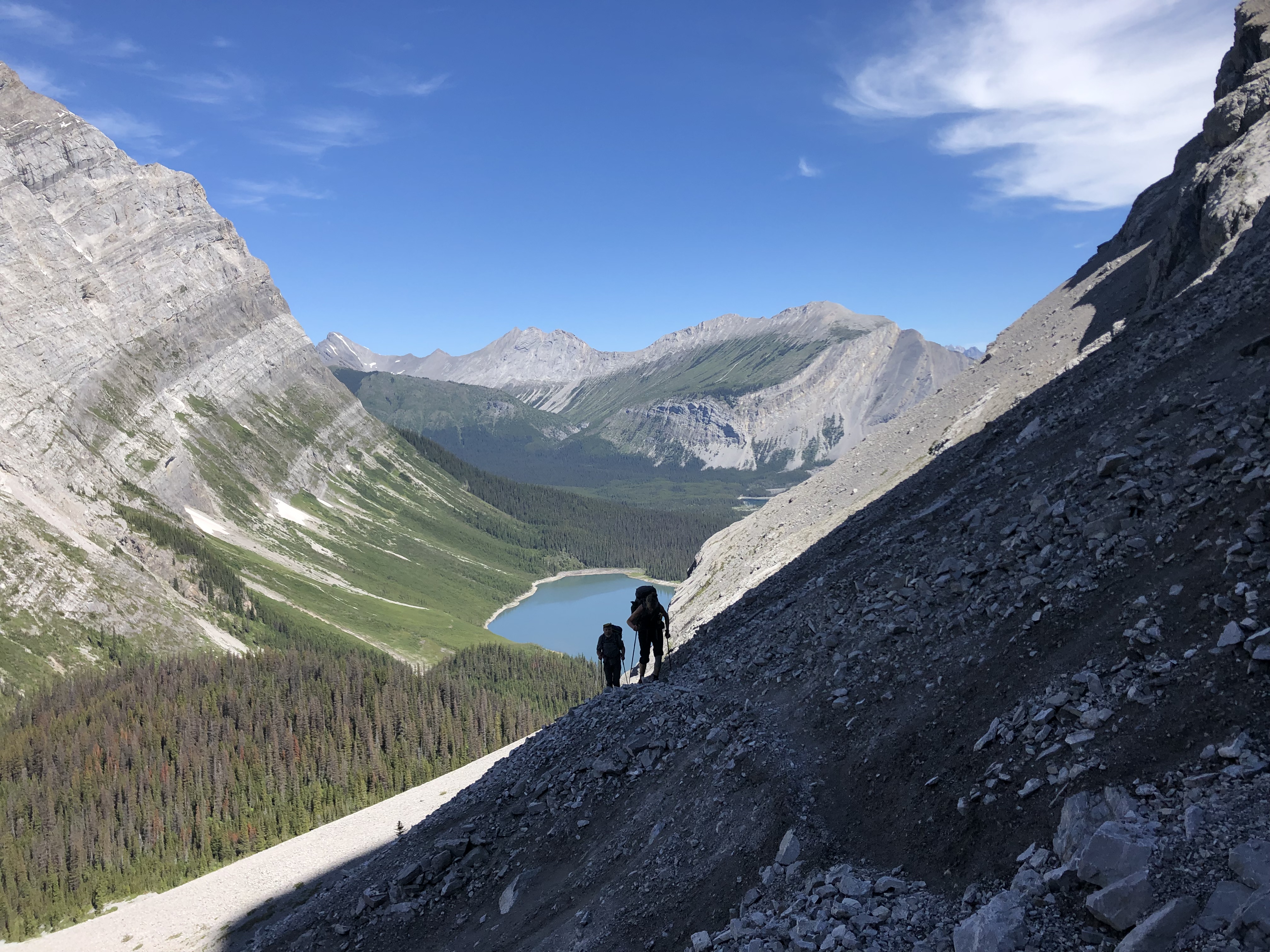
    After a few more hours (about 7 after we initially started) the park’s site was slowly coming back to life.  If I selected one night at a time and didn’t try to link them I could successfully add them to the cart.  By hour 8 I had finally secured 3 more sites, one site was fully booked and with the other 11 already booked it was impossible to change our plan.  Skyline Trail in a day was our fate.  Not an ungodly distance but 53km is still a big day, in fact our biggest day on the whole trail.  In contrast to other trails with less bookings I was looking forward to a big day.  Through booking the GDT sites everything has to be calculated, there isn’t really an option to go for the 24-hour challenge and see how many KMs I can hike.  So having a big day, particularly at the end of a section was a challenge I was looking for.

    The remaining bookings we have are for provincial parks and aren’t nearly as stressful.  There are more alternate options, and with the Parks Canada sites locked down, what briefly felt like uncertainty is now a firm plan.  8 hours of looking at a screen timing out is plenty of time to question whether this trip is going to even happen.  Thankfully, persistence and help from the GDT community made my permit experience troubling but we prevailed!

    Food/Resupply
    The next big chunk of preparation that will likely be the last to finish is our resupplying plan and our food situation.  I have hiked quite a bit but never tackled a thru-hike.  My longest hike was last September when we did a large chunk of Section E, from Saskatchewan Crossing to Poboktan Creek.  About 100km over 4 days.  I have heard of hiker hunger and have experienced increased appetite but I know my hunger level will grow beyond what I have ever known.  Planning for this is planning for the unknown. How much food will I want?  Will I get sick of the foot I pack?  With few options to fully resupply on trail I won’t be able to vastly overhaul my food plan.  I am stuck with my choices for nearly the entire hike.

    In addition to preparing our food we also need to mail our boxes to the resupply points along the trail.  Queue overthinking.  With a box filled with food sitting for a few weeks there are so many things that could happen.  It could get lost, get eaten (by humans or other animals), we could potentially need a piece of gear or knowingly be short on food for the upcoming section.  Currently, we are planning for 3000 calories per day in the first section and then 4000 for the rest of the trail.  With another pair of shoes at Saskatchewan Crossing or Lake Louise and a few more pairs of socks.  My naivety is driving me crazy, knowing that after the hike is done future thru-hikes will hopefully be that much easier on the mind.

    For our food, we were recently gifted a dehydrator. Currently on a crash course on meal prepping we have tried a few meals at home and were very surprised at how good they were.  Albeit, it did take a few tries to nail down the proportions (usually we just needed to double or triple the spices).  The current plan is to have 4 different dinners: beans and rice, marinara pasta, mac n’ cheese and chili.  We will also be carrying 2-4tbsp per day of olive oil to get an easy few hundred calories.

    1. Beans and Rice: Quite possibly the most famous DIY backpacking meal thanks to Andrew Skurka.  We found some dehydrated black bean flakes from OM Foods in Nelson, BC. Which happens to be our new home come August.  The rest of the recipe is super easy- instant rice, taco seasoning (bulk barn!), and some dehydrated bell peppers and corn.
    2. Marinara Pasta: We made a massive batch of marinara sauce and went overkill on the spices.  A shortage of flavour wasn’t a problem I was willing to risk.  For the pasta we are using orzo, it’s the most dense since there isn’t really any air or wasted space.  Cooking the pasta and dehydrating it makes the rehydrating process much shorter.  We also found 2kg packs of extra-lean ground beef at Wholesale Club.  We cooked it until it was very well done and then dehydrated it.  Once dehydrated and a very unappetizing consistency resembling dog food we crushed it up so it broke down into rice sized pieces.  The marinara sauce turns to a fruit-leather like consistency and rehydrates extremely well.  With some olive oil and parmesan this thing is a calorie bomb!
    3. Mac n’ Cheese: Cheese holds a special place in my heart, particularly after a big day.  As we did with the orzo, we cooked the macaroni first and then dehydrated it again.  The cheese powder we got from Bulk Barn.  We are adding some dehydrated peas for a bit of something green.  Lastly we bought a bunch of ham lunch meat, after finding some big pieces on sale we have moved to buying it pre-sliced to save some time and for better consistency.  Then cut it up into about 1cm square slices and dehydrate it.  A friendly tip- we have been vacuum sealing all of our food.  The ham is very pointy and has punctured the bag several times, we have been double vacuum sealing it and haven’t had a broken bag yet.
    4. Chili: The chili recipe came out of a bit of an experiment.  I made some chili a few weeks ago and was curious about how it would be dehydrated.  All part of our crash course on dehydrating.  I just threw it in and dehydrated the crap out of it.  I poured some boiling water on it a few days later and it came out almost identical to the initial chili!

    For breakfast I will be eating a bigger bar like a ProBar or Hornby Organic bar and I am bringing a breakfast protein shake powder to get a few more nutrients.  Tanya is going to eat granola and might bring instant coffee.

    For lunch we are planning to do a mix of quite a few things.  Previously on hikes we would bring summer sausage, Babybel cheese, and some nice crackers.  But with the resupply box being mailed weeks before we arrive sausage is out of the question.  Instead we made a big batch of hummus (with low oil) and dehydrated it, it becomes a bit like a dry, grainy dough.  We can rehydrate and add the oil on trail.  We are also buying 400 bars.  It is going to be a small fortune but I am a big fan of eating lunch while walking, or at least decreasing prep time for lunch.  The stove will only be coming out for dinner.  Hopefully this plan will work or we will have to adjust on trail with the little options we have.

    Gear. Gear. Gear.
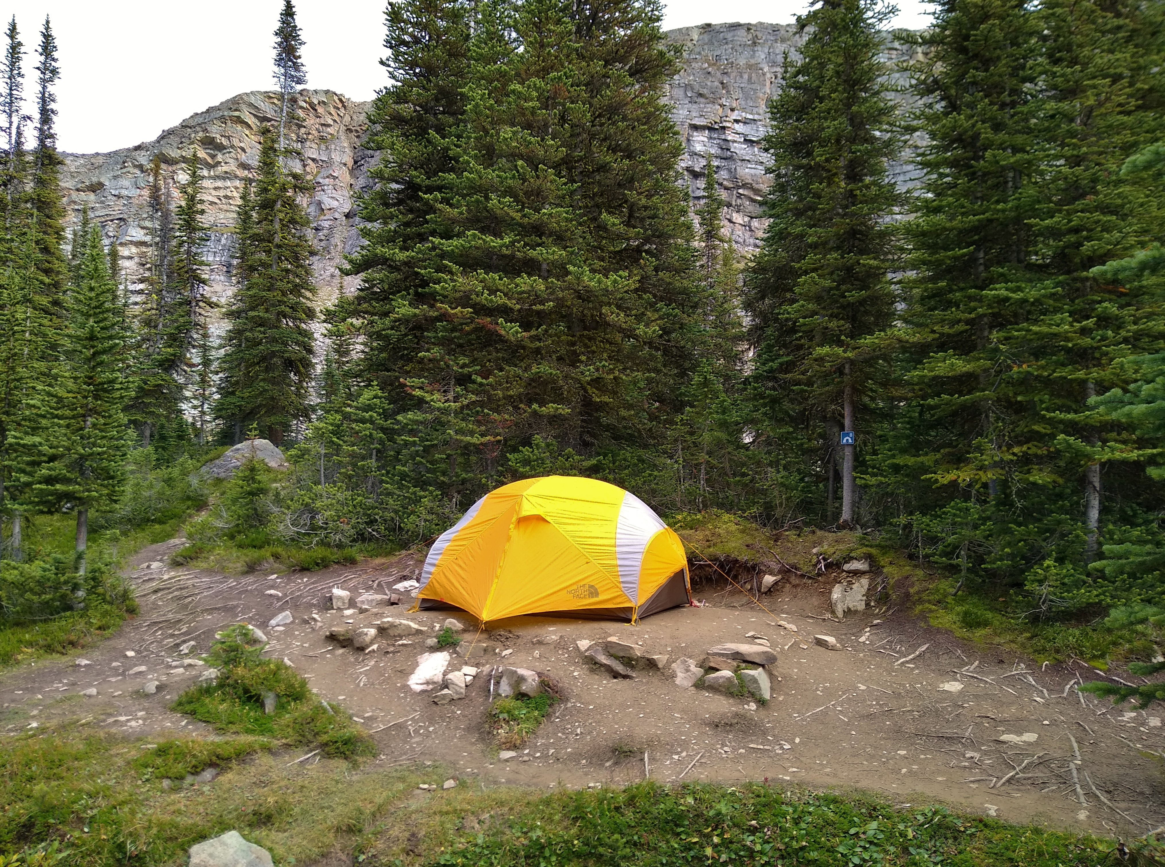
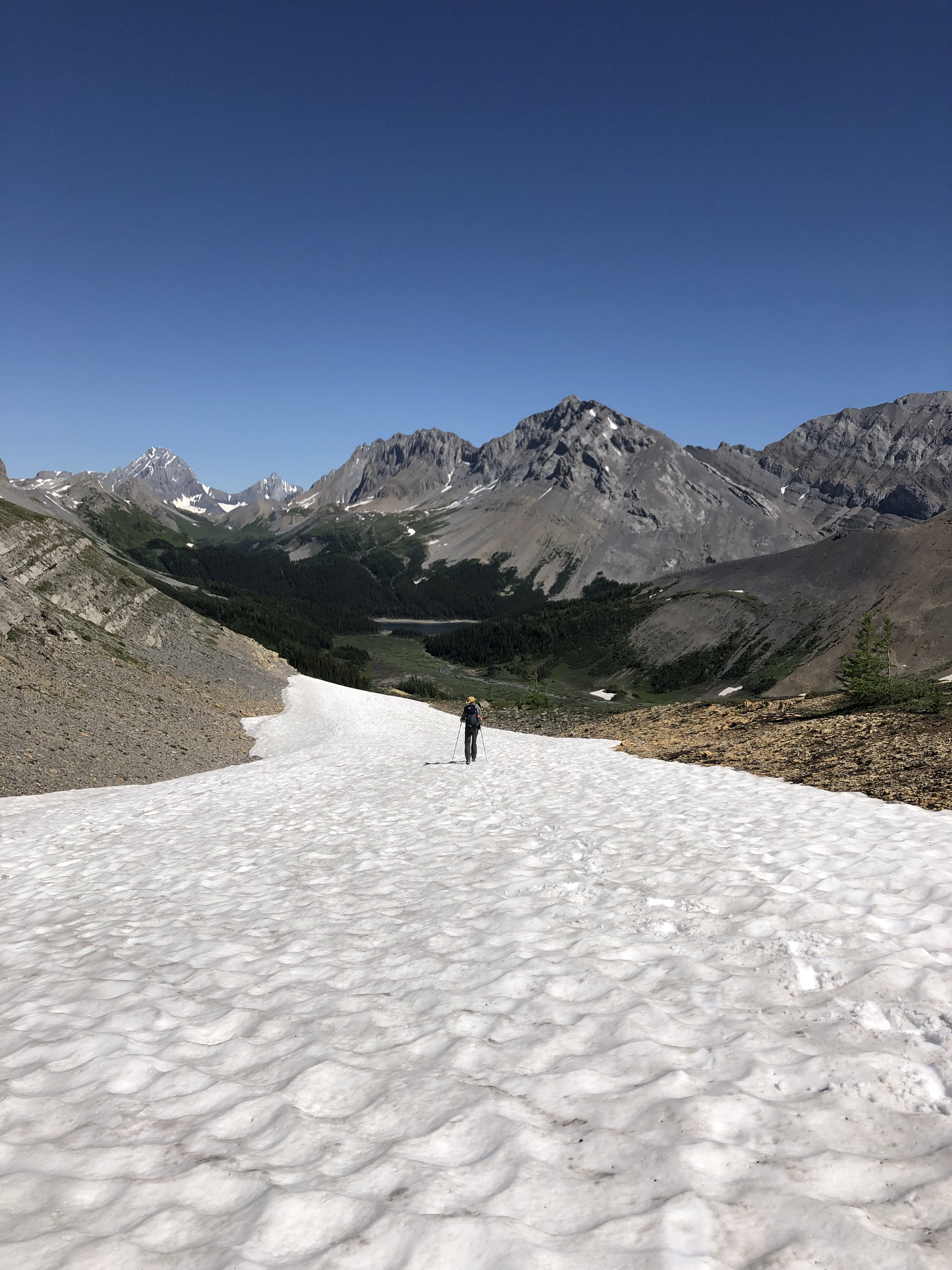
    Living in the mountains for almost 2 months requires a certain level of gear to maintain sanity.  Fortunately some of the big purchases have been made in years past.  Tent, pad, stove, and most clothing has already been used and tested to make sure it works for us.  As I have found in the past, just because something is top-rated or it works for someone else does NOT mean that it works for everyone.  I am currently waiting for a new pack to arrive, I have smaller frameless packs for quick weekend trips and larger packs for 5+ days.  However, for the GDT I upgraded to a quilt and am not bringing some luxury items I have brought on other trips.  Now that larger pack is a bit too big.  Queue overthinking.  We are combining Section F and G with a planned duration of 10 or 11 nights, dependent on weather for the Perseverance Alternate.  I have never even come close to carrying that much food so understanding how much room I need in my pack is merely guesswork.  Given my hiker hunger at that point I feel like any estimate at this point will be so far off it is pointless.  Needless to say I agonized over pack size for weeks before finally pulling the trigger.

    As the GDT is substantially more remote and less travelled than the PCT, CDT or AT gear recommendations are much harder to come by.  This was a particular hurdle I hadn’t really thought about before.  I couldn’t read through 100 different gear lists to see what the common items were, nor does HalfwayAnywhere publish info on the GDT.  Thankfully the GDTA had a webinar with gear, I really appreciated that they had 3 distinct philosophies behind pack weight: traditional, lightweight and ultralight.  I find I am somewhere between ultralight on weekend trips to lightweight for this thru-hike.  I did have to purchase several new things specific to the GDT, rain pants in particular.  With shorter hikes “dealing with it” is a viable option.  “Dealing with it” means something different when you are hiking for weeks on end and don’t have the ability to reassess or alter the plan.  With such a long hike and so much unknown I find I am packing for my fears a lot more than normal.  While there are some things I could get to shave some grams I have finally reached a point where I think it is good enough and will definitely suffice.  The only problem I think I will have is that I will have too many warm clothes at the expense of a few ounces.

    Training
    The first 3 aspects of preparation seem to be more specific to the Great Divide Trail.  The remaining 2 are more straightforward and are required for any physically motivated goal. Training being the first.  Until the GDT I had never trained for anything, with the exception of sports teams in high school.  In the past decade my idea of training has been the Nike slogan, “Just Do It”.  No matter the sport or activity, my idea of training was just going out and doing what I wanted to do.  Outside of hiking my life is filled with climbing in the shoulder seasons and snowboarding in the winter.  There isn’t usually a lapse between most of these sports so I don’t usually find the time or the need to go out and train specifically for the next season.  All of this changed for the GDT.

    With such a big event looming I want to do everything I can to reduce any possible problems.  The risk of a physical issue on trail can be decreased through proper training.  With the snowline relatively low still training has to look a bit different than going out on big multi-day hikes.  I also have recently started developing a bit of patellar tendinosis which is queuing the overthinking yet again.  I went to see a physio preemptively to let them know what I was going to do and ask how I could best prepare my body.  My training has involved several kinds of squats and stretches for the lower body.  For the upper body I have mostly just stuck with climbing (which also includes hiking with a weighted pack to the crag).  Every week I am also trying to hike 10km twice with about 500m gain.  I will slowly be ramping up these distances over the month.  Part of these hikes will also be working towards hiking 2000km in 2021 which I will talk about in the final section.  My goal is to hike 400km before starting the GDT.  Starting the trail in decent shape will hopefully fend off any injuries and I will have muscles ready to tackle big alpine days.

    Finding My Purpose
    The final area of preparation for my Great Divide Trail thru-hike was the first part of my decision to hike the trail; finding my purpose.  I know I need an answer to why I am hiking the trail.  When it’s the third day of rain/snow mix and everything hurts I need to be able to answer the question with a meaningful answer.

    About a year and a half ago I lost someone very dear to me, she took her own life.  I had never lost anyone that fundamental to my life, nor had I ever lost anyone to suicide.  Her and I both found our love of hiking together and I want to honor her life and celebrate our chapter together while on the GDT.  Had it not been for her I don’t know if I ever would have ventured into the realm of backpacking in the same way, nor would I have had those foundational moments spent in the mountains.

    The road through grief is long but creating a plan has been extremely helpful.  It also made me think about the thousands of Canadians that take their own life every year, and how we need to do what we can to help.  I started a fundraiser, Hike4Hope.ca with a goal of hiking 2000km in 2021.  All of the funds raised will go to the Canadian Association for Suicide Prevention.  My goal is $10,000, and I am already over 40% of the way.  I have been working with CASP directly and they have been extremely supportive through the whole process and are cheering me on.  I now have over 40 people pledged and feel the support behind me.  I truly hope that this can be a small shift towards reframing and destigmatizing suicide and starting conversations around mental health.  CASP has some fantastic initiatives they are working on, including a national 3-digit hotline for crisis support.  My purpose for hiking the Great Divide Trail is to help support others by chipping away at the ever growing epidemic of suicide in our culture; through hiking I am motivated to get help for those in need and start the shift of how we talk about and understand mental health and suicide.  I am devoted to facing these problems and won’t turn a blind eye on those that need help.

    Despite all the stressful preparation and countless hours spent I couldn’t be more excited to start hiking.  I’ve been working on laying down as many kilometres as possible before the start date and the legs are already feeling strong.  I am very hopeful that many of the bumps in the preparation are due to a lack of personal experience and growing pains of the GDT and the relationship with Parks Canada.  I am happy I am part of the Great Divide Trail community!

  • Pathfinder Newsletter – Winter 2021

    Pathfinder Newsletter – Winter 2021

    Winter 2021

    As we leave 2020 behind and look forward to 2021, the Great Divide Trail Association continues to consider what is best for the health and safety of the trail community that we serve. Even while the pandemic continues, staying active in the outdoors is an excellent way to keep your body and mind healthy. This edition of the Pathfinder Newsletter includes information to help you safely plan your summer on the GDT hiking and/or volunteering, inspiration from past adventures, wildlife appreciation on the Great Divide, news on a nearby coal project, insight into committee activity, a couple of announcements, and a big Thank You to all of our donors after a very successful fundraising campaign. Enjoy!  

    1. COVID-19 Update: Enjoy the GDT safely in 2021.
    2. Our Amazing Donors: Making an impact on the GDTA!
    3. Trail Building & Maintenance Trips – Call for Volunteers: Trip dates for 2021 are now available and we need you!
    4. A Step-by-Step Guide to Planning Your GDT Hike: Step by step basics to bring order to the volumes of detail for planning a successful hike.
    5. What About Those Parks Permits…?: Why they are an essential part of the GDT experience and helpful hints to navigate landing them.
    6. Parks Canada Campground Reservations: Open April 16, 2021 at 8:00am MDT.  
    7. Identifying Tracks in the Snow: The animals are out and about in the winter. Which ones?
    8. Hiking Northover Ridge: The beauty and challenge, all in perfect weather.
    9. A Day on the GDT: The spectacular Carthew Alderson Traverse, a GDT day hike.
    10. Alberta Coal Lease Impacts on the Great Divide Trail: Information on the status of Alberta coal leases along the GDT.
    11. Committee Corner: Insights into what the GDTA committees are working on.
  • What About Those Parks Permits…?

    What About Those Parks Permits…?

    The Great Divide Trail (GDT) is unique.  It is wild!  It is rugged!  It is wilderness!  It is pristine!  It is beautiful!  If it wasn’t, it wouldn’t be the GDT.  Let’s keep it that way – it is unique.  It travels through many areas that are particularly sensitive to overuse or in some cases, in areas that are managed as low use to secure habitat for certain species.  And so requires trail camp permits that protect the trail and its environment by limiting the number of individuals at any given site on any given day, thus controlling the number of individuals in a given backcountry area of the National and Provincial Parks.  These trail camp permits are required in some places, not all places.  And of these permit-requiring places, some but not all, are popular places.  It takes a bit of effort to get permits for these popular places, but definitely is not impossible.  It wouldn’t be the GDT without these Parks permits….  BECAUSE they are one of the reasons the GDT is still wild! and rugged! and wilderness! and pristine! and beautiful!  Let’s keep it that way and put in the effort to get those permits (this effort is nothing compared to the effort to hike the GDT).  Besides, the permits are part of the GDT experience; without them, one doesn’t truly hike the GDT.

    jasper_moose_pass_4

    Permit Importance

    How do permits ensure the GDT stays wild, rugged, wilderness, pristine, and beautiful?

    Permits prevent overuse and overcrowding.  The available number of permits per night, at each trail camp, is limited.  Thus, the number of people on the trail is limited and spread out.  These limits are a reflection of what the facilities can handle and environmental impact considerations.  Minimal environmental impact and wildlife preservation are very important priorities of the Parks management, and needless to say, are necessary to preserve the wild, rugged, wilderness, pristine, and beautiful nature of the GDT.  Without these limits, the GDT would not be the GDT, it would degrade into just another long trail where one would see far too many people or worse, result in closures of sections of the GDT eliminating the contiguous nature of the trail. Let’s hope this never happens.

    Permits limit high impact human activity to small designated areas – the trail camps.  Even with quotas/limits to the number of hikers, hikers still have high impact human “activities” mostly camping activities such as cooking, clean-up, waste disposal, storage, tents, campfires, etc., that are not part of the natural wilderness order.  Again, for minimal environmental impact, fragile vegetation, and wildlife considerations, it is important to keep these high impact human camping activities in designated spots – the trail camps.  Hikers can do all their camping activities that typically scare animals, or habituate animals to humans, disturb the natural vegetation, etc., in small, widely scattered locations – the trail camps, that also have facilities (i.e. toilets, bear lockers/hangs, food areas, etc.) to minimize the environmental impact and animal disruption and habituation to humans.  An example – one caribou herd has already been extirpated in the southern half of Jasper National Park, and Parks Canada is trying their best to make sure the other two small caribou herds here are not lost too.  These environmental, wildlife, and vegetation considerations, are big reasons why “stealth” camping is one of the most harmful things a person can do in these popular Parks.

    waterton_lakes_red_rock_pkwy_bearThe animals live here.  Humans are just guests.

    Permits justify and support Parks maintenance of trails, bridges, trail camps, signage, and so forth.   As anyone who has hiked significant portions of the GDT knows, there are stretches of easy-to-follow, well maintained trail, with good bridges over tough water crossings.  And there are stretches that are overgrown, and/or hard to follow, and/or have tough fords, etc.  Parks maintenance crews (along with their partners such as the GDTA, Jasper Trails Alliance, etc.) are the ones who maintain the good sections of trail in the Parks, and the ones who oversee/manage this maintenance.  Permits help make it worthwhile to Parks to do this trail maintenance that GDT hikers so appreciate and benefit from, especially after enduring some of the unmaintained sections of the GDT.

    jasper_nigel_pass_23_bridgeNice bridge.  Thank you, Parks Canada.

    Parks require permits.  It is of paramount importance for GDT hikers to get these permits to ensure GDT support from Parks Canada and a good working relationship with Parks Canada.  Parks Canada has a mission to preserve the wildlife, environment, ecology, ecosystems – a noble mission that results in what the GDT is – wild, rugged, pristine, beautiful, wilderness – and permits are part of this mission implementation strategy.  Parks Canada also has management objectives to maintain trails, signage, bridges, trail camps, etc., – all of which benefit GDT hikers, and permits help support and justify these objectives.

    Improvements to challenging GDT stretches within the national parks are possibilities with a good Parks Canada-GDTA relationship.  Parks Canada is the GDT’s friend and host of major stretches of the GDT (more than 45% of the GDT is within national parks).  Getting Parks Canada-required permits, shows Parks Canada that one honours their rules, just as one would follow the rules of any other host/hostess or good friend.  Besides, if one doesn’t, it endangers the GDT’s existence.  A good working relationship with Parks Canada is necessary for the GDT to go forward into the future, to be there for you, your fellow hikers, your children, your grandchildren, and so on.  In the words of Parks Canada, here is their noble mission: “The Parks Canada mandate and charter“.

    Permit Pragmatism

    Obviously, to get permits, one must have a daily itinerary that identifies the desired camping spot for each night.  If the entire task of planning at such a detailed, daily level seems daunting, the GDTA website has plenty of resources to assist.  A good starting place are the GDTA’s Trip Planning Resources.  Another handy, quick reference is “A Step-by-Step Guide to Planning Your GDT Hike“ – a Winter 2021 Pathfinder Newsletter article.

    Fortunately, most GDT hikers put in the effort and get their permits.  But as on any long hike, things don’t always adhere to schedule, plans may not be 100% complete, plans may need to be changed…  Here are some tips to be able to still get all the required permits and stick with their dates.

    Plan around where permits are required – the National and Provincial Parks.  The GDTA website has some very detailed sample itineraries for all speeds of hikers – relaxed, average, and fast.  And these itineraries do a good job of planning around the permit-requiring Parks.  These itineraries provide detailed information for each night, including if a permit is required and how popular each trail camp is.  The number of popular/harder-to-get (popularity rated High or Very High) Parks permits may be much lower than anticipated:

    Pace Hard to Get Permitted Nights Total Permitted Nights Total Nights
    Relaxed 10 (5 in Section C + 5 in Section E) 28 75
    Average 7 (3 in Section C + 4 in Section E) 16 50
    Fast 5 (2 in Section C + 3 in Section E) 10 38

    Get permits as soon as possible.  You will need some permits (see Table above), but it doesn’t have to be too bad.  Be ready when the permitting process opens up, and go for them.  It varies by Park, which is good – you won’t need to be trying to get all Parks at the same time. Check out the GDTA’s detailed instructions for obtaining national park backcountry permits.

    People cancel all the time.  Keep an eye on the reservation system daily for openings needed for permits you weren’t able to get initially.  Additionally watch the GDT Hikers Facebook Group where people broadcast their intent to cancel (often closer to the date), so that you are aware and can snag any desired trail camp when they do.

    Try alternate trail camps close to your desired trail camp.  This may mean adjusting distances hiked on days, but still be doable.  An example is Watchtower trail camp in the middle of Skyline Trail (Section E).

    Add extra zero days into your day-by-day itinerary.  Use these “zeroes” to catch up if you get behind so you stay on schedule for your permitted trail camps going forward.

    Consider skipping sections and coming back to them.  Popular/hard-to-get permits are really only in two of the seven sections – C and E.  If you can’t get these permits in the crowded July/early August time period, consider skipping these stretches, and coming back later – late August/September, to hike them.  Skipping sections and coming back is common on other thru hikes – CDT, PCT, although typically for other reasons, such as weather/snow-covered trail.

    The GDT will be there next year.  If you discover too late that you should have gotten permits earlier, consider coming next year, especially if you are section hiking, as opposed to thru-hiking, and so it may be easier to find the time next year also.

    jasper_skyline_45Permitted camping at designated trail camp.

    Happy Trails!

    Permits in hand, those trail camps with their good tent pads, water sources, and other amenities, are something to look forward to.  One less thing to think about while hiking, keeping the experience most enjoyable.

    jasper_maligne_pass_34


  • Hiking Northover Ridge

    Hiking Northover Ridge

    By Barb Lauer

    It’s time to start dreaming about epic summer backpacking trips!  And the Northover Ridge should be on your list – it’s on the continental divide (directly on the BC-Alberta border), is easily accessible from Calgary as a short 1,2 or 3 day hike and is spectacular!  It’s not for the faint hearted though – ~33 km loop, more than ~1,500m elevation gain with some exposure and route-finding challenges.  It has it all!  But it’s sooooo worth it.  If you do it clockwise and get to the bit that has some exposure, you can always turn around… you would have the benefit of walking the best part of the ridge twice!

    picture 1Lynnie, Peter and I did a two-day hike of the Northover on July 23 and 24. The dates are important because the snow was probably the most dangerous part of this trip!  It was late enough in the season that there was no snow on the ridge but getting there required some unique hiking techniques (see photo below).  A few of the slopes had a hard, crusty layer from freeze thaw days.  We wished that we had spikes for two of the slopes.

    As we planned to random camp at the tarns that are in BC, we were able to take a game day decision and hike only if the weather looked great.  And we were lucky… clear, blue skies with limited wind, absolutely perfect!

    We did the trail as a clockwise loop, starting at the Upper Kananaskis Lake parking lot.  We headed around Upper Kananaskis Lake, then past Hidden Lake and up the valley towards Aster Lake campground. The first part of the trail around Hidden Lake is through some lovely trees and I don’t remember too many route-finding challenges in here, although others have mentioned them in their articles. Beyond Hidden Lake, the hike up the valley is spectacular!

    picture 2

    picture 3


    We hit our first bit of tricky snow toward the top of this long climb.  We opted to go down slightly, around the snow as much as possible, hop across the water and then up.  Mighty Lynnie led us up the other side of the stream and then lost her footing and started to slide down.  Luckily, Peter and I were right there and able to grab her ankles, one each, to steady her.  (What you can’t see in the photo below is that the snow continues down the stream, where Lynnie would have gone had she picked up any speed).  A bit shaken up but with her adrenalin flowing, Lynnie used her poles as an ice axe and knelt her way up the slope.  Peter let me go next (thank you Peter!) and I was able to photograph the technique for future hikers!

    picture 4


    A lot happened in this small area… we met very few people on the entire hike but somehow at this point we met a few gals coming down and a couple going up. Anyways, Lynnie got to the top of the snow, met a couple of young ladies, and immediately said something to the effect of “that was the stupidest thing I’ve ever done.” “Huh” the gals responded, “that was nothing, I dropped my backpack down a small down scramble up ahead and it rolled off the mountain!”.  True story.  In fact, it is such a small world that the gals were friends of a neighbour’s daughter, who when he heard we’d just hiked the Northover, shared the lost backpack story with us.  Apparently, the girls went back to look for the backpack the next weekend, no luck.  It was gone.

    We soon came to the small scramble, where the girls lost the backpack, and it was a bit of a surprise.  It’s about 5-6ft straight up with a okay holds.  The girls thought it was harder than the ridge.  When we looked back, the ground did look deceptively flat.

    We soon came to Aster Lake campground, walked around the lake and into an open area with many options for the route but no clear trail.    Many folks get discombobulated in here and waste hours hiking to Warrior Mountain (not a bad destination, just not the Northover).  If you take the faint trail on your left in this valley which becomes a pretty well-defined trail, that’s where you’ll end up, Warrior Mountain.  We were also tempted to go right out of this valley (this leads nowhere).  You want to go straight across the valley as best you can; I got out my GPX through this area and this helped.  The picture below shows Lynnie and Peter walking up out of the valley with Aster Lake off to the left in the photo.

    picture 5With this final up and around (you will pick up the trail again), you come to the tarns, which are in BC and our destination for the first night. Random camping is allowed here.  The picture does not do the site justice.  It is lovely!  But there are no trees for a bear hang and tons of marmots; a bear jar is a must.    If you do camp here, please take everything with you, TP and all.  It is a sensitive area so let’s keep it pristine.

    picture 6The next day, we did the final push up to the ridge.  This was our second sketchy piece of snow.  But with this bit of snow we were able to kick our boots into the snow and walk up.  And then we were on the ridge which was snow free and glorious!

    Here’s a picture from the ridge looking back to our campsite.

    picture 7


    Here’s one of the ridge:

    picture 1


    And here’s a photo from a safe point along the ridge looking back towards the sketchy bit.  I don’t remember the exposure feeling that bad and it certainly looks wider in the photo than I remembered.  But if you are queasy about exposure, why not turn around here?  Really.  Don’t prevent yourself from doing this hike because you think it’s too hard.  Better to turn around and see the best part of the trail twice from different directions!  And if you didn’t want to random camp, you could spend two nights at Aster Lake campground, it’s lovely.

    picture 9After the exposed bit, it’s pretty clear sailing.  There is another iffy part to the ridge, but you can hike around it (as I suspect most people do).  At the end of the ridge, there was a bit of a steep down on loose rock (which isn’t that nice but it’s okay) and then a snow run to Three Isle Lake.  We stopped at Three Isle for a quick dip and it was refreshing!  From Three Isle Lake, it’s pretty much all downhill back to the car.  There are lovely views of the valley and oddly you seem to go through a rain forest, which is beautiful.  Beyond this though, it felt like a bit of a slog after being on the ridge.  Alternatively, if you’re looking for a longer trip or doing the Northover as an alternate GDT route in Section C, you would head around Three Isle Lake and instead of turning right at the end of the lake towards Forks campground, you’d keep going around the lake and head towards South Kananaskis pass, Beatty Lake (great campsite there), onto Leroy Creek to rejoin the main GDT trail towards Palliser Pass or loop around to North Kananaskis pass, Turbine Canyon and out.

    picture 10

    It’s been a few years since we did this hike but I have to say it was a pleasure writing about it.  During this time when we can’t do much (and anyway it’s winter), writing about the trip really brought me back to the trail.  If you have a hike on the Great Divide Trail that you enjoyed and want to re-live, think about writing an article for the newsletter (email: greatdividetrail@gmail.com)


  • A Day on the GDT – The Carthew Alderson Traverse

    A Day on the GDT – The Carthew Alderson Traverse

    By Joan Pendleton

    The Great Divide Trail (GDT) is a backpackers’ trail.  Known as an epic thru-hike, it is over 1100 km long.  Divided into seven sections, with the shortest section about 100 km long, section hiking also entices backpackers.  But what if one wants to do a day hike on the GDT?  On a trail that can be easily driven to?

    The Carthew Alderson Traverse is a one-way, 20 km day hike in Waterton Lakes National Park.  It runs from Cameron Lake along the Akamina Parkway, to Cameron Falls in Waterton Townsite.  This stretch of the GDT is arguably one of the most beautiful.  It samples some of the best of what the GDT is known for – fir forests, creeks, waterfalls, meadows, turquoise lakes, high, barren passes, snowy mountain views that go on forever, and snow into July.  Shuttle service to Cameron Lake is available from The Tamarack outdoor store in Waterton Townsite.

    It was late July 2016 and during a solo trip, on my way home from Regina, I found myself in Waterton Lakes N. P. as it had been on my “list” forever to come here and hike.  Only prepared for day hiking, I car camped at the drive-in campground in Waterton Townsite, did some shorter day hikes, and explored the town – cute town.  Stopping in at Tamarack Outdoor Outfitters (now named The Tamarack), I learned about the Carthew Alderson Traverse and their convenient shuttle to its trailhead at Cameron Lake.  Yes! this had to be hiked.  I signed up for an early morning shuttle, and continued exploring the Townsite.

    Carthew Alderson Traverse Day, woke up early, had a big breakfast, packed two lunches plus snacks into my day pack, and off I went, walking over to Tamarack Outdoor Outfitters to catch the early shuttle to the trailhead.  Hikers had already started gathering on the front porch at Tamarack Outdoor Outfitters, milling around, introducing themselves, striking up conversation while waiting, as hikers do.  Mostly small groups.  Seeing I was alone, some invited me to hike with them.  I am old and slow.  They were all half my age or less, and likely much faster, so explaining a bit, I politely declined.  The bus showed up and we all piled in.  And we were off, up Akamina Parkway to Cameron Lake.  The chatting continued and before we knew it we were there.  Everyone piled off and headed for the trail.  Quite a crowd.  I held back so the fast, young ones could start first, not wanting to be continually passed in the first 500m.  Eventually, most were off down the trail, and a couple looking about my age, were still there with me.  They invited me to hike with them – Shannon and Serge from somewhere in BC.  Very nice people, and off we went, our Merry Band of 3.

    The trail started flat, in the fir forest.  It did not disappoint; almost immediately we passed Cameron Lake with Mount Custer looming over its far end.

    waterton_lakes_cameron_lake_1Mount Custer reflected in Cameron Lake

    Continuing on at a steady, leisurely pace we enjoyed the fir forest as the trail began its climb.  The climb, on long switchbacks in the cool forest, was not very steep, quite pleasant.  Gentle enough to carry on a conversation (which of course, we did).  We soon noticed the trees had thinned as we had gotten higher.

    waterton_lakes_carthew_alderson_1Thinning fir forest along the trail with glimpses of Chapman Peak through the trees

    After a few kilometers we finished our last switchback (for now), and found ourselves in beautiful, green, grassy meadows.  We soon arrived at Summit Lake.  This is a very deceiving name; there is no “summit” here at all, and we still had a lot more uphill ahead.  But what a beautiful setting!  The tops of snowy Mount Custer and Chapman Peak poked up above the trees on the far side of Summit Lake.

    waterton_lakes_summit_lake_1Chapman Peak (left) and Mount Custer (right) rise behind Summit Lake

    At Summit Lake, there was a trail junction.  One could continue straight and flat, and end up in the States, enticing, but not where we wanted to go.  Or one could turn left and start uphill again.  We turned left and started climbing again, gradually.  The scenery just got better and better.  The trail was on a hillside, with firs on the right.  On the left, a broad, very green valley of meadows and firs dropped off below.  And behind us in the distance was a wall of snowy mountains including Chapman Peak and Mount Custer.  The trail itself was lined with greenery and blooming bear-grass.  All just gorgeous!

    waterton_lakes_carthew_alderson_2Mount Custer (distant center) to the south along the trail

    After another few kilometers, still on the hillside, the trail curved left, and now above tree line, we found ourselves on a loose rocky slope.  Looking up the slope there was a barren, rocky saddle between two mountains – Mount Carthew and Mount Alderson.  And that was where we had to get to.  But it was still a ways off and the slope was steep.  Fortunately, once again there were long, gentle switchbacks.  And the trail was good… for a rocky slope.  We slowly made our way up, taking many scenic rest breaks along the way.  And they sure were worth it!  We had a better view of the green valley below.  And the remote North Lakes – Lake Wurdeman (left) and Lake Nooney (right), could now be seen between Chapman Peak and Mount Custer.  These lakes and the wall of mountains behind them, are all across the border, in the northernmost part of Glacier National Park in Montana.  This side of these mountains and the lakes at their bases are not accessible by trail (or road).

    waterton_lakes_carthew_alderson_3Left to right – Chapman Peak, Lake Wurdeman, Lake Nooney, Mount Custer

    We finally reached the saddle.  It was breezy, but not unpleasant, and the view was great!  Now at the saddle, the view on the other side to the north, opened up.  It was a very different view, but just as awesome.  The three turquoise Carthew Lakes were strung out in a line into the distance in the valley below.  The steep rocky sides of this valley were the slopes of Mount Carthew ahead on the left, and Mount Alderson ahead on the right.  In the very, very far distance in the haze, we could see the prairies.

    waterton_lakes_carthew_lakes_1Three Carthew Lakes in the valley between Mount Carthew (left) and Mount Alderson (right)

    The trail went along the ridgeline of the saddle for a ways.  Behind, to the east, a shoulder of Mount Alderson rose up from the saddle.  And ahead was a shoulder of Mount Carthew to the northwest.  We reached the point where the trail turned right and started descending, and decided we didn’t want to leave these hard earned views yet.

    Lunch time!  We sat down on the rocky slopes to eat.  We ate slowly, conversed, and just enjoyed the scenery on this beautiful bluebird day.  After quite a long break we packed up and our Merry Band of 3 was off again.

    We descended the loose rocky slopes to the first of the three Carthew Lakes.  Here on the north side of the saddle, there were still snow patches in late July.  The trail crossed a snow patch that went right down to the edge of the lake.  The snowy slope above the lake was steep enough that we wished we had spikes, but we didn’t.  Carefully making our way across, we all made it without falling in the lake.

    waterton_lakes_carthew_lakes_2First Carthew Lake, the trail crosses snow just above the lake

    From here, the trail ran along the west shorelines of all three Carthew Lakes.  The lakes were connected by creeks, and the outlet creek of the third lake was Carthew Creek.  Leaving the third Carthew Lake behind, we descended down a short slope back into grassy meadows.  Veering right after this short descent, we met up with Carthew Creek cascading down as a waterfall.  The trail crossed Carthew Creek at a break in the waterfall and soon came to a short spur trail that led to Alderson Lake where there is a trail camp.

    Traveling on and continuing to gradually descend, the trees, small at first, re-appeared.  Soon we were in a full-fledged fir forest.  In the forest, the trail ran in the Carthew Creek Valley for about the next 6 km.  Carthew Creek could be heard, but not seen, at the valley bottom.  The hike was getting long now.  The Merry Band of 3 was munching on trail mix as we hiked on down the forested valley.  It was a beautiful forest, but after the earlier dramatic views, we were all eager to get back to town.  After about an hour of this forest hiking, louder water sounds could be heard, and we reached the bend to the right in the trail where Carthew Creek emptied into Cameron Creek.  Now we followed Cameron Creek downstream on a steep hillside, with a view of Waterton Townsite below, in the not too far distance.

    Before we knew it, our Merry Band of 3 popped out of the trees at Cameron Falls and paved road.  It was late afternoon, about 4pm, and we were all rather tired.  We wished each other well and said our good-byes.  What a glorious day!  What a beautiful 20 km of the GDT!


  • Alberta Coal Lease Impacts on the Great Divide Trail

    Alberta Coal Lease Impacts on the Great Divide Trail

    In May 2020, the Alberta government rescinded, without public consultation, its 1976 Coal Policy, banning open-pit mining on Category 2 lands since they were deemed vital to environmental protection.  This decision to rescind exposed these Eastern Slope headwaters to coal exploration and strip-mining, and resulted in more than 350 new coal agreements.

    As a result of an outcry across the province, on January 19, 2021, Alberta’s Energy Minister, Sonya Savage, announced a temporary pause on future coal lease sales and the cancellation of 11 coal leases.   On February 8, Minister Savage further announced a change of course, and that the Alberta government is “keeping the 1976 Coal Policy in place and committing to consult on a modernized policy”, and applications for additional exploration in former Category 2 lands will be prohibited pending “widespread consultations on a new coal policy”.

    The Great Divide Trail Association (GDTA) is pleased the government appears to be listening to Albertans who seek a voice in land-use decisions that affect these valuable headwaters, sensitive ecosystems, and critical wildlife habitats. However, the threat certainly remains with many coal leases remaining intact.  Among these intact leases are lands at the northern end of Willoughby Ridge, overlapping 4.5 km of the Great Divide Trail (GDT) – See maps below.

    GDT-CoalAgreements-sectionB-01 GDT-CoalAgreements-HighRockTrail-01 GDT-CoalAgreements-sectionA-01


    Coal exploration alone, including the installation of drill sites and exploratory roads, can negatively impact the environment and the GDT experience. However, the development of open-pit coal mining in or near the GDT’s corridor will most certainly negatively impact the world-class wilderness recreation experience the GDTA has worked hard to build over more than 40 years.  It will also reduce the environmental gains the GDTA has achieved while building and maintaining an environmentally sustainable trail along the Great Divide of the Canadian Rockies.

    The GDTA joins the voices of those Albertans who advocate for rigorous and collaborative land-use planning, where attention to the long-term impacts on water, soil, wildlife, and Alberta’s unique wilderness legacy are fully factored into policy.

  • Identifying Tracks in the Snow

    Identifying Tracks in the Snow


    Did you know: The Great Divide Trail (GDT) is a 1,095 kilometre trail running along the continental divide watershed from Waterton Lakes National Park to Kakwa Provincial Park in Canada. Each year several hundred hikers attempt to traverse the entire trail. Many more hike a small section, or volunteer with the Great Divide Trail Association.

    If you’ve found this article interesting or helpful, please consider learning more about the Great Divide Trail Association, and how you can help preserve this Canadian Treasure!


    By Jenny L. Feick, PhD


    identifying_tracks_snow_1Snow provides a blank canvas for the artistry of wildlife tracks

    Figuring out which creatures are sharing their home turf with you while you are passing through an area can provide an interesting diversion from cold oatmeal, blisters and fixing broken gear.  Winter snow provides a wonderful medium to record evidence of which animals have travelled through an area. Identifying tracks in the snow can be a bit like detective work. Consider every scrap of evidence while it exists. Snow is ephemeral and constantly changing so impressions can easily get distorted as the snow melts or sublimates, or tracks fill in with drifting snow, or get covered by debris and other tracks.

    Be sure to get a good guidebook to track identification such as Louise Forrest’s Field Guide to Tracking Animals in Snow or a wildlife tracking app like iTrack Wildlife.  You can also set up a profile within iNaturalist.ca so that others can assist you identify tracks after you upload your pictures to iNaturalist, which contains a specific project devoted to animal tracks and signs.

    Hints from the Habitat
    Know where you are and what could be there. A variety of animal species live in the Rocky Mountains in the vicinity of the GDT[1]. It helps to know what animal species frequent the part of the trail you are on. In winter, you are most likely to see the tracks of mammals and some birds.  Few reptiles and amphibians live in the Rockies and the ones that do will be hibernating in the mud or deep in their dens. Fish will be under the ice. While some arthropods such as springtails and crane-flies can flourish in mild winters (another riveting story for another issue), they don’t leave tracks that most of us notice.

    Are you snow hiking amid the Engelmann spruce and sub-alpine fir deep in a coniferous sub-alpine forest, a recently burned forest with young lodgepole pine emerging, or cross-country skiing through an open sub-alpine larch forest with its needle-less trees? Are you standing on a windswept alpine ridge or trekking over a tundra meadow? Or are you snowshoeing along an icy mountain stream, beside a frozen alpine tarn, or atop a frozen wetland with willow thickets in the valley bottom? The habitat provides clues as to what the tracks might be.  Red squirrels live in coniferous forests. River otter and mink are more likely to be seen along streams. Wolverines and wolves require large remote areas while mule deer and wapiti or elk tolerate human presence.

    identifying_tracks_snow_2Elk bedded down in a park in downtown Canmore, AB in January 2020

     
    Bird or mammal?
    So, usually, your first question will be, “Am I looking at the tracks of a mammal or a bird?” The most conclusive features to confirm that the tracks are avian is if you see the imprints of feathers and/or the distinctive narrow three toes forward and one back that are characteristic of perching birds like chickadees or members of the jay family.

    One of the birds most superbly adapted to mountain environments is the white-tailed ptarmigan. As it has feathered feet to protect it from the cold and a shuffling walk, the tracks can be confused with some small mammals. Like other so-called game birds such as grouse, their hind toe is small and thus not very visible. Although they can fly, ptarmigan generally prefer walking over flight to conserve energy in their unforgiving alpine habitat. In winter, this species occupies willow-dominated basins or riparian areas at or below treeline where they lead a very sedentary lifestyle, roosting in snow banks, and walking on top of the snow.

    identifying_tracks_snow_3The characteristic tracks and snow roosting holes of the white-tailed ptarmigan adorn this snow slope.

     
    What type of mammal?
    If you have ascertained that the tracks you see do not belong to a bird, then you need to figure out what type of mammal made them. Is it a carnivore (meat-eater), an ungulate (hoofed animal), a rodent, or lagomorph (rabbit-like)? If it is a carnivore, you need to find out if it is a canid (dog-like), feline (cat-like), or mustelid (weasel-like)?  If you see claw marks, chances are the track if from one of the three wild canine species (in order of decreasing size, wolf, coyote, fox), or if associated with human tracks, a domestic dog.  You can also detect an X-shape between the paw pads as opposed to the arch- shape visible on wild feline tracks (cougar, lynx, bobcat).

    identifying_tracks_snow_4


    Numerous members of the weasel family live in the Rockies. You are most likely to see the tracks of pine marten. Count yourself lucky if you find wolverine tracks, which can be tricky to distinguish from the similarly sized wolf tracks since they sometimes show claw and foot drag marks.

    identifying_tracks_snow_5


    If the tracks belong to an artiodactyl (even-toed ungulate) is it a member of the deer family, a mountain goat, or a Rocky Mountain bighorn sheep? Artiodactyls tend to drag their feet, especially in deep snow, so look for drag marks. Regard the shape and size of the two toes visible in the cloven-hoof print and, if the snow is deep, look for the imprint of dewclaws. Measure the straddle (width between prints) and the stride (distance between steps), and compare these against the dimensions you will find in a book on animal tracks. Artiodactyls typically place their hind feet neatly into their front hoof prints.

    identifying_tracks_snow_6Rocky Mountain elk and mule deer leave the vicinity of the GDT to spend winter in the valleys where the snow is not so deep.


    Track and Trail Tales
    Refine your track identification by looking at an animal’s trail, the series of tracks in the snow. You can discern a lot just by noticing the track pattern in that trail, i.e., the distinctive arrangement of the paw or hoof prints that gives you clues about its gait.  To do that, you will need to follow the animal’s trail for at least several metres to get a sense for the animal’s most typical track pattern and to look for other clues to the animal’s identity, such as scat (animal feces), urine, blood, hair, depressions in the snow from where an animal has laid down, characteristic damage to vegetation from scent marking, thrashing, browsing, etc.

    identifying_tracks_snow_7


    What Type of Track Pattern?
    Another step in determining the type of animal whose tracks you are investigating is figuring out its track pattern. Three primary track patterns (with variations) exist: alternating, two-print, or four-print.  Alternating tracks show two parallel rows of tracks with the prints alternately spaced. This is the pattern humans make and is typically produced when an animal walks or trots.  The two-print track pattern has two tracks close together followed by a distinct space, with two more tracks after that, and so on. In the Rockies, the animals doing this were loping, bounding, or trotting. In the four-print track pattern, four footprints are grouped together followed by a space, and then four more prints. The most common example is created by rodents and lagomorphs as they jump or hop. Startled mule deer create a very unique clustered four-print pattern while “stotting”, i.e., when they jump off all four legs at once in Pogo-stick-like movements.

    identifying_tracks_snow_8


    How can you tell the difference between the tracks of two of the most common mammals in the Rockies, the red squirrel and the snowshoe hare, both of which make four-print track patterns? Tree-dwellers like squirrels place their front feet side by side while ground dwellers like hares usually place their front feet on a diagonal.

    identifying_tracks_snow_9


    What about the little critters? Of course, for most of the winter, mice and especially voles stay under the insulating blanket of snow as a means of conserving energy and avoiding avian and mammalian predators. When they do venture forth in search of seeds and other food, making their tiny tracks in the snow, what evidence is left behind? How do you know if you are looking at mice or vole tracks?  Mice tend to make a four-print hopping track pattern with a distinct tail drag in the snow whereas voles characteristically make a two-print pattern with no tail drag when they jump along through the snow.

    identifying_tracks_snow_10


    What’s the Story?
    On some occasions an atypical track pattern proves indecipherable and mysterious. Other times, one feels intrigued by the patterns and cannot help speculate about what may have transpired. Sometimes one can see tracks of more than one individual of the same species. “Could this be a playful lynx kitten intercepting the steady plodding tracks of its mom?” you wonder. Or, you realize that the tracks you see represent different species. “Hmmm, this looks like a wolf following a snowshoe hare trail.” Tracks tell a tale for those willing to use their imagination and to take the time to observe.

    identifying_tracks_snow_11


    identifying_tracks_snow_12Mystery tracks clockwise from top left: What startled animal made these distinctively-shaped large bounding prints? Which creature made this alternating pattern with tail drag beside a snow covered log? Who emerged from its hole onto the frozen stream and then turned around and went back? These hopping and feather-like patterns suggest a bird, but which one?


    While far fewer folks venture out onto parts of the Great Divide Trail in the winter, there can still be snow on much of the trail until June, with some patches lingering in summer, and snowfalls resuming again in earnest in the fall.  So, it is worthwhile investing some time and attention to develop and hone your snow tracking ID skills wherever and whenever you are out safely enjoying the great outdoors.

    identifying_tracks_snow_13Red squirrel and cross country ski tracks on Lookout Hill, Peter Lougheed Provincial Park, AB, March 2020


    All photographs were taken by the author in the Canadian Rockies and Columbia Mountains.

    [1] While there are over 50 species of mammals you could expect to find living year-round along the GDT, you are likely to only encounter the tracks of a small number of these during winter.  The most commonly observed tracks include mule deer, elk, moose, mountain sheep, wolf, coyote, cougar, lynx, pine marten, snowshoe hare and red squirrel, mice and voles.

  • Committee Corner Winter 2021

    Committee Corner Winter 2021

    Committee Corner is where one finds news about what various committees are working on.  Sharing news is voluntary and committees are busy, so may not always find time to share news.  We hope committee participation grows over time.  Thank you to the committees that sent news on such short notice.


    Outreach Committee News

    The GDTA Outreach Committee has some interesting things in development for members, hikers and the public in the coming few months leading into the 2021 hiking season.

    After a quiet previous year, the GDTA’s Outreach Committee has been working on some new experiences for all of us to enjoy and learn from. From exploring new possible merchandise options, developing webinars for educational and insightful topics and looking into possible trips without the sweat equity component of the trail building trips.

    The schedule for the webinars will be available mid-March, with the first presentation being offered late March. Stay tuned for details, coming soon. The Outreach Committee is looking forward to sharing these experiences with you all.

    Ensuring Financial Capacity Committee News

    We are pleased to welcome Meaghan Underhill and David Peets to the EFC Committee.  They join Mary Jane Kreisel, Co-Chair and Doug Whiteside, Interim Co-Chair of this committee.  Meaghan will be working on grants and researching funder prospects, whereas David will be developing our corporate sponsorship program.  M.J. will continue to handle the donations portfolio.  We are currently developing a work plan and revenue figures to go into the overall GDTA budget to be approved by the Board in March.


  • Our Amazing Donors

    Our Amazing Donors

    By Mary Jane Kreisel

    Last June, I wrote an article in the Pathfinder about our newly registered charitable status and how donations could support the GDTA’s work.  I am writing now to update you on the progress of our donation program and its impact on the GDTA over the last year.

    Throughout the summer and fall, we saw a steady stream of donors who generously donated on our website Donation Form.  Some even pledged monthly donations – truly, the gift that keeps on giving!

    fund_raiserOne of the photos used in our Trail Supporter Campaign

    In November and December of 2020, we held our first ever Trail Supporter Campaign – coinciding with “Giving Tuesday” and the holiday season. This campaign sought support for the GDTA and our multiple trail projects in B.C. and Alberta coming up this summer. We created a donation form unique to the campaign that could be used on mobile devices as well as our website. It also gave us the ability to track progress through a fundraising thermometer.

    We established a fundraising goal of $5,000 which some of us thought ambitious at the time. Much to our delight and surprise, we met this goal within six days – our fundraiser thermometer had almost burst! We decided to keep the campaign going to the scheduled end date of December 20.  In total, the campaign raised over $8,000 for the GDTA.

    Individual donations ranged in all shapes and sizes but what was striking was the sense that our donors were giving straight from the heart. We received a number of comments on our donation forms that were very inspirational:

    Thank you for all that you do and continue to do to make the trail so great.

    I’m a section hiker who started the GDT two summers ago and plan on finishing next summer. Keep up the good work!

    Congratulations on all you have accomplished in this challenging year.

    Walked bits and pieces of the GDT in 2020 – thank you!”

    GDTA does amazing work and I am happy to support your work.”

    Thank you for all the fantastic work you do! I had a blast thru-hiking the GDT this summer and the experience wouldn’t have been the same without the work of your volunteers.”

    It is difficult to express how much we appreciate receiving this kind of support from our donors. As we approach the end of our fiscal year on March 31, we are starting to see the impact of donors’ contributions on our financial position.  Since April 1, 2020, individual donors have brought in over $15,000 which represents about 50% of the GDTA’s total revenue this fiscal year.  Some donors have also contributed this year through Benevity (a corporate donor platform) adding another $900 to our revenue. We have gone from a projected deficit in our budget this year to a potential surplus. In a year in which we initially experienced a significant hit because of the pandemic and economic downturn, this is truly significant!

    We are planning a very ambitious trail building and maintenance season this summer. This will involve multiple projects in Alberta and BC as well as supports for our emerging youth program. Similar to last year, we will continue with safety protocols as necessary to protect our volunteers as the COVID-19 pandemic wears on.

    Our trail projects are becoming increasingly complex and multidimensional. For example, the Cairnes Creek Pedestrian Bridge project in BC will involve highly technical on-site construction and transportation to get bridge materials to this remote site.

    Our communications team continues to produce a first-class newsletter and provide critical trip planning resources to hikers and equestrians who attempt the challenge of the GDT.  The Trail Protection and Advocacy Committee remains involved in collaborative land-use planning in designated areas throughout both provinces and is carefully monitoring the impact of coal exploration along the GDT in Alberta.  Our Outreach Committee is adjusting its work to reach members and the public through alternative types of media and outdoor activities.

    The importance of donations in support of these programs cannot be overstated. The least we can say is a heartfelt “Thank you!” to all who contributed this year. This also includes our volunteers who work on the trail as well as behind the scenes to keep the organization running. The vision of a world class long-distance trail straddling the Great Divide of the Canadian Rockies – full of scenery, challenge, and adventure – is made possible by people like you.

  • A Step-by-Step Guide to Planning Your GDT Hike

    A Step-by-Step Guide to Planning Your GDT Hike

    By Charlene Deck

    The Great Divide Trail offers an unparalleled wilderness experience thanks to the numerous national parks, provincial parks, and wilderness areas through which it passes, but it requires more challenging trip planning logistics than most other long-distance trails. So where should you begin?

    getting_started


    1.    Start with a trail map

    Choose the part of the trail you’d like to explore from the Great Divide Trail’s more than 1100 kilometres.

    Tip: Read about the GDT’s seven sections to help you decide.


    2.    Plan your access

    Know your options to access the trail. Even though the GDT is remote and crosses few highways, public transportation and trailheads do exist to allow you to access the trail at various points.

    Tip: Check for updates on the access roads, including the changeable conditions of Walker Creek Forest Service Road.


    3.     Review the opening dates for campground reservations

    Note the opening dates for backcountry reservations so you can have your itinerary ready. For 2021, online reservations for Banff, Kootenay, Yoho, and Jasper national parks open on April 16th. Opening dates for provincial parks are listed here.

    Tip: Make your Waterton Lakes National Park backcountry reservations up to 90 days in advance and your townsite reservations starting on April 13th in 2021.


    4.    Plan your itinerary 

    Create your itinerary with a complete list of campgrounds to be used on your trip. For each campground, record the park in which you’ll be camping, the permit that’s required, and the opening date for reservations.

    Tip: Build some flexibility into your itinerary in case your preferred campgrounds are not available and to allow for unexpected delays. Refer to the popularity ratings of campgrounds.


    5.    Book your campgrounds

    Click here for detailed instructions on reserving your national parks backcountry permits online and for information on reserving your national parks random camping permits. Instructions for reserving provincial park backcountry campgrounds are here.

    Tip: Practice using the Parks Canada Reservation Service so you’re ready on opening day.


    6.    Plan your resupply

    Check out the resupply options. Each of these places will accept resupply packages and are access points for section hikes.

    Tip: Note the locations that sell stove fuel as it cannot be mailed through Canada Post.


    Before you go

     Learn about potential hazards, wildlife, food storage, and more.

    Find potential hiking partners and the advice of experienced hikers on the GDT Hikers Facebook group.

    Read trail journals of other GDT hikers.

    Check out Dustin Lynx’s GDT guidebook.

    Research current trail conditions and closures.

    Check out our FAQ for answers to the most frequently asked questions.


    Happy hiking!