Several amazing videos were made by 2019 GDT thru-hikers. Here is a list of links to them. These videos are great watching during the long winter, and when dreaming of next summer on the trail. Many thanks to all the hikers that made the extra effort during their hike to shoot these videos, and then edit and post them.Note: If a 2019 GDT thru-hike video is missing from this list, it is only because we did not know about it.
This was not supposed to be a swim adventure. It was supposed to be a lovely five day loop on the GDT and one of its scenic alternates. The plan was to hike south from Maligne Lake, up the Maligne River Valley to Maligne Pass on the GDT, and then take the high route – the 6 Passes Alternate back to Maligne Lake. All on uncrowded “trail” and in an exquisitely beautiful area. Starting out, yesterday had been a “bluebird” sky day, and the sun was out again.
The Maligne River Valley has a reputation of being challenging – bugs, solitude, overgrown, disappearing trail, and the Maligne River crossing. But I had done my homework, reading what I could find on the crossing, etc., had the GPX track loaded on my phone, had done well crossing the Smoky River last year, and was looking forward to the challenge and seeing this beautiful area.
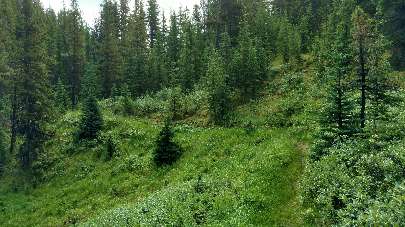
From Maligne Lake, good trail started out through beautiful forest. And there was not another soul to be seen. But there was wildlife. Some animal, maybe a marten crossed the trail ahead and went up a tree, too big to be a squirrel, too small to be a bear, black, long bushy tail….
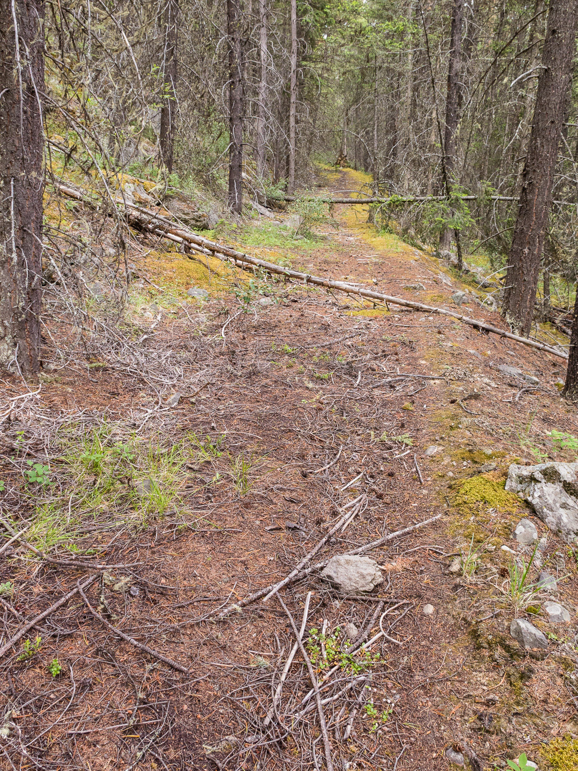
Beautiful forest
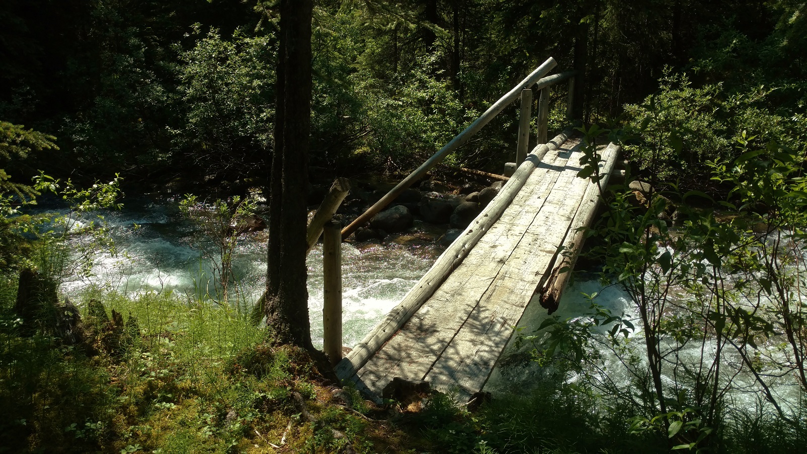
It then clouded up and the rain began, on and off at first. Still good trail, including a bridged creek right before Trapper Creek campground.
Some creeks are bridged
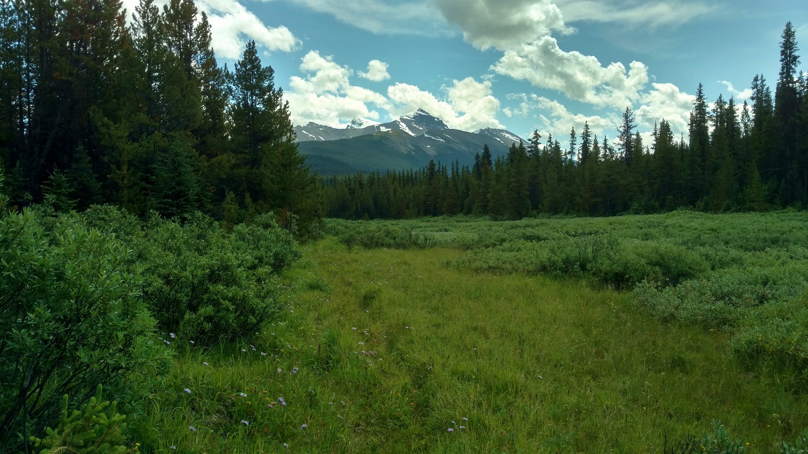
Although this trail and its camps get little to no maintenance, Trapper Creek campground was in good shape, good bear hang, picnic table, and so forth. A substantial creek about 3 km south of Trapper Creek was flowing fast but only shin deep, So crossing went smoothly, but it took some looking to find the trail after crossing. The forest began to open up into beautiful meadows and blue skies came back with distant mountain views. It was just gorgeous back here. Sure the trail was overgrown, but it was there and not hard to follow. Hey, this trail didn’t seem nearly as bad as its reputation…..
Pristine beauty
Then it clouded up and started raining with no let up. Still beautiful countryside. The Maligne River came into view and a short ways later the trail reached the river where the old bridge used to be. A part of it was still there, but definitely only as a landmark, not at all useful for crossing.
Approaching the Maligne River
Well, the Maligne River was flowing fast and high. Nothing like what the blogs or trail descriptions portrayed, that had said to expect maybe knee deep or even lower at this time of the year. But this year had set records for rain, supposedly the most since 1923 or something. Even the Maligne Lake/Medicine Lake outlet channel that had been dry for years, was flowing high this summer. On top of all that, this was mid-July; July 23, 2019 to be exact, when water levels are still relatively high due to snow melt. My inadequate homework and judgement was beginning to show. This could be a “show stopper”…. However with utmost focus and patience, I was able to successfully cross:
First, searching up and down the banks to find a good place to cross, looking for 1) a wider and therefore shallower place, 2) looking for gravel bars on both sides, 3) looking for places where the bottom could be seen so I knew it was shallower.
Finally finding a place that looked like it might be doable 1) a gravel bar on each side, with 2) a relatively short deeper section between them, deeper but the bottom was visible, and this was at a wider spot with an island in the middle. The crossing on the other side of the island was shallow with much less water.
So wanting the best possible footing, kept my boots on;
and wanting to be able to ditch my pack if I fell in, I unclipped its waist belt and top strap;
and wanting the best possible stability, hiking poles in hand, I stepped out onto the gravel bar;
and started down it, into the river.
The water gradually got deeper, over the ankles and then shins, and then up to the knees. It sure was going fast and pushing on me.
Taking it one step at a time, focusing intently, I made sure to have solid foot and hiking pole plants, before raising the other foot to take another step, which consisted of searching by feel for a solid foot plant before shifting my weight to it and lifting the other foot for another step. Repeat.
Now almost in the middle, the water was mid thigh deep and then high thigh deep, and with the swiftness it was really pushing on me. Leaning upstream, into the current, progress was slow and steady. Passed the middle without it getting any deeper. Then almost to the gravel bar leading to the island. No slips or close calls yet, so just keep the focus, keep doing what I was doing, one step at a time, yes it was hard, but I could make it.
And then I was at the gravel bar, it got shallower and easier, and then I was on the island.
Not wanting to underestimate the shallower channel from the island to the opposite shore, I didn’t declare victory yet.
The shallower channel was no higher than high shin deep, and not nearly as fast flowing.
And then it was over, I was across, on the trail on the south side of the Maligne River. Wow!
Thinking this shouldn’t be too bad, should get to Mary Schaffer trail camp late, but still with plenty of light, off I went down the trail….. Until there was no trail, no trail evidence at all, no ruts, no corridor, definitely no flagging or blazes, not even old style blazes, nothing. The GPX track showed the route followed the Maligne River. And so the bushwhacking began. And it was slow. About 2 km before Mary Schaffer trail camp, with the sun dropping, I had to stop for the night. This was getting worrisome – supposedly there was about 6 – 8km more of this bushwhacking, and my abysmally slow rate through it meant an extra day was needed. But I didn’t have an extra day of food, and hitting some of the alternate’s passes, especially the one with a short scramble, without enough fuel in me could be bad. Well what a night it was, thunder and lightning, and pouring rain on and off all night. Unable to sleep, deliberating about the situation, I finally decided, it was best to turn around and go back, that was a known quantity, although I really wasn’t looking forward to re-crossing the Maligne River. But since I had done it, I should be able to do it again… not thinking about what all this rain was going to do to the Maligne River. Very bad judgement here with this decision, but I didn’t understand that at the time.
Morning came, July 24, packed up, began the bushwhacking back to the Maligne River crossing. It was still raining. Came upon a giant female moose very close. What a treat! Giving her plenty of room, continued on and came to the river crossing before noon. Optimistically, thought this would work out OK. Until, I saw the river. It was at least a foot higher, brown muddy swirling water, and couldn’t see the bottom anywhere. I knew where to cross, and so doing it as I had successfully done it the day before, I went for it. Very bad judgement! This time it got deeper and deeper, past high thigh, crotch high, then waist high, with about 6 more feet until it looked better. Waist high was no good – too much of me in the water for the river to push against and not being able to find a next foot plant, I lost it, and the river swept me away. It was BAD! Banged against rocks. The current took me in the deep channel up against the island. Went under, and thought I was a goner. It crossed my mind, this is how people die… Then saw willow branches sticking out from the island above me and grabbed for them. Pulled my head above water for sure, but couldn’t climb out there, too deep, the bank was too steep, and the current was too strong to be able to stand. So hanging onto the willows, branch after branch eased down to the end of the island. And there in the shadow of the current was a low gravel bar that I pulled myself onto – ALIVE! So thankful just to be alive.
But my hiking poles were gone, so no way I would be able to cross even if the water dropped a foot to what I had crossed the day before. And it was still raining so it could go higher before dropping.
Fast forward…, with some wonderful help, I got back to Jasper. No broken bones, lots of black and blue marks, some scrapes, and pulled but not torn ligaments/tendons/whatever the things that hold knees together are, and important lessons learned the hard way. Among them, how not to cross a river:
Anything swift and higher than crotch deep – DO NOT TRY. Too much of one is in the water to be pushed on by the current, it just won’t work.
Anything lower, if it is pushing on one hard enough so that one is having a hard time or is uncertain or scared that they can’t keep finding solid foot holds – TURN BACK. Even though it may be lower, if the strength and endurance isn’t there, it isn’t going to work.
DO NOT rush into a decision to cross something that looks hard/scary. Think about options. Take a break, have a snack, think some more.
DO NOT just try to bulldoze through if it’s too hard. TURN BACK, search more for a better place, think about waiting for the water to drop some, possible other ways to bail out and avoid the crossing, and so forth.
Frankly, people that say they are scared of river crossings are the wise ones. I should have been more scared. Probably there is a happy middle ground, between being too scared and not scared enough, of river crossings. And that happy middle ground is probably reached by SAFE river crossing experiences and practice :>) Happy trails!
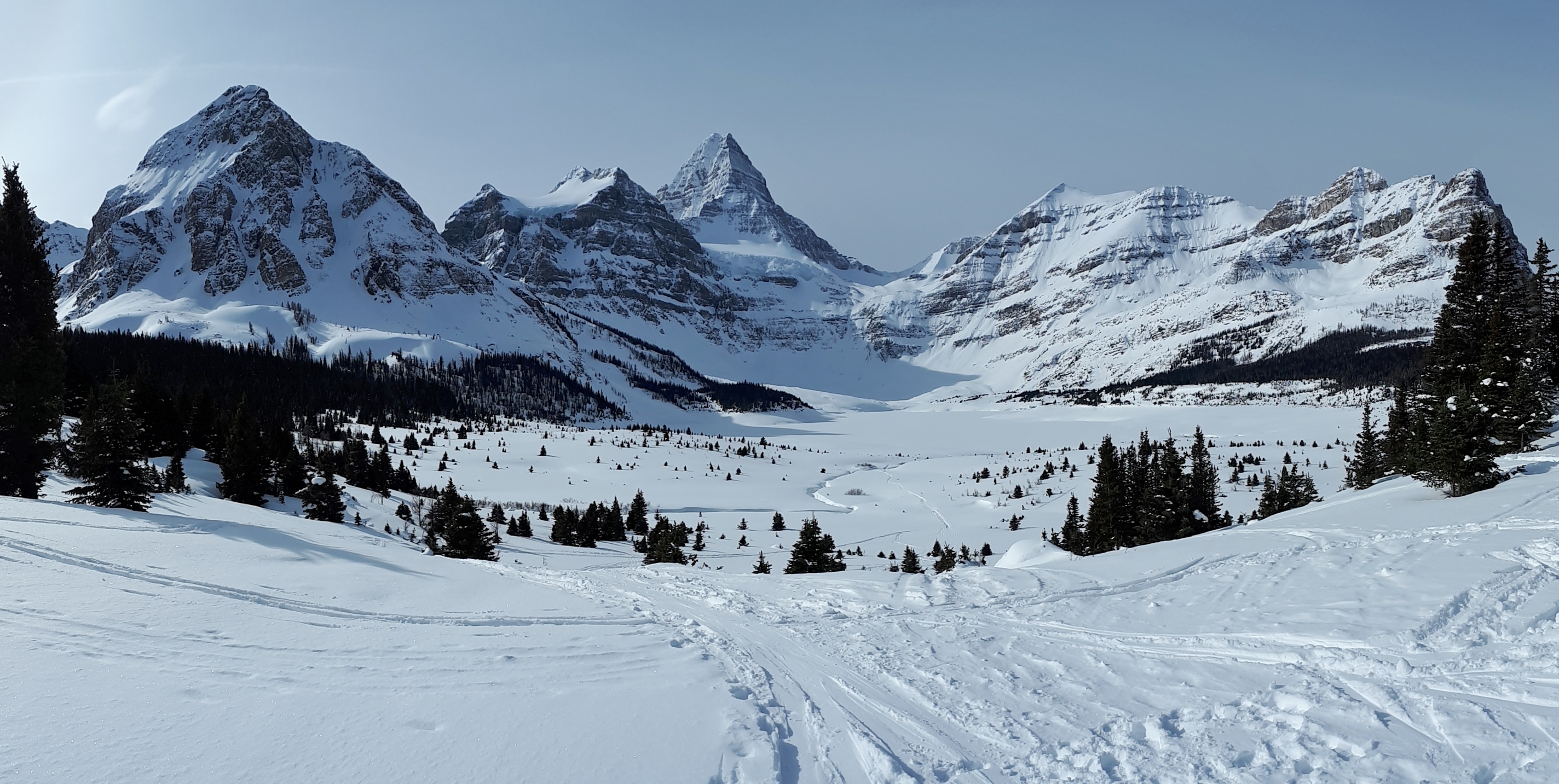
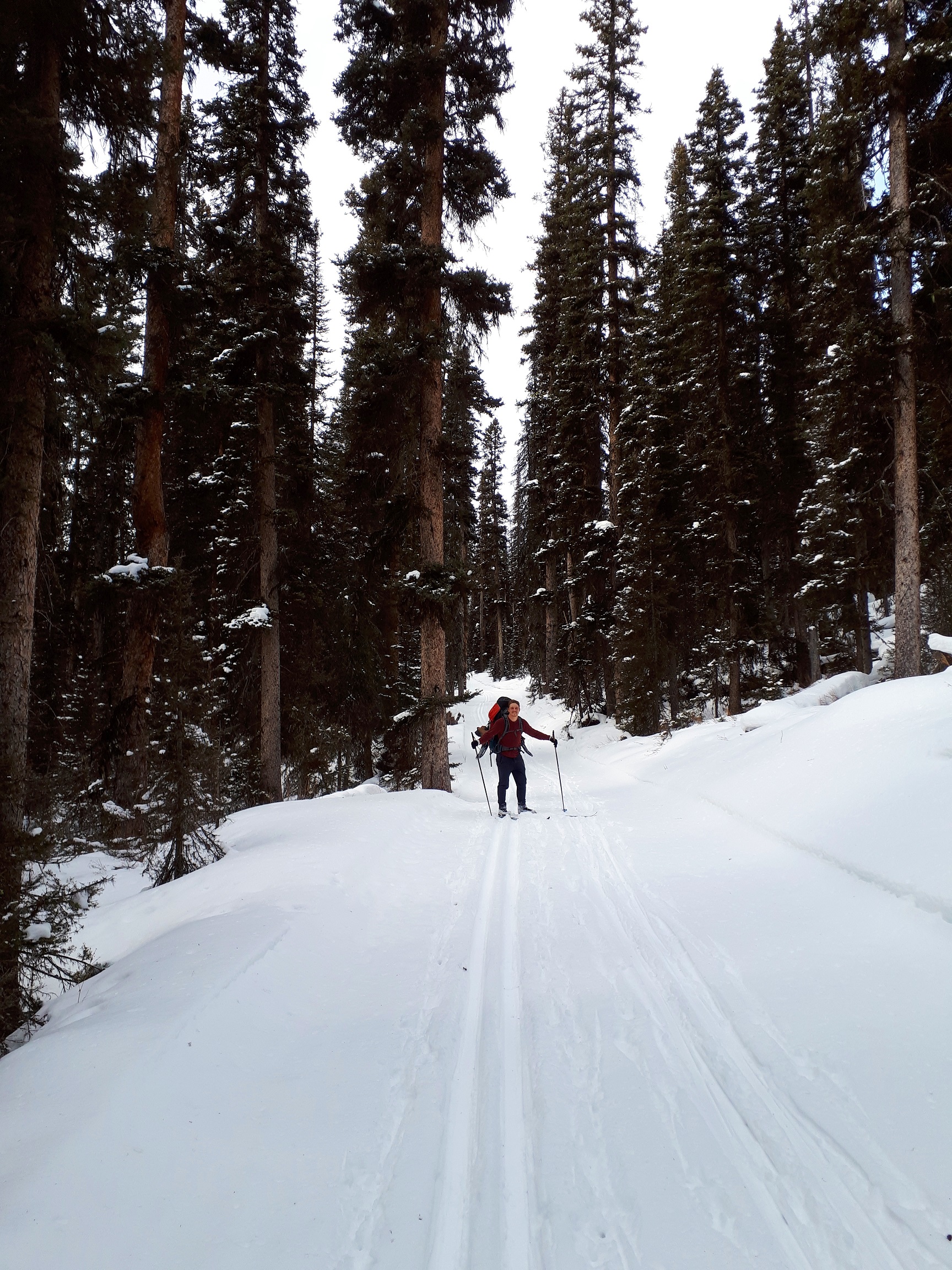
Are you looking for a winter adventure in the mountains and lamenting your hiking boots retired for the season? Mount Assiniboine is the perfect, true winter experience. Mount Assiniboine is a remote gem, inaccessible by road. It is about 20 km south of Sunshine Ski resort (as the crow flies) accessible by trails from Kootenay or Banff National Parks.
It’s been a winter tradition amongst our hiking group for the past five years. In winter, Mount Assiniboine, a 28 kilometre trek, is only accessible via the Mount Shark entrance, due to avalanche risk via other routes. The trail starts at Mount Shark on cross country ski trails, gentle track set trails, to Watridge Creek. The trail continues through a wooded forest heading west towards the Bryant Creek Hut at kilometre 14.
Mt. Shark Ski Area on the Way to Bryant Creek Hut
Bryant Creek Hut – This rustic cabin with a wood stove, firewood and wooden bunks is a good night stopping point to break up the upward hike into Assiniboine into two parts. We carry our winter sleeping bags, head lamps and one pot gourmet meal. Many good stories have been shared in front of the stove or star gazing in the meadow outside.
With fresh legs the next morning and fresh snow decorating the trees we snap on the snow shoes to head up the switchbacks of the pass. We are rewarded at the top with the “Welcome to Mount Assiniboine” sign.
This beckons us onward across the meadow and along the trails another 3 km to Mount Assiniboine lodge and a welcoming beer.
The lodge (private) and the Naiset huts (operated by BC parks) are accessible daily by helicopter. We have no shame in sending in some tasty food and beverages this way. It is an excellent bailout option when gear malfunctions also.
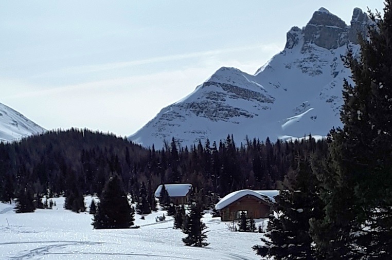
Naiset Huts at Mt. Assiniboine
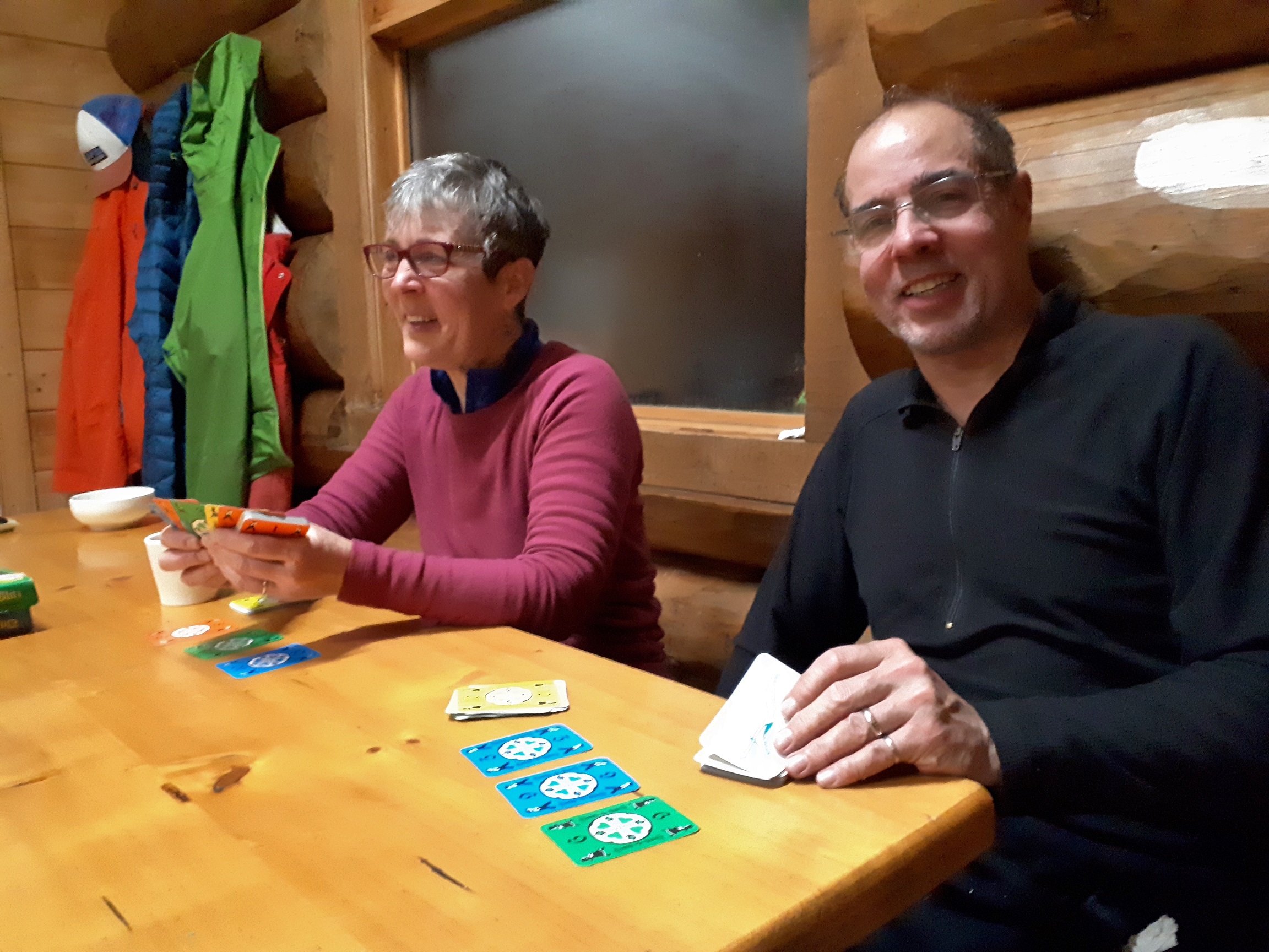
The Naiset huts, cozy log cabins, are a welcome repose on padded bunks at the end of a day skiing or snow shoeing on the plateau. The shared kitchen and common area is better equipped than most restaurants. Pots, dishes cutlery, even a coffee maker is available in this heated, lighted refuge. We have met people from all parts of the world there, sharing adventures of their favourite mountains.
Evening Fun Inside the Naiset Huts Kitchen Building
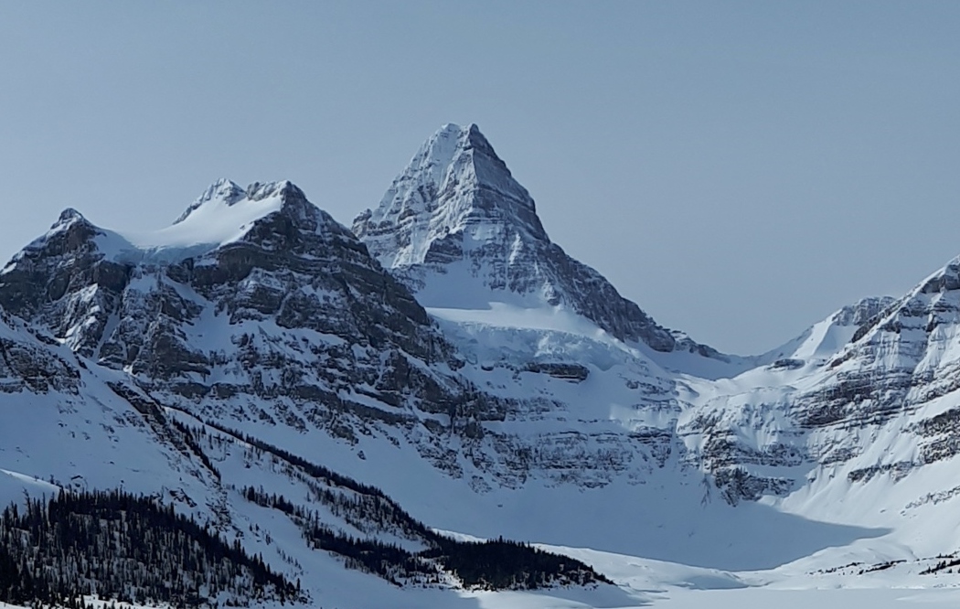
Assiniboine peaks through the cloud and majestically towers over this quiet valley blanketed in white – a true winter escape!
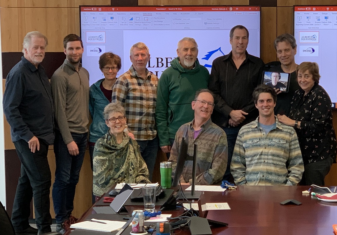
On January 11, Board members, the Organizational Excellence Committee and representatives from other GDTA committees gathered in Bantrel’s comfortable boardroom for some concentrated learning and at times challenging thinking about what makes for a living breathing strategic plan.
The retreat was facilitated by Ken Larson of Champion Performance Systems. Dave Hockey introduced Ken, describing how his current work coaching leaders, businesses and organizations grew out of inspirational coaching he received during his three years on the Canadian Men’s National Basketball Team. Ken has an MA in Performance Psychology and is a Certified Executive Coach. He is also an avid reader, and in Dave’s 20+ years of friendship with him, he’s shown that he really cares about the people he’s coaching.
The GDTA participants brought a great deal of expertise to the room as well. While we shared a bit of our backgrounds in a round of introductions, Ken tallied up our years of planning experience and arrived at a grand total of 356 years!
Ken’s strategic planning focus is on execution and for an action-oriented group like the GDTA, that seemed a good fit. He showed us examples of the one-page template he helps organizations condense their strategic plan into. The template is designed to show clear alignment between vision, mission, purpose, core values and goals over three-year, one-year, and quarterly periods. But we weren’t ready to launch into that yet. First, we had to think through the key components of a solid strategic plan.
We began with an analysis of the GDTA’s strengths and weaknesses, the trends influencing our work, and the opportunities and threats created by those trends. Refining this analysis was the first task of the day to go on the WWW, i.e., the Who What When board. This is a tool for naming, assigning responsibility, and deciding timelines for the next step when a group has discussed something long enough to become clear that they want to move forward with an idea.
We then revisited the values, vision and mission that the GDTA Board approved in January 2017. Ken recommended we add our purpose to these since a purpose statement answers the ‘why’ that underlies our vision (which says who we are and where we’re going) and mission (which says how we’re going to get there). After some discussion, we decided further review, and possibly some refinement of our values, vision and mission was in order. This became task number two on the WWW.
Next it was figuring out the measurement that would allow us to track progress on our goals. What type of things should we measure, what metric would be appropriate for each of those things, and was each metric we came up with a leading indicator or a lagging indicator? We learned our set of metrics needs to include both types of indicator. Leading indicators are the things we do (e.g., events) that are predictive of the things we want to achieve. Lagging indicators are the hoped-for results of the things we do (e.g., growth in membership).
Now we were ready to craft some goals. Ken patiently coached us through applying an Action-Focus-Results (AFR) approach to defining what two of our committees would accomplish in the next three years. The AFR is worked through in a specific order:
FOCUS: Decide what the most important area is for the committee to focus on for the next three years.
RESULT: Decide what result we want to achieve in that focus area over the next three years.
ACTION: Identify the actions that will lead to the desired results.
Then we re-ordered those elements into a succinct affirmative sentence that starts with strongly-worded actions and ended with desired results. This was an exercise in logic and language that had many of us struggling at times, trying to encapsulate a large area of work into a small number of words and still convey a clear meaning. Ken assured us our effort would be well worthwhile – we would end with clear, actionable, measurable ‘three-year key thrusts’ that could be broken down into ‘2020 key initiatives’ and ‘quarterly big rocks.’ We agreed to apply this AFR approach to all of our committees and that added five more tasks to the WWW board.
It was a productive day! It was great to learn some new ways of thinking and receive some new tools for continuing to build organizational excellence in the GDTA. We will continue the work in a second retreat day this spring.
By Brad Vaillancourt, Dan Durston and Rogier Gruys
While there have been many improvements to the GDT other the past few years, there are still several sections of road walking that offer less than appealing hiking experiences, including the West Castle Road in Section A, highway walking in Coleman, the first 60 km in Section B, the Blaeberry valley in Section D, and the start of Section F out of Jasper. So in the spirit of a new decade, described below are some new and improved alternate routes that offer far more interesting, rewarding and in some cases more challenging hiking experiences that GDT Hikers should consider on their next hike to avoid road-walking. GDTA maps and the Guthook App have been updated accordingly.
SECTION A
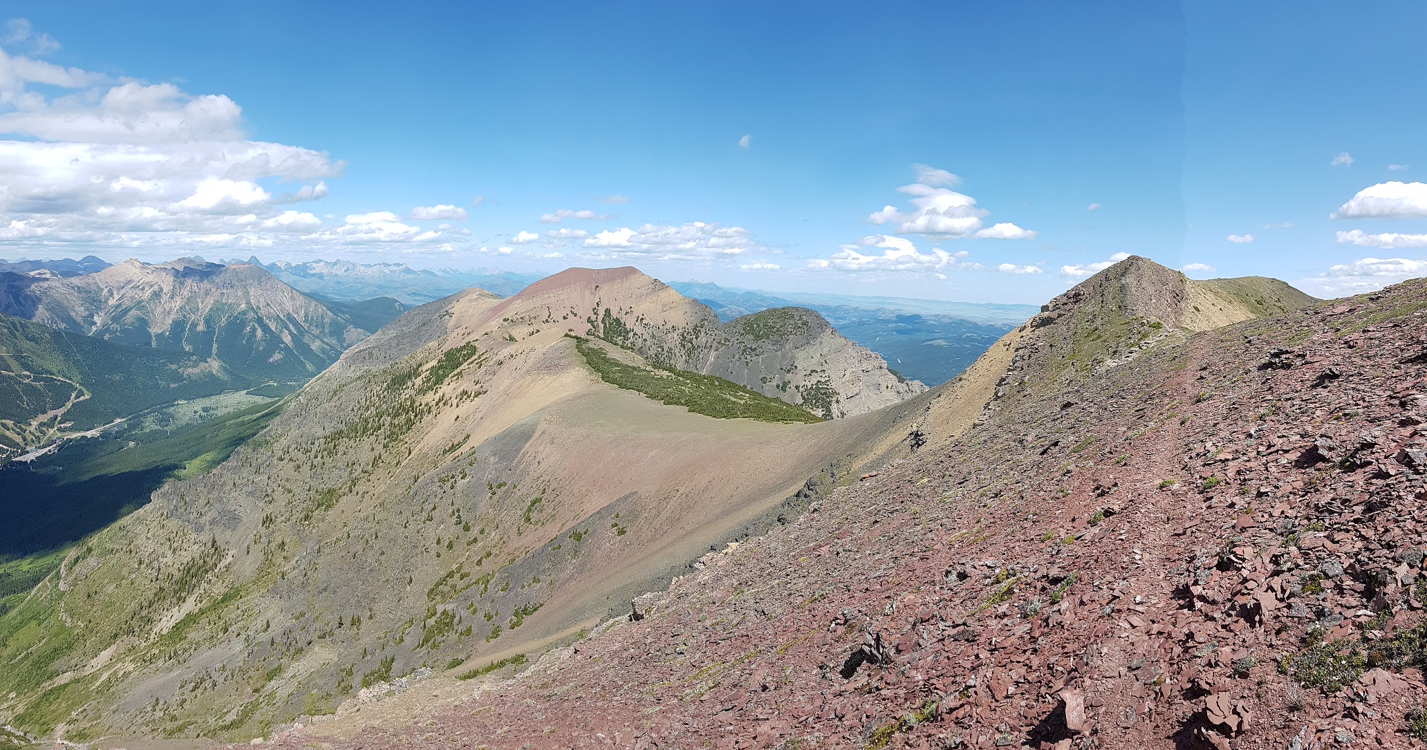
Barnaby Ridge (23.5 km vs 24 km on the GDT) is a spectacular alternate route that is significantly more scenic and rewarding than the valley-bottom dirt road that the main route of the GDT follows but requires significantly more effort. In his guidebook, Hiking Canada‘s Great Divide Trail, Dustin Lynx describes the Barnaby Ridge route as “beyond the scope of hiking” due to some difficult scrambling along the ridge, taking perhaps twice as long as walking down the valley. Other than remnant snow, the ridge is waterless but there are three campgrounds along the route, Grizzly Lake (400 metres off route) at km 6.5, Southfork Lakes at km 19 and Barnaby Lake at km 19.7. In 2019, a small crew of GDTA volunteers set out to find and mark non-technical routes bypassing the most difficult scrambles on Barnaby Ridge and assess whether the ridge could be used as the main route of the GDT.
Awesome Barnaby Ridge
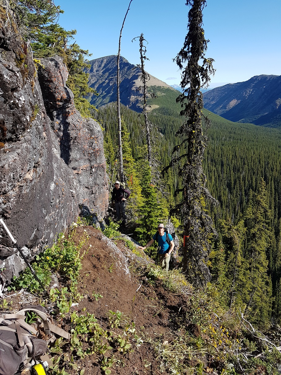
Heading NOBO from La Coulotte Peak (a26), the first major obstacle is the immediate downclimb from the summit where hikers must scramble down steep shale-covered rock steps to reach the ridge crest, where travel becomes easier.
7 km north of La Coulotte Peak is the second major obstacle: an imposing 8m cliff about 500 metres north of the Grizzly Lake trail junction @ 49.25499, -114.33656. The cliff is too large and steep to be safely climbed in either direction without a rope. A route traversing the northeastern side of the ridge, bypassing the cliff, has been cleared and flagged, including scrubbing the route clear of vegetation and placement of a large stepping stone to considerably decrease the difficulty of the scramble. Approaching NOBO 20 metres south of the cliff, look for flagging in the trees on the east side of ridge marking the start of the traverse. Descend slightly and follow a narrow path along the steep eastern edge of the ridge, scrambling down and up a few rock steps before rejoining the ridge crest beyond the base of the cliff. The total distance of the bypass traverse is only 40 metres.
Traverse to avoid cliff
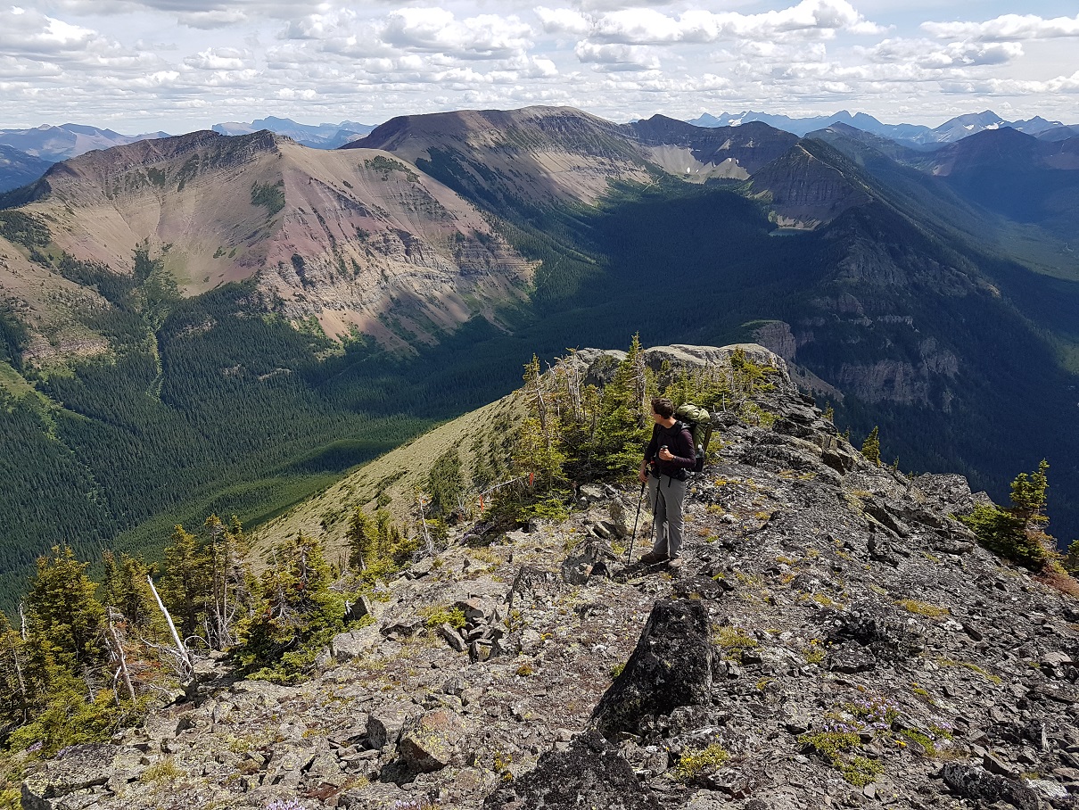
3 km farther NOBO, the second and most challenging obstacle is a 500 metre-long very narrow and rocky crest starting @ 49.280221, -114.341266. This section of the ridge is very exposed with a lot of loose rock and has resulted in more than one hiker abandoning the ridge and detouring straight down to the West Castle Road (not an easy descent). A non-technical route has been blazed traversing below the east side of the ridge that avoids all of the difficult scrambling along the ridge crest. Look for an orange blazed cairn marking the start of the route. The route contours around the east side of the ridge for 650 metres, until you reach an orange blazed arrow indicating where to start climbing. A steep but easy scramble up a rocky gully leads to a large cairn at 2400m at the north end of the narrow crest where relatively easier hiking continues north along the ridge.
Looking back at the crux
The GDTA crew also cleared the trail of deadfall along the forested crest north of Grizzly Lake, but the trail through there is still quite brushy. Even with these improvements, we decided that Barnaby Ridge should remain an alternate route as the difficulty level, particularly in bad weather, is still just a bit too high overall. It is definitely a spectacular route that with these improvements deserves the attention of more GDT hikers.
Crowsnest Pass Community Trail (2.5 km vs 3.6 km on the GDT) – The main route of the GDT follows roads or busy Highway 3 for 4 km through Coleman. Hikers resupplying in Coleman will have to walk at least a portion of this distance but there is a much quieter non-motorized trail next to the Crowsnest River that bypasses most of the road walking. NOBO, after crossing the bridge over the river on 83 Street, turn left (west) onto 14 Avenue. In 180 metres you will reach a T-junction with 81 Street. Turn left (south) to find the Crowsnest Pass Community trailhead next to the Crowsnest River. Follow the riverside trail west for 1.8 km until you reach an intersection with 67 Street (dirt road). Turn right (north) and follow 67 Street as it curves northwest for 450 metres to reach Highway 3. Carefully cross the highway to rejoin the GDT at the 66th Street intersection (b1).
Crowsnest Pass Community Trail
SECTION B
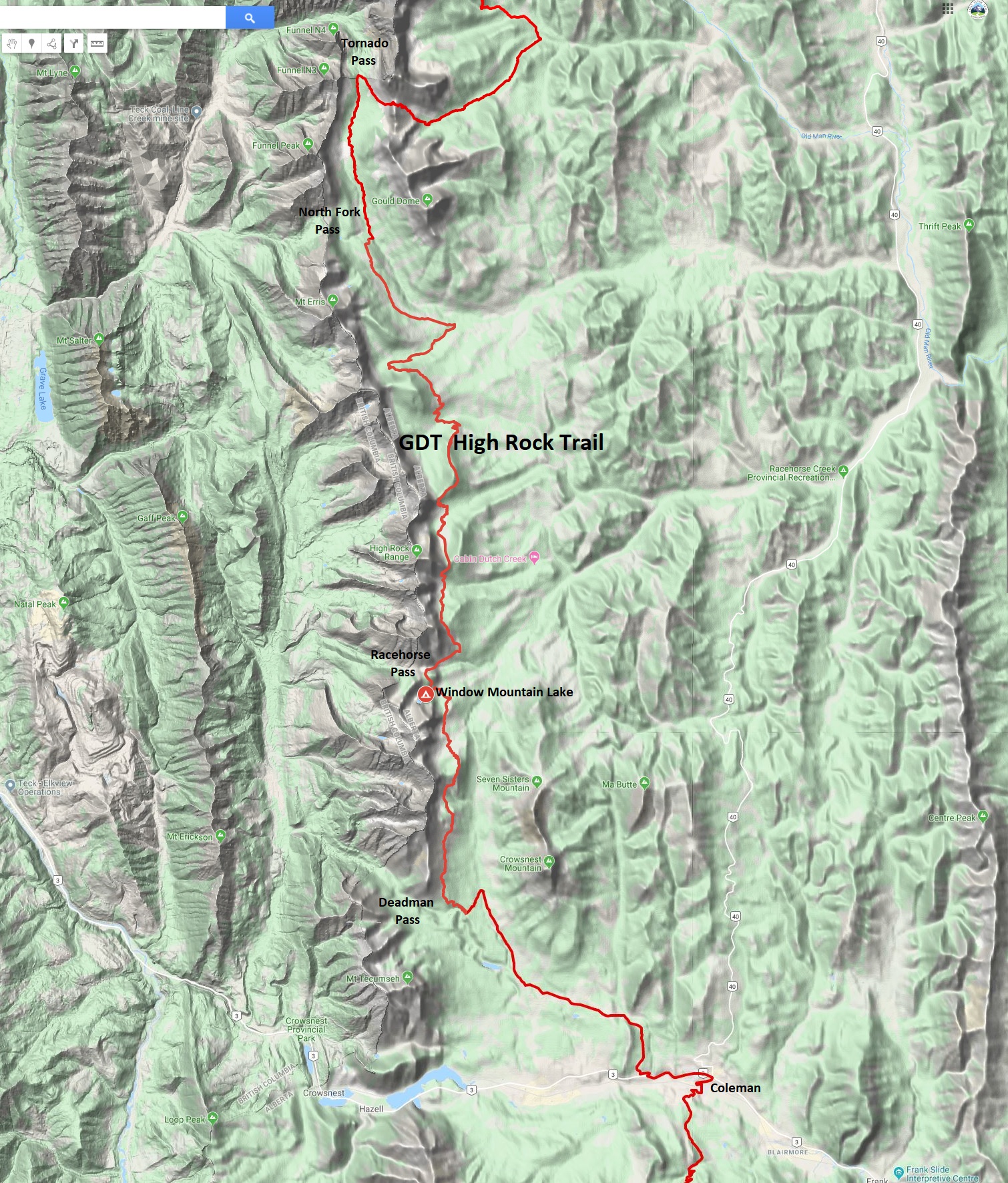
The NEW High Rock Trail (45 km vs 46 km on the existing GDT) – Construction of the High Rock Trail began in 2016 as the first new section of trail on the GDT in more than 30 years. It is a beautiful route, staying close to the Divide and above treeline for much of the route.
On the High Rock Trail
NOBO, the High Rock Trail begins at the Atlas Staging Area and rejoins the existing GDT near North Fork Pass (b13), eliminating more than 30 km of road walking. The GPS track has been posted to our map page where it can be downloaded. The High Rock Trail will officially become the main route of the GDT in 2022!
High Rock Trail
SECTION D
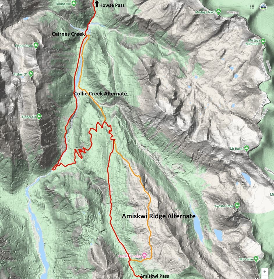
Amiskwi Ridge (8 km vs 6 km on the GDT). For those who prefer spectacular ridge walking to an active logging road, this alternate is for you!
Amiskwi Ridge
NOBO begin 1.5 km north of Amiskwi Pass by hiking steeply on good trail (+200m over 1 km) to reach Amiskwi Lodge at the tree line, where the trail ends and 5 km of stunning cross-country ridge walking begins. Camping is not allowed at the lodge, please do not trespass on private property. Camping is available in the meadows 200 metres farther.
Amiskwi Ridge Alternate
The route requires some route-finding and a short section of moderate bushwhacking. The alternate is 8 km vs 6 km on the main route of the GDT, and highly recommended. Tack on the Collie Creek alternate and you can avoid 20 km of walking on active logging roads.
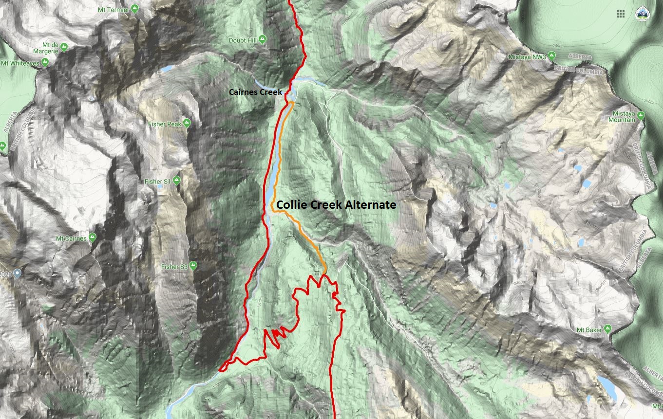
Collie Creek Alternate (6 km vs 14.4 km on the GDT) is a shortcut that skips much of the road walking in the Blaeberry valley and instead offers a shorter journey on old trail and floodplain. From where it leaves the Ensign Creek FSR, the Collie Creek alternate runs 6 km to reach the David Thompson Heritage trailhead while the official GDT travels a longer 14 km on the road to reach the same point. Many hikers will prefer the Collie Creek alternate for its much shorter distance and more interesting terrain, but it does include challenges – most notably a potentially tough ford of Collie Creek.
Collie Creek Alternate
For a NOBO hiker, the Collie Creek alternate begins after 8 km of road walking on the active Ensign Creek FSR (watch out for logging trucks). The alternate leaves the GDT on the outside of a sharp switchback at 1650m elevation as you descend into the Blaeberry valley. Look for an old trail leaving the road directly at the outside of the sharp bend @ 51.678487, -116.698431. The entrance is subtle but easily found by those looking for it.
This trail descends 1.2 km (and 320m elevation) to reach Collie Creek. The trail itself is in poor condition as it hasn’t been regularly used in decades, but it is fairly easy to follow and makes for reasonably fast travel. Despite poor maintenance and a steep grade, hikers will soon see the Collie Creek floodplain through the trees, which historical floods have carved out into an impressively wide cobble strip – many times wider than the creek itself. Collie Creek flows from the Wapta Icefield which also supplies the mighty Mistaya River that you will cross in a couple days’ time (at a bridge thankfully).
When you reach Collie Creek you have arrived at the crux of the route, as you must either ford the creek or retreat steeply back to the GDT. The route ahead travels NW 1.4 km down the Collie Creek floodplain with ample cobble to walk on either side of the creek, so there is flexibility in where you ford Collie Creek but it must be done at some point. Like Cairnes and Lambe creeks ahead, the water level rises late in the day as the summer sun melts the icefield, so crossing in the morning and/or during cool weather eases the task. The suggested route crosses Collie Creek after about 300 metres in a braided portion of the reach (but this may vary from year to year). Beyond this, the slope of the creek steepens, so if you haven’t found a suitable crossing by this point then it is suggested you turn back.
Once across Collie Creek, complete the section on the cobbled floodplain, now on the north side of the creek as you enjoy spectacular views of Mt. Cairnes ahead. Atop that impressive cliff face is the Cairnes Glacier, out of which flows Cairnes Creek which the GDT later crosses. Collie Creek itself is named for J. Norman Collie, who completed many first ascents in the area including Howse Peak and the lofty (3612m) Mt. Forbes in 1902 – both of which you will see later in Section D from the Howse floodplain.
About 150 metres before the creek reaches the Blaeberry River, enter the woods on the north side of Collie Creek and follow a brushy trail for 150 metres in a NW direction to reach a large old floodplain above the east bank of the Blaeberry River. Don’t be tempted to descend all the way to the Blaeberry River, as travelling upstream along the banks of Blaeberry is initially difficult until the floodplain starts.
Once you have reached the floodplain, your task is to travel 3 km up river until you reach a new bridge (built in 2019) over the Blaeberry that will allow you to cross the river and join the official GDT at the start of the David Thompson Heritage Trail. This 3 km is mostly loosely treed floodplain that makes for enjoyable and reasonably fast travel. Route-finding along the way is straight forward with the Blaeberry River always on your left (west) to aid navigation. When you arrive at the bridge, cross the river to rejoin the GDT near Cairnes Creek Rec Site at the David Thompson trailhead (d9).
SECTION F
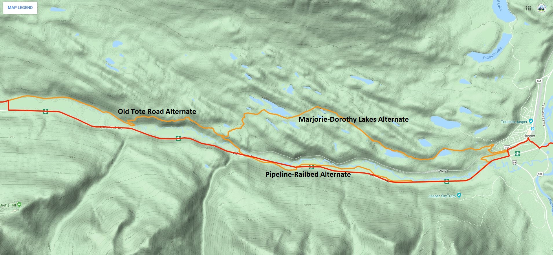
Jasper to Miette River Trailhead(23.3 km vs 21 km on the GDT) – The 21 km of walking next to Highway 16 out of Jasper is the longest (and possibly most dangerous) road walk on the entire GDT that many hikers justifiably choose to hitchhike rather than walk. In his guidebook, Hiking Canada‘s Great Divide Trail, Dustin Lynx suggests an alternate route via Minnow Lake that includes a gnarly cross-country section to the Dorothy-Christine Lakes trail. Combine the Minnow Lake alternate route with the historic Tote Road (described below; also included in the 3rd edition of Hiking Canada‘s Great Divide Trail) and the walk next to the highway can be completely eliminated. However, if the Minnow to Dorothy Lake bushwhack doesn’t appeal to you, there is now a second alternate route out of Jasper.
Jasper Alternate Routes
From Jasper town centre, follow the Discovery Trail (trail 11) west to where it passes under the train tracks and crosses Connaught Drive at a gated intersection with Wynd Road. Follow Wynd Road west for 500 metres to where a hiking trail leaves the road on your left (south) and continues paralleling the road. This junction may not be easy to see, but one can also continue a bit farther on Wynd Road to the official start of Trail 3J. Look for the (white) back of a directional map sign. In 625 metres, the trail takes a sharp left and heads southeast for 400 metres down to Highway 16, eliminating 1 km of highway walking. From the end of Trail 3J, hikers must walk the shoulder on the north side of the highway to the start of the pipeline route (This is the only highway walking on this alternate).
In 3.3 km leave the highway, walk through a parking lot and head towards the Miette River to reach the open, grassy pipeline right-of-way in 100 metres. The pipeline right-of-way is a winter cross-country ski route. There is no actual trail tread and in the summer it may be wet in spots but it is easy walking and much preferred over the highway shoulder. Follow the pipeline route for 4.8 km, until the pipeline turns north towards the river. Leave it and return to the highway. Note for 2020: The pipeline operators may be doing maintenance work on the pipeline this summer, which means you may not be able to walk along the route. Since the pipeline is close to the highway, it is easy to return to the highway if the pipeline right-of-way is blocked.
From this point it is another 2 km along the highway to the Dorothy-Christine trailhead but if you want to continue to avoid the highway and are feeling energetic, cross the highway and climb the slope to an abandoned railbed. The old railbed is easy to follow as it parallels the highway but heavily overgrown with alder in sections so be prepared for some serious bushwhacking. Follow the railbed for 2.3 km, until it drops back to the highway near the Meadow Creek Bridge. Cross the bridge and the highway to reach the Dorothy-Christine trailhead. From here it is still 10 km along the highway to the Miette River trailhead, but now you have the option to follow the Old Tote Road.
The Old Tote Road was built during the construction of the railroad in the early 1900s. It has not been officially maintained since then, but it is still in surprisingly good shape and easy to follow for most of the way. From the Dorothy-Christine trailhead, walk down the gravel road to the railroad tracks and cross the tracks on the official pedestrian crossing. The trail crosses a new bridge across the Miette River and heads uphill. From the bridge walk about 1 km to just before a sharp right switchback turn in the trail. The indistinct junction with the Tote Road is @ 52.873693, -118.263953 about 20 metres before the switchback, heading northwest at a slight left angle. The Tote Road is overgrown here, so this junction can be difficult to see. When coming from Dorothy-Christine Lakes, descend the well-maintained trail towards Highway 16 until the last switchback, where the trail turns sharply southeast. Look for the junction with the Old Tote Road 20 metres past the last turn.
Old Tote Road junction (photo by Rogier Gruys)
In most places, the old road looks like a faint trail but the tread is inconsistent and navigating around blowdown might cause you to lose the track. Look for rows of rocks, which were used to delineate the downhill side of the Tote Road. The road climbs steeply for the first 200 metres beyond the trail junction until levelling out. From here, the road contours along the mountainside at approximately 1200m. It is very faint to non-existent in places, so keep an eye on the canopy which in most places has a distinct opening where the road is/was. In about 600 metres, the road improves significantly and hiking becomes easier.
Old Tote Road (photo by Rogier Gruys)
Continue hiking west for about 1 km to a creek bed and fire guard where the road can be difficult to find. Beyond here the road is easy to follow for 400 metres until it disappears in an open area. Pick up the road again across the meadow where it should again be easy to follow. In 1.3 km you join the old Golden Lakes Trail. Follow the surprisingly good Golden Lakes Trail 1.2 km downhill to an overgrown trailhead parking area. Follow an old road bed west out of the old parking area. In 1.4 km the road becomes an old railroad bed. Follow this beautiful railbed west for 4 km, past the Decoigne station, all the way to the Miette River trailhead (f1) to rejoin the GDT.
Aside from a bit of bushwhacking and route finding, this is a very pleasant route, and a wonderful historic alternative to walking along the highway!
OTHER UPDATES
Kiwetinok Alternate – The start of the climb up to Kiwetinok Gap now begins 650 metres farther down the Kiwetinok valley in order to avoid the worst section of bushwhacking.
Perseverance High Route – Two updates to the Perseverance High Route eliminate two difficult scrambles and enable almost entirely good travel in the first half of this alternate, south of Perseverance Mountain.
Perseverance High Route
The first update is a detour that avoids the steep, loose scramble descent into upper Spider Creek basin. This section is replaced with a pleasant journey over a highly scenic pass that is slightly longer (7.6 km vs 5.2 km) but not slower as it offers much improved footing and easier hiking. NOBO, split off the original alternate route in the headwaters of Castor Creek valley, 7.2 km beyond the junction with the Jackpine Mountain Trail (g7). Here, the original route traverses above a cliff band. When possible at the end of this cliff band, leave the original route and contour around the alpine bowl you are in at 2000m to 2075m to reach the south-facing side. Contour entirely around this bowl and continue north over the subsequent shoulder just above treeline at 2040m to reach a second valley north of the original one. Descend gentle slopes below talus fields to reach the open valley bottom of this unnamed tributary of Castor Creek after 3 km, where excellent camping exists. From here, the remaining 4.5 km back to the original alternate is simple navigation. Walk a pleasant 3 km up the open valley past a beautiful green alpine lake to the obvious pass at 2275m at the west end of the valley. Once over the pass, the initial 400 metres of the descent are talus which range from medium to very large sizes. Use caution and choose a descent path that avoids the largest blocks and provides the least steep grade. After the talus, stay right (north) around a small cliff band and then continue to walk the fall line downhill as you enjoy the final kilometre of pleasant walking on gravel and marvel at the steep face south of you that the original route descended. Continue downhill and rejoin the original route at the point where views open up of the entire Spider Creek valley. Travel on the High Route is relatively straightforward until the next detour is reached in 5 km.
The second update is a detour that replaces a very steep portion of the original route at the saddle immediately south of Perseverance Mountain. This detour begins @ 53.42668, -119.7606 where NOBO you will veer right in an ESE direction to walk a gentle ramp to the valley bottom rather than descending the 40 degree slope ahead. During this 1 km descent you will have ample views of the 450m upcoming climb to the summit of Perseverance Mountain, allowing you to assess the path ahead. From where you reach the valley bottom, the ascent up Perseverance Mtn is steep but much less so than the original route. From this point, almost any route up this face will work. The suggested route links a series of benches to minimize the grade, but hikers can ascend this face in whatever style suits them with little difficulty to reach the summit. North of Perseverance Mountain substantial challenges remain, including some difficult scrambling.
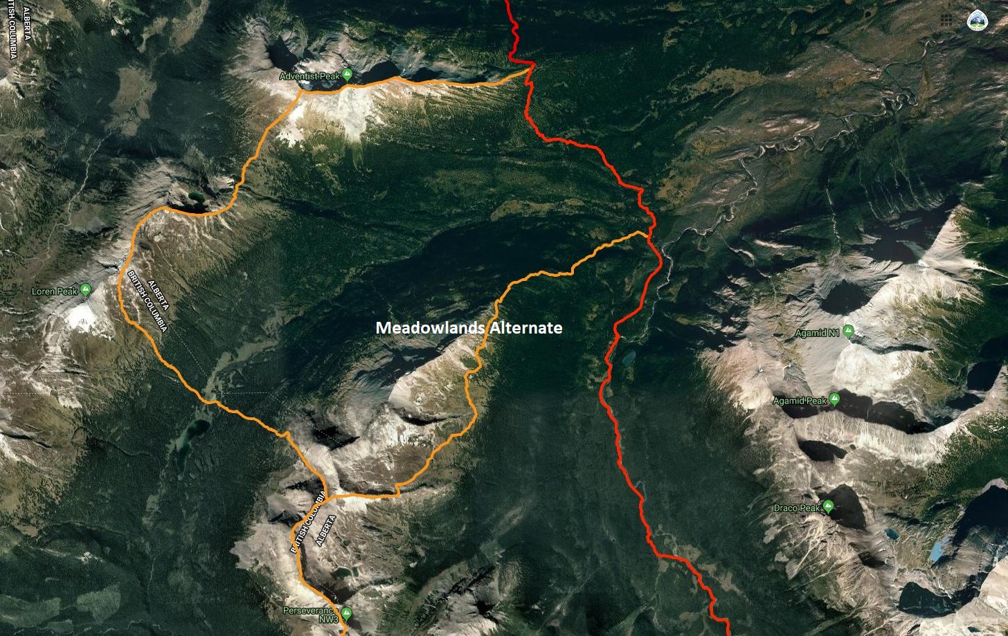
Meadowlands Alternate – is a new northern access route to/from the Perseverance High Route, 9 km to the GDT + 4.8 km to Little Shale Hill = 13.8 km total vs 14.8 km on the original alternate route.
Meadowlands Alternate
Rejoining the official GDT from the northern end of the Perseverance High Route poses a substantial challenge for anyone on this alternate. There are many ways to make this linkage. All of them include some challenges, but none more so than the northernmost section of the original alternate route which includes onerous bushwhacking through Loren Pass followed by very difficult scrambling before re-joining the GDT on Little Shale Hill. A suggested way to make this linkage that reduces the difficulty and improves the hiking quality is to continue generally along the divide of the Jackpine River and Meadowlands Creek valleys to rejoin the GDT at the ford of Meadowlands Creek.
From the summit of Perseverance Mountain, the High Route follows the watershed ridge of the Great Divide for 6.6 km as it passes above three large alpine bowls including a few challenging scrambles. As you reach the northern end of the 3rd bowl, the original alternate descends off the ridge in a NW direction. Rather than descending, continue a further 200 metres NE along the ridge to a point where you could turn north to remain on the ridge crest (a more difficult but scenic high route), but instead head east on the new recommended route following the sub-ridge that divides the 3rd bowl from a 4th bowl. After about 1 km along this sub-ridge, a short scree chute on the north side allows for a quick descent into the 4th bowl where a creek and good camping are found.
Cross the flat open bottom of this 4th bowl in a NE direction and wrap around the east end of the sub-ridge that separates it from the next bowl (5th) to the north. Cross the flat bottom of the 5th bowl and then begin to ascend gently to rejoin the main watershed ridge on the far (NE) side. Climb gently as you stay generally above treeline, while mostly letting the ridge descend to join you. By staying above treeline, you will end up back on the ridge 1 – 1.5 km NE of the 5th bowl. From here, you will walk the increasingly rounded and indiscernible ridge all the way down to the valley bottom. Below treeline you will initially encounter a mix of moderate bushwhacking and pleasant meadows until you reach the last remaining obstacle of note: a cliff band in the ridge at 1650m. Skirt these cliffs on the right (east) side and then continue to descend in a NE direction to reach the GDT at Meadowlands Creek (g10). Don’t be tempted to turn straight east to rejoin the GDT sooner, as the official route here is also a bushwhack and no easier terrain than what you are currently in. Once you reach the GDT ford at Meadowlands Creek, a faint but followable route heads north through swampy areas for several hundred metres before defined trail resumes.
Surprise Pass High Route – The GPS track for the northern end of this alternate route has been corrected to avoid the unnecessarily steep and dangerous descent off Wallbridge Mountain to Providence Pass.
This edition of the Pathfinder Newsletter includes articles from our AGM, a walk through Section C of the GDT, a summary of the past summer’s maintenance trips and information on the book launch of Tales from the Great Divide. Enjoy!
Tales from the Trail: Lynnie and Barb hit the trail again this summer… completing Section C – Field to Kananaskis.
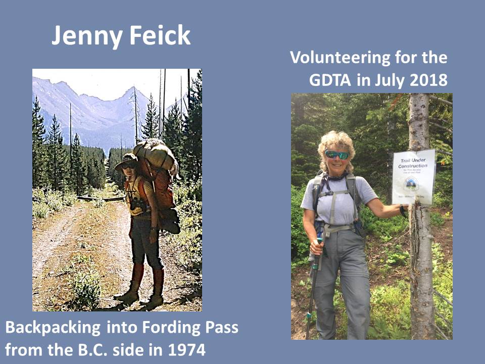
AGM Keynote Speaker: If you missedour AGM, read a short summary of Jenny Feick’s talk about the ‘original gang of six ‘ who surveyed the GDT route in 1974.
Book Launch: A book about the history of the Great Divide Trail has been published and is now available for purchase.
Trail Permit Reservations open in January so it’s not too early to start planning your 2020 GDT hike.
Changes to our Board Membership: We say thank you to the retiring Board members and introduce the re-elected and new members.
As you may already know the GDTA is a volunteer based organization that relies on the work and passion of people like you. Every year we recognize the efforts of volunteers who go above and beyond to help us achieve our objectives.
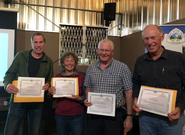
Left to right: Dave Hockey, Jenny Feick, Wayne Marshall, Dave Higgins
Alistair Des Moulins – For representing the GDTA at in the meeting of Livingstone and Porcupine Hills Recreation Advisory Group with Minister of Environment, Jason Nixon.
Jenny Feick – One of the Original GDT’ers, we would like to recognize Jenny’s dedication to compiling and documenting the history of the GDT, in particular leading the production of the “Tales of the Great Divide”.
Dave Higgins – Another Original GDT’er, Dave’s resilience and remarkable commitment to the GDT for so many years is remarkable, leading two important Trail Maintenance trips in 2019 to Lost Creek and the David Thompson Heritage Trail. Dave is a regular contributor to the Pathfinder newsletter and helped Jenny Feick with her travel plans to come to this year’s AGM.
Wayne Marshall – For his important contributions as the GDTA Signature Trip Camp Manager, always making improvements and mentoring new volunteers. Wayne has been a mentor and a teacher to so many GDTA volunteers over the years and deserves to be recognized.
Rogier Gruys – For championing the GDT in Jasper National Park allowing us to make significant progress towards trail maintenance, recognition and signage in a national park.
Darrell Aunger – Primary mover and shaker for organizing a strategic planning session where a wide range of GDTA volunteers were participants. Primary results were creation of a GDTA vison and mission statements, a scan of the GDTA’s strengths, weaknesses and threats as well as establishing a framework for committee structure for engaging more volunteers. Constantly reminding board members to look beyond day to day operations by maintaining a vision for the future towards organizational health and sustainability. Prime proponent for devoting half of each board meeting for refining goals developed at the strategic planning session. Chair of the 2018 board Nominating Committee. Without Darrells’ participation along with others on our Safety Committee in 2018 resulting in compilation of our Safety Manual there’s a high likelihood that we would have lost an entire year’s trail work. The GDTA was the only authorized NFP group to continue trail work on Alberta’s public land. As Darrell expressed “A corporate entity would have taken months to compile what our volunteers accomplished in three weeks.” The safety Committee was spared weeks of wheel spinning through Darrell’s collecting best practices from other area trail volunteer organizations. Created the necessary linkages with STARS air ambulance to handle remote work site medical emergencies. 2018 camp manager along with spouse Julie, trip leading and, most notably, averting a 2018 Signature Trip food disaster by driving from a remote camp to Blairmore to purchase fresh groceries.
Dave Hockey – Dave Hockey has served two terms on the GDTA Board and has been not just leading the GDTA over this time but has been actively involved in just about all aspects of the organization. He has been a tireless, fearless, passionate supporter of the GDTA.
In 2013, with the support of Brad Vaillancourt and others, Dave led the efforts to re-establishing the GDTA organization – a new Board, new bylaws, new organization.
In 2016, Dave became GDTA President and over the next three years his leadership has led to amazing results:
Construction of the High Rock Trail began in 2016, the first new section of trail to be built in over 30 years. Dave personally did more than 20 scouting trips, hiking (bushwhacking) hundreds of kilometres scouting the new route.
Membership grew from about 50 to over 200; our email list from around a hundred to about 1,000
Number of active volunteers on maintenance trips grew from ~20/year to more than 150
Developed positive relationships with many partnering government departments and organizations: Alberta Parks, Alberta Hiking Association, Alberta Wilderness Association, Alberta Equestrian Federation to name a few.
GDT trail recognized in the new Castle Provincial Park
Set the standard for trail planning with the Alberta government
Established committees to help engage volunteers in GDTA activities
But it’s not just the big stuff Dave contributed to, he worked day in day out on the GDTA:
Led more maintenance and scouting trips than any other volunteer
Developed trail building and maintenance trip models
Assisted with the development of the GDTA Safety Manual
Housed the maintenance trailer (for years)
Cleaned and packed away the equipment after the maintenance trips
Set the record for the number of new memberships sold at the Banff Film Festival (~10)
Drove Erin Saver to the trailhead and helped charge her phone
Wrote letters to government in support of the trail
Answered countless emails from thru hikers
Met with sponsors to obtain donations
Gave presentations on the GDTA to anyone who asked
Attended as many meetings of affiliated organizations as he could
Well, it was another busy year for the GDTA, and I would like to give you an update on all the progress.
First and foremost, I would to thank the Board of Directors for all the work they have done to make all this happen, it has not been easy, but everyone has pitched in to move the organization forward. The biggest highlight has been our work on the Strategic Plan, which is nearly done. We have dedicated half of our board meetings to this document that will clearly guide us for the next 3 years.
Our focus on building great relationships & partnerships continues to serve us well. Our Key Sponsors continue to show faith in our organization. Mountain Equipment Co-op needs to be highlighted as a long-term sponsor of the GDTA, and this year they more than doubled their financial support. I can’t thank them enough for this huge show of support. Teck, The North Face, Stihl continued their generous support this year also. Columbia Basin Trust and the Alberta Equestrian Federation are new supporters this year and we hope to develop a long-term relationships with them too.
Alberta Environment and Parks continues to support our trail building and maintenance especially in the Livingstone Public Land Use Zone. Their office in Blairmore lost two key supporters of our work and I was concerned but this year the support has been amazing, and we are so happy to have them as a partner. Recreational Sites and Trails BC has also worked hard to support our efforts to maintain and improve the David Thompson Heritage Trail.
Our work with the Jasper Trails Alliance on the Maligne Pass Trail is continuing to build and at the same time strengthen our bond with Jasper National Park. For the first time I am really hopeful for a breakthrough with a National Park, time will tell.
There are many more relationships such as the Willmore Wilderness Foundation whose equestrian users who do maintenance on remote sections of the GDT, we could not do it with out them.
To all of them and big Thank You!
As usual, our Outreach Team has been busy throughout the year. It started with talks such as the presentation to the Junior Forest Wardens and a busy winter with the Best of Banff Film Festival. We not only had booths in Calgary but Edmonton, Red Deer, Olds, and Lethbridge. Sounds easy but you would not believe in the logistics to make that all happen with volunteers. The successful events continued with Chasing Sunsets, Backcountry Emergencies, and the Dan Durston GDT Yo-Yo presentation. All great events that not only provide much needed exposure but contribute financially as well. Of course, their work continued with a great AGM in October. To all involved thank you!
Ensuring Financial Capacity is another committee that took off this year. Building on some of the long term grants we do, the committee brought in the Columbia Basin Trust and Alberta Equestrian Federation grants. They are also working on more grants with a plan for a solid financial future. I was very excited to see the application for Charitable Status submitted. This will be another big step forward for our organization, good work team.
It was also another busy season for the Trail Building and Maintenance Committee. With all the trips planned they hired a Trip Coordinator to handle most of the trip communications and logistics. This was a good decision as it can be overwhelming trying to keep up with all the emails and questions for 14 trips. The committee hopes to expand this position next year. We started with our largest scouting trip to date trying to increase capacity in this area followed up with 8 successful trail building trips on the High Rock Section. After two years of heat and fires we moved our trips to start earlier in the year, only to be met by a very wet and cold spring, mother nature always wins.
Next it was on to the maintenance side of things. We want to show that we can operate in many areas and take care of what we have already established. We held a maintenance trip on the original section of the GDT in the Lost Creek area and held two concurrent trips on the David Thompson Heritage Trail, installing much needed handrails on a bridge over Lambe Creek and improving tread as well. We also continued to work with the Jasper Trails Alliance and Jasper National Park to maintain trail in the Trapper Creek area. Dan Durston was able to put up reassurance markers in the Kakwa region and Alberta Parks were installing them in the Castle Parks as well. It’s great to see more of the trail marked every year.
One of my great takeaways of the season was reading the volunteer surveys and see the results of our safety committee, it seems as though the volunteers felt our safety focus was the best yet. And to wrap up the season another scouting trip confirming trail alignment and marking trees to be felled by Alberta Environment and Parks last week.
Why do we do all this work? To support all who hike the GDT but specifically our thru hikers. This year was another record with close to a 100 thru-hikers. This continues our rapid growth trend and I can tell you there are way more coming, so let’s keep working to provide the best experience we can.
As this is my last President’s report I would like to again thank everyone on the board and the committees for all your efforts. To my mentor Wayne Marshall who in 2010 said to Brad Vaillancourt and myself that if we wanted to see the GDT survive, the organization needed to “grow up”, well in the last 9 years I think we have come a long ways.
Lynnie and I once again hit the trail this summer, tackling Section C – SOBO, Field to Kananaskis. After hiking Section E (Owen Creek to Jasper) last summer, we were ready for something a bit longer and wanted to hike the best of the Canadian Rockies!
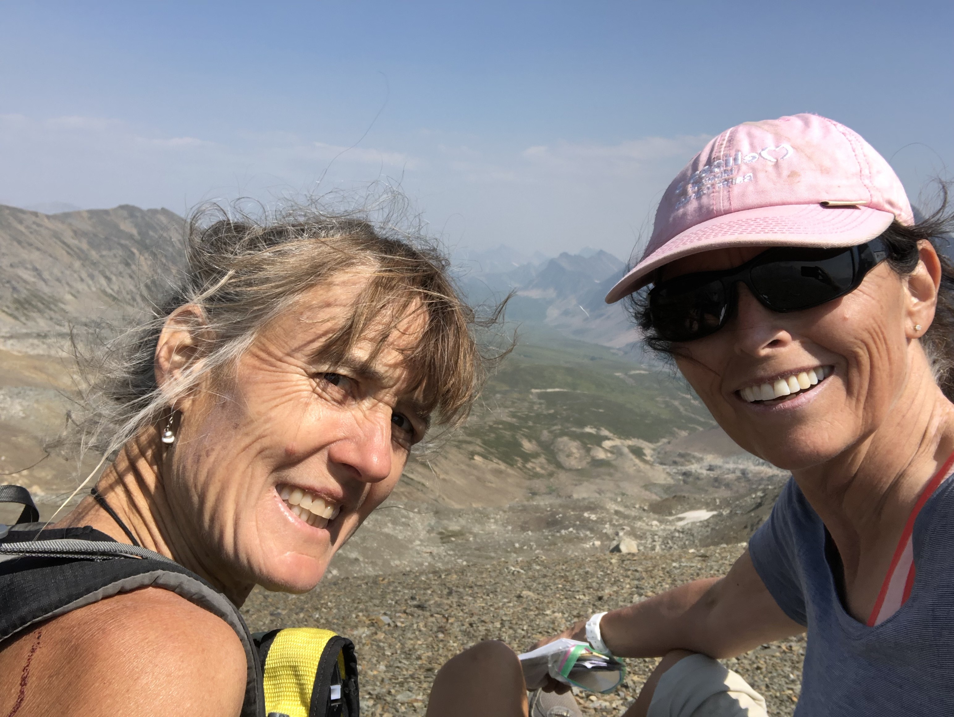
Lynnie and Barb
Probably the hardest part about hiking Section C is …. the planning. The route goes through some of the busiest provincial and national parks in Canada and securing a campsite can be tricky. I booked us into the national parks when bookings opened in January but couldn’t book Assiniboine until 4 months before our date. This meant that we had to re-gig things a bit later; in the end it all worked out.
My favourite section of the trail was through the meadows from the Bryant Creek turn off to Palliser Pass, over Palliser Pass and then down to Leroy Creek. We saw no one on this section of trail except for 10 toads, not including the one I stepped on… Be careful in this section – you look around because it’s green and beautiful and pretty flat as you go through the meadow and before you know it, SQUISH. I didn’t even realize I’d stepped on a toad until I looked back and saw Lynnie closely examining something on the trail. Apparently it looked like something from biology class. Walk carefully here!
Of course the scenery was spectacular along the Rockwall … really, really amazing but with heavy packs and the relentless up, up, up and down, down, down it was hard work! The walk from Healy Pass to Assiniboine and onto Marvel Lake was also spectacular! But our timing was a bit off and we went through there on a weekend with half of Calgary (okay, maybe not quite that many people).
This year we had to contend with a bit of rain and snow, which was a change from the smoke we had last year. It stopped raining at Floe Lake just before we woke up (so lucky!)….and then didn’t start again until we were on our way up Ball Pass. The ground was wet though and the first person through was taking a lot of the water from the plants onto their pant legs… not a nice feeling. And then it started to rain, slowly at first, lulling us into a false sense of security before it started to really come down. At this point we took cover for a bit.. probably the best thing we did. We were a bit bored with putting our rain gear on and off with a number of false starts but have to say that this is all good practice and when it really starts to rain, do not delay – layer up. If your partner looks like they are developing hypothermia (me), help them layer up but then don’t forget about yourself (Lynnie). It stopped raining just before we came over Ball Pass. The orange rock there is spectacular, and we soon forgot about the rain (except for the mud pit waiting for us at Ball Pass campsite).
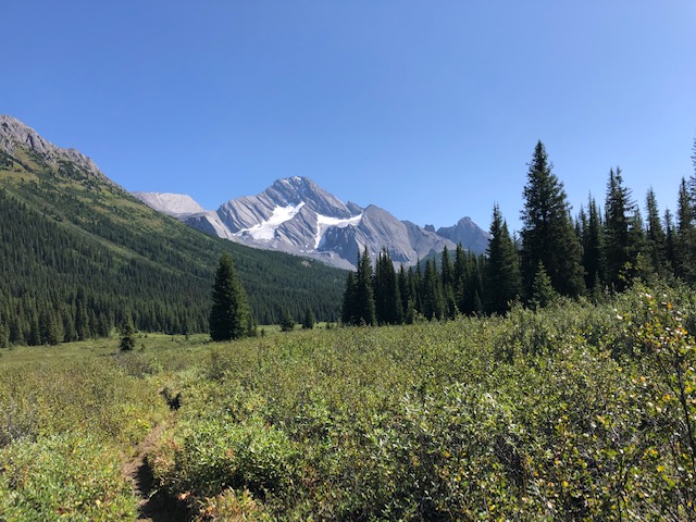
Mountain reflections
We had frost on our tent at Ball Pass but it didn’t snow there like it did everywhere else in the area! The walk over Whispering Pass was wonderful. There was snow everywhere. And later that day we walked through Healy Pass and as we were walking through, plants were slowly popping up through the snow, pushing off the snow as it started to melt. It was like a very quiet symphony … a squish here, a plop there. Beautiful!
When we got to Assiniboine, we spend a few hours sitting around and taking in the views. We tried to buy a mid-morning coffee from Assiniboine Lodge but sadly it’s not possible. However, they do host an afternoon tea for campers from 4:00 that people raved about… sorry no information on price but it sounded great if you’re in the area. Later that day we hiked over Wonder Pass and onto Marvel Lake – the views are wonderful here, as you would expect!
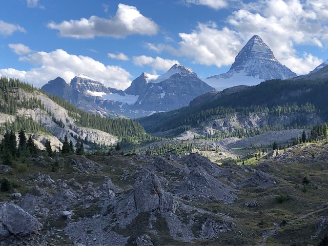
Assiniboine
The hike down from Palliser Pass to Leroy Creek is pretty straight forward, we were expecting more bushwhacking. It was a bit overgrown but completely manageable. The confluence at the bottom of Palliser Pass can be discombobulating, there is a lot of fast flowing, scary water. As long as you know that the Palliser River is actually a creek and the Leroy Creek is a very fast flowing, scary river at that point and that you do not cross Leroy Creek here, you will be fine. You cross Leroy Creek at the trail heading up to North Kananaskis Pass and onto Turbine Canyon or at the trail heading up to South Kananaskis Pass via Beatty Lake, depending on your route. [NB: maybe the Palliser River is bigger earlier in the summer? We hiked the third week of August].
Palliser view
We saw two bears, a black bear at the North Interlaken parking lot and a grizzly at the roadside as we were driving home. So on the trail, other than the toads, we saw very little wildlife….. probably because we were shouting HELLOOOO! And WHOOOO HOOOOO! at every turn. I did manage to scare a young fellow with one of my shouts. He had his bear spray out and was ready to use! Nice to see young people so prepared!
Overall, I’d highly recommend this section… navigation is very easy – you can rely almost exclusively on paper maps and trail signs; you can do it entirely in campsites if you miss out the random camping at Palliser Pass (saving the need for a bear hang), and the scenery is the best of the Canadian Rockies. However, once you get used to the adrenaline rush of working out “now where?”, it can be hard to go back to well-marked trails. I’m looking forward to going into the more remote, wilder side of the Great Divide Trail again next year.
Bit’sn bobs:
We took 8 nights, 9 days to hike Section C. A Here was our plan: McCarthur Creek, Tumbling Creek, Floe Lake, Ball Pass, Healy Creek, Og Lake, Lake Marvel, Palliser Pass and out. Favourite campsites: Floe Lake and Og Lake.
If you have an inReach and I would recommend it – do make sure you know how to use it. We had some fun arranging a ride from North Interlaken Lake parking lot because I had a brain fart and couldn’t remember how to send a text. Thank you to the family who drove me to the Fortress gas station and the lovely lady and her daughter who drove me back to the North Interlaken Lake parking lot. And thank you Stephen for coming to get us at such short notice.
Weirdly, it always seems that the trail is harder in the opposite direction to the one you’re going. We had a number of people say to us that they were very happy to be going in the other direction and as we walked up the steep trail to North Kananaskis Pass, we thought the same…. “Boy are we glad that we’re not going in the opposite direct!”
It’s going to rain, not something to fear but do be happy with your rain gear (I had a poncho and loved it; Lynnie really liked her rain pants and jacket)
If you hiked a section or an even smaller part of the Great Divide Trail, please consider sharing your story with us. Email: greatdividetrail@gmail.com
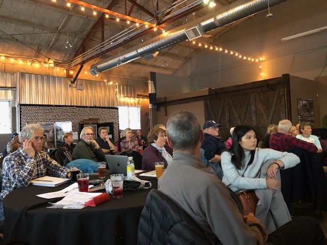
This year’s GDTA Annual General Meeting was a celebration of 45 years of the Great Divide Trail Association. It was exciting to see so many members of the original team that surveyed the trail and that started the Great Divide Trail Association in attendance. This included Jenny Feick, Dave Higgins, and Mary Jane Kreisel (nee Cox), who were part of the ‘original gang of six’ who surveyed the route in 1974 and Jeff Gruttz, Lani Smith, Desmond and Peter Allen, and Chris Morrison who helped set up the GDTA in 1975/76.
GDTA AGM
For those that missed the AGM, below is a summary of Jenny’s talk.
A Short Summary of “The Adventure of a Lifetime, Project: Great Divide Trails”; How the ‘original gang of six’ surveyed the Great Divide Trail route from Waterton to Banff in the summer of 1974
Jenny Feick shared the story of Project: Great Divide Trails and how it was an adventure of a lifetime for all six of the crew 45 years ago. First, to provide some context, she took the audience on a trip back in time to 1974, playing music from the mid-1970s and reminding everyone about what was going on in the world and in Canada, politically, economically, socially, environmentally, and with regard to long-distance trails. She then described the first proposals for a Great Divide Trail in the Canadian mountain national parks made in the 1960s. This included the one developed by Jim Thorsell and approved in 1970 by Jean Chretien, Minister of Indian and Northern Affairs at the time. Jenny told the crowd about how Jim Thorsell inspired Cliff White of Banff to promote the idea for a trail survey and feasibility study for a Great Divide Trail route linking Banff and Waterton Lakes national parks. She explained how she and the other young people got involved, and how they successfully obtained a federal Opportunities For Youth (OFY) grant to fund the project. The majority of the presentation focused on the project’s ambitious mission, challenging logistics, and the extraordinary amount of field work conducted despite enormous obstacles and without all of the communications and route-finding methods we take for granted today. Jenny shared a few of the hair-raising and funny stories about the crew’s adventures. She revealed the project’s findings, not just the 5000 km surveyed, 166 trails described and the options developed and mapped for GDT routes, but also how the crew brought to light the devastation resulting from resource extraction activities in the headwaters of the major rivers of western Canada. Lastly, she outlined how Project: Great Divide Trails led to the establishment of the Great Divide Trail Association and applauded the work of the current GDTA volunteers.
Jenny Feick, Original Great Divide Trails Project
Jenny noted that her talk covered just one part of the history of the Great Divide Trail. The story of Project: Great Divide Trails is captured in Chapter Three of Tales from the Great Divide, which was launched at the GDTA’s AGM on September 30, 2019.
For more information on how to purchase the book Tales from the Great Divide, Vignettes on the Origins and Early History of Canada’s Great Divide Trail and the Great Divide Trail Association email jenny.feick@gmail.com.