This edition of the Pathfinder Newsletter includes articles showcasing GDT hiking, information to help plan your 2020 summer on the GDT – hiking and/or volunteering, plans and goals for the GDT’s future, and an upcoming event announcement. Enjoy!
Blazing the Trail: A look at the blazes and other markers guiding the way on the GDT.
Maligne River Swim Adventure: Walk through a swift high water river crossing, successfully and unsuccessfully, for greater understanding to tackle river fords.
Sure, there are more up-to-date options available nowadays if you want to follow precisely a defined walking route, or track, through untamed spaces between two widely-separated terrestrial points on this planet. For example, you can purchase a highly sophisticated electronic gadget that receives coded digital transmissions from several even more sophisticated objects in medium earth orbit 20,200 km above the surface, with the kind (and hopefully uninterrupted) blessing of the U.S. military’s Space Force agency, and simply adhere to the course indicated by the wiggly line highlighted on your little device’s tiny display. Just don’t lose it in the next stream you cross, and remember to appreciate to the fullest your escape from modern civilization and all its trappings.
As for me, I prefer a decidedly low-tech system of physical markers, or what we old-timers call signs and blazes, to show the way (but since I’m an admitted old guy, you could have expected that!). I know – signs and blazes create clutter, are unnatural and compromise the wilderness experience (as alluded to in the previous paragraph). In my defense, though, I prefer a bare minimum of signage and loathe the traditional blaze (a slash made with an axe on a tree trunk), favouring a painted-on facsimile out of concern for the health of the tree as well as the sensibilities of the observer.
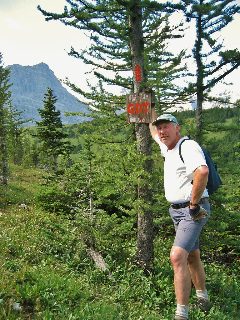
Author with quick & dirty GDT marker and blaze at Cataract Plateau, 2004
With my bias out in the open, then, here we go with my (hopefully) convincing arguments in support of the lowly paint blaze. But first, some background details:
A PATH TO ADVENTURE
When I first set foot on Ontario’s Bruce Trail in 1970, at the tender age of 16, and noticed the small rectangular white marks painted on trees leading off through the forest in both directions, what struck me was the notion that I could follow those marks for days, weeks and perhaps months, and eventually come to the famed Niagara Gorge or, in the opposite direction, the northern tip of the storied Bruce Peninsula, and who knows what treasures and experiences I’d encounter along the way? In a very real sense, those paint marks were an enticement to discovery and adventure.
A few years later, after hiking most of the Bruce Trail and learning the hard way to always be on the lookout for blazes and to not miss a change in direction, I began attending organized work outings and learned the craft of trail maintenance and, of course, paint blazing. The acknowledged pro was a fiftyish Kiwi named Chris Horne, and he taught me to make perfect two-by-six-inch blazes. The idea, Chris said, was to lessen the intrusive aspect of the paint marks by keeping them as uniform and tidy as possible, so that the hiker is less conscious of their presence. Think of official signs along highways – if they all look the same you barely notice them, unless of course, you’re on the lookout for where to turn or need reassurance that you’re still on the right road.
I also learned that the idea of rectangular paint blazes to mark trails was originated in the U.S., by the Appalachian Trail Conference in the 1950s. That footpath crosses many roads, makes innumerable abrupt turns, intersects countless other trails, and traverses long stretches of bare ground and rock. From my personal experience on over 1000 km of the AT, a uniform system of markers is crucial to staying on the main path and avoiding constant backtracking or searching for the correct route. And from the perspective of a thru-hiker doing long days on a tight daylight budget, unnecessary steps and lost time are to be avoided like the plague.
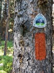
White blaze and homemade reassurance marker on the Appalachian Trail
OTHER MARKERS
Paint blazes aren’t the only system of standardized marking used on long distance trails. There’s also what we refer to as a “reassurance marker” – a small metal or plastic placard bearing the trail’s official logo, nailed to trees or posts. For cost and other reasons, these markers are usually placed about an hour’s hike apart. Aside from confirming to trail users that they’re indeed on the correct route, for some (like the author) there’s also a kind of intangible emotional reaction when encountering this kind of marker – that they’re on the actual honest-to-goodness official path, and thus participating in a grand and marvelous endeavour.
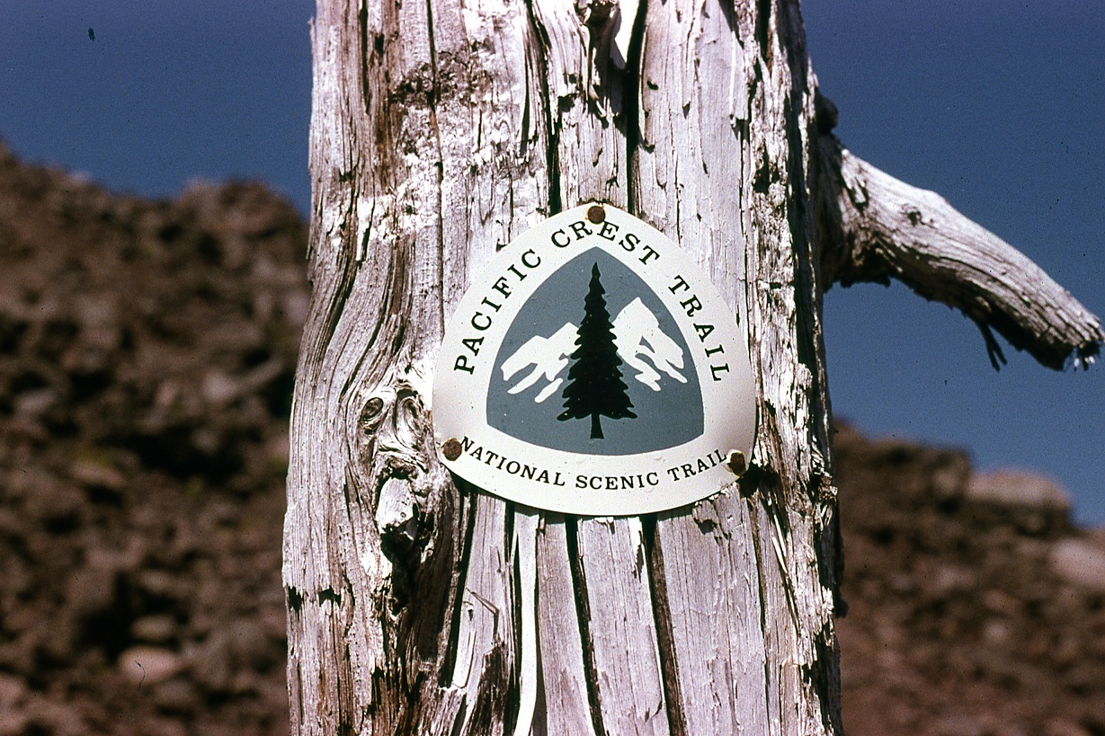
PCT reassurance marker
Another type of marker occasionally seen (and invariably appreciated by users) is a small sign pointing the way to a campsite, access point, or perhaps a water source off the main trail. Larger, more descriptive signs can also be found, normally only at access points, but to me these are a necessary evil – like the set of rules posted at public swimming pools – an admonishment to the irresponsible to not wreck the trail and the experience for other users. One thing I like to see at these locations, though, is an indication of trail direction, e.g. north or south.
BLAZING ON THE GDT
But this is a piece about trail blazing, so I’ll get back on topic and discuss what we’re doing and why on the Great Divide Trail. Years ago, 1976 specifically, we put forward a detailed proposal to the Alberta government to obtain permission to begin construction of the Trail in the upper Highwood River watershed. For consistency with other trail systems, white paint blazing was part of the proposal, and long story short, they were in agreement but requested that we use “Forest Service Orange,” which was what they sprayed on trees to demarcate blocks of forest slated for study or harvest. They even provided us, helpfully, with a pallet-load of this stuff, probably enough to paint every tree top to bottom from Banff to Waterton. An awful colour, we thought, and even worse it was a thin lacquer, suitable only for spraying. So we found, at Canadian Tire of all places, a marine grade oil-based enamel that was a close match to Forest Service Orange, and only used the other stuff as thinner!
Orange blazes go well with golden larch (if nothing else)
Why oil-based paint, you ask, instead of the more user- (and environmentally) friendly water-based latex? First and foremost, for longevity and durability. Realistically, we can’t be re-blazing every couple or even every few years. The correct paint will last decades when applied to the right surface (the smooth bark of subalpine fir is awesome). Other reasons: you can apply oil-based paint in cold or wet weather, and one coat is sufficient. As it turned out, the bright orange colour was an inspired if unintentional choice – we were out on the newly-marked Trail after an early snowstorm, and those orange blazes were easily distinguished from the patches of white snow plastered on tree trunks at higher elevations. And with the path obscured it was still possible to follow it.
Over the course of the late 1970s and early 1980s, we blazed the GDT from Fording Pass south to Tornado Mountain, a trail distance of about 100 km. As of today this is still the only section that’s so marked. With the expanded scope of the GDT in recent years, national and provincial parks are now traversed by the official route, but it’s highly unlikely there will ever be paint blazing in those jurisdictions. Not that there needs to be; unlike non-park sections of the route, there are few road crossings or unmarked trail intersections and no cutlines or logging roads to cause confusion, and all trails used by humans are more or less official and therefore signed and maintained (again, more or less!).
Non-park GDT routes of cultural significance, such as the David Thompson Heritage Trail in BC, probably won’t be blazed either, (although an occasional, well placed reassurance marker may be used) to preserve both the historical integrity of the place and quality of user experience. However the route linking Amiskwi Pass with the David Thompson trailhead, which alternates logging roads with single-track segments, is a good candidate for marking.
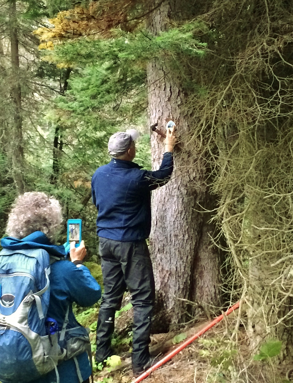
The author installing a reassurance marker on the David Thompson Heritage Trail
I’ve talked to many people who’ve hiked the entire GDT or just portions, and to date the only feedback on the blazed section has been positive. As might be expected, for most the hiking experience becomes more relaxed and enjoyable when it’s not necessary to be continuously route-finding. If there’s a negative, though, it’s that the user can become overly dependent on an uninterrupted series of blazes, which underlines the importance of ongoing inspection and maintenance, as well as good standards.
This is harder than it might seem. If the GDT was always a pathway through the forest, maintaining a uniform, unbroken system of paint blazes would be a breeze in the trees. Instead, long stretches traverse meadows, ridgetops and mountain passes, making it difficult to find and preserve blazing opportunities. Paint on tree trunks in higher-elevation exposed locations, for example, gets blasted away by severe weather within a few years. The most effective solution is an old one: stone cairns, but with the addition of a painted vertical finger of rock at the top (no particular offense intended, but commonly taken by the hapless hiker caught out in appalling weather!). Of course, this pre-supposes a supply of suitable rocks nearby, which, bizarrely, can often be hard to find in the Rocky Mountains. We’ve also tried wooden posts supported by rocks, but wind and snowslides usually make short work of them. So in the long run, it may be necessary to haul metal posts into certain locations where they can be securely anchored.
BLAZING HOW-TO’s
I’ve touched on the importance of good blazing practice, and some reasons why it should be adhered to. I’ve also mentioned that it can be tough to do that. But there are three things it’s easy to stick with in forested sections, and those are size, placement and spacing. I always instruct volunteers to paint nice neat, square-cornered blazes as close to 50mm wide by 150mm high (or 2” x 6”) as possible, so that they don’t stand out from each other. Slightly larger blazes are permitted if it makes them easier to find, for example at the far side of a clearing.
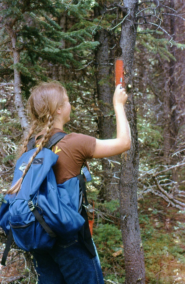
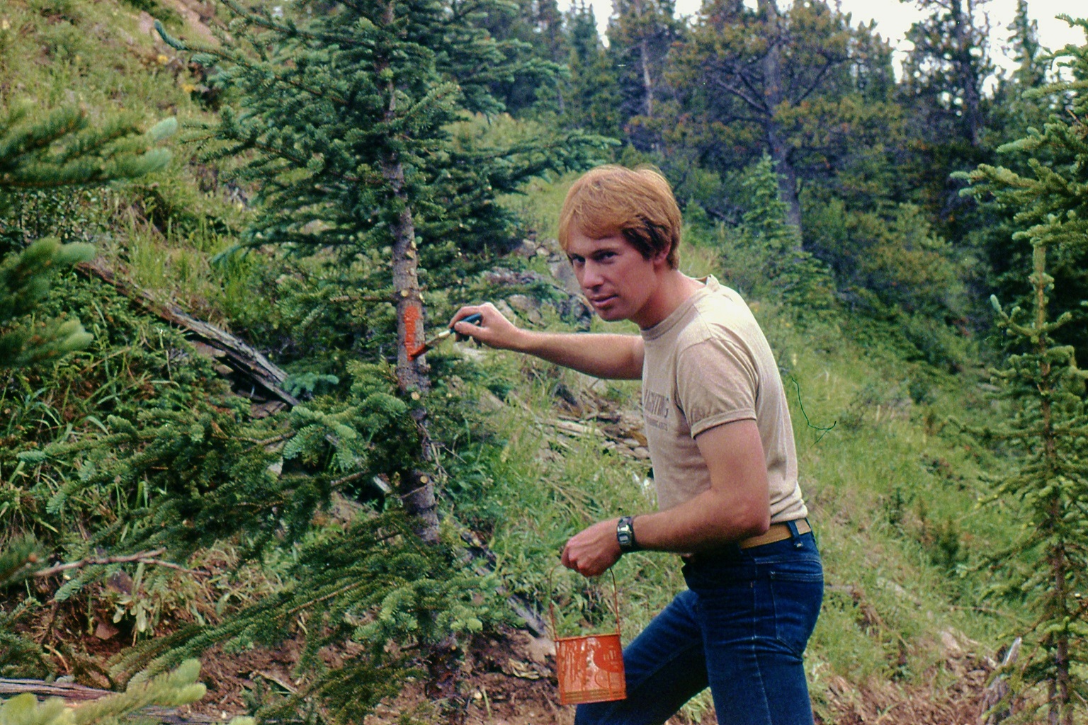
How to Blaze – Jill Frazer painting a perfect blaze on the GDT in 1979How NOT to Blaze – The author blazing too low on the wrong kind of tree, circa 1978 (before he became a pro)
Blazes should always be located just above eye level for an average height person, and if at all possible on a mature (but not TOO mature) tree that’s likely to remain alive and standing for the next few decades. The tree chosen should be visible from a point 25 to 50 metres back down the trail, and the blaze should be centred on the tree: blazes are always positioned to be seen in the direction of travel. Over the years we’ve managed to stay close to this ideal, but we’ve often painted too many blazes where the trail is perfectly obvious, creating visual pollution. Nowadays I advocate the bare minimum we can get away with – no less than 100m apart and preferably twice that distance, so that you see a blaze no more frequently than, say, once per minute unless the way ahead is hard to discern. I like this quote from Canadian climbing legend Brian Greenwood: “Blazes should make the route intelligible, but only enough so that the adventure is preserved.”
A double blaze (one above the other), indicates the Trail abruptly changes direction at that point – again, unless the way forward is obvious. In some cases the upper blaze is offset from the lower one to show which direction the trail turns. Another single blaze is usually visible from the double, confirming the new direction, for example where a footpath tee’s into a cutline.
WHAT ABOUT SPRAY PAINT?
Often, while demonstrating paint blazing techniques, new volunteers ask why I use a brush and not a spray can with a template, which would be faster and produce a more uniform result. I’m tempted to reply that I’m NOT into tagging! The next best answer is cost, but spray cans also produce a lot of waste and aren’t practical to carry in quantity for long distances. Other good reasons: handling a wet template would be a lot messier than a brush, and spray paint is so thin it requires a second or third coat, making it more likely to run down the tree trunk (the worst sin a paint blazer can commit!).
Spray paint does have a role to play, however. When we reroute a section of trail, it becomes necessary to get rid of the blazes on the old route. The most efficient and least harmful way to do this is NOT to cut them off with an axe (as I’ve seen done by vandals), it’s to paint them over with a grey-brown flat primer spray.
ACCESS TRAILS
Trails that provide access to the GDT, or access from the GDT to points of interest such as campsites, may also be marked but with blue blazes. The same system applies: one blaze – the trail continues; two blazes – the trail changes direction. Only a few such trails have been deemed worthy of blazing; usually where there’s a good chance of losing the route in a maze of old logging roads and cutlines.
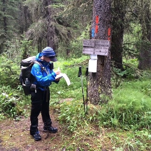
Junction of GDT and Baril Creek access trail showing blue blaze. Photo courtesy of Erin (“Wired”) Saver
THAT’S ALL, FOLKS
So there you have it – paint blazing is a time-proven system of denoting the route of a trail and helping users avoid getting lost. But it can never be a perfect system; time, nature and sometimes humans themselves take their toll on anything we add to the landscape. The fact the Trail is blazed doesn’t change the need for map (and/or GPS), good route-finding skills and plain old common sense. And that suits an old-timer like me just fine.
Several amazing videos were made by 2019 GDT thru-hikers. Here is a list of links to them. These videos are great watching during the long winter, and when dreaming of next summer on the trail. Many thanks to all the hikers that made the extra effort during their hike to shoot these videos, and then edit and post them.Note: If a 2019 GDT thru-hike video is missing from this list, it is only because we did not know about it.
This was not supposed to be a swim adventure. It was supposed to be a lovely five day loop on the GDT and one of its scenic alternates. The plan was to hike south from Maligne Lake, up the Maligne River Valley to Maligne Pass on the GDT, and then take the high route – the 6 Passes Alternate back to Maligne Lake. All on uncrowded “trail” and in an exquisitely beautiful area. Starting out, yesterday had been a “bluebird” sky day, and the sun was out again.
The Maligne River Valley has a reputation of being challenging – bugs, solitude, overgrown, disappearing trail, and the Maligne River crossing. But I had done my homework, reading what I could find on the crossing, etc., had the GPX track loaded on my phone, had done well crossing the Smoky River last year, and was looking forward to the challenge and seeing this beautiful area.
From Maligne Lake, good trail started out through beautiful forest. And there was not another soul to be seen. But there was wildlife. Some animal, maybe a marten crossed the trail ahead and went up a tree, too big to be a squirrel, too small to be a bear, black, long bushy tail….
Beautiful forest
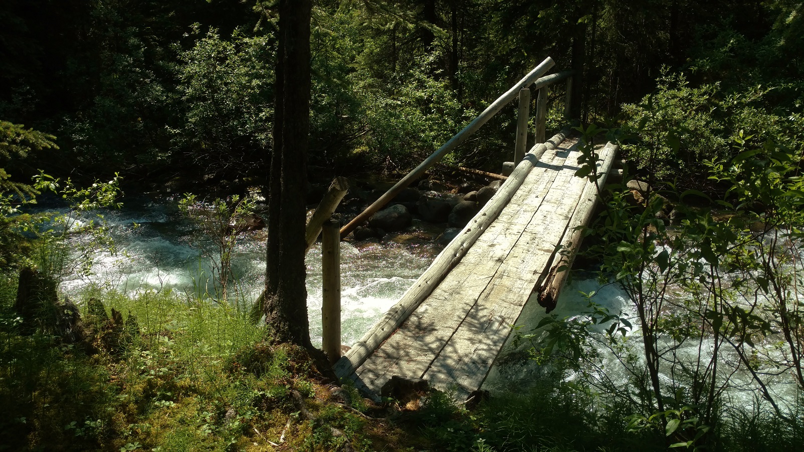
It then clouded up and the rain began, on and off at first. Still good trail, including a bridged creek right before Trapper Creek campground.
Some creeks are bridged
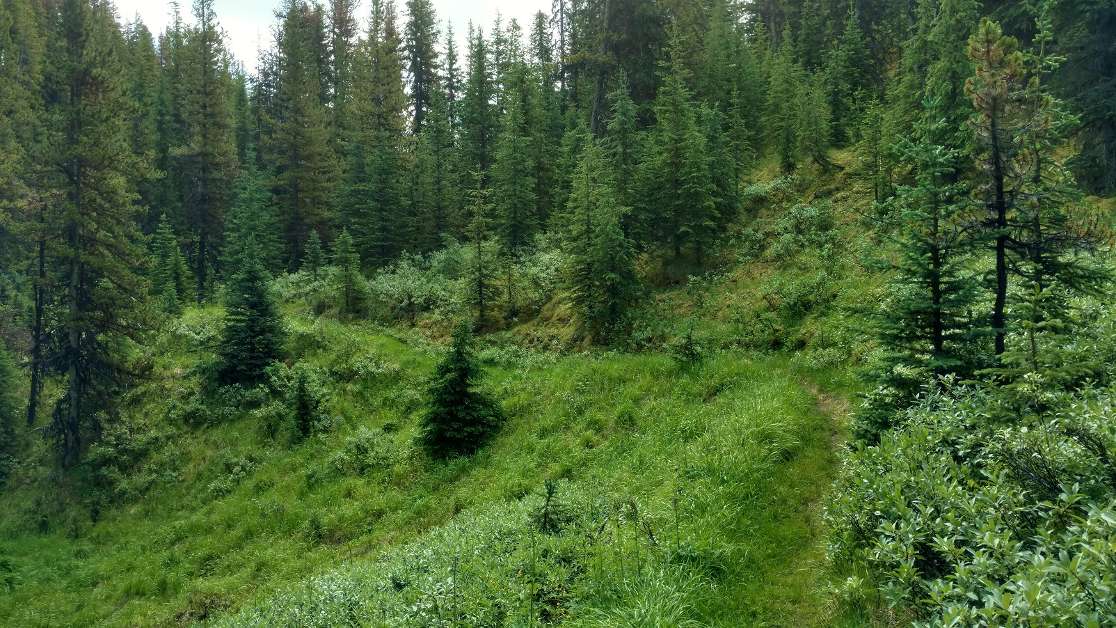
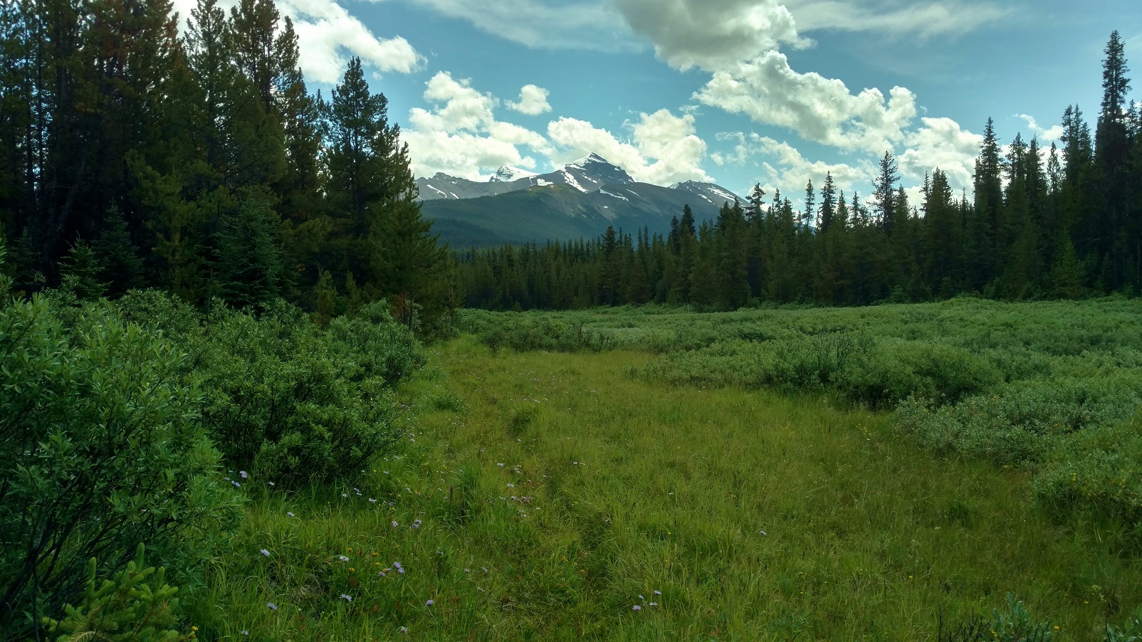
Although this trail and its camps get little to no maintenance, Trapper Creek campground was in good shape, good bear hang, picnic table, and so forth. A substantial creek about 3 km south of Trapper Creek was flowing fast but only shin deep, So crossing went smoothly, but it took some looking to find the trail after crossing. The forest began to open up into beautiful meadows and blue skies came back with distant mountain views. It was just gorgeous back here. Sure the trail was overgrown, but it was there and not hard to follow. Hey, this trail didn’t seem nearly as bad as its reputation…..
Pristine beauty
Then it clouded up and started raining with no let up. Still beautiful countryside. The Maligne River came into view and a short ways later the trail reached the river where the old bridge used to be. A part of it was still there, but definitely only as a landmark, not at all useful for crossing.
Approaching the Maligne River
Well, the Maligne River was flowing fast and high. Nothing like what the blogs or trail descriptions portrayed, that had said to expect maybe knee deep or even lower at this time of the year. But this year had set records for rain, supposedly the most since 1923 or something. Even the Maligne Lake/Medicine Lake outlet channel that had been dry for years, was flowing high this summer. On top of all that, this was mid-July; July 23, 2019 to be exact, when water levels are still relatively high due to snow melt. My inadequate homework and judgement was beginning to show. This could be a “show stopper”…. However with utmost focus and patience, I was able to successfully cross:
First, searching up and down the banks to find a good place to cross, looking for 1) a wider and therefore shallower place, 2) looking for gravel bars on both sides, 3) looking for places where the bottom could be seen so I knew it was shallower.
Finally finding a place that looked like it might be doable 1) a gravel bar on each side, with 2) a relatively short deeper section between them, deeper but the bottom was visible, and this was at a wider spot with an island in the middle. The crossing on the other side of the island was shallow with much less water.
So wanting the best possible footing, kept my boots on;
and wanting to be able to ditch my pack if I fell in, I unclipped its waist belt and top strap;
and wanting the best possible stability, hiking poles in hand, I stepped out onto the gravel bar;
and started down it, into the river.
The water gradually got deeper, over the ankles and then shins, and then up to the knees. It sure was going fast and pushing on me.
Taking it one step at a time, focusing intently, I made sure to have solid foot and hiking pole plants, before raising the other foot to take another step, which consisted of searching by feel for a solid foot plant before shifting my weight to it and lifting the other foot for another step. Repeat.
Now almost in the middle, the water was mid thigh deep and then high thigh deep, and with the swiftness it was really pushing on me. Leaning upstream, into the current, progress was slow and steady. Passed the middle without it getting any deeper. Then almost to the gravel bar leading to the island. No slips or close calls yet, so just keep the focus, keep doing what I was doing, one step at a time, yes it was hard, but I could make it.
And then I was at the gravel bar, it got shallower and easier, and then I was on the island.
Not wanting to underestimate the shallower channel from the island to the opposite shore, I didn’t declare victory yet.
The shallower channel was no higher than high shin deep, and not nearly as fast flowing.
And then it was over, I was across, on the trail on the south side of the Maligne River. Wow!
Thinking this shouldn’t be too bad, should get to Mary Schaffer trail camp late, but still with plenty of light, off I went down the trail….. Until there was no trail, no trail evidence at all, no ruts, no corridor, definitely no flagging or blazes, not even old style blazes, nothing. The GPX track showed the route followed the Maligne River. And so the bushwhacking began. And it was slow. About 2 km before Mary Schaffer trail camp, with the sun dropping, I had to stop for the night. This was getting worrisome – supposedly there was about 6 – 8km more of this bushwhacking, and my abysmally slow rate through it meant an extra day was needed. But I didn’t have an extra day of food, and hitting some of the alternate’s passes, especially the one with a short scramble, without enough fuel in me could be bad. Well what a night it was, thunder and lightning, and pouring rain on and off all night. Unable to sleep, deliberating about the situation, I finally decided, it was best to turn around and go back, that was a known quantity, although I really wasn’t looking forward to re-crossing the Maligne River. But since I had done it, I should be able to do it again… not thinking about what all this rain was going to do to the Maligne River. Very bad judgement here with this decision, but I didn’t understand that at the time.
Morning came, July 24, packed up, began the bushwhacking back to the Maligne River crossing. It was still raining. Came upon a giant female moose very close. What a treat! Giving her plenty of room, continued on and came to the river crossing before noon. Optimistically, thought this would work out OK. Until, I saw the river. It was at least a foot higher, brown muddy swirling water, and couldn’t see the bottom anywhere. I knew where to cross, and so doing it as I had successfully done it the day before, I went for it. Very bad judgement! This time it got deeper and deeper, past high thigh, crotch high, then waist high, with about 6 more feet until it looked better. Waist high was no good – too much of me in the water for the river to push against and not being able to find a next foot plant, I lost it, and the river swept me away. It was BAD! Banged against rocks. The current took me in the deep channel up against the island. Went under, and thought I was a goner. It crossed my mind, this is how people die… Then saw willow branches sticking out from the island above me and grabbed for them. Pulled my head above water for sure, but couldn’t climb out there, too deep, the bank was too steep, and the current was too strong to be able to stand. So hanging onto the willows, branch after branch eased down to the end of the island. And there in the shadow of the current was a low gravel bar that I pulled myself onto – ALIVE! So thankful just to be alive.
But my hiking poles were gone, so no way I would be able to cross even if the water dropped a foot to what I had crossed the day before. And it was still raining so it could go higher before dropping.
Fast forward…, with some wonderful help, I got back to Jasper. No broken bones, lots of black and blue marks, some scrapes, and pulled but not torn ligaments/tendons/whatever the things that hold knees together are, and important lessons learned the hard way. Among them, how not to cross a river:
Anything swift and higher than crotch deep – DO NOT TRY. Too much of one is in the water to be pushed on by the current, it just won’t work.
Anything lower, if it is pushing on one hard enough so that one is having a hard time or is uncertain or scared that they can’t keep finding solid foot holds – TURN BACK. Even though it may be lower, if the strength and endurance isn’t there, it isn’t going to work.
DO NOT rush into a decision to cross something that looks hard/scary. Think about options. Take a break, have a snack, think some more.
DO NOT just try to bulldoze through if it’s too hard. TURN BACK, search more for a better place, think about waiting for the water to drop some, possible other ways to bail out and avoid the crossing, and so forth.
Frankly, people that say they are scared of river crossings are the wise ones. I should have been more scared. Probably there is a happy middle ground, between being too scared and not scared enough, of river crossings. And that happy middle ground is probably reached by SAFE river crossing experiences and practice :>) Happy trails!
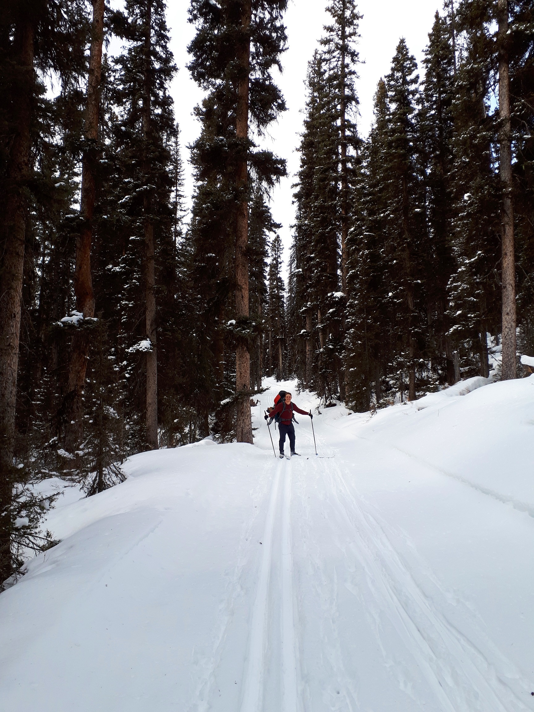
Are you looking for a winter adventure in the mountains and lamenting your hiking boots retired for the season? Mount Assiniboine is the perfect, true winter experience. Mount Assiniboine is a remote gem, inaccessible by road. It is about 20 km south of Sunshine Ski resort (as the crow flies) accessible by trails from Kootenay or Banff National Parks.
It’s been a winter tradition amongst our hiking group for the past five years. In winter, Mount Assiniboine, a 28 kilometre trek, is only accessible via the Mount Shark entrance, due to avalanche risk via other routes. The trail starts at Mount Shark on cross country ski trails, gentle track set trails, to Watridge Creek. The trail continues through a wooded forest heading west towards the Bryant Creek Hut at kilometre 14.
Mt. Shark Ski Area on the Way to Bryant Creek Hut
Bryant Creek Hut – This rustic cabin with a wood stove, firewood and wooden bunks is a good night stopping point to break up the upward hike into Assiniboine into two parts. We carry our winter sleeping bags, head lamps and one pot gourmet meal. Many good stories have been shared in front of the stove or star gazing in the meadow outside.
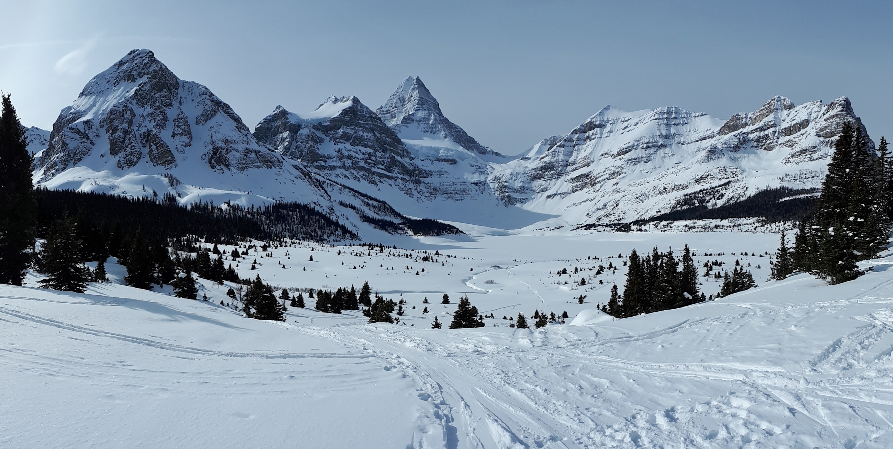
With fresh legs the next morning and fresh snow decorating the trees we snap on the snow shoes to head up the switchbacks of the pass. We are rewarded at the top with the “Welcome to Mount Assiniboine” sign.
This beckons us onward across the meadow and along the trails another 3 km to Mount Assiniboine lodge and a welcoming beer.
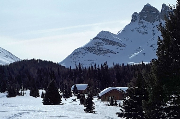
The lodge (private) and the Naiset huts (operated by BC parks) are accessible daily by helicopter. We have no shame in sending in some tasty food and beverages this way. It is an excellent bailout option when gear malfunctions also.
Naiset Huts at Mt. Assiniboine
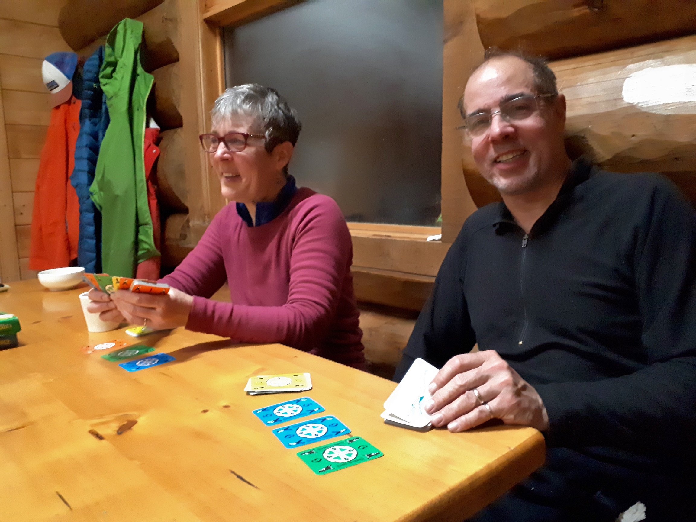
The Naiset huts, cozy log cabins, are a welcome repose on padded bunks at the end of a day skiing or snow shoeing on the plateau. The shared kitchen and common area is better equipped than most restaurants. Pots, dishes cutlery, even a coffee maker is available in this heated, lighted refuge. We have met people from all parts of the world there, sharing adventures of their favourite mountains.
Evening Fun Inside the Naiset Huts Kitchen Building
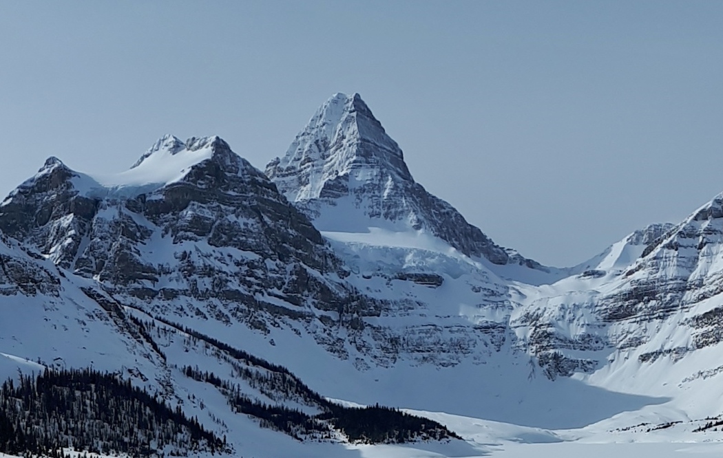
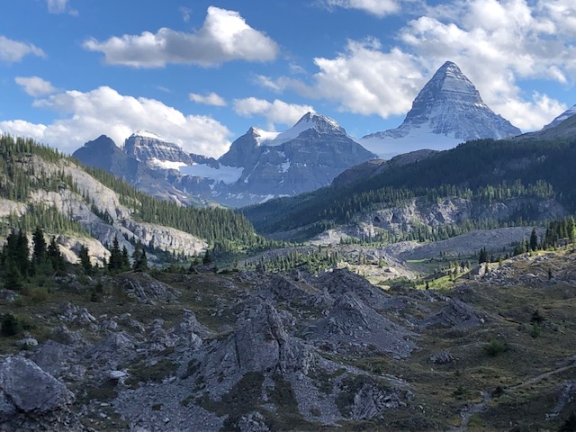
Assiniboine peaks through the cloud and majestically towers over this quiet valley blanketed in white – a true winter escape!
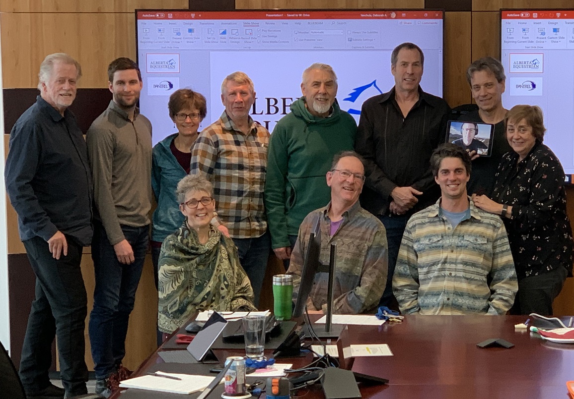
On January 11, Board members, the Organizational Excellence Committee and representatives from other GDTA committees gathered in Bantrel’s comfortable boardroom for some concentrated learning and at times challenging thinking about what makes for a living breathing strategic plan.
The retreat was facilitated by Ken Larson of Champion Performance Systems. Dave Hockey introduced Ken, describing how his current work coaching leaders, businesses and organizations grew out of inspirational coaching he received during his three years on the Canadian Men’s National Basketball Team. Ken has an MA in Performance Psychology and is a Certified Executive Coach. He is also an avid reader, and in Dave’s 20+ years of friendship with him, he’s shown that he really cares about the people he’s coaching.
The GDTA participants brought a great deal of expertise to the room as well. While we shared a bit of our backgrounds in a round of introductions, Ken tallied up our years of planning experience and arrived at a grand total of 356 years!
Ken’s strategic planning focus is on execution and for an action-oriented group like the GDTA, that seemed a good fit. He showed us examples of the one-page template he helps organizations condense their strategic plan into. The template is designed to show clear alignment between vision, mission, purpose, core values and goals over three-year, one-year, and quarterly periods. But we weren’t ready to launch into that yet. First, we had to think through the key components of a solid strategic plan.
We began with an analysis of the GDTA’s strengths and weaknesses, the trends influencing our work, and the opportunities and threats created by those trends. Refining this analysis was the first task of the day to go on the WWW, i.e., the Who What When board. This is a tool for naming, assigning responsibility, and deciding timelines for the next step when a group has discussed something long enough to become clear that they want to move forward with an idea.
We then revisited the values, vision and mission that the GDTA Board approved in January 2017. Ken recommended we add our purpose to these since a purpose statement answers the ‘why’ that underlies our vision (which says who we are and where we’re going) and mission (which says how we’re going to get there). After some discussion, we decided further review, and possibly some refinement of our values, vision and mission was in order. This became task number two on the WWW.
Next it was figuring out the measurement that would allow us to track progress on our goals. What type of things should we measure, what metric would be appropriate for each of those things, and was each metric we came up with a leading indicator or a lagging indicator? We learned our set of metrics needs to include both types of indicator. Leading indicators are the things we do (e.g., events) that are predictive of the things we want to achieve. Lagging indicators are the hoped-for results of the things we do (e.g., growth in membership).
Now we were ready to craft some goals. Ken patiently coached us through applying an Action-Focus-Results (AFR) approach to defining what two of our committees would accomplish in the next three years. The AFR is worked through in a specific order:
FOCUS: Decide what the most important area is for the committee to focus on for the next three years.
RESULT: Decide what result we want to achieve in that focus area over the next three years.
ACTION: Identify the actions that will lead to the desired results.
Then we re-ordered those elements into a succinct affirmative sentence that starts with strongly-worded actions and ended with desired results. This was an exercise in logic and language that had many of us struggling at times, trying to encapsulate a large area of work into a small number of words and still convey a clear meaning. Ken assured us our effort would be well worthwhile – we would end with clear, actionable, measurable ‘three-year key thrusts’ that could be broken down into ‘2020 key initiatives’ and ‘quarterly big rocks.’ We agreed to apply this AFR approach to all of our committees and that added five more tasks to the WWW board.
It was a productive day! It was great to learn some new ways of thinking and receive some new tools for continuing to build organizational excellence in the GDTA. We will continue the work in a second retreat day this spring.
This edition of the Pathfinder Newsletter includes articles from our AGM, a walk through Section C of the GDT, a summary of the past summer’s maintenance trips and information on the book launch of Tales from the Great Divide. Enjoy!
Tales from the Trail: Lynnie and Barb hit the trail again this summer… completing Section C – Field to Kananaskis.
AGM Keynote Speaker: If you missedour AGM, read a short summary of Jenny Feick’s talk about the ‘original gang of six ‘ who surveyed the GDT route in 1974.
Book Launch: A book about the history of the Great Divide Trail has been published and is now available for purchase.
Trail Permit Reservations open in January so it’s not too early to start planning your 2020 GDT hike.
Changes to our Board Membership: We say thank you to the retiring Board members and introduce the re-elected and new members.
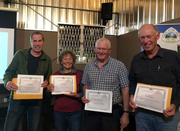
As you may already know the GDTA is a volunteer based organization that relies on the work and passion of people like you. Every year we recognize the efforts of volunteers who go above and beyond to help us achieve our objectives.
Left to right: Dave Hockey, Jenny Feick, Wayne Marshall, Dave Higgins
Alistair Des Moulins – For representing the GDTA at in the meeting of Livingstone and Porcupine Hills Recreation Advisory Group with Minister of Environment, Jason Nixon.
Jenny Feick – One of the Original GDT’ers, we would like to recognize Jenny’s dedication to compiling and documenting the history of the GDT, in particular leading the production of the “Tales of the Great Divide”.
Dave Higgins – Another Original GDT’er, Dave’s resilience and remarkable commitment to the GDT for so many years is remarkable, leading two important Trail Maintenance trips in 2019 to Lost Creek and the David Thompson Heritage Trail. Dave is a regular contributor to the Pathfinder newsletter and helped Jenny Feick with her travel plans to come to this year’s AGM.
Wayne Marshall – For his important contributions as the GDTA Signature Trip Camp Manager, always making improvements and mentoring new volunteers. Wayne has been a mentor and a teacher to so many GDTA volunteers over the years and deserves to be recognized.
Rogier Gruys – For championing the GDT in Jasper National Park allowing us to make significant progress towards trail maintenance, recognition and signage in a national park.
Darrell Aunger – Primary mover and shaker for organizing a strategic planning session where a wide range of GDTA volunteers were participants. Primary results were creation of a GDTA vison and mission statements, a scan of the GDTA’s strengths, weaknesses and threats as well as establishing a framework for committee structure for engaging more volunteers. Constantly reminding board members to look beyond day to day operations by maintaining a vision for the future towards organizational health and sustainability. Prime proponent for devoting half of each board meeting for refining goals developed at the strategic planning session. Chair of the 2018 board Nominating Committee. Without Darrells’ participation along with others on our Safety Committee in 2018 resulting in compilation of our Safety Manual there’s a high likelihood that we would have lost an entire year’s trail work. The GDTA was the only authorized NFP group to continue trail work on Alberta’s public land. As Darrell expressed “A corporate entity would have taken months to compile what our volunteers accomplished in three weeks.” The safety Committee was spared weeks of wheel spinning through Darrell’s collecting best practices from other area trail volunteer organizations. Created the necessary linkages with STARS air ambulance to handle remote work site medical emergencies. 2018 camp manager along with spouse Julie, trip leading and, most notably, averting a 2018 Signature Trip food disaster by driving from a remote camp to Blairmore to purchase fresh groceries.
Dave Hockey – Dave Hockey has served two terms on the GDTA Board and has been not just leading the GDTA over this time but has been actively involved in just about all aspects of the organization. He has been a tireless, fearless, passionate supporter of the GDTA.
In 2013, with the support of Brad Vaillancourt and others, Dave led the efforts to re-establishing the GDTA organization – a new Board, new bylaws, new organization.
In 2016, Dave became GDTA President and over the next three years his leadership has led to amazing results:
Construction of the High Rock Trail began in 2016, the first new section of trail to be built in over 30 years. Dave personally did more than 20 scouting trips, hiking (bushwhacking) hundreds of kilometres scouting the new route.
Membership grew from about 50 to over 200; our email list from around a hundred to about 1,000
Number of active volunteers on maintenance trips grew from ~20/year to more than 150
Developed positive relationships with many partnering government departments and organizations: Alberta Parks, Alberta Hiking Association, Alberta Wilderness Association, Alberta Equestrian Federation to name a few.
GDT trail recognized in the new Castle Provincial Park
Set the standard for trail planning with the Alberta government
Established committees to help engage volunteers in GDTA activities
But it’s not just the big stuff Dave contributed to, he worked day in day out on the GDTA:
Led more maintenance and scouting trips than any other volunteer
Developed trail building and maintenance trip models
Assisted with the development of the GDTA Safety Manual
Housed the maintenance trailer (for years)
Cleaned and packed away the equipment after the maintenance trips
Set the record for the number of new memberships sold at the Banff Film Festival (~10)
Drove Erin Saver to the trailhead and helped charge her phone
Wrote letters to government in support of the trail
Answered countless emails from thru hikers
Met with sponsors to obtain donations
Gave presentations on the GDTA to anyone who asked
Attended as many meetings of affiliated organizations as he could
Well, it was another busy year for the GDTA, and I would like to give you an update on all the progress.
First and foremost, I would to thank the Board of Directors for all the work they have done to make all this happen, it has not been easy, but everyone has pitched in to move the organization forward. The biggest highlight has been our work on the Strategic Plan, which is nearly done. We have dedicated half of our board meetings to this document that will clearly guide us for the next 3 years.
Our focus on building great relationships & partnerships continues to serve us well. Our Key Sponsors continue to show faith in our organization. Mountain Equipment Co-op needs to be highlighted as a long-term sponsor of the GDTA, and this year they more than doubled their financial support. I can’t thank them enough for this huge show of support. Teck, The North Face, Stihl continued their generous support this year also. Columbia Basin Trust and the Alberta Equestrian Federation are new supporters this year and we hope to develop a long-term relationships with them too.
Alberta Environment and Parks continues to support our trail building and maintenance especially in the Livingstone Public Land Use Zone. Their office in Blairmore lost two key supporters of our work and I was concerned but this year the support has been amazing, and we are so happy to have them as a partner. Recreational Sites and Trails BC has also worked hard to support our efforts to maintain and improve the David Thompson Heritage Trail.
Our work with the Jasper Trails Alliance on the Maligne Pass Trail is continuing to build and at the same time strengthen our bond with Jasper National Park. For the first time I am really hopeful for a breakthrough with a National Park, time will tell.
There are many more relationships such as the Willmore Wilderness Foundation whose equestrian users who do maintenance on remote sections of the GDT, we could not do it with out them.
To all of them and big Thank You!
As usual, our Outreach Team has been busy throughout the year. It started with talks such as the presentation to the Junior Forest Wardens and a busy winter with the Best of Banff Film Festival. We not only had booths in Calgary but Edmonton, Red Deer, Olds, and Lethbridge. Sounds easy but you would not believe in the logistics to make that all happen with volunteers. The successful events continued with Chasing Sunsets, Backcountry Emergencies, and the Dan Durston GDT Yo-Yo presentation. All great events that not only provide much needed exposure but contribute financially as well. Of course, their work continued with a great AGM in October. To all involved thank you!
Ensuring Financial Capacity is another committee that took off this year. Building on some of the long term grants we do, the committee brought in the Columbia Basin Trust and Alberta Equestrian Federation grants. They are also working on more grants with a plan for a solid financial future. I was very excited to see the application for Charitable Status submitted. This will be another big step forward for our organization, good work team.
It was also another busy season for the Trail Building and Maintenance Committee. With all the trips planned they hired a Trip Coordinator to handle most of the trip communications and logistics. This was a good decision as it can be overwhelming trying to keep up with all the emails and questions for 14 trips. The committee hopes to expand this position next year. We started with our largest scouting trip to date trying to increase capacity in this area followed up with 8 successful trail building trips on the High Rock Section. After two years of heat and fires we moved our trips to start earlier in the year, only to be met by a very wet and cold spring, mother nature always wins.
Next it was on to the maintenance side of things. We want to show that we can operate in many areas and take care of what we have already established. We held a maintenance trip on the original section of the GDT in the Lost Creek area and held two concurrent trips on the David Thompson Heritage Trail, installing much needed handrails on a bridge over Lambe Creek and improving tread as well. We also continued to work with the Jasper Trails Alliance and Jasper National Park to maintain trail in the Trapper Creek area. Dan Durston was able to put up reassurance markers in the Kakwa region and Alberta Parks were installing them in the Castle Parks as well. It’s great to see more of the trail marked every year.
One of my great takeaways of the season was reading the volunteer surveys and see the results of our safety committee, it seems as though the volunteers felt our safety focus was the best yet. And to wrap up the season another scouting trip confirming trail alignment and marking trees to be felled by Alberta Environment and Parks last week.
Why do we do all this work? To support all who hike the GDT but specifically our thru hikers. This year was another record with close to a 100 thru-hikers. This continues our rapid growth trend and I can tell you there are way more coming, so let’s keep working to provide the best experience we can.
As this is my last President’s report I would like to again thank everyone on the board and the committees for all your efforts. To my mentor Wayne Marshall who in 2010 said to Brad Vaillancourt and myself that if we wanted to see the GDT survive, the organization needed to “grow up”, well in the last 9 years I think we have come a long ways.
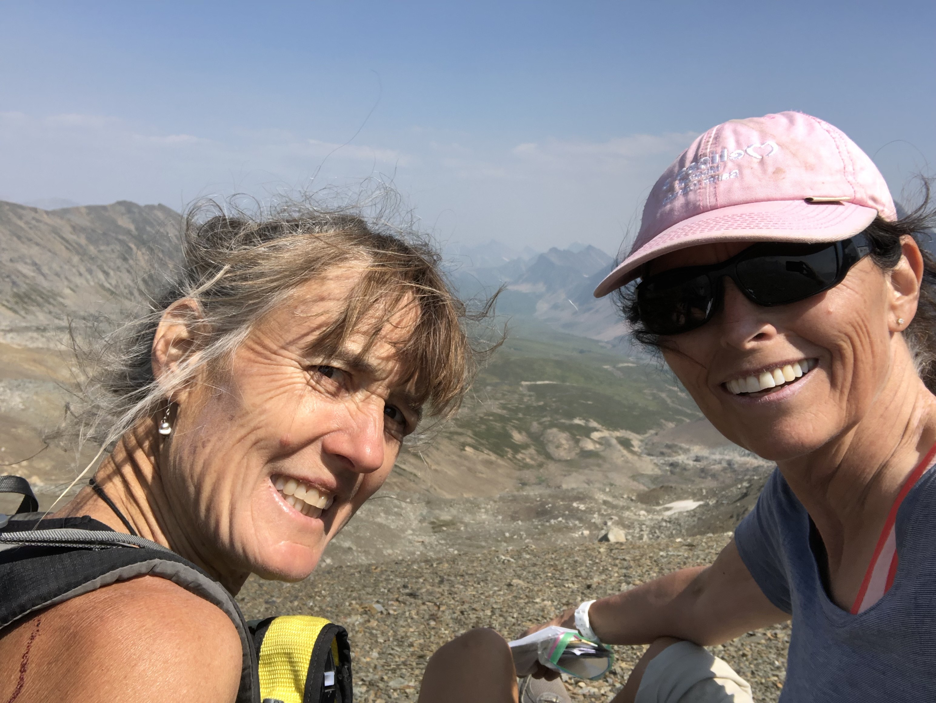
Lynnie and I once again hit the trail this summer, tackling Section C – SOBO, Field to Kananaskis. After hiking Section E (Owen Creek to Jasper) last summer, we were ready for something a bit longer and wanted to hike the best of the Canadian Rockies!
Lynnie and Barb
Probably the hardest part about hiking Section C is …. the planning. The route goes through some of the busiest provincial and national parks in Canada and securing a campsite can be tricky. I booked us into the national parks when bookings opened in January but couldn’t book Assiniboine until 4 months before our date. This meant that we had to re-gig things a bit later; in the end it all worked out.
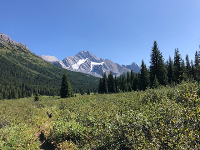
My favourite section of the trail was through the meadows from the Bryant Creek turn off to Palliser Pass, over Palliser Pass and then down to Leroy Creek. We saw no one on this section of trail except for 10 toads, not including the one I stepped on… Be careful in this section – you look around because it’s green and beautiful and pretty flat as you go through the meadow and before you know it, SQUISH. I didn’t even realize I’d stepped on a toad until I looked back and saw Lynnie closely examining something on the trail. Apparently it looked like something from biology class. Walk carefully here!
Of course the scenery was spectacular along the Rockwall … really, really amazing but with heavy packs and the relentless up, up, up and down, down, down it was hard work! The walk from Healy Pass to Assiniboine and onto Marvel Lake was also spectacular! But our timing was a bit off and we went through there on a weekend with half of Calgary (okay, maybe not quite that many people).
This year we had to contend with a bit of rain and snow, which was a change from the smoke we had last year. It stopped raining at Floe Lake just before we woke up (so lucky!)….and then didn’t start again until we were on our way up Ball Pass. The ground was wet though and the first person through was taking a lot of the water from the plants onto their pant legs… not a nice feeling. And then it started to rain, slowly at first, lulling us into a false sense of security before it started to really come down. At this point we took cover for a bit.. probably the best thing we did. We were a bit bored with putting our rain gear on and off with a number of false starts but have to say that this is all good practice and when it really starts to rain, do not delay – layer up. If your partner looks like they are developing hypothermia (me), help them layer up but then don’t forget about yourself (Lynnie). It stopped raining just before we came over Ball Pass. The orange rock there is spectacular, and we soon forgot about the rain (except for the mud pit waiting for us at Ball Pass campsite).
Mountain reflections
We had frost on our tent at Ball Pass but it didn’t snow there like it did everywhere else in the area! The walk over Whispering Pass was wonderful. There was snow everywhere. And later that day we walked through Healy Pass and as we were walking through, plants were slowly popping up through the snow, pushing off the snow as it started to melt. It was like a very quiet symphony … a squish here, a plop there. Beautiful!
When we got to Assiniboine, we spend a few hours sitting around and taking in the views. We tried to buy a mid-morning coffee from Assiniboine Lodge but sadly it’s not possible. However, they do host an afternoon tea for campers from 4:00 that people raved about… sorry no information on price but it sounded great if you’re in the area. Later that day we hiked over Wonder Pass and onto Marvel Lake – the views are wonderful here, as you would expect!
Assiniboine
The hike down from Palliser Pass to Leroy Creek is pretty straight forward, we were expecting more bushwhacking. It was a bit overgrown but completely manageable. The confluence at the bottom of Palliser Pass can be discombobulating, there is a lot of fast flowing, scary water. As long as you know that the Palliser River is actually a creek and the Leroy Creek is a very fast flowing, scary river at that point and that you do not cross Leroy Creek here, you will be fine. You cross Leroy Creek at the trail heading up to North Kananaskis Pass and onto Turbine Canyon or at the trail heading up to South Kananaskis Pass via Beatty Lake, depending on your route. [NB: maybe the Palliser River is bigger earlier in the summer? We hiked the third week of August].
Palliser view
We saw two bears, a black bear at the North Interlaken parking lot and a grizzly at the roadside as we were driving home. So on the trail, other than the toads, we saw very little wildlife….. probably because we were shouting HELLOOOO! And WHOOOO HOOOOO! at every turn. I did manage to scare a young fellow with one of my shouts. He had his bear spray out and was ready to use! Nice to see young people so prepared!
Overall, I’d highly recommend this section… navigation is very easy – you can rely almost exclusively on paper maps and trail signs; you can do it entirely in campsites if you miss out the random camping at Palliser Pass (saving the need for a bear hang), and the scenery is the best of the Canadian Rockies. However, once you get used to the adrenaline rush of working out “now where?”, it can be hard to go back to well-marked trails. I’m looking forward to going into the more remote, wilder side of the Great Divide Trail again next year.
Bit’sn bobs:
We took 8 nights, 9 days to hike Section C. A Here was our plan: McCarthur Creek, Tumbling Creek, Floe Lake, Ball Pass, Healy Creek, Og Lake, Lake Marvel, Palliser Pass and out. Favourite campsites: Floe Lake and Og Lake.
If you have an inReach and I would recommend it – do make sure you know how to use it. We had some fun arranging a ride from North Interlaken Lake parking lot because I had a brain fart and couldn’t remember how to send a text. Thank you to the family who drove me to the Fortress gas station and the lovely lady and her daughter who drove me back to the North Interlaken Lake parking lot. And thank you Stephen for coming to get us at such short notice.
Weirdly, it always seems that the trail is harder in the opposite direction to the one you’re going. We had a number of people say to us that they were very happy to be going in the other direction and as we walked up the steep trail to North Kananaskis Pass, we thought the same…. “Boy are we glad that we’re not going in the opposite direct!”
It’s going to rain, not something to fear but do be happy with your rain gear (I had a poncho and loved it; Lynnie really liked her rain pants and jacket)
If you hiked a section or an even smaller part of the Great Divide Trail, please consider sharing your story with us. Email: greatdividetrail@gmail.com